Mountain Bike Hike Albine-Candesoubre via the Ridges
heavy
Navigace na stránkách
Navigace na stránkách
Pořiďte si tuto prohlídku do mobilního telefonu
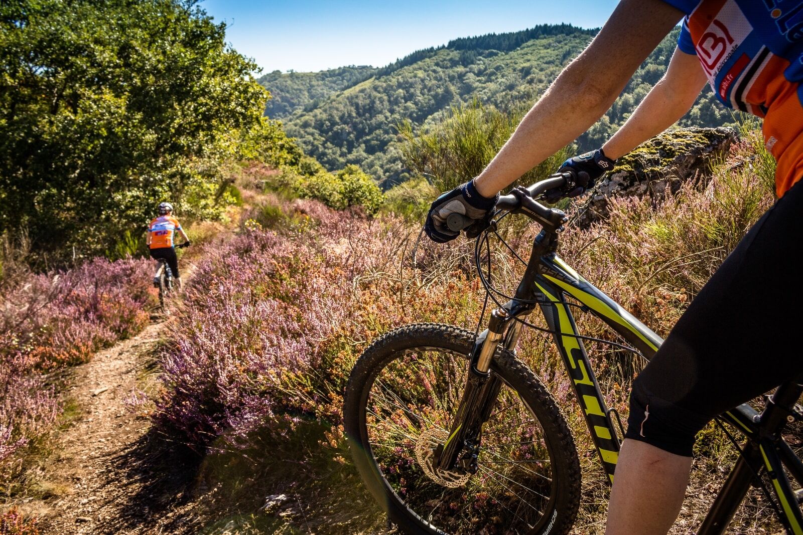
Mountain Bike Hike Albine-Candesoubre via the Ridges
heavy
Mountainbike
43.57
km
Naskenujte QR kód a spusťte navigaci v aplikaci bergfex.

Pěší turistika a stopování


Mountain Bike Hike Albine-Candesoubre via the Ridges
heavy
Vzdálenost
43.57
km
Doba trvání
05:33
h
Ascent
1260
hm
Hladina moře
314 -
961
m
Stažení skladby
Mountain Bike Hike Albine-Candesoubre via the Ridges
heavy
Mountainbike
43.57
km
Some large agricultural “clearings” have been maintained on small plateaus, notably at the hamlet of Sales.
On the scale of the entire massif, there is a sharp contrast between the two slopes: a humid northern...
Popis
Some large agricultural “clearings” have been maintained on small plateaus, notably at the hamlet of Sales.
On the scale of the entire massif, there is a sharp contrast between the two slopes: a humid northern slope with beech and fir trees, and a Mediterranean southern slope with holm oaks and pubescent oaks. This contrast explains the diversity of environments. The northern slope has many ecological, faunal, and floral interests due to a great diversity of habitats (heaths, peat bogs, forest and mountain agropastoral environments...) and low human impact.
The diversity of environments and their conditions result in botanical wealth with notable plants recorded. Among them, 7 benefit from national protection. This northern slope also has a remarkable breeding population of birds of prey. This situation stems partly from the presence of many suitable nesting sites (wooded and rocky areas that are little frequented), and partly from the proximity of hunting areas (open zones of agropastoral clearings). Several pairs of Northern Goshawk and 3 to 4 pairs of Peregrine Falcon are present. The open areas of the clearings, relatively preserved from intensive agriculture, allow species to persist (Eurasian Skylark and woodlark, Common Linnet, harriers...).
To see:
- Giant interpretation trail (on the GR7)
- Peyremaux rock
- Fountain of the three bishops
- Hamlets and villages
- Nearby: old glass furnace, departmental textile museum, greenway
Trasa
Albine
(318 m)
Vesnice
0.1 km
Église Saint-Jean
(332 m)
Místo konání bohoslužeb
0.1 km
Roc de Peyremaux
(1008 m)
Summit
9.9 km
Église Notre-Dame
(836 m)
Místo konání bohoslužeb
19.1 km
Cantignous
(450 m)
Vypořádání
25.7 km
Cathalo
(415 m)
Sousedství
30.8 km
Dressou
(761 m)
Vypořádání
36.7 km
Trasa
Mountain Bike Hike Albine-Candesoubre via the Ridges
heavy
Mountainbike
43.57
km
Albine
(318 m)
Vesnice
0.1 km
Église Saint-Jean
(332 m)
Místo konání bohoslužeb
0.1 km
La Caunette
(327 m)
Sousedství
0.3 km
La Richarde
(395 m)
Koridor/terén
0.7 km
Roc de Peyremaux
(1008 m)
Summit
9.9 km
Fontaine des Trois Évêques
(916 m)
Zdroj:
13.2 km
Bartassade
(867 m)
Koridor/terén
15.7 km
Sales
(837 m)
Vypořádání
19.0 km
Église Notre-Dame
(836 m)
Místo konání bohoslužeb
19.1 km
Cantignous
(450 m)
Vypořádání
25.7 km
La Feuillade
(408 m)
Sousedství
26.3 km
Labastide-Rouairoux
(389 m)
Vesnice
29.6 km
Foun Troumpet
(413 m)
Koridor/terén
30.2 km
Cathalo
(415 m)
Sousedství
30.8 km
Cantignous
(450 m)
Vypořádání
31.3 km
Dressou
(761 m)
Vypořádání
36.7 km
Rabasset
(350 m)
Koridor/terén
42.2 km
La Caunette
(327 m)
Sousedství
42.7 km
Moulin Bas
(316 m)
Koridor/terén
43.1 km
Albine
(318 m)
Vesnice
43.3 km
Autor
Poskytuje Tarn Tourisme
Prohlídku Mountain Bike Hike Albine-Candesoubre via the Ridges zajišťuje outdooractive.com.

Vybavení
Mountain Biking as you want! but…
Use the marked trails for your safety and respect the direction of the routes Do not overestimate your abilities and stay in control of your speed Be careful and courteous when overtaking or crossing hikers as pedestrians have priority Check the condition of your mountain bike and plan for supplies and repair accessories If you go alone, leave your route with someone close to you Wearing a helmet is strongly recommended Respect private property and cultivated areas Watch out for agricultural and forestry machinery Close the gates behind you Avoid picking wild flowers, fruits, and mushrooms Do not disturb the peace of wild animals Keep your trash, be discreet and respectful of the environment
Bezpečnostní pokyny
Emergency number: 112
Informace o příjezdu
Parkování
Greenway parking - Albine
Další informace a tipy
Další informace
APIDAE Tourism data updated on 05/12/2021 by "Tarn Tourisme".
An error on this sheet? Write to the owner recalling these references:
Sheet name: Mountain Bike Hike Albine Candesoubre Ridges | Sheet ID: 845867 | URL (link) of this Outdooractive page.
An error on this sheet? Write to the owner recalling these references:
Sheet name: Mountain Bike Hike Albine Candesoubre Ridges | Sheet ID: 845867 | URL (link) of this Outdooractive page.
Zatím žádné recenze
Oblíbené prohlídky v okolí
-
5.0
Les Escaunelles
světloTuristika 6.87 km -
Peyremaux rock
heavyTuristika 13.3 km -
HIDDEN HIKING TRAIL
středníTuristika 17.5 km -
CIT'ART HIKE OF THE HAUTS DE FERRALS
středníTuristika 15.5 km -
CYCLE LOOP NO.12 - THE ASSAULT ON THE HAUT-LANGUEDOC FROM MINERVE
světloJízda na kole 37.3 km -
OENORANDO® LE CRU LA LIVINIERE
světloTuristika 11.5 km -
Hiking: Les clairières de Sales
světloTuristika 8.46 km -
LE SENTIER DES MEULIERES
světloTuristika 1.02 km -
VÉLOCCITANIE, FROM THE NAUROUZE THRESHOLD TO BÉZIERS
středníJízda na kole 236.6 km -
HIKING FÉLINES MINERVOIS VENTAJOU
středníTuristika 13.7 km
Pěší turistika a stopování

Více než 550.000 návrhů výletů, podrobné mapy a intuitivní plánovač tras dělají z aplikace nezbytnou výbavu pro všechny milovníky přírody.

Nenechte si ujít nabídky a inspiraci pro vaši příští dovolenou
Přihlaste se k odběru newsletteru
Chyba
Došlo k chybě. Zkuste to prosím znovu.
Děkujeme za vaši registraci
Vaše e-mailová adresa byl přidán do poštovního seznamu.
Zájezdy po celé Evropě
Rakousko
Švýcarsko
Německo
Itálie
Slovenia
Francie
Nizozemsko
Belgie
Polsko
Lichtenštejnsko
Česko
Slovensko
Španělsko
Chorvatsko
Bosna a Hercegovina
Lucembursko
Andorra
Portugal
Iceland
United Kingdom
Ireland
Greece
Albania
North Macedonia
Malta
Norway
Montenegro
Moldova
Kosovo
Hungary
San Marino
Romania
Estonia
Latvia
Belarus
Cyprus
Lithuania
Serbia
Bulgaria
Monaco
Denmark
Sweden
Finland