


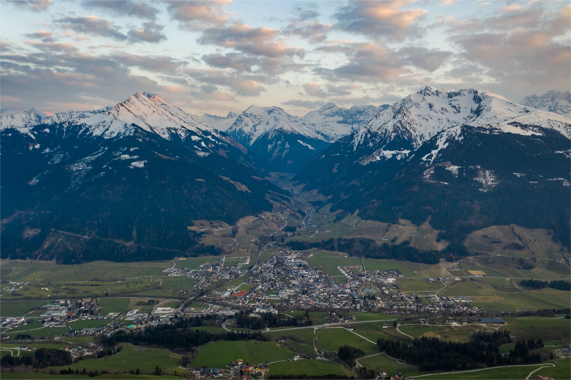
HOHE TAUERN PANORAMA TRAIL | ET07: Around the Gaisstein | Mittersill-Bürglhütte
After a day in Mittersill and a visit to the National Park Worlds, the 1,800 m² alpine adventure world, the path leads again on lonely paths back up to the heights. Almost 1,300 meters of altitude are...
After a day in Mittersill and a visit to the National Park Worlds, the 1,800 m² alpine adventure world, the path leads again on lonely paths back up to the heights. Almost 1,300 meters of altitude are gained up to the stage destination Bürglhütte (1,699 m) high above the national park town Stuhlfelden: The hut lies idyllically at the foot of the Gaisstein (2,366 m), one of the highest grassy mountains in Europe.

Up to the railway crossing in Mittersill, the route is the same as the end of the previous stage. From the entrance of the National Park Center, head to the north side of the building and thus to the ornamental pond in the park-like grounds. At the pond, pass to the right onto the street leading north (Hintere Lendstraße). At the end, turn right into Lendstraße and after a few meters diagonally left across the small parking lot to a bike and footpath. From here, go right (east) to a major road. Follow this road left across the railway line, thereby leaving the previous stage's route.
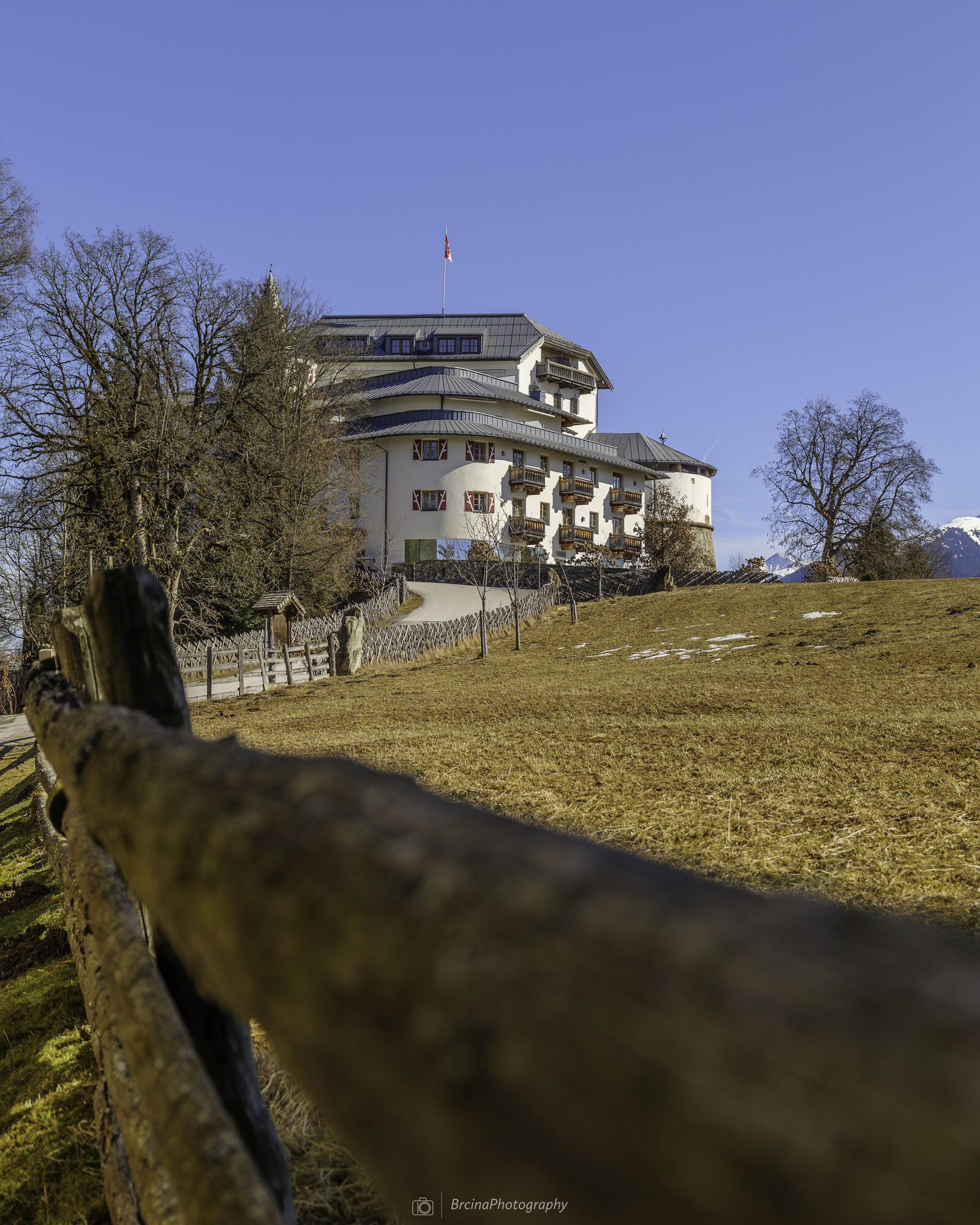
After the railway crossing, continue straight onto the street "Schettbühel," follow its course right until a sharp left curve where the hiking trail "Schlossrundweg" branches off. Then walk under the Pass-Thurn federal road, cross a small paved street and reach the Pass-Thurn federal road again, which you also cross. Next to a small paved street on the right, turn onto a hiking trail into the forest. This leads up to the east side of the castle. Now circle around Mittersill Castle and walk on its north side westward, passing the house Neidhäusl on the left up to a farm. Here turn right, pass under the Pass-Thurn street for the last time to a paved road and follow it straight toward Rosswegscharte. At the next two junctions, follow the "702 Liendlalm/Rosswegscharte" signposts to the right.
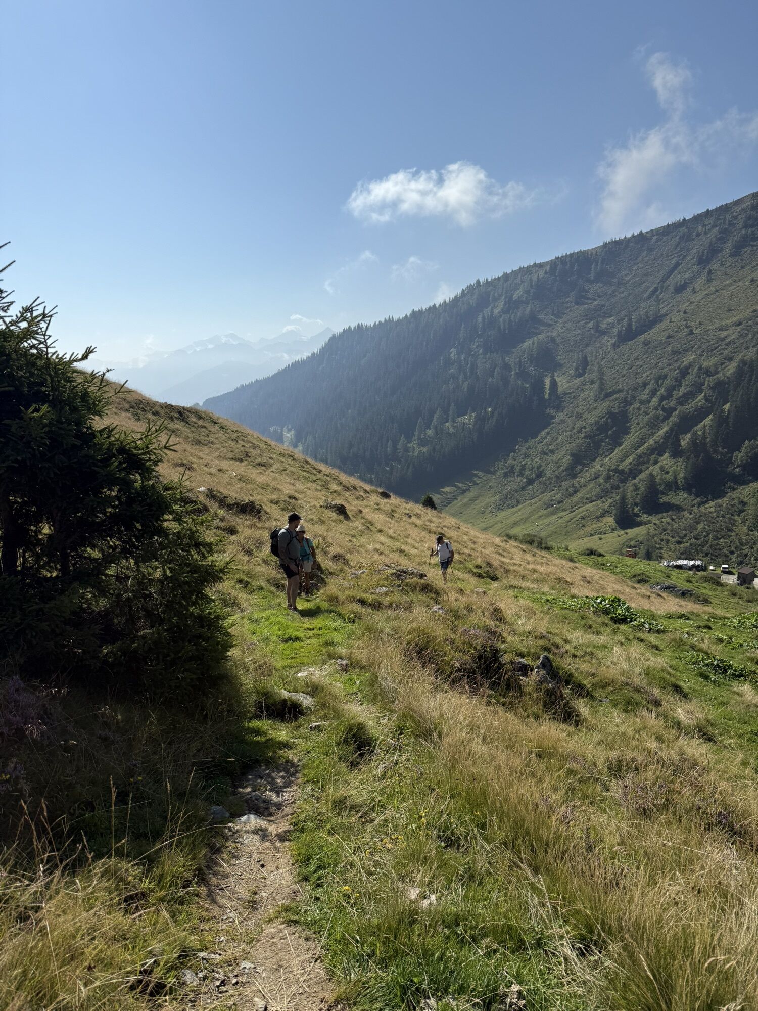
On a right curve further along the paved road, the shortcut for a beautiful hiking trail through the forest begins, branching off left. You hike this trail uphill for quite a while, with short interruptions on paved roads, always following the "Liendlalm" signposts. Along the way, you repeatedly cross forest roads. At an altitude of 1,400 m, the shortcut forest trails end, and you reach a forest road again. Take this left uphill for about 80 meters elevation until it turns into a hiking trail. Soon you reach the first alpine pastures and ascend a beautiful meadow path to the unattended Liendlalm (approx. 1,700 m). From here, you have a wonderful view of the town of Mittersill. Beyond the Liendlalm, hike on a path or mostly without a trail, but well marked, the beautiful alpine meadows up to Rosswegscharte (2,060 m). Beyond the saddle, descend briefly over a three-meter-high rock step with climbing aids and then cross the slope slightly descending for about 15 minutes to Sintersbachscharte (2,035 m). At a crossroads, take the hiking trail down to the right and after about 300 meters elevation, over beautiful alpine meadows, you reach the rustic Bürglhütte (1,699 m), your stage destination.
Ano
An alpine hiking equipment is required for the Hohe Tauern Panorama Trail:
Day hiking backpack (about 20 liters) with rain cover Sturdy and comfortable footwear Weather-appropriate and durable clothing in multilayer principle. The Hohe Tauern Panorama Trail is mostly at altitudes between 1,300 m and 2,450 m - this must be considered when selecting your hiking equipment (especially your clothing) Trekking poles are recommended due to often long descents Sun and rain protection Make sure to bring enough provisions and sufficiently large drinking bottles as not all stages have dining options and fountains (e.g., on stages 5 and 7) First aid kit Pocket knife Mobile phone Route description or hiking mapThe path in the alpine terrain is well marked but partly only very faintly developed. In very poor visibility, orientation problems may occur. Also, there is no dining option or fountain above the castle.
Coming from the north - (D, NL, ...): Munich - Kufstein - St. Johann in Tirol - Kitzbühel - Pass Thurn - Mittersill - Hollersbach
Coming from the west (CH): Inntal motorway - Wörgl East exit - St. Johann in Tirol - Kitzbühel - Pass Thurn - Mittersill
Coming from the east: Vienna - Salzburg - Lofer - St. Johann in Tirol - Kitzbühel - Pass Thurn - Mittersill
Coming from the south: Lienz - Matrei - Felbertauernstraße (toll road) - Mittersill
From Zell am See, start at Zell am See train station with regional bus 670 (direction Krimml via Uttendorf-Mittersill-Neukirchen to Mittersill town square. From here about a 6-minute walk to the starting point of the stage at Mittersill station.
From Zillertal, start from Zell am Ziller train station with regional bus 4094 to Almdorf Königsleiten junction Gerlospass. Change to regional bus 673 (Wald town center via Krimml). At Krimml station, change to regional bus 670 (Mittersill station via Neukirchen) to Mittersill station, the starting point of the stage.
Current timetables at https://fahrplan.salzburg-verkehr.at/
Free parking spaces are available at the respective starting points of the trail journey, e.g., in Mittersill P2 - near the ornamental pond.
The parking spaces are free and not supervised. No liability is assumed.
National Park Hohe Tauern holiday region
Gerlosstraße 18 5730 Mittersill, Austria
Tel. +43 6562 40939, E-mail: hohetauerntrail@nationalpark.at
Booking center & info hotline
Trail Angels GmbH
9821 Obervellach 15, Austria
Tel. +43 4782 93093, E-mail: info@bookyourtrail.com
Oblíbené prohlídky v okolí
- 3,6
Smaragdwanderweg Habachtal/Bramberg
světloTuristika 7,17 km - 5,0
Panorama route 3 peaks and 2 lakes
středníTuristika 7,35 km - 3,8
Mittersill - Hintersee und Plattachsee
heavyTuristika 9,90 km - 4,7
Tristkogel
heavyTuristika 15,6 km - 4,7
Hollersbach - Neue Fürther Hütte
Turistika 16,0 km - 3,8
Hollersbach: Pihapper Wegnr. 935
heavyTuristika 12,8 km - 4,0
Mittersill: ski tour Sonnalm
středníLyžařská trasa 4,87 km - 4,1
Via the Schösswendklamm to Hintersee
středníTuristika 8,29 km - 5,0
Manlitzkogel
heavyTuristika 13,4 km - 3,4
Mittersill: Raised bog Wasenmoos path no. 77
světloTematická stezka 7,06 km
Pěší turistika a stopování


Nenechte si ujít nabídky a inspiraci pro vaši příští dovolenou
Vaše e-mailová adresa byl přidán do poštovního seznamu.