


Salzburg Alpine Pasture Trail – Stage 11: Hüttschlag - Tappenkarsee Hut
Úroveň obtížnosti: T2


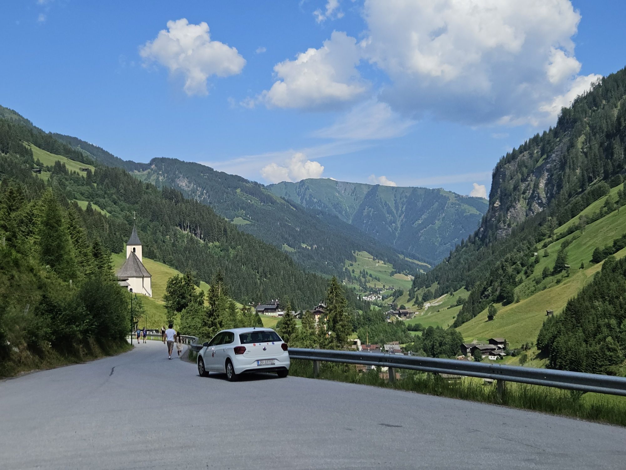
Stage 11 leads from the Bergsteigerdorf® Hüttschlag over a fairly demanding ascent through flower-rich meadows to the Karteistörl and to the largest mountain lake in the Eastern Alps, which is reached...
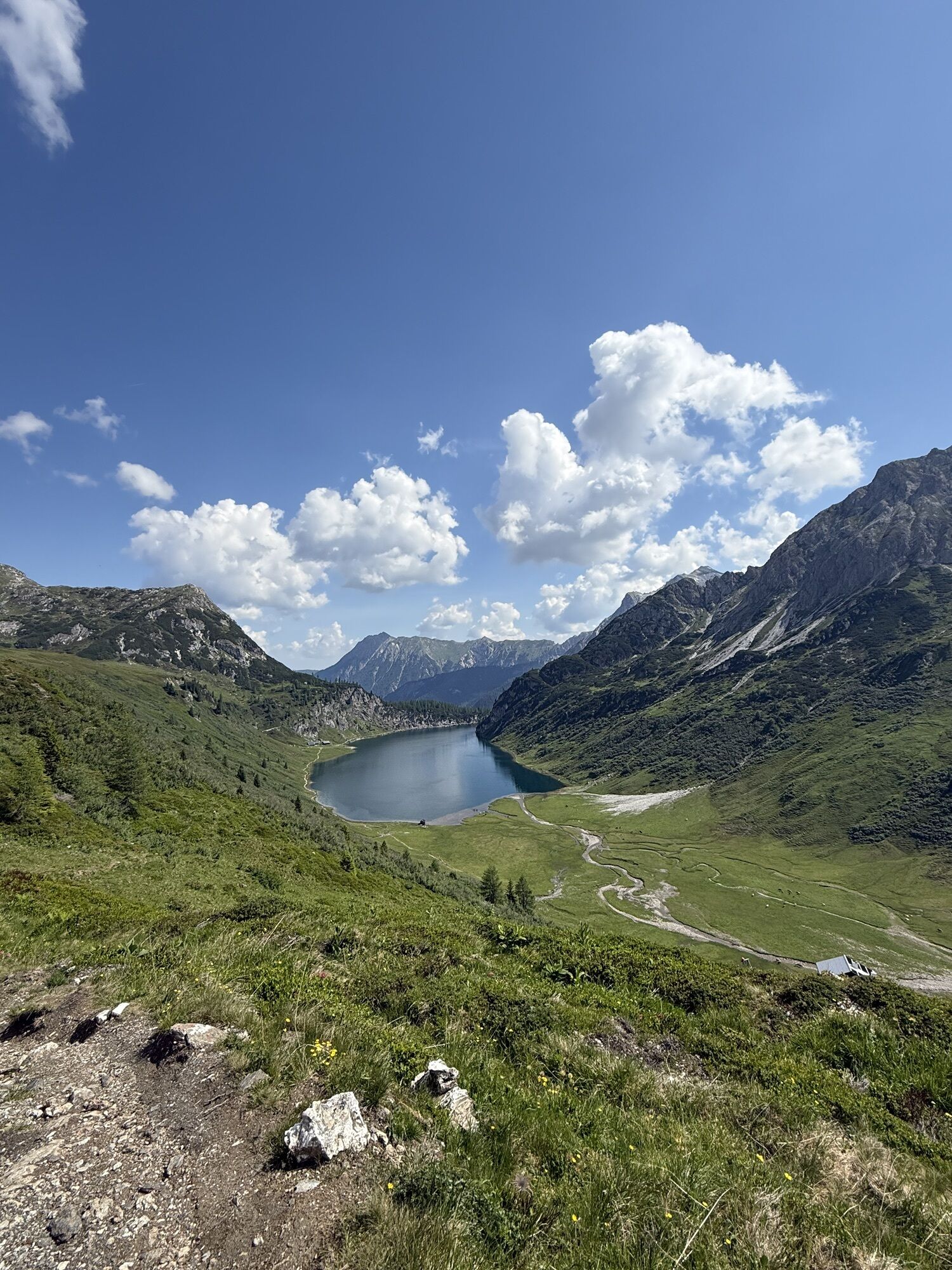
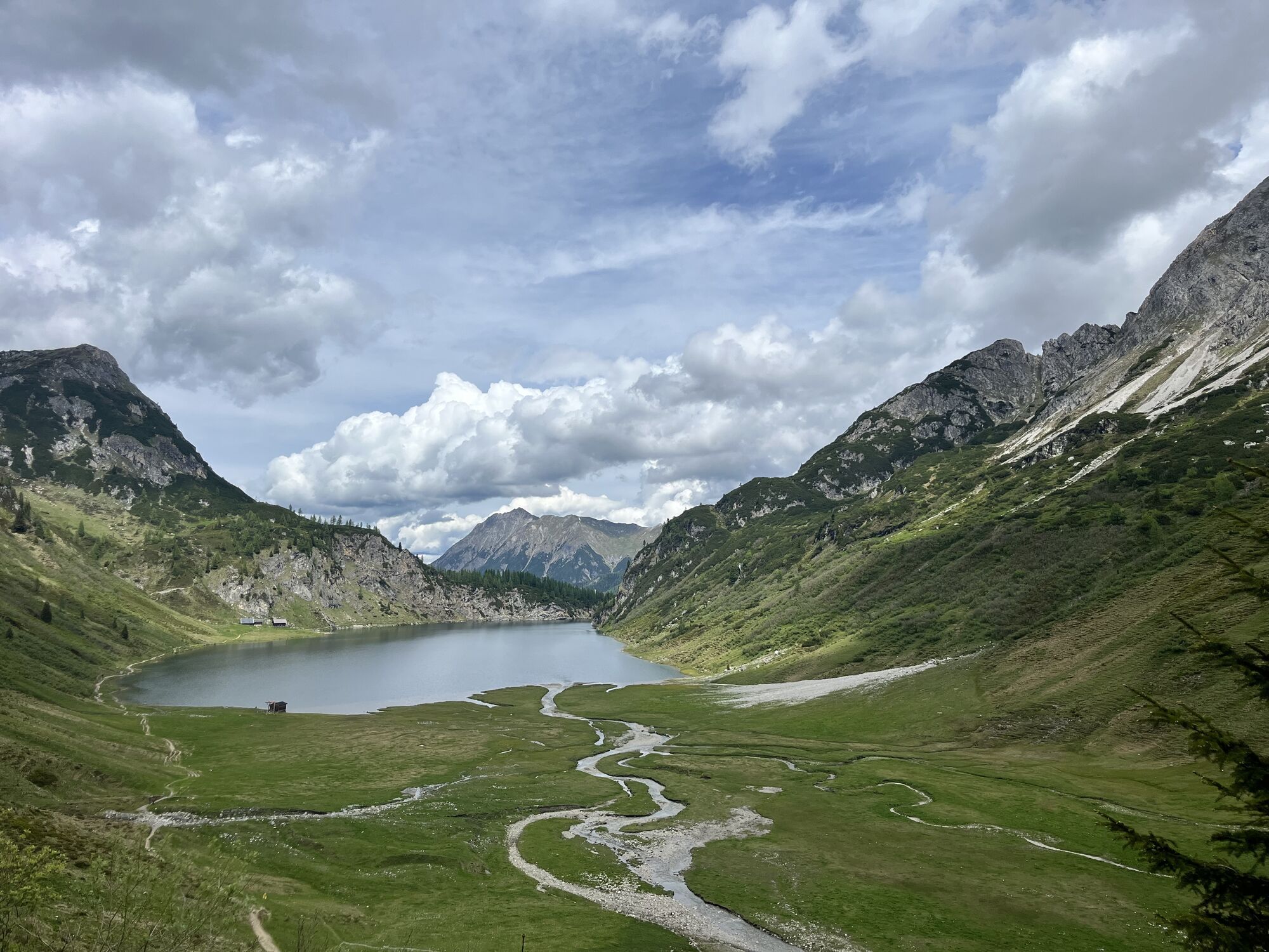
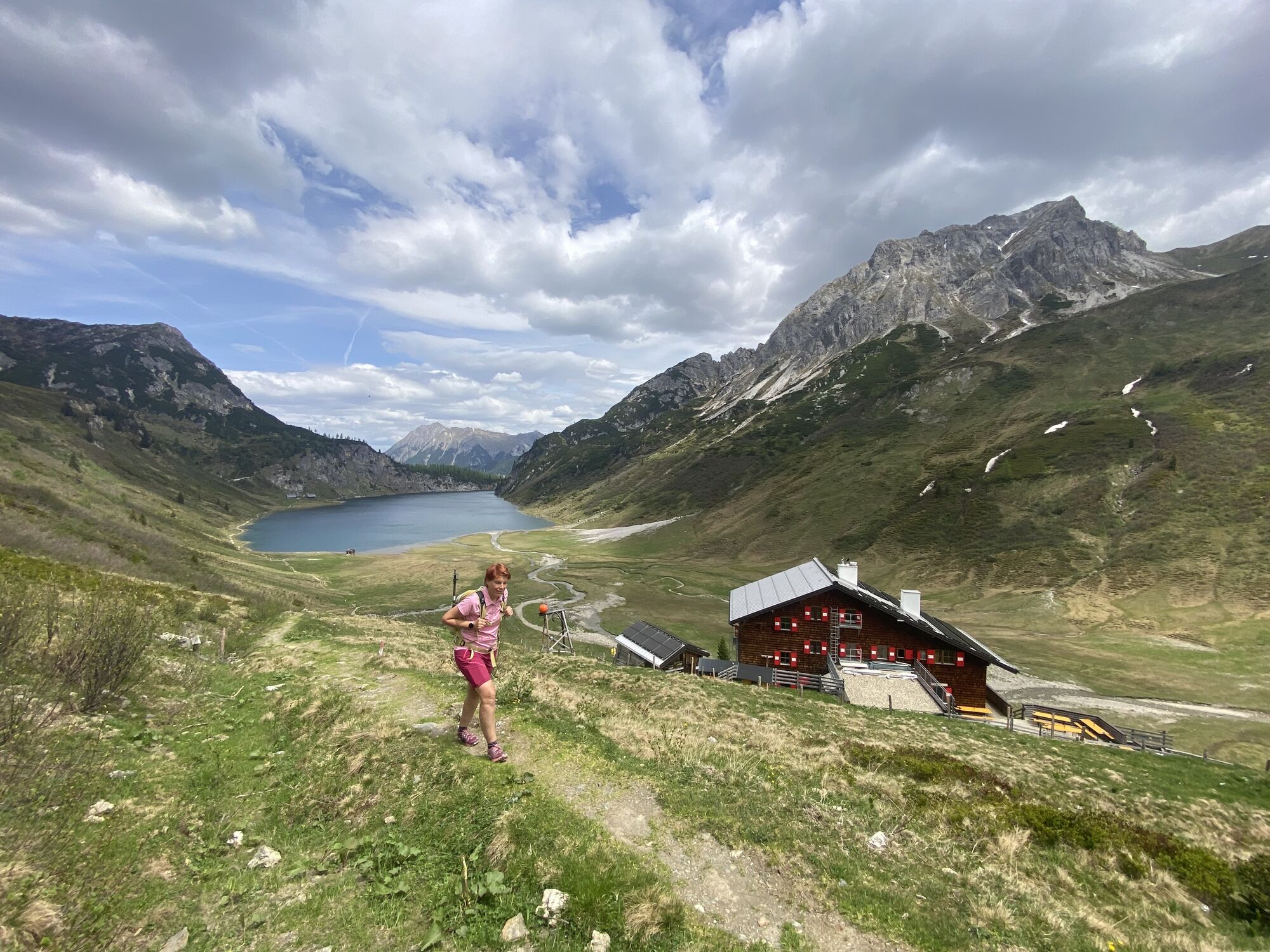
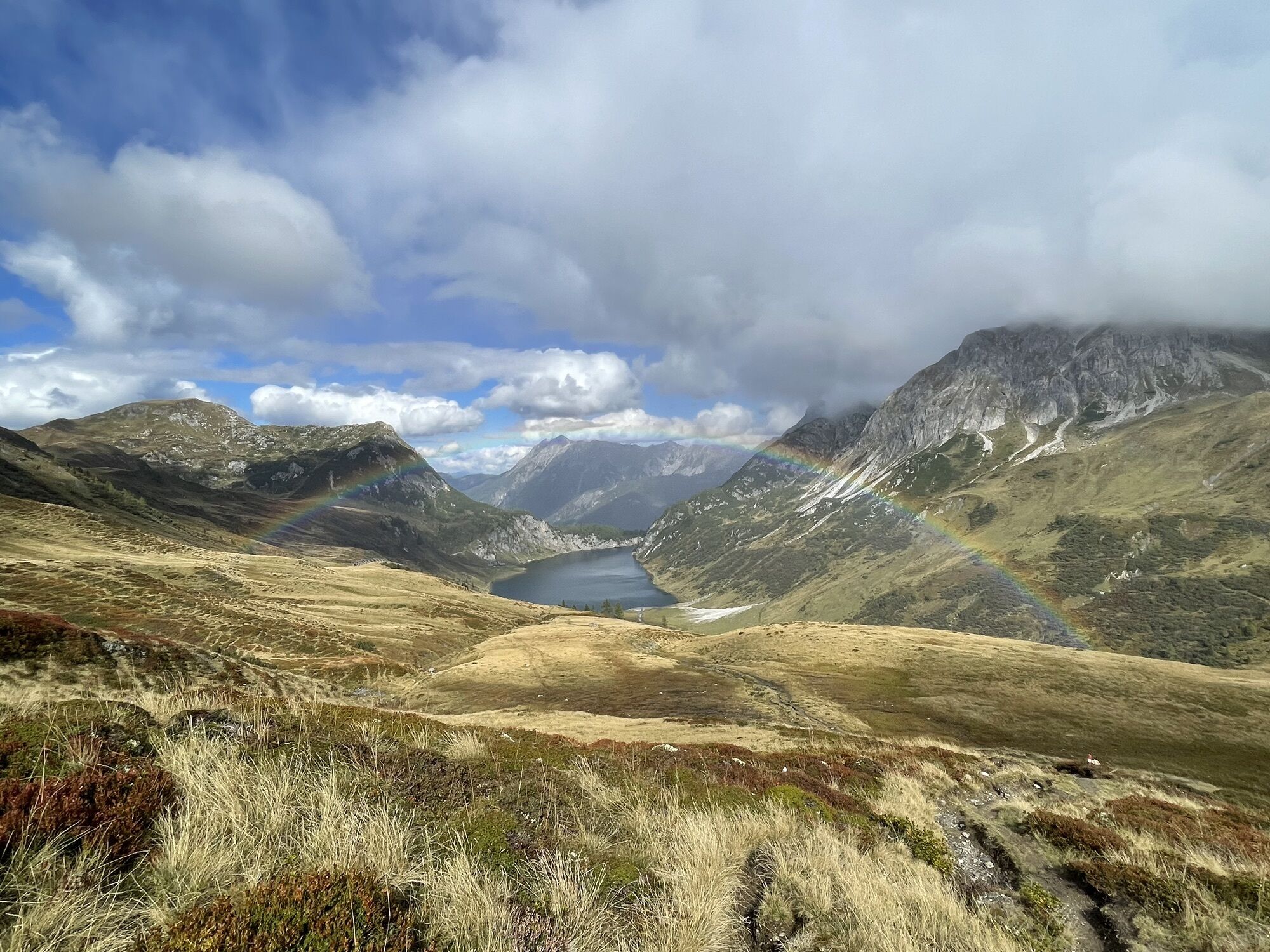
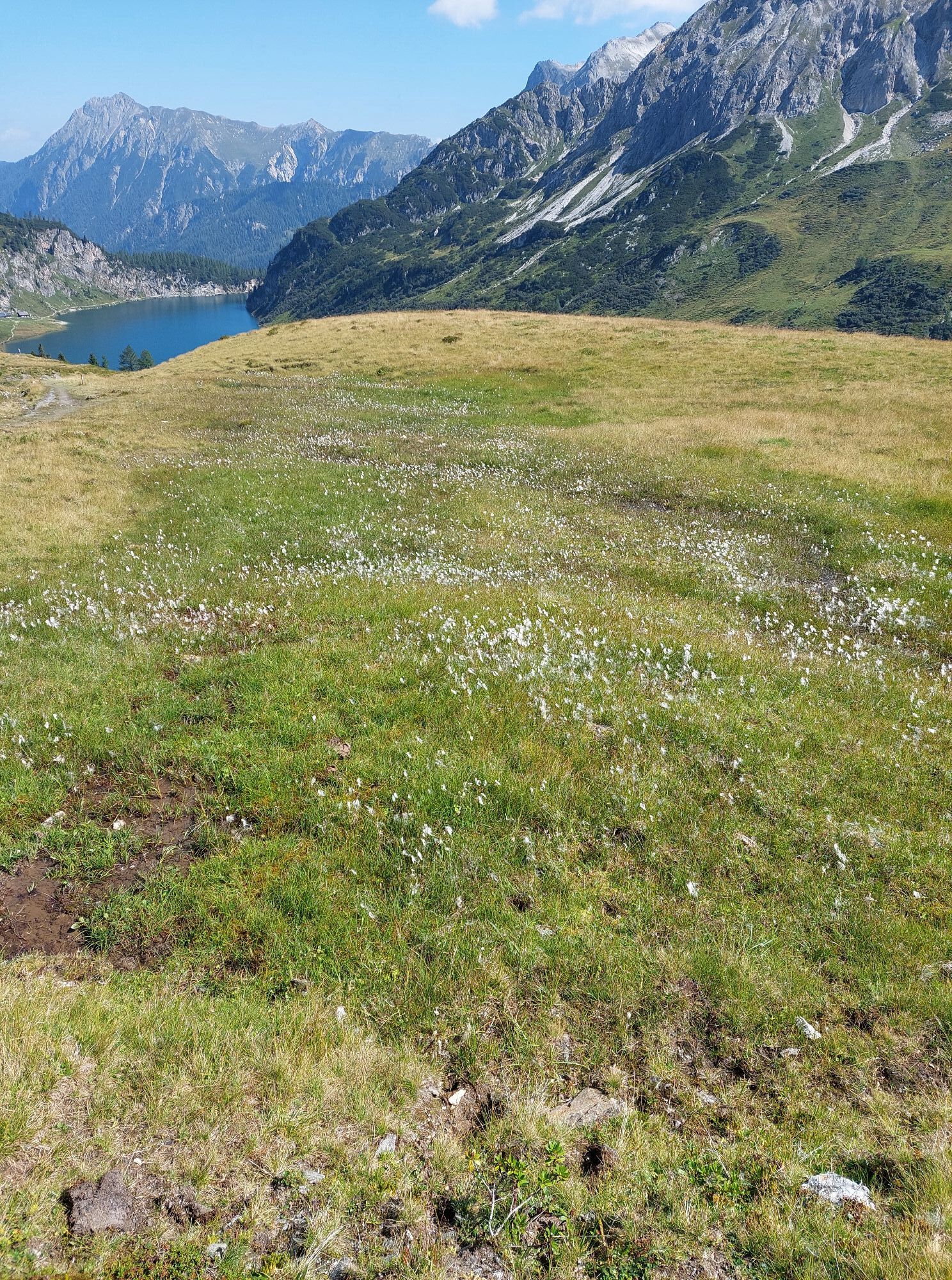
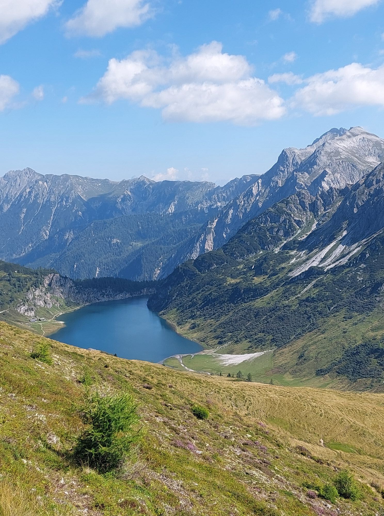
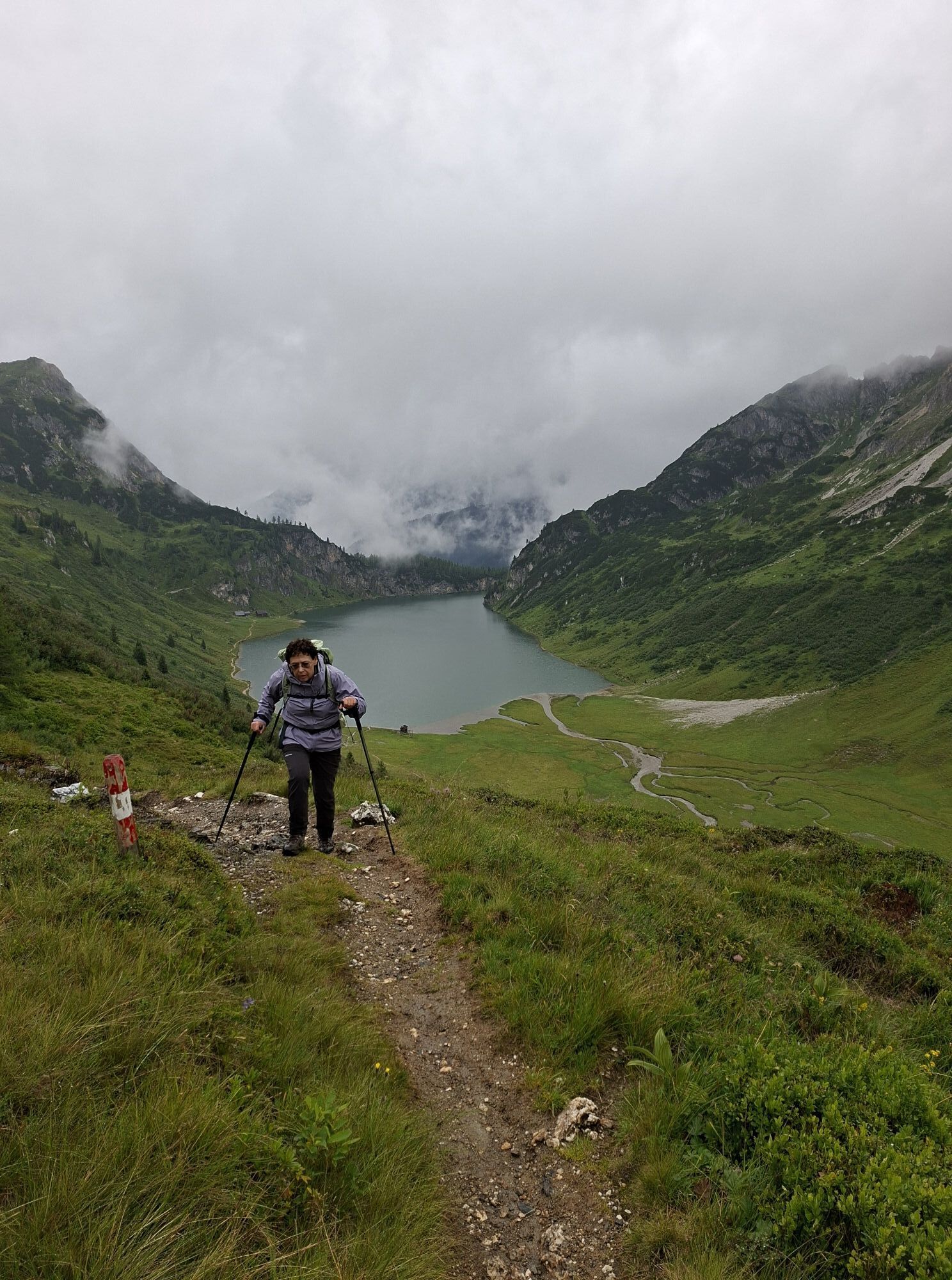
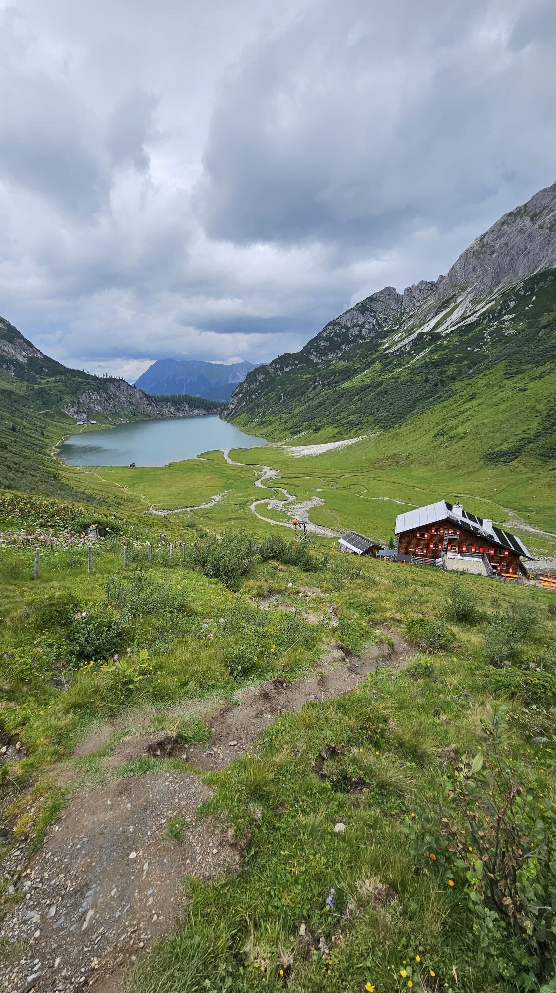
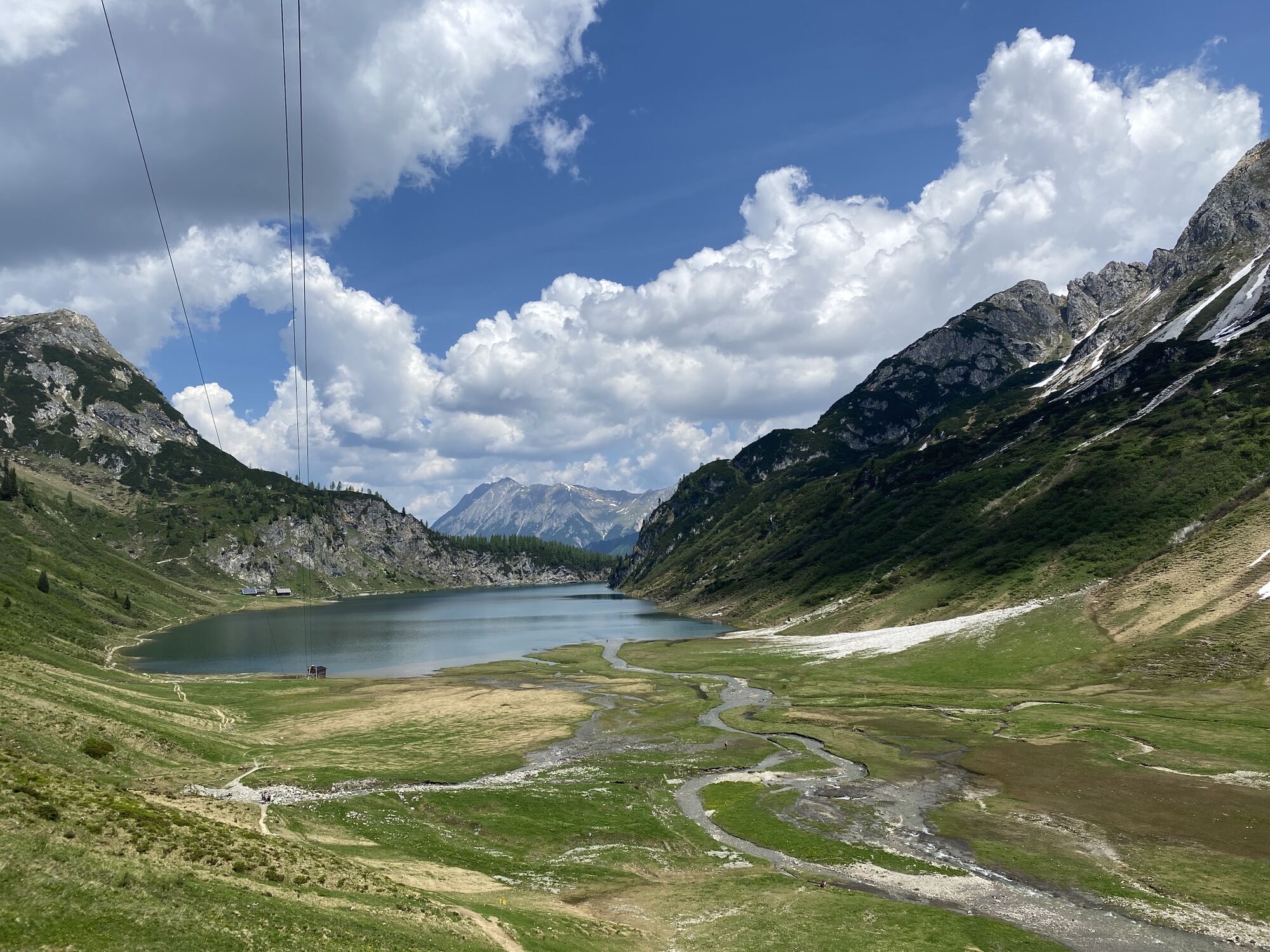
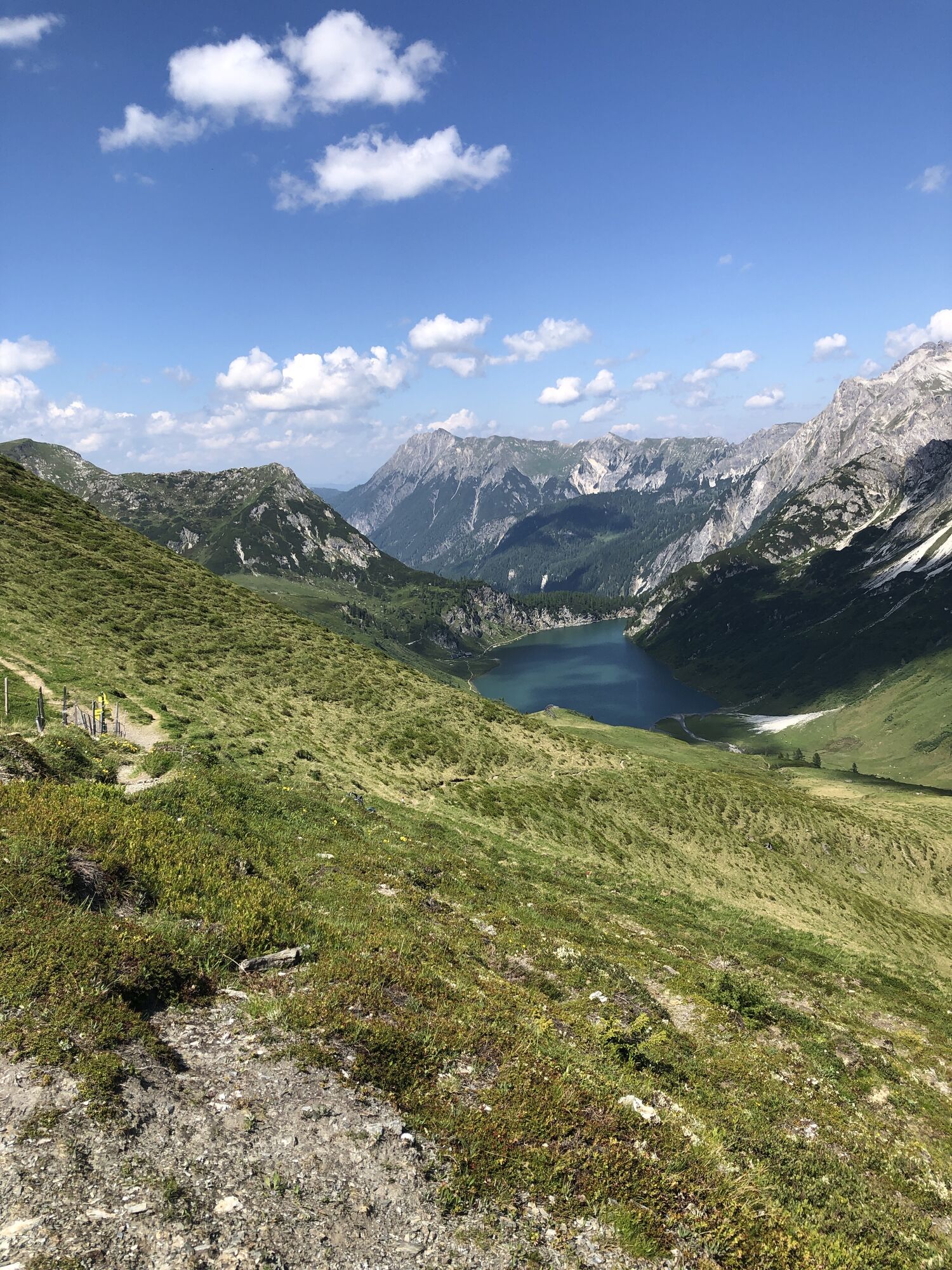
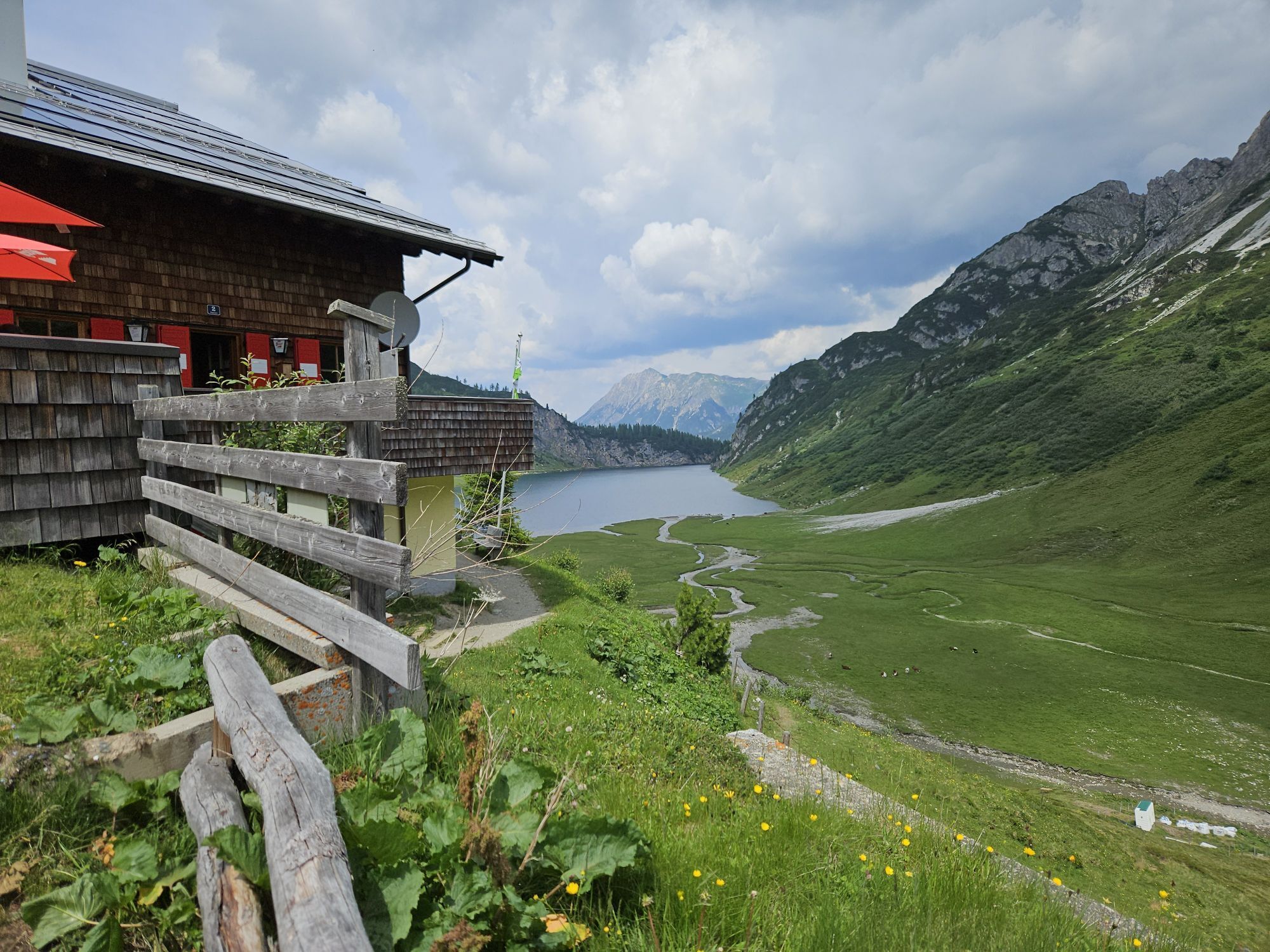
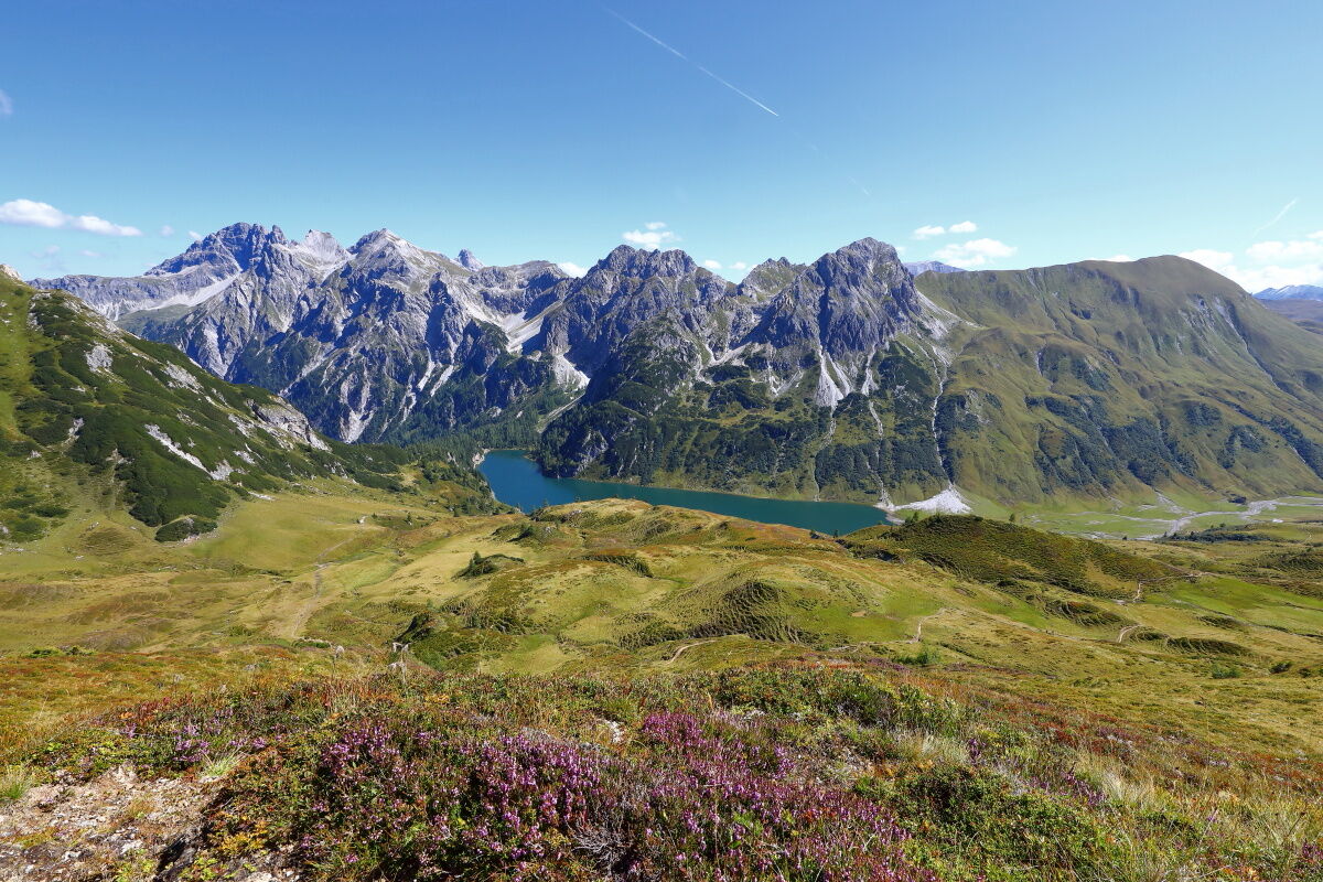
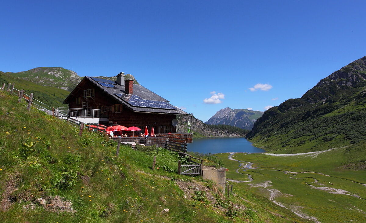
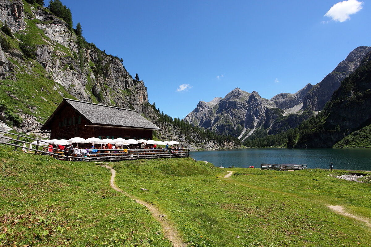
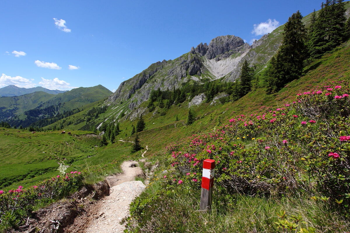
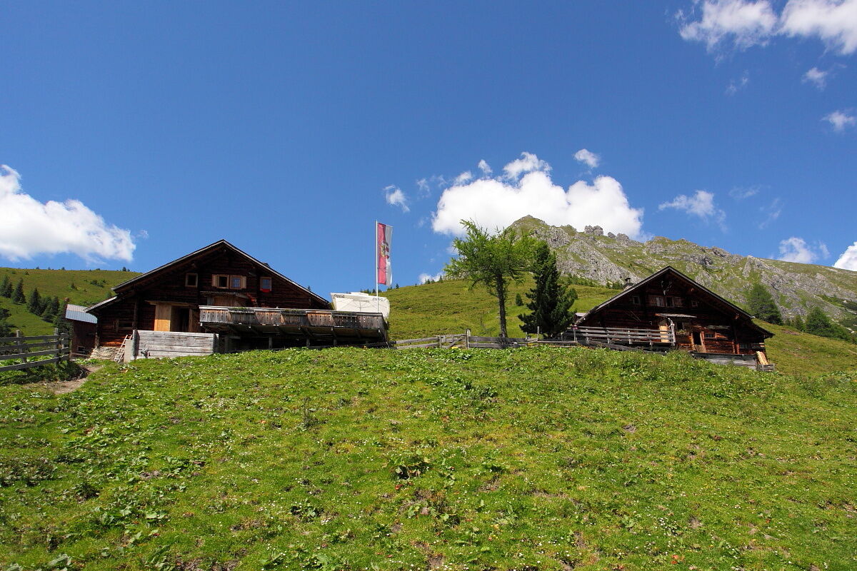
Stage 11 leads from the Bergsteigerdorf® Hüttschlag over a fairly demanding ascent through flower-rich meadows to the Karteistörl and to the largest mountain lake in the Eastern Alps, which is reached in just over five hours of walking. But beware: there are no dining options on the way to today's stage destination, so be sure to pack snacks! In addition, this stage, with 1,264 meters of ascent, is one of the longest on the entire Alpine Pasture Trail. The green-glowing Tappenkarsee lies at around 1,800 meters above sea level, and we’re sure: when you first see it just after the Karteistörl, you will be overwhelmed and pause to take it all in. It is no coincidence that many consider this stage one of the most beautiful sections of the Salzburg Alpine Pasture Trail. The lake is nestled between the Großarl grass mountains and the rocky peaks of the Radstädter Tauern in Kleinarl and – according to legend – is home to a voracious monster. Overnight stays are at the Tappenkarsee Hut, which lies just above the lake and offers a wonderful view: from here, you can keep an eye on the lakeshore to watch for a possible appearance of the vengeful lindworm. Should it not show itself, you will still sleep extraordinarily well! If you cannot get a place at the well-frequented Tappenkarsee Hut or the two nearby Draugstein alms, stage variant 11a is also suitable – here you make a small detour from the Salzburg Alpine Pasture Trail to the Franz-Fischer Hut already located in Lungau.
Along the path
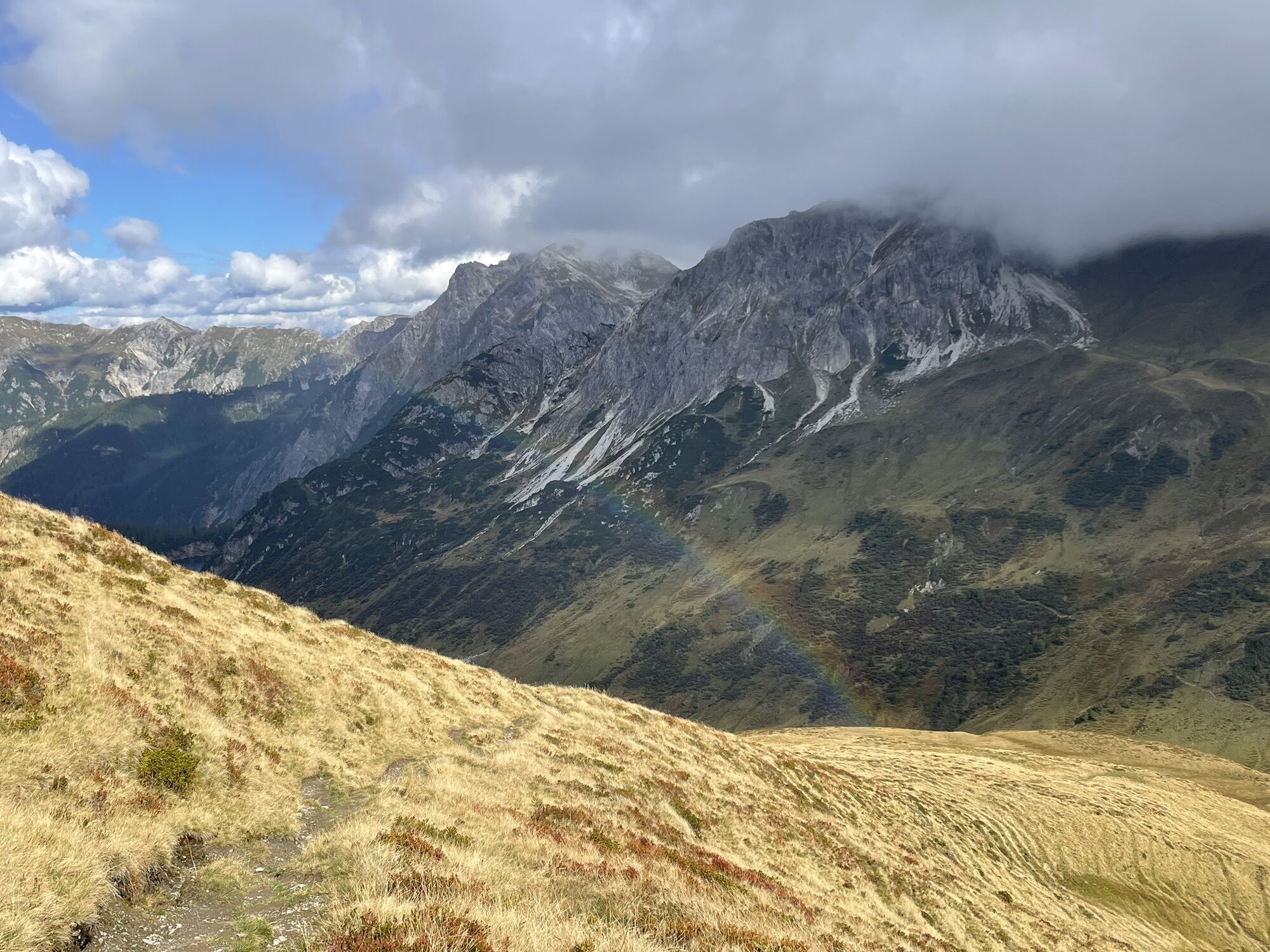
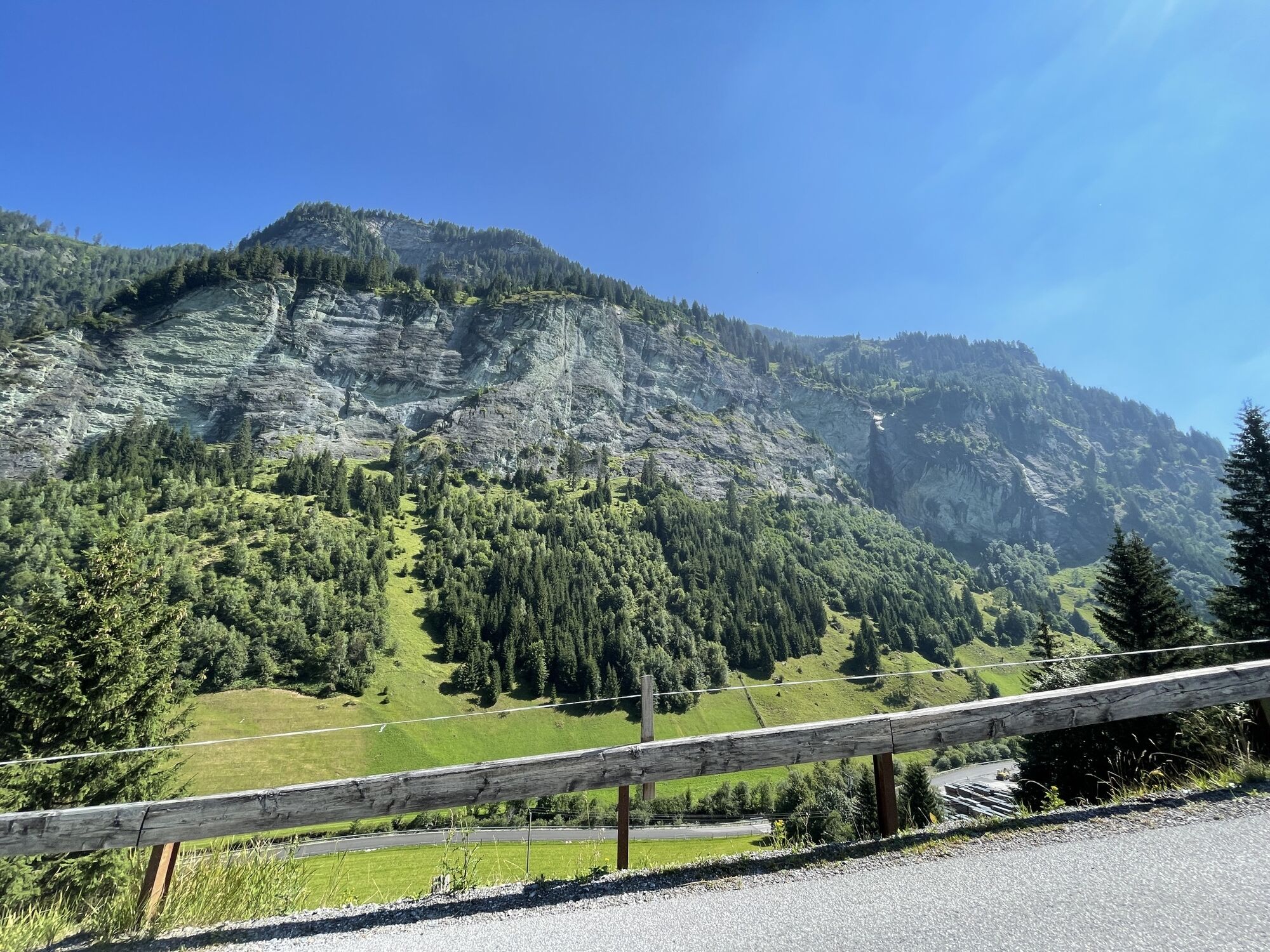
The mighty Draugstein, at 2,358 meters high, with its broad flanks, is one of the few limestone mountains in the Großarl Valley, revealing a very distinctive vegetation. Even during the ascent to Karteistörl, flowers lovers can enjoy a lavish display of colors and blossoms: countless shades of green mix with the bright pink of alpine roses, the dark purple of the marsh orchids – a native orchid species –, the yellow of arnica, and the white of the fluffy cotton grass.
Alpine Pasture Trail Story(ies)
Fancy a little bedtime story? Then let us tell you the story of the lindworm in the Tappenkarsee. This legend is part of the cultural heritage of the Salzburg region and relates that once a voracious lindworm caused much terror around the lake, which is up to fifty meters deep. It swallowed everything that moved on the shore, so some men decided to kill the beast. However, the plan failed, and full of vengeance, the lindworm has since sat on the lake bottom, gnawing on the rock that bounds the Tappenkarsee to the Kleinarl Valley. If it succeeds in breaking through the wall, the entire valley down to Wagrain will be submerged under the floodwaters. According to another legend, the Tappenkarsee is connected underground with the Schuhflickersee north of Schuhflicker, two valleys further between Großarl and Gastein Valley. There, the wheel of a cart was supposedly found that had previously fallen into the Tappenkarsee.
Refreshment on the Alpine Pasture Trail
At the Tappenkarsee Hut, "Three-Colored Kaiserschmarrn" is served. This colorful variant of the classic flour dish is accompanied by apple sauce as well as lingonberry and blackcurrant jam. The blackcurrants (also known as bilberries, blueberries, or moss berries) can, of course, also be picked and eaten along the trail. They are usually ripe at this altitude from late August to mid-September.

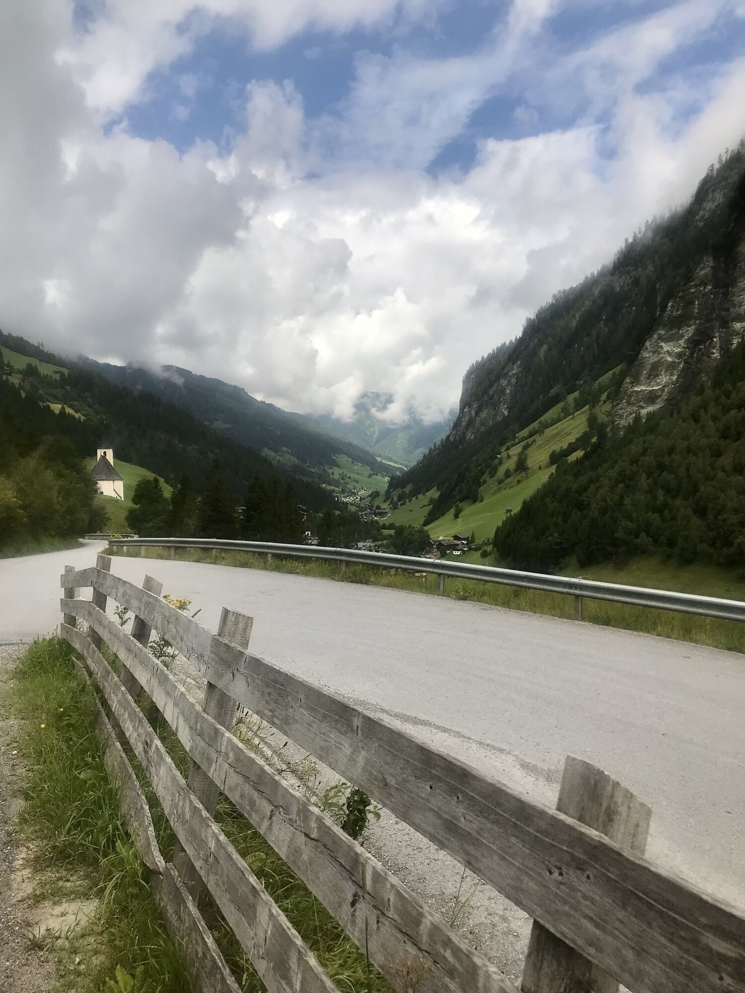
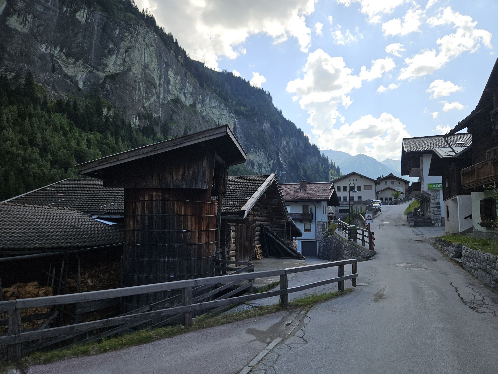
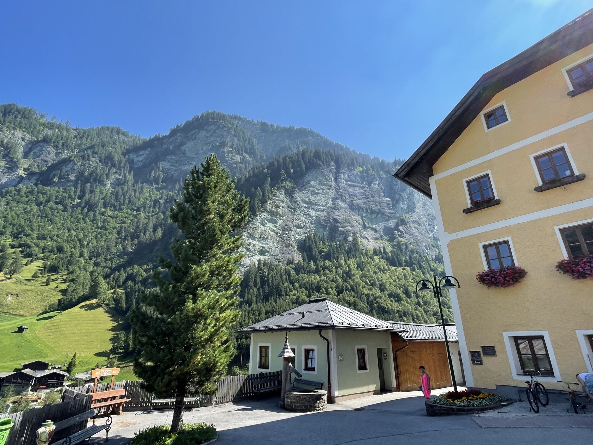
From the starting point at the hiking trailhead in the Bergsteigerdorf® Hüttschlag, it is best to follow the markings of the "Chapel Hiking Trail" parallel above the federal road heading into the valley. It is recommended to take a look at the Christophorus Chapel in Wolfau and the Karteis Chapel with its magnificent Madonna of the Protective Cloak in Karteis: The Christophorus Chapel is located just above the trail – shortly thereafter you either follow the slightly higher hiking trail or for a short stretch along the state road before leaving the state road again at the Karteis Chapel and crossing the Großarlbach. Shortly before the road forks about 200 meters behind the chapel in Karteis, a footpath (No. 55a) branches off to the left between the houses to Oberstein, an old farmstead with a beautiful view of the valley. Following this footpath uphill, it leads below Mühlegg to the right (trail No. 55a) towards Hallmoosalm and further uphill consistently on the other side of the ditch on a farm road.
Past the first parking lot at Hallmoosalm, at the second parking lot – at the fork with the two barriers – follow trail No. 53 on the right and the signs to Karteisalm.
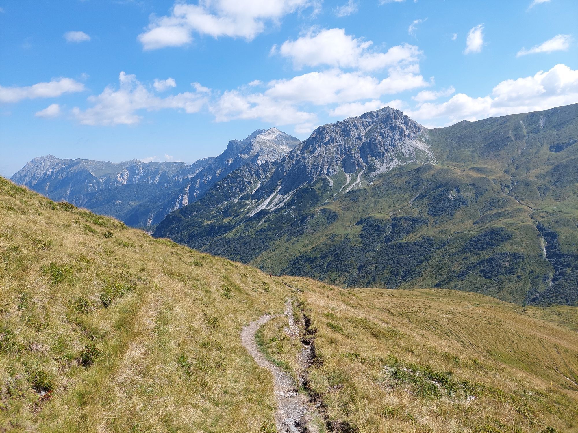
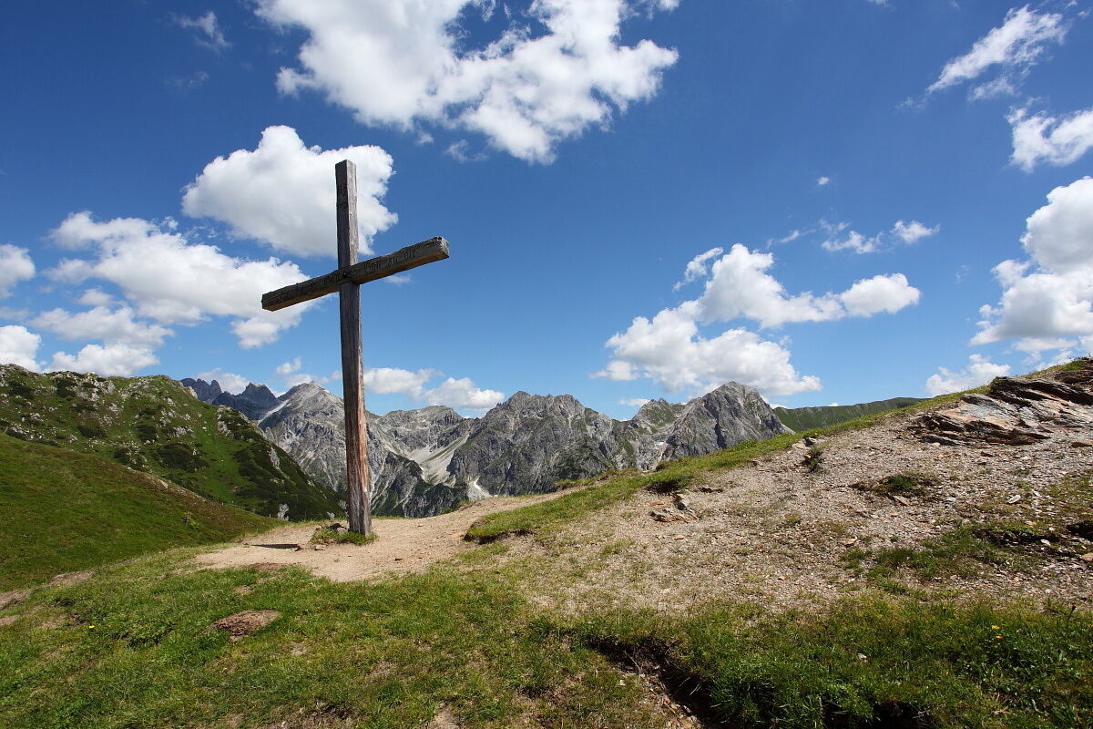
From the forest road, after about 10 minutes of walking, a farm road (No. 53) branches off to the left to Karteisalm, which becomes narrower and finally leads into an alpine path. From the alm, the path leads through a wide cirque up to Karteistörl (2,145 m), from where a roughly 15-minute detour to Kreuzeck (2,204 m) is possible and highly worthwhile. From Karteistörl, trail No. 721 leading downhill to the left takes about 40 minutes to reach today's stage destination, the Tappenkarsee Hut (ÖAV Section Edelweiß). The hut is located in a fantastic location near the lake of the same name.
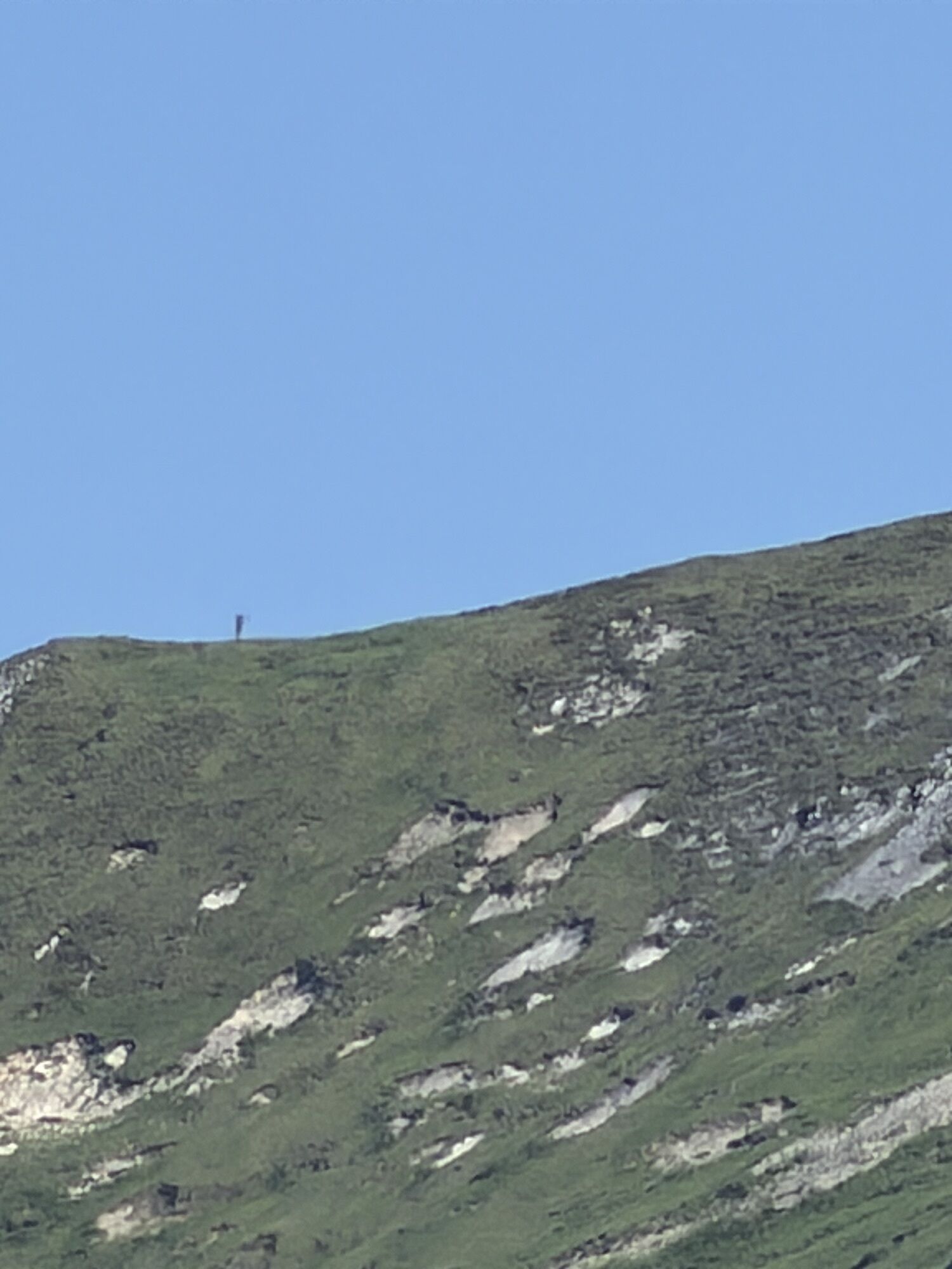
Note: A nice variation includes the Kreuzeck, at 2,204 meters high, as a circular route in today’s stage. For this, about 30 minutes after Karteisalm, follow trail No. 53a to the right onto the western ridge of Kreuzeck and over this to the summit. From here, descend via the northern ridge (trail No. 53) to Karteistörl, where you rejoin the official route of the Salzburg Alpine Pasture Trail. The advantage of this small "detour" is the breathtaking panoramic view of Glingspitz (2,433 m), Keeskogel (2,884 m), and the Hohe Tauern mountains in the southwest, as well as Mosermandl (2,680 m), Faulkogel (2,654 m), and Weißeck (2,711 m) to the east. Also, the ridge usually has a pleasant breeze even in summer, while in the broad valley basin it can get quite hot.
Stage Variant 11a: Hüttschlag - Karteistörl - Franz-Fischer Hut
If the popular Tappenkarsee Hut, as well as the two nearby alternative overnight options, the two Draugstein alms, are fully booked, it is recommended to take a small but very scenic detour off the Salzburg Alpine Pasture Trail on stage variant 11a into the Salzburg Lungau. From Karteistörl, you hike via Haselloch to the vegan & vegetarian Franz-Fischer Hut. The next day, follow Stage Variant 12a back to the Tappenkarsee Hut. From there, you rejoin the original Salzburg Alpine Pasture Trail route of Stage 12.
Dining (E) and overnight accommodation (Ü)
Tappenkarsee Hut (1,820 m), (after approx. 6 hours) June to end of September, phone +43 664 5793178 E/Ü
Tappenkarsee Alm (1,768 m), (after approx. 6.25 hours), located just below the Tappenkarsee Hut) June to end of September, phone +43 676 3409923 E
Ano
Here you will find everything about the right hiking boots, perfect equipment, and the correct walking technique.
To ensure your day in the mountains becomes an unforgettable experience, we give you some tips to stay safe in the mountains.
Hüttschlag is best reached by public transport via the St. Johann in Pongau railway station. From there, take the Postbus (line 540) to Hüttschlag. Use of the Postbus lines is free with the Guest Mobility Ticket.
If arriving by car, you can park it free of charge for several days in Hüttschlag in the town center near the Schappach Chapel. Please leave the "Almenweg parking clock" from the brochure in the parked car!
T2
All further information about the Salzburg Alpine Pasture Trail can be found here.
The impressive National Park experience exhibition "On the Alm – Between Heaven and Earth" at the valley end of Hüttschlag deals with the special features of the alpine pasture landscape and alpine life and complements the exhibition "Secrets of the Mountain Forest." Open daily from mid-May to the end of October from 10 a.m. to 5 p.m.


Oblíbené prohlídky v okolí
-
4.9
Großarl: Aualm - Liechtensteinkopf - Aukopf - Schuhflicker - Schuhflickersee
středníTuristika 5.84 km -
5.0
Großarl: Alpine pasture circuit in Ellmautal
středníTuristika 9.69 km -
4.1
Tappenkarsee Kleinarl
středníTuristika 9.11 km -
4.7
Großarl: Mooslehenalm – Niggeltalalm – Viehhausalm
středníTuristika 5.44 km -
5.0
Hüttschlag: Karteistörl - Tappenkarsee - Draugsteintörl - Draugsteinalmen
středníTuristika 13.5 km -
4.5
Mountain route from the Kötschachtal to the natural jewel Reedsee
středníTuristika 12.5 km -
4.4
"Elendrunde" Kleinelend Valley - Zwischenelendscharte - Großelend Valley
středníTuristika 21.9 km -
4.8
Höhenweg vom Grünen Baum bis Bad Hofgastein
světloTuristika 7.92 km -
4.8
Kölnbreinspeicher bis Osnabrücker Hütte
světloTuristika 15.9 km -
4.6
Großarl: Saukaralm - Saukarkopf - Gerstreitalm
středníTuristika 9.39 km
Pěší turistika a stopování


Nenechte si ujít nabídky a inspiraci pro vaši příští dovolenou
Vaše e-mailová adresa byl přidán do poštovního seznamu.