


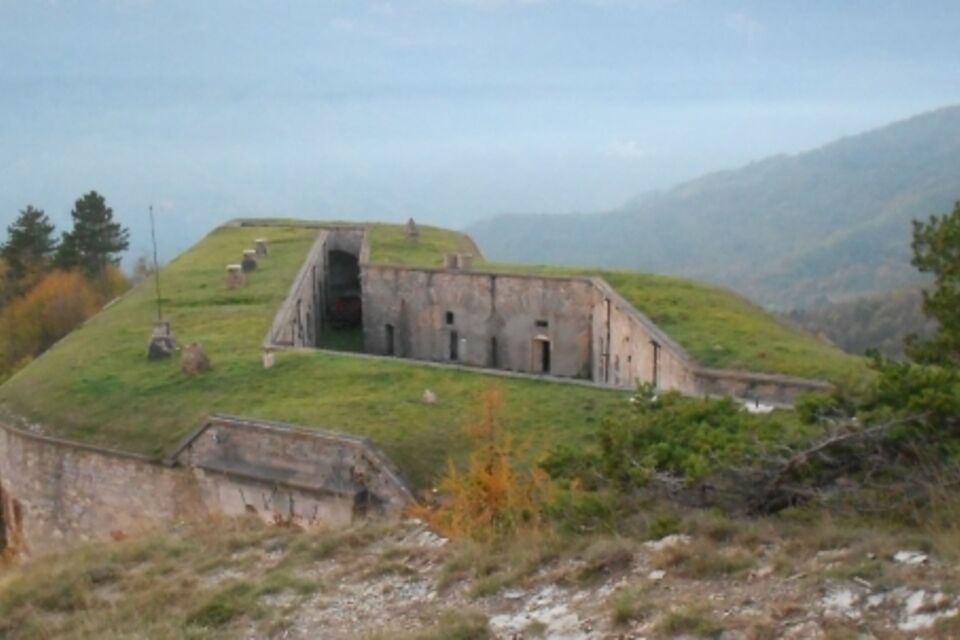
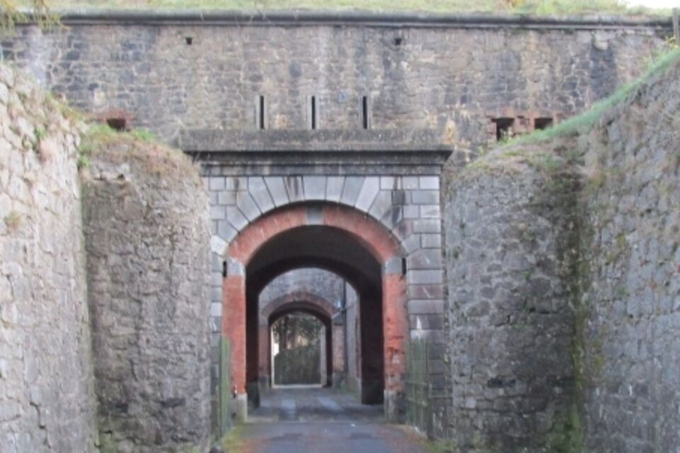
IM_22 Le fortificazioni del Colle di Nava
from Colle di Nava (934 m) follow the asphalt road eastwards towards Forte Centrale. Walk between the walls and then inside the fort. Out of the fort, at the next crossroads, go left on the asphalt road....
from Colle di Nava (934 m) follow the asphalt road eastwards towards Forte Centrale. Walk between the walls and then inside the fort. Out of the fort, at the next crossroads, go left on the asphalt road. You shortly reach Forte Ballarasco, excellent panoramic point on the upper Arroscia Valley. Continue along the level road through the eastern side of the mountain: past a house on the right, the road turns unpaved. At the next crossroads take a mule-track which rises to the left and, a little way ahead, turn right (“Forte Richermo” sign), ignoring a track on the left. The footpath reaches the wide eastern ridge of Monte Bellarasco; nearby, at a crossroads, turn left to follow the ridge. Carry on walking on the wide ridge, which is first uphill and panoramic, then it becomes level and woody. After a short stretch through a dense conifer wood you reach Forte Richermo (1210 m; 1.30 hours). Here you turn left, ignoring the footpath which continues along the watershed. Walking downhill in the wood on a wide footpath with hairpin turns you return to Colle di Nava (45 minutes from Forte Richermo; 2.15 hours in total).

by train, get off at Imperia Oneglia station (Genova-Ventimiglia line). From Oneglia, by bus, reach Colle di Nava (www.rtpiemonte.it).
coming from east: from Albenga motorway exit (A10 Genova-Savona-Ventimiglia) follow the signs for “Valle Arroscia SS 453” reaching Pieve di Teco and thence Colle di Nava (39 km from Albenga). Coming from west, exit at Imperia Est (A10 motorway) and follow the signs for “Colle di Nava SP 28”. At the pass there is a large car park on the right (35 km from Imperia).
Nature and Landscape * * * * Family * * * * Gourmet * * * Culture * * * * *
Oblíbené prohlídky v okolí
- 4,0
IM_11 Ring path of Pizzo d’Evigno
Turistika 10,8 km IM_13 Ring path of Triora
Turistika 8,70 kmIM_02 Passo della Teglia - Passo della Mezzaluna - Monte Mónega
Turistika 14,3 km- 5,0
Tour of Marguareis | Stage 4 Mongioie Refuge - Don Barbera Refuge
středníTuristika 11,6 km Trail no. 06: Sella della Valletta - Colla S. Barnardo
Turistika 8,04 kmXC Molini di Triora
heavyMountainbike 31,5 kmSea Mountains
heavyMountainbike 48,0 kmIM_04 Monte Saccarello da Realdo
Turistika 6,09 kmIM_16 Mendàtica - Cascate dell'Arroscia
Turistika 5,12 kmTour of Marguareis | Stage 3 Mondovì Refuge - Mongioie Refuge
Turistika 11,3 km
Pěší turistika a stopování


Nenechte si ujít nabídky a inspiraci pro vaši příští dovolenou
Vaše e-mailová adresa byl přidán do poštovního seznamu.