







Languard via ferrata

Úroveň obtížnosti: E
Anyone who wants to climb the Languard via ferrata first follows the hiking trail uphill from the exit of the Resgia trail towards Alp Languard until a sign on the right signals: Languard via ferrata....
Anyone who wants to climb the Languard via ferrata first follows the hiking trail uphill from the exit of the Resgia trail towards Alp Languard until a sign on the right signals: Languard via ferrata. A short climb up a grassy slope leads to the start. Then it gets intense, with short overhanging sections alternating with airy traverses. A wooden beam, which you balance over, offers a short rest for tired muscles. A shaky three-cable bridge may strain your nerves, and the final overhang to the exit again requires some arm strength (½ hour). Only for fit via ferrata climbers!
Descent: Either hike down the trail to Pontresina or take the chairlift Alp Languard down comfortably.
Prefer to be guided on the via ferrata? Here you can book your adventure
Further information
Engadin Tourism AG
Via Maistra 1
CH-7500 St. Moritz
Phone: +41 81 830 00 01
Email: allegra@engadin.ch
Website: www.engadin.ch

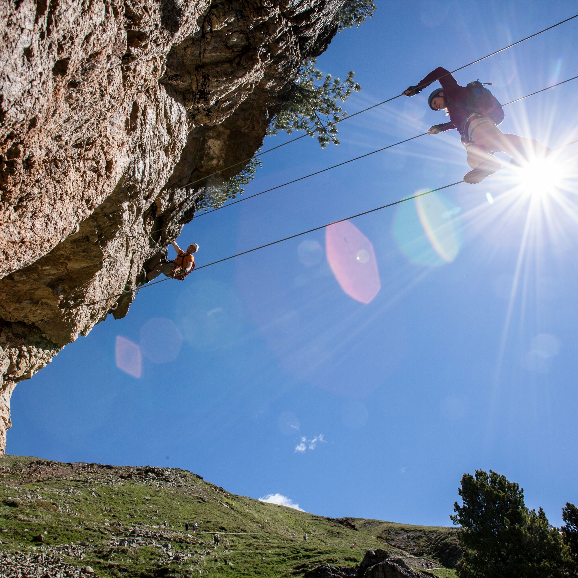
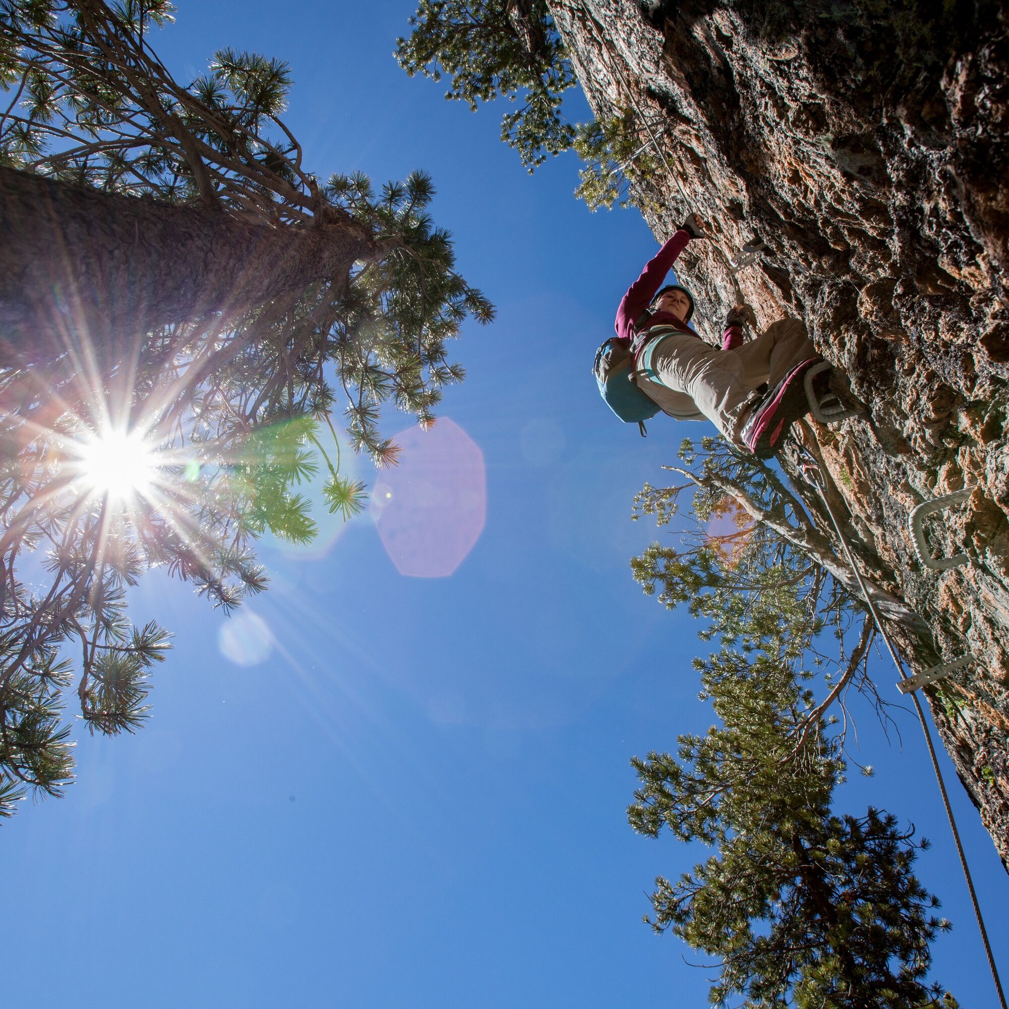

MANDATORY: Helmet, fall arrester (EN 958:2017), climbing harness, and gloves
RECOMMENDED: Mountain or via ferrata shoes, warm clothing (even in good weather), snacks, drinks (water/tea), mobile phone, backpack, first aid kit
Equipment can be rented at the sports shops in Pontresina.
Via ferrata scale K5. Ascent at your own risk and responsibility. For the first time, it is recommended to use the services of a professional mountain guide from the Pontresina mountaineering school.
Climbing via ferratas involves risks. Insufficient preparation, inadequate equipment, or improper behavior can lead to falls. Therefore, climbing via ferratas is only recommended with the necessary knowledge and good physical condition. Surefootedness and a head for heights are required.
ADDITIONAL POINTS TO NOTE:
Only start in stable weather conditions
In case of thunderstorm risk, stay away from iron fixtures and leave the via ferrata
Do not trigger rockfall and pay attention to other climbers
Partner check at the start (helmet, climbing harness, and fall arrester)
Keep sufficient distances (only one person between two fixed points)
Do not leave the via ferrata and always use the safety rope
Be considerate of fauna and flora. Carry out all waste
Children (under 40 kg): the via ferrata set and harness (possibly combined harness) must be suitable for the children's weight
Do not enter closed via ferratas
Via ferrata set according to EN 958:2017 is intended for users weighing between 40 kg and 120 kg.
E
The Alp Languard mountain restaurant awaits with delicacies for hungry and thirsty climbers.
Webové kamery z prohlídky
-
St. Moritz / Samedan - Muottas Muragl
-
Camping Morteratsch
-
St. Moritz / Samedan - Muottas Muragl
-
St. Moritz / Samedan - Muottas Muragl
-
St. Moritz / Samedan - Muottas Muragl
-
St. Moritz / Samedan - Muottas Muragl
-
Sporthotel Pontresina
-
Pontresina - Hotel Walther
-
Pontresina - Langlauf und Bikezentrum
-
Pontresina - Eiskletter-Schlucht
-
Pontresina - Hotel Saratz

Oblíbené prohlídky v okolí
-
5.0
Morteratsch station - Boval Hut
středníTuristika 10.5 km -
4.7
Panoramic route Muottas Muragl
světloTuristika 6.75 km -
4.7
Diavolezza - Munt Pers
světloHorská turistika 3.82 km -
5.0
Muottas Muragl - Segantini hut - Pontresina
středníTuristika 6.46 km -
4.5
Pontresina - Val Roseg - Pontresina
světloTuristika 13.8 km -
4.8
SAC Tschierva
světloTuristika 24.7 km -
4.8
Around Lake St. Moritz
světloTuristika 4.32 km -
4.8
Lagalb - Val Minor - Motta Bianca - Lagalb
středníTuristika 9.80 km -
4.7
Morteratsch Glacier route
světloTematická stezka 2.88 km -
4.4
Piz Palü (3.905m) – Hochtour
středníVysokohorská turistika 13.4 km
Pěší turistika a stopování


Nenechte si ujít nabídky a inspiraci pro vaši příští dovolenou
Vaše e-mailová adresa byl přidán do poštovního seznamu.





