


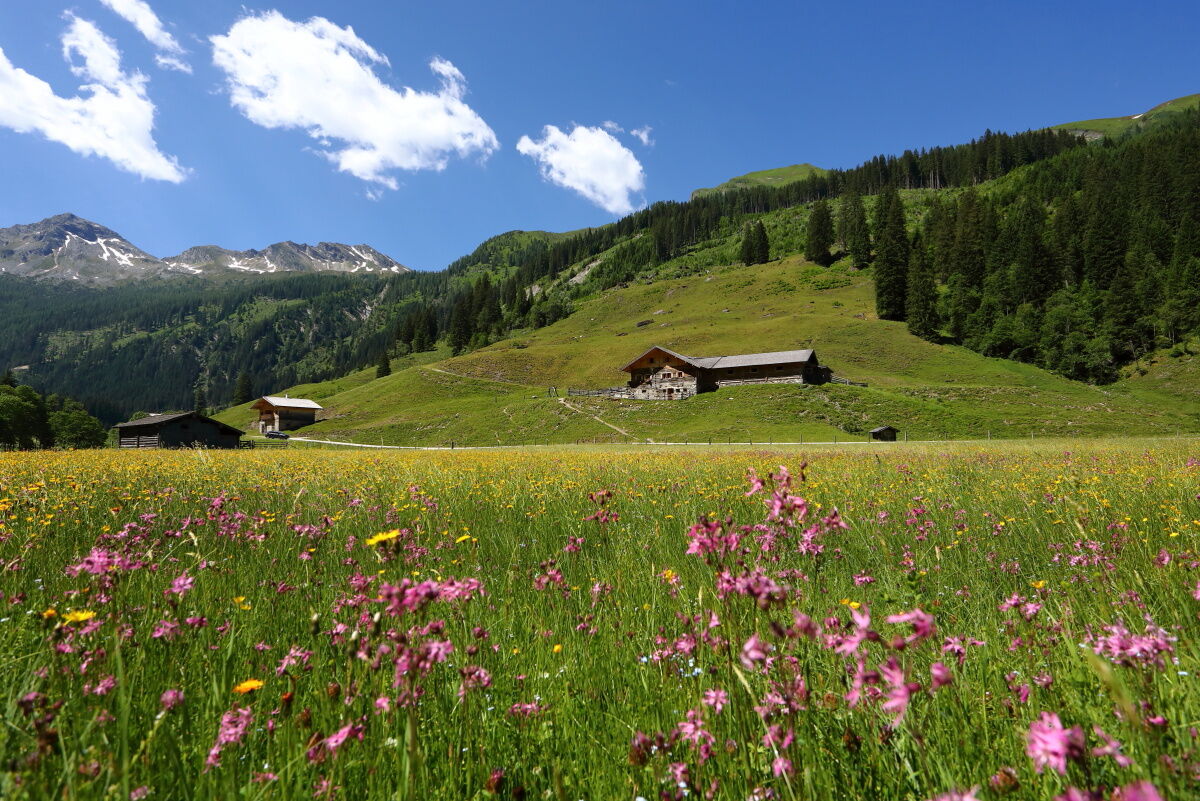
Hüttschlag: Hubalm


From the village center in Hüttschlag, the road leads to the start of the hiking trail above the church, where there is also a parking lot (Hubalmweg). From here, follow the road uphill to the curve. There...
From the village center in Hüttschlag, the road leads to the start of the hiking trail above the church, where there is also a parking lot (Hubalmweg). From here, follow the road uphill to the curve. There begins the old Hubalm path which leads through the forest to the Hubalm chapel. This is a place for pausing and giving thanks and should inspire every hiker to reflect briefly. After that, the path gently follows along the stream to the Hubalm. Here the dairy farmers like to spoil guests with homemade delicacies such as bread, butter, cheese, bacon, or a small glass of schnapps. The return route follows the forest road back to the village center Hüttschlag. The Hubalm area is one of the wildest regions in our valley. It can happen that during a hike you might encounter a deer or a stag, and especially in autumn you can hear the stag rutting (= roaring).

Drive by car to Hüttschlag – through the village – past the elementary school to the highest point of the road. Around where the road goes downhill again, there is a small parking lot (Hubalmweg) and the starting point of the hike. From here, follow the upper road to hiking trail No. 46b and then the forest road into the Hubalm valley (trail No. 46) to the Hubalm, 1,311 m (approx. 1 1/4 hours) – back via the forest road (trail No. 46).
Ano
Ano
Hiking boots, hiking map
Drive by car or hiking taxi to the Hubalmweg parking lot. Alternatively, you can take Postbus No. 540 to the Hüttschlag village center bus stop.
Parking option above the elementary school in Hüttschlag (Hubalmweg parking lot)
The Hubalm is a hiking destination in any weather and accessible for all who are not very good on foot as well as easily reachable with a stroller.
Webové kamery z prohlídky
Oblíbené prohlídky v okolí
-
4.7
Bahnhof Bad Hofgastein nach Bahnhof Bad Gastein
středníTuristika 13.0 km -
4.5
Mosermandl Windischscharte, Salzburger Land/Österreich
heavyTuristika 14.6 km -
5.0
Türchlwand von der Bergstation Schlossalmbahn Bad Hofgastein, Österreich
středníHorská turistika 7.05 km -
4.2
Ennskraxn (2410m)
heavyTuristika 14.7 km -
4.8
Hüttenkogel - Graukogel von der Bergstation
středníHorská turistika 4.68 km -
4.8
Gasteiner Höhenweg von Bad Gastein nach Bad Hofgastein
světloTuristika 8.58 km -
4.1
Großarl: Unterwandalm - Karseggalm - Breitenebenalm
středníTuristika 5.93 km -
4.4
Wasserfall Bad Hofgastein
světloTuristika 3.89 km -
4.6
Bergtour vom Kötschachtal zum Naturjuwel Reedsee
středníTuristika 12.5 km -
4.7
Kölnbreinspeicher bis Osnabrücker Hütte
světloTuristika 15.9 km
Pěší turistika a stopování


Nenechte si ujít nabídky a inspiraci pro vaši příští dovolenou
Vaše e-mailová adresa byl přidán do poštovního seznamu.