


Fusch: 727 | Käfertal nature adventure path

From the Ferleiten parking lot (1,145m) continue over the Fuscher Ache to the Tauern inn (end of the public traffic route). From here, a narrow gravel road runs flat through the diverse alpine landscape...
From the Ferleiten parking lot (1,145m) continue over the Fuscher Ache to the Tauern inn (end of the public traffic route). From here, a narrow gravel road runs flat through the diverse alpine landscape of the Käfertal.
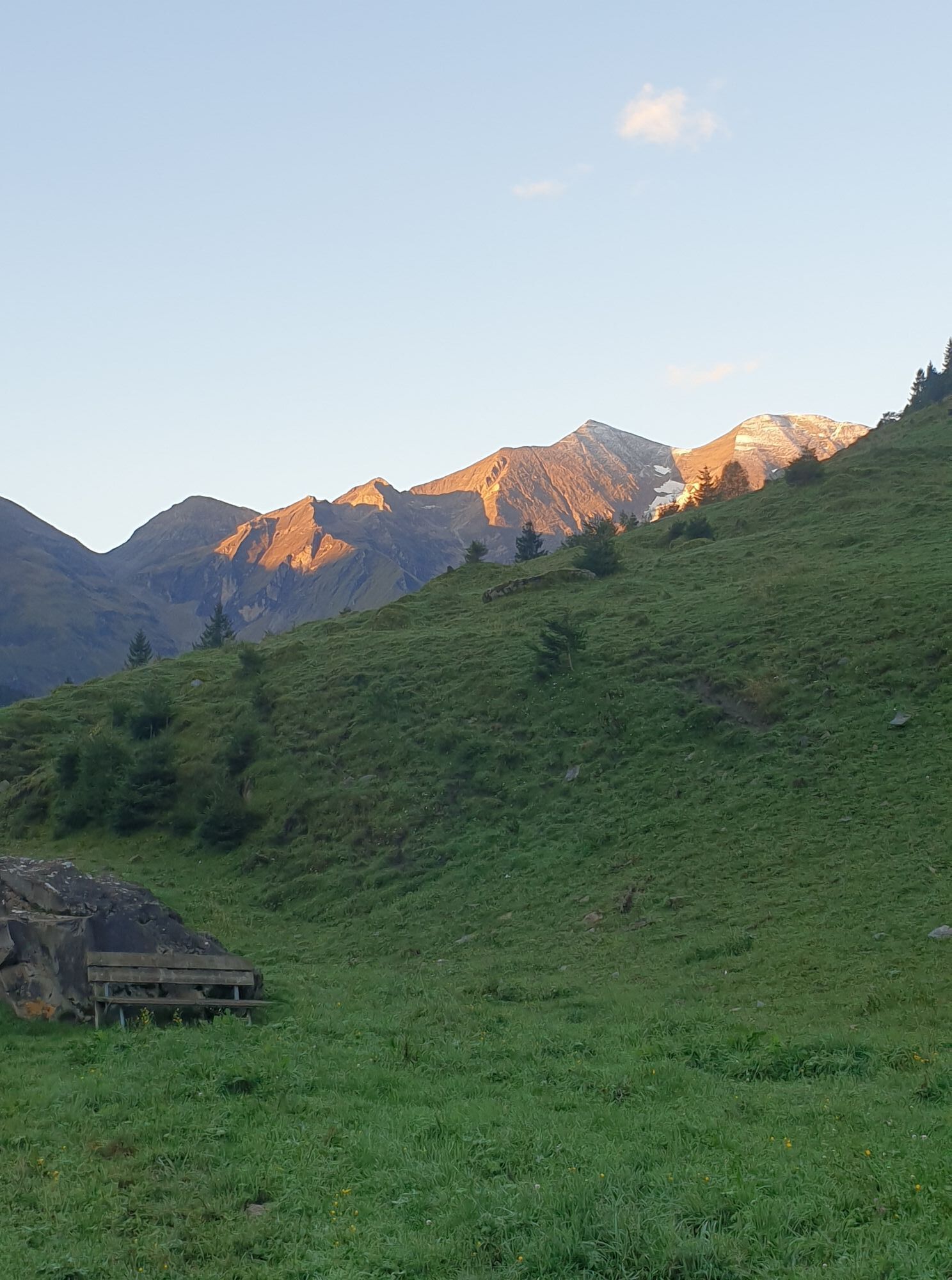
After some gates, the path becomes stonier, narrower, and rises slightly towards the valley end. Here, only a piece of forest separates you from the view of the western Käfertal. Steep rock walls, where waterfalls flow deep down, adorn the valley end.
Small woods, pastures, and alpine huts accompany you to the Rotmoos, which is reached after 1 hour 30 minutes (1,428 m).
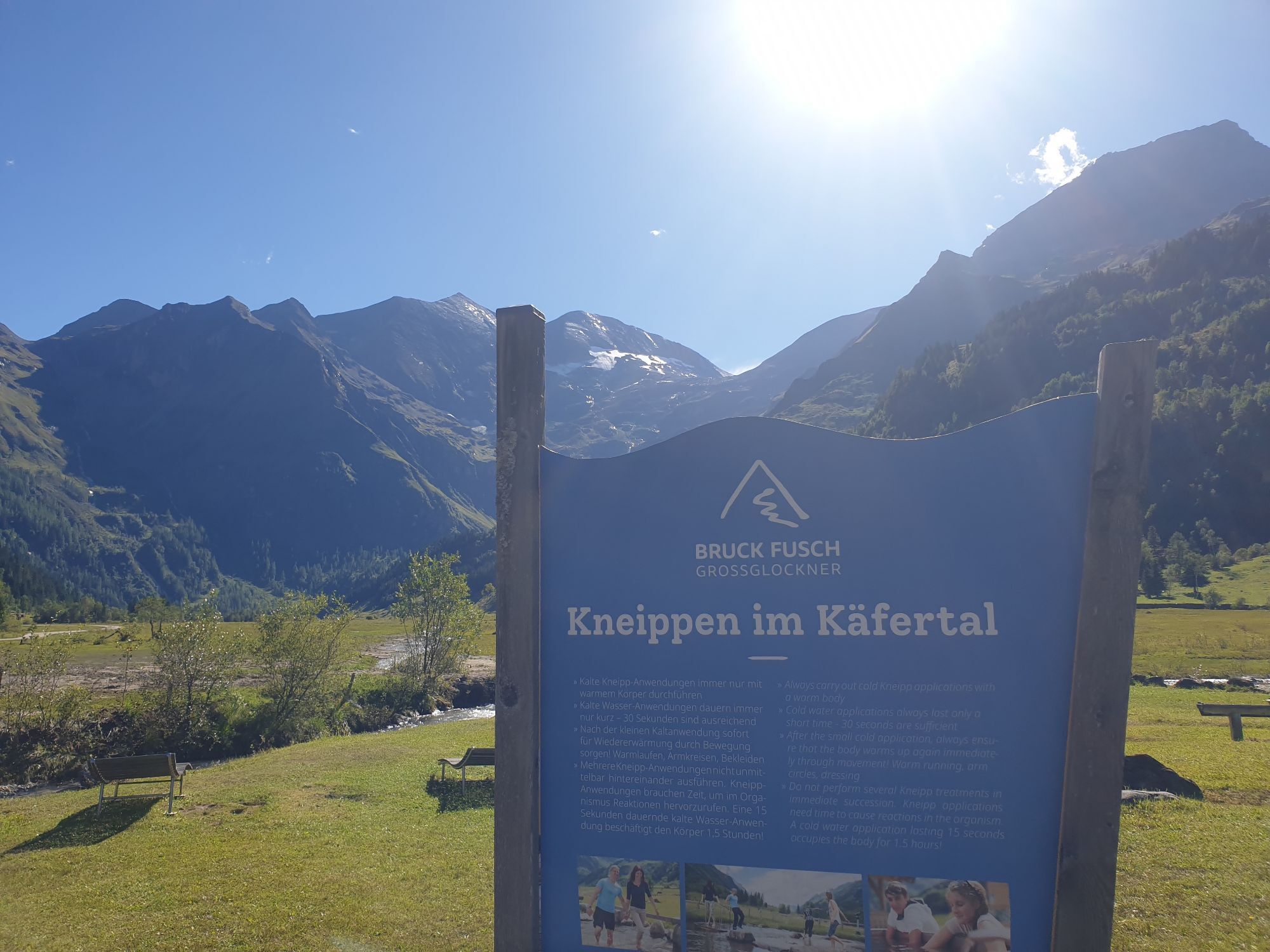
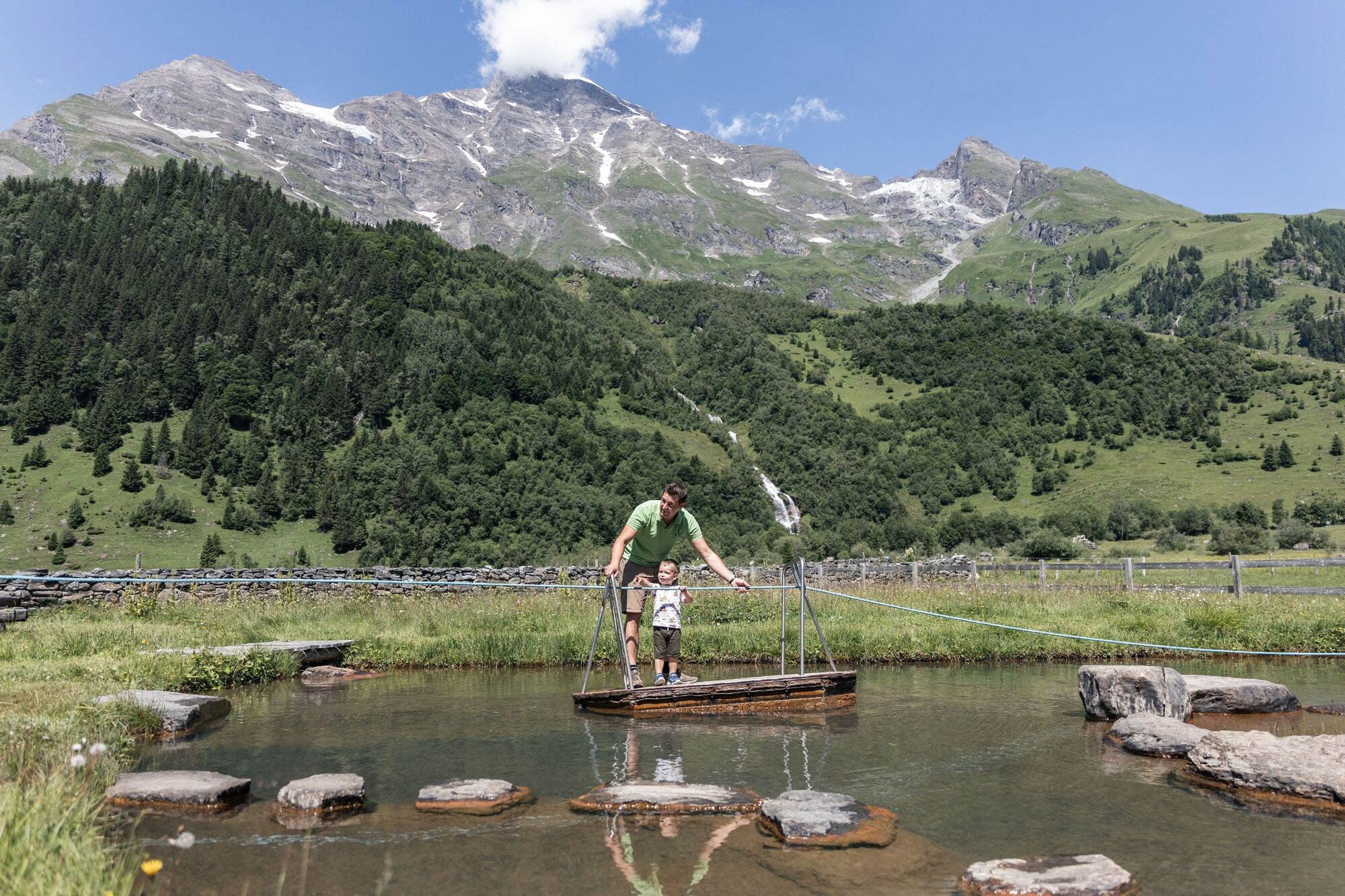
At various stations and on display boards, visitors are introduced to the special features of this valley. The highlight is the water playground with a cable ferry and Kneipp facility.
From here, there is the option to hike 1 hour to the managed Trauneralm.
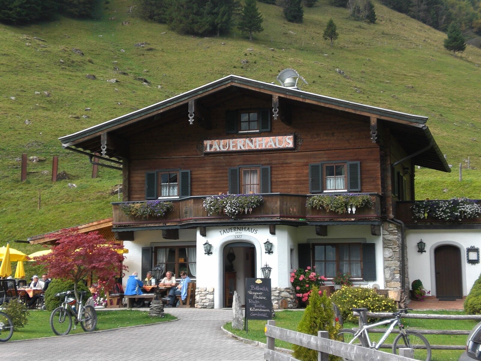
There is a place to stop on the way back at the Oberstattalm or the Tauernhaus Ferleiten inn.


Ano
Ano
Ano
Alternatively, by Postbus line 650, Ferleiten Wildpark stop
Postbus line 650, Ferleiten Wildpark stop
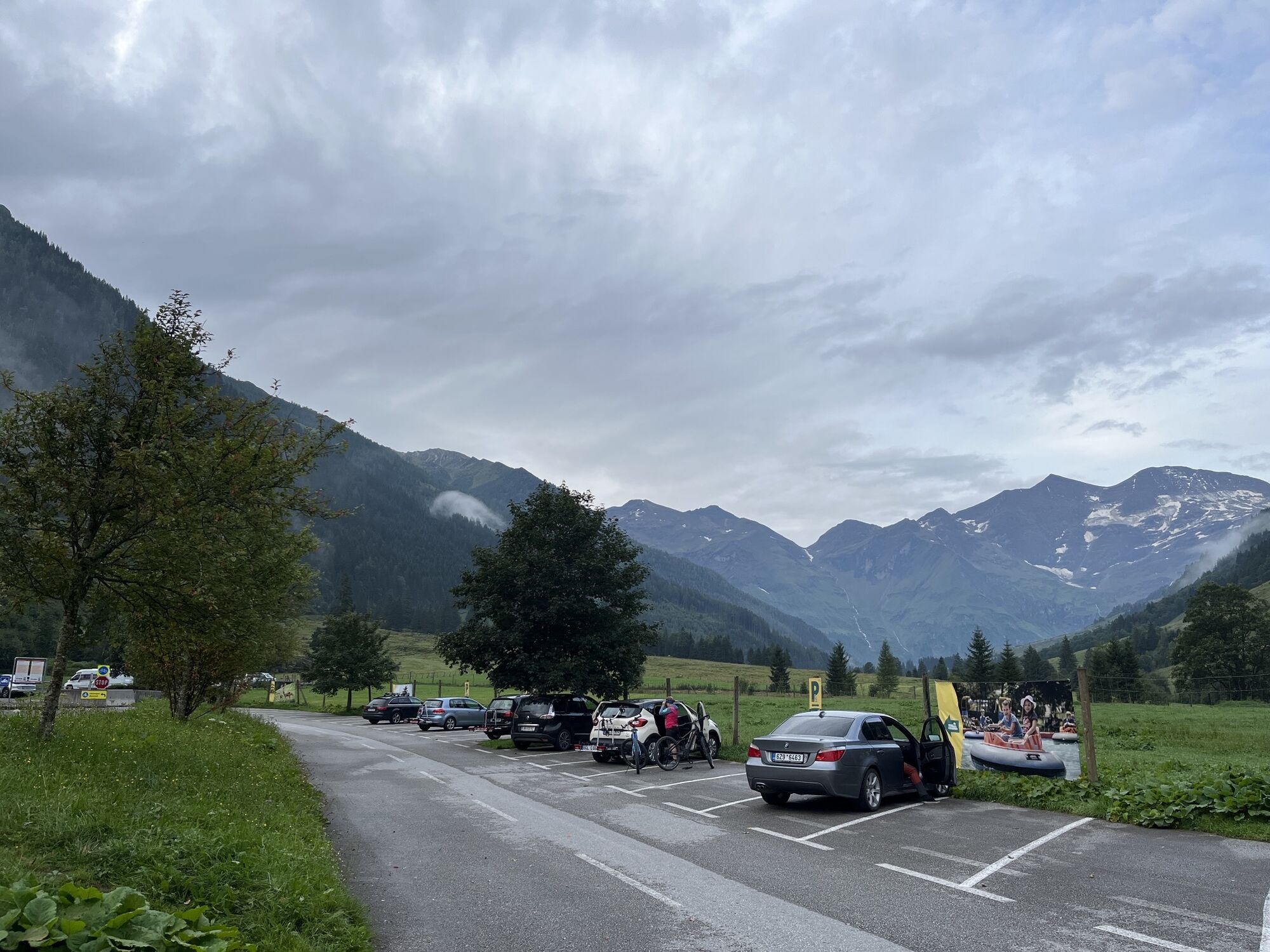
Ferleiten parking lot

Oblíbené prohlídky v okolí
- 4,8
Sigmund Thun Klamm, Klammsee, Bürgkogel
světloTuristika 4,56 km - 4,7
Geotrail Tauernfenster
světloTuristika 5,90 km - 4,9
Glockner
středníVysokohorská turistika 19 km - 4,5
Sigmund Thun Klamm
světloTuristika 3,10 km - 3,9
Glacier Route to the Pasterze with Gamsgrubenweg (up to Tunnel 6)
středníTuristika 8,05 km - 4,3
Stüdlhütte -Großglockner
Turistika 4,68 km - 4,9
Kaiser-Franz-Josefs-Höhe to Oberwalderhütte
heavyTuristika 5,52 km - 4,9
Großes Wiesbachhorn 3564 mnv Kaprun, Austrija
heavyTuristika 13,4 km - 4,3
Lucknerhaus zur Glorerhütte über Lucknerhütte zurück
středníTuristika 11,2 km - 3,9
Großglockner Hochalpenstrasse
heavyJízda na kole 20,2 km

Pěší turistika a stopování


Nenechte si ujít nabídky a inspiraci pro vaši příští dovolenou
Vaše e-mailová adresa byl přidán do poštovního seznamu.