


HOHE TAUERN PANORAMA TRAIL | ST13: Kitzlochklamm | Taxenbach-Embach
Fotografie našich uživatelů
-
 © Jerzy borysVytvořeno dne 24.09.2025
 -
 © Jerzy borysVytvořeno dne 24.09.2025
 -
 © Jerzy borysVytvořeno dne 24.09.2025
 -
 © Jerzy borysVytvořeno dne 24.09.2025
 -
 © Jerzy borysVytvořeno dne 24.09.2025
 -
 © Jerzy borysVytvořeno dne 24.09.2025
 -
 © Jerzy borysVytvořeno dne 24.09.2025
 -
 © Jerzy borysVytvořeno dne 24.09.2025
 -
 © Jerzy borysVytvořeno dne 24.09.2025
 -
 © Michele BolzenaroVytvořeno dne 07.09.2025
 -
 © Michele BolzenaroVytvořeno dne 07.09.2025
 -
 © Michele BolzenaroVytvořeno dne 07.09.2025
 -
 © Michele BolzenaroVytvořeno dne 07.09.2025
 -
 © Michele BolzenaroVytvořeno dne 07.09.2025
 -
 © Christian SchindlbeckVytvořeno dne 06.08.2025
 -
 © Christian SchindlbeckVytvořeno dne 06.08.2025
 -
 © Christian SchindlbeckVytvořeno dne 06.08.2025
 -
 © Christian SchindlbeckVytvořeno dne 06.08.2025
 -
 © Christian SchindlbeckVytvořeno dne 06.08.2025
 -
 © Christian SchindlbeckVytvořeno dne 06.08.2025
 -
 © Christian SchindlbeckVytvořeno dne 06.08.2025
 -
 © Christian SchindlbeckVytvořeno dne 06.08.2025
 -
 © Christian SchindlbeckVytvořeno dne 06.08.2025
 -
 © Christian SchindlbeckVytvořeno dne 06.08.2025
 -
 © Christian SchindlbeckVytvořeno dne 06.08.2025
 -
 © Christian SchindlbeckVytvořeno dne 06.08.2025
 -
 © Christian SchindlbeckVytvořeno dne 06.08.2025
 -
 © Christian SchindlbeckVytvořeno dne 06.08.2025
 -
 © Christian SchindlbeckVytvořeno dne 06.08.2025
 -
 © Christian SchindlbeckVytvořeno dne 06.08.2025
 -
 © Christian SchindlbeckVytvořeno dne 06.08.2025
 -
 © Christian SchindlbeckVytvořeno dne 06.08.2025
 -
 © Christian SchindlbeckVytvořeno dne 06.08.2025
 -
 © Henrik SingelmannVytvořeno dne 05.09.2024
 -
 © Henrik SingelmannVytvořeno dne 05.09.2024
 -
 © Henrik SingelmannVytvořeno dne 05.09.2024
 -
 © pedaklausVytvořeno dne 09.08.2025
 -
 © pedaklausVytvořeno dne 09.08.2025
 -
 © pedaklausVytvořeno dne 09.08.2025
 -
 © pedaklausVytvořeno dne 09.08.2025
 -
 © pedaklausVytvořeno dne 09.08.2025
 -
 © pedaklausVytvořeno dne 09.08.2025
 -
 © pedaklausVytvořeno dne 09.08.2025


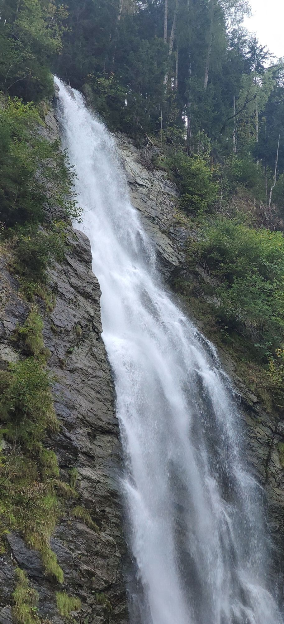
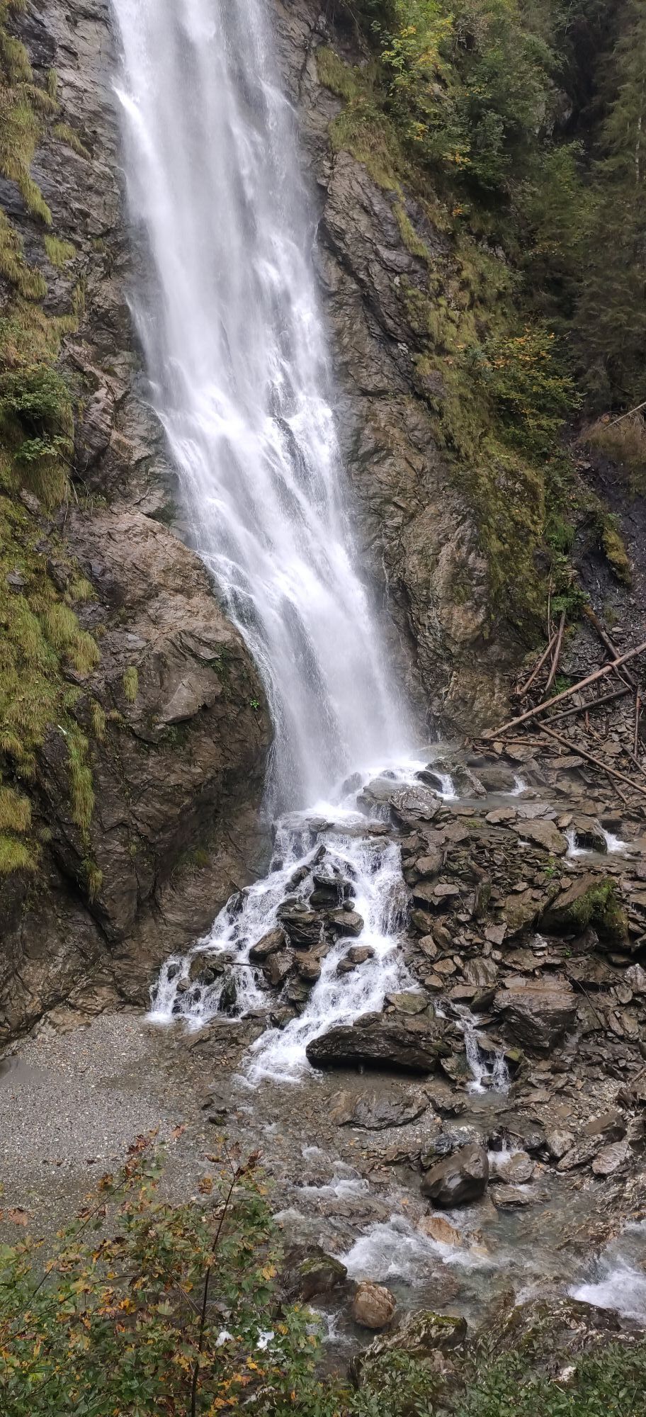


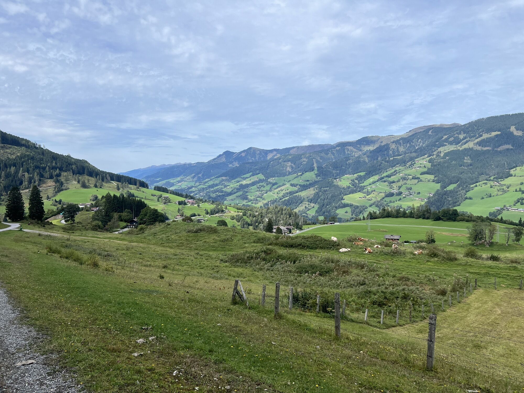


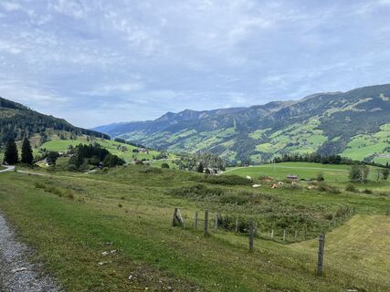
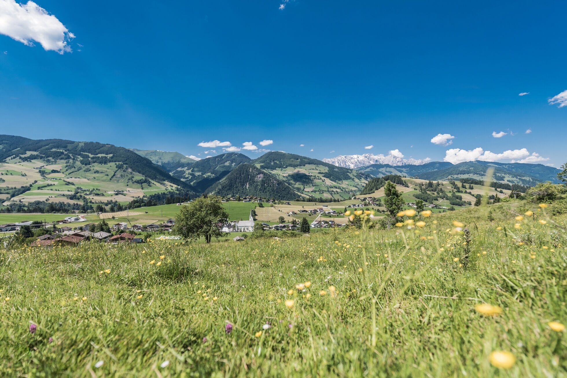
With only three hours of walking time, this stage is pleasantly short and immediately rewarded with two high points for the exertions of the previous day. On the route from Taxenbach to Embach, the path...
TIP: Enjoy an unforgettable hiking experience on the Hohe Tauern Panorama Trail! The official Hohe Tauern Panorama Trail info and booking center with the award-winning Trail Angels team will gladly support you. Experience a combination of personal freedom and longing for the special, paired with service, comfort, and security. Top offer: The small escape package: 2 overnight stays, 2 stages including luggage service, shuttle and return transfer and much more from €218.

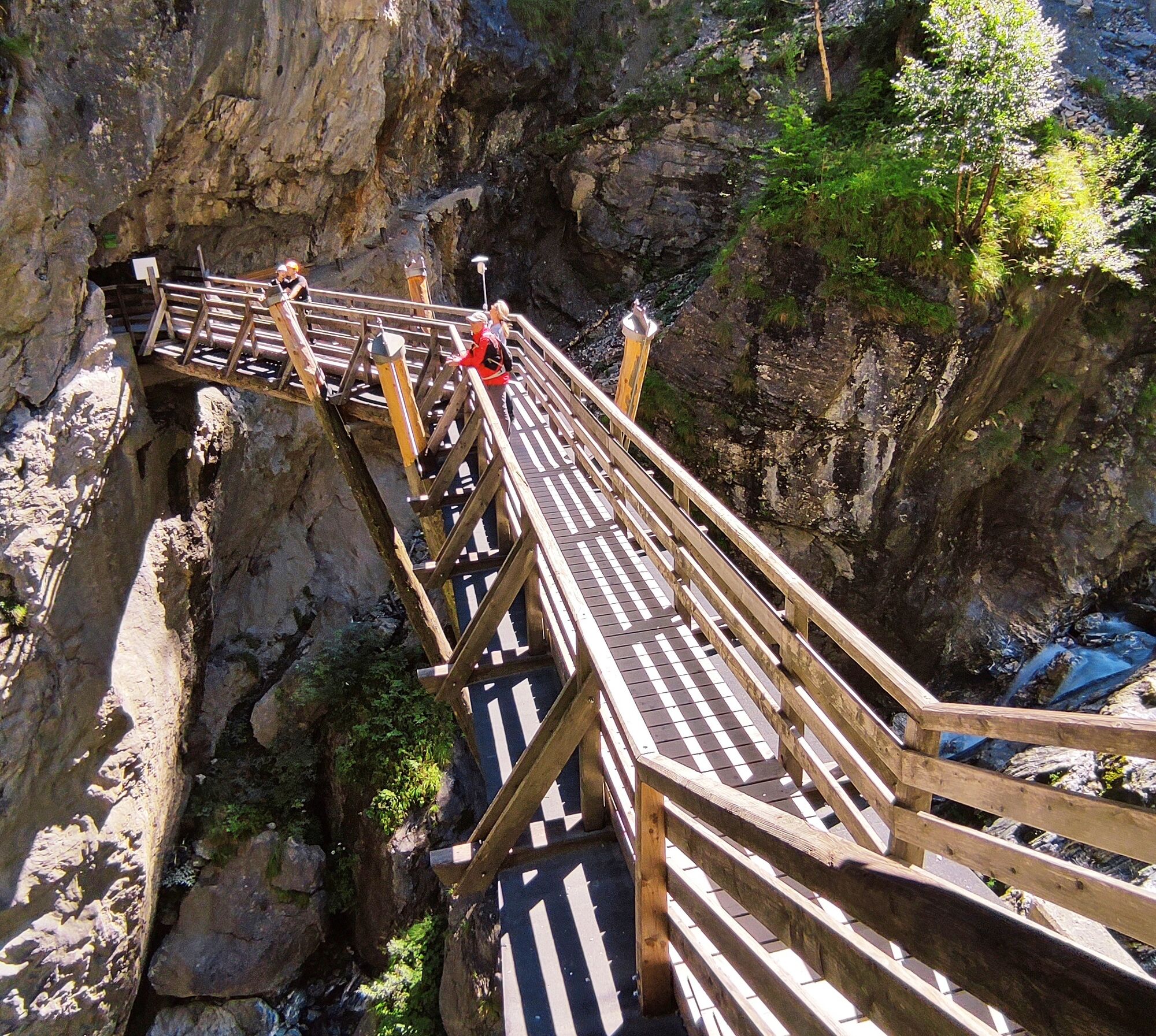
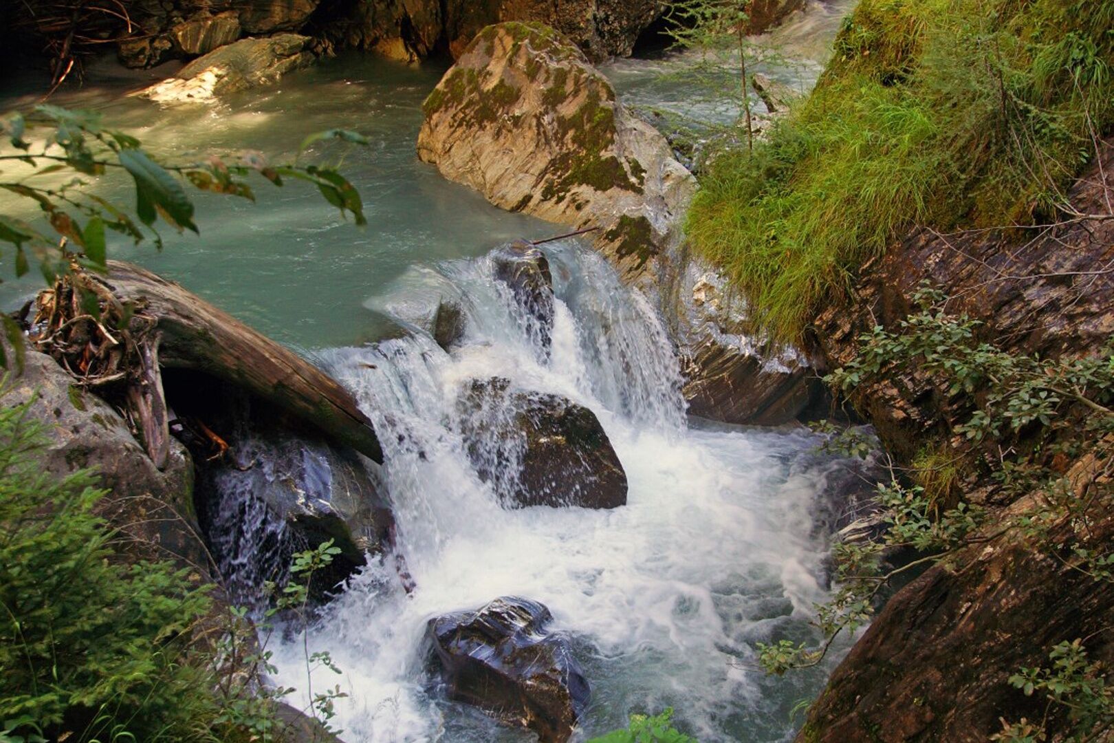
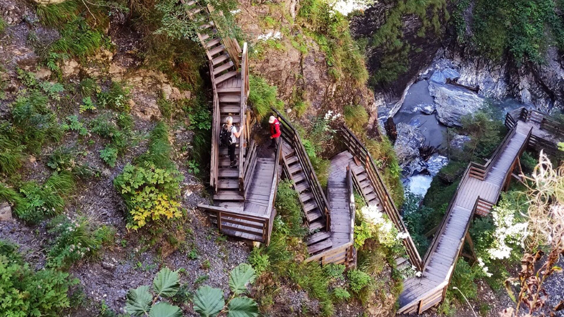
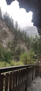
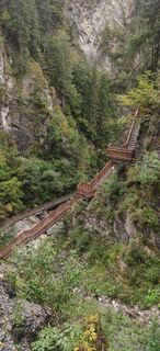
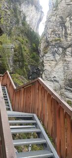
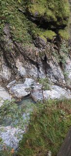
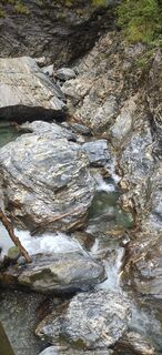
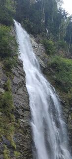
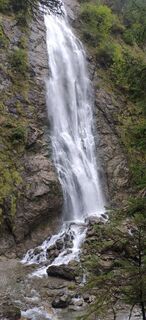
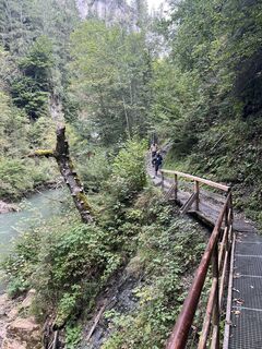
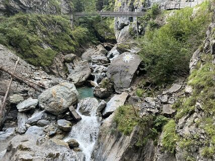
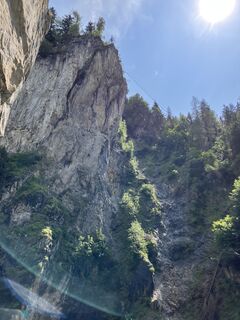
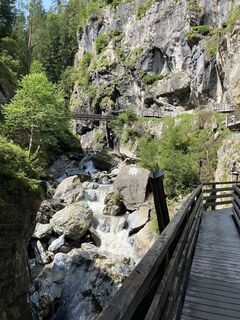
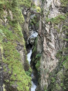
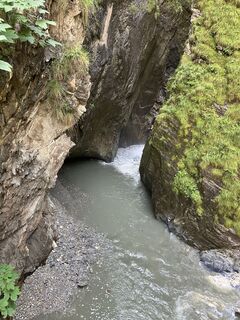
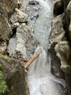
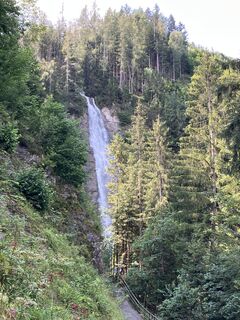
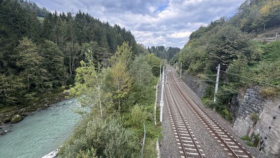
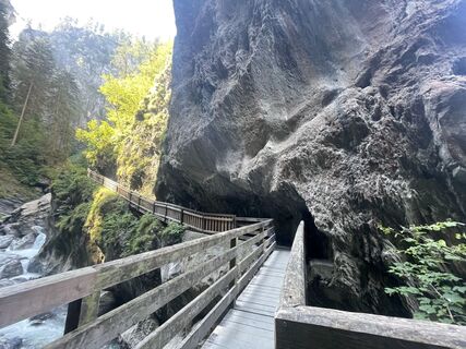
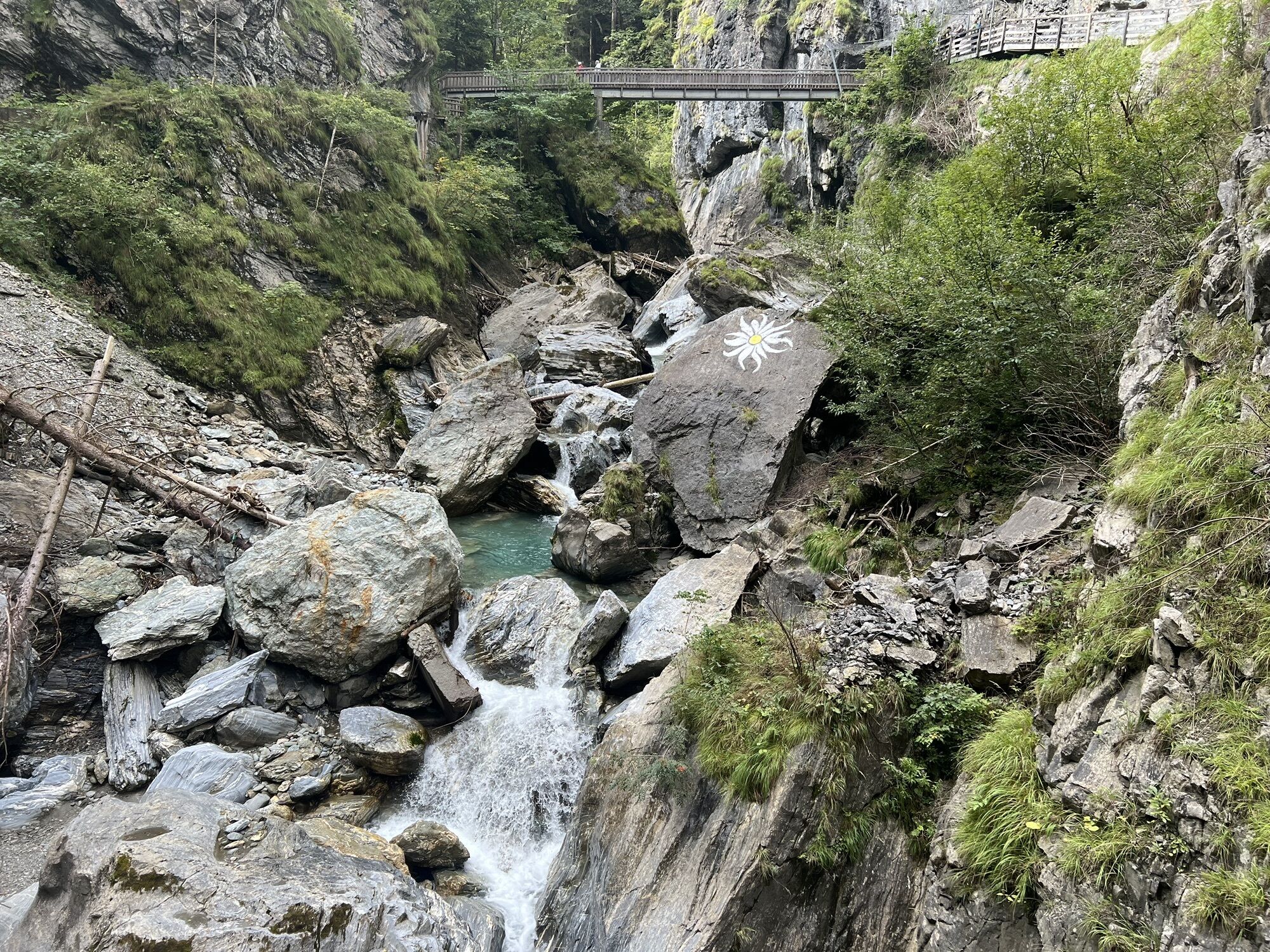
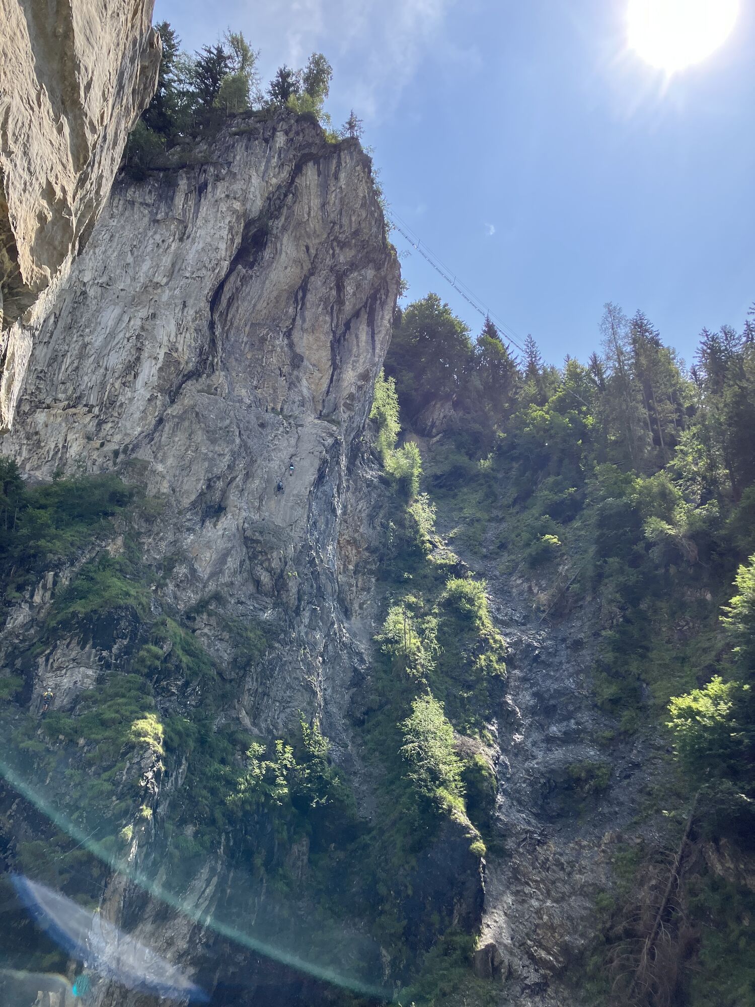
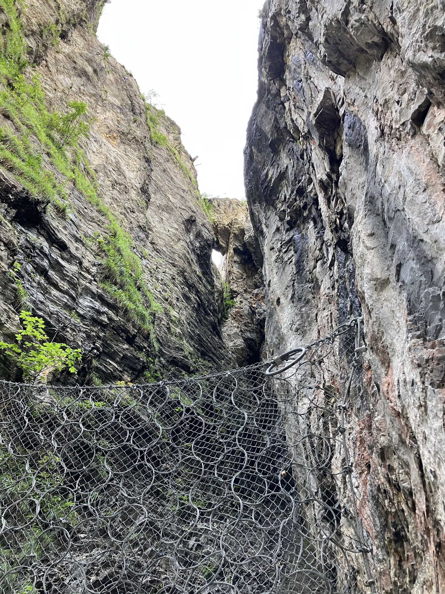
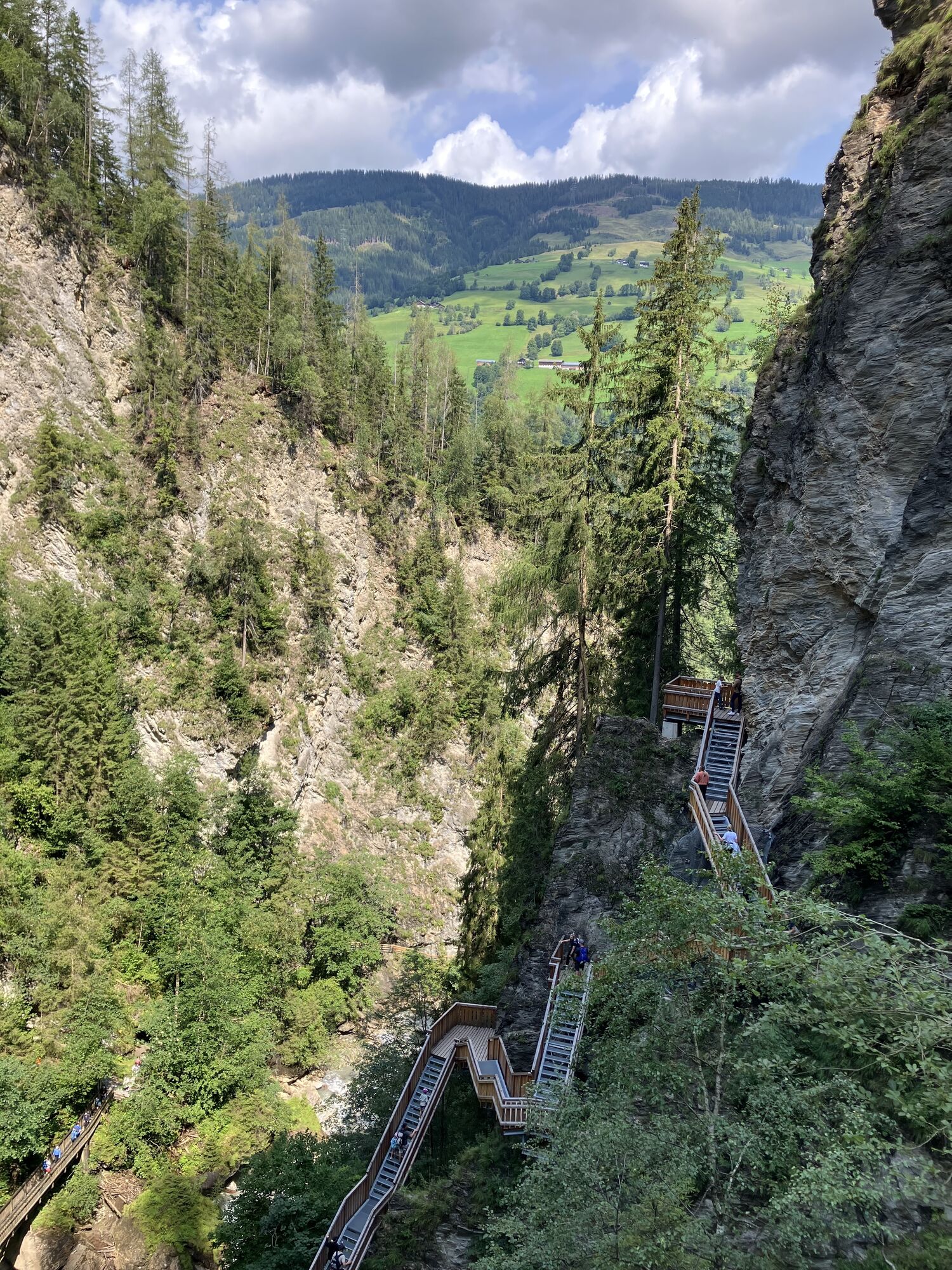
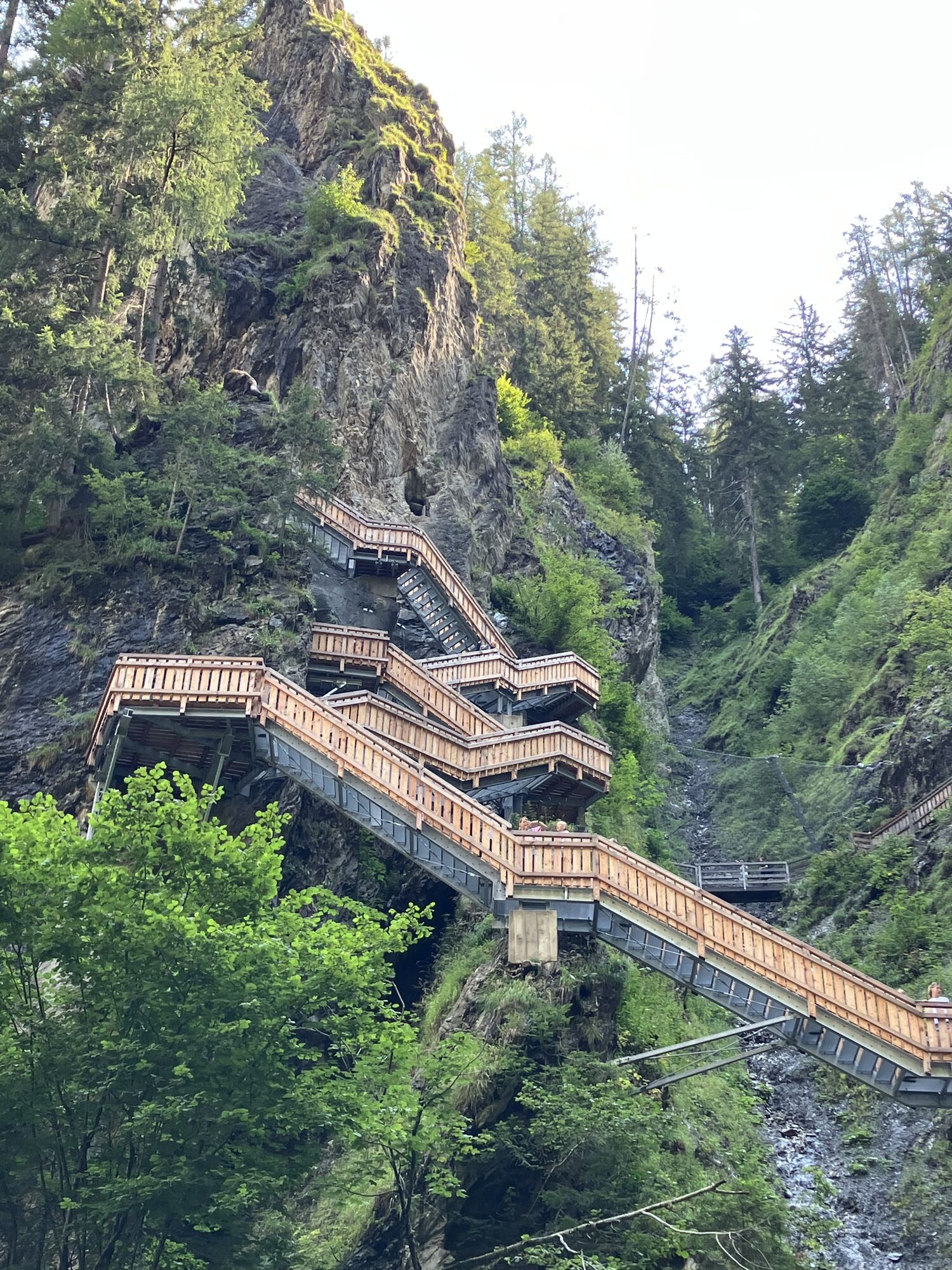
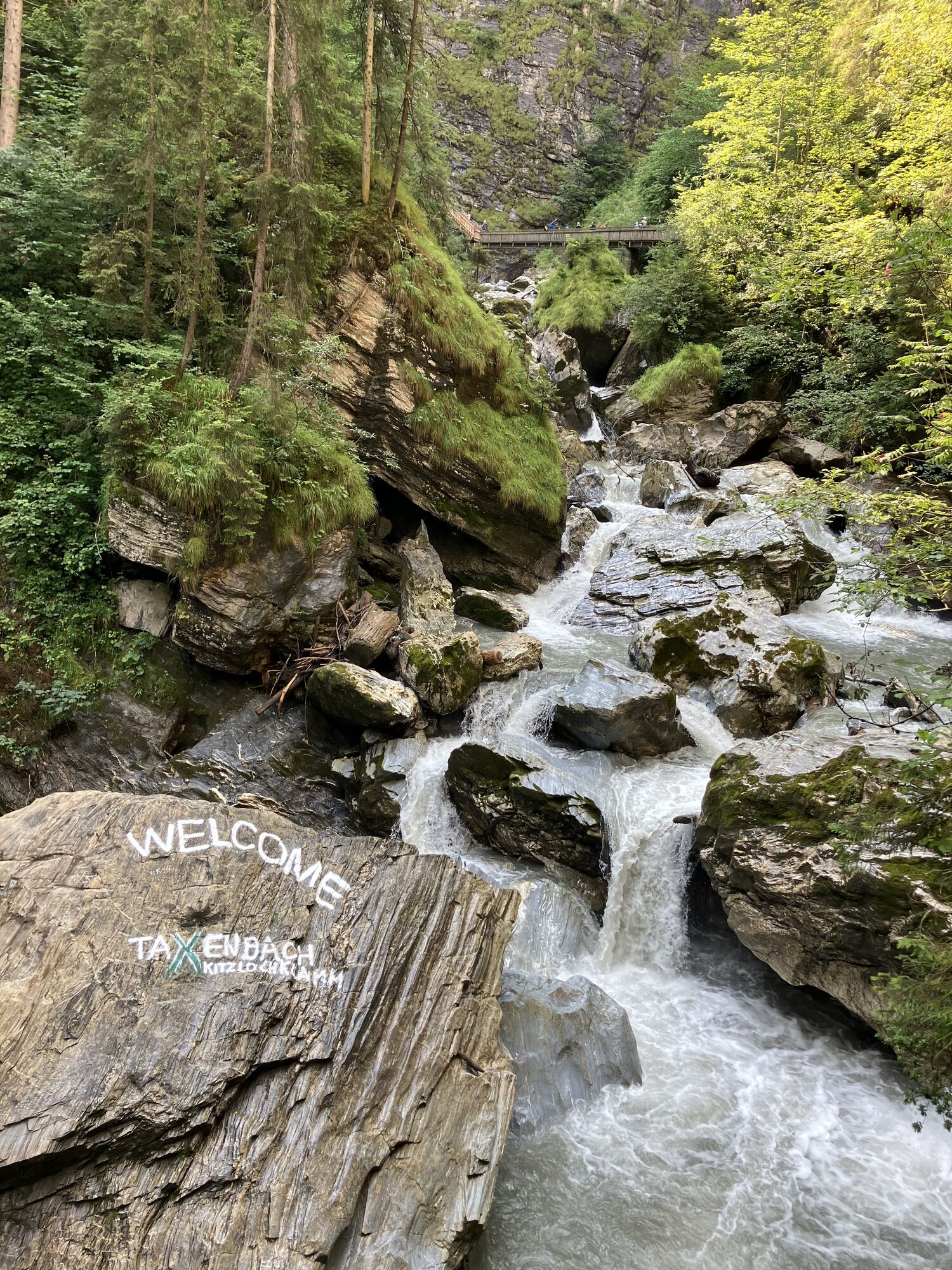
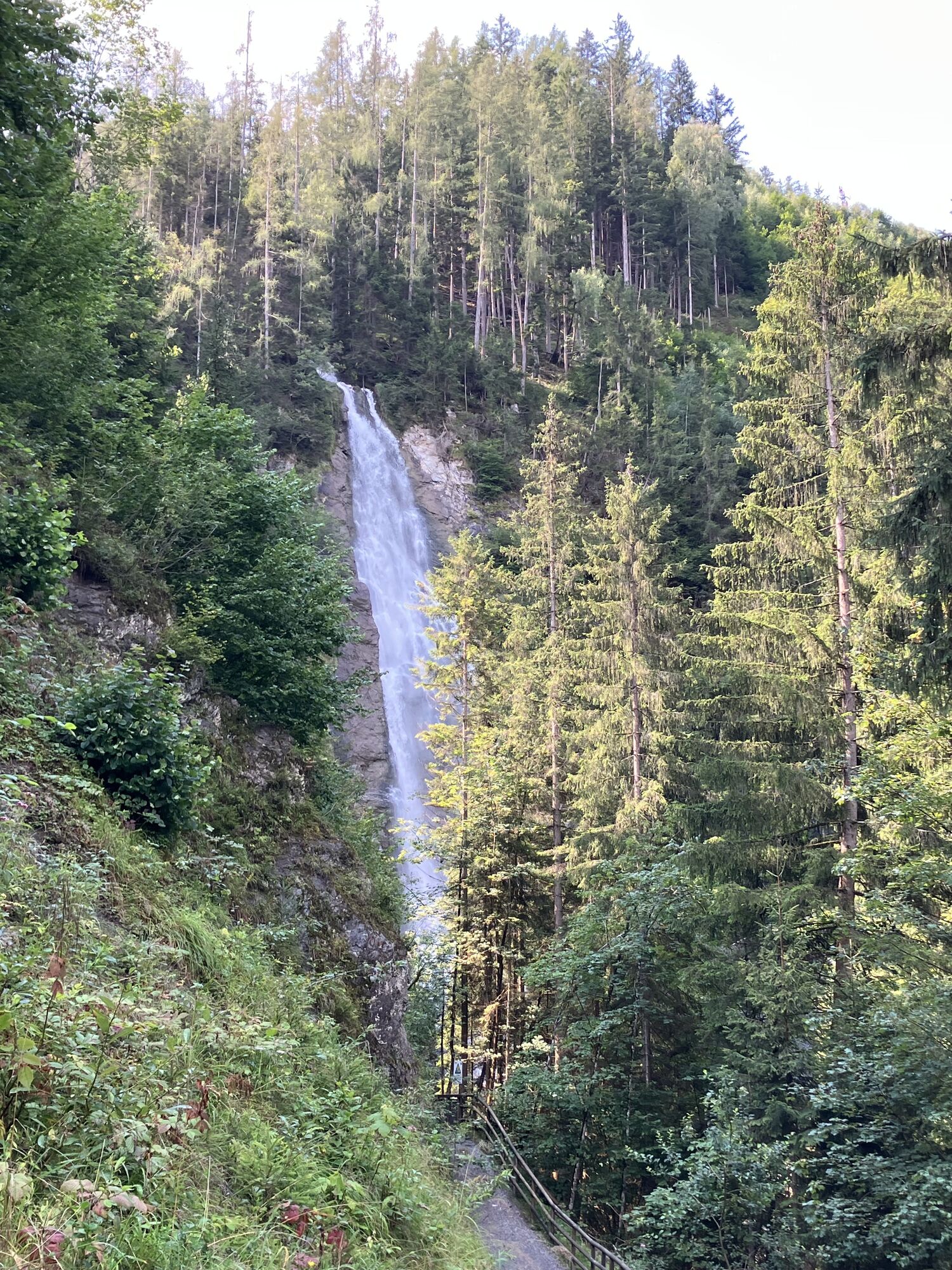
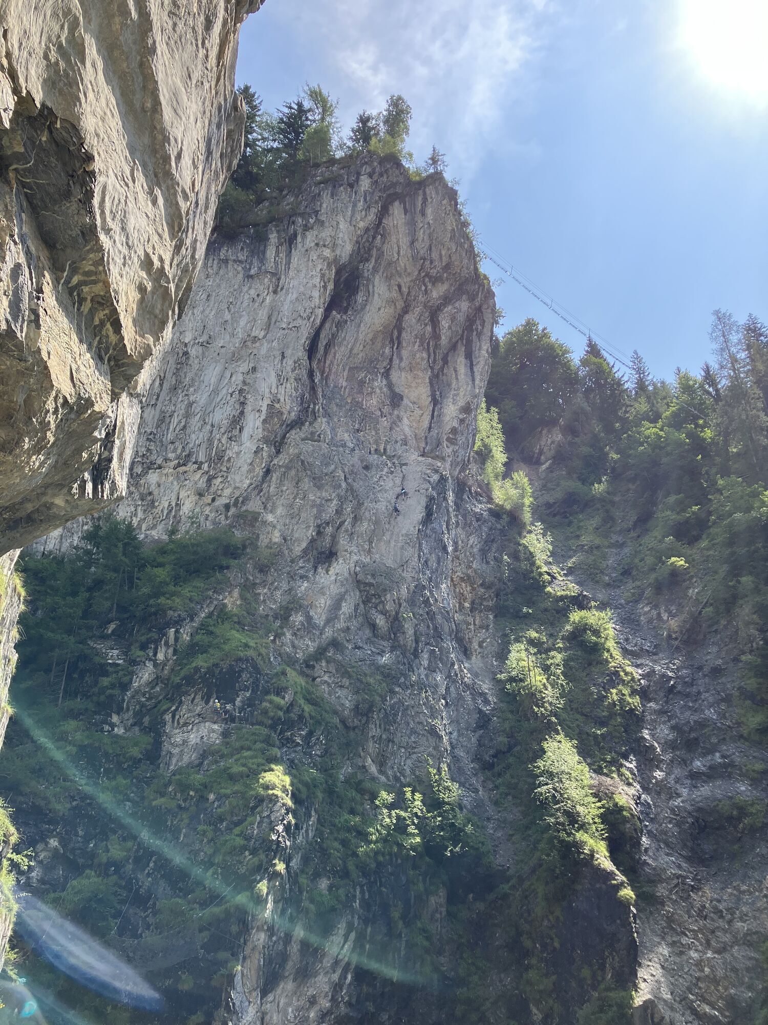
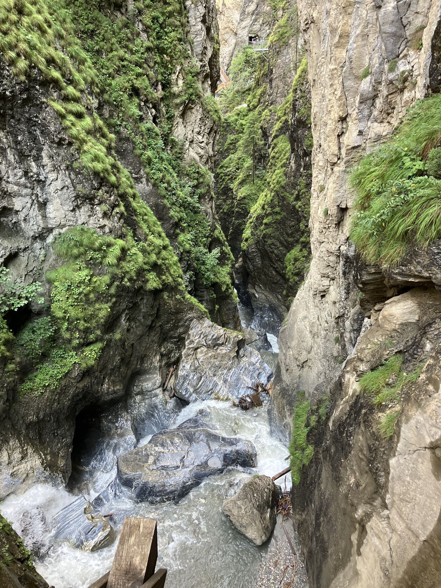
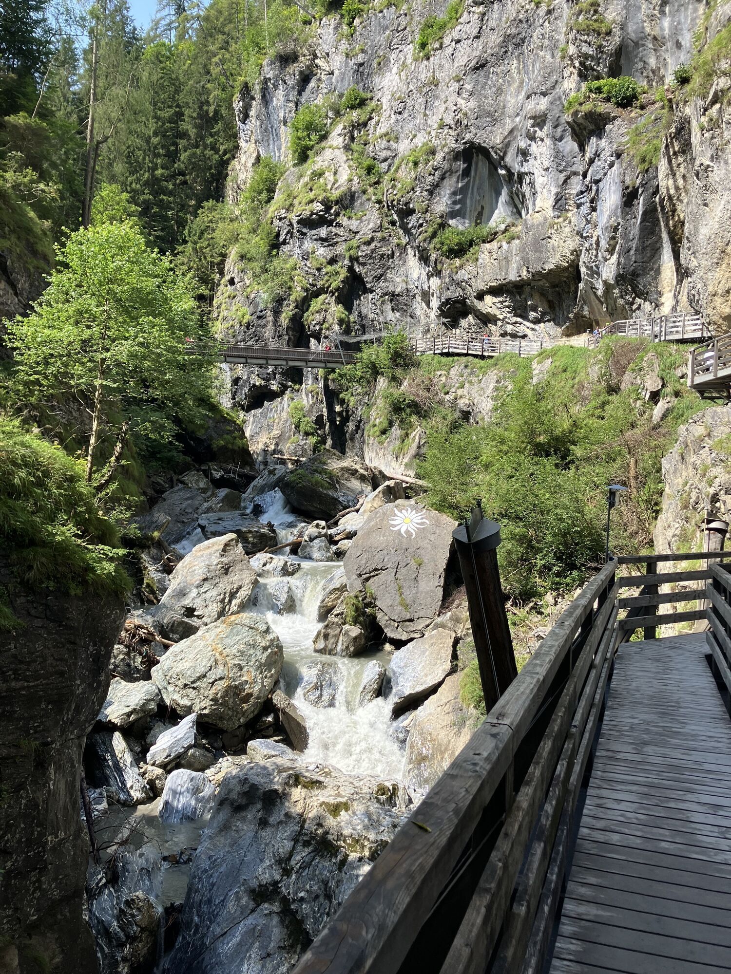
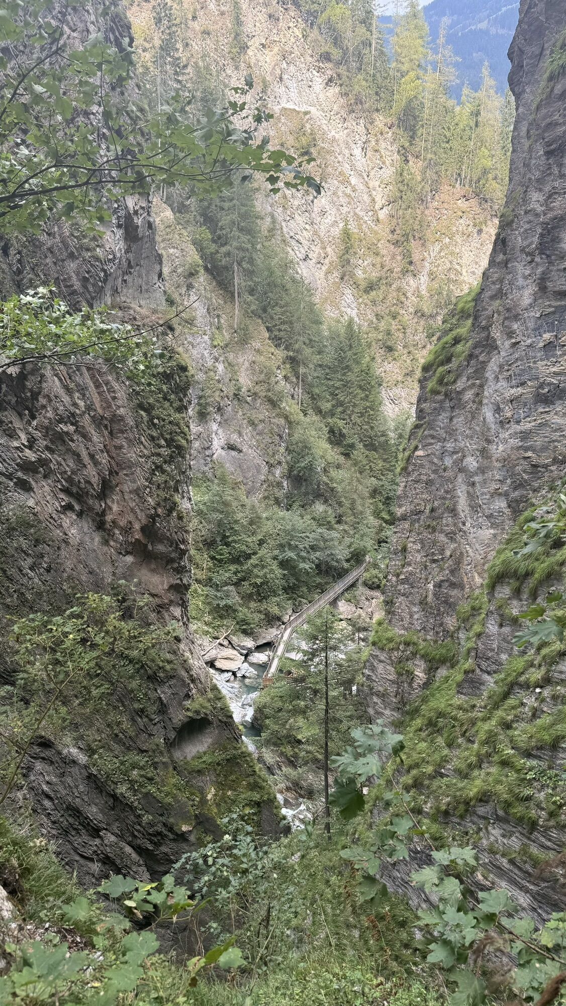
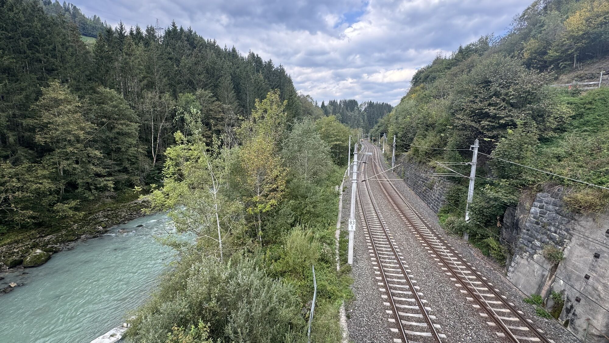
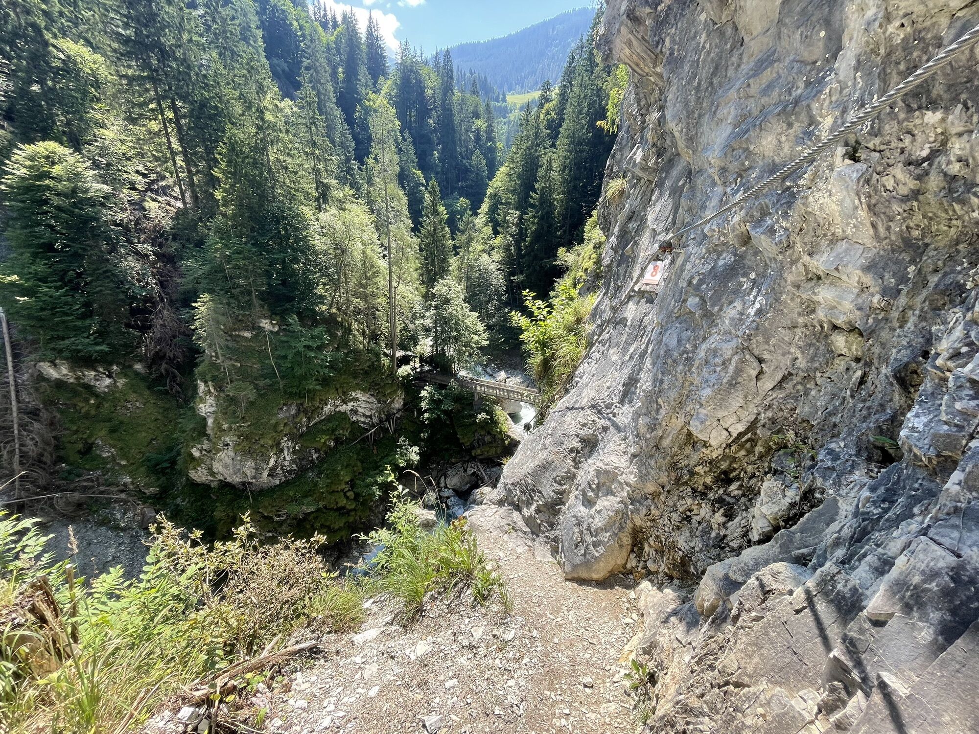
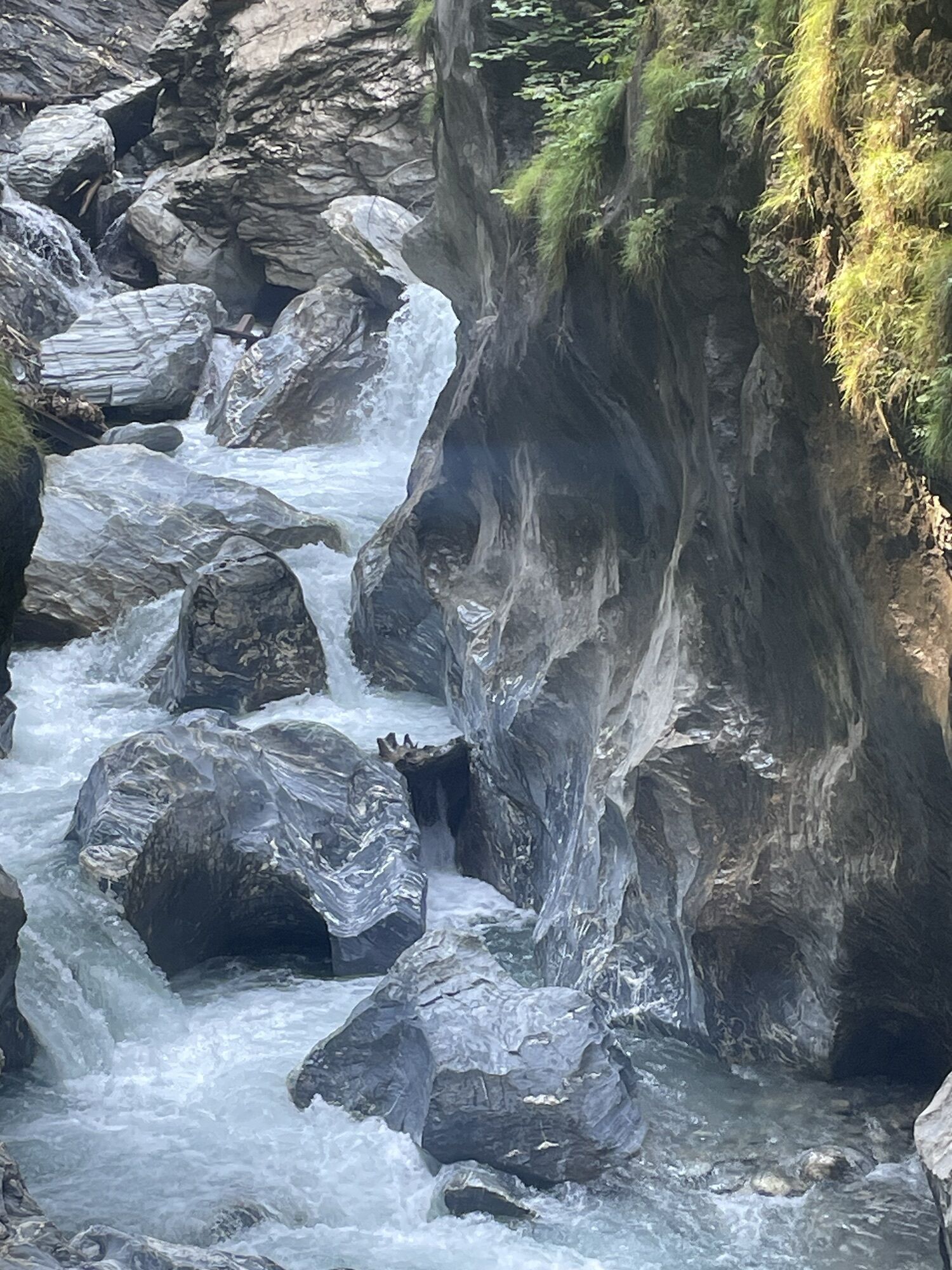
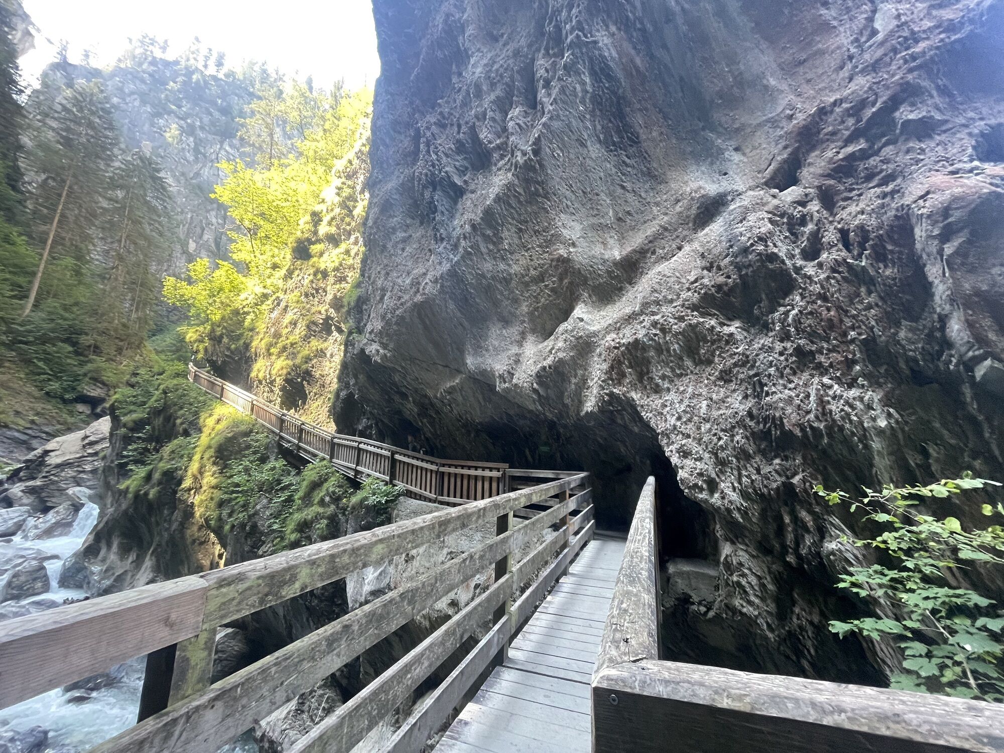
From the start of the stage at the tourist information or municipal office in the center of Taxenbach, walk east along the village street, then turn left opposite the “Haus für Kinder” into Elisabeth-Lackner-Gasse and at the end of the alley pass under the federal road using an underpass. Now keep to the left, at the next street intersection turn right towards the “Salzachpromenade” (path no. 1) and continue straight down towards the Salzach. A bridge leads over the tracks to the other side of the Salzach. Here the actual Salzachpromenade begins which you follow to the left, running very nicely through forest along the Salzach riverbank to an asphalt road. The road leading right is also the approach to the entrance of the Kitzlochklamm.
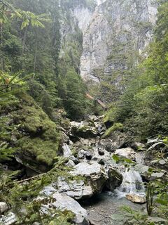
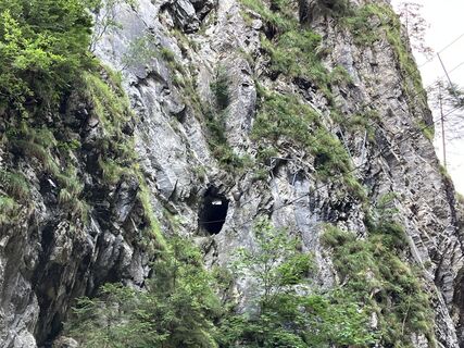
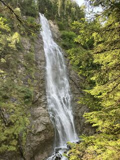
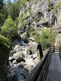
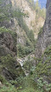
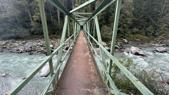
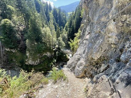
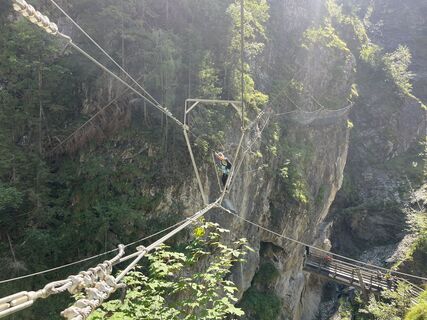
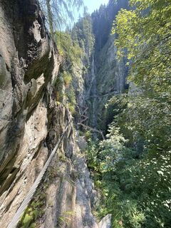
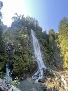
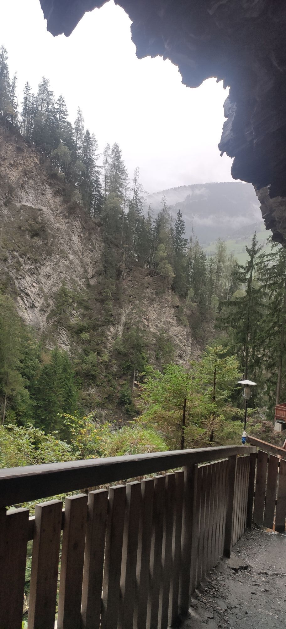
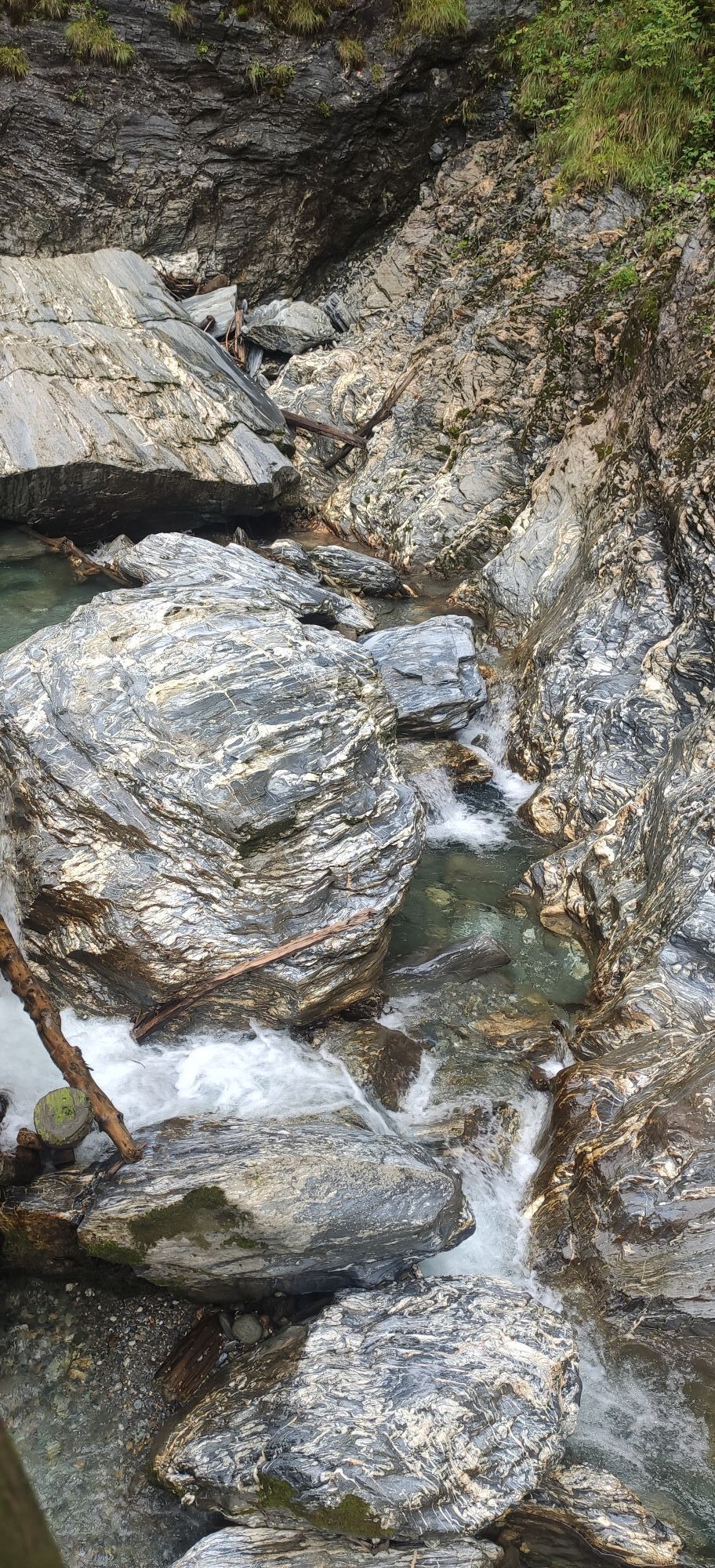
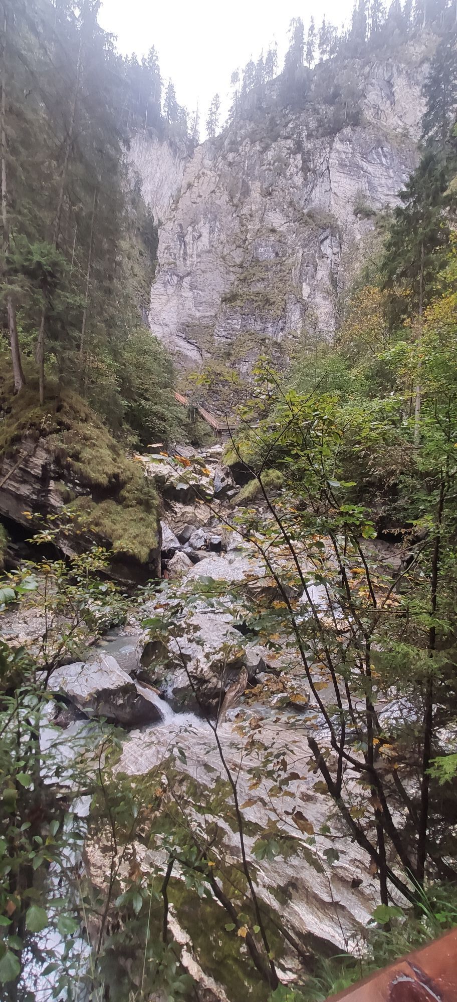
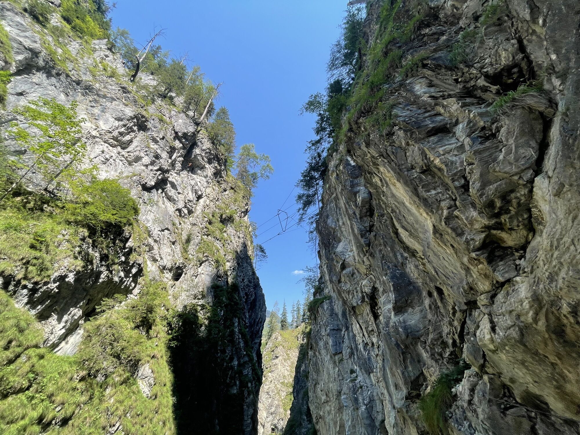
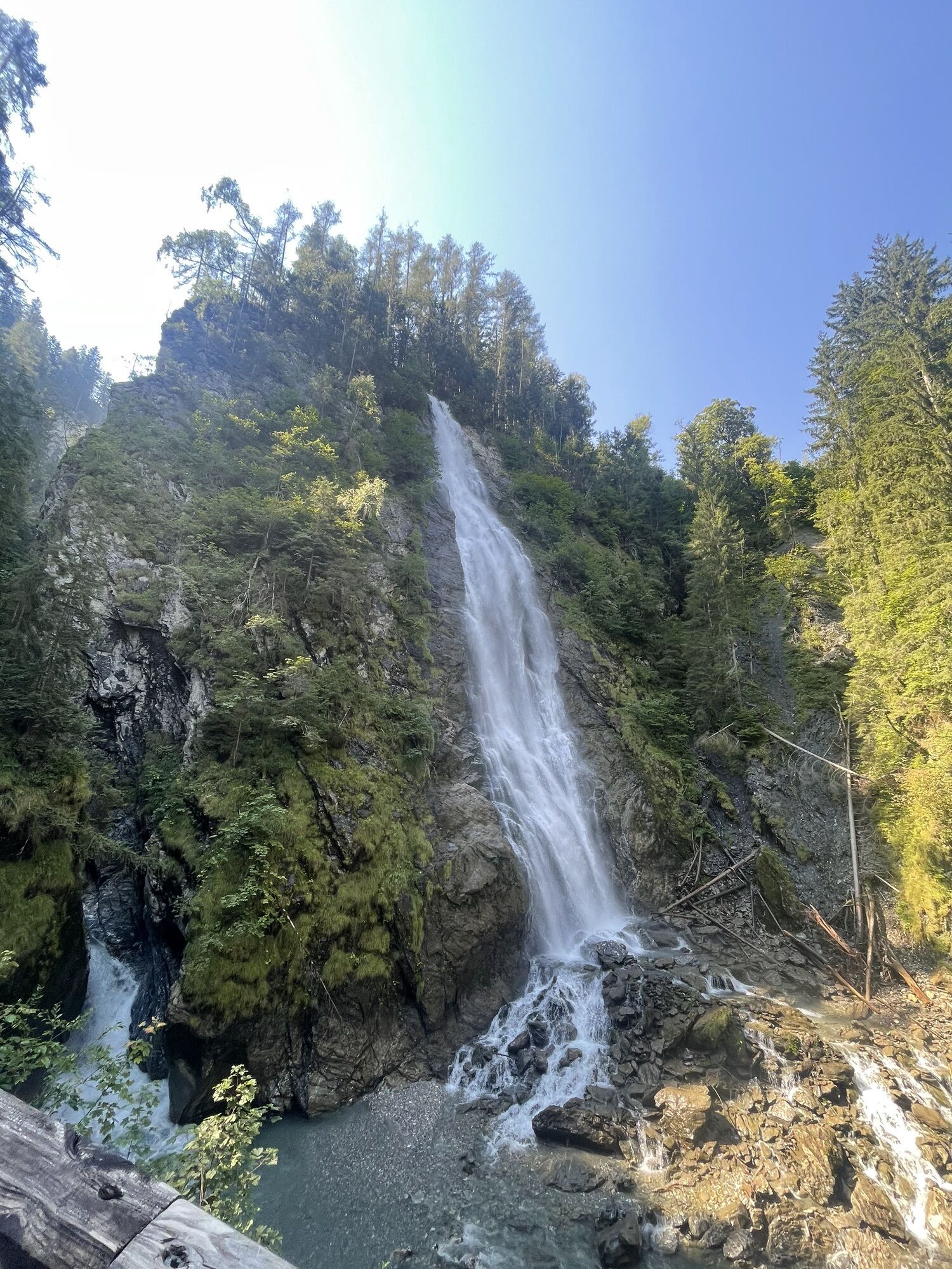
You then pass the entrance and follow the impressively stunning but very well developed trail upwards through the entire gorge to the exit at its upper end (at the only fork keep right). Most hikers turn back from here, but you continue following the beautiful hiking path above the here much gentler gorge until after a bridge the hiking trail no. 4 “Embach” branches left and shortly steeply leads up to the road towards Embach.
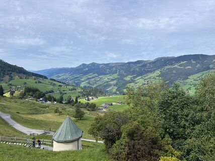
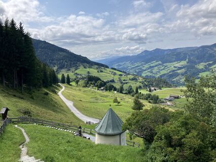
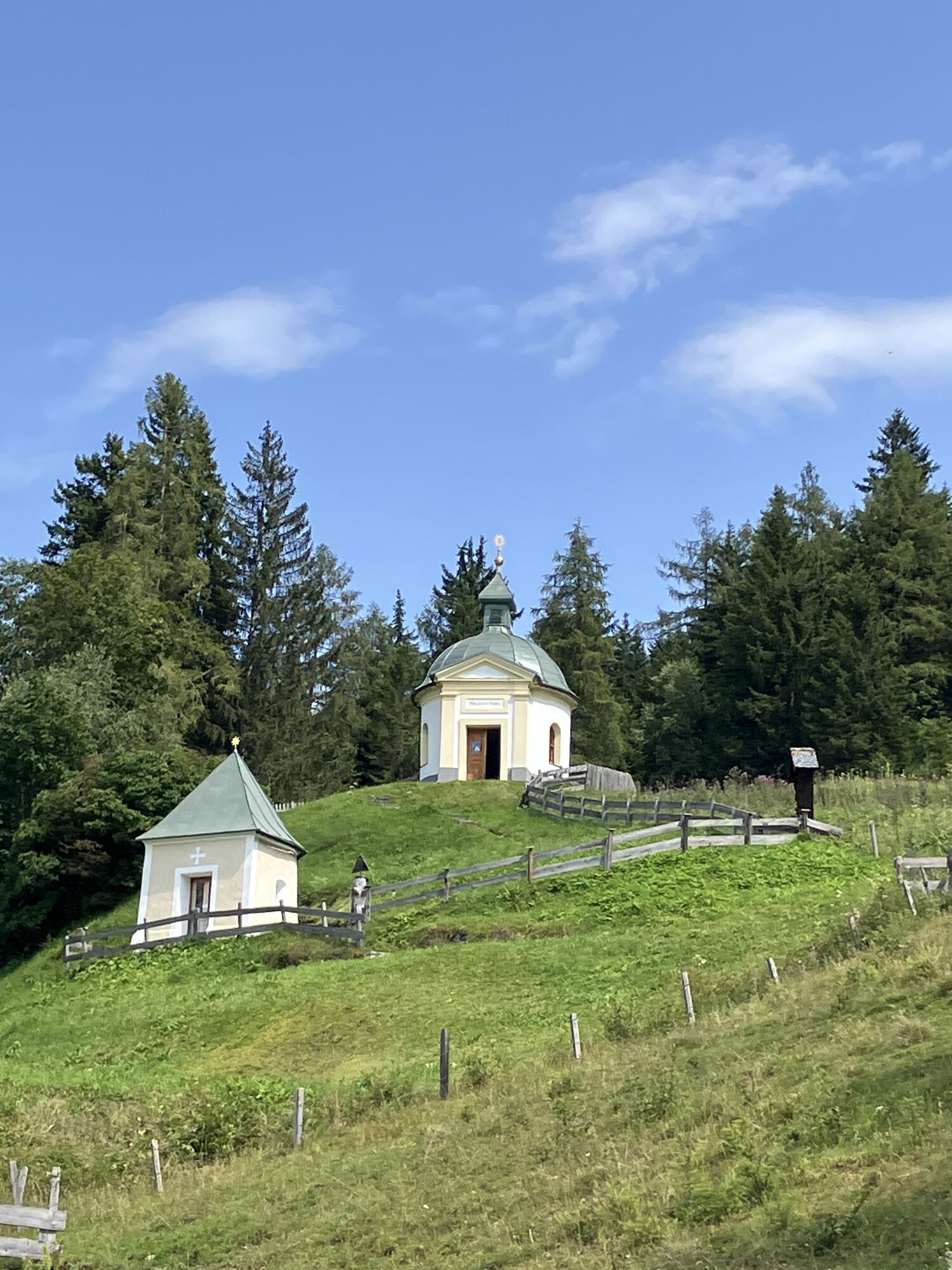
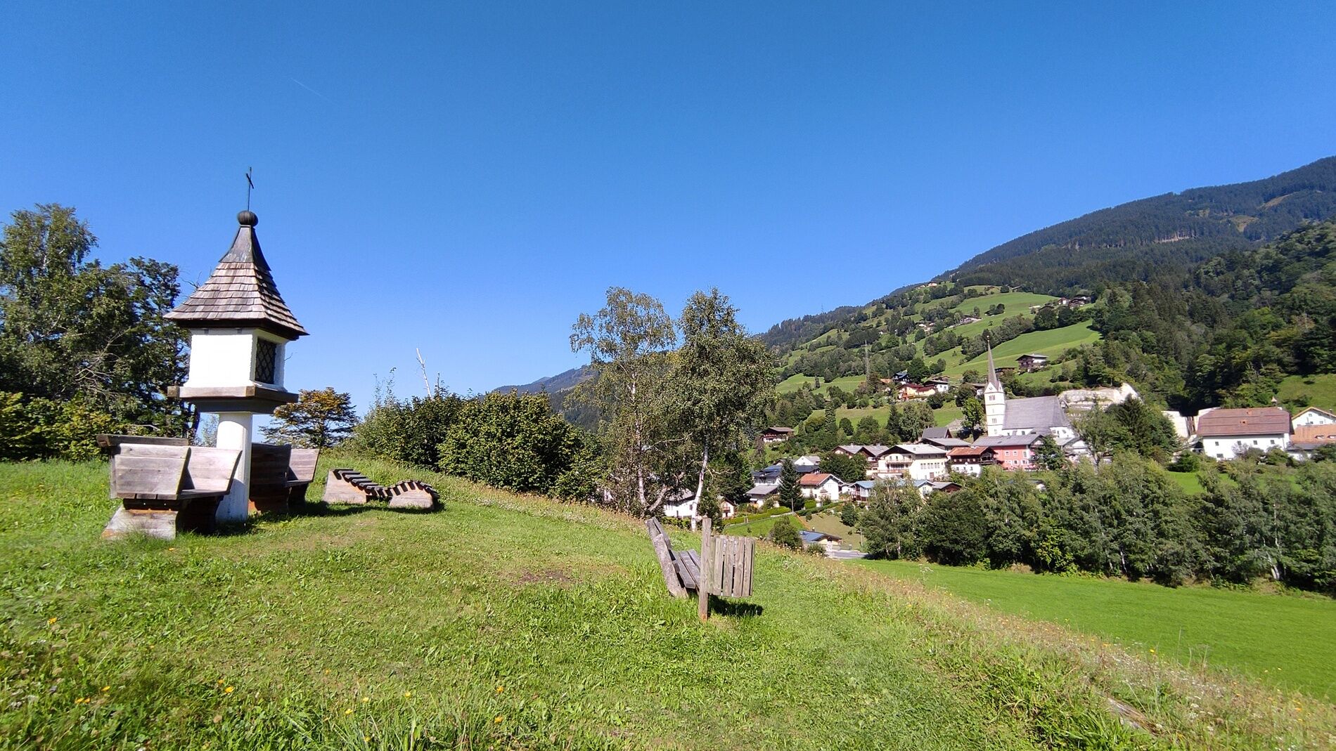
Now cross the road and continue hiking the trail steeply uphill to a forest road. This leads left to a small asphalt road. The signpost no. 4 “Embach” leads over the road slightly uphill to the small pilgrimage chapel Maria Elend.
Below the pilgrimage site, the hiking trail no. 1 towards Embach branches diagonally left. Here you hike over idyllic meadows to a small asphalt road on the upper edge of Embach. Left down the small road until a short hiking trail leads straight through the village down to the main road through Embach. Immediately on the right on the road is the tourist information and thus the official end of this stage.
Ano
Alpine hiking equipment is required for the Hohe Tauern Panorama Trail:
Day hiking backpack (approx. 20 liters) with rain cover Sturdy and comfortable footwear Weather-appropriate and durable clothing in multiple layers. The Hohe Tauern Panorama Trail is mostly at altitudes between 1,300m and 2,450m - this must be considered when selecting your hiking equipment (especially your clothing) Trekking poles are recommended due to often long descents Sun and rain protection Make sure to carry enough provisions and sufficiently large water bottles, as not all stages have dining options or fountains (e.g. stages 5 and 7) First aid kit Pocket knife Mobile phone Route description or hiking map
Coming from the north: German autobahn A9 from Munich
Coming from the east: A1 West Autobahn
Coming from the south: A10 Tauern Autobahn
Coming from the west: A12 Inntal Autobahn to Wörgl (then on federal roads)
Coming from Schwarzach or Zell am See, take the S-Bahn S3 to Taxenbach - Rauris station. From there, about a 31-minute walk to the Taxenbach tourist information or Taxenbach municipal office (Marktstraße 30, 5660 Taxenbach), the starting point of the stage.
Current timetables at https://fahrplan.salzburg-verkehr.at/
Holiday region Nationalpark Hohe Tauern
Gerlosstraße 18 5730 Mittersill, Austria
Tel. +43 6562 40939 E-Mail: hohetauerntrail@nationalpark.at
Booking center & info hotline Trail Angels GmbH
9821 Obervellach 15, Austria
Tel. +43 4782 93093 E-Mail: info@bookyourtrail.com
The Kitzlochklamm has an entrance fee (adults €10 - with guest card €9, included in the Nationalpark SommerCard). Please observe the opening hours of the Kitzlochklamm.
Oblíbené prohlídky v okolí
-
4.9
Großarl: Aualm - Liechtensteinkopf - Aukopf - Schuhflicker - Schuhflickersee
středníTuristika 5.84 km -
4.8
Summit stormer route Lauskopf
heavyTuristika 8.16 km -
4.8
Summit storming route Taghaube
heavyTuristika 6.25 km -
4.1
Schwalbenwand Nr. 80, 81, 82
středníTuristika 13.0 km -
4.4
Alpine and hut hike "Hochmaisalm & Steinbockalm"
středníTuristika 8.10 km -
4.3
Family hike Prinzensee
světloTuristika 4.13 km -
4.4
Thumersbach, Runde um den Zeller See
světloTuristika 13.3 km -
4.7
Highlight Kitzlochklamm Classic round
středníTuristika 2.02 km -
4.2
Hundstein-Runde von Maria Alm
heavyMountainbike 44.4 km -
4.7
Goldeggweng Hochleitenalm
světloTuristika 2.92 km

Pěší turistika a stopování


Nenechte si ujít nabídky a inspiraci pro vaši příští dovolenou
Vaše e-mailová adresa byl přidán do poštovního seznamu.