


Schober -Aussichtsplattform mit Seensicht


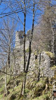
From the parking lot of the restaurant and hotel "Forsthaus Wartenfels" a short path leads uphill to the first fork. Follow the left path in the direction of the Wartenfels ruins, which can be visited...
From the parking lot of the restaurant and hotel "Forsthaus Wartenfels" a short path leads uphill to the first fork. Follow the left path in the direction of the Wartenfels ruins, which can be visited (optional).
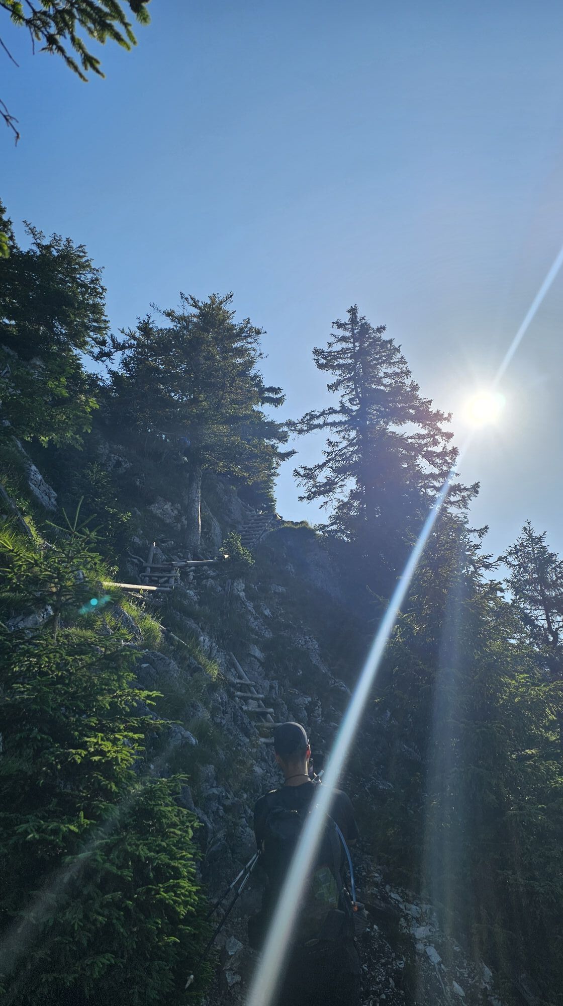
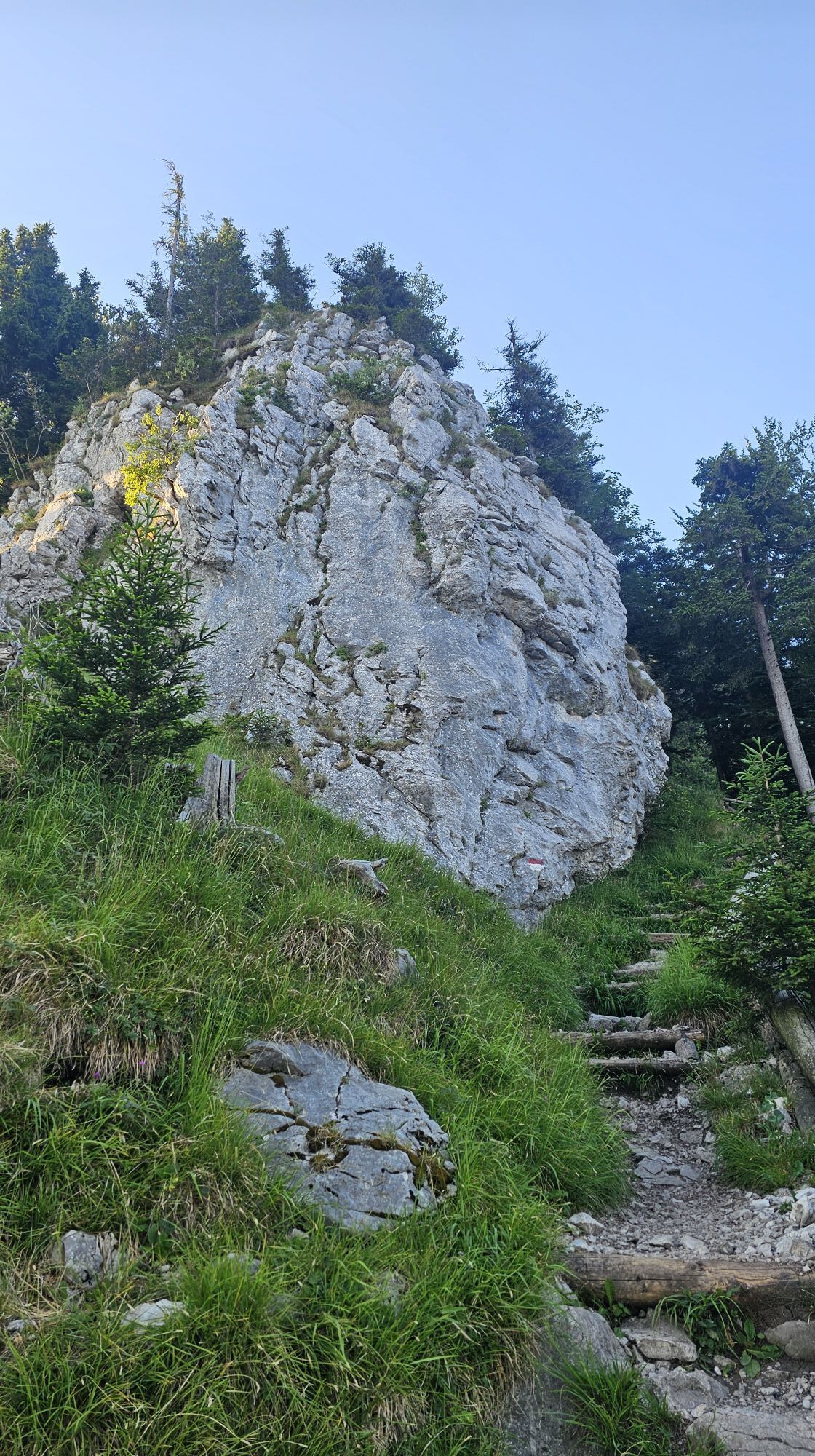
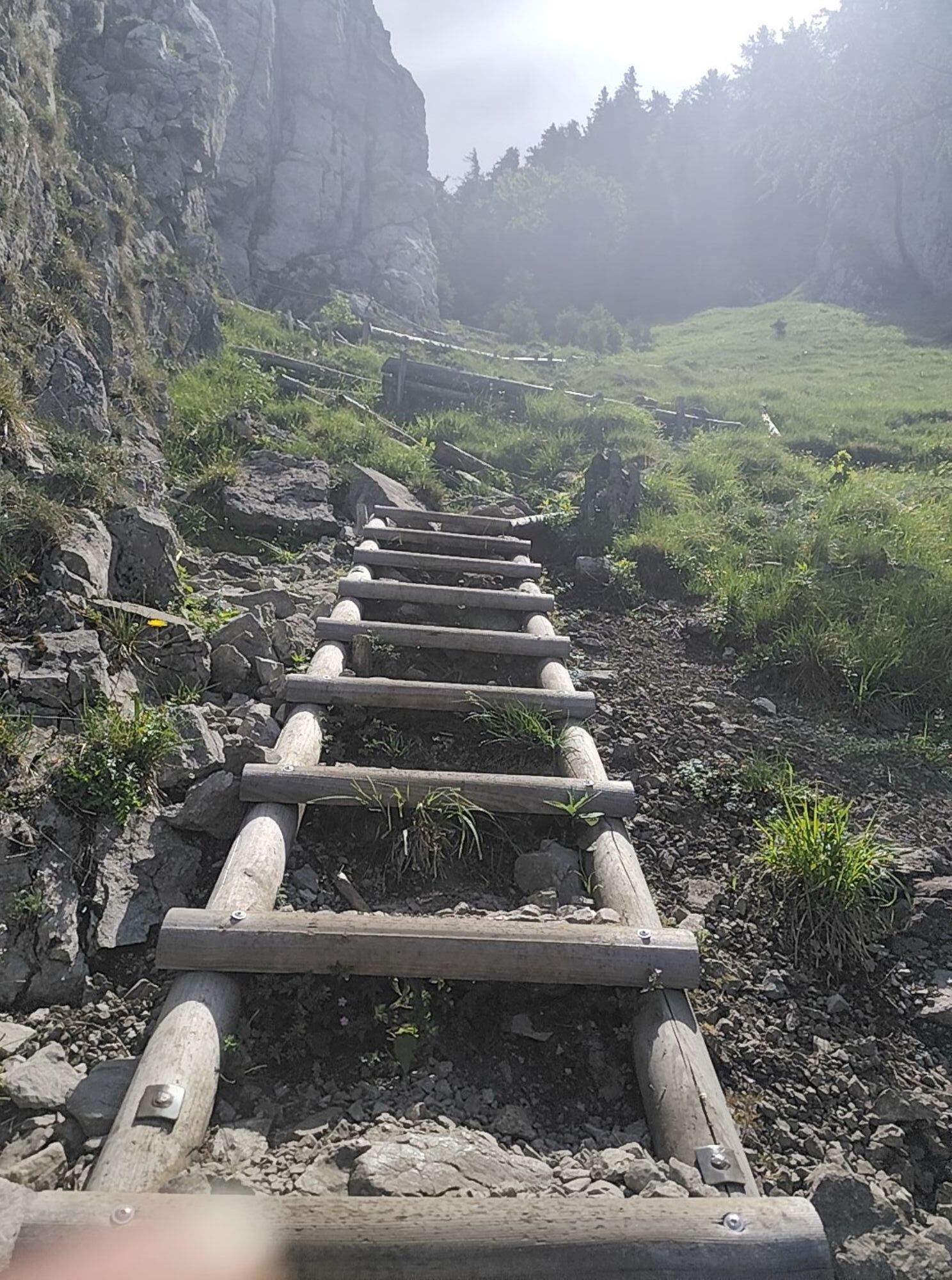
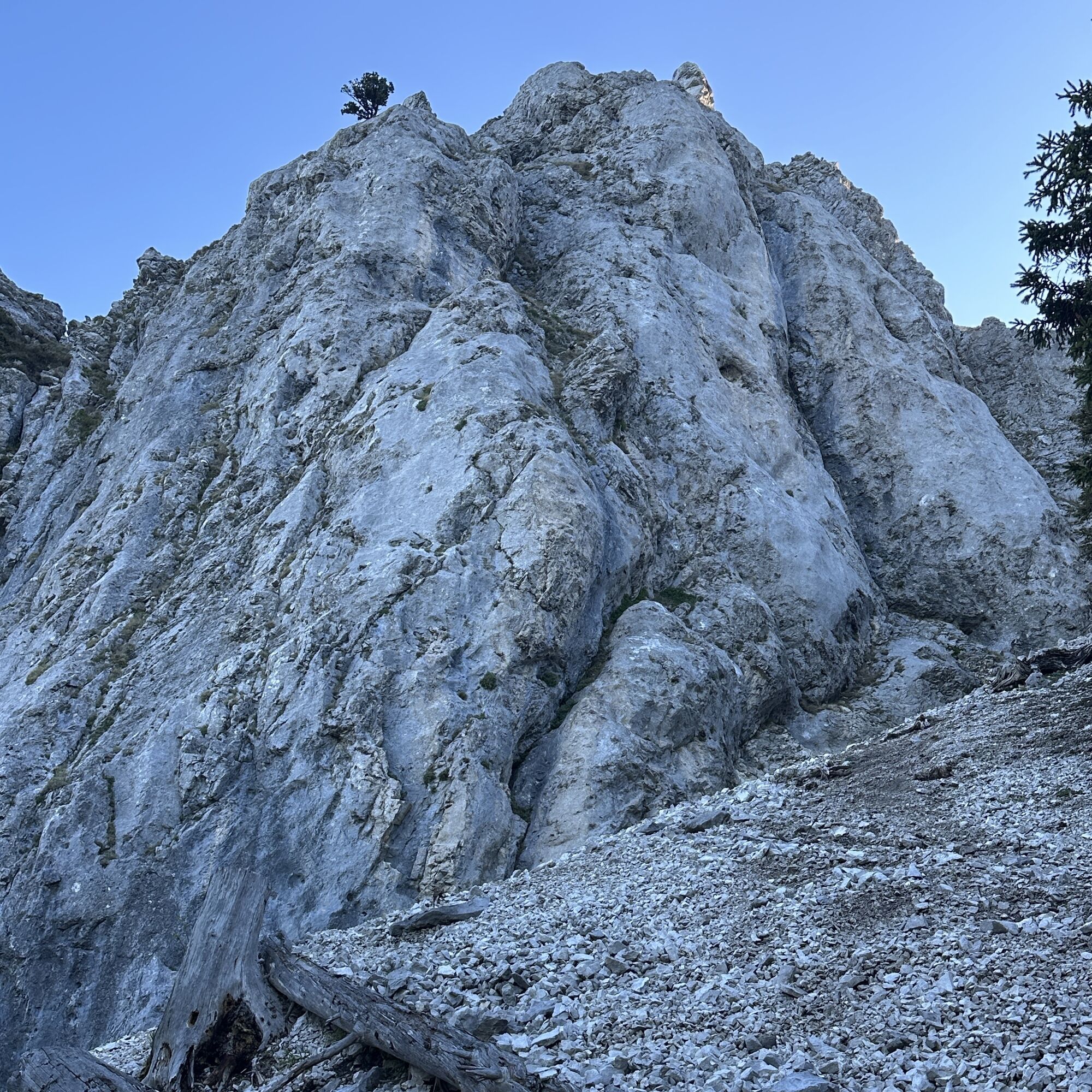
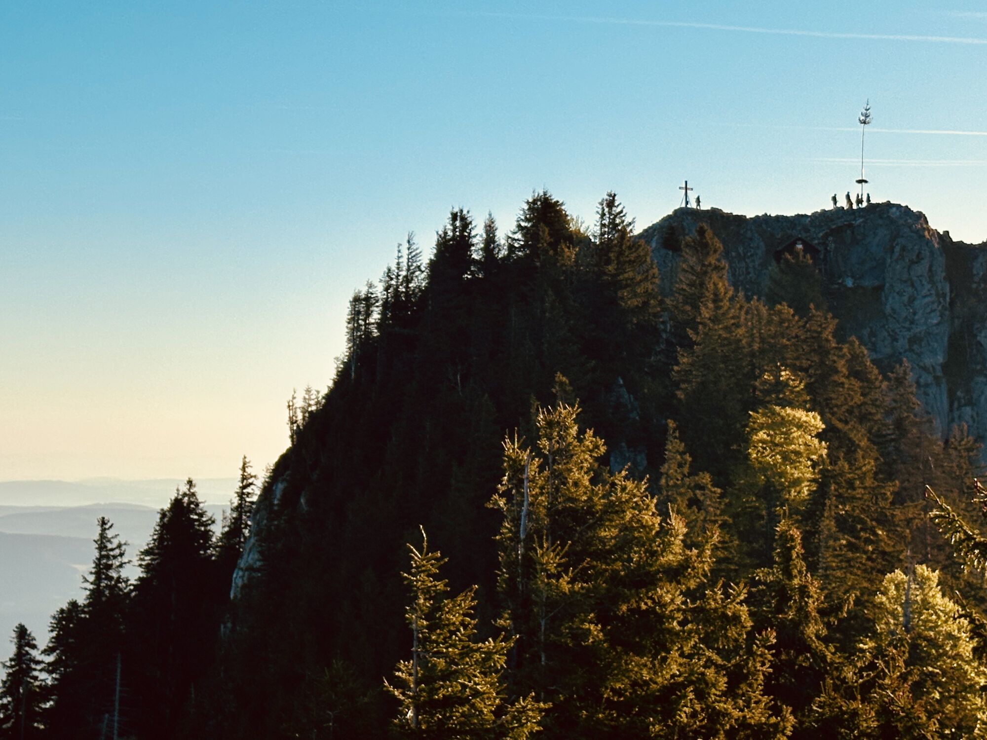
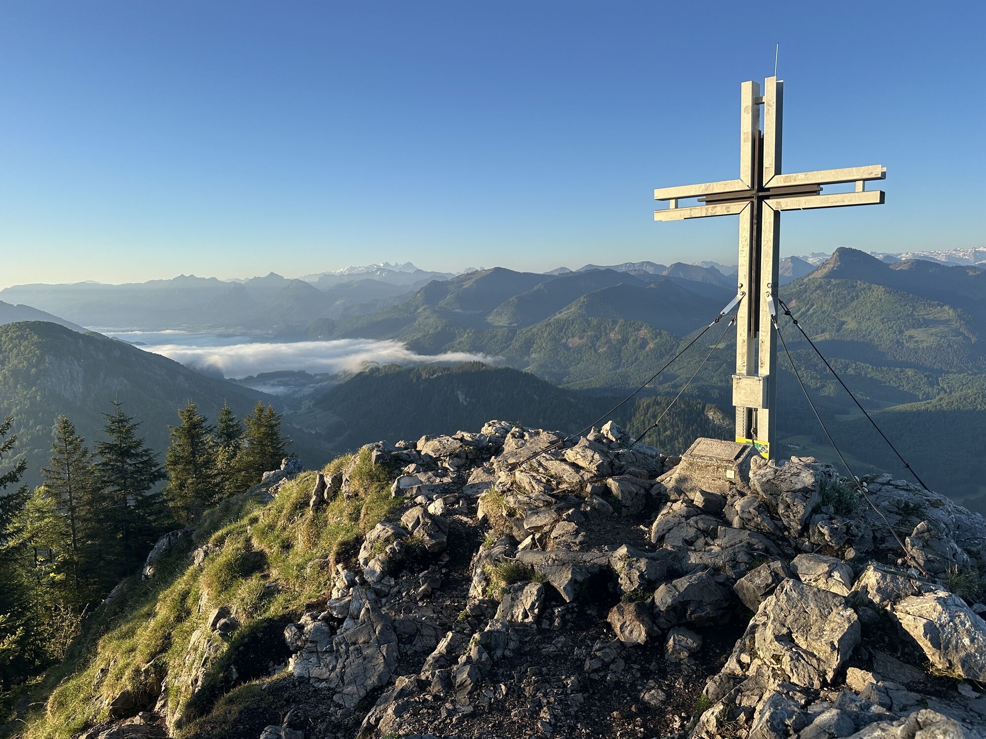
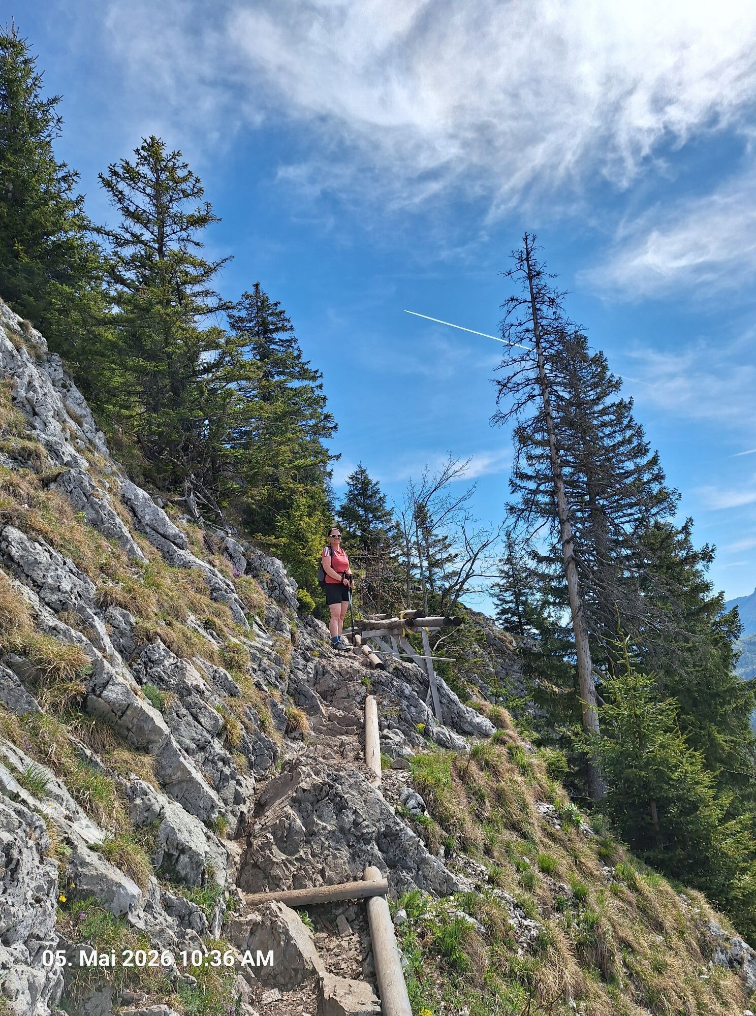
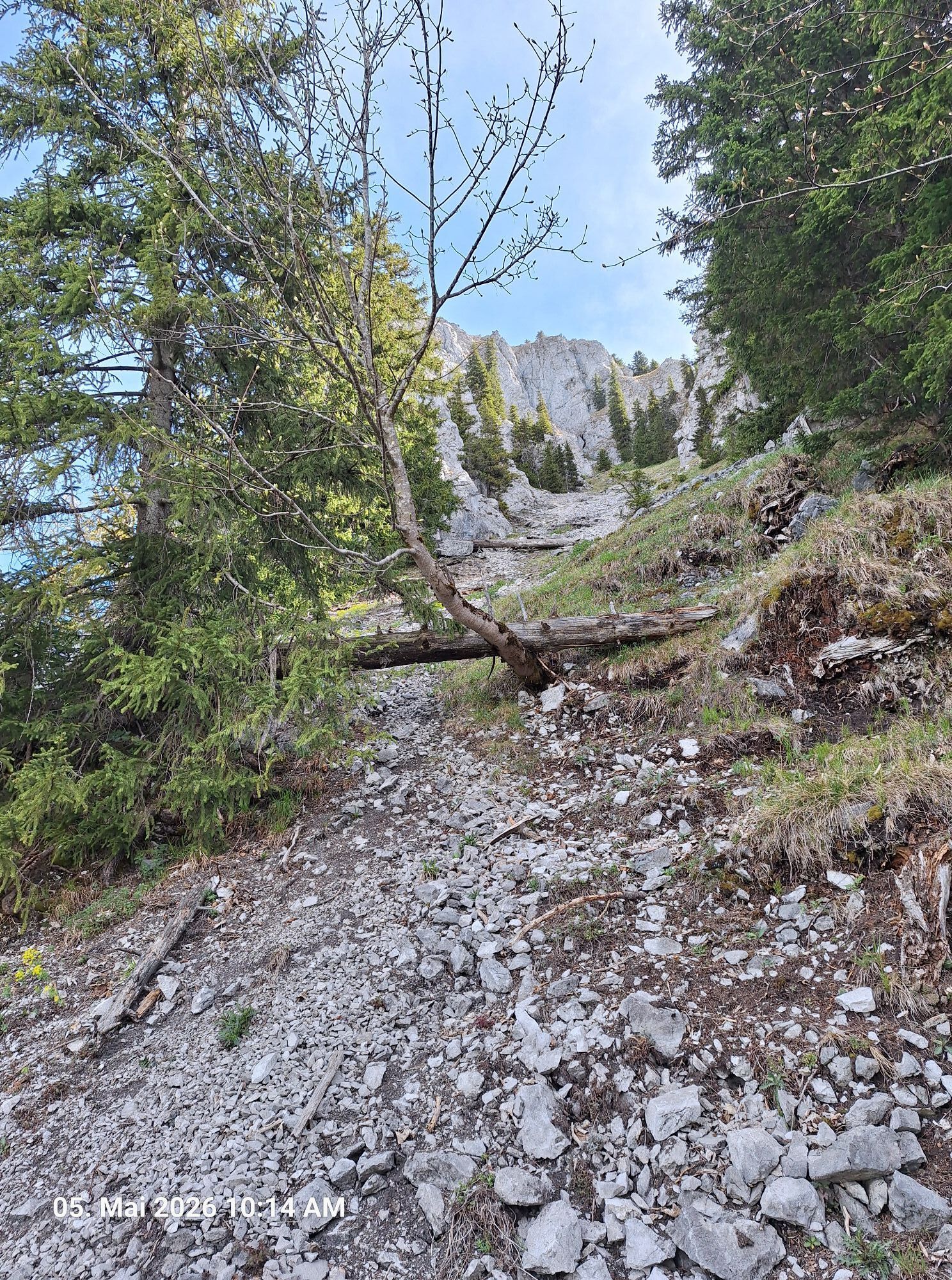
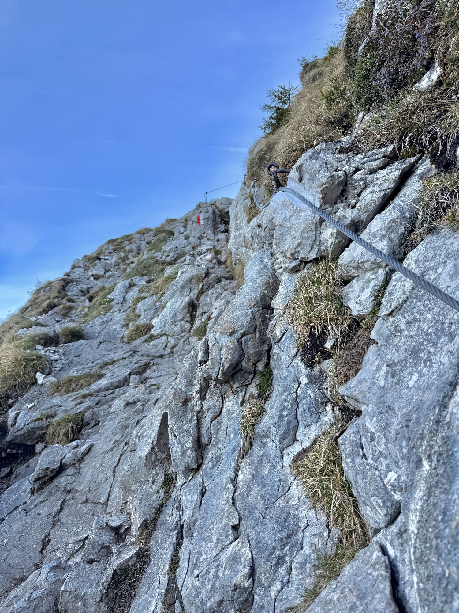
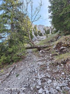
At the ruin begins the steep, partly exposed, climb to the Schober, which, although often in the forest, becomes sweaty. Shortly before the Schober summit, there are well-secured ascents that require some head for heights and also surefootedness and good footwear.
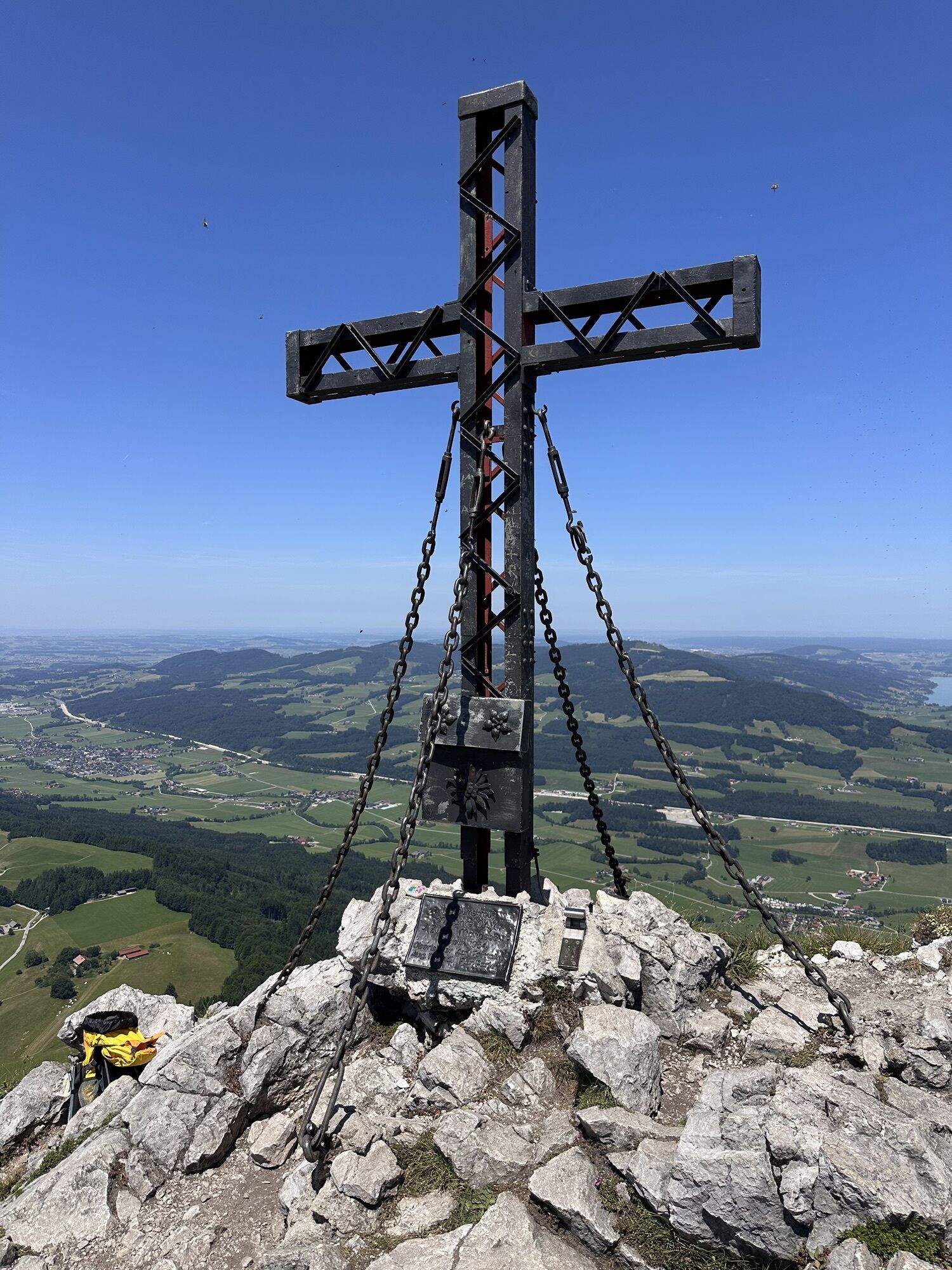
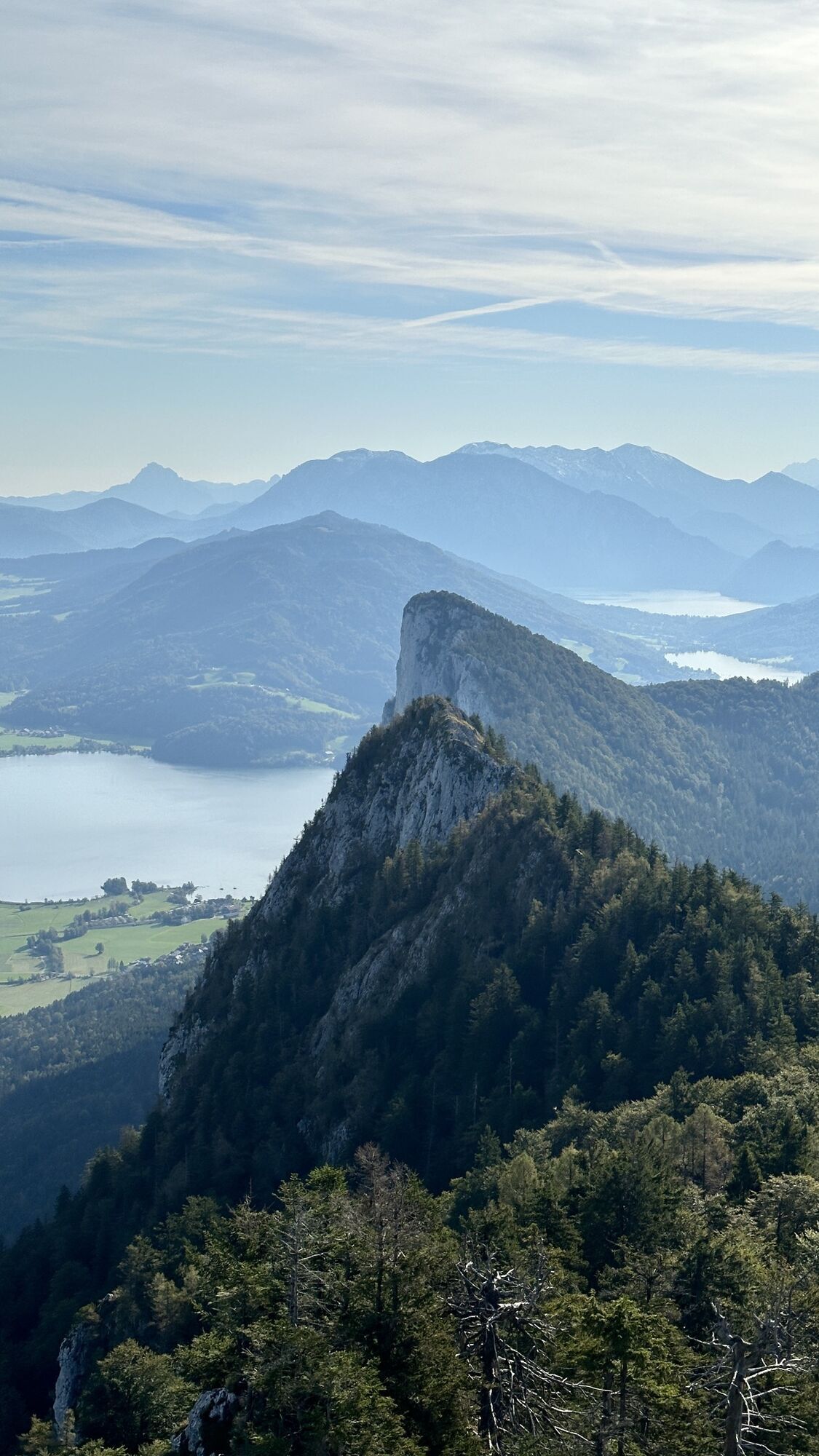
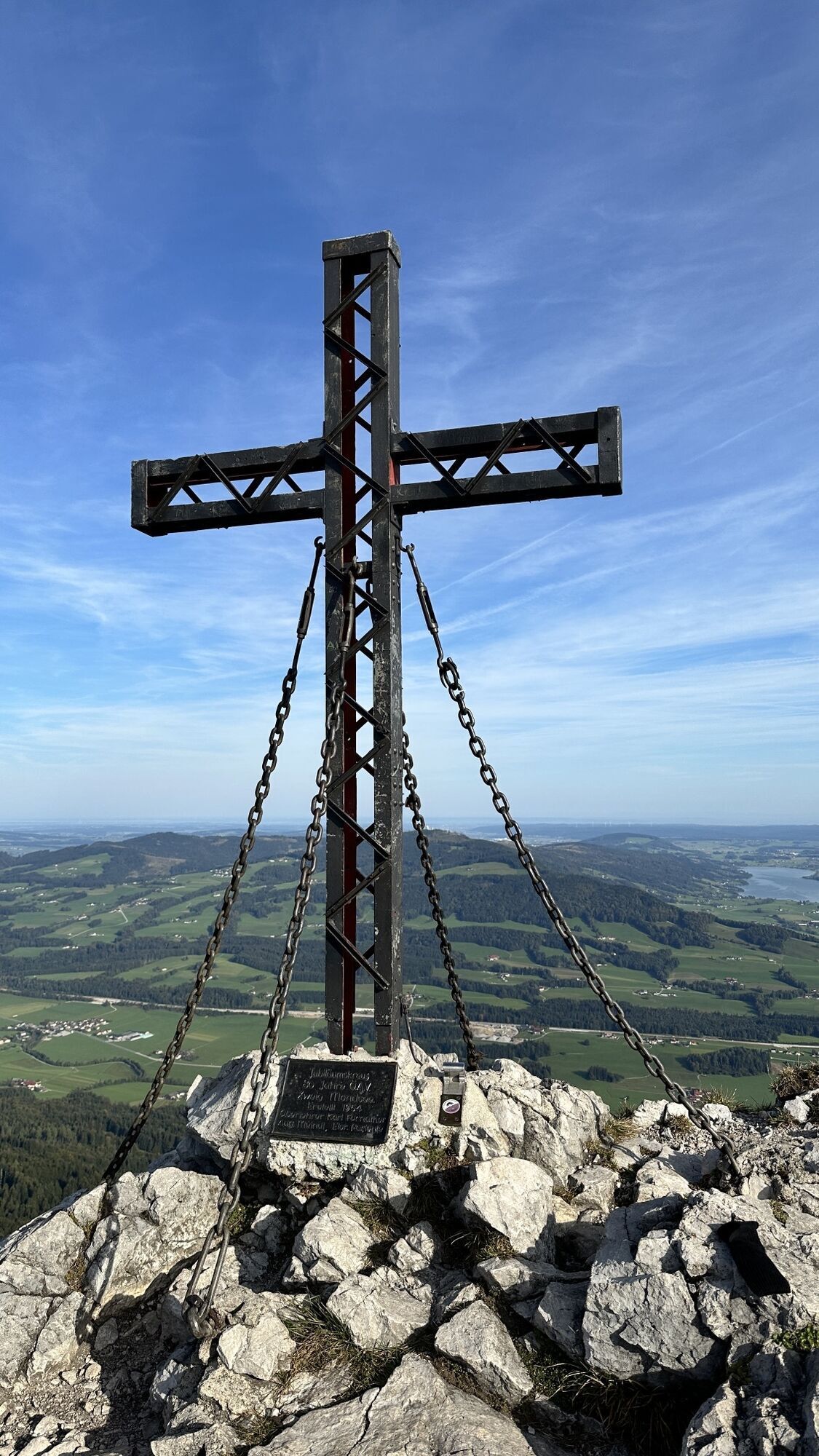
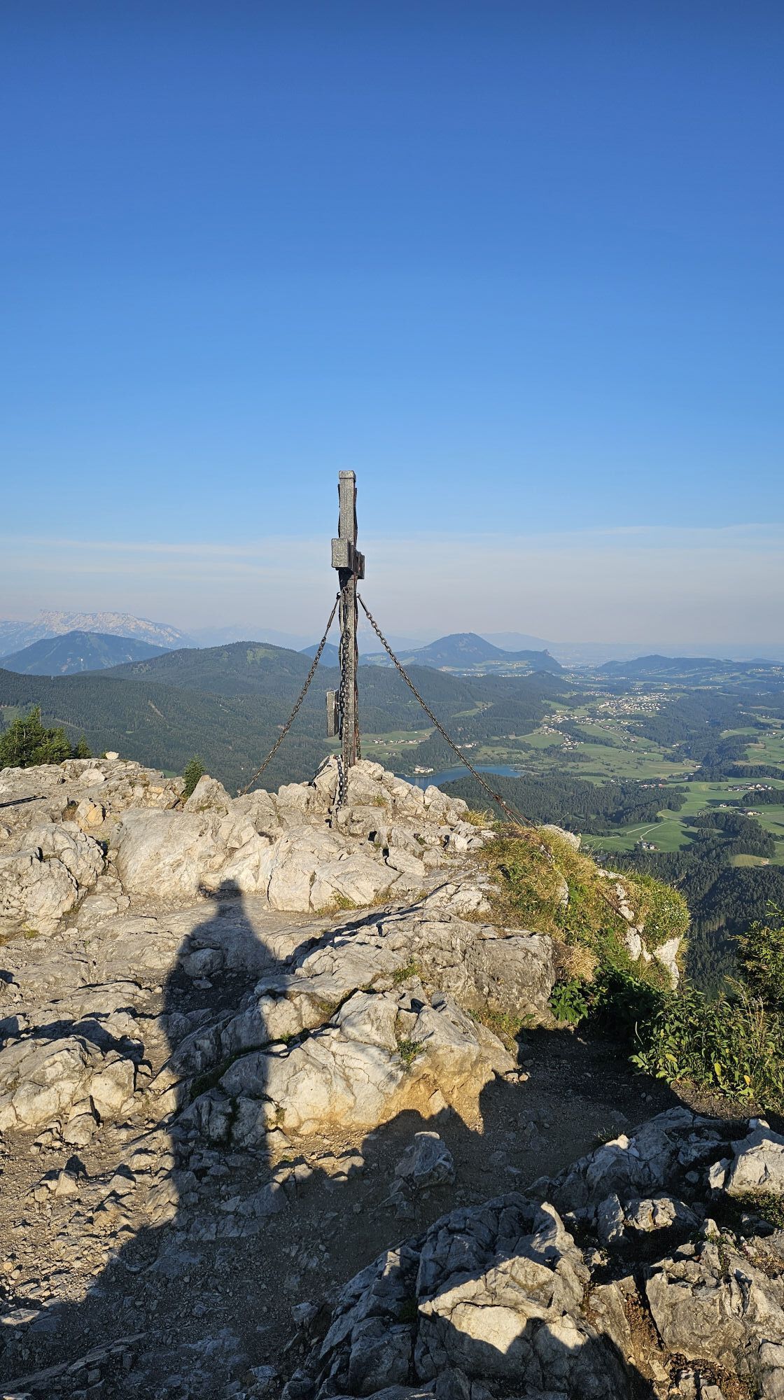
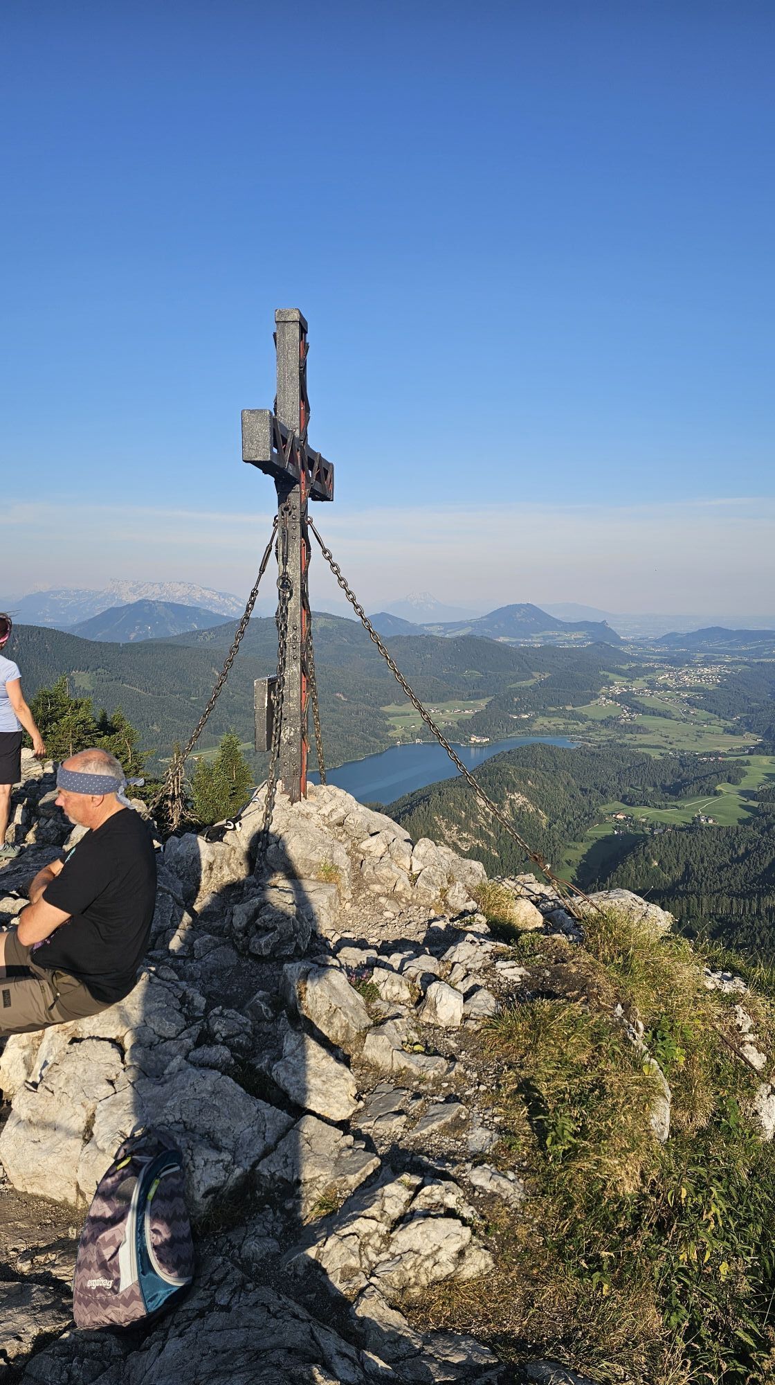
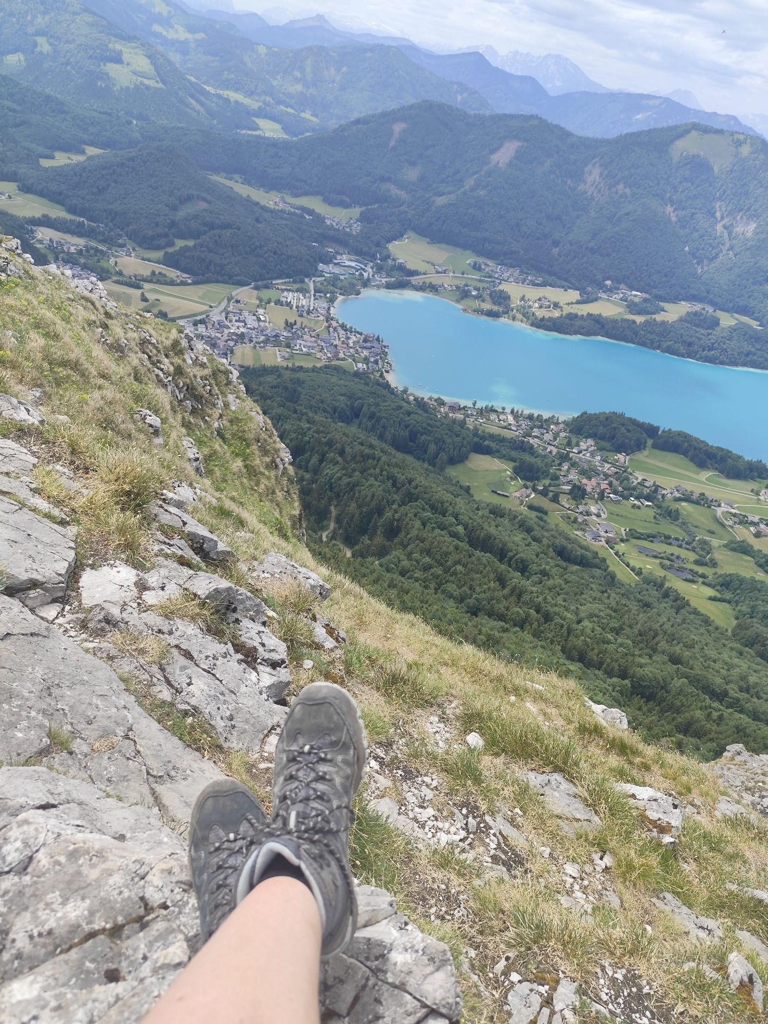
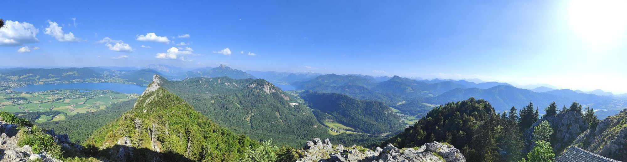
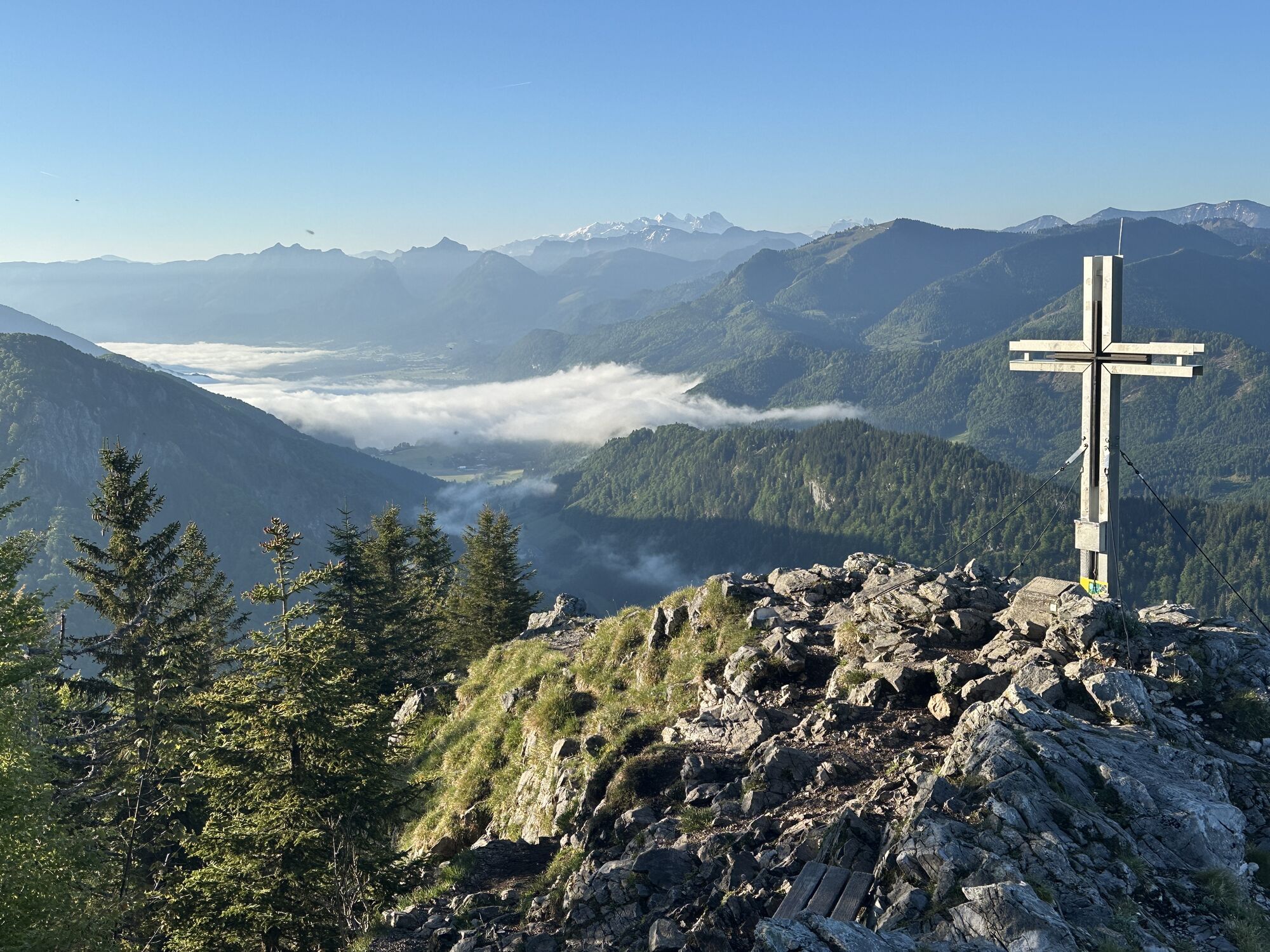
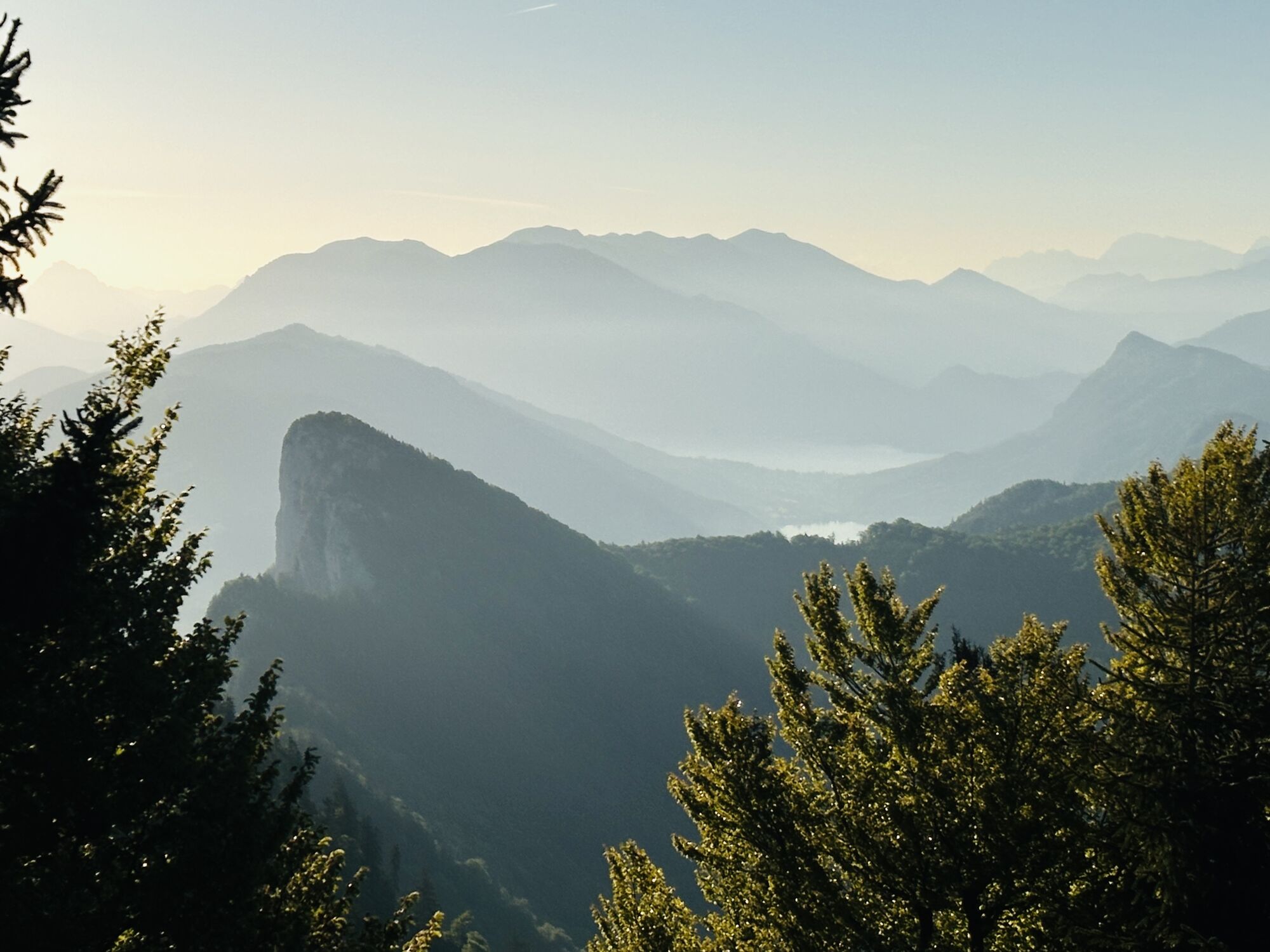
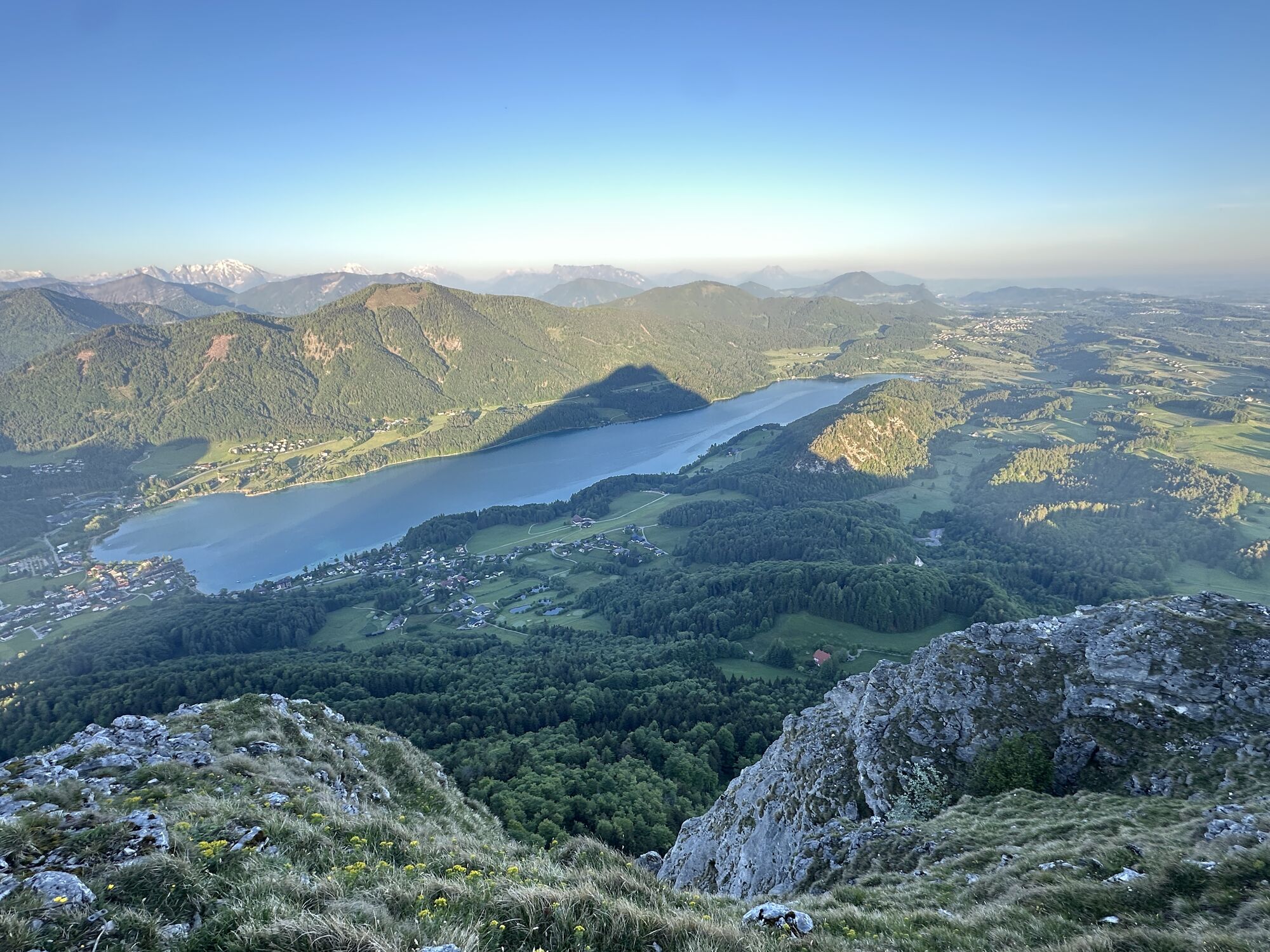
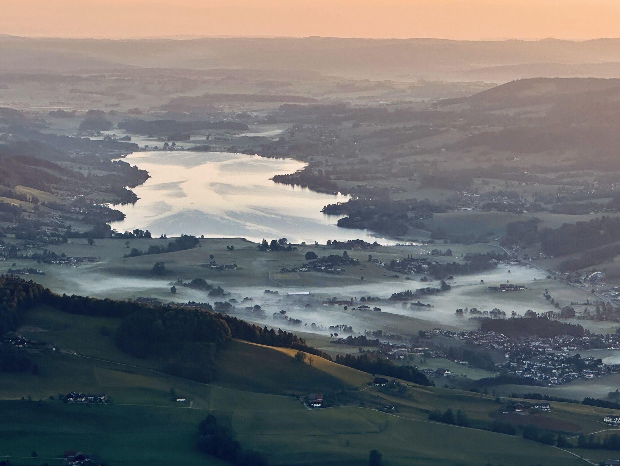
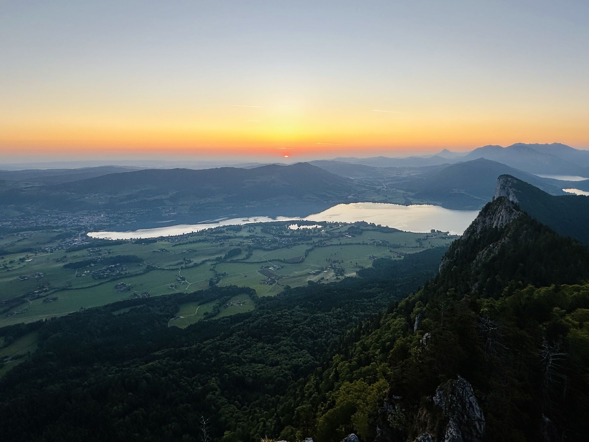
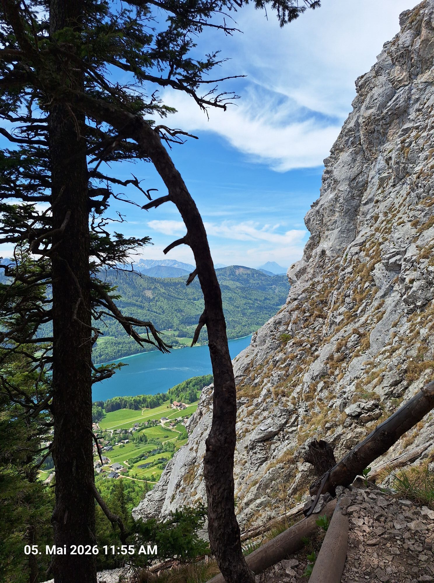
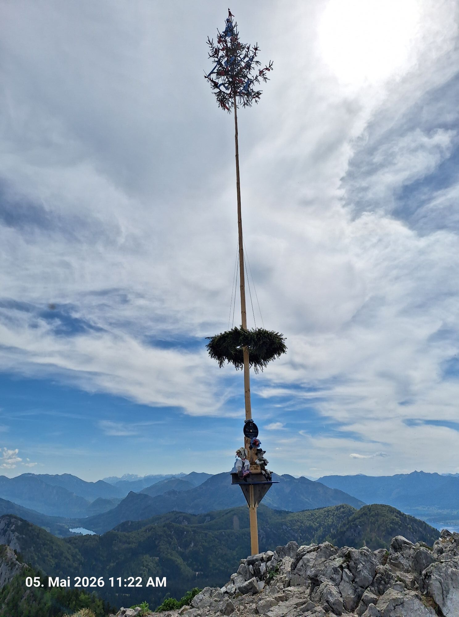
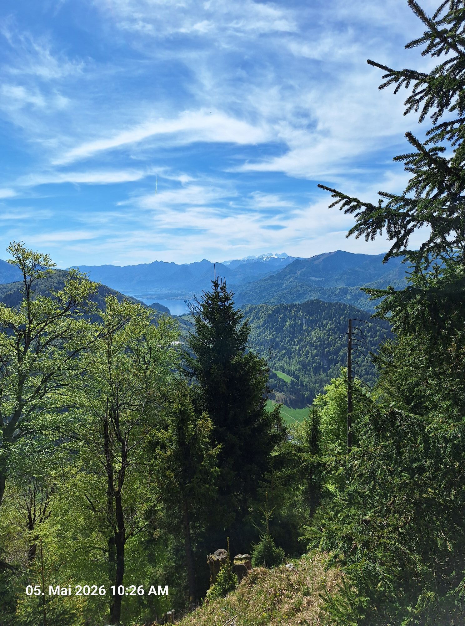
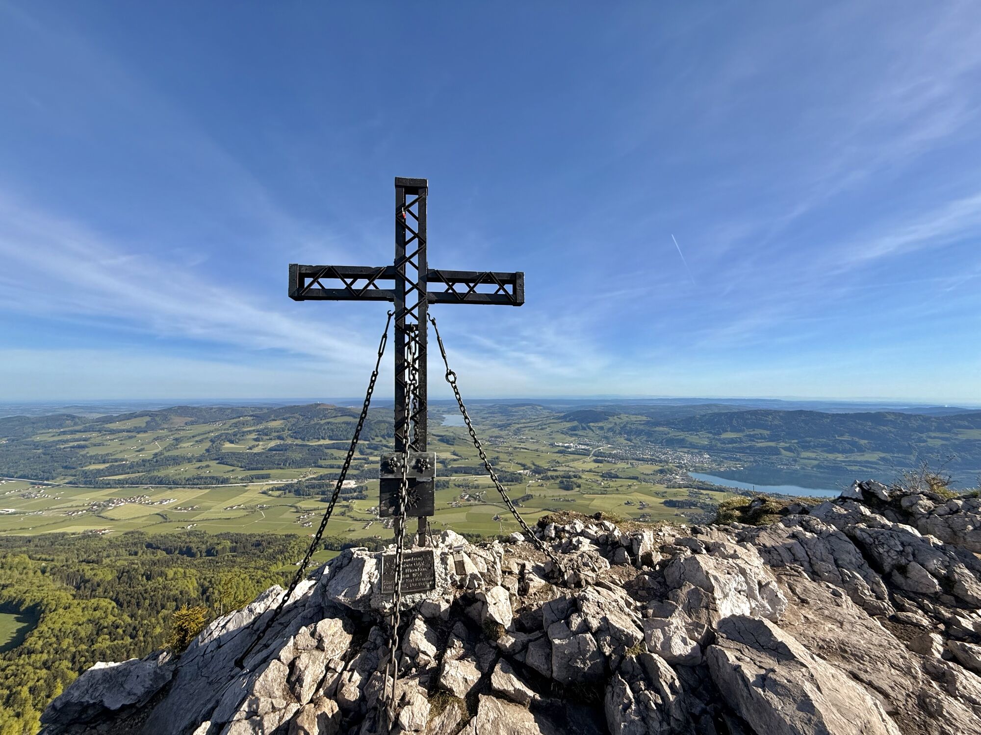
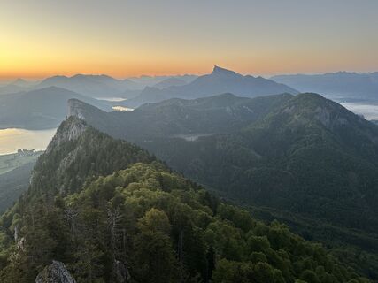
At the summit, one enjoys a fantastic panoramic view, as the Schober, isolated from other mountain blocks, towers over the local hills like a viewing platform: the view sweeps, clockwise from east to north, the Mondsee (2 sections), the Attersee, the Wolfgangssee, the Fuschlsee, with some imagination a small foothill of the Wallersee and finally the Irrsee. In the south, the Dachstein glacier can be seen in full width.
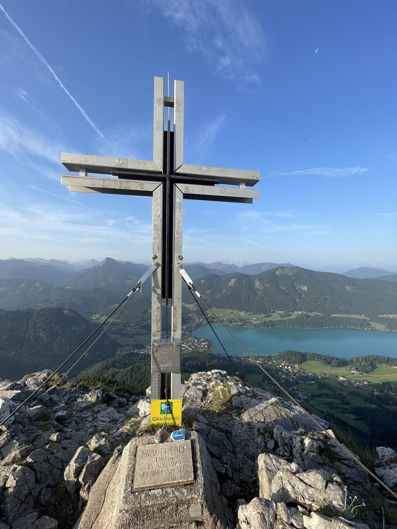
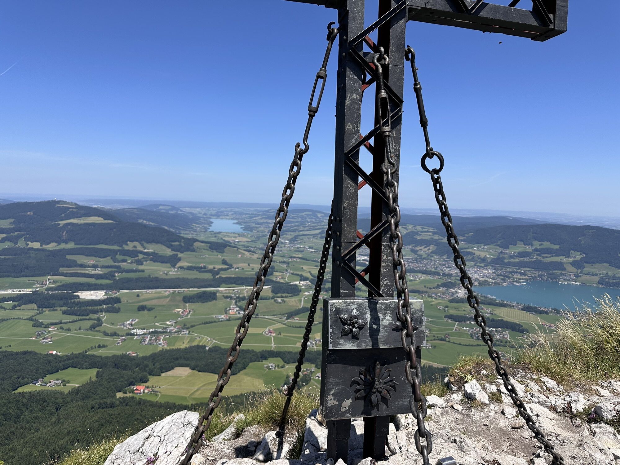
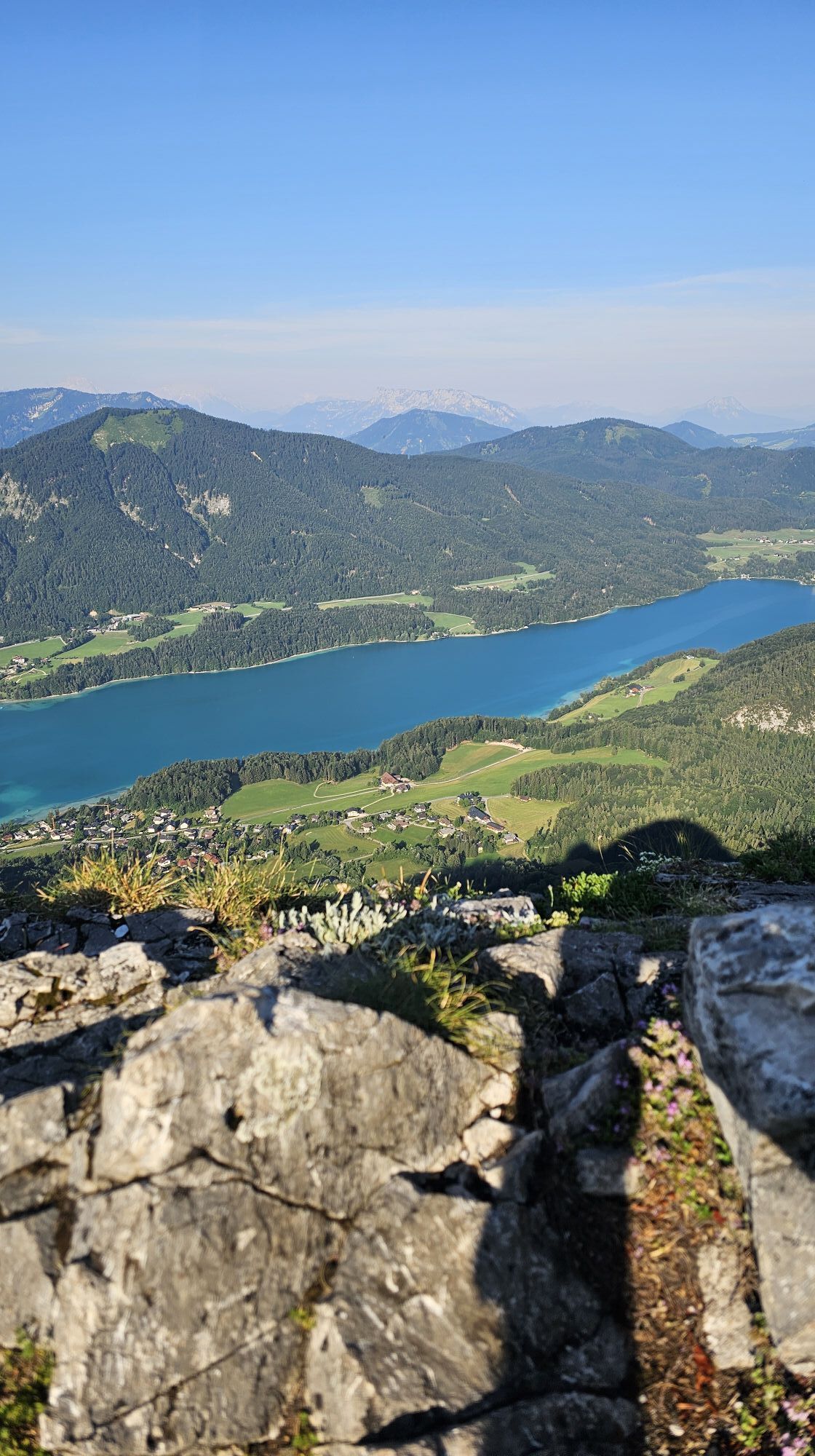
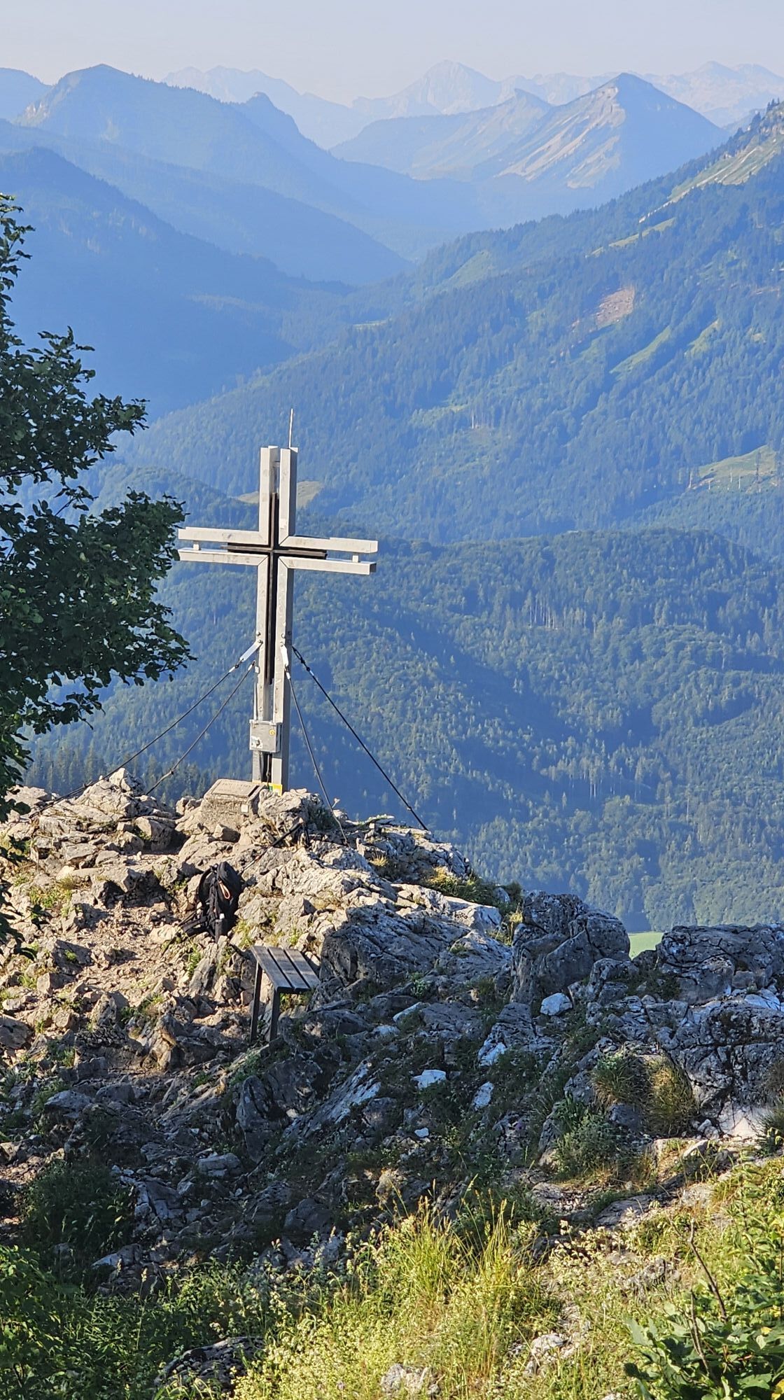
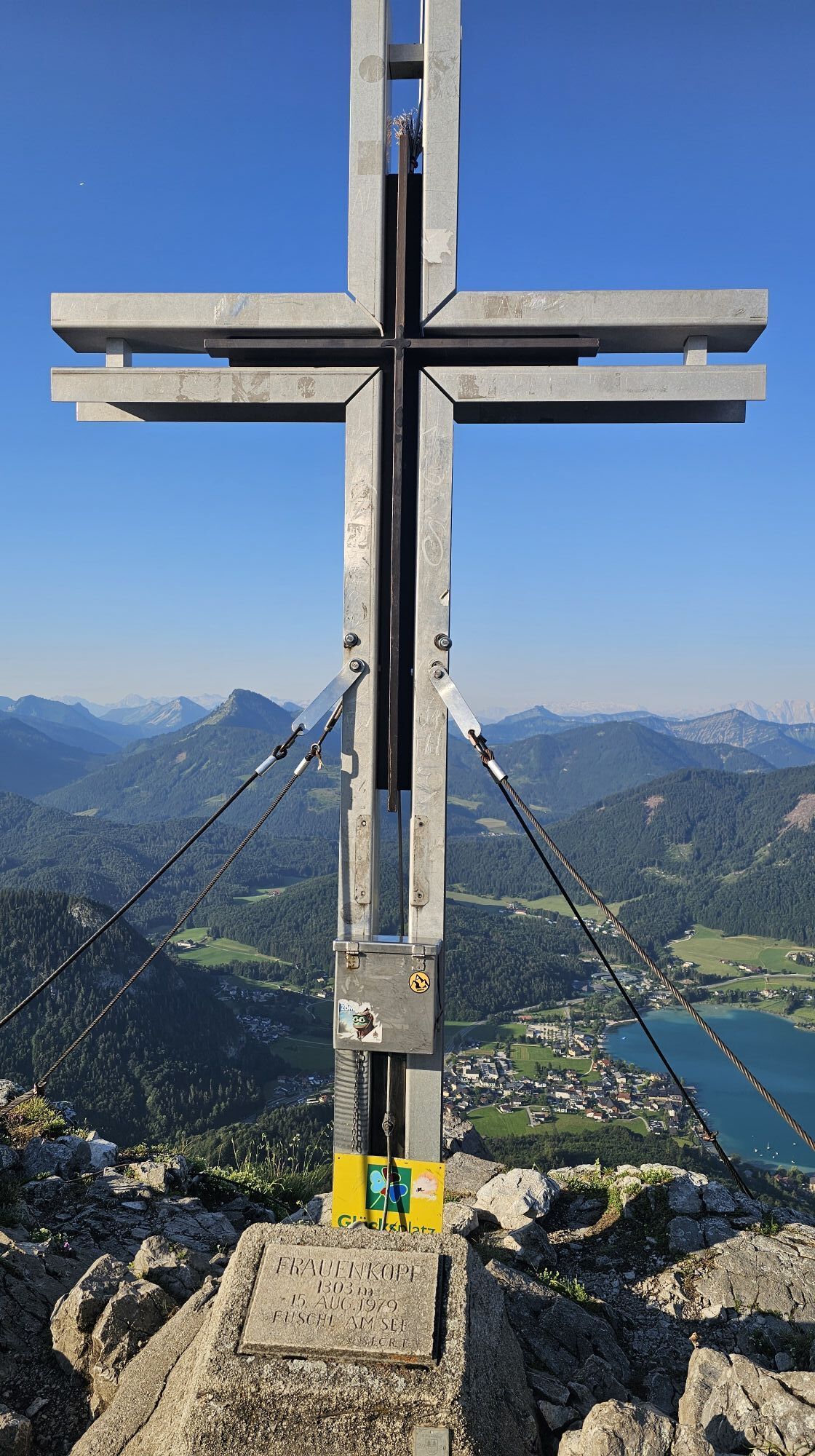
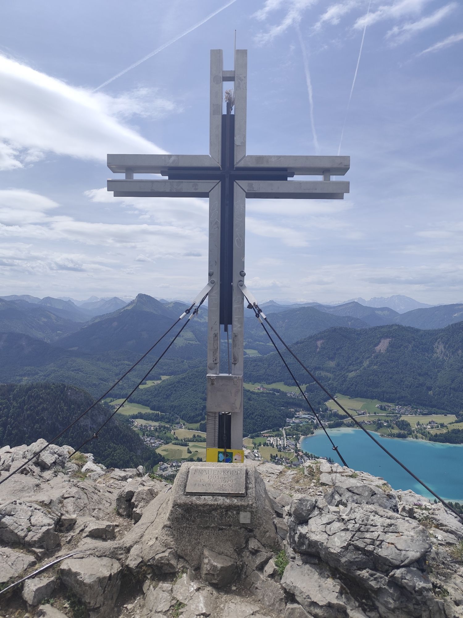
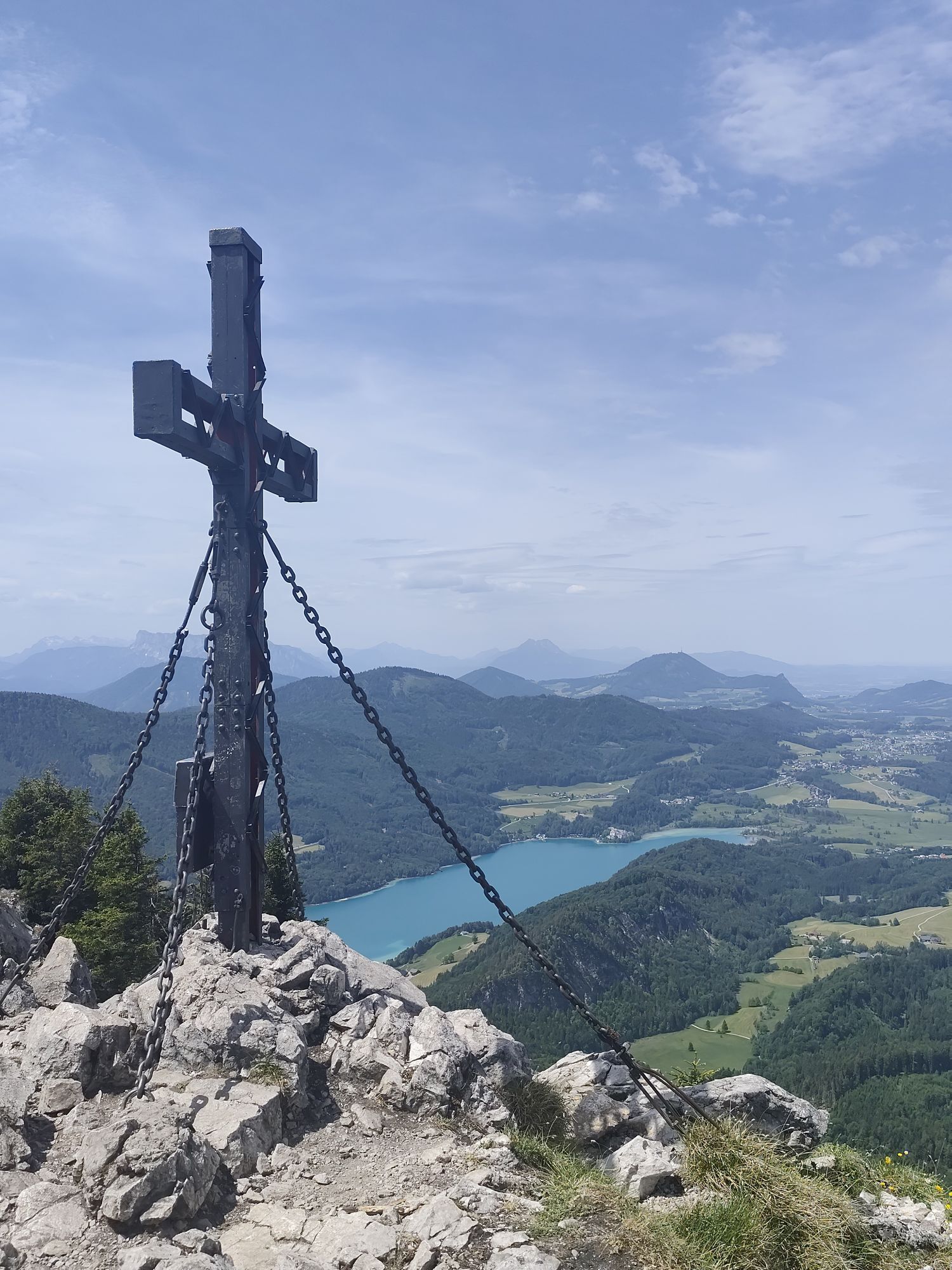
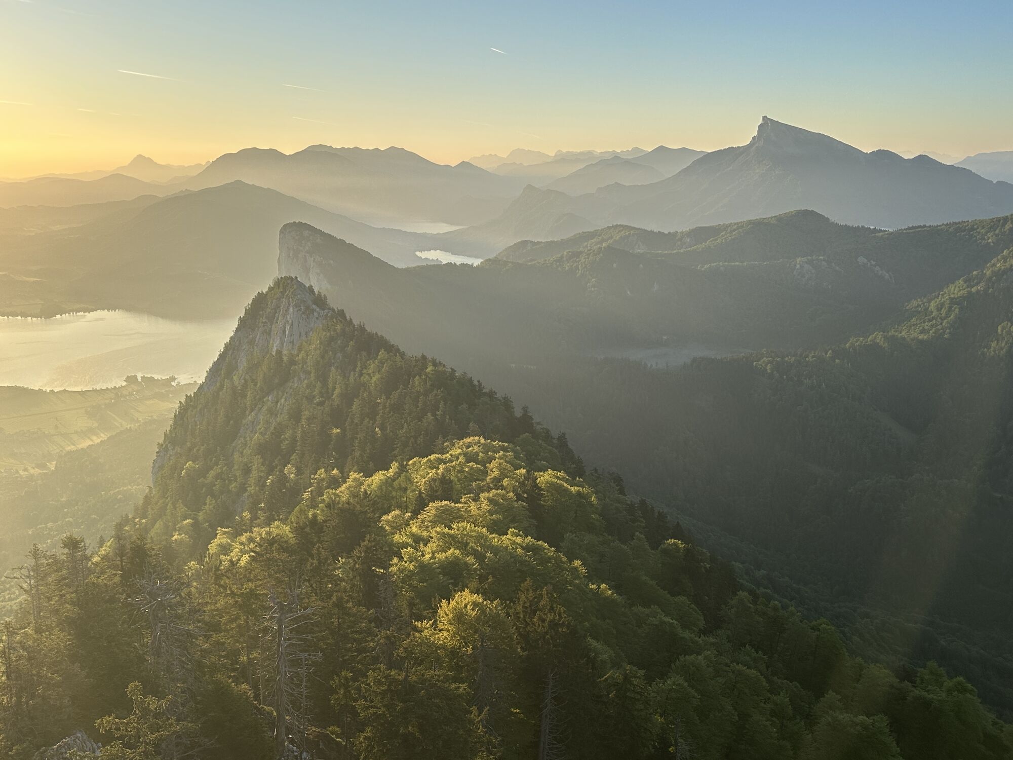
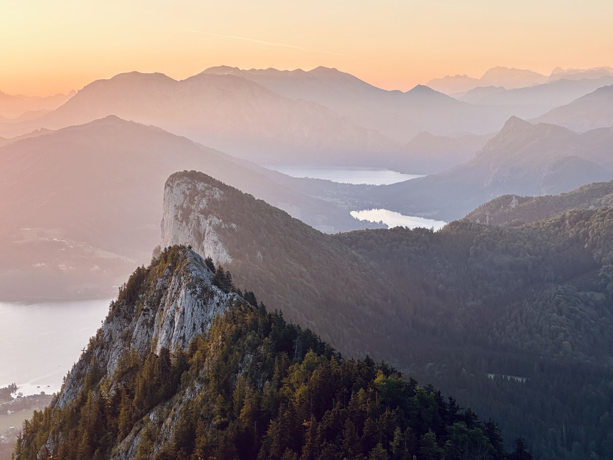
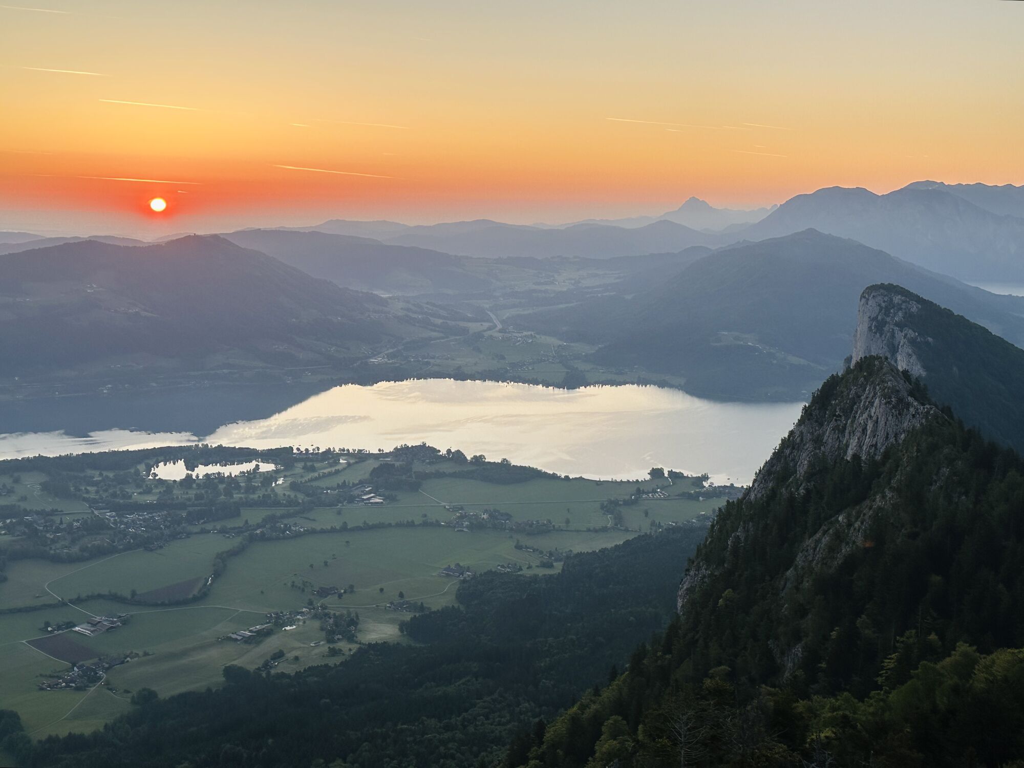
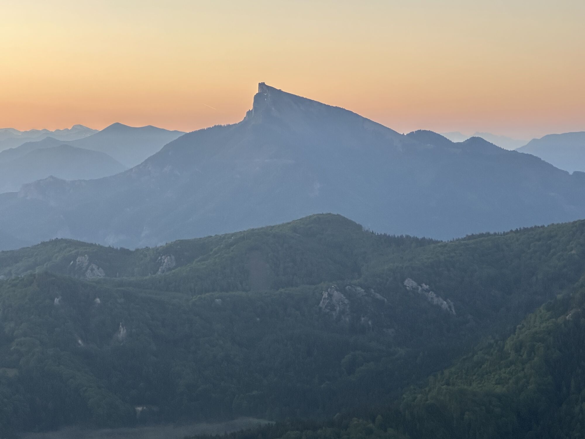
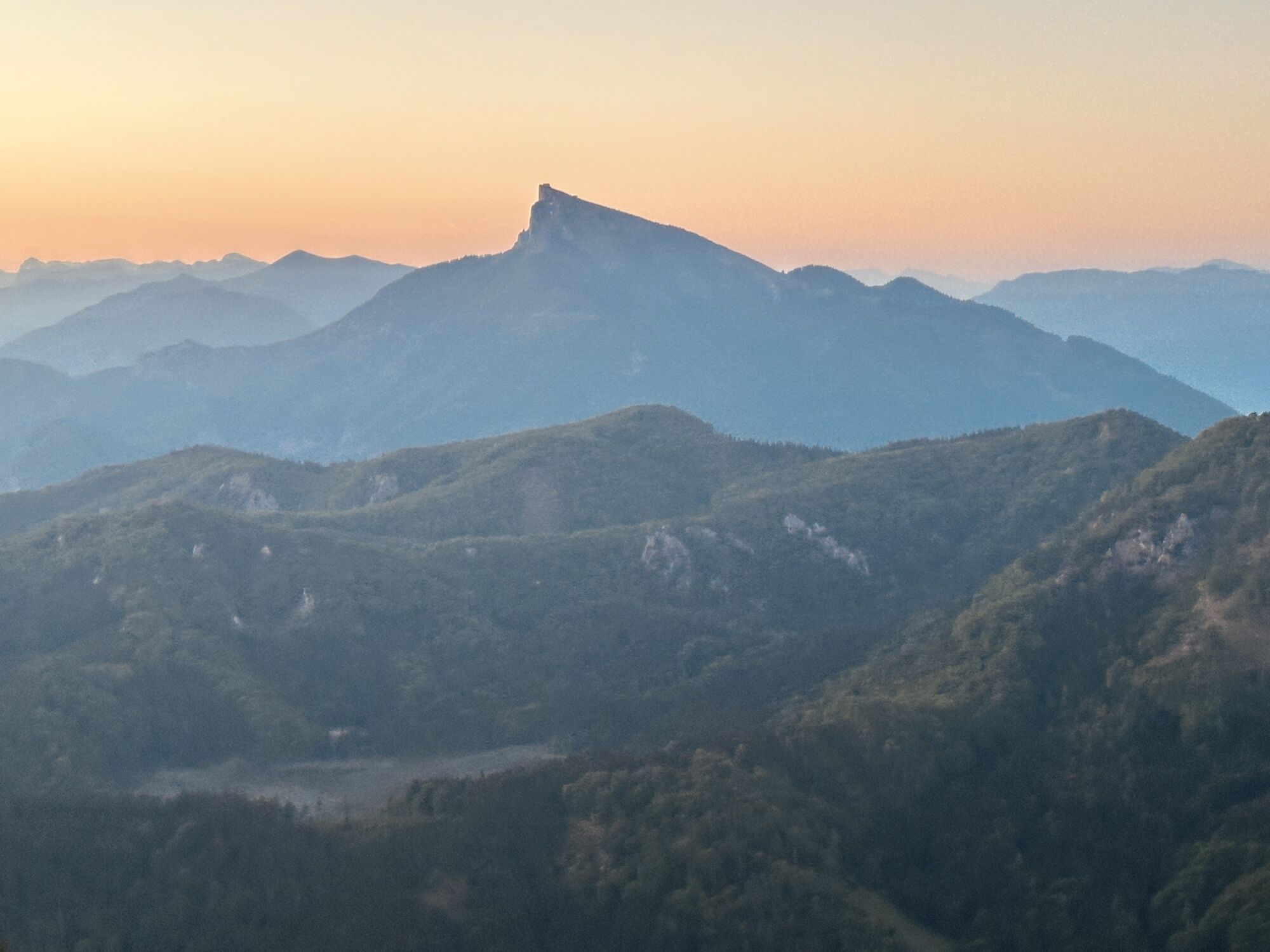
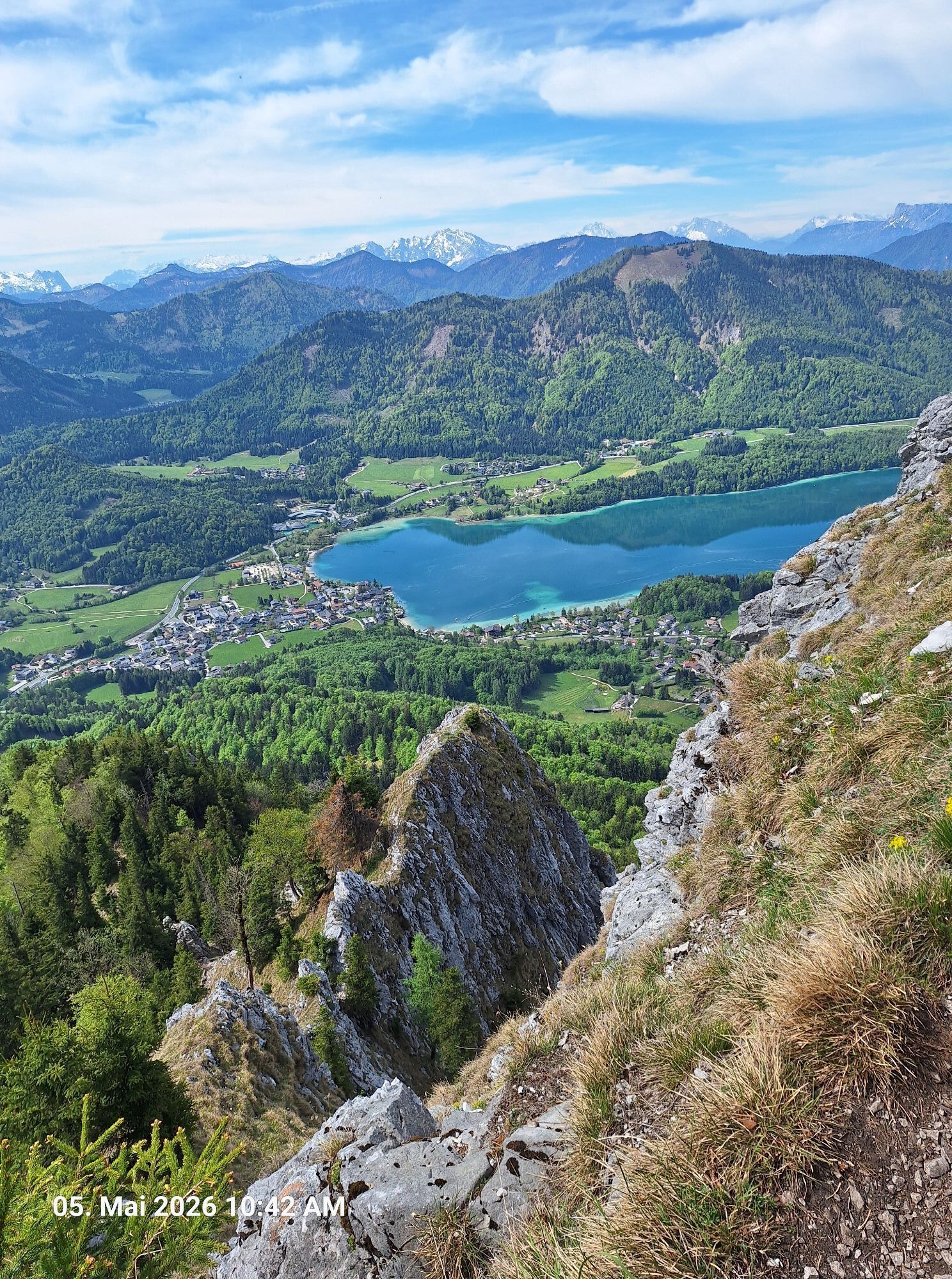
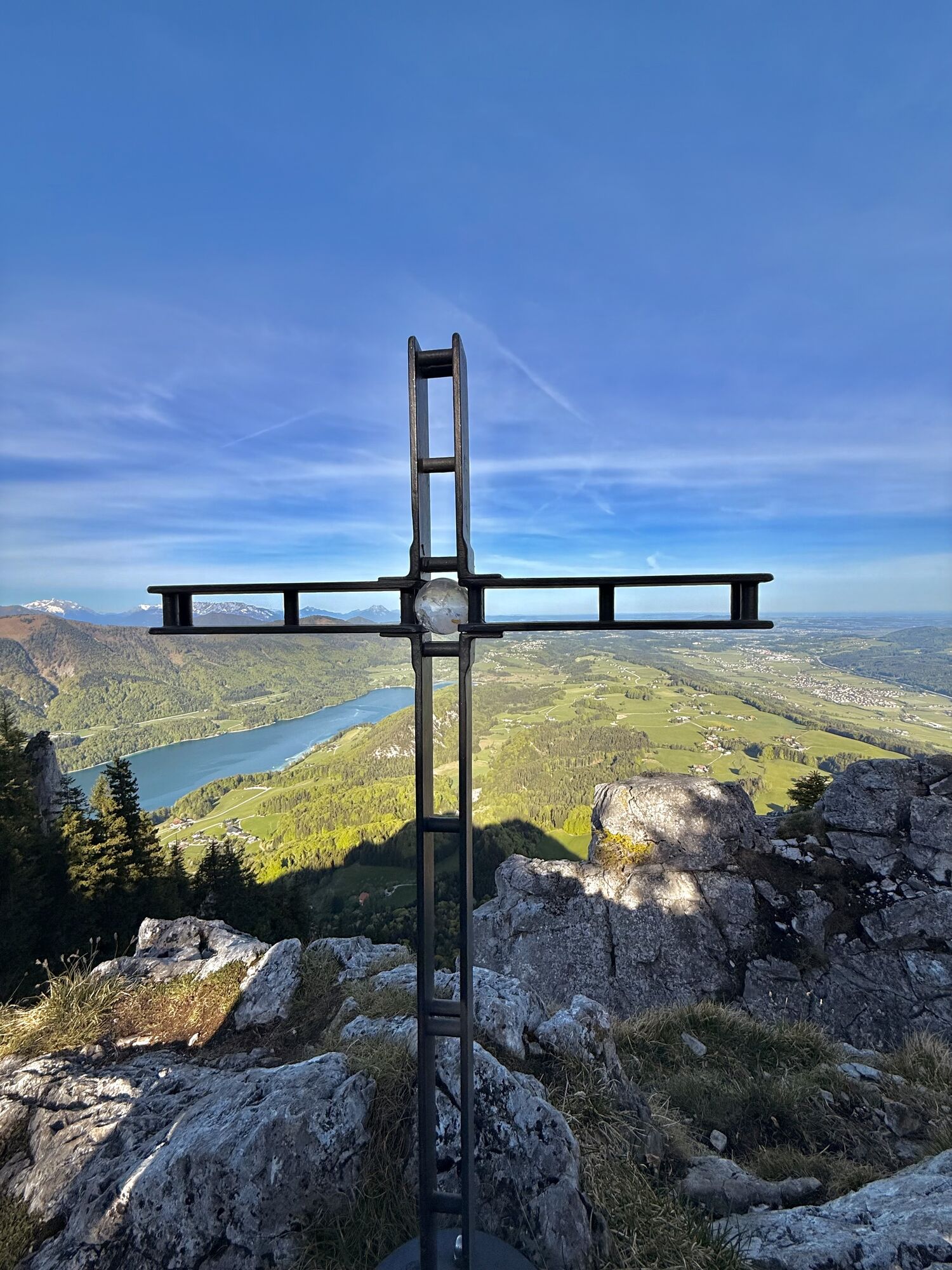
Afterwards it goes carefully short and steeply downhill. You pass a shelter hut in the Schobergipfel area and climb again briefly to the right to the Frauenkopf, from whose summit you have a very nice view of the entire Fuschlsee.
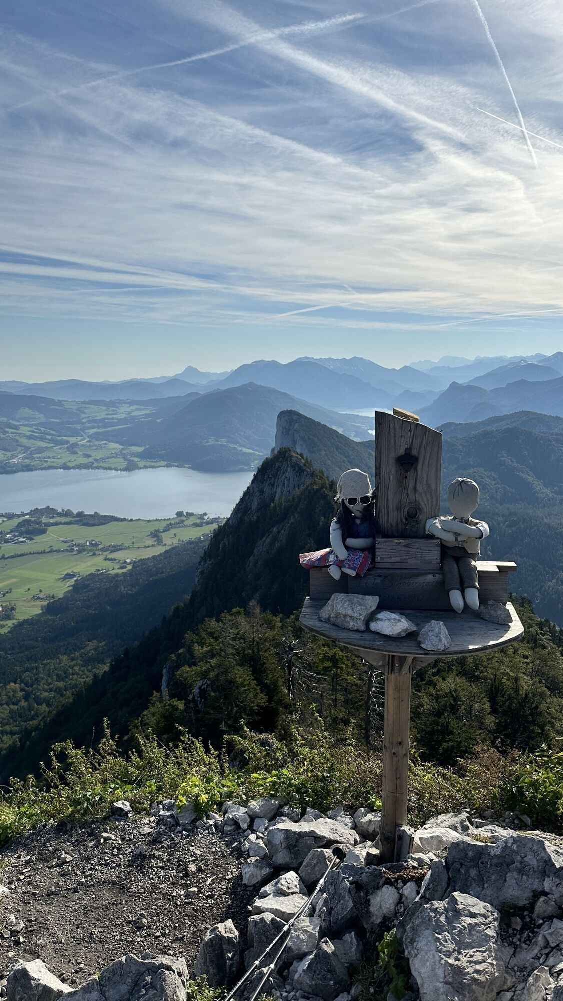
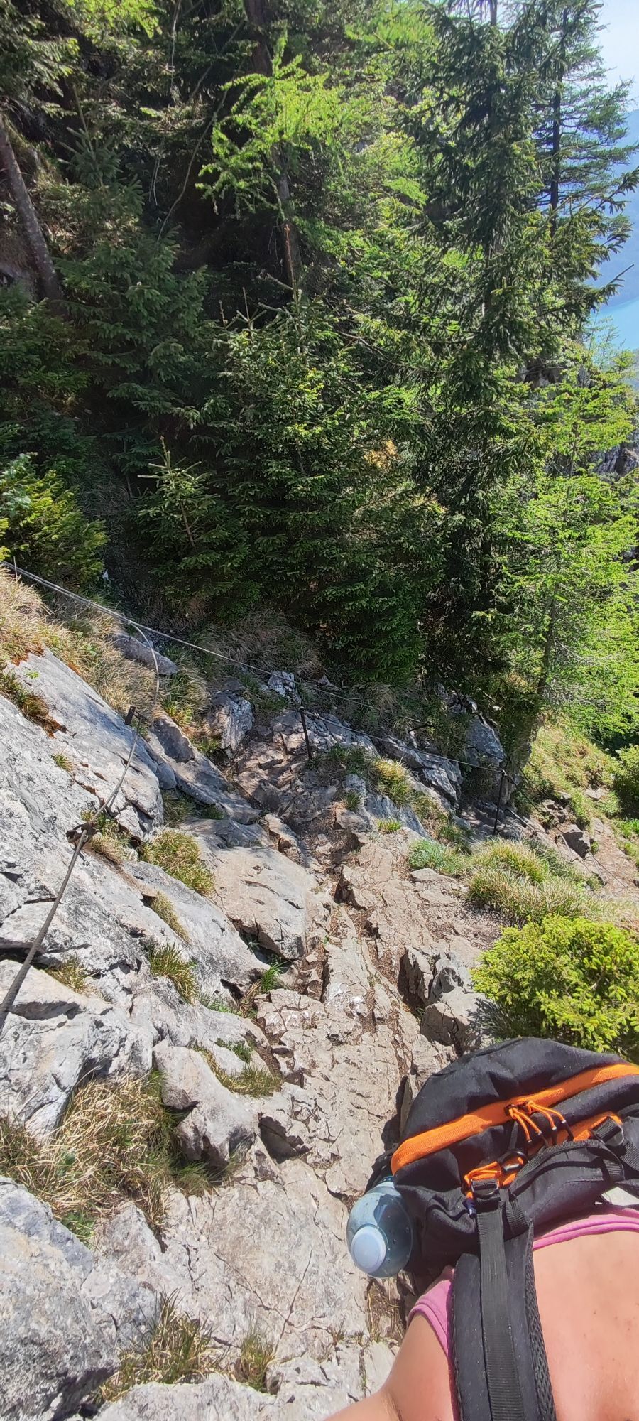
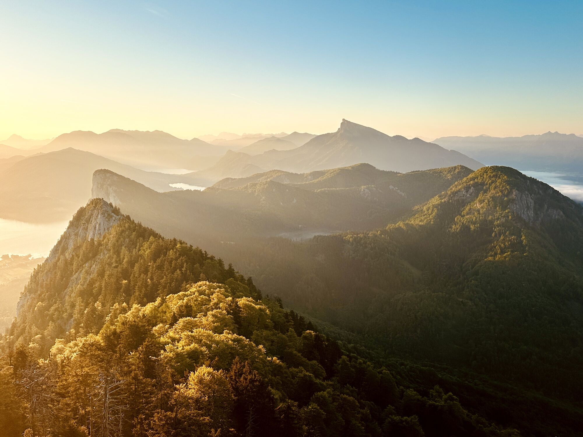
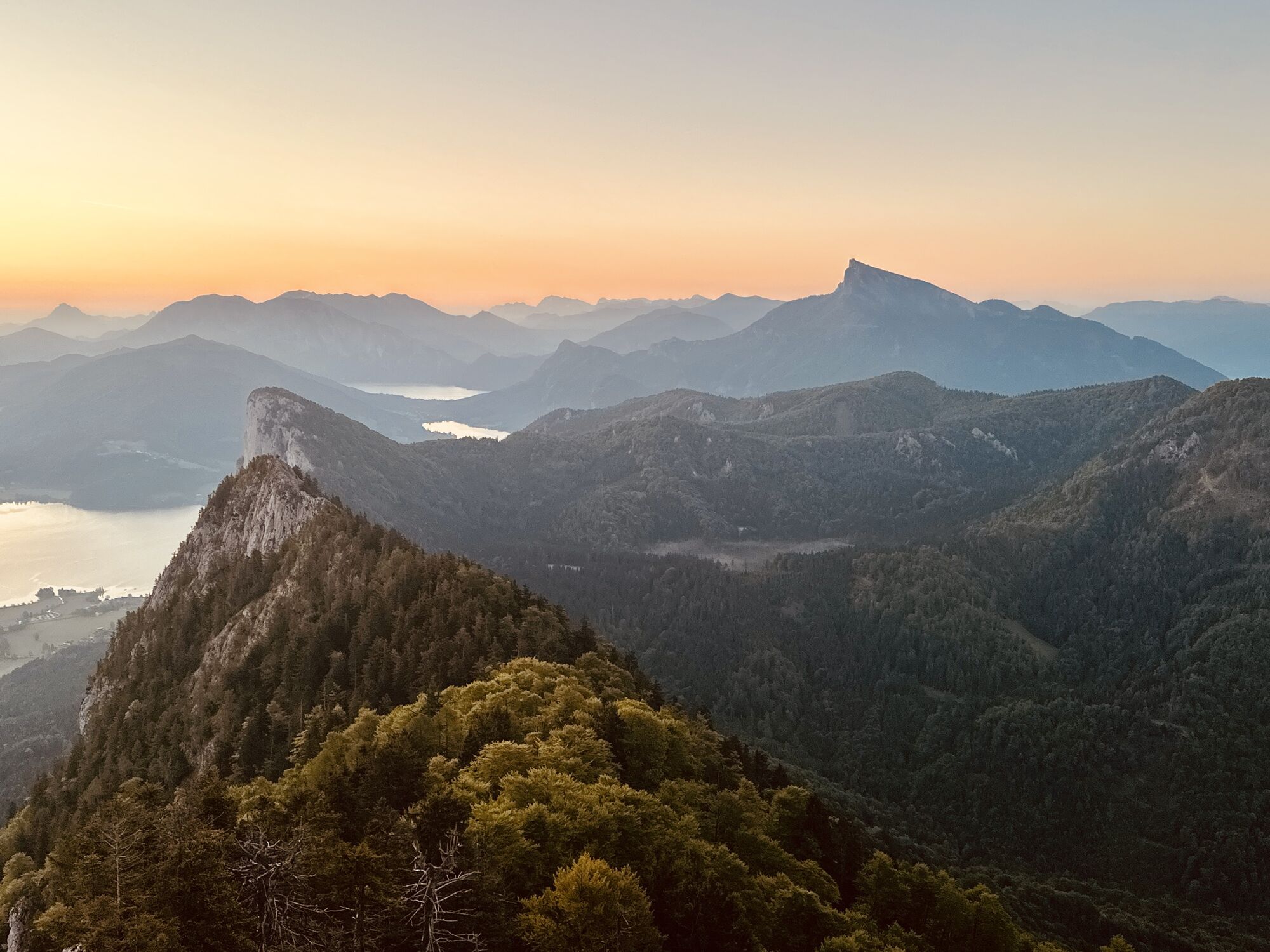
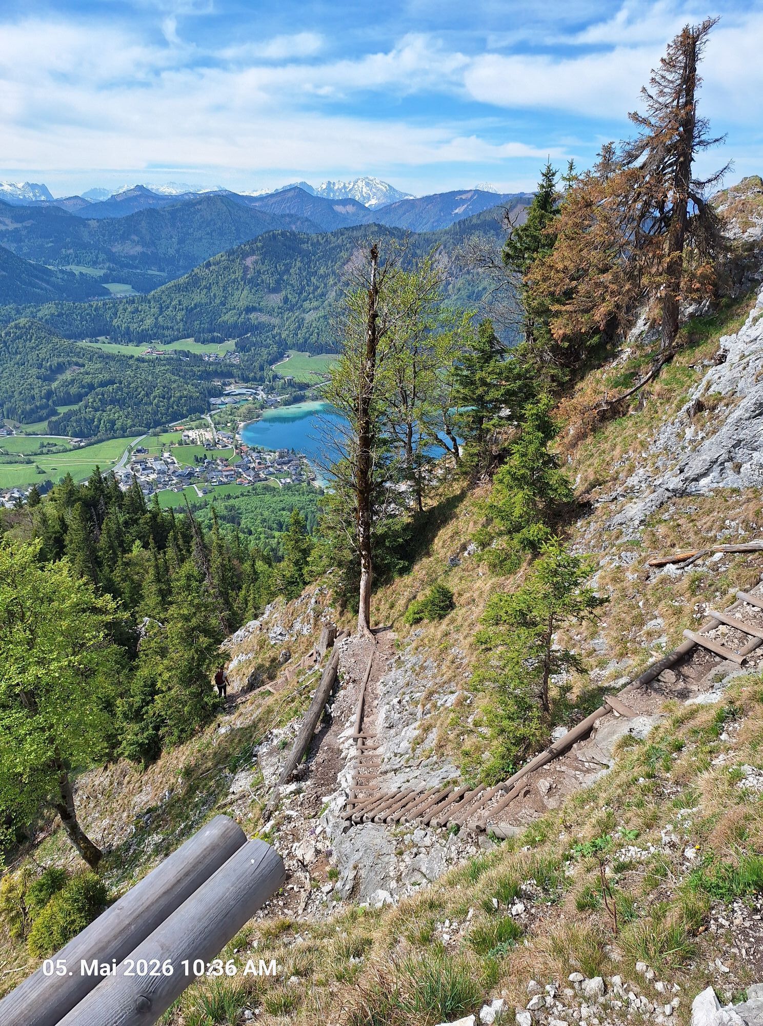
Then it goes very steeply down---perhaps with a short branch to a narrow panoramic "Bankerl" below the Frauenkopf. Paying the utmost attention to the path, you follow the steep, partially secured path with steps down to a forest road, which you follow to the parking lot.


Ano
Ano
good footwear, non-slip soles
by car or bike, possibly on foot from Fuschl
parking lot of the restaurant and hotel "Forsthaus Wartenfels"
Webové kamery z prohlídky
Aktivity na trase

Thalgau, Salzburg/Österreich
19.06.2026 – Mountainbike
Thalgau, Salzburg/Österreich
13.06.2026 – Turistika
Thalgau, Salzburg/Austria
06.06.2026 – TuristikaThalgau, Salzburg/Österreich
26.05.2026 – TuristikaThalgau, Salzburg/Österreich
24.05.2026 – Turistika
Thalgau, Salzburg/Österreich
22.05.2026 – TuristikaThalgau, Salzburg/Österreich
19.05.2026 – TuristikaThalgau, Salzburg/Österreich
19.05.2026 – Turistika
Thalgau, Salzburg/Österreich
18.05.2026 – Turistika
Thalgau, Salzburg/Österreich
14.05.2026 – Turistika
Thalgau, Salzburg/Österreich
13.05.2026 – Turistika
Schober u.Frauenkopf, Fuschl am See
09.05.2026 – Turistika
Thalgau, Salzburg/Österreich
06.05.2026 – Horská turistika
Thalgau, Salzburg/Österreich
05.05.2026 – Turistika
Schober und Frauenkopf
03.05.2026 – Horská turistika
Schober, Frauenkopf
03.05.2026 – TuristikaThalgau, Salzburg/Austria
26.04.2026 – Turistika
Thalgau, Salzburg/Österreich
24.04.2026 – Turistika
Thalgau, Salzburg/Österreich
24.04.2026 – TuristikaThalgau, Salzburg/Österreich
22.04.2026 – Turistika
Oblíbené prohlídky v okolí
- 4,8
Fuschl: Ruine Wartenfels - Schober - Frauenkopf
středníTuristika 7,62 km - 4,4
Fuschlseewanderung
světloTuristika 11 km - 4,2
Pillstein Panorama Rundweg
světloTuristika 3,40 km - 4,7
Pleasure hike over the Falkenstein
středníTuristika 9,81 km - 3,6
Mondsee: Rund um den Mondsee
světloJízda na kole 26,3 km - 3,6
Unterach am Attersee: Hochplettspitz
Turistika 4,25 km - 4,6
The Plombergstein: Adventure and summit panorama
světloTuristika 4,12 km - 4,0
Bärenweg am Lidaun
světloTuristika 9,05 km - 4,4
From Koppl to the Gaisberg summit
středníTuristika 9,86 km - 4,8
Salzkammergut: Die Drachenwand
heavyVia ferrata 4,32 km
Pěší turistika a stopování


Nenechte si ujít nabídky a inspiraci pro vaši příští dovolenou
Vaše e-mailová adresa byl přidán do poštovního seznamu.