


Kaisertour - Großglockner
Úroveň obtížnosti: 5
Fotografie našich uživatelů

 © Reinhold Wallner 1Vytvořeno dne 01.05.2026
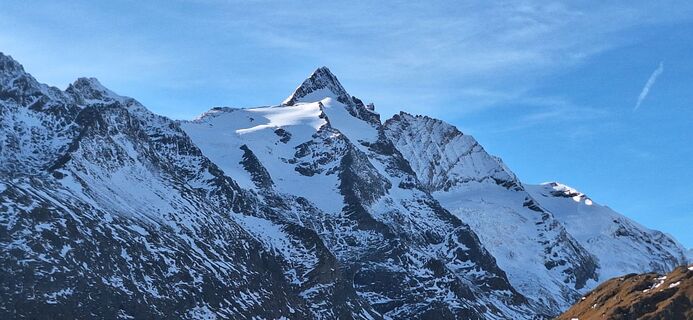
 © Manfred Pirker 1Vytvořeno dne 11.10.2025
 © Manfred Pirker 1Vytvořeno dne 11.10.2025
 © Heinz SperlVytvořeno dne 14.08.2025
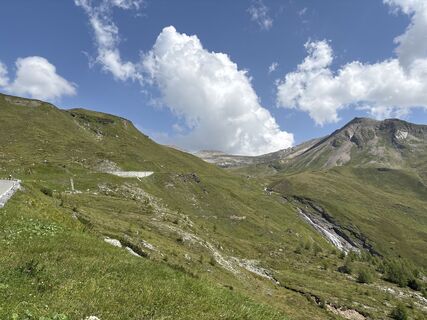 © Heinz SperlVytvořeno dne 14.08.2025
 © Heinz SperlVytvořeno dne 14.08.2025
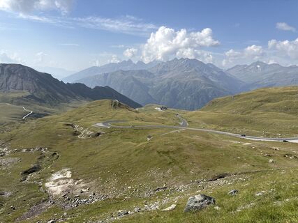 © Heinz SperlVytvořeno dne 14.08.2025
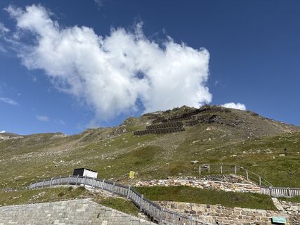 © Heinz SperlVytvořeno dne 14.08.2025
 © Heinz SperlVytvořeno dne 14.08.2025
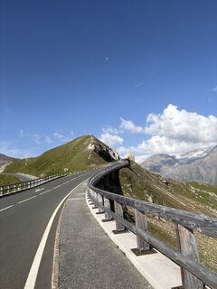 © Heinz SperlVytvořeno dne 14.08.2025
 © Heinz SperlVytvořeno dne 14.08.2025
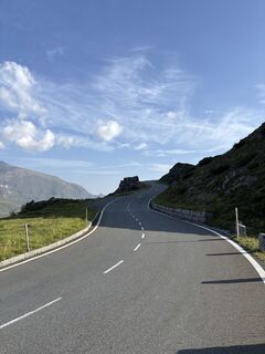 © Heinz SperlVytvořeno dne 14.08.2025
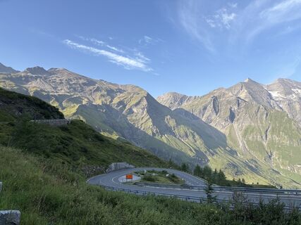 © Heinz SperlVytvořeno dne 14.08.2025
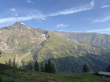 © Heinz SperlVytvořeno dne 14.08.2025
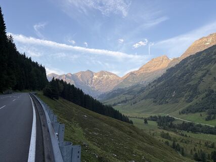 © Heinz SperlVytvořeno dne 14.08.2025
 © Heinz SperlVytvořeno dne 14.08.2025
 © Christian LeidenfrostVytvořeno dne 24.06.2025
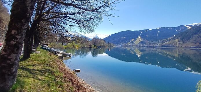
 © martl122Vytvořeno dne 12.04.2025
 © thschoeVytvořeno dne 29.08.2024
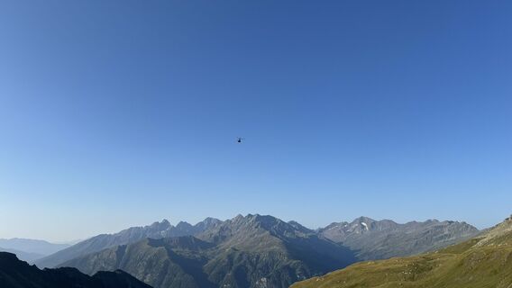 © thschoeVytvořeno dne 29.08.2024
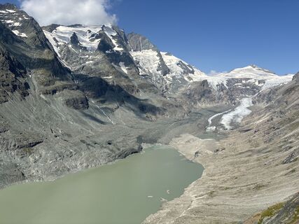 © Heinz SperlVytvořeno dne 14.08.2024
 © Heinz SperlVytvořeno dne 14.08.2024
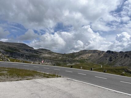 © Heinz SperlVytvořeno dne 18.08.2023
 © Heinz SperlVytvořeno dne 18.08.2023
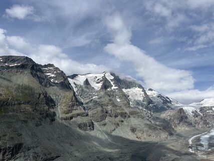 © Heinz SperlVytvořeno dne 18.08.2023
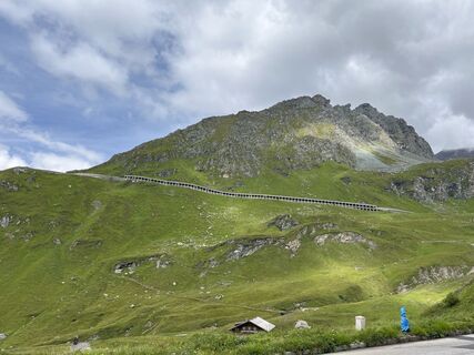 © Heinz SperlVytvořeno dne 18.08.2023
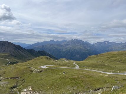 © Heinz SperlVytvořeno dne 18.08.2023
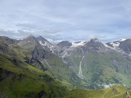 © Heinz SperlVytvořeno dne 18.08.2023
 © Heinz SperlVytvořeno dne 18.08.2023
 © Heinz SperlVytvořeno dne 18.08.2023
 © Heinz SperlVytvořeno dne 18.08.2023
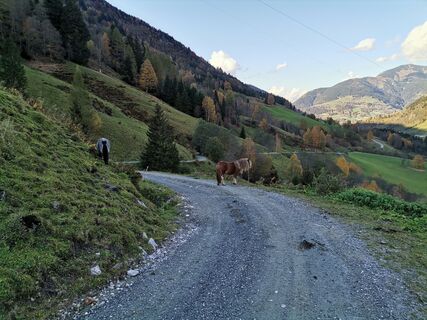
 © Matej Mikus 1Vytvořeno dne 12.10.2022
 © Matej Mikus 1Vytvořeno dne 12.10.2022
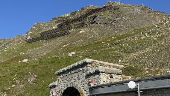 © thschoeVytvořeno dne 29.08.2024
 © thschoeVytvořeno dne 29.08.2024
 © thschoeVytvořeno dne 29.08.2024
 © thschoeVytvořeno dne 29.08.2024
 © thschoeVytvořeno dne 29.08.2024
 © thschoeVytvořeno dne 29.08.2024
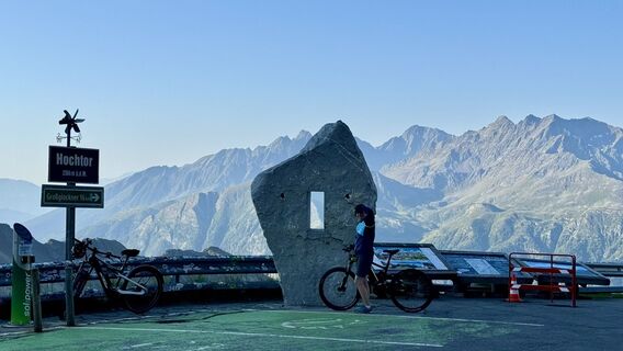 © thschoeVytvořeno dne 29.08.2024
 © Patrick FresenbergerVytvořeno dne 18.06.2024
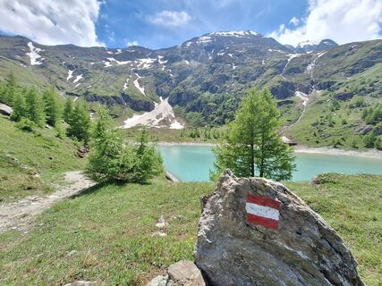 © Patrick FresenbergerVytvořeno dne 18.06.2024
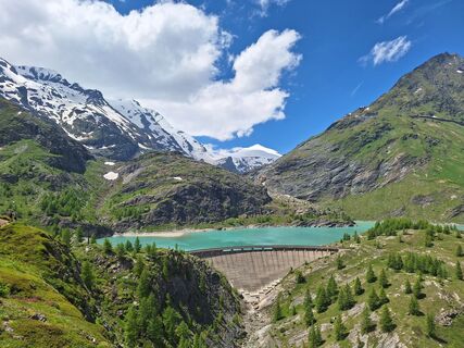 © Patrick FresenbergerVytvořeno dne 18.06.2024
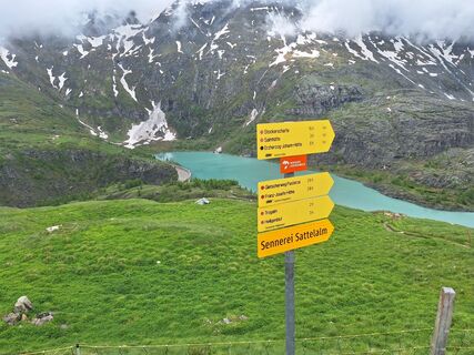 © Patrick FresenbergerVytvořeno dne 16.06.2024
 © Alois LechnerVytvořeno dne 17.10.2022
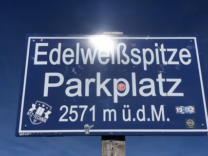 © Alois LechnerVytvořeno dne 17.10.2022
 © Lars LeonhardtVytvořeno dne 10.03.2026
 © Lars LeonhardtVytvořeno dne 10.03.2026
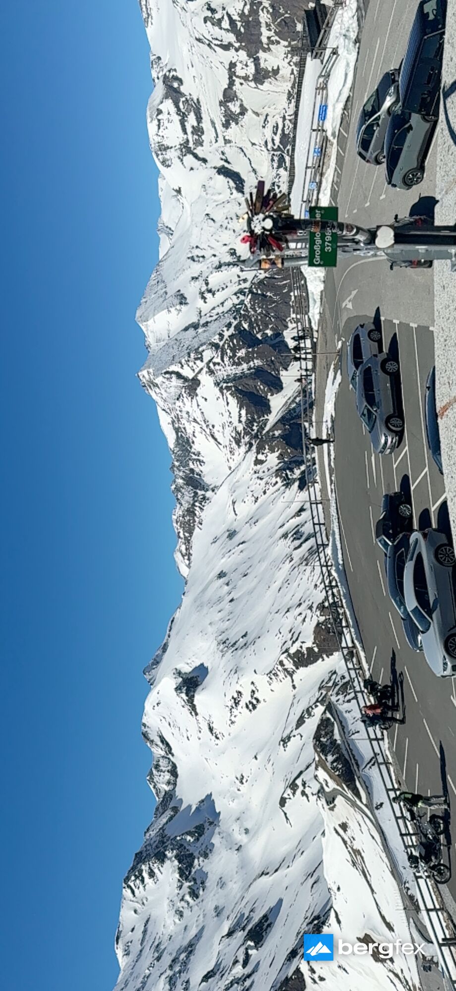

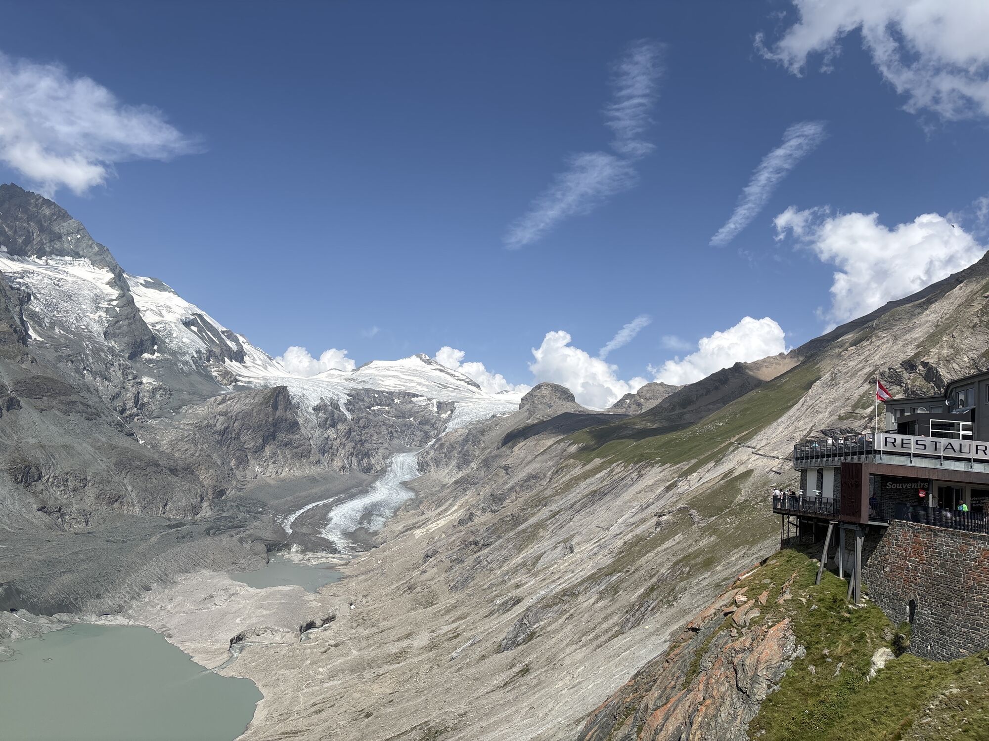
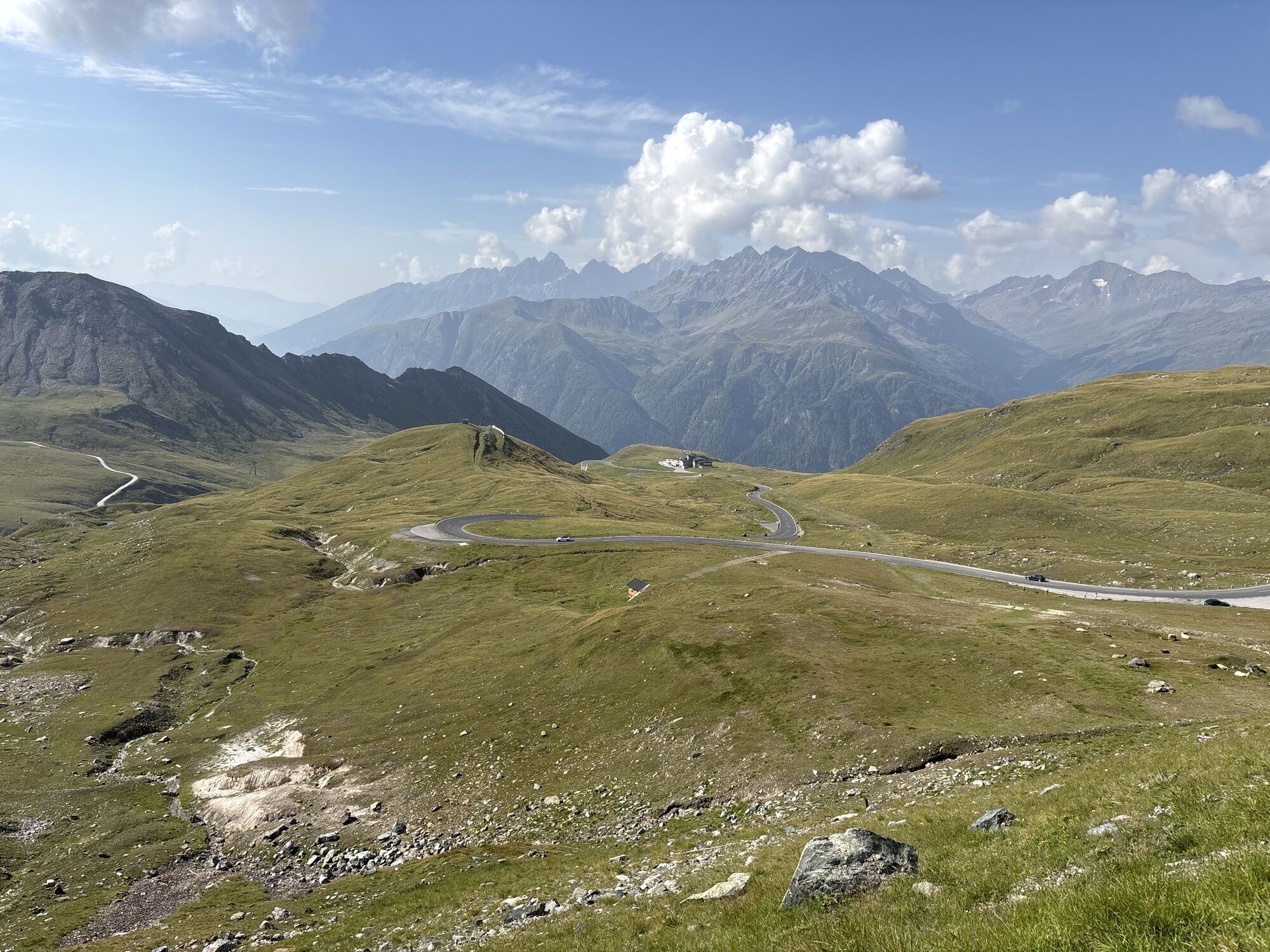

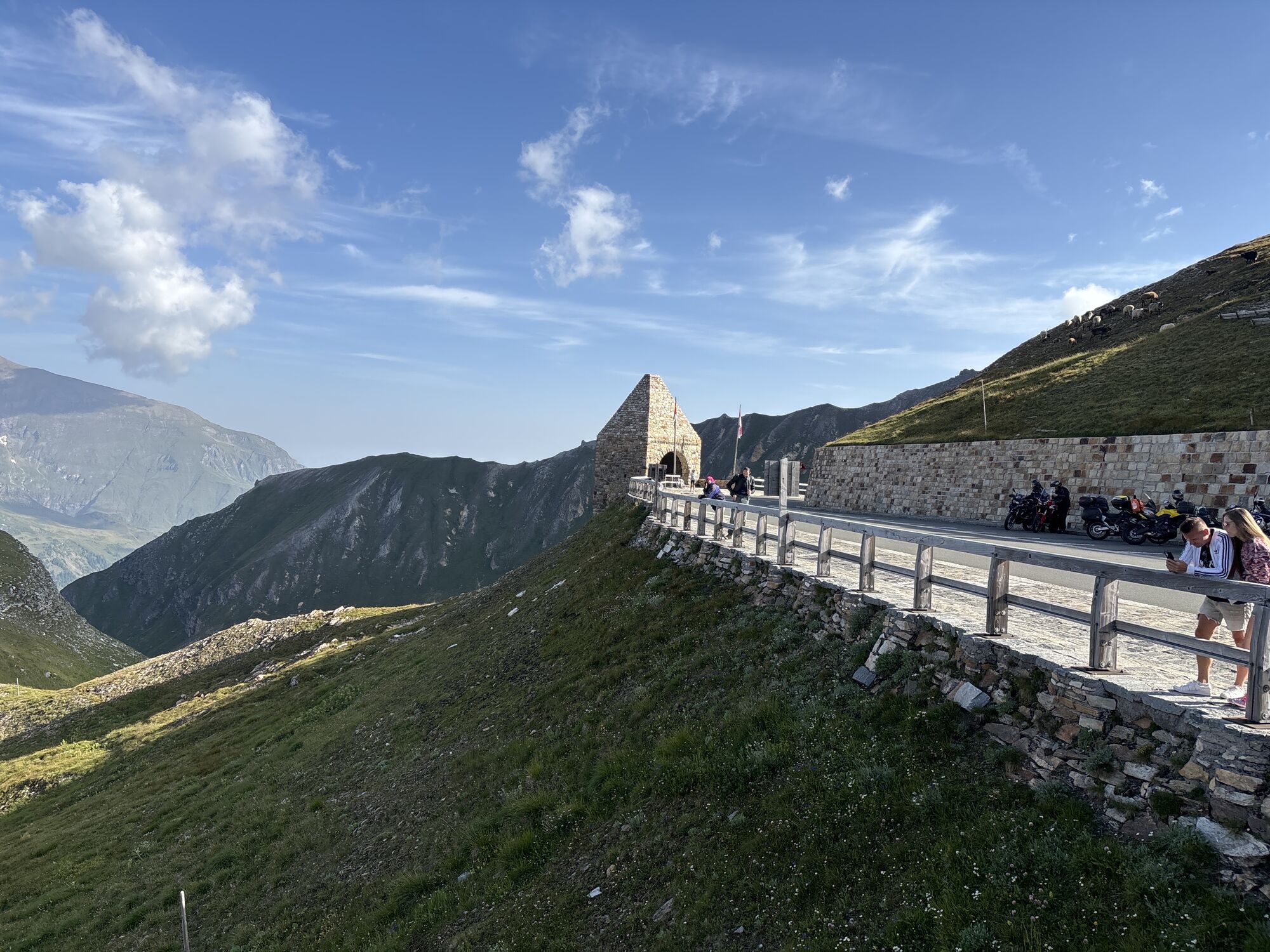

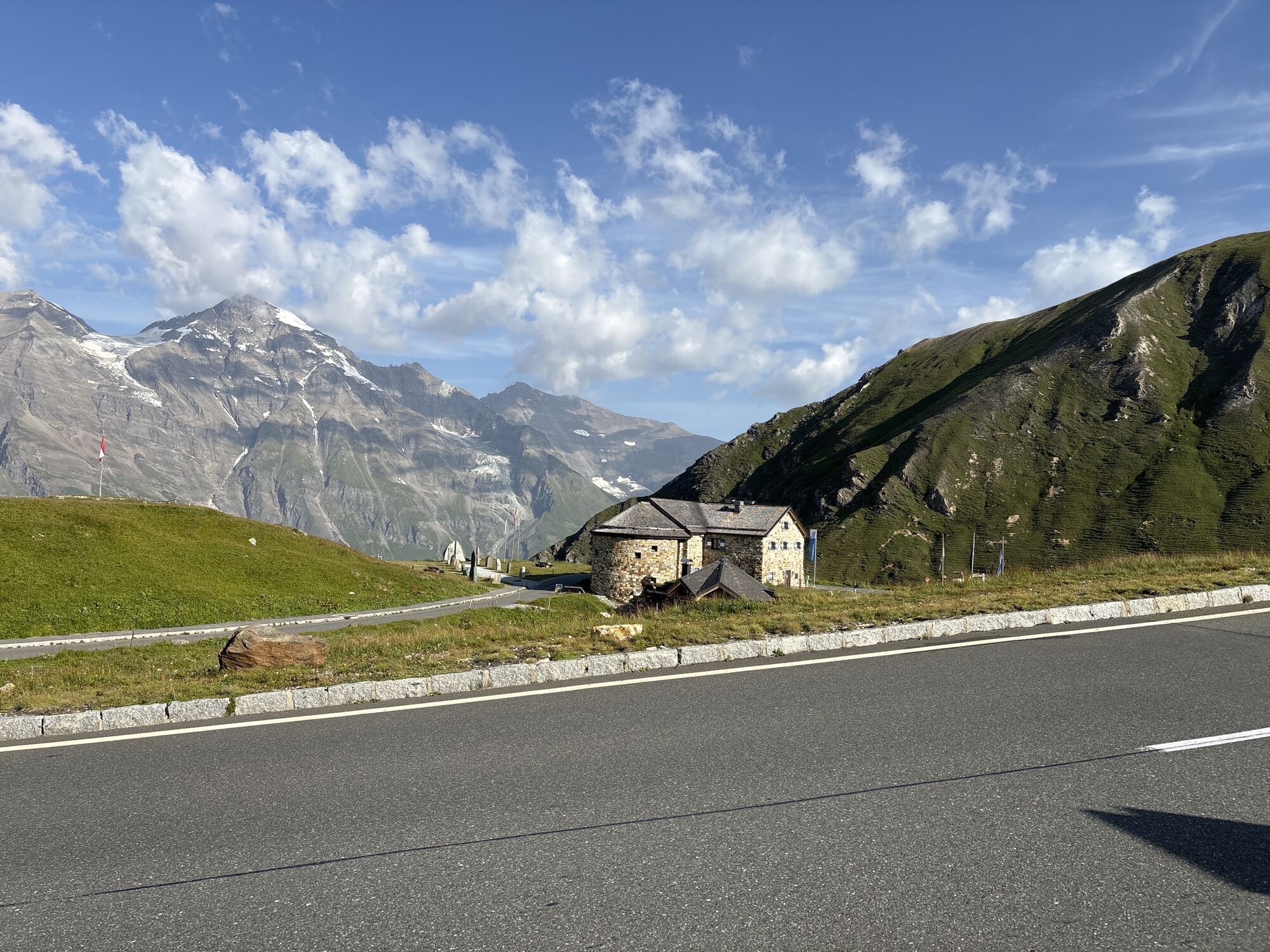
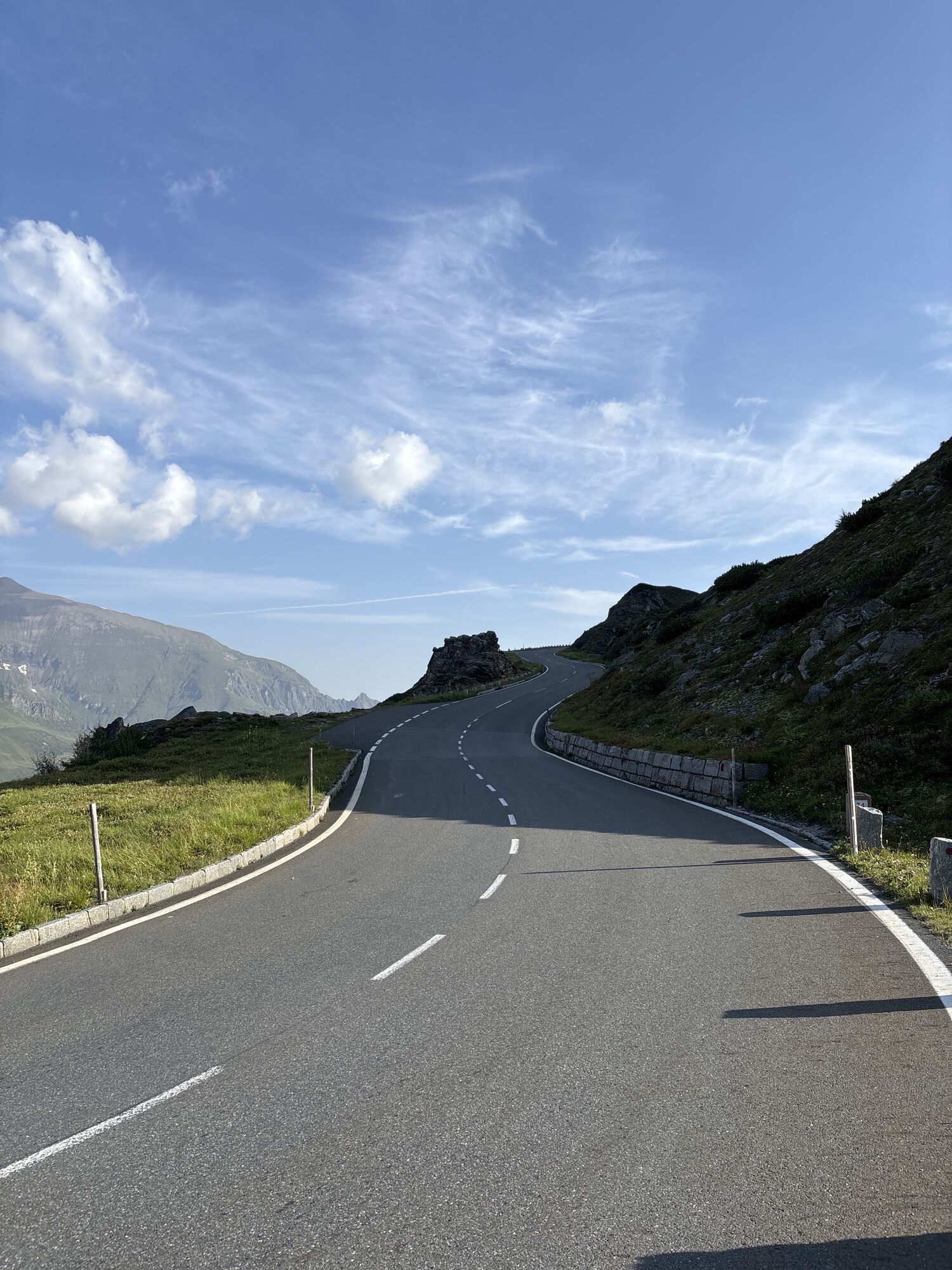
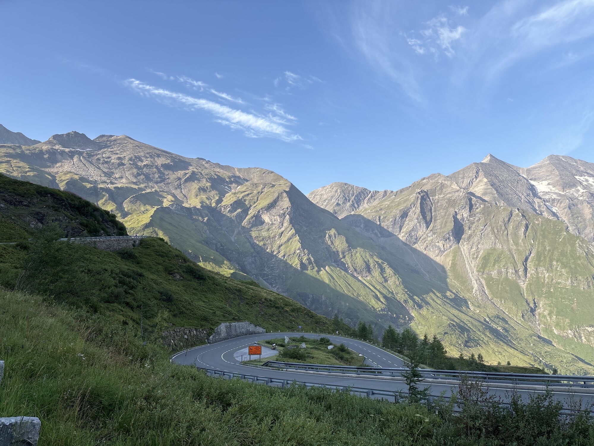
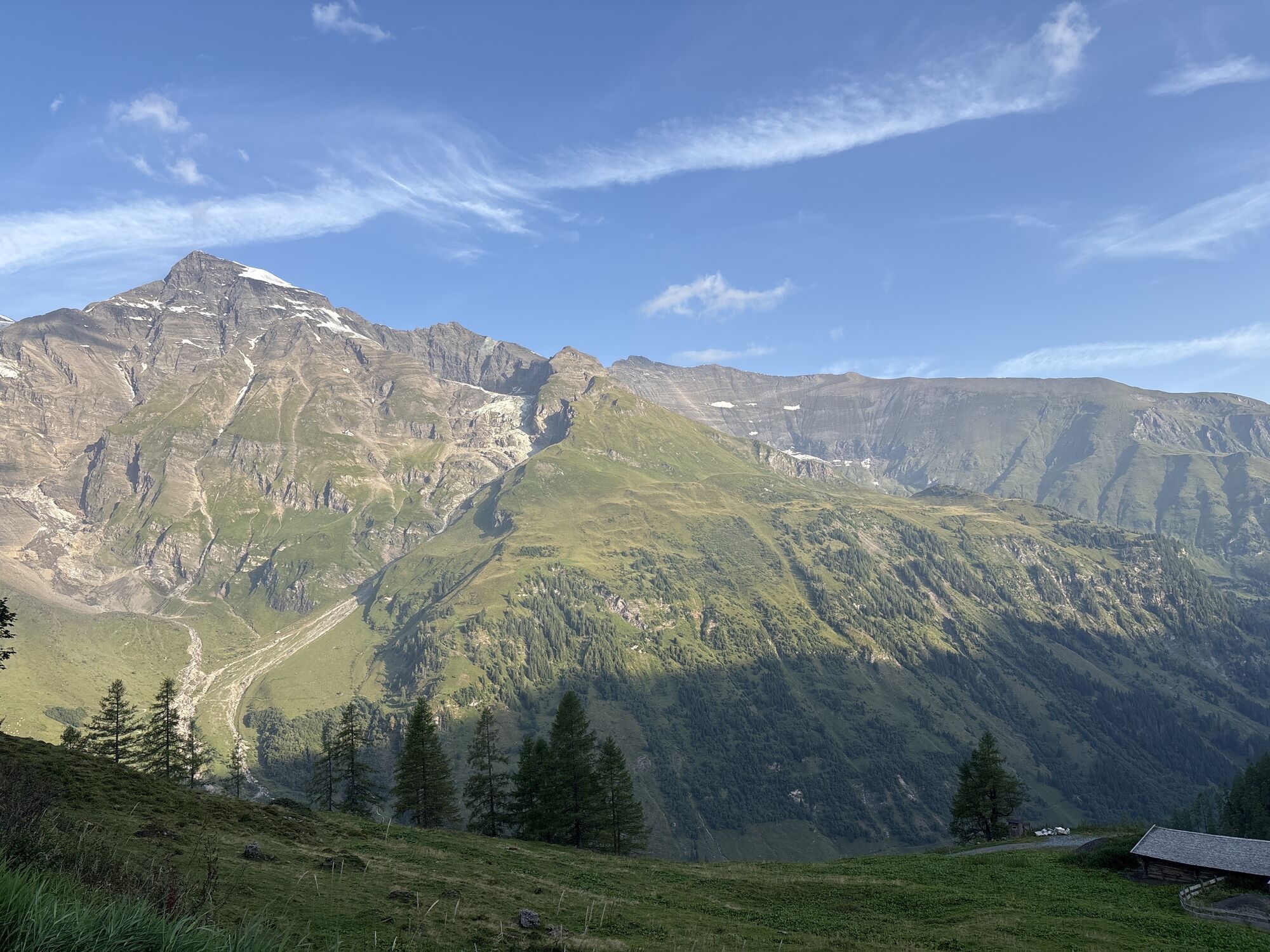


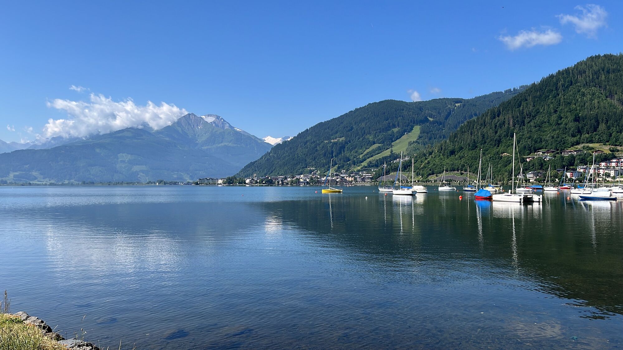


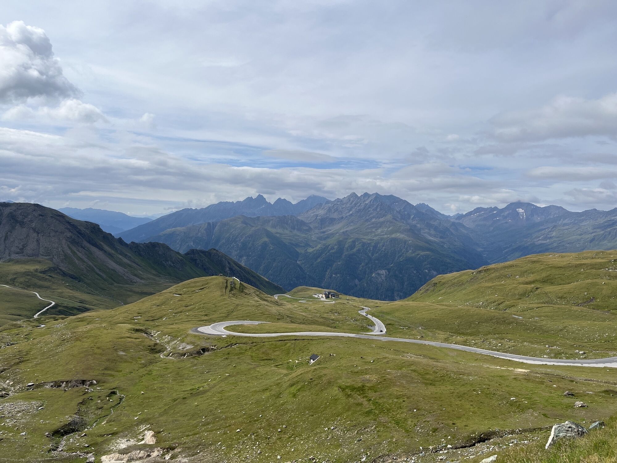
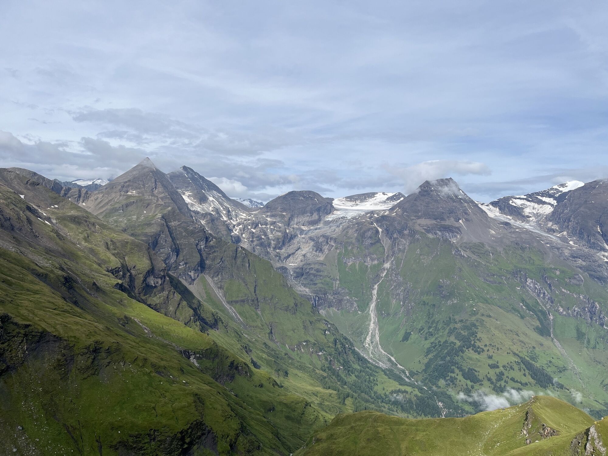


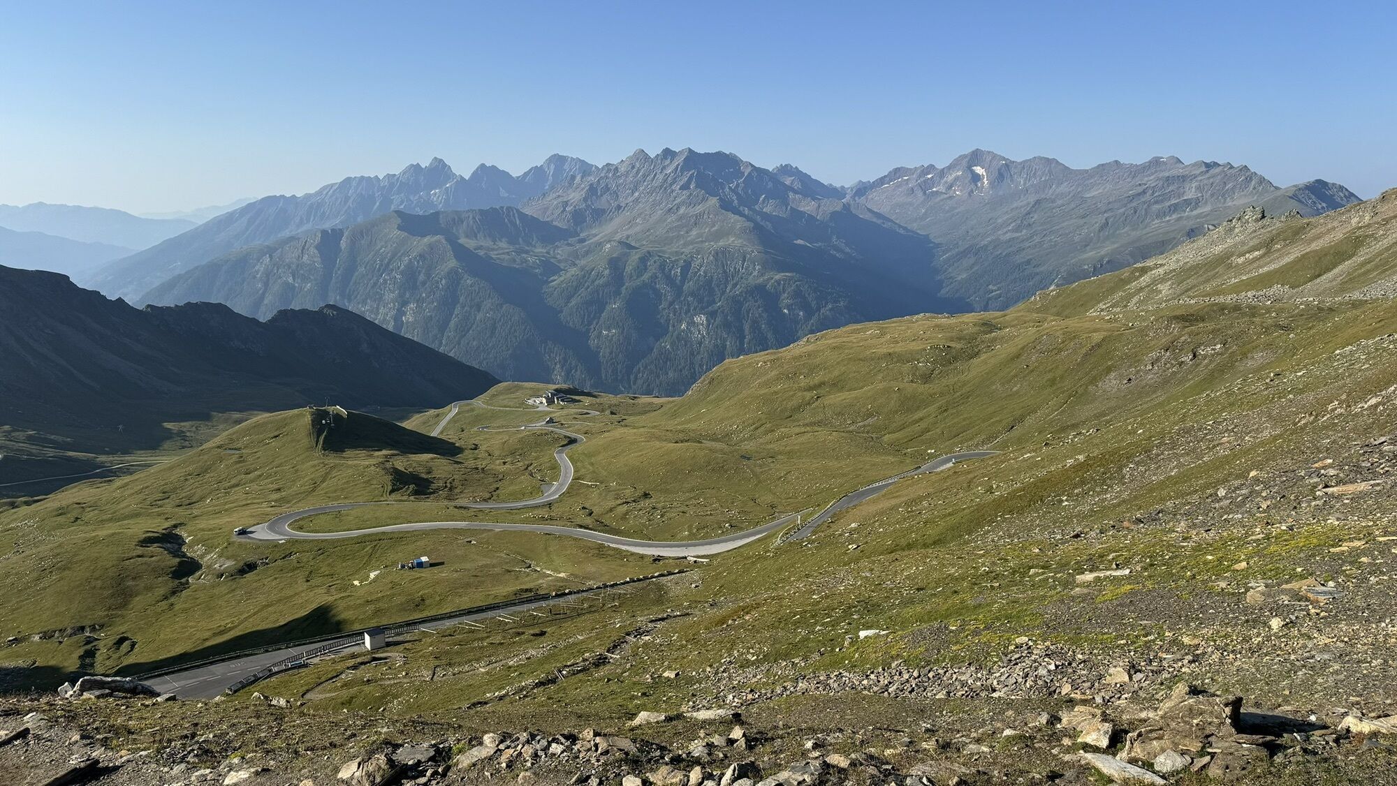
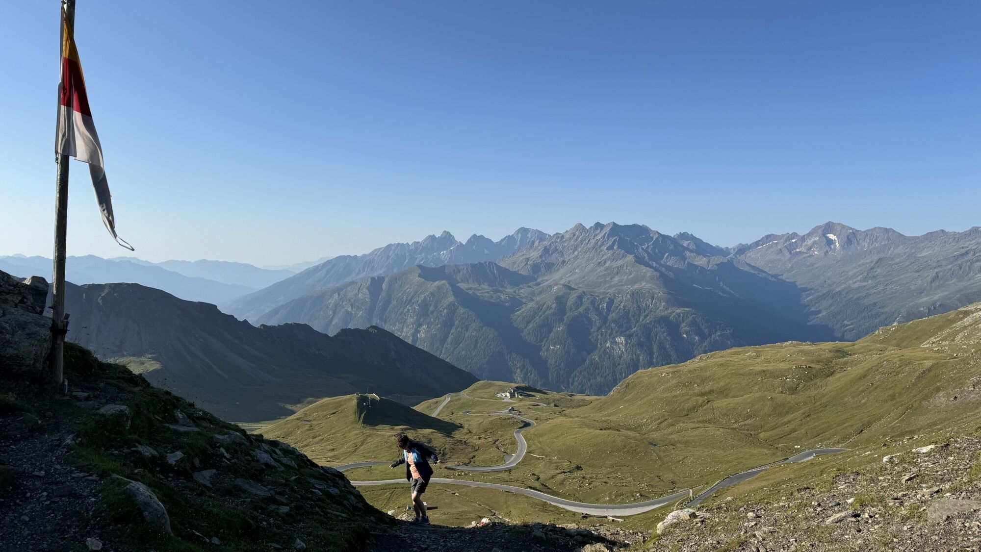
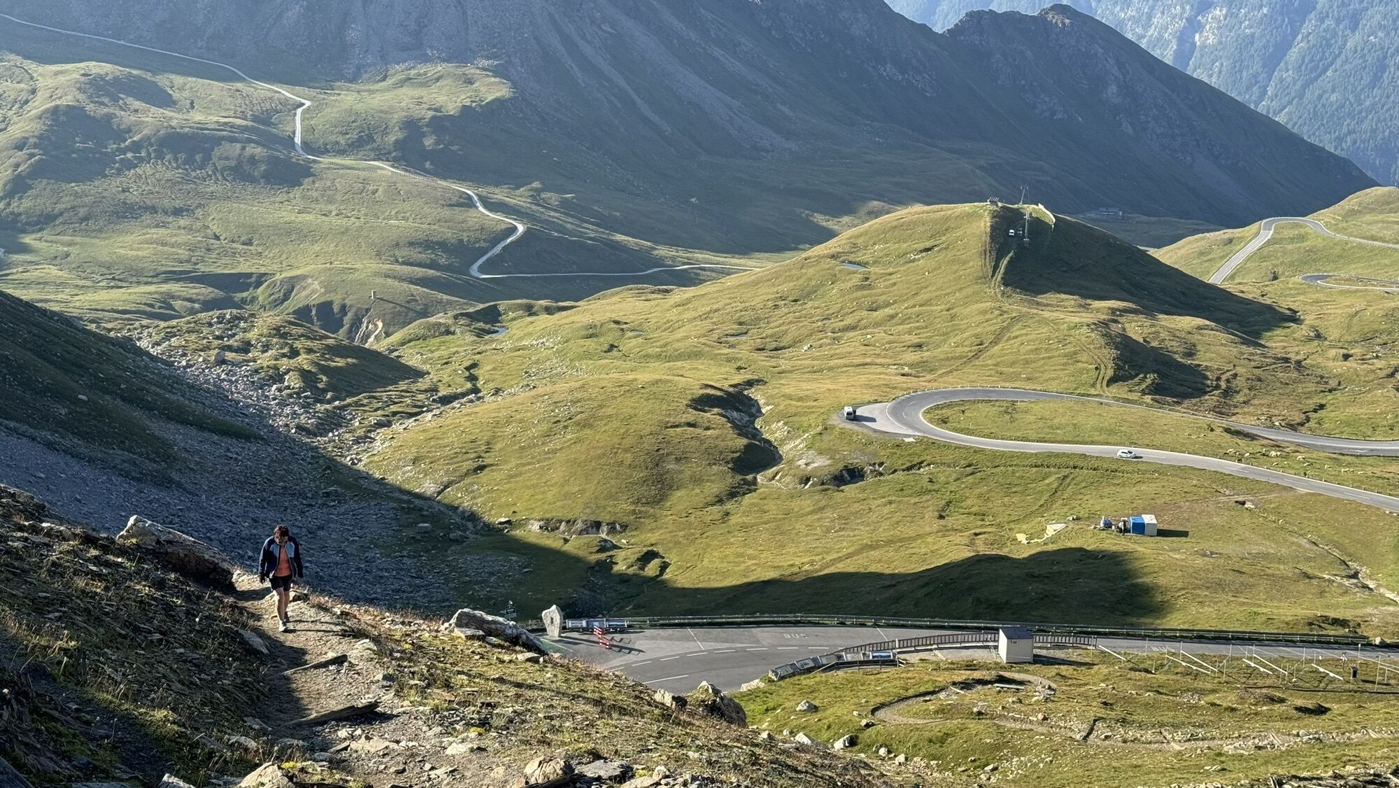


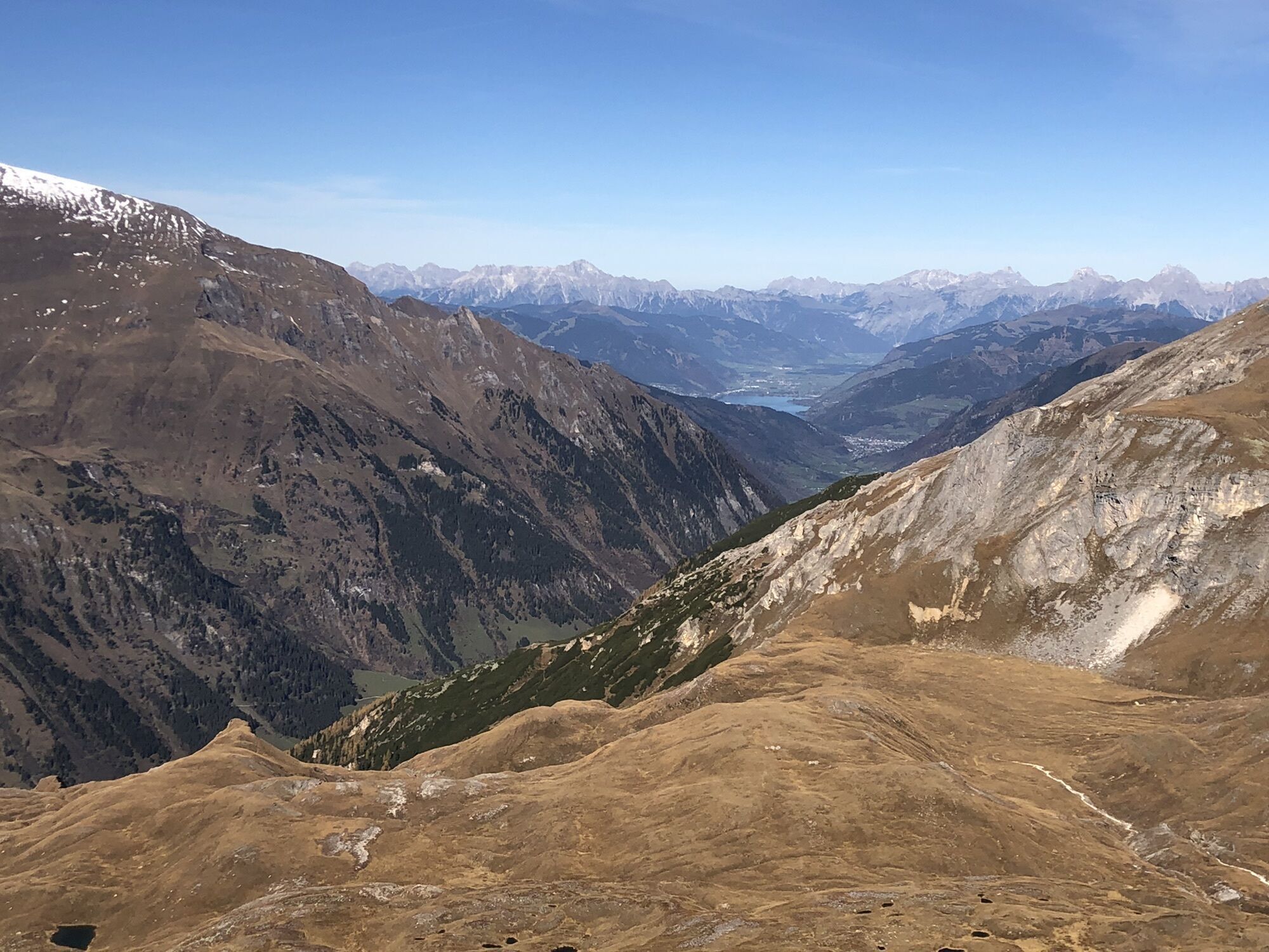
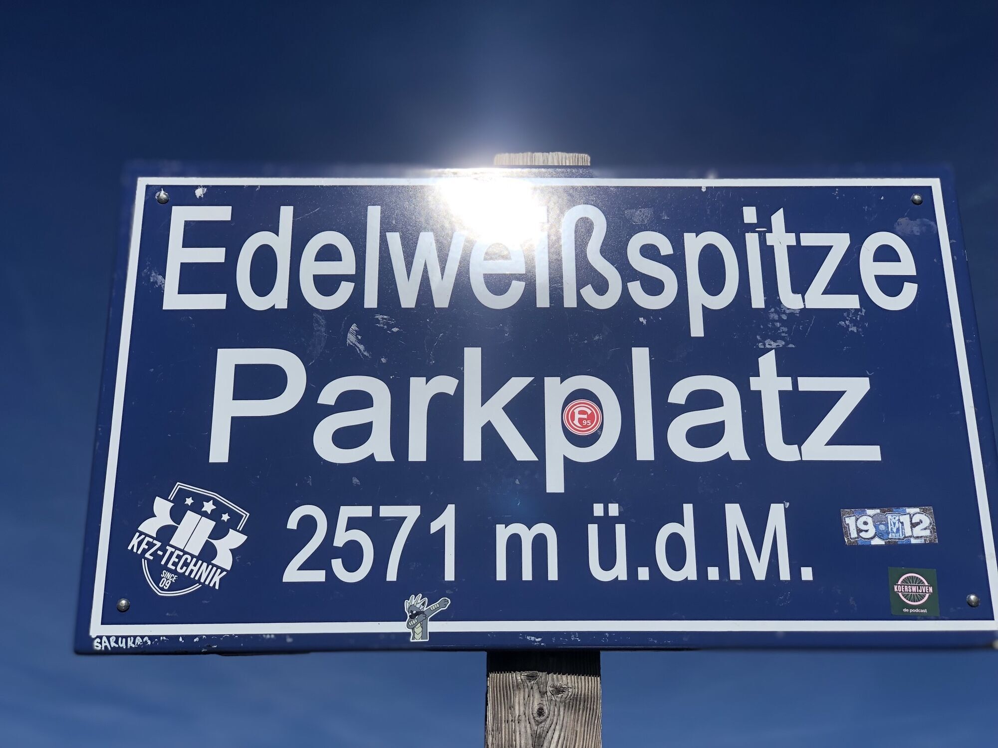


From Saalfelden, this route leads to Maishofen and on to Thumersbach along the banks of the lake zell and on to Bruck Fusch. The main ascent up to the highest mountain in Austria begins after 44 km. The impressive Alpine road leads past Ferleiten and winds its way up 1.283 m of altitude and with a route length of 12.9 km to the Fuscher Törl at 2.428 m. Those with some energy left may wish to take a detour from the Fuscher Törl to the Edelweissspitze peak at 2.571 m (an additioanal 143 m of altitude). Very experienced cyclists can also tackle the second stage. First - a winding downhill section and then the next ascent begins via Schöneck to the Kaiser-Franz-Josefs-Höhe at 2.369 m.
Ano
Ano
Attention:
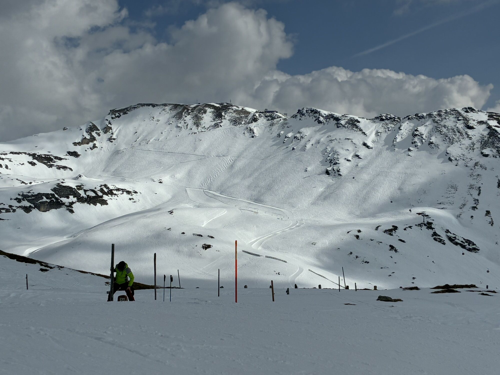
The weather can change very quickly in alpine areas. Snow in Summer is not uncommon.
5
Webové kamery z prohlídky
Schmittenhöhe
Heiligenblut Ort
Fallbichl
Sonnkogel
Rossbach Mittelstation
Schmittenhöhe
Mitterberg bei Thumersbach
Sommerrodelbahn
Großglockner Hochalpenstraße - Edelweißspitze
Fuschertörl /Großglockner Hochalpenstraße
Zell am See / Hotel Berner
Mesenatenhütte, Wallackhaus
Schmittenhöhe
Schmittenhöhe
Freiwandeck
Mesenatenhütte, Wallackhaus
Zell am See
Saalfelden
Leogang Schanteilift
Thumersbach
Schareck
Sommerrodelbahn
Sommerrodelbahn
Sommerrodelbahn
Sommerrodelbahn
Sommerrodelbahn
Fallbichl
Fallbichl
Fallbichl
Maishofen Sausteige
Maishofen - Schloss Kammer
Peter Wiechenthaler Hütte
Rossbach Mittelstation
Rossbach Mittelstation
Rossbach Mittelstation
Heiligenblut Ort
Heiligenblut Ort
Heiligenblut Ort
Heiligenblut Ort
Adlersruhe
Oblíbené prohlídky v okolí
- 4,7
Geotrail Tauernfenster
světloTuristika 5,90 km - 4,5
Sigmund Thun Klamm
světloTuristika 3,10 km - 4,9
Hochsonnberg Runde
středníMountainbike 59,8 km - 3,9
Glacier Route to the Pasterze with Gamsgrubenweg (up to Tunnel 6)
středníTuristika 8,05 km - 4,4
Thumersbach, Runde um den Zeller See
světloTuristika 13,3 km - 4,9
Kaiser-Franz-Josefs-Höhe to Oberwalderhütte
heavyTuristika 5,52 km - 4,9
Großes Wiesbachhorn 3564 mnv Kaprun, Austrija
heavyTuristika 13,4 km - 4,8
Sigmund Thun Klamm, Klammsee, Bürgkogel
světloTuristika 4,56 km - 3,9
Großglockner Hochalpenstrasse
heavyJízda na kole 20,2 km - 4,6
3 Oktober Fusch Walcher Grung und Hohalm
středníTuristika 8,57 km

Pěší turistika a stopování


Nenechte si ujít nabídky a inspiraci pro vaši příští dovolenou
Vaše e-mailová adresa byl přidán do poštovního seznamu.