


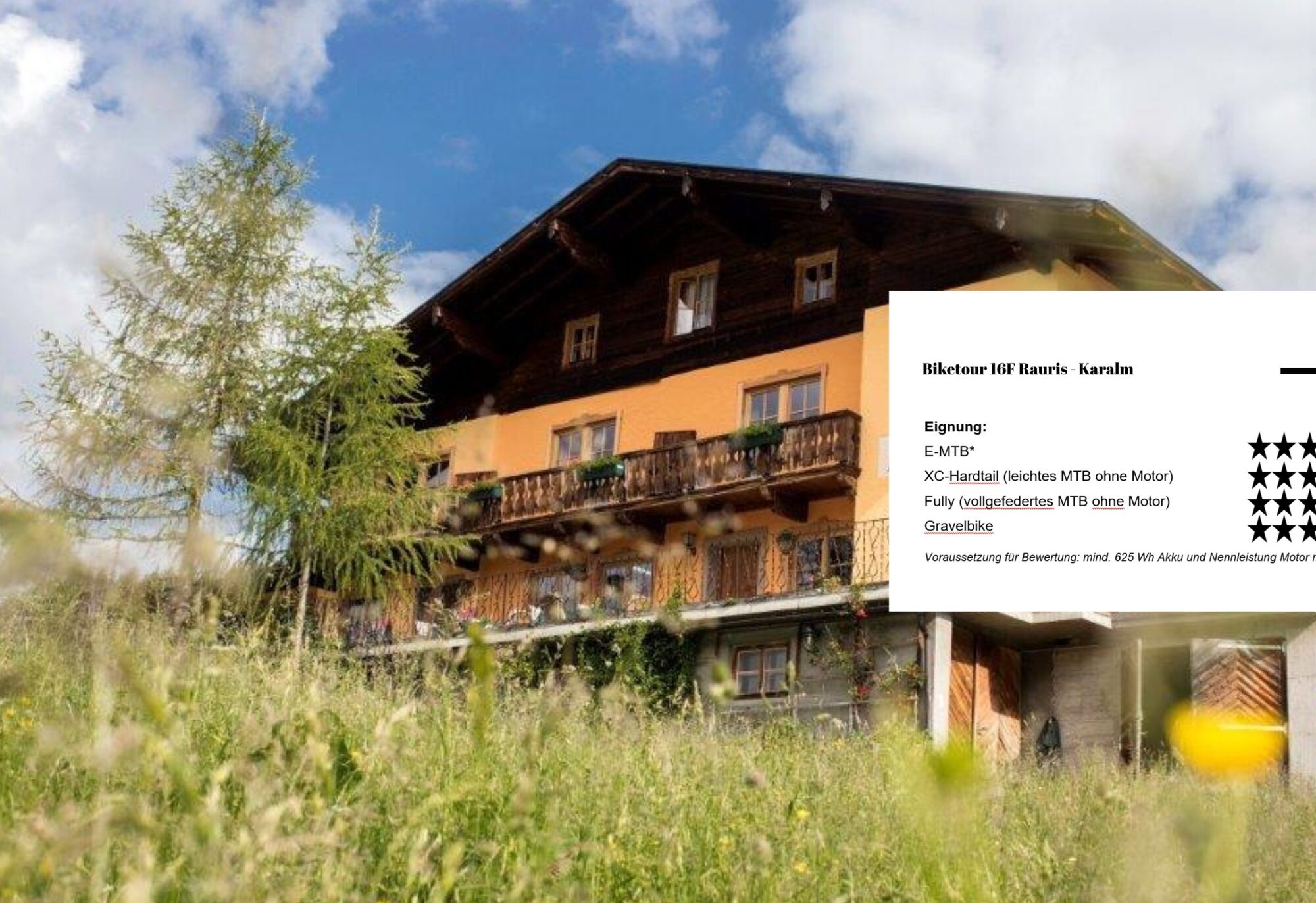
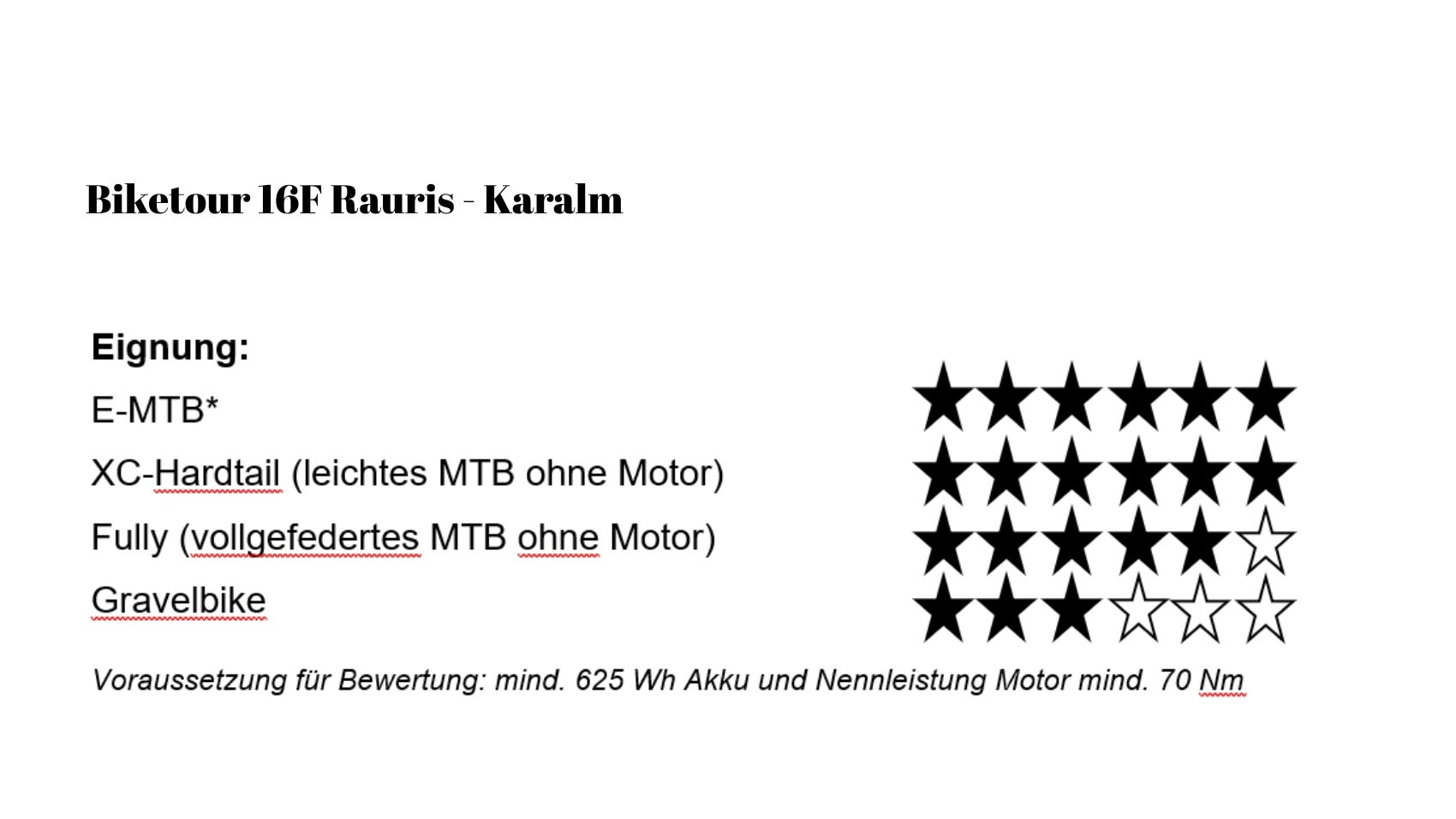
NP 16f | Bike tour Karalm in the Raurisertal
A bike tour into the beautiful Gaisbachtal to the managed Karalm is a real natural experience for connoisseurs. Already at the valley entrance, you can feel how everyday life slowly recedes into the background....
Lush meadows, dense forests, and the soft murmur of the stream accompany the path on both sides.
The gentle ascent makes the tour pleasantly sporty without overwhelming. You have enough time to enjoy the landscape, stop again and again, and let your gaze wander over the surrounding mountains. With every meter, it becomes quieter, more original, and more impressive.
At the top awaits the Karalm – a cozy place to catch your breath and stop for refreshments. On the sun terrace, a hearty snack or a cool drink tastes especially good after the ride up. While you let your gaze wander back into the valley, you know: The journey was the goal – and the descent will be just as delightful.

After a short ride on the asphalt road, you reach the forest road in Gaisbachtal after about 15 minutes. At the beginning still a bit steeper, it becomes slightly less demanding over time, but always gently ascending to the Karalm.
From the town center, you start cycling towards Gaisbachtal and follow the paved road into the valley. After about 15 minutes, the forest road (gravel) begins. Right at the start awaits a steeper climb section, which challenges you noticeably in the first few minutes and quickly gains altitude.
After a few altitude meters, the route continues uphill but the incline becomes much more moderate and steady – ideal for finding a good pedal stroke and keeping the rhythm.
You ride into the original Gaisbachtal, accompanied by forest sections, the flow of the brook, and repeatedly beautiful views of the surrounding mountains.
The path continues diversely through the natural landscape until you finally reach the Karalm – a worthwhile destination for a pleasurable break before returning to the valley.
Ano
Ano
Note: A small parking lot on the left side, starting from the forest road in Gaisbachtal, is available.
At the beginning of the forest road, there is a small parking lot on the left side of the road.
From the center of Rauris – towards Gaisbachtal the road is paved | From the Gaisbachtal parking lot onwards, the forest road begins (gravel road).
Refreshment options:
Gasthof Neuwirt (Rauris)
Gasthof Platzwirt (Rauris)
Restaurant "das Albert" (Rauris)
Restaurant Sonnblick (Rauris)
Stadl Cafe (Rauris)
Wischtl-Hittn (Rauris)
Hoamatladen Imbis (Rauris)
Burgis Cafe (Rauris)
Karalm (Gaisbachtal)
Further tip:
This bike route is also simultaneously the flower trail with flower information boards along the route to the Karalm.

Oblíbené prohlídky v okolí
- 4,9
Großarl: Aualm - Liechtensteinkopf - Aukopf - Schuhflicker - Schuhflickersee
středníTuristika 5,84 km - 4,7
Großarl: Mooslehenalm – Niggeltalalm – Viehhausalm
středníTuristika 5,44 km - 4,8
Höhenweg vom Grünen Baum bis Bad Hofgastein
světloTuristika 7,92 km - 4,8
Highlight Kitzlochklamm Classic round
středníTuristika 2,02 km - 4,6
Bahnhof Bad Hofgastein nach Bahnhof Bad Gastein
středníTuristika 13,0 km - 4,7
Bad Hofgastein Bergbahn Parkplatz - Rastötzenalm Bad Hofgastein
středníMountainbike 16,9 km - 4,3
Wasserfall Bad Hofgastein
světloTuristika 3,89 km - 4,7
Goldeggweng Hochleitenalm
světloTuristika 2,92 km - 5,0
Großarl: Heukareck
středníTuristika 12,5 km - 5,0
Türchlwand von der Bergstation Schlossalmbahn Bad Hofgastein, Österreich
středníHorská turistika 7,05 km
Pěší turistika a stopování


Nenechte si ujít nabídky a inspiraci pro vaši příští dovolenou
Vaše e-mailová adresa byl přidán do poštovního seznamu.