


OENORANDO® FROM VINEYARD TO VIRGIN ROCK
Situated in the foothills of the Larzac, Saint-Saturnin-de-Lucian offers a remarkable landscape. Starting from the cooperative cellar, you can wander through vineyards and garrigues before climbing the...
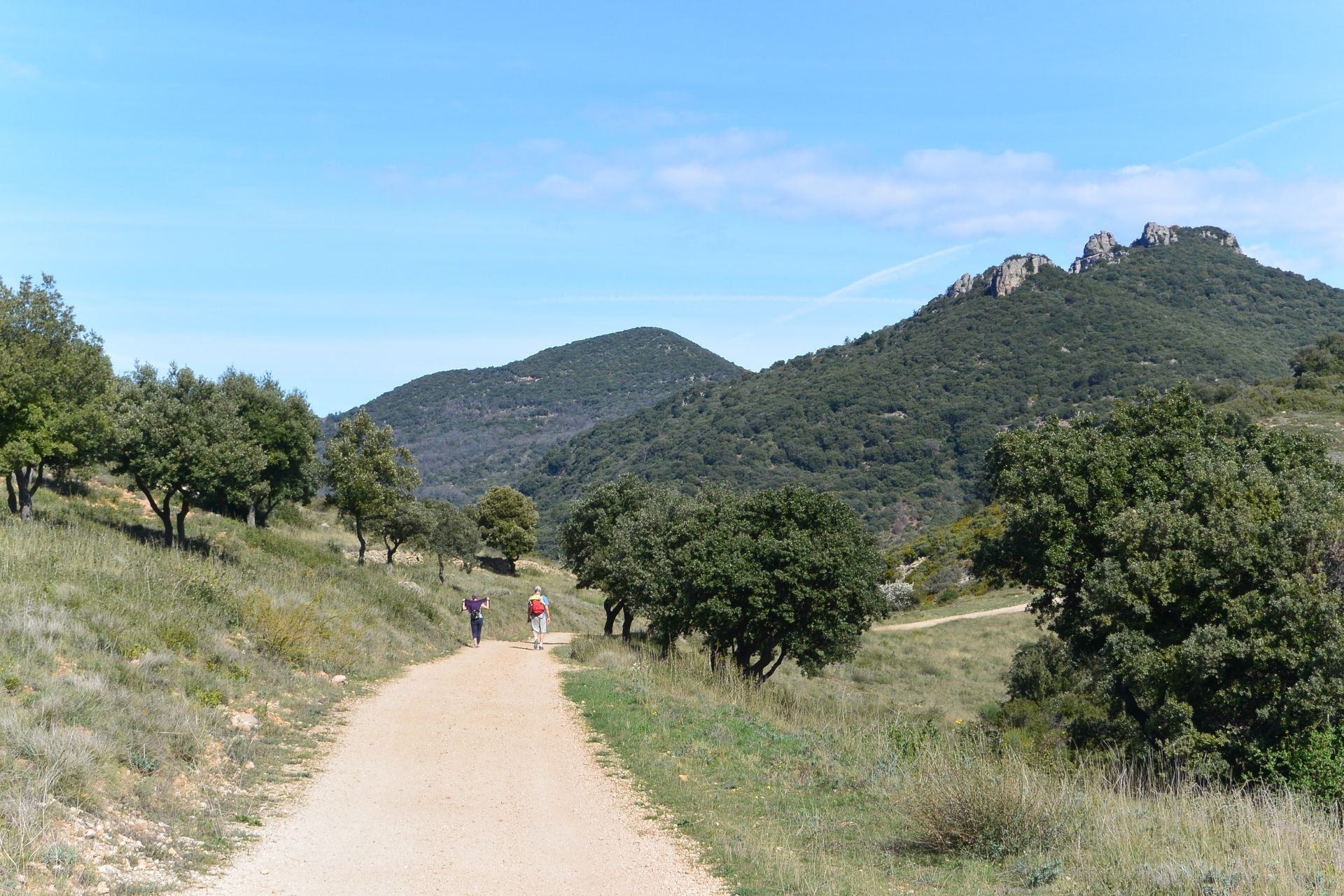
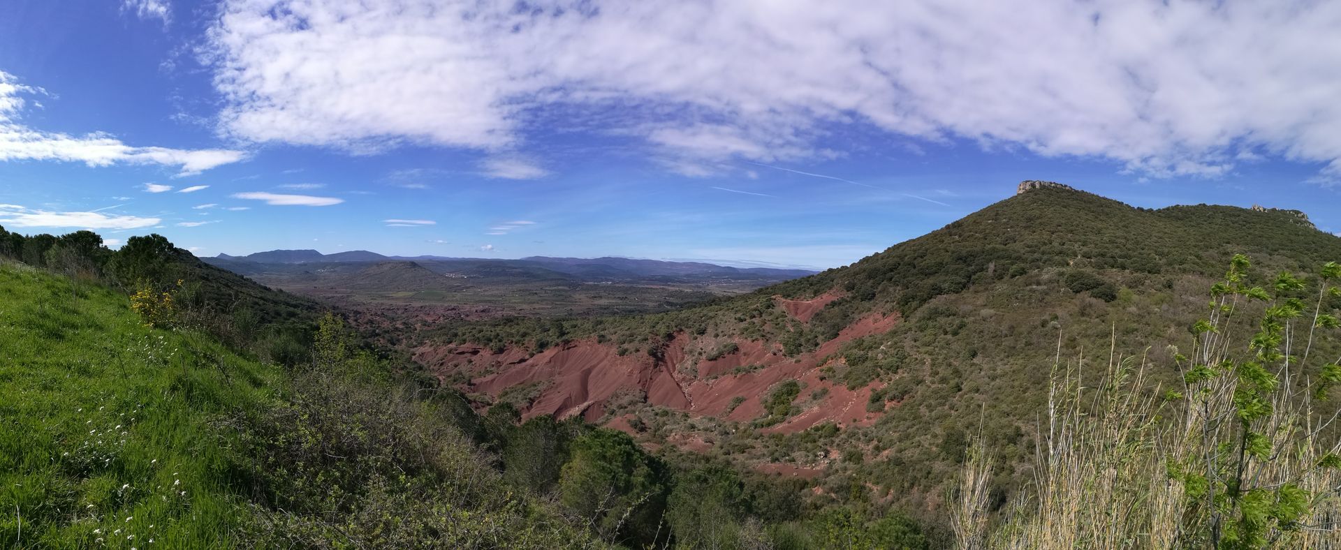
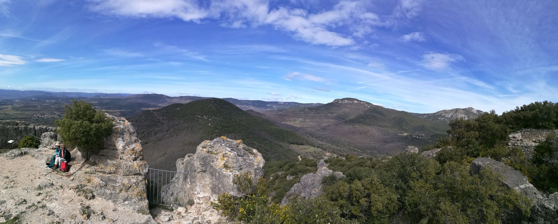
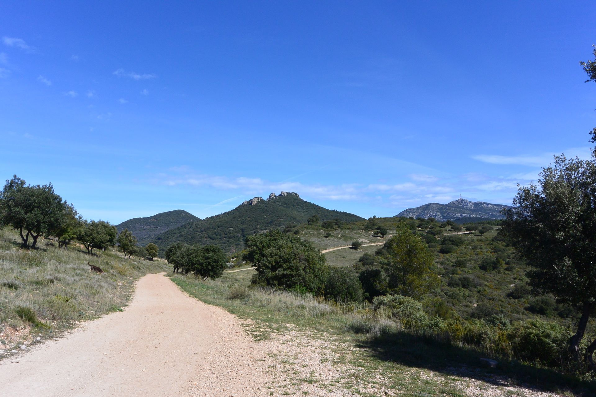
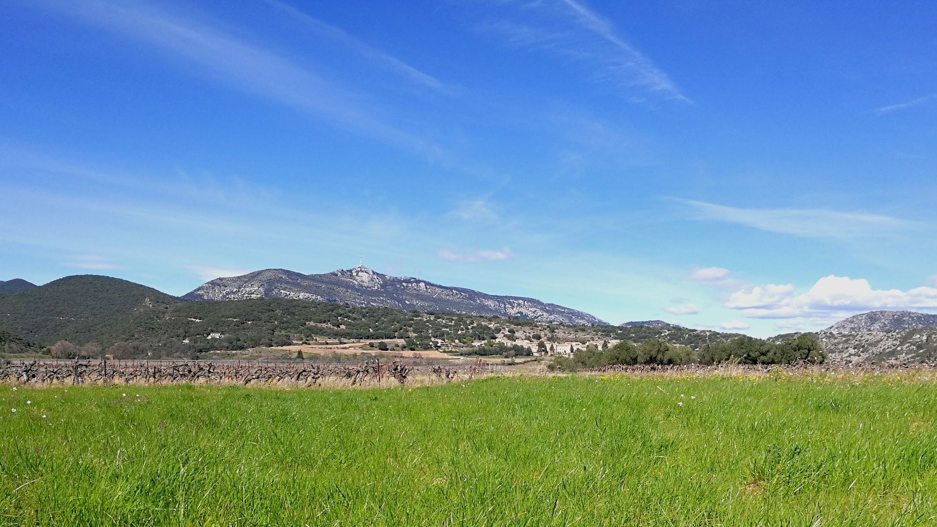
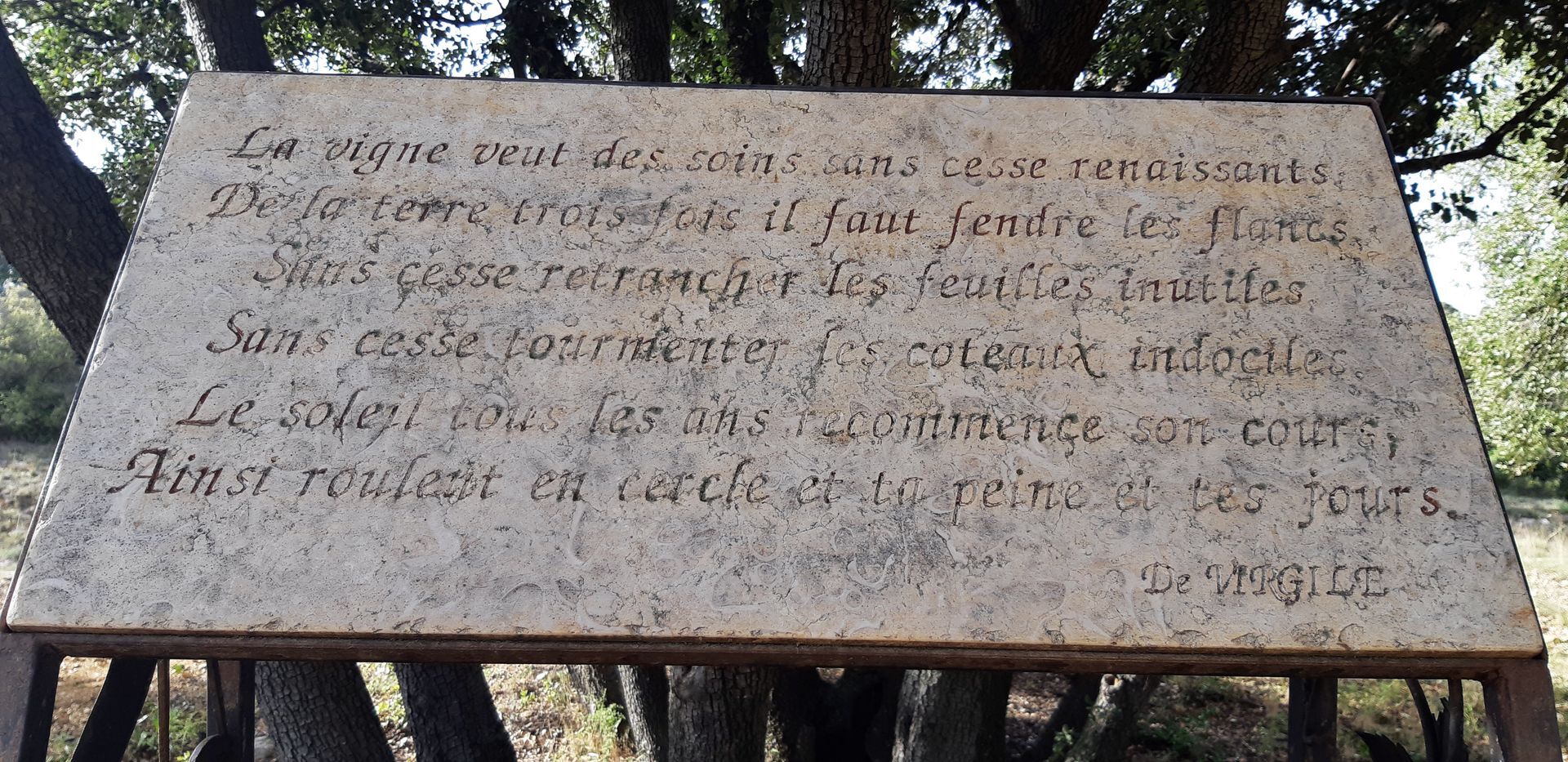
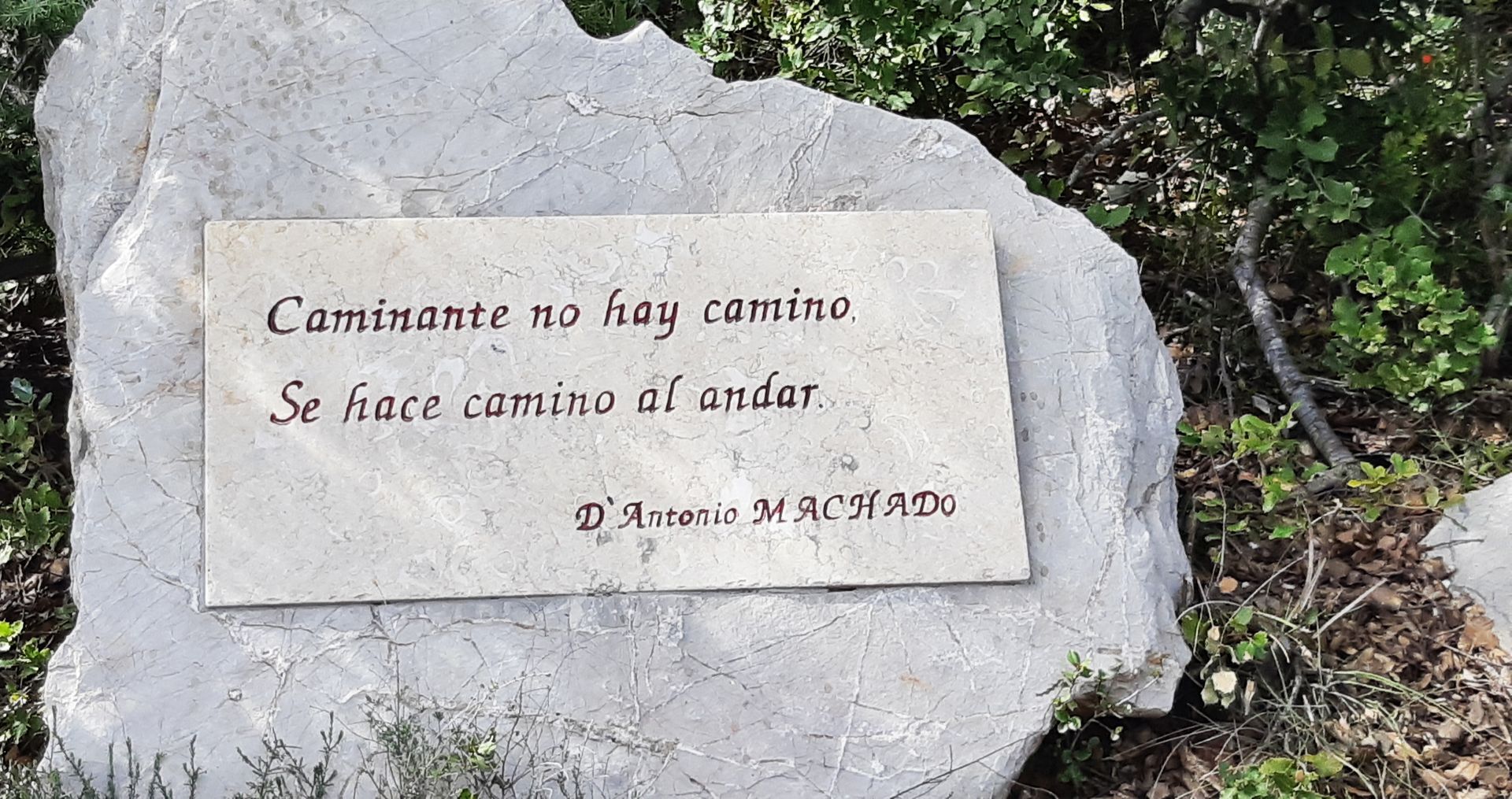
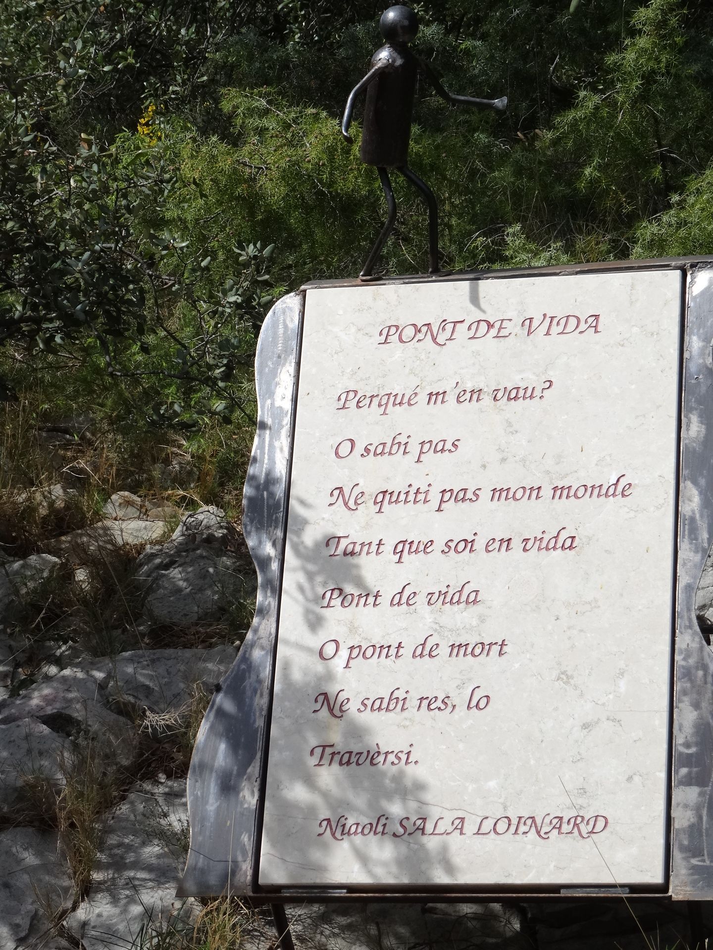
Situated in the foothills of the Larzac, Saint-Saturnin-de-Lucian offers a remarkable landscape. Starting from the cooperative cellar, you can wander through vineyards and garrigues before climbing the Roque des Deux Vierges, the highest point of the massif. The village's history is closely linked to poetry and viticulture, two activities that have made the area famous.

1
From the parking lot, turn right into the street alongside the Cave Coopérative. Turn left, then right. Drive through the village under the archway of plane trees. After the town hall and church, turn right into rue de la Source and left into rue du Réservoir. Pass the water tower and take the right-hand road up to the crossroads.
2
Very short alternative (45 min; 2 km) left along the Vin des Poètes path (red markings). 2: Go down the path opposite, cross the bottom of the combe, then climb the path on the right.
3
Take the Saint-Guiraud trail on the right. It runs along the ridge for 1.5 km. At the cemented crossroads, take the road to the left for 200 m to the junction at the end of the vineyard.
4
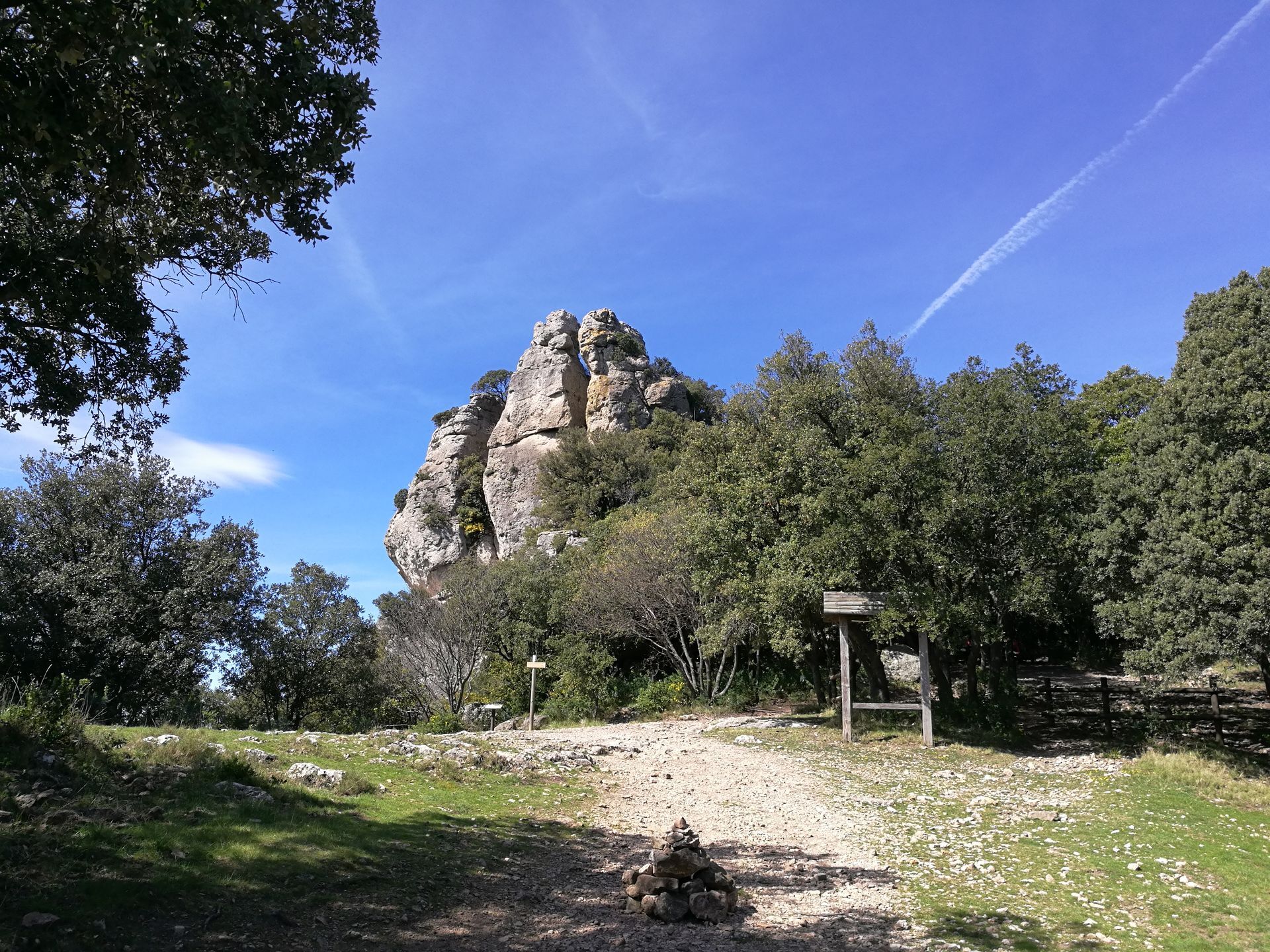
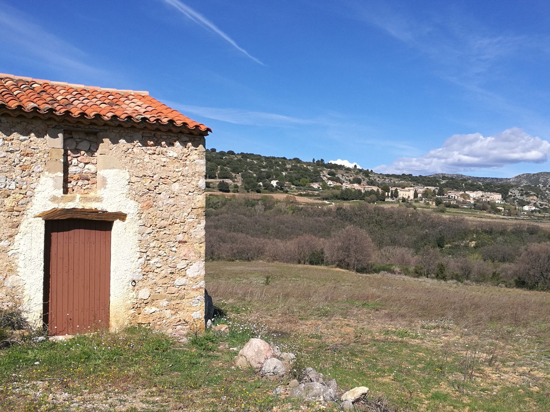
Short option (2 h; 6.5 km): continue along the road for 50 m, pass between the mazets and turn right along the vineyard path. Cross the track and continue along the edge of the pine forest. Further on, continue through the kermes oaks on a narrower, well-marked path. Climb the track, reach the road and take the path on the left. Descend the stony, winding path and return to the crossroads (yellow markings). 4: Go left and, shortly afterwards, go right up the path through the oaks. Pass a ruin and, on the right, reach the access parking lot (375 m) to the Roc des Deux-Vierges.
5
Take the interpretation trail on the left. It climbs to the summit of the Roc des Deux-Vierges. To return: Cross the parking lot and follow the road down (GR® 653). In the right-hand bend, head down the straight, stony track. At the bottom, take the left-hand track for 2.5 km.
6
Return down the same path.
7
Turn left on the D 130 for 150 m, right on the D 131 E2 and right on the small road. At the calvary, turn right to reach the start parking lot.
Saint-Saturnin-de-Lucian
Saint-Saturnin-de-Lucian
Jaune PR
+33 4 67 57 58 83
Saint-Guilhem - Vallée de l'Hérault Intercommunal Tourist Office
Oenorando®
Oblíbené prohlídky v okolí
- 5,0
CIRQUE DE MOUREZE HIKE
středníTuristika 6,86 km - 5,0
LES VAILHÉS HIKING TRAIL
středníTuristika 9,28 km - 5,0
MONT LIAUSSON HIKE
středníTuristika 7,36 km - 5,0
CIRCUIT N°1 LE LAC DU SALAGOU - ESPACE VTT-FFC DU SALAGOU
středníMountainbike 26,9 km - 4,0
CYCLE LOOP No.4 - THE HÉRAULT GORGES AND THE COL DES LAVAGNES
středníJízda na kole 53,3 km - 4,0
HIKE OF THE GRÉZAC PLATEAU
středníTuristika 14,0 km HIKING OF THE FENESTRETTES
středníTuristika 10,4 kmTRAIL OF THE TOUR OF LAKE SALAGOU (SHORES OF CLERMONT) - GR® OF THE REGION BETWEEN 2 LAKES Avène – Salagou
středníTrailrunning 25,6 kmCOURTINALS TRAIL HIKE
světloTuristika 2,36 kmHIKING OF THE BALCONIES OF THE HERAULT
středníTuristika 17,9 km
Pěší turistika a stopování


Nenechte si ujít nabídky a inspiraci pro vaši příští dovolenou
Vaše e-mailová adresa byl přidán do poštovního seznamu.