







Triangia, Ligari, Alpe and Lake Colina (MTB-EMTB)

The itinerary is quite long, the average slope is not excessive, but some sections of very rough dirt road are very steep and require medium-high motor assistance. It starts from Triangia, a hamlet of...
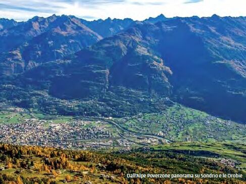
The itinerary is quite long, the average slope is not excessive, but some sections of very rough dirt road are very steep and require medium-high motor assistance. It starts from Triangia, a hamlet of Sondrio at almost eight hundred meters, and reaches an asphalt road with average slopes at the hamlet of Ligari. After three hairpin bends, the road makes a long traverse to the right (east) and becomes predominantly dirt with some cemented sections. You reach Prati Rolla and start climbing again with increasing slopes until becoming very steep (rough surface) after the huts of Forcola. At Alpe Poverzone (1900 m) begins the long high-altitude crossing westward that leads to Alpe and Lake Colina. The more trained who eventually started from Sondrio can make a loop route, descending from Colina on a fairly rocky dirt road down to Postalesio and then reaching the valley floor.

Piateda
Ano

Oblíbené prohlídky v okolí
- 5.0
Palu' Lake, a blue pearl in the center of Valmalenco.
středníTuristika 8.41 km - 5.0
Rifugio Longoni
světloTuristika 4.83 km - 4.5
Porro and Ventina Shelters
světloTuristika 3.12 km - 5.0
Sentiero Roma in Val Masino
heavyTuristika 33.8 km Alta Via della Valmalenco
heavydálková pěší trasa 102.5 km- 5.0
Chiareggio-rifugio grande camerini
středníHorská turistika 13.8 km - 5.0
Lake and Alpe Lagazzuolo
středníTuristika 2.34 km - 4.0
Mufule' Lake Ring
středníTuristika 5.49 km - 5.0
Dazio's Colmen - A Mediterranean oasis in the midst of the Alps
světloTuristika 5.62 km Rifugio Bosio-Galli (from Primolo)
středníTuristika 8.35 km
Pěší turistika a stopování


Nenechte si ujít nabídky a inspiraci pro vaši příští dovolenou
Vaše e-mailová adresa byl přidán do poštovního seznamu.





