





Lakeland by Cycle: Hitonhauta Gravel Route

Úroveň obtížnosti: 2
The Vistula Ice Age ended in the current territory of Finland about 10,500 years ago when the last glacier remnants melted in Northern Finland. The Ice Age, which began 116,000 years ago and lasted over...
Hitonhauta, located on the border of Äänekoski and Laukaa, is one of Finland’s most majestic gorge valleys. It is over half a kilometer long and 20-25 meters deep. Hitonhauta is believed to have formed as a result of meltwater streams at the end of the Vistula Ice Age. The gorge is important not only geologically but also for its biodiversity and was protected already in the mid-1980s. Several endangered plants and habitat types are found in and around the gorge. The name Hitonhauta comes from a folk tale about the Hitto goblin, who scared people in the gorge for fun. You can even find Hitto’s petrified face on the gorge’s rock wall if you look carefully.
As impressive as Hitonhauta is, so is the 5-7 day cycling route that passes through it. The Hitonhauta Gravel Route is a versatile circular route showcasing some of the best gravel roads, services, and natural attractions north, east, and southeast of Jyväskylä. It stands out from other Finnish cycling routes especially due to its geology and the number of swimming beaches along the route. In 349 km of riding, the route passes by even 20 swimming beaches. The value of swimming beaches is significant in today’s rapidly warming world.
The route starts from Jyväskylä city center and winds along small gravel and forest roads along the edges of Päijänne to Leivonmäki National Park and Joutsa. From Joutsa, the elongated route returns northwards towards Toivakka and Lievestuore, following partly forgotten gravel roads deep in the forest shade. The northern part of the route includes Saraakallio rock paintings and Kirkkoniemi Nature Reserve, Kuusankoski and Kapeenkoski rapids, as well as Hitonhauta. The westernmost part of the route is in Uurainen, whose world-class gravel roads entertain hikers back towards Jyväskylä’s bustle.
In addition to interesting nature sites and quality gravel roads, the route is seasoned with several unique farm tourism destinations, each with its own specialties and charm. The service rhythm on the route is excellent for relaxed cycling trips, and the route can overall be ridden without a tent, provided you book accommodation well in advance. You probably get the most out of the route by combining the best camping sites and the more interesting guesthouses. Logistically, the route is easy. You generally do not need to carry food or water for more than half a day — just a few liters at most.
Despite the elevation changes, the route suits almost everyone, as there are hardly any technically challenging sections, and especially with a tent, you can travel according to your own mood and fitness. A relaxed pace on this route is seven travel days, whereas a faster rider can easily cut a few days off, if doubling the elevation on some days is not problematic.
You can easily view the entire route network, including connecting routes, on the Bikeland website: Lakeland by Cycle in Bikeland

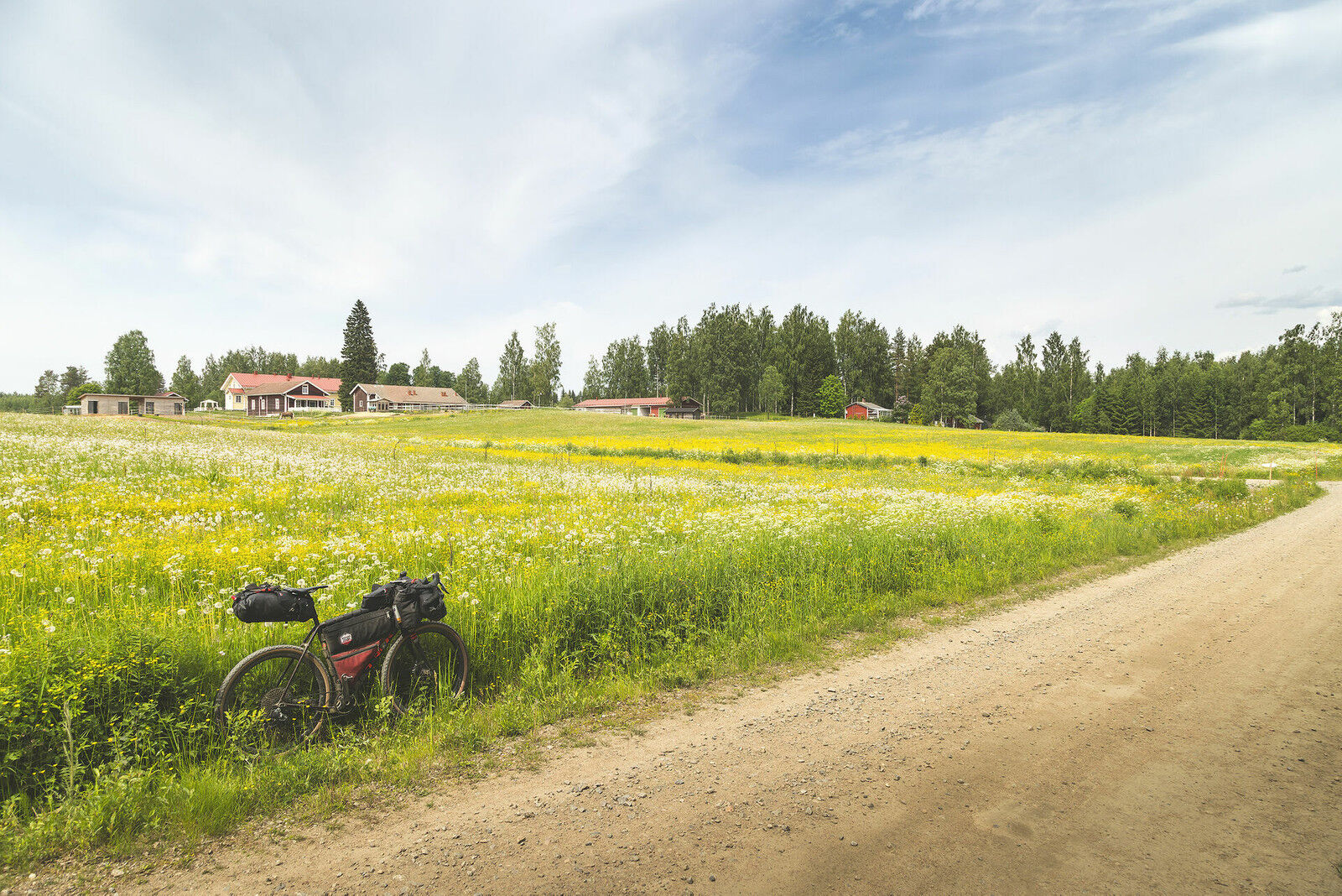
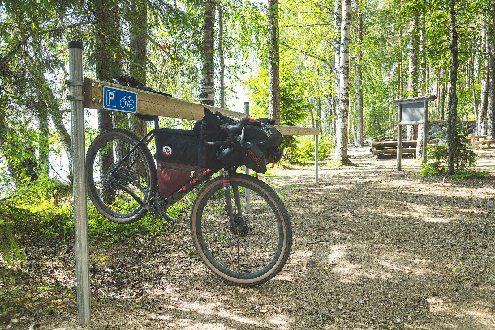
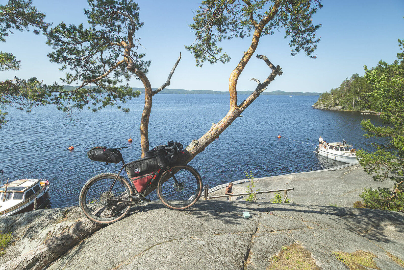

This is a suggested pacing from guesthouse to guesthouse with reasonable daily distances. More fit cyclists can combine at least some riding days, though some route parts have significant elevation gain even with short distances.
Day 1: Jyväskylä - Nukula (36 km and 600 meters ascent)
The first riding day starts from the heart of Jyväskylä at the railway and bus station. The route goes through Lutakko harbor park and over the beautiful Kuokkala bridge via light traffic routes out of the city. The first roughly 15 km section mainly consists of paved roads and light traffic lanes. Check if Elvis Hut is open on Elvis street. Graceland is located at around 14 km and offers coffee and small salty snacks.
From the Elvis atmospheres, continue riding on paved surface briefly before the route shifts onto gravel roads. These gravel roads are in good condition; there can be some traffic, especially during summer holidays. The gravel sections include nice elevation variation and some climbs are very steep! Steep climbs can easily cause visibility obstruction between drivers and cyclists, so be especially attentive on this section.
The gravel road is quite narrow approaching the shore of Päijänne and the old Nukula farm. Nukula offers accommodation and food. The short first day stage ends at Nukula, but tent campers are advised to head about three kilometers further to the Mämminiemi outdoor area.
Day 2: Nukula - Röykkälä Sheep Farm, Leivonmäki National Park (37 km and 630 m ascent)
From Nukula, the second day continues on pleasant gravel roads. A true gem is offered right at the start, the Mämminiemi outdoor area, which is the first night spot for tent campers. The area offers great possibilities for resting and camping, and a rental sauna is also available. On hot summer days, there are plenty of swimming places, and you will likely meet other cheerful outdoor enthusiasts and boaters in the area.
From Mämminiemi, the route continues as an interesting gravel road with pleasant elevation changes. In some places, there is newer rougher gravel, which can feel unstable under the tire, especially on downhill sections. Before Rutalahti village, the route briefly runs on a narrow paved road, but soon after Rutalahti, you enter the Leivonmäki National Park area.
The wonderful gravel roads of Leivonmäki National Park are worth savoring carefully. The beautiful surroundings and excellent forest roads offer real cycling pleasure. There are hiking facilities on the shore of Lake Rutajärvi, which are easily accessible by gravel bike. Both Lintuniemi and Joutsiniemi are excellent spots for tent campers. At the park's parking lot, the Karoliina park café serves travelers.
From the northern shore of Rutajärvi, the route temporarily shifts back to the narrow paved road, but traffic is calm, and the distance to the second day's accommodation is only about five kilometers. Röykkälä Sheep Farm offers excellent accommodation with saunas. A nice tent camping spot is found 4 km after Röykkälä Sheep Farm at the northern end of Lake Harjujärvi.
Day 3: Röykkälä Sheep Farm - Tampinmylly Camping (33 km and 340 meters ascent)
From Röykkälä Sheep Farm, the journey continues a short distance on narrow paved road. However, soon the route moves to the southern part of Leivonmäki National Park, renowned for its stunning scenery. The gravel road is dense sand road in a dry pine forest. Beautiful pine eskers and small water bodies surround the area. At Lake Harjujärvi, there is a cooking shelter, which serves as a good rest and camping spot.
Although the route soon leaves the national park, the gravel road remains excellent even outside the park. Varying forest roads have only occasionally been repaired with coarser material. The gravel road eventually leads briefly to Korpilahti Road, but you only ride on paved surface for just over a kilometer before the gravel roads continue towards Joutsa.
The section before Joutsa runs through farms and open fields; the gravel road is wide and in good condition. Large agricultural machines use the road, and although visibility is good, caution is required. You enter Joutsa center by going under the E75 highway via a light traffic route.
Joutsa has abundant services, all easily accessible in the compact center. You can stop to enjoy refreshments or take a break at Joutsa’s swimming beach, which is clean and pleasant. The Haihatus art institute also offers an interesting stop. As Joutsa is the southernmost point of this route, the route begins to ascend northwards.
After a short gravel section and the following asphalt section, the route reaches Tampinmylly Camping accommodation. The asphalt road is occasionally busy and narrow, so be careful. You ride about four kilometers among traffic. Tampinmylly offers several accommodation options and a camping area.
Day 4: Tampinmylly Camping - Toivakka (50 km and 1000 meters ascent)
From Tampinmylly Camping, the route continues on well-maintained gravel roads towards Leivonmäki village. The last 5 km gravel section experiences regular log truck traffic due to a wood storage yard by the road. In Leivonmäki village, you find the Hyvän Mielen store and Karoliina’s coffee mill.
Leaving Leivonmäki, you enter a good gravel road that combines via a short asphalt link with a more varied gravel road surface. The road has occasional crushed stone sections and some steep climbs and descents. Pay attention especially on the descents with soft rock material.
After 24 km of Leivonmäki village, you reach the beautiful Pirttijärvi lean-to shelter. The lean-to is located on top of an esker with a clear-water lake below. There is a fireplace at the lean-to, but no firewood. The path to the lean-to is already somewhat overgrown, but you can find it, especially with the map tip. An excellent resting place!
Soon after Pirttijärvi lean-to, you arrive at the end of the fourth day’s stage at the charming Toivakka settlement. In addition to accommodation services, shops and a restaurant are available. The Toivakka church’s ceiling paintings are by Pellervo Lukumies and definitely worth a visit. Huikon Huilaus lean-to is suitable for camping about 10 km ahead of Toivakka, although it is slightly off the route.
Day 5: Toivakka - Kapeenkoski (63 km and 950 meters ascent)
From Toivakka, the route continues ascending towards the north. The day begins with a short asphalt section, and soon the route is again on gravel roads. Initially, the gravel road is a wide, busier rural road but becomes smaller and sometimes narrow cart paths. On the western side of the lake area, the condition of the gravel road varies from rough crushed gravel to smooth clay bottoms. Expect also steep elevation changes! It’s a varied and interesting section.
The next settlement is Lievestuore, which has all necessary services except bike repair. Slightly before Lievestuore, there is also the Highway 13 Grill, if hunger can’t wait until town. Lievestuore also has a train station beside the shops and restaurants. The route continues naturally alongside the railway as a narrow gravel road, bordered by a flower field in summer. The route continues as small gravel roads and momentarily on an excellent trail.
The gravel road widens a bit east of Lievestuore Lake but still detours onto a narrow, beautiful village road before Mustan Korpi saloon. North of the saloon lies Kirkkoniemi lean-to, a worthwhile spot and excellent camping and resting place. Take necessary firewood from the woodpile at the parking lot, as there is generally no firewood at the lean-to beyond what previous campers have carried there.
The route continues from Kirkkoniemi lean-to to the Kuusa canal via a well-maintained gravel road through farmland. About halfway between Kirkkoniemi and Kuusa are the Saraakallio rock paintings, the largest in Fennoscandia, located along a 7,000-year-old water route. At Kuusa, you can explore the canal area, and nearby are Varjola farm accommodation services, Koskikahvio café, and Kuusankoski lean-to.
The route continues towards Suolahti and briefly uses a paved road after leaving the Kuusa canal. The gravel sections utilize sandy roads and sections of outdoor routes, ranging from soft sand to hard trail surfaces. The route passes through Suolahti services, where you’ll find many restaurants, accommodation, and shops. Just before the services, the route takes a pleasant shore route passing Ahonius park.
The fifth day’s stage ends appropriately by a short transfer to Kapeenkoski. The beginning is on an outdoor route base and some occasional trail sections, all easily rideable also with a loaded gravel bike. In the Kapeenkoski area are several lean-tos and good camping opportunities, in addition to Kapeenkoski Inn.
Day 6: Kapeenkoski - Marjoniemi Farm (44 km and 640 meters ascent)
The sixth travel day starts from the beautiful scenery of Kapeenkoski. The route continues mainly on paved roads towards Hitonhauta Canyon but eventually turns into fast gravel road past the clear-water Suolampi pond.
The route to Hitonhauta consists of beautiful forest roads and even short trail-like sections. It’s recommended to walk all the way to the gorge mouth, as the view is magnificent. Similar gorge valleys are rare in Finland. Bicycles should be left by the forest road at the point where the challenging trail to Hitonhauta begins.
After the gorge valley, the route continues on rougher logging roads towards Iso-Hirvanen beach in Vehniä village. At the equestrian farm north of Luonetjärvi in Tikkakoski, there is active equestrian activity, and the gravel road used as the route is in daily riding use. Ride calmly and give space to horses coming from or passing you. If uncertain about the best way to pass safely, ask the rider for instructions. As the route turns towards the north and Uurainen, there is no longer horse traffic on the gravel roads.
The village of Uurainen offers restaurants and shops. Services in the center still require a short transfer towards the sixth day’s lodging at Marjoniemi farm. The gravel road leading to the farm is very beautiful, and the farm itself is a sight.
Day 7: Marjoniemi Farm - Jyväskylä (57 km and 640 meters ascent)
The last stage starts from Marjoniemi farm services to the starting point in Jyväskylä. Initially, there is about a five-kilometer asphalt transfer to the west side of Lake Kyynämöinen. The gravel road on the west side of Kyynämöinen is a rolling flow route and fun to ride. Early on, you can detour for a swim at Huutoniemi swimming beach or check out Esa’s pine at the end of a short nature trail. On the shore of Kyynämöinen is also a large campsite, Hietajärvi camping. Note that the sandy road can have heavy car traffic during holiday seasons.
The good flow continues to the small village of Höytiä, where a charming and very clean lean-to shelter is located in the village center, perfect as a rest stop. Along the way to Höytiä is also the Konttivuori nature reserve. From Höytiä, the route heads south along well-maintained gravel roads. In Nyrölä village, you can detour off-route to Nyrölä lean-to island. The island has a resting place combining several lean-tos and a dock for swimming. The island is conveniently accessible by ferry, which can easily carry two cyclists with bikes. The ferry ride is short and there’s little wait for your turn.
From Nyrölä, the journey continues on pleasant side gravel roads all the way to Keuruntie road. You ride a short, about one-kilometer, paved section on Keuruntie before returning to the gravel road via a steep climb. Jyväskylä is getting close, and after crossing Keuruntie and a short asphalt section at Ruokkee, you arrive at outdoor routes.
The return to Jyväskylä city bike lanes is via Laajavuori outdoor routes. The surfaces of the outdoor routes vary between sand and forest roads. Finally, the route descends back into Jyväskylä city center and the starting point.
The route is rideable on any bike, provided the tire size is at least 35 mm. Surface qualities vary from smooth to quite coarse, so having bigger air volume is not necessarily a disadvantage. Bigger tires also float over soft spots more smoothly.
The best time for cycling trips in southern Central Finland is usually from late May to the end of September. Daytime temperatures in early and late summer are around 12–20 degrees Celsius and during the summer months between 15–25 degrees Celsius.
When choosing a sleeping bag, it is good to assume that night temperatures especially in early and late summer can drop well below 10 degrees Celsius.
The route has only digital navigation guidance, read the instructions and tips for successful route navigation on bikepacking.com here and here.
Always stay on the marked route and try to use only the camping and resting places recommended in the route description. Also follow Metsähallitus’s hiking etiquette and Finnish Outdoor Sports Federation’s mountain biking etiquette.
Mobile phone coverage covers the entire route area: you can always call for help by dialing 112 or through the 112 app.
Water points are often far apart on the route, so carry enough water capacity especially during summer heat. At least two litres of water capacity is recommended, and having more is not a disadvantage.
The route mainly consists of easy and flat gravel and forest roads but also includes some coarser and softer sections. There are no technically demanding mountain biking trails except for a few short exceptions, making the route suitable for everyone. Paved roads, gravel roads, forest roads, and trails are distinguished from each other on the map with color codes. Read more about the route’s difficulty classification here.
Train and bus connections to the starting point of the route in central Jyväskylä are excellent from almost anywhere in Finland. Reserving a bike space on the train well in advance is recommended unless you have flexibility in choosing the train.
Lievestuore railway station is also along the route, so you can conveniently access or leave the route from there as well.
2
The route is rideable without camping equipment at the daily pace described in the route notes, when overnight stays are booked in advance.
Accommodation prices vary from affordable to premium, but usually have excellent price-quality ratio.
Camping is allowed and free at all marked tent sites on the map, unless it is a paid campsite with services. Some paid tent sites are associated with accommodation services.
Drinking water is generally not available at the recommended camping sites, so carry water for the night from the preceding water point. There are hardly any water points in nature along the route.
Firewood and toilets are found only at some rest and overnight sites.
There are AirBnB accommodation options along the route, but availability varies.
Hitonhauta gorge valley in the northern part of the route
Rolling flow gravel roads from village to village and from service to service
20 swimming beaches evenly scattered along the route
Abundance of services makes hiking light and easy
Idyllic and unique farm accommodations along the route
Leivonmäki National Park’s gravel roads, old forests, and lakeside campfire sites
Kirkkoniemi nature reserve with its lean-to shelters
Mämminiemi outdoor area with camping spots, beaches, and saunas
Nyrölä lean-to island accessible by a small ferry
Oblíbené prohlídky v okolí
-
Huikko mountain bike route - Toivakka
středníMountainbike 8.53 km -
Toivakka - Kahvila-Ravintola Leena - Huikko
středníJízda na kole 21.5 km -
Toivakka - Kahvila-Ravintola Leena - Ruuhimäki - Kankainen
heavyJízda na kole 54.4 km -
Jyväskylä - Jyväskylän satama - Vaajakoski
středníSilniční kolo 62.2 km
Pěší turistika a stopování


Nenechte si ujít nabídky a inspiraci pro vaši příští dovolenou
Vaše e-mailová adresa byl přidán do poštovního seznamu.





