


Assing - Oberraster Alm - Lumkofel (2,287 m)
The route to the mountain with the double name can certainly be titled as follows:
Lonely and adventurous. Easy, although sometimes steep and without switchbacks in the immediate summit area. Well marked...
The route to the mountain with the double name can certainly be titled as follows:
Lonely and adventurous. Easy, although sometimes steep and without switchbacks in the immediate summit area. Well marked and signposted. Pure nature, especially in the primeval-like forest around the Grünkofel. And more than 200 km of distant views from the summit are also easily possible.
So all those conditions that you secretly expect from a mountain route.
Attention: Please inquire about the current trail and weather conditions before every route!
Attention: Please inquire about the current trail and weather conditions before every route!
ROUTE DESCRIPTION (Ascent):
In Assing, starting from the highest house, head east on the trail towards Oberraster Alm. Signposts show you the way. Initially making a wide arc to the southeast, you first pass through a forest. Then a trail leads you eastward across a small mountain meadow before you plunge again into primeval-like forest sections. Small streams now accompany you on your way and finally you reach the “Old Mill.”
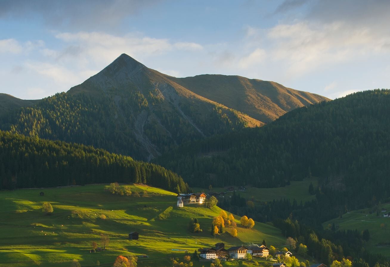
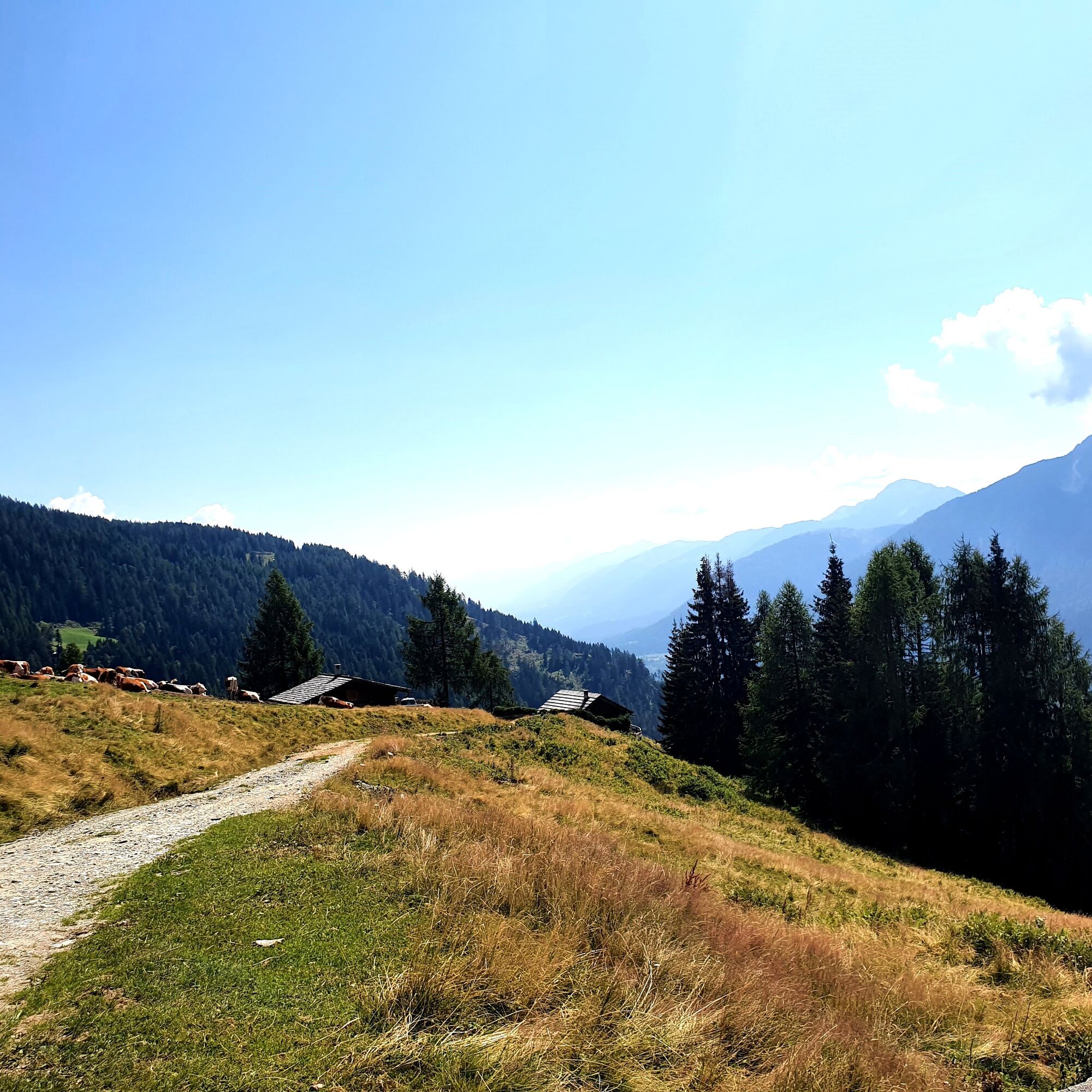
From this Seiwald hut, you still have about 60 minutes on a wide alpine path to Oberraster Alm (1619 m). This alpine pasture can certainly be described as one of the most beautiful viewpoints in the Gailtal Alps. Like from a pulpit, you can let your gaze wander over the Lesachtal lying before you. In the south, the Carnic Alps stand face to face.
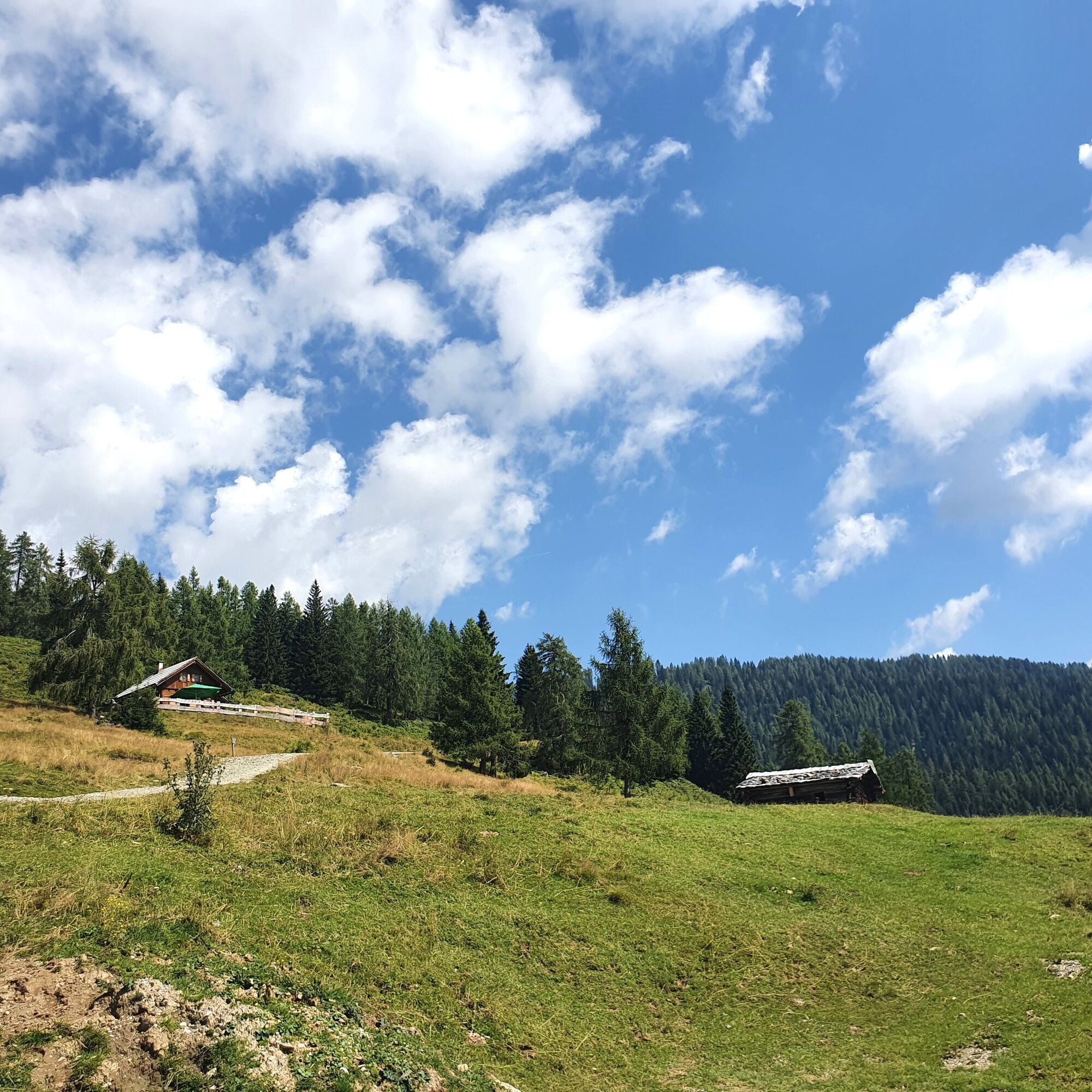
From Oberraster Alm, a forest road leads northward to Mahdalpe (Motalm, 1814 m). On this gently ascending section, you bypass the 1886 m high forested Grünkofel on the east side and then arrive at the already mentioned alpine pasture. Sheltered in a grassy saddle, you are greeted by some haystacks. Silent witnesses to the hard work of mountain farmers on the parceled mountain meadows on the southern slopes of the mountain that are still visible to the naked eye today.
And suddenly it stands before you:
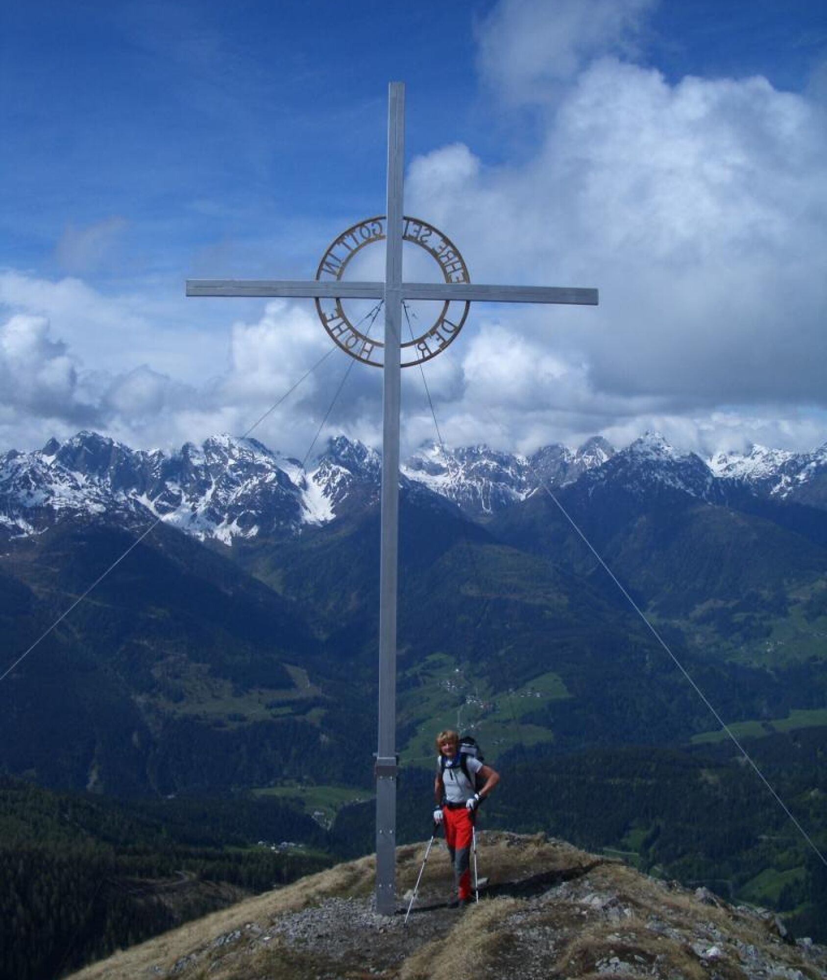
The mighty and widely visible summit cross of the Lumkofel. Although still some altitude and sweat drops away, you already have the goal in sight.
Whether it is still far from here, everyone will judge for themselves. One will feel the remaining meters to the summit one way, the other another. Each in their own way. But for all, the fact remains that, in view of the summit cross, one always gains the necessary motivation for the last section, no matter how steep it is.
With the necessary caution and surefootedness, it does not take much longer until you find yourself at the summit cross.
The views offered to you here are certainly worth all the climbing efforts. Particularly impressive is the view from 270° (W) to 360° (N) of further peaks of the western Gailtal Alps and Lienz Dolomites. To the east, you can also follow the further course of the Gailtal Alps, and you have already looked at the summit chain of the Carnic Mountains in the south during the ascent.
ROUTE DESCRIPTION (Descent):
After the extensive panorama viewing, you descend again via the ascent route to Mahdalm (Motalm).
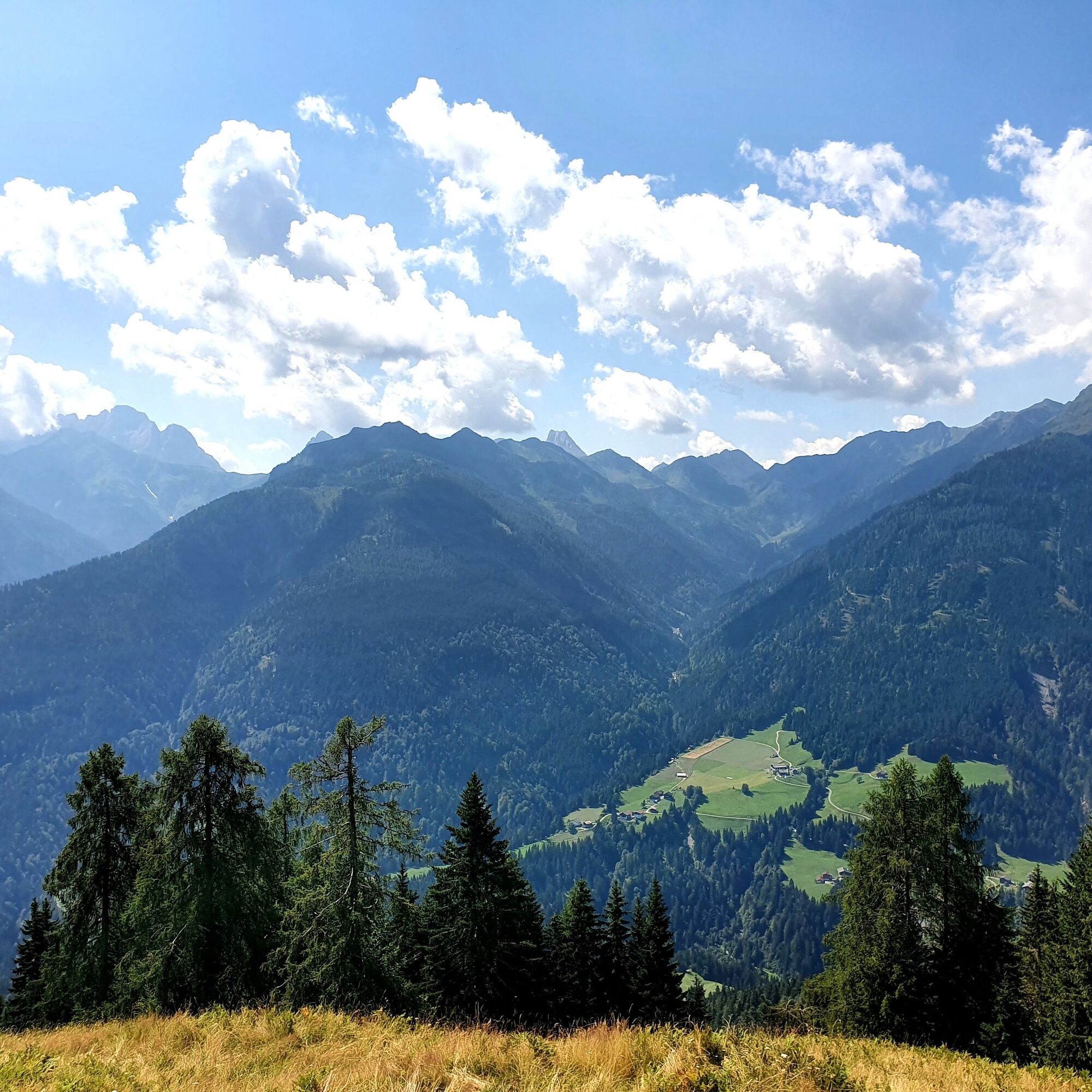
From there, turn west and hike – accepting small ascents – over the saddle between Lumkofel and Grünkofel through a seemingly completely forgotten primeval forest with a rustic character. Take your time and observe the bizarre and gigantic larches and other tree species!
The trail crosses a forest road a few times further on and then leads down in several switchbacks over a steep forest ridge back to Assing.
Ano
Ano
This varies depending on the season. But always included are:
Functional hiking clothing, windbreaker, headgear, rainwear/protection, mountain boots, provisions, sufficient drinks, change of clothes, various personal items like camera, mobile phone, sun protection, sunglasses, hiking poles, first aid kit, etc.
If you are accompanied by your four-legged friend on this route, be sure to keep them on a leash in the area of the Alpine pastures!
Check the current trail situation or possible trail closures before the hike.
In the Lesachtal, you drive in the village center of Liesing (Dorfbrunnen, 1044 m) up the sunny mountainside over Pallas (1335 m) to Assing (1427 m) via numerous hairpin bends. You reach this hamlet after about 4 km on an asphalt mountain road.
Parking spaces for cars are limited here. However, if possible, please ask fairly where and if you can park your car. For example, at the highest house.
Oblíbené prohlídky v okolí
- 4,7
Karlsbader Hütte über Rudl-Eller-Weg
heavyTuristika 5,10 km - 5,0
Ederplan round from the parking lot Stronach
středníTuristika 7,19 km - 4,5
Karnischer Höhenweg – Etappe 4: Hochweißsteinhaus – Wolayersee Hütte
heavydálková pěší trasa 15,9 km - 4,9
Pirknerklamm (C)
středníVia ferrata 2 km - 4,8
Lienzer Dolomiten-Lasertörl
středníTuristika 13,2 km - 4,7
Obergail - Obergailer Alm - Obergailer Lake - Enderberg hut - Source for Health & Peace - Madonna circular hiking route - Obergail
středníTuristika 11,4 km - 3,9
Karlsbader Hütte - Lienzer Dolomiten
Turistika 8 km - 4,9
Karnischer Hauptkamm - Hohe Warte 2.780m - Hike and Bike
heavyHorská turistika 19,5 km - 4,3
Mountainbiketour von der Hubertuskapelle zum Wolayersee
heavyMountainbike 9,06 km - 3,9
Summit hike to the Hochstadel
středníTuristika 7,83 km

Pěší turistika a stopování


Nenechte si ujít nabídky a inspiraci pro vaši příští dovolenou
Vaše e-mailová adresa byl přidán do poštovního seznamu.