


Ski tour Nostra - Runseck

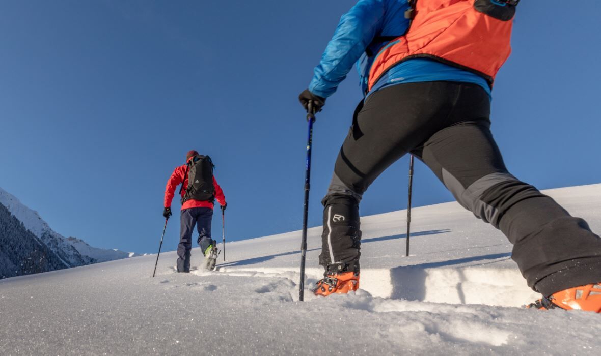
The ski tour to Runseck is one of the easy summit tours in the Lesach valley, the ascent leads over forest roads, larch meadows, and alpine pastures and poses no major technical difficulties. Additionally,...
The ski tour to Runseck is one of the easy summit tours in the Lesach valley, the ascent leads over forest roads, larch meadows, and alpine pastures and poses no major technical difficulties. Additionally, you mostly move on a steadily rising mountain ridge, which has only a few very steep sections. The only small disadvantage of this route is that the upper part of the summit ridge is often windblown and the snow conditions there can be rather hard.
Attention: Logging work is repeatedly carried out along this route. Please inquire beforehand about the current situation!
------------------------------------------------------------------------------------------------------------------------------------------------------------------------
Important: Always observe the current avalanche warning level and inform yourself about the current trail and weather situation before the tour!


From the last houses in Nostra (access by car possible via road), the ski route leads fairly steeply through the forest via the summer path until you reach the alpine road again on flatter terrain. Via small detours and the alpine trail, you come to a fork near a hut. Here you leave the alpine trail again and follow the summer path partly through lightly wooded terrain and across beautiful meadows up to the base of the summit. This is climbed on the west side starting with some hairpin turns, and from the south you finally reach the summit of Runseck.
Beautiful panoramic view, into the Gail valley to the east, the gentle slopes of the Gailtal Alps to the north, deep into the Lesach valley to the west, and majestically the Biegen mountain range to the south. It is best to descend along the ascent track. The summit slope can also be descended a bit on the east-north side. However, this descent is steep and the conditions must be very good. After the summit ridge, it is also possible to descend slightly northwest over beautiful slopes to Nostra alp. From there, the alpine trail leads back to the ascent track. Nice route that can also be undertaken with skillful track setting even in higher snow conditions.
Ano
Ski touring and standard safety equipment, crampons
Please always observe the current avalanche warning level!
From Kötschach-Mauthen via the B111 westwards to the village Birnbaumm, shortly after that turn left towards Nostra. Upon arriving in Nostra, the road forks, here take the left road up to the upper houses of the hamlet. From Lienz/East Tyrol turn in Tassenbach towards Obertilliach/Maria Luggau and follow the road, shortly before the village Birnbaum turn right towards Nostra and follow the above description to the starting point of the route.
Starting point of the route is not accessible by public transport.
Parking is only possible along the road, please park the vehicle so that traffic is not obstructed.
A descent into the Niedergail valley or Wolay valley is NOT possible, even if some slopes look very tempting. Please make sure to descend along the ascent track!
Oblíbené prohlídky v okolí
-
4.7
Karlsbader Hütte über Rudl-Eller-Weg
heavyTuristika 5.10 km -
4.5
Karnischer Höhenweg – Etappe 4: Hochweißsteinhaus – Wolayersee Hütte
heavydálková pěší trasa 15.9 km -
4.8
Pirknerklamm (C)
středníVia ferrata 2 km -
4.8
Lienzer Dolomiten-Lasertörl
středníTuristika 13.2 km -
4.7
Obergail - Obergailer Alm - Obergailer Lake - Enderberg hut - Source for Health & Peace - Madonna circular hiking route - Obergail
středníTuristika 11.4 km -
3.9
Karlsbader Hütte - Lienzer Dolomiten
Turistika 8 km -
4.9
Karnischer Hauptkamm - Hohe Warte 2.780m - Hike and Bike
heavyHorská turistika 19.5 km -
4.3
Mountain bike route from the Hubertus Chapel to the Wolayersee
heavyMountainbike 9.06 km -
3.9
Summit hike to the Hochstadel
středníTuristika 7.83 km -
5.0
Tuffbad - Guggenberger Sattel - Samalm - Tuffbad
středníTuristika 12.2 km
Pěší turistika a stopování


Nenechte si ujít nabídky a inspiraci pro vaši příští dovolenou
Vaše e-mailová adresa byl přidán do poštovního seznamu.