


SW_N2 Missoriaalm
Úroveň obtížnosti: WT1
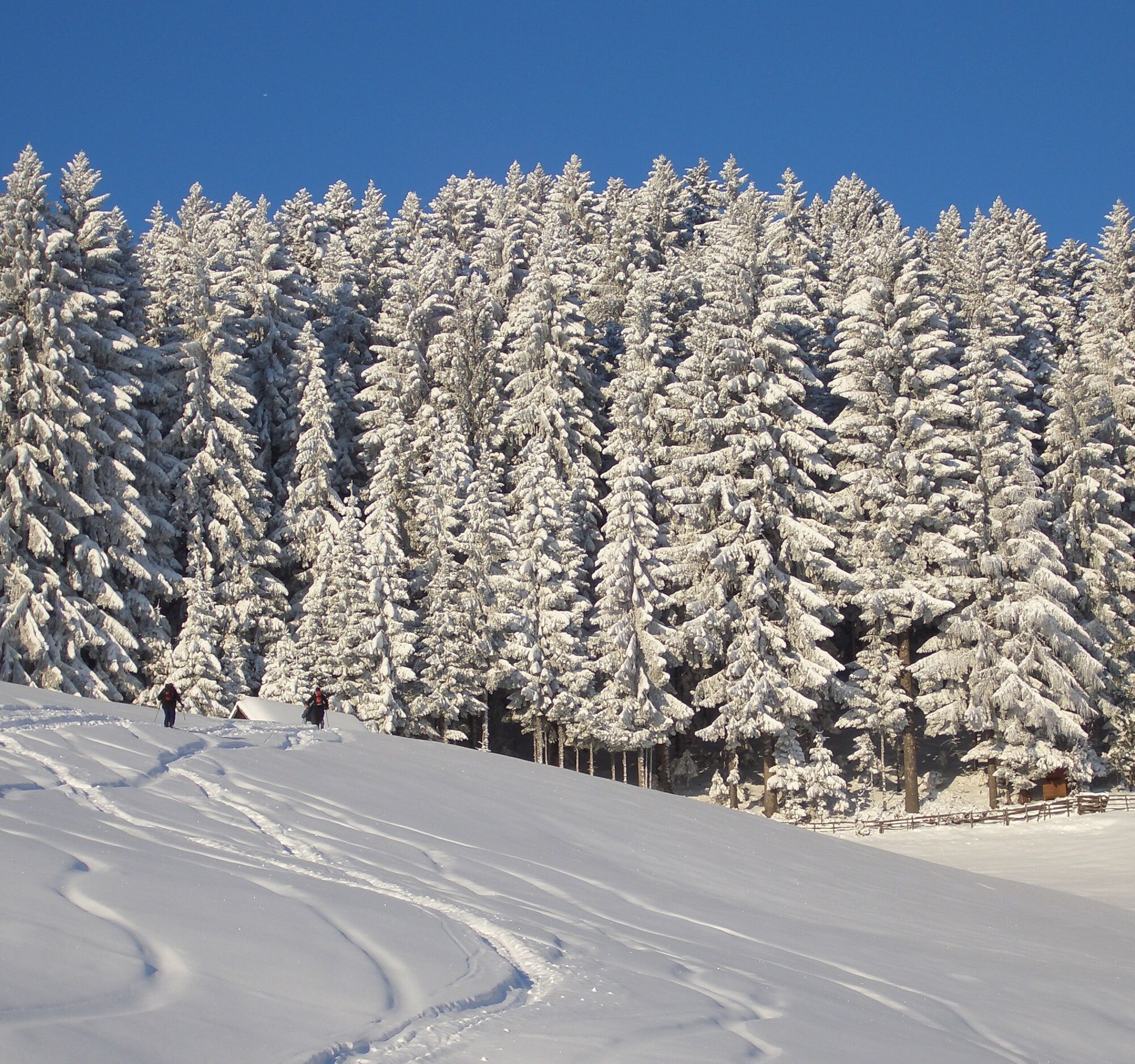
The snowshoe tour runs through the wooded, idyllic and quiet forest area of the mountaineering village Mauthen – partly on the forest road and on idyllic hiking paths – via the Missoriaalm, then on to...
The snowshoe tour runs through the wooded, idyllic and quiet forest area of the mountaineering village Mauthen – partly on the forest road and on idyllic hiking paths – via the Missoriaalm, then on to Dolling and Würmlach, back to Mauthen

Starting and end point:
From the parking lot at the natural swimming pool Waldbad in the mountaineering village Mauthen you first walk over the Valentin Bridge, then continue onto the forest road, which you follow for a few minutes.
You then reach a signpost pointing to Missoriaalm and hike upwards along a forest path that leads back onto the forest road.
The snowshoe hiking route runs through wooded areas – alternating between sections along forest roads and wider and narrower hiking paths.
After you have completed the ascent and walked about half of the round, you reach Missoriaalm – where you will also find some interesting information about the Veneterstein.
The further route now leads you downhill, via Dolling, to the village of Würmlach.
After a few meters outside the forest, the route runs again along a forest path (“Wiener Weg”) starting from Weildegg Castle in Würmlach.
The last meters you walk along the Valentinbach stream to finally return to your starting point.
FAIR PLAY & RESPECT:
Care for nature – landowners – your health.... and safety on the mountain are the highest priorities on your route and its planning!
Therefore, before every snowshoe hike check the rules of conduct - Mountain Safety, the current snow and avalanche report Carinthian Avalanche Warning Service and the weather conditions.
Waste disposal:
Waste is not always avoidable – but it has no place in nature and must be disposed of properly (preferably in the valley or at home).
Emergency numbers:
European emergency number: 112 (accessible on any available network)
Mountain rescue Austria: 140
Arrival by car:
From Hermagor via the B111 (Gailtal Road) or from Oberdrauburg via the B110 (Plöckenpass Road) to Kötschach-Mauthen.
The most sustainable way to arrive is by train to Oberdrauburg (coming from Lienz or Villach) or to Hermagor (coming from Villach).
From Oberdrauburg or Hermagor you can then reach the town of Kötschach-Mauthen by bus.
Details at - Mobility information Nassfeld and Route planner Carinthian Lines
Free parking is available in Kötschach-Mauthen at the natural swimming pool and at the bus station very close to the town center of the mountaineering village Mauthen (opposite the church) - right next to the B110 Plöckenpass Road.
WT1
Are you looking for snowshoe hiking route tips in the region as well as a certified guide for a guided snowshoe hike?
You can find this and many other infos at - Route tips and provider information
In Kötschach-Mauthen there are numerous year-round open dining options - details at Service A-Z
Webové kamery z prohlídky
Oblíbené prohlídky v okolí
-
4.9
Pirknerklamm (C)
středníVia ferrata 2 km -
4.9
Karnischer Hauptkamm - Hohe Warte 2.780m - Hike and Bike
heavyHorská turistika 19.5 km -
4.3
Mountainbiketour von der Hubertuskapelle zum Wolayersee
heavyMountainbike 9.06 km -
3.7
Cellon-Stollen und Senza Confini auf den Cellon und Steinberger Weg zum Abstieg
středníVia ferrata 7.09 km -
3.6
RW_N61 Kleiner Pal (1,867 m)
heavyTuristika 6.52 km -
4.3
WW_N18 flower paradise Mussen
středníTuristika 6.52 km -
4.1
Assing - Oberraster Alm - Lumkofel (2,287 m)
středníTuristika 9.45 km -
5.0
Valentin-Wolayersee-Runde
středníTuristika 12.4 km -
4.5
03 Südalpenweg, 24. Etappe: Valentinalm - Wolayerseehütte
střednídálková pěší trasa 9.63 km -
5.0
Frischenkofel
středníTuristika 5.25 km
Pěší turistika a stopování


Nenechte si ujít nabídky a inspiraci pro vaši příští dovolenou
Vaše e-mailová adresa byl přidán do poštovního seznamu.