






Cody Trail - T73
Úroveň obtížnosti: S1
The Cody Trail - T73 is a mountain bike trail for beginners, but it also provides a lot of fun for more advanced bikers. It is characterized by its flowy design and the fabulous views of the emerald green...
The Cody Trail - T73 is a mountain bike trail for beginners, but it also provides a lot of fun for more advanced bikers. It is characterized by its flowy design and the fabulous views of the emerald green Lake Ossiach. The trail itself is about 0.5 km long. The trailhead is reachable via a short access road over a municipal street.
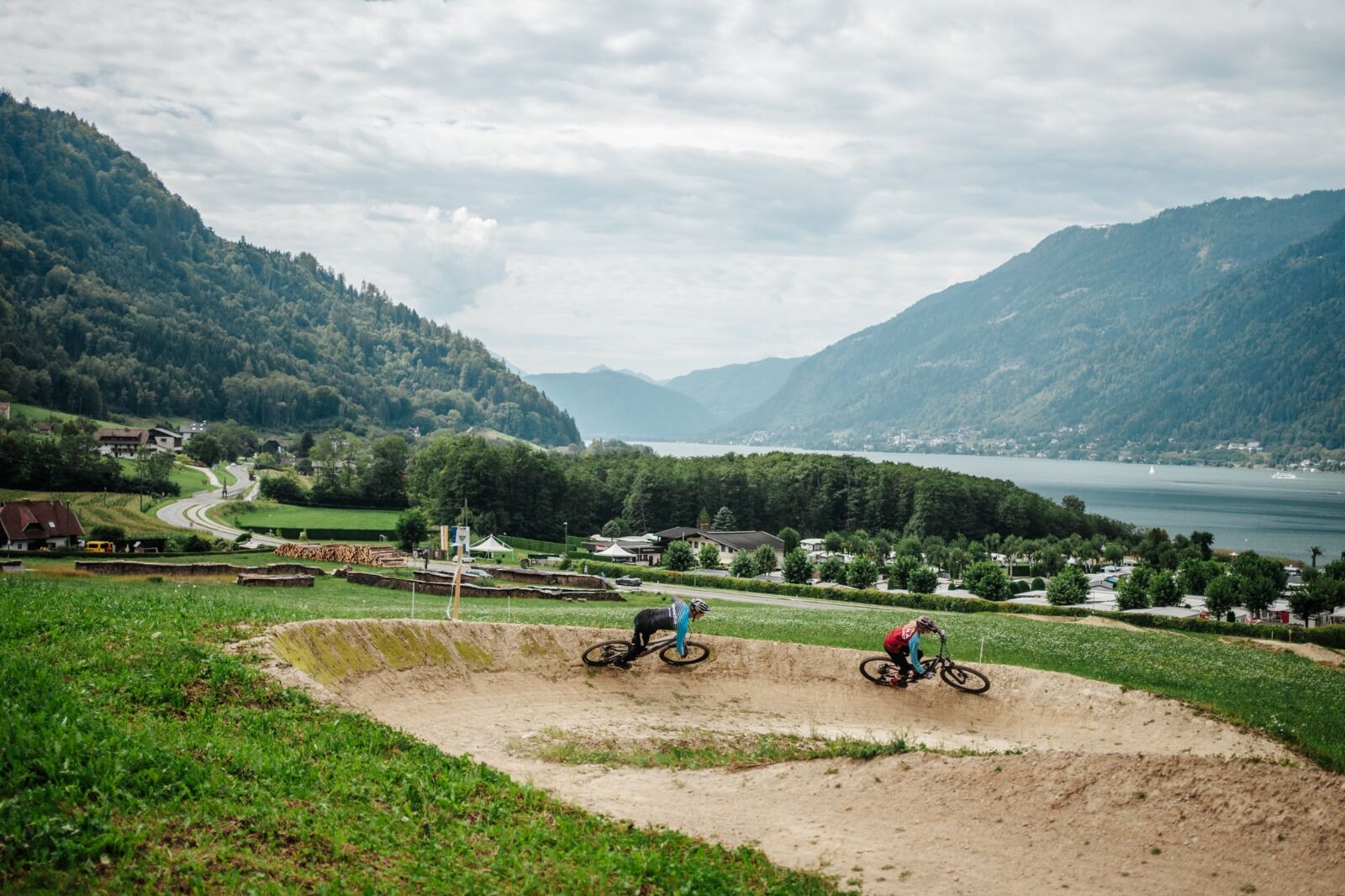
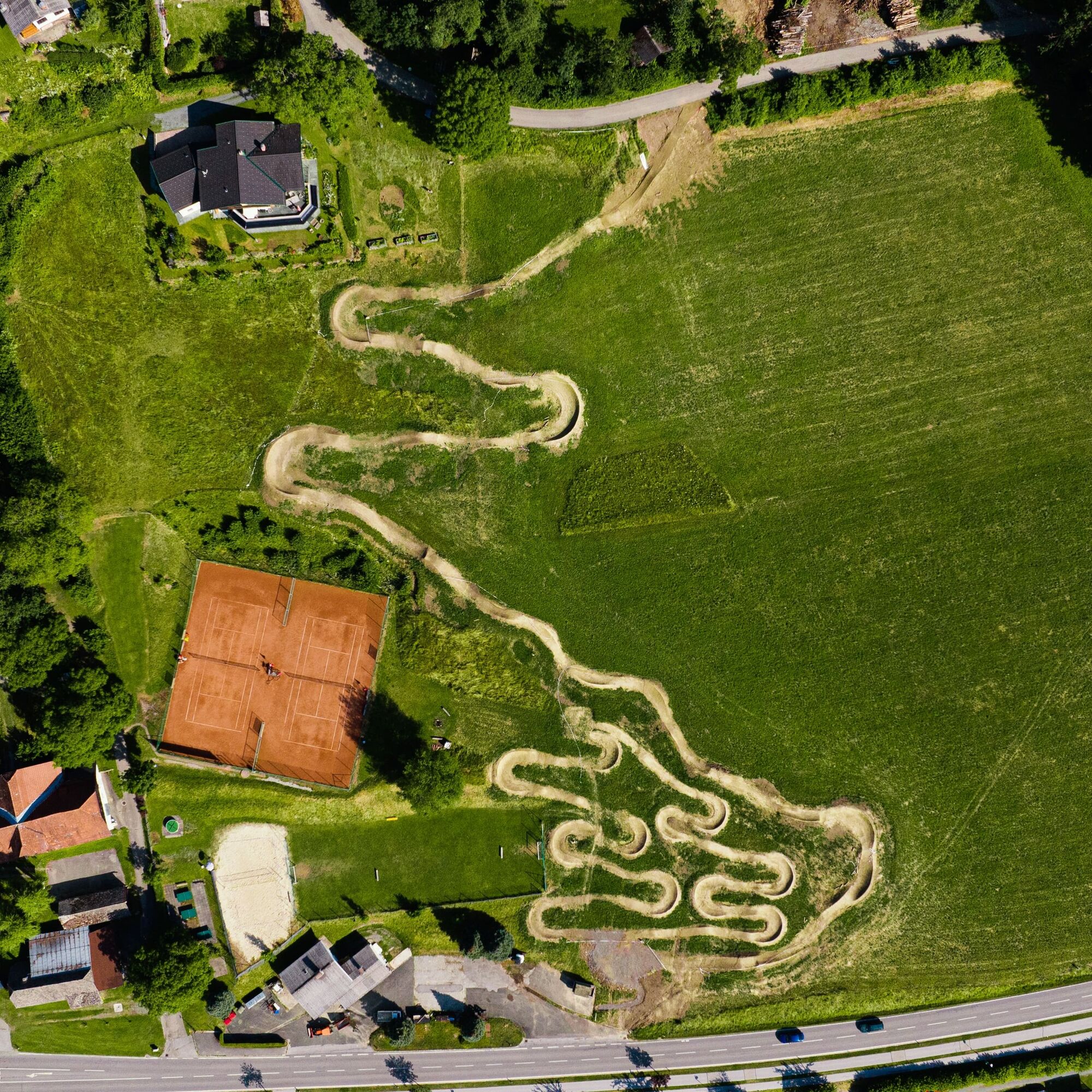
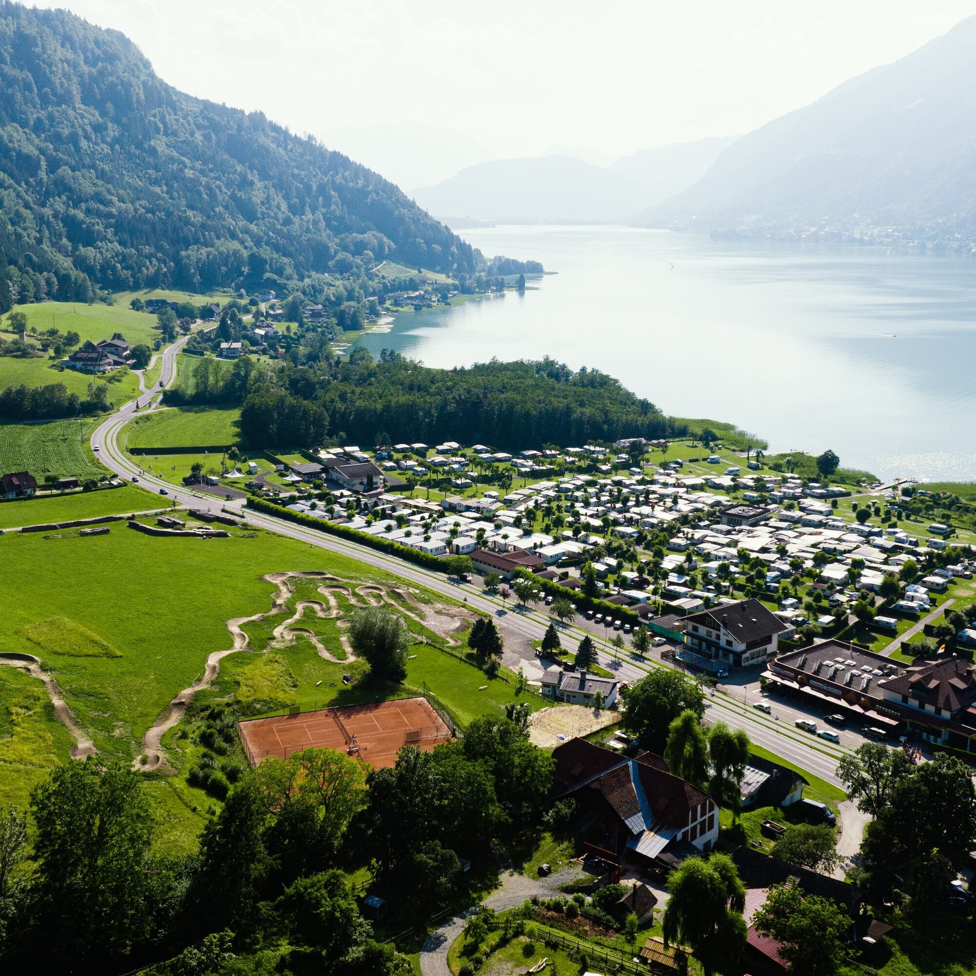
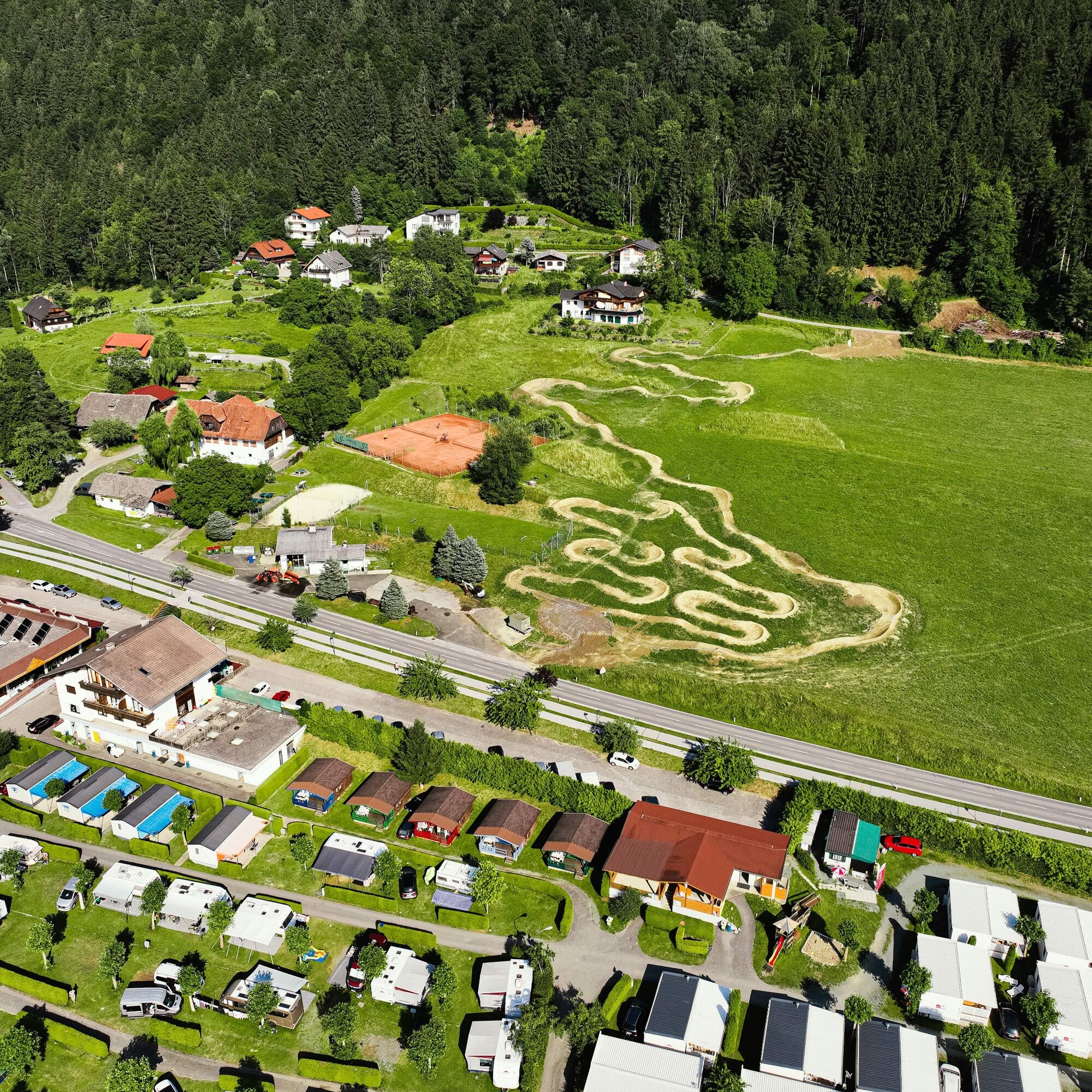
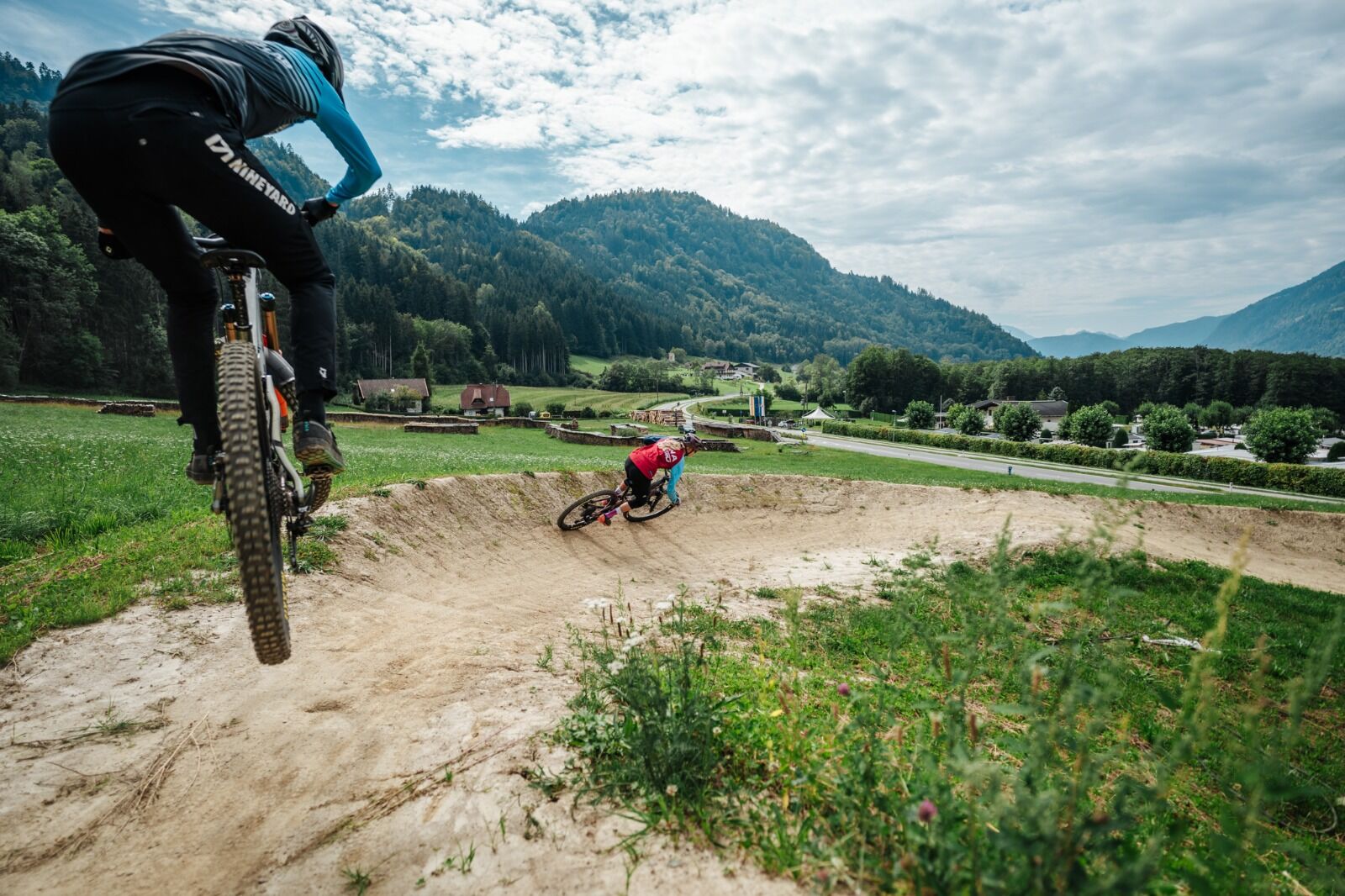
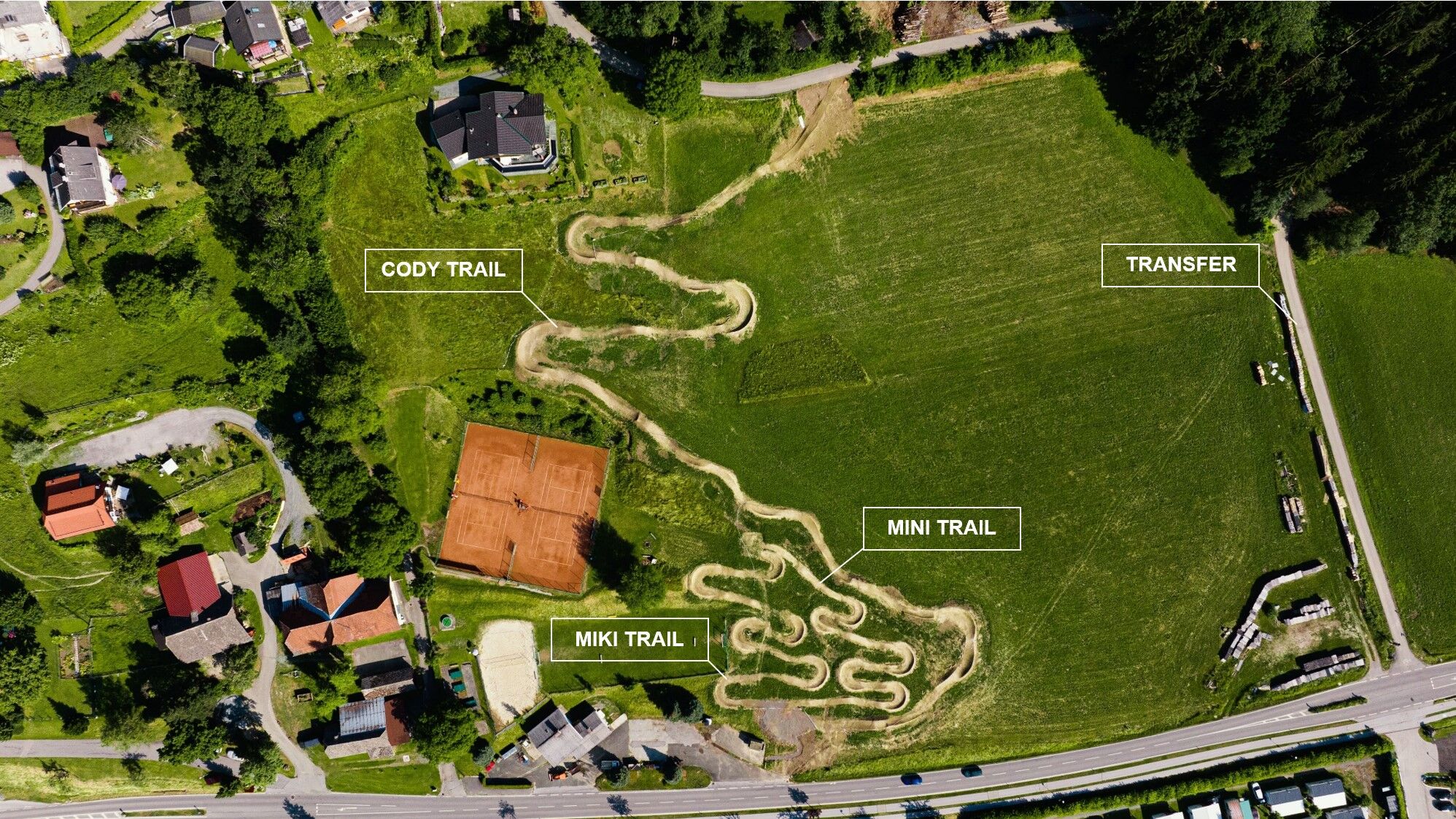

The Cody Trail – T73 starts above the Ostriach district directly on a meadow.
Start of the access road
To reach the Cody Trail – T73, it is best to start from one of the parking lots in the town center of Ossiach. From the parking lot in front of the town hall, all transfer routes (feeders) to the trails are also signposted.
Description of access to the trailhead
Starting from the town hall in Ossiach, first drive towards the main road (L49). At the junction with the L49, turn right and follow bike path R2A for about 1.5 km west. At the entrance to Camping Köbl, turn left and follow the asphalt road to the trailhead.
Cody Trail - T73
Once at the trailhead, simply follow the trail route and the signposting until the end of the trail.
Riding the trail is only allowed with the necessary protective gear (helmet, glasses, gloves, protectors, and suitable shoes) and a mountain bike appropriate for this type of use!
It is also recommended to carry a working mobile phone for making emergency calls and, of course, for taking photos, a first aid kit, sufficient fluids, and a second suitable person to ride the trail with you.
Similar to ski slopes and hiking trails, approved mountain bike routes and single trails are also divided into levels of difficulty. Essentially, the gradient, hazards, and trail condition determine the classification into very easy, easy, moderate, and difficult trails.
It is recommended to start with the very easy level (green) and to carefully inspect each mountain bike trail beforehand.
Riding the trail is only allowed with the necessary protective gear (helmet, glasses, gloves, protectors, and suitable shoes) and a mountain bike appropriate for this type of use!
Definition of trail difficulty:
The color blue indicates easy!
For whom is this trail suitable and what riding skills are required?
For trail beginners and advanced riders! Advanced mountain bike skills required: good balance, weight shifting to overcome obstacles, riding steps, secure cornering and braking technique, possibly jumping skills, and trail experience.
Hazards:
Falls from greater heights into relatively natural terrain possible, rarely risk of falling off the trail.
Trail surface:
Uneven surface, grippy ground with occasional roots or larger stones.
Obstacles:
Small drops and jumps.
Gradient:
Flat. Average under 12%. Steepest section around 30%.
Turns:
Tight, but rollable with longer flat turn exits. Some flow trails have artificial steep turns.
Trail width:
Narrow. At least 0.6 m wide.
Jumps:
Rollable, safe main line. Variants possible for experienced riders.
From Villach via the L49 to Ossiach.
Ossiach is regularly accessible by public transportation
Here is the timetable information.
There are a variety of parking lots available in Ossiach. These are subject to a fee during the summer months.
S1
Detailed information about the route can be found at www.lake.bike
Before pedaling to the entrance of the Cody Trail, first ride the Miki and Mini Trail. Only when these can be ridden safely does the descent on the Cody Trail really become fun.
Získejte přehled
Vždy živě na místě s více než 9 500 webkamerami. bergfex Jako uživatel Pro si nyní můžete zobrazit odpovídající webové kamery pro mnoho prohlídek v aplikaci prohlídky z. Můžete si tak přímo prohlédnout aktuální podmínky.
Oblíbené prohlídky v okolí
-
4.8
4 Huts route
středníTuristika 8.96 km -
5.0
Wörthersee EXTREM
heavyTuristika 60.1 km -
4.5
Pyramidenkogel path Maria Wörth
středníTuristika 10.8 km -
4.6
Hoher Gallin route
středníTuristika 7.09 km -
4.4
Finsterbach Waterfalls - Circular route
středníTuristika 3.87 km -
4.5
Lake circular trail
světloNordic Walking 9.85 km -
4.4
Cycling around Lake Wörthersee – leisurely cycling between turquoise blue water and fantastic views
středníJízda na kole 48.2 km -
4.3
Lake Wörthersee Circular Route
středníJízda na kole 41.2 km -
4.1
Slow Trail Bleistätter Moor (Variant A)
světloTuristika 7.22 km -
3.6
Forstsee round - Römerschlucht
středníTuristika 11.3 km
Pěší turistika a stopování


Nenechte si ujít nabídky a inspiraci pro vaši příští dovolenou
Vaše e-mailová adresa byl přidán do poštovního seznamu.





