





MTB park Werra valley Route 1: Bilstein Marathon
Places to eat: Mountain inn Zum Bilsteinturm, gastronomy in Großalmerode, Hotel Pempel

The Bilstein Bike Marathon route runs through the northern Hessian Kaufunger Forest, which borders Kassel to the east, Witzenhausen to the west, Hann. Münden to the south, and Großalmerode to the north.
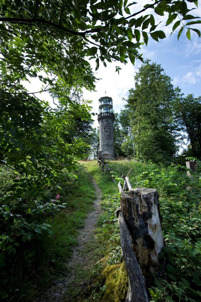
The highest elevation is the Bilstein at 641 m. This mountain with its observation tower, from which one can enjoy a unique view of the northern Hessian uplands, gave the marathon its name.
The route starts from the Schwarzenberg Stadium near the panoramic pool in Großalmerode and loops three times around the Bilstein before ending again at the stadium.
With 53 km length and 1,300 meters of elevation gain, a varied route was created with the kind support of Hessen-Forst and the private and public landowners, suitable for intermediate to advanced demands in cross-country style.
The race runs over gravel forest roads, narrow single trails on forest floor, downhills, winding descents, and steep climbs without crossing any public roads or paths.
Points of interest along the way:
- Steinberg lakes
- Basalt quarry with barbecue hut
- Bilstein tower with forest inn and wonderful panoramic view
- Wyland monument
- Places to rest: Forest inn at the Bilstein tower, gastronomy in Großalmerode
At the "multi-armed signpost", which is reached twice (after 19 km and after 46 km), at the water treading facility in Dohrenbach (after 38 km), and in the start/finish area, refreshment stations are set up during the marathon event. For the mountain biking experts, a double lap (106 km / 2600 m) is offered, and since 2004 a shortened hobby route—the middle loop is omitted—with 26 km / 600 m is marked out for beginners. For young riders, a school race for 8 to 13-year-olds is held in the stadium area on a 2.5 km circuit that must be ridden multiple times depending on age. Service and support along the route are provided by the German Red Cross, the Technical Relief Agency, and the local fire brigade, as well as clubs from Großalmerode and Hessisch Lichtenau. The board and organizing team of the Großalmerode gymnastic club thank all those who help plan and carry out the Bilstein Bike Marathon.
Získejte přehled
Vždy živě na místě s více než 9 500 webkamerami. bergfex Jako uživatel Pro si nyní můžete zobrazit odpovídající webové kamery pro mnoho prohlídek v aplikaci prohlídky z. Můžete si tak přímo prohlédnout aktuální podmínky.
Oblíbené prohlídky v okolí
-
4.0
Premium route P1 Hoher Meißner
heavyTuristika 13.8 km -
5.0
Premium trail P14 Bilstein
středníTuristika 9.96 km -
4.0
Premium route P11 Niester Riesen
světloTuristika 11.6 km -
4.3
Premium route P22 Sankt Ottilien
středníTuristika 11.0 km -
5.0
Premium route P2 Frankershäuser Karst
heavyTuristika 10.2 km -
3.5
Premium route P27 Ludwigstein
středníTuristika 11.2 km -
5.0
Premium route P10 Reichenbach
středníTuristika 13.1 km -
5.0
Premium route P25 Kleinalmerode
středníTuristika 13.4 km -
Premium route P9 Wacholderpfad Roßbach
středníTuristika 11.1 km -
Premium route P23 Höllental
středníTuristika 9.89 km

Pěší turistika a stopování


Nenechte si ujít nabídky a inspiraci pro vaši příští dovolenou
Vaše e-mailová adresa byl přidán do poštovního seznamu.





