


National Park: Val Tantermozza
Úroveň obtížnosti: T2
The path leads from the service road in the God d’Arduond area as a rarely used dead-end route into the otherwise inaccessible Val Tantermozza. For some time now, a bearded vulture pair has been breeding...
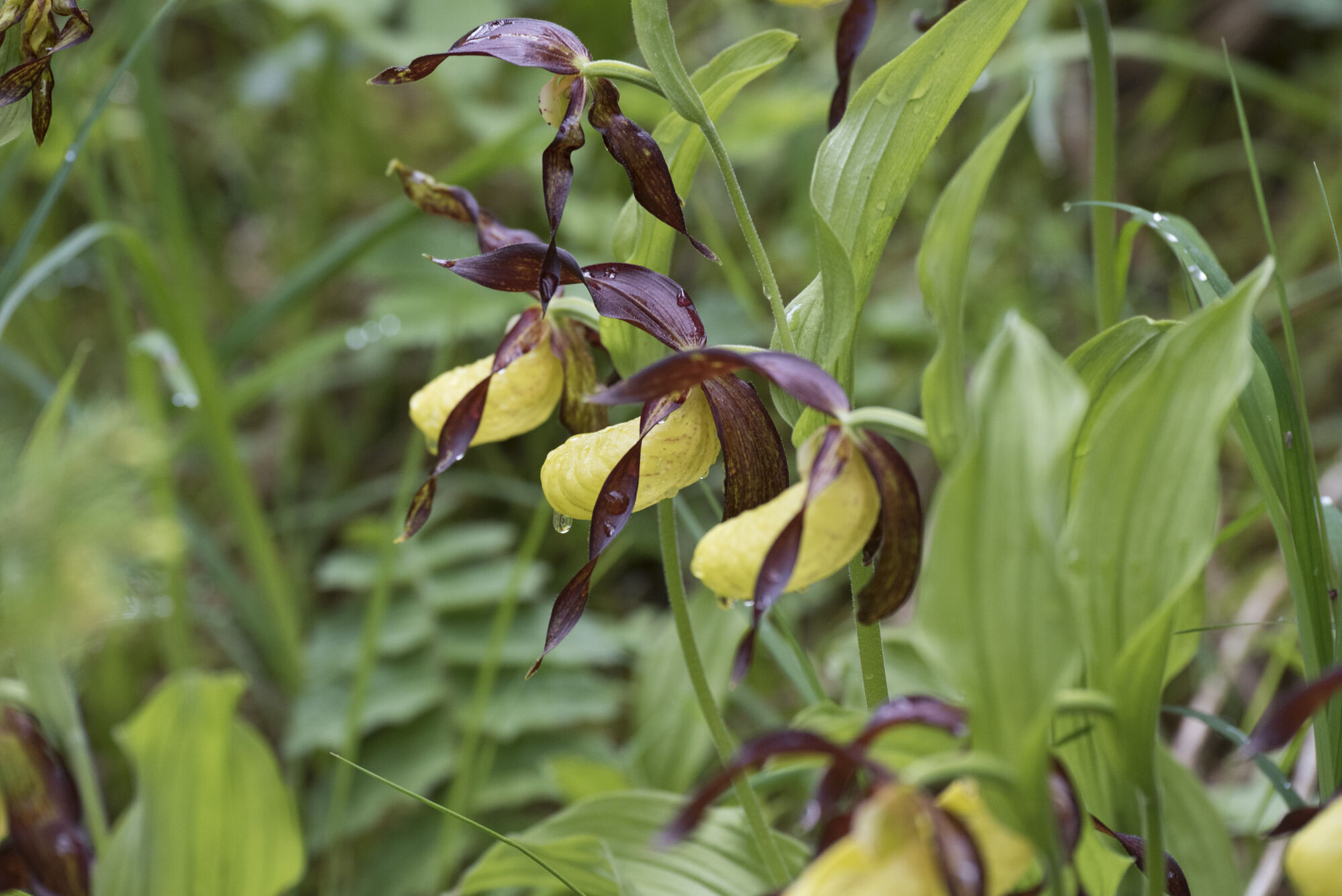
The path leads from the service road in the God d’Arduond area as a rarely used dead-end route into the otherwise inaccessible Val Tantermozza. For some time now, a bearded vulture pair has been breeding in this valley and can be observed with some luck. During the hike, besides hoofed animals, one may occasionally discover mountain lizards, adders, and grass frogs. Furthermore, golden eagles often circle over the valley. Also, in June, the lady's slipper orchid blooms at the park boundary.
Note: Dogs are not allowed in the Swiss National Park, not even on a leash. Further information and all protection regulations can be found at nationalpark.ch/schutzbestimmungen.

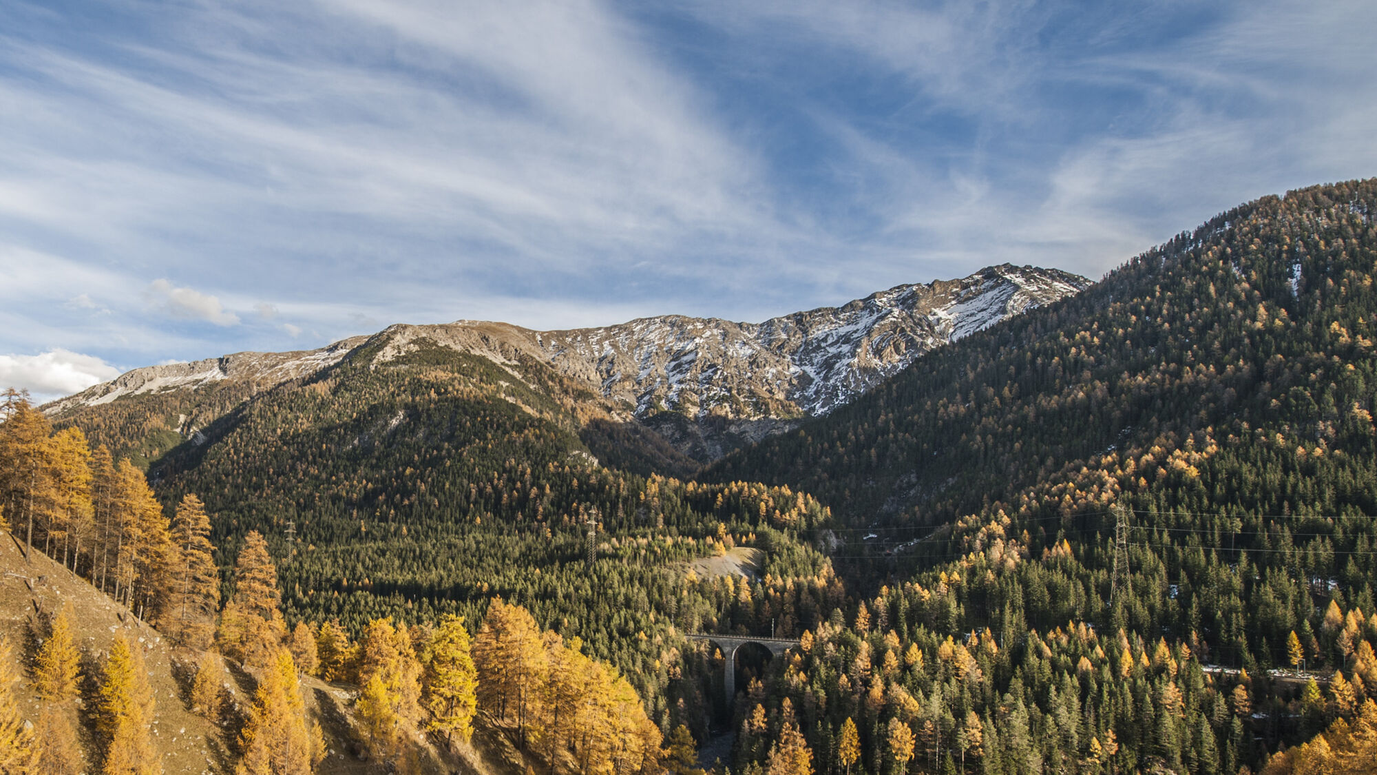
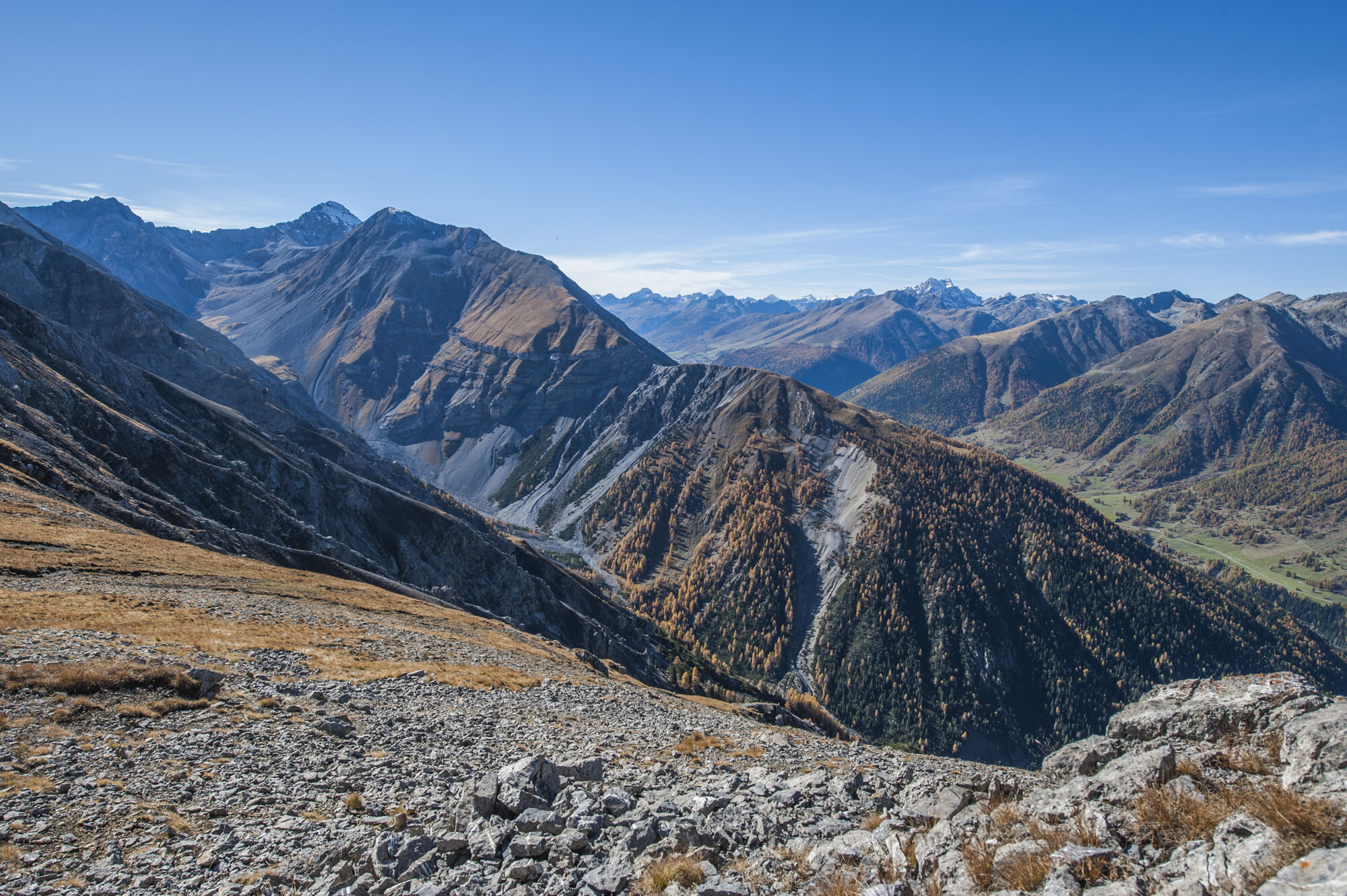
From Zernez train station (1474 m asl) on an easy walking path toward God Carolina / Cinuos-chel. After about an hour, before the service road crosses the Ova da Tantermozza, a mountain path branches off at the turning area in God d’Arduond (1625 m asl) heading toward Val Tantermozza. The path leads after a short ascent into the valley through various, sometimes very dry forest areas and past a large debris slope. After the park boundary, wetter forest areas with impressive giant trees follow. The path ends at Chamanna Tantermozza (1771 m asl), with a beautiful view into the wild valley, which is bounded by the chain of Piz Tantermozza – Piz Quattervals – Piz Cotschen and Piz d’Esan. Then return on the same path to the starting point.
Ano
Ano
Hiking boots or mountain boots, warm clothing, sun and rain protection, trekking poles if needed, binoculars recommended.
Easy mountain hike (white-red-white). Some slopes with unstable rock masses must be crossed
Emergency numbers:
144 Emergency, first aid
1414 Mountain rescue REGA
112 International emergency number
Zernez is located directly on the Engadin road H27.
Hourly Rhätian Railway service (from Chur, Prättigau, Upper and Lower Engadin) to Zernez
Free parking at the train station, in the village, and at the National Park visitor center in Zernez.
Access possible via Kraftwerkstrasse, which branches off H27 between Zernez and Brail, to the turning area God d’Arduond. You can park your car there.
T2
For those who want a complete view of the wild Val Tantermozza, the "Murtaröl" route is recommended.
Webové kamery z prohlídky
Oblíbené prohlídky v okolí
- 4,9
Jöriseen
středníTuristika 11,3 km - 4,8
National park: Zernez – Munt Baselgia – Macun lakes – Alp Zeznina – Lavin
heavyTuristika 22,9 km - 4,0
National Park: Margunet
světloTuristika 7,76 km - 4,8
National Park: Grimmels (circular hike)
světloTuristika 6 km Flüelapass – Schwarzhorn (return)
středníTuristika 7,92 kmKesch Trek Tour (4 stages)
střednídálková pěší trasa 47,6 km- 5,0
Fluela Schwarzhorn 3147 m
světloVysokohorská turistika 7,34 km - 5,0
National Park: Murtaröl
heavyTuristika 15,6 km National Park: Chamanna Cluozza
středníTuristika 8,37 km- 5,0
National Park: Spöl Valley
světloTuristika 7,67 km
Pěší turistika a stopování


Nenechte si ujít nabídky a inspiraci pro vaši příští dovolenou
Vaše e-mailová adresa byl přidán do poštovního seznamu.