
Aussois Râteau walking trail
heavy
Pořiďte si tuto prohlídku do mobilního telefonu
Aussois Râteau walking trail
heavy
Turistika
12.93
km
Naskenujte QR kód a spusťte navigaci v aplikaci bergfex.


Pěší turistika a stopování





Aussois Râteau walking trail
heavy
Vzdálenost
12.9
km
Doba trvání
07:00
h
Ascent
1065
hm
Hladina moře
2026 -
3110
m

Navigujte po trase v aplikaci
Nainstalujte si aplikaci zdarma a mějte trasu vždy na očích díky GPS navigaci a sledování polohy.
Využijte nyní službu „ bergfex “ v aplikaci
Naskenuj QR kód pomocí fotoaparátu
Jakmile je aplikace nainstalována, obsah se otevře přímo. Pokud aplikaci ještě nemáš, budeš přesměrován na stránku, kde si ji můžeš zdarma stáhnout.
Stažení skladby
Aussois Râteau walking trail
heavy
Turistika
12.93
km
The majority of the circuit passes through a busy and perfectly marked path. You'll reach the Col de la Masse at 2,923 m without difficulty. If you're lucky, you might even come across "étagnes", female...
Popis
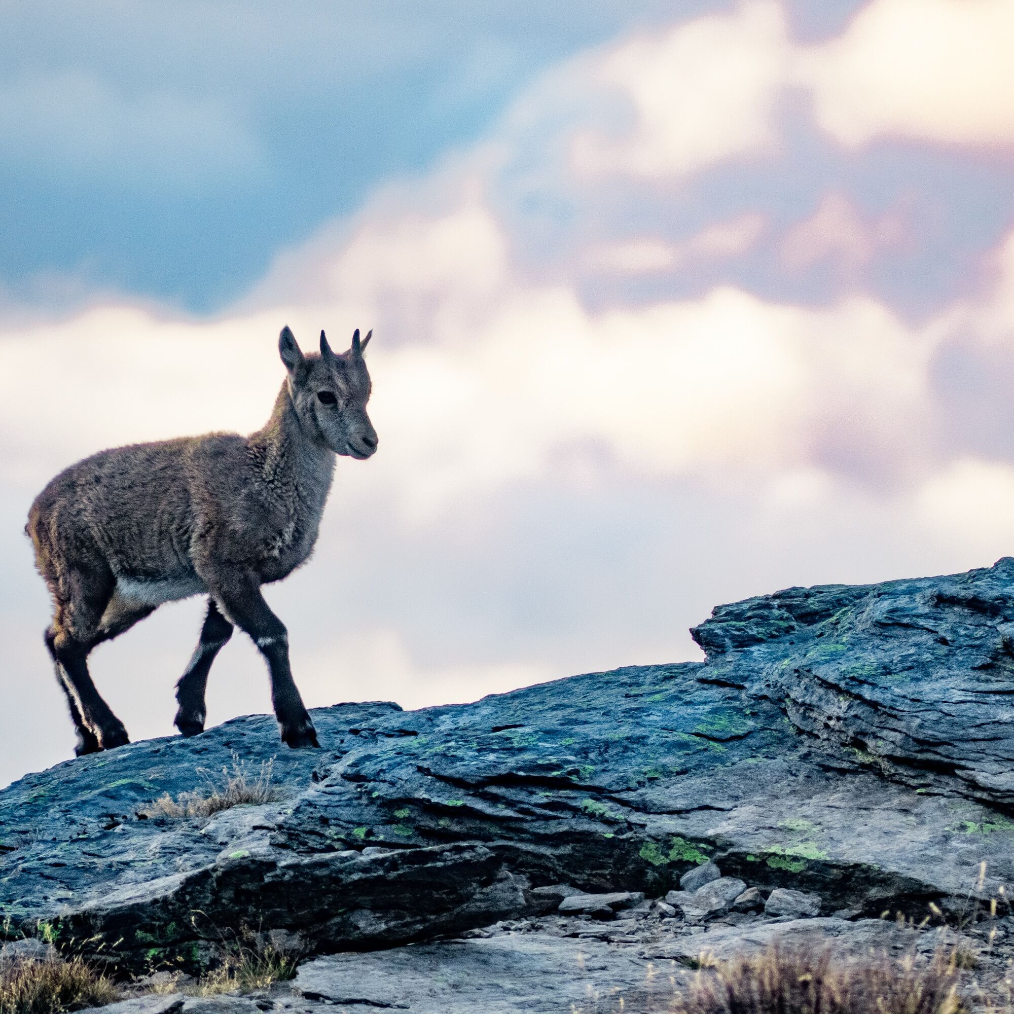
The majority of the circuit passes through a busy and perfectly marked path. You'll reach the Col de la Masse at 2,923 m without difficulty. If you're lucky, you might even come across "étagnes", female ibexes, accompanied by their adorable young, known here as "éterlous". From cairn to cairn, make your way between the boulders as you tackle the last ascent. The view awaiting is unforgettable – and well-deserved! What that 4,810-metre-tall you can see in the distance? After a moment of contemplation at the highest point, your next reward
appears: Plateau du Mauvais Berger. The marmots have set up a base camp here. Look at them fooling around among the blueberries and rhododenrons. Before reaching the Col du Barbier, picture how the plateau would look in autumn, all decked out in flamboyant colours. Now, that's a sight worth seeing! With your mind already filled with precious memories, take your time walking back to the well-marked GR® trail southwards. You're still feeling full of energy, and you make light of the descent, back towards Plan d'Aval. Let's go! One last push and you'll deserve a hero's welcome at Plan d'Amont.
appears: Plateau du Mauvais Berger. The marmots have set up a base camp here. Look at them fooling around among the blueberries and rhododenrons. Before reaching the Col du Barbier, picture how the plateau would look in autumn, all decked out in flamboyant colours. Now, that's a sight worth seeing! With your mind already filled with precious memories, take your time walking back to the well-marked GR® trail southwards. You're still feeling full of energy, and you make light of the descent, back towards Plan d'Aval. Let's go! One last push and you'll deserve a hero's welcome at Plan d'Amont.
Trasa
Trasa
Aussois Râteau walking trail
heavy
Turistika
12.93
km
Autor
Poskytuje Haute Maurienne Vanoise
Prohlídku Aussois Râteau walking trail zajišťuje outdooractive.com.


Informace o trase
Trasa
To guide you in the field, consult the "step-by-step" directional diagram provided in pdf.
Další informace a tipy
Další informace
The duration of hiking trails is calculated using reference paces: 300 m/h ascent, 500 m/h descent and 4 km/h on the flat.
As hazards may occur at any time on the routes, the GPX tracks provided are not contractual. They are given for information only. Riders use them at their own risk, depending on their level of technological proficiency and their understanding of the terrain.
As hazards may occur at any time on the routes, the GPX tracks provided are not contractual. They are given for information only. Riders use them at their own risk, depending on their level of technological proficiency and their understanding of the terrain.
Oceňování
1 Komentář:
Denis mugnier

20. Jul. 2026
Râteau d aussi us
Superbe les 200 derniers mètres sont difficiles

Všechny webové kamery na mapě
Nainstaluj si aplikaci zdarma a porovnej si živé záběry z několika míst, než vyrazíš.
Využijte nyní službu „ bergfex “ v aplikaci
Naskenuj QR kód pomocí fotoaparátu
Jakmile je aplikace nainstalována, obsah se otevře přímo. Pokud aplikaci ještě nemáš, budeš přesměrován na stránku, kde si ji můžeš zdarma stáhnout.
Oblíbené prohlídky v okolí
-
5.0
BARDONECCHIA Colle Sommeiller
středníMountainbike 25.4 km -
BARDONECCHIA Rochemolles Dam - Scarfiotti Mountain Hut
středníTuristika 7.24 km -
Refuge du Fond d'Aussois - a wild valley in the Vanoise - 2-day hike
světloTuristika 9.22 km -
The White Lake
světloTuristika 4.42 km -
BARDONECCHIA Decauville Loop - Scarfiotti Refuge
světloMountainbike 34.0 km -
Col du Mont Cenis from Modane
heavySilniční kolo 34.8 km -
5.0
The Builder's Trail on foot
světloTematická stezka 7.23 km -
5.0
Girarde footpath
světloTuristika 8.10 km -
5.0
Goldtoni - Alpenbogen A068 Refuge de la Leisse-Termignon Val Cenis
střednídálková pěší trasa 28.7 km -
Ascent to 'Plan du Lac'
heavySilniční kolo 15.6 km
Pěší turistika a stopování

Více než 550.000 návrhů výletů, podrobné mapy a intuitivní plánovač tras dělají z aplikace nezbytnou výbavu pro všechny milovníky přírody.

Nenechte si ujít nabídky a inspiraci pro vaši příští dovolenou
Přihlaste se k odběru newsletteru
Chyba
Došlo k chybě. Zkuste to prosím znovu.
Děkujeme za vaši registraci
Vaše e-mailová adresa byl přidán do poštovního seznamu.
Zájezdy po celé Evropě
Rakousko
Švýcarsko
Německo
Itálie
Slovenia
Francie
Nizozemsko
Belgie
Polsko
Lichtenštejnsko
Česko
Slovensko
Španělsko
Chorvatsko
Bosna a Hercegovina
Lucembursko
Andorra
Portugal
Iceland
United Kingdom
Ireland
Greece
Albania
North Macedonia
Malta
Norway
Montenegro
Moldova
Kosovo
Hungary
San Marino
Romania
Estonia
Latvia
Belarus
Cyprus
Lithuania
Serbia
Bulgaria
Monaco
Denmark
Sweden
Finland





