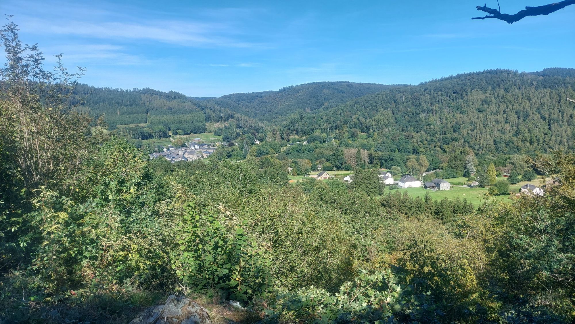
Laforêt - Église Sainte-Agathe
střední
Navigace na stránkách
Navigace na stránkách
Pořiďte si tuto prohlídku do mobilního telefonu
Laforêt - Église Sainte-Agathe
střední
Turistika
15.13
km
Naskenujte QR kód a spusťte navigaci v aplikaci bergfex.

Pěší turistika a stopování


Laforêt - Église Sainte-Agathe
střední
Vzdálenost
15.13
km
Doba trvání
04:01
h
Ascent
406
hm
Hladina moře
187 -
347
m
Stažení skladby
Laforêt - Église Sainte-Agathe
střední
Turistika
15.13
km

Trasa
Laforêt
(221 m)
Vesnice
0.0 km
Église Sainte-Agathe
(214 m)
Místo konání bohoslužeb
0.0 km
Laforêt
(221 m)
Vesnice
15.0 km
Église Sainte-Agathe
(214 m)
Místo konání bohoslužeb
15.1 km
Trasa
Laforêt - Église Sainte-Agathe
střední
Turistika
15.13
km
Laforêt
(221 m)
Vesnice
0.0 km
Église Sainte-Agathe
(214 m)
Místo konání bohoslužeb
0.0 km
Laforêt
(221 m)
Vesnice
15.0 km
Église Sainte-Agathe
(214 m)
Místo konání bohoslužeb
15.1 km
Zatím žádné recenze
Oblíbené prohlídky v okolí
-
4.9
Laddertjeswandeling Rochehaut
středníTuristika 5.06 km -
4.7
Église Saint-Firmin - Rochehaut - Poupehan - Église Saint-Remacle
Turistika 11.0 km -
Laforêt - Chapelle Notre-Dame - Église Sainte-Agathe - Vresse-sur-Semois
středníTuristika 13.0 km -
Alle - Mouzaive - Chapelle Notre-Dame
středníTuristika 8.09 km -
Membre - La Riviera - Chapelle Saint-Donat - Église Sainte-Anne
heavyMountainbike 38.0 km -
Chairière - Le Relais de Vresse - Église Saint-Lambert - Église Saint-Walfroid
středníTuristika 8 km -
Église Saint-Léger - La Riviera - Chapelle Notre-Dame - Bohan
středníMountainbike 31.6 km -
Floing - Saint-Menges - Église Sainte-Agathe - Église Saint-Remi
středníMountainbike 44.1 km -
Frahan - Église Saint-Firmin - Église Saint-Maur - Église Notre-Dame de l'Assomption
středníMountainbike 42.5 km -
Vresse-sur-Semois - Église Saint-Pierre - Chapelle Saint-Donat - Église Saint-Lambert
středníTuristika 13.9 km
Pěší turistika a stopování

Více než 550.000 návrhů výletů, podrobné mapy a intuitivní plánovač tras dělají z aplikace nezbytnou výbavu pro všechny milovníky přírody.

Nenechte si ujít nabídky a inspiraci pro vaši příští dovolenou
Přihlaste se k odběru newsletteru
Chyba
Došlo k chybě. Zkuste to prosím znovu.
Děkujeme za vaši registraci
Vaše e-mailová adresa byl přidán do poštovního seznamu.
Zájezdy po celé Evropě
Rakousko
Švýcarsko
Německo
Itálie
Slovenia
Francie
Nizozemsko
Belgie
Polsko
Lichtenštejnsko
Česko
Slovensko
Španělsko
Chorvatsko
Bosna a Hercegovina
Lucembursko
Andorra
Portugal
Iceland
United Kingdom
Ireland
Greece
Albania
North Macedonia
Malta
Norway
Montenegro
Moldova
Kosovo
Hungary
San Marino
Romania
Estonia
Latvia
Belarus
Cyprus
Lithuania
Serbia
Bulgaria
Monaco
Denmark
Sweden
Finland