



Tulipe Bike mountain bike

Úroveň obtížnosti: S2
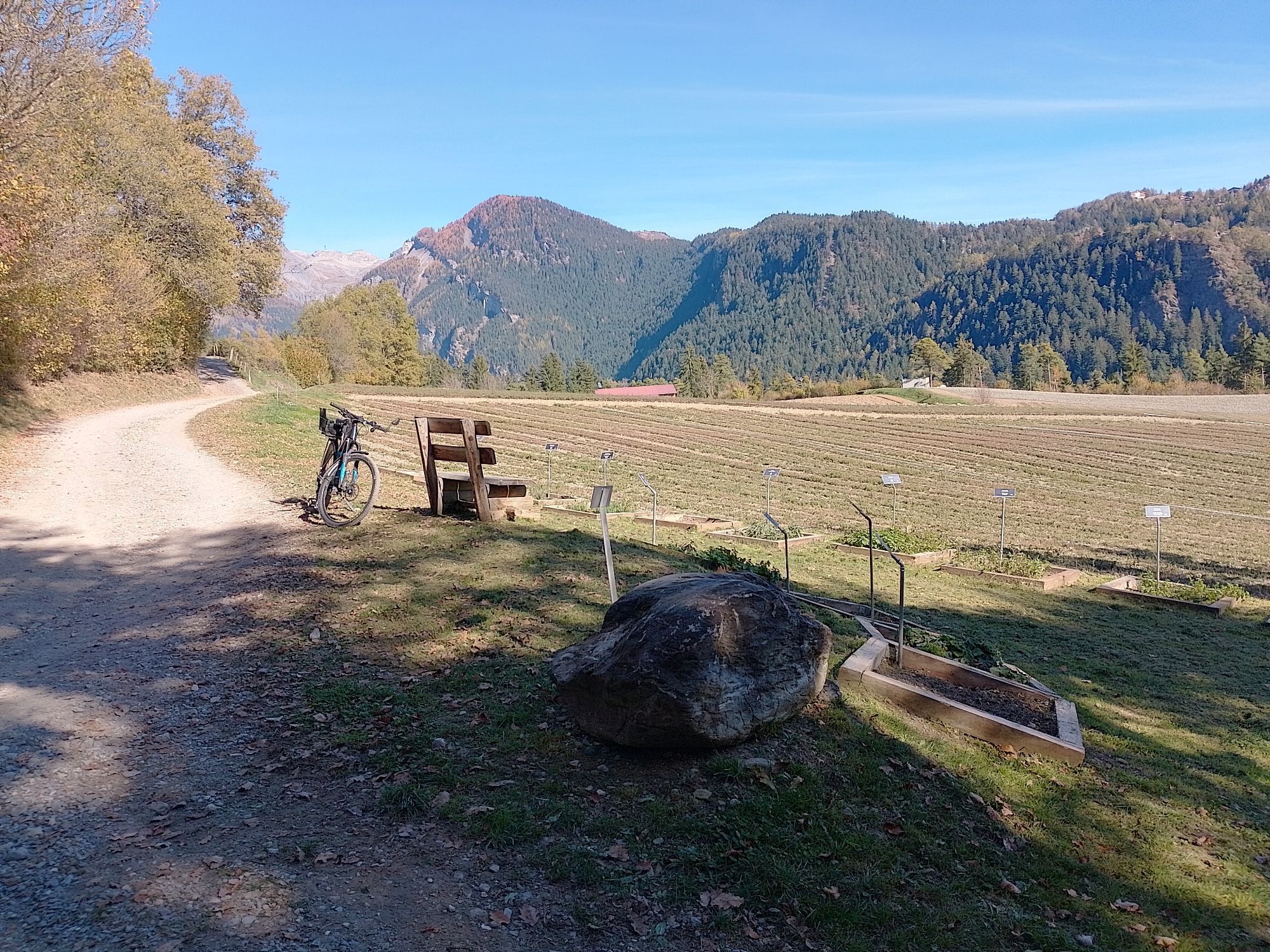
The Tulipe Bike route starts at the Cable Car plaza, offering a panoramic view of the surrounding mountains. Crossing the mayens of Gô, you will be immersed in a landscape of traditional chalets surrounded...
The Tulipe Bike route starts at the Cable Car plaza, offering a panoramic view of the surrounding mountains. Crossing the mayens of Gô, you will be immersed in a landscape of traditional chalets surrounded by alpine meadows, before descending into the picturesque Arbaz valley. The descent towards Arbaz via Planège reveals a beautiful picnic area surrounded by nature. Continuing through the villages of Blignou, Botyre, and Luc, the route offers views of authentic rural landscapes and breathtaking panoramas, until reaching the locality of the Giettes. The climb back to Anzère via the forest road allows you to enjoy the scents and tranquility of the alpine forest, thus completing a route rich in natural beauty.



The Cable Car plaza will be the starting point of the Tulipe Bike route. It then crosses the mayens of Gô to enter the Arbaz valley. From there, descend to Arbaz via Planège where there is a magnificent picnic area. The rest of the route passes through the villages of Blignou, Botyre, and Luc until the place called Giettes. Climb back to Anzère via the forest road.
Our recommendations: technically impeccable mountain bike, helmet, gloves and bell, suitable clothing depending on the weather, rain protection, drink and snacks.
Prepare your mountain bike outing
Follow only marked paths and roads as well as appropriate signs. Always close gates and enclosures behind you. Respect hikers as well as flora and fauna. Hikers generally have priority. Properly assess your physical condition and capabilities. Use of different routes is always at your own risk.
Exit no. 27 $ion-East then direction Ayent/Anzère
Access by PostBus from Sion towards Anzère Cable Car. Remember to reserve your mountain bike space using the SBB mobile app or on cff.ch.
Paid parking at the Anzère Cable Car
S2
This activity is offered to you by Anzère Tourism. Valais/Wallis Promotion is not responsible for the content provided.
Anzère Tourism website

Webové kamery z prohlídky
Oblíbené prohlídky v okolí
-
4.2
Grand Bisse de Lens
světloTuristika 8.73 km -
4.5
Tour de l'éboulement des Diablerets
světloTuristika 6.52 km -
4.6
Lauenen - Höji - Bühlhaus Lauenensee
středníTuristika 9.03 km -
4.0
Tripon - Brac – Ancien Bisse du Torrent Neuf – St. Marguerite – Torrent Neuf – Prafirmin - St. Germain
světloTuristika 12.9 km -
5.0
Grand bisse d’Ayent
středníTuristika 11.7 km -
5.0
Family-friendly Tsittoret bisse
světloTuristika 7.14 km -
4.0
Belvédère via ferrata
středníVia ferrata 1.81 km -
4.0
Around the Tseuzier Reservoir
světloTuristika 4.58 km -
5.0
Wildstrubel Umrundung 4-Tage
středníTuristika 79.1 km -
5.0
Lapis de Zanfleuron
středníTuristika 9.64 km
Pěší turistika a stopování


Nenechte si ujít nabídky a inspiraci pro vaši příští dovolenou
Vaše e-mailová adresa byl přidán do poštovního seznamu.


