


Altissimo - Tour
Fotografie našich uživatelů
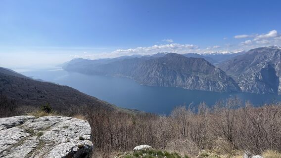
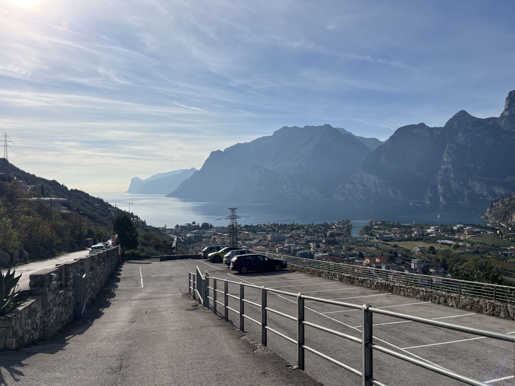
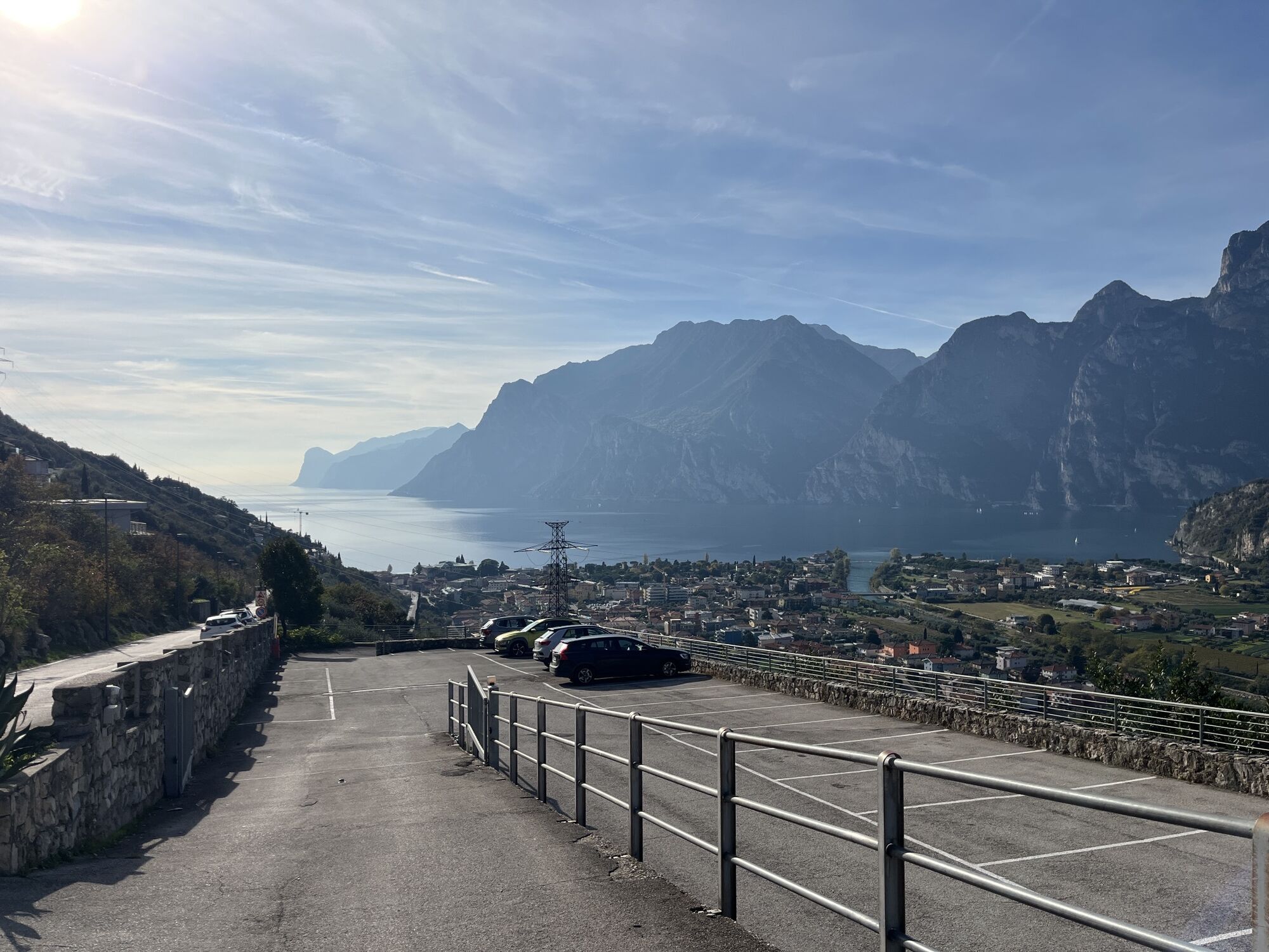
 © Mauro Caldonazzi 1Vytvořeno dne 03.04.2025
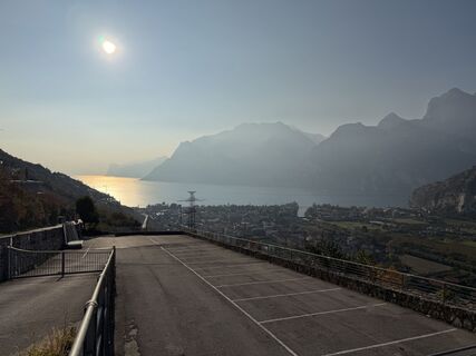
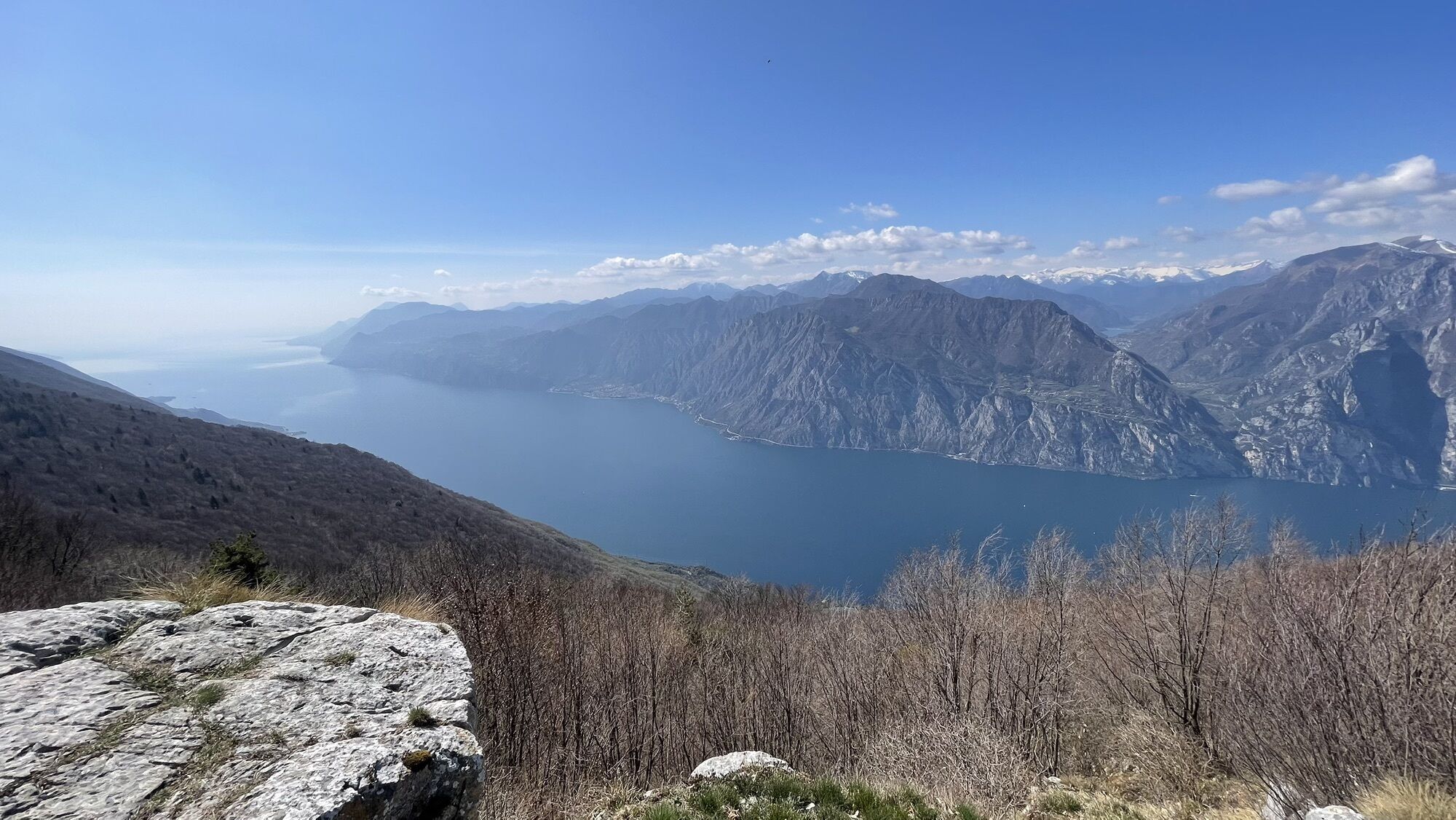
 © Stefano “Iddo”Vytvořeno dne 08.11.2025
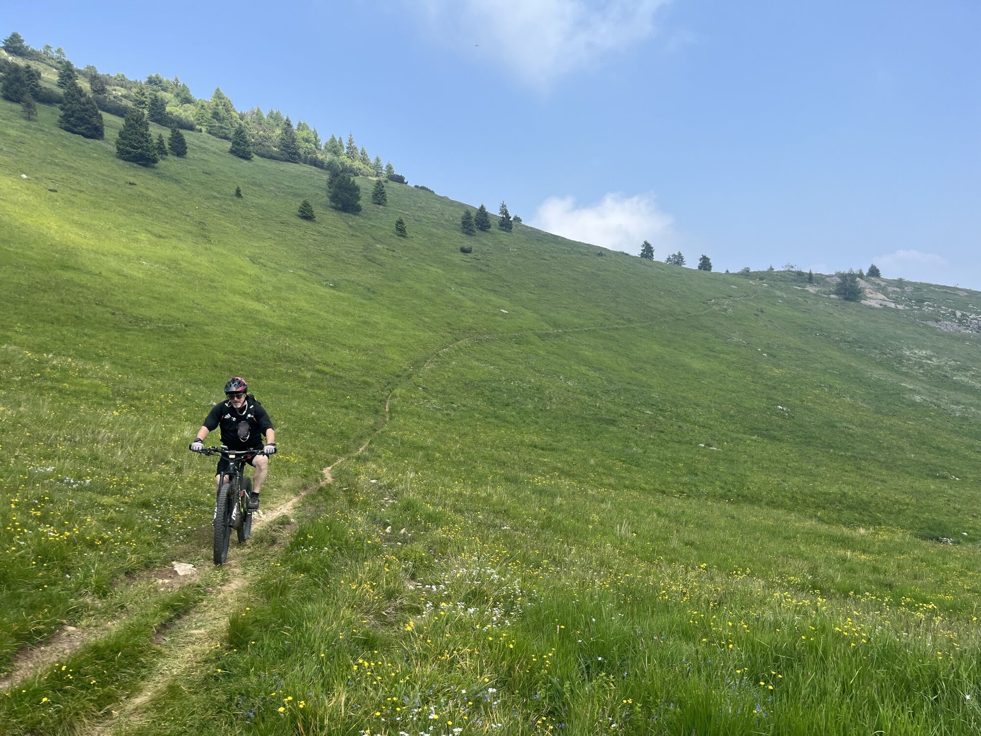
 © Alexander Herrmann 2Vytvořeno dne 15.10.2025
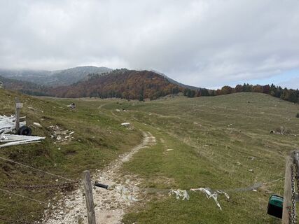 © Alexander Herrmann 2Vytvořeno dne 15.10.2025
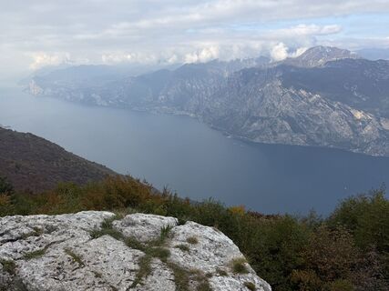 © Alexander Herrmann 2Vytvořeno dne 15.10.2025
 © Alexander Herrmann 2Vytvořeno dne 15.10.2025
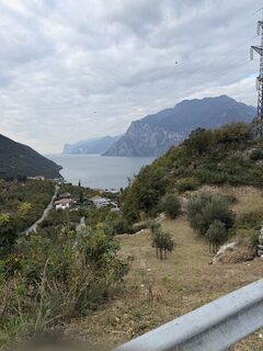 © Alexander Herrmann 2Vytvořeno dne 15.10.2025
 © Petra PoslusnyVytvořeno dne 24.08.2025
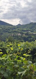 © Petra PoslusnyVytvořeno dne 24.08.2025
 © Gianberto ZilliVytvořeno dne 11.07.2025
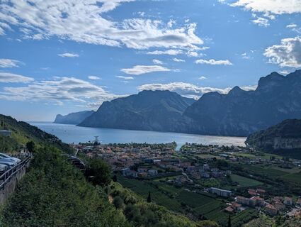
 © GfechterVytvořeno dne 09.07.2025
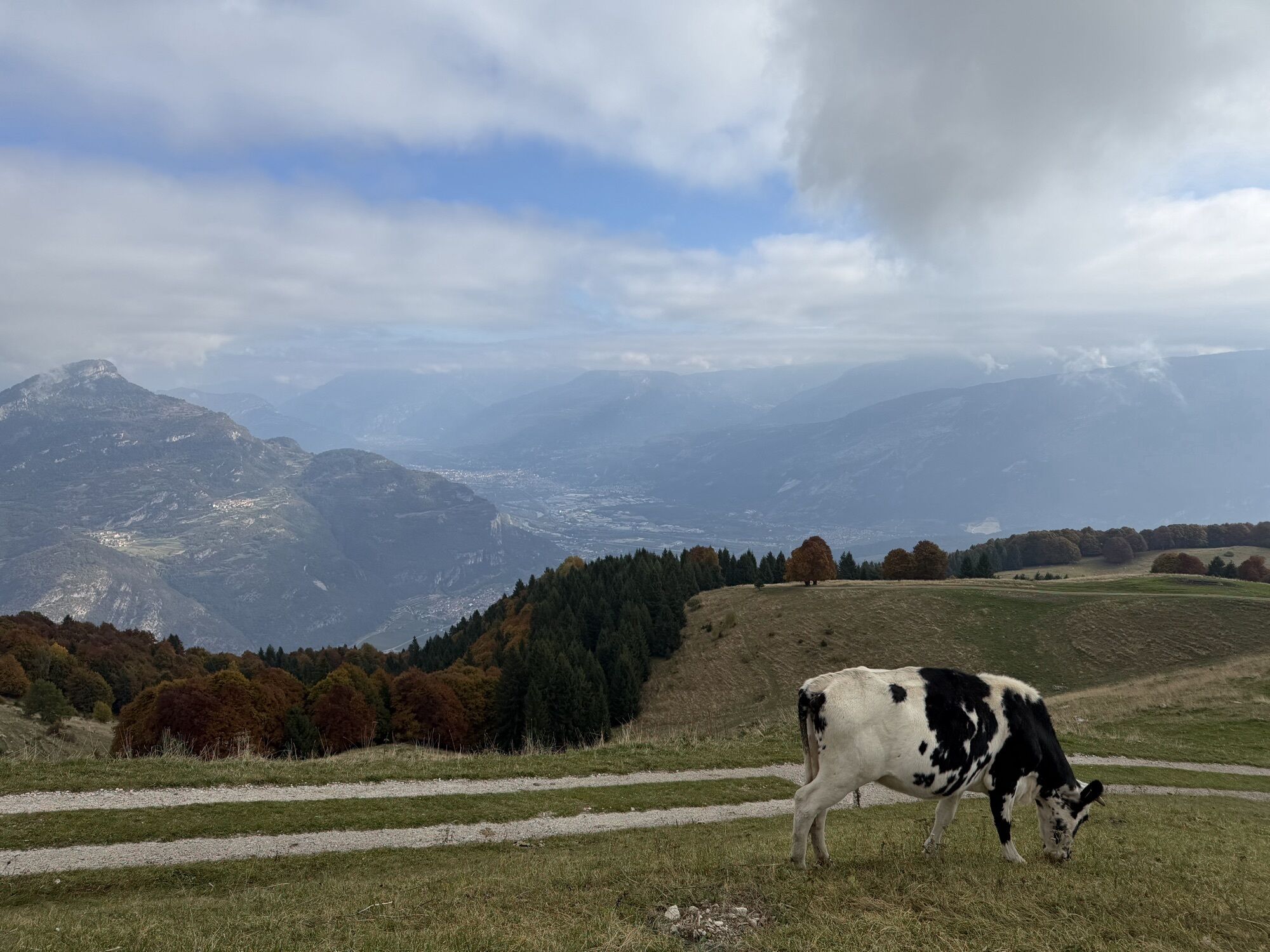
 © Heinz SperlVytvořeno dne 23.06.2025
 © Heinz SperlVytvořeno dne 23.06.2025
 © Heinz SperlVytvořeno dne 23.06.2025
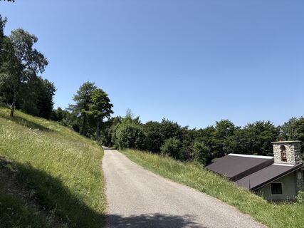 © Heinz SperlVytvořeno dne 23.06.2025
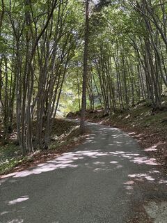 © Heinz SperlVytvořeno dne 23.06.2025
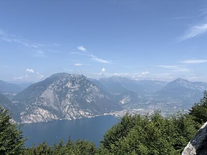 © Heinz SperlVytvořeno dne 23.06.2025
 © Heinz SperlVytvořeno dne 23.06.2025
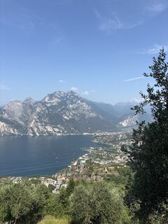 © Heinz SperlVytvořeno dne 23.06.2025
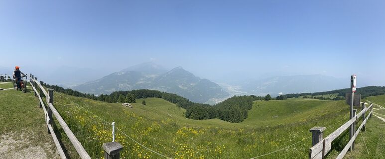 © Stefano “Iddo”Vytvořeno dne 12.06.2025
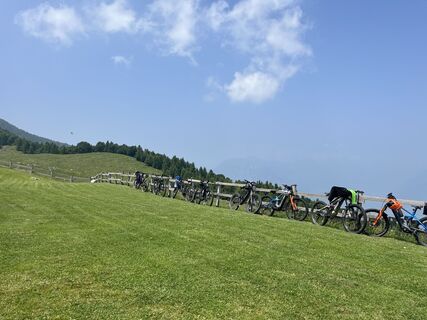 © Stefano “Iddo”Vytvořeno dne 12.06.2025
 © Stefano “Iddo”Vytvořeno dne 12.06.2025
 © Stefano “Iddo”Vytvořeno dne 12.06.2025
 © Stefano “Iddo”Vytvořeno dne 09.11.2024
 © Stefano “Iddo”Vytvořeno dne 09.11.2024
 © Mauro Caldonazzi 1Vytvořeno dne 03.04.2025
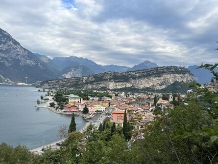
 © fehaeu-gerhartVytvořeno dne 20.09.2024
 © fehaeu-gerhartVytvořeno dne 20.09.2024
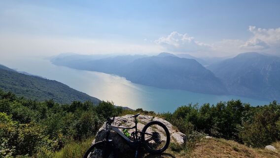
 © Daniël van der MaarlVytvořeno dne 10.08.2024
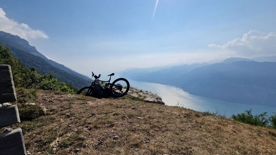 © Daniël van der MaarlVytvořeno dne 10.08.2024
 © SkiprofiVytvořeno dne 27.07.2023
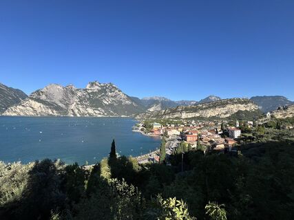
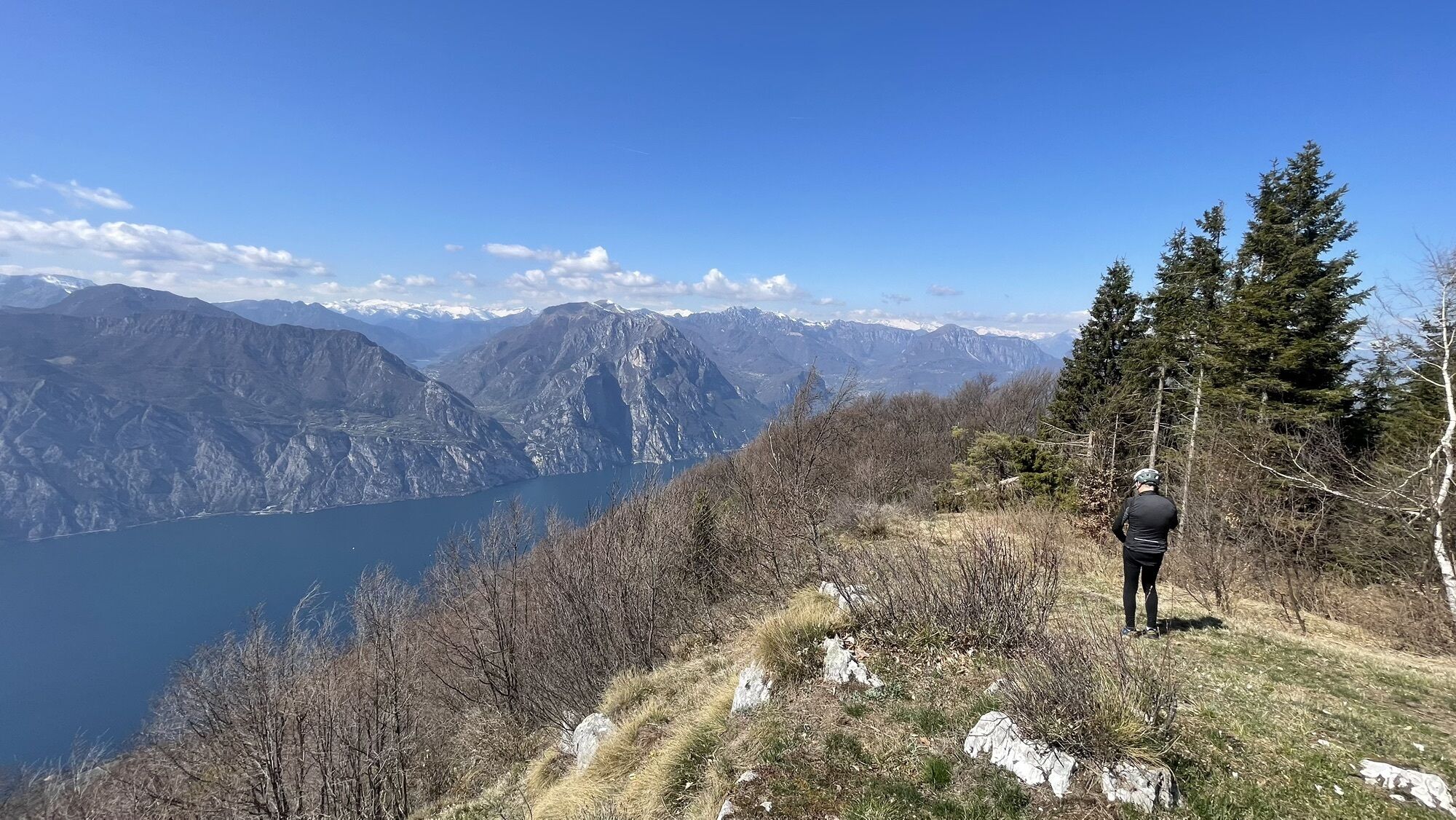
 © Wiesiek WVytvořeno dne 06.09.2025


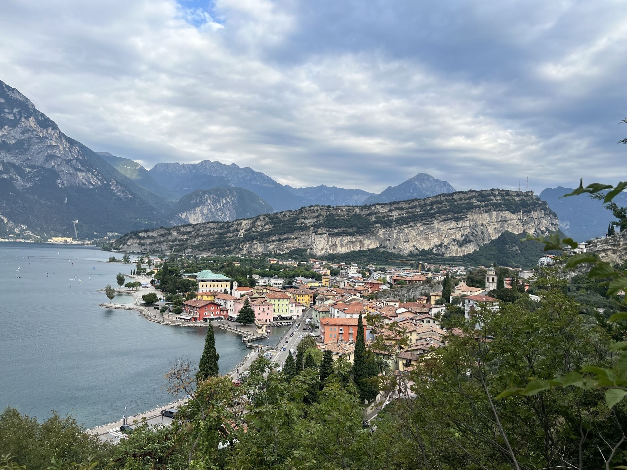
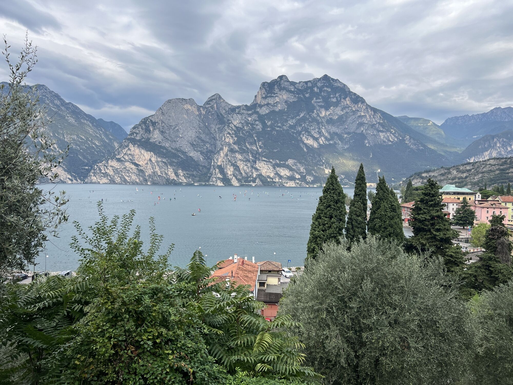
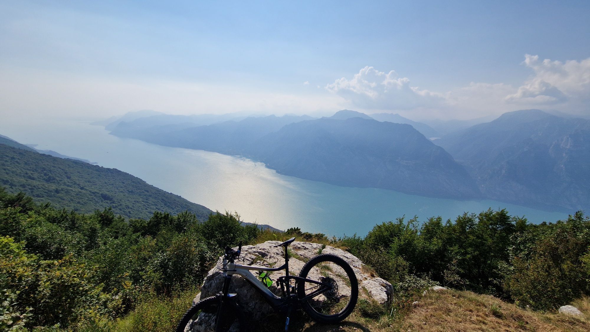
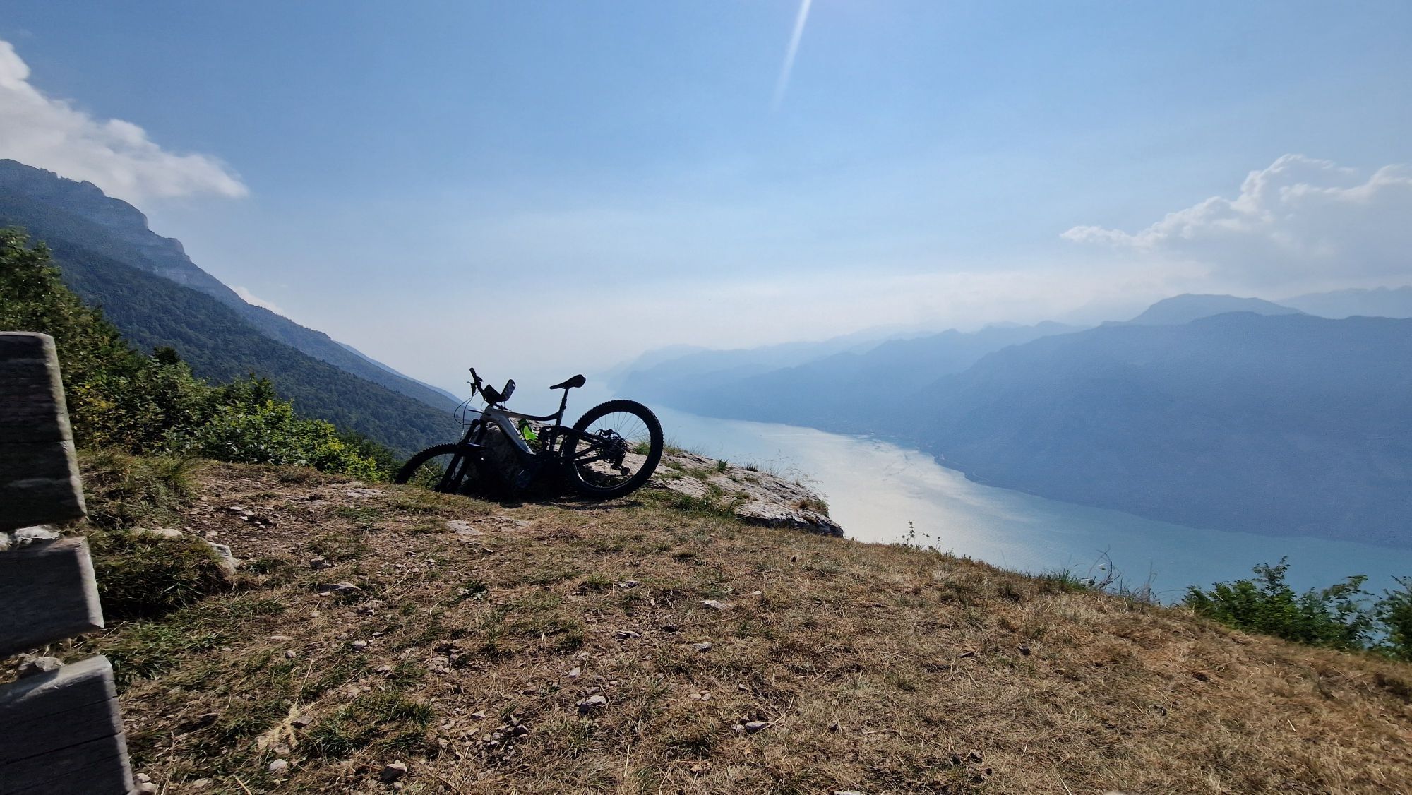
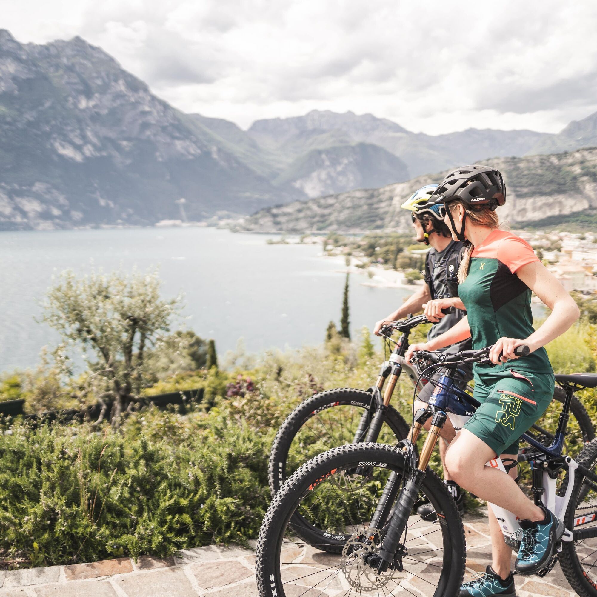
Signage: 765. Altissimo - Tour
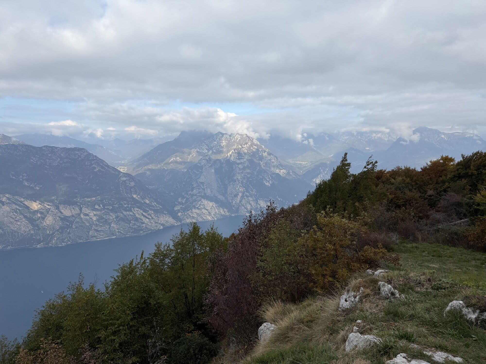
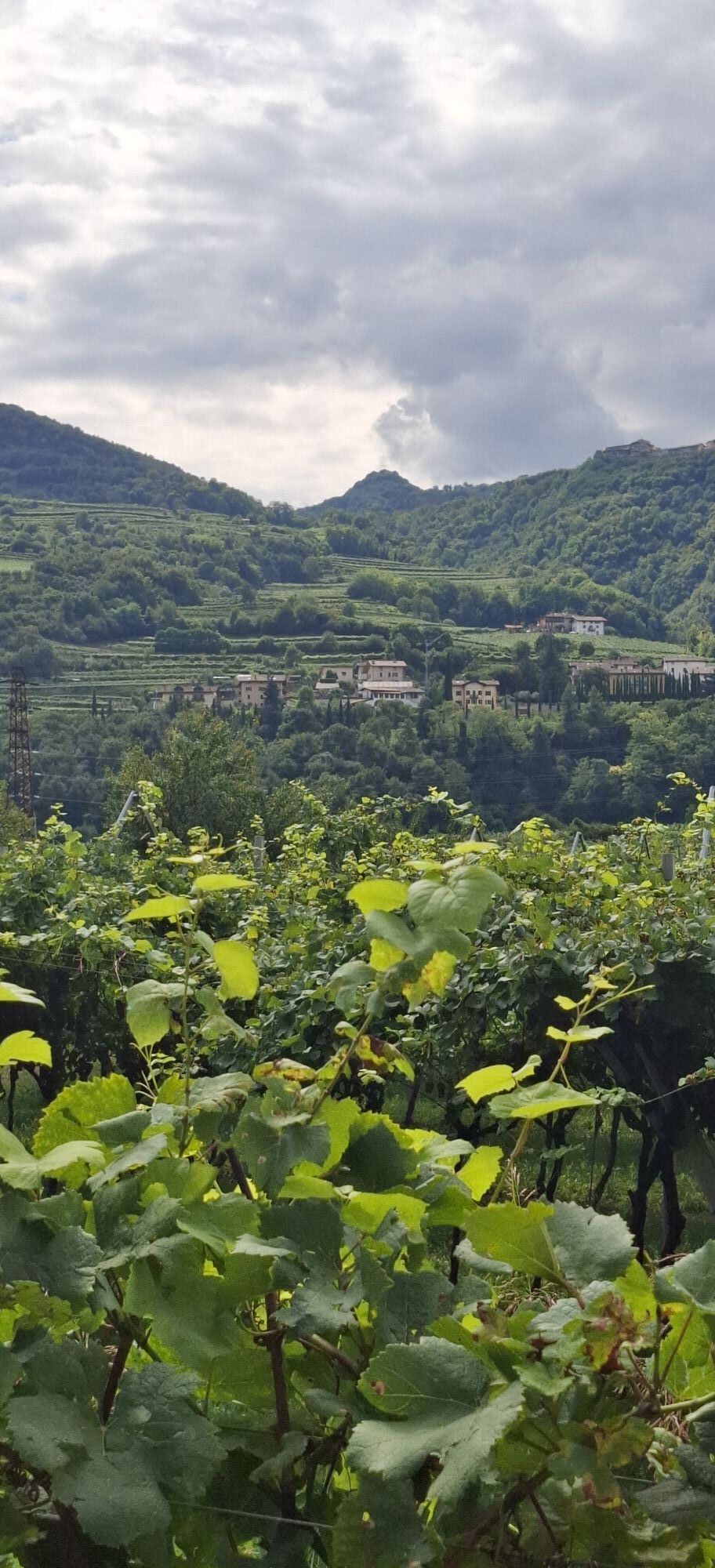
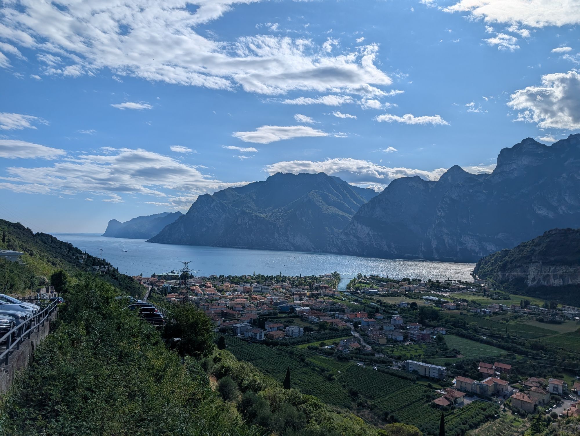
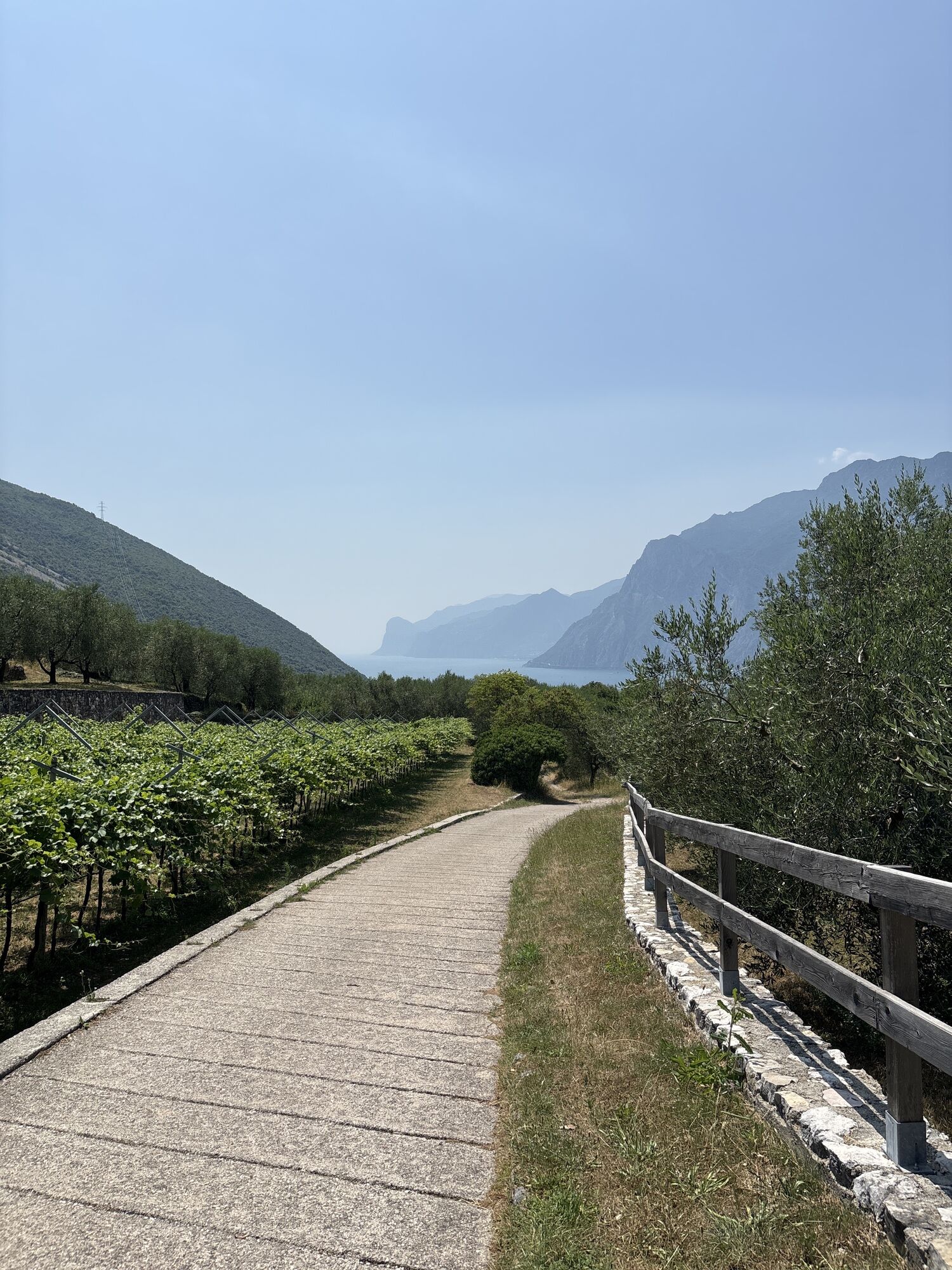
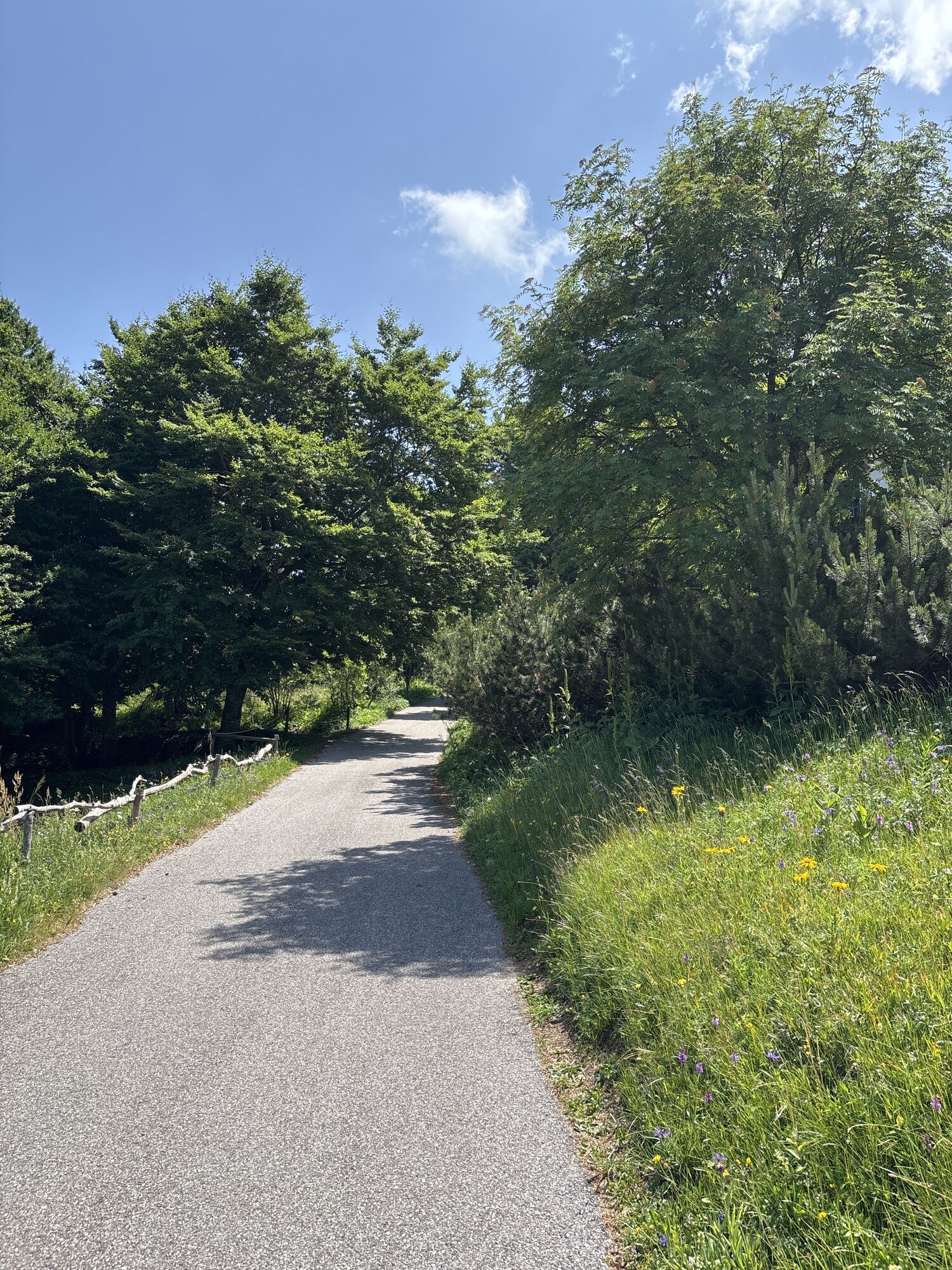
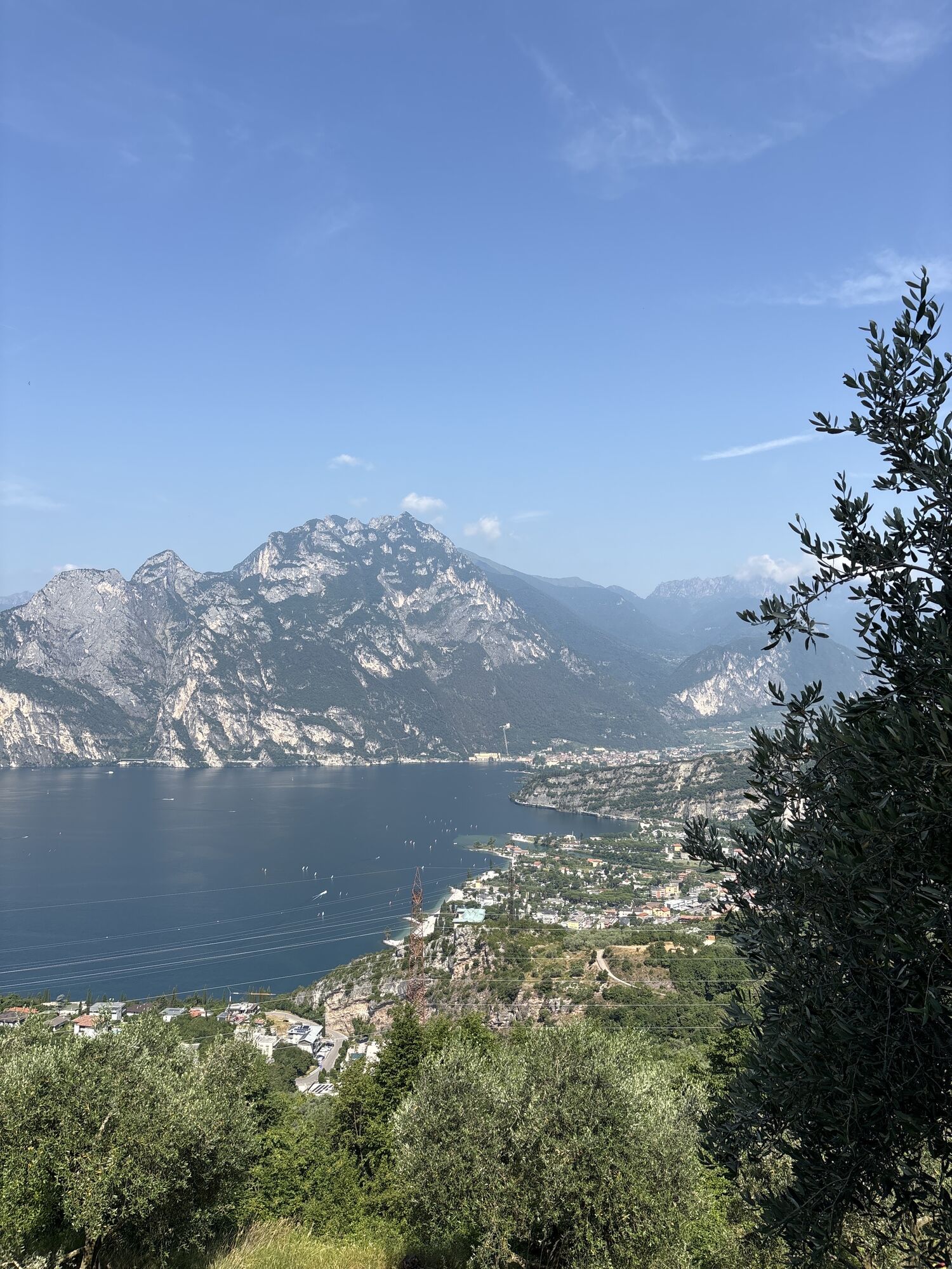
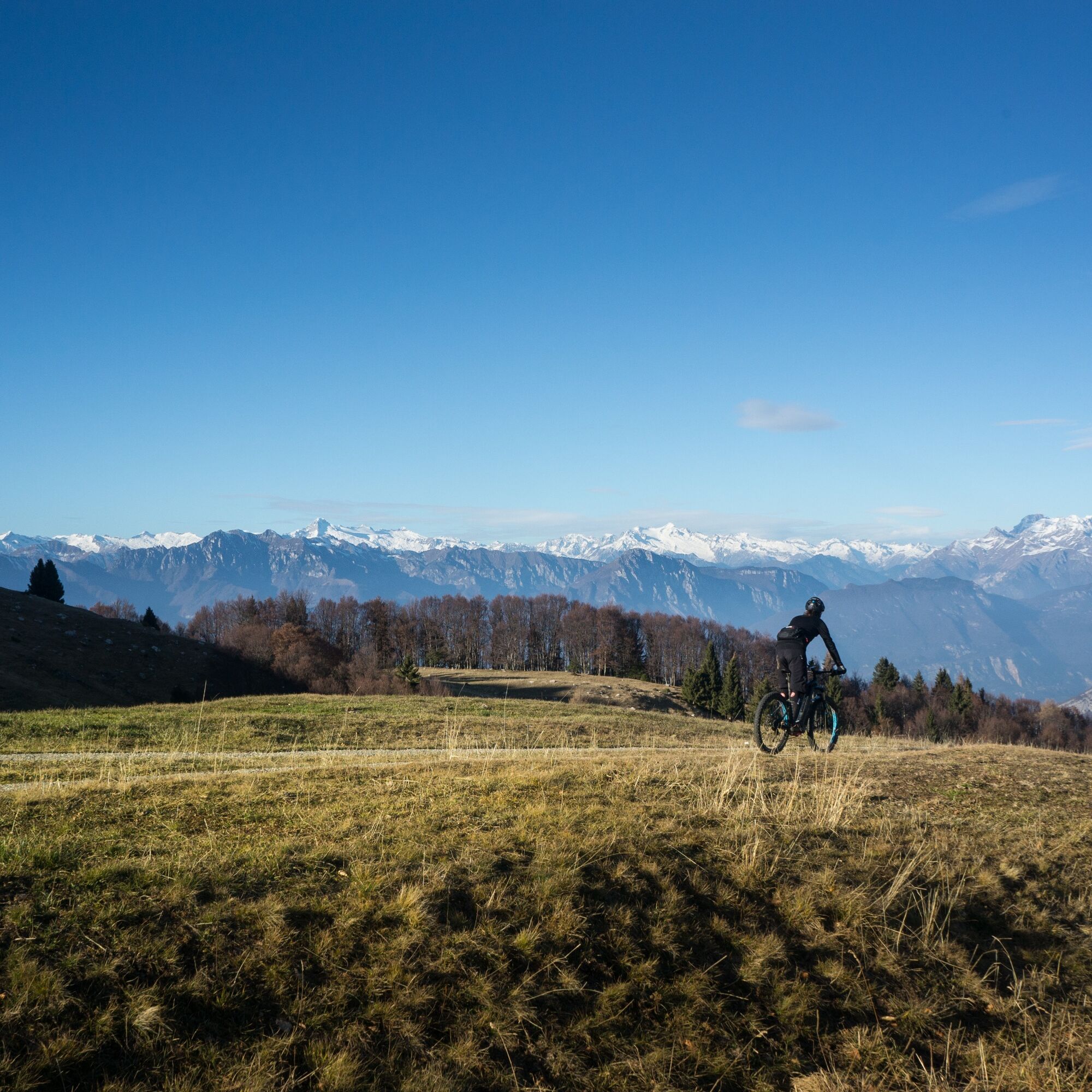
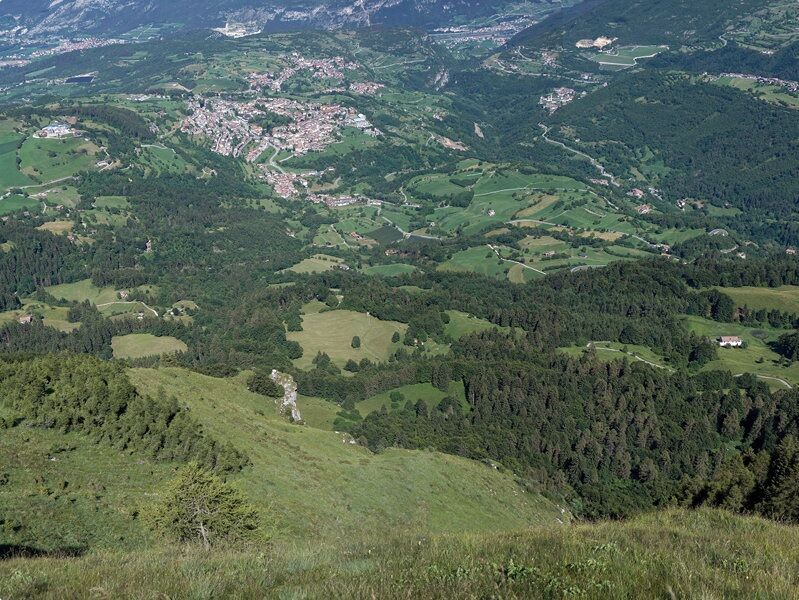
From Torbole you pass through the centre and ride up to Parco delle Busatte, then onto the tarmacked road towards Monte Altissimo. Follow the road, which rises steadily....
Signage: 765. Altissimo - Tour
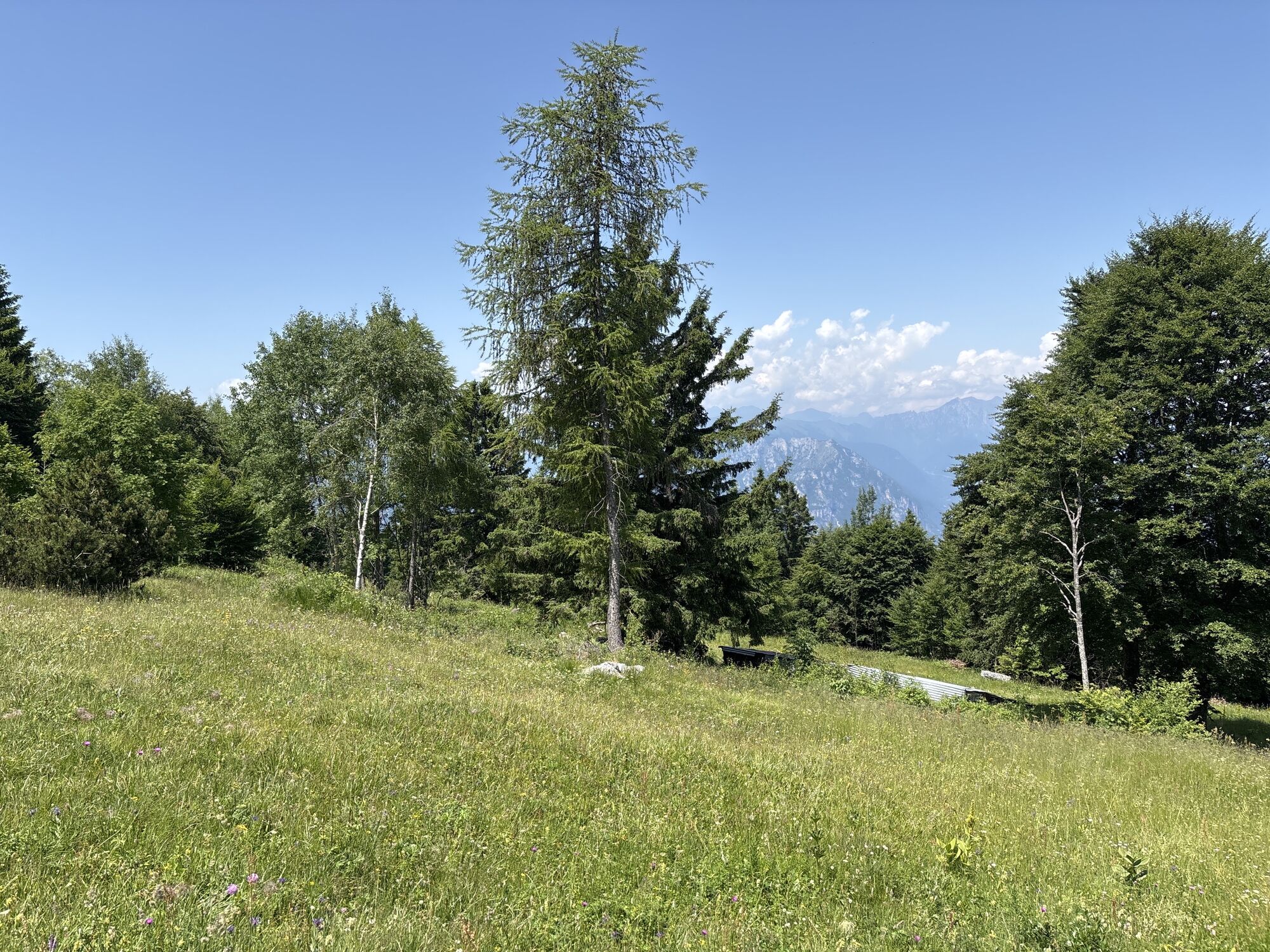
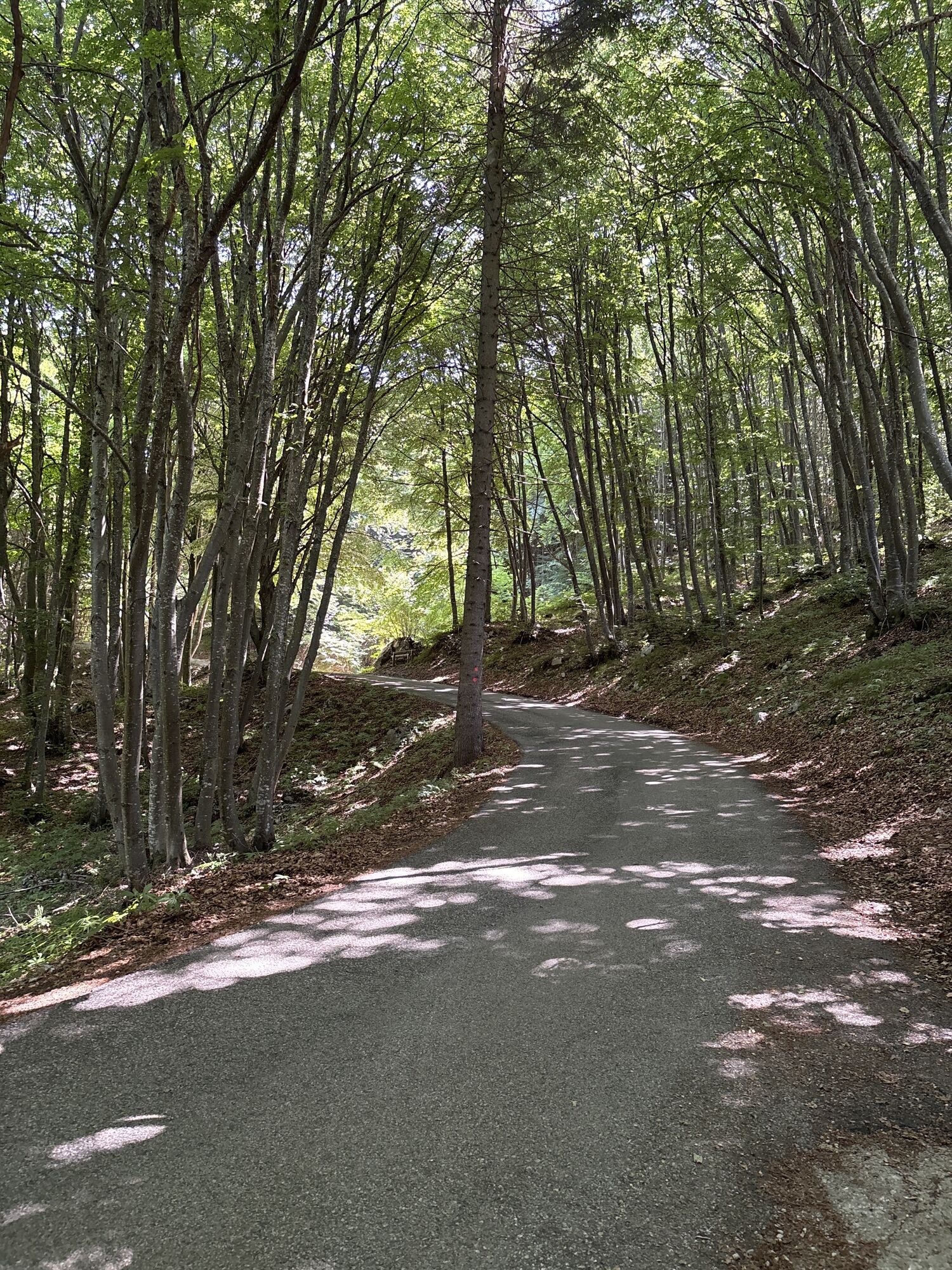
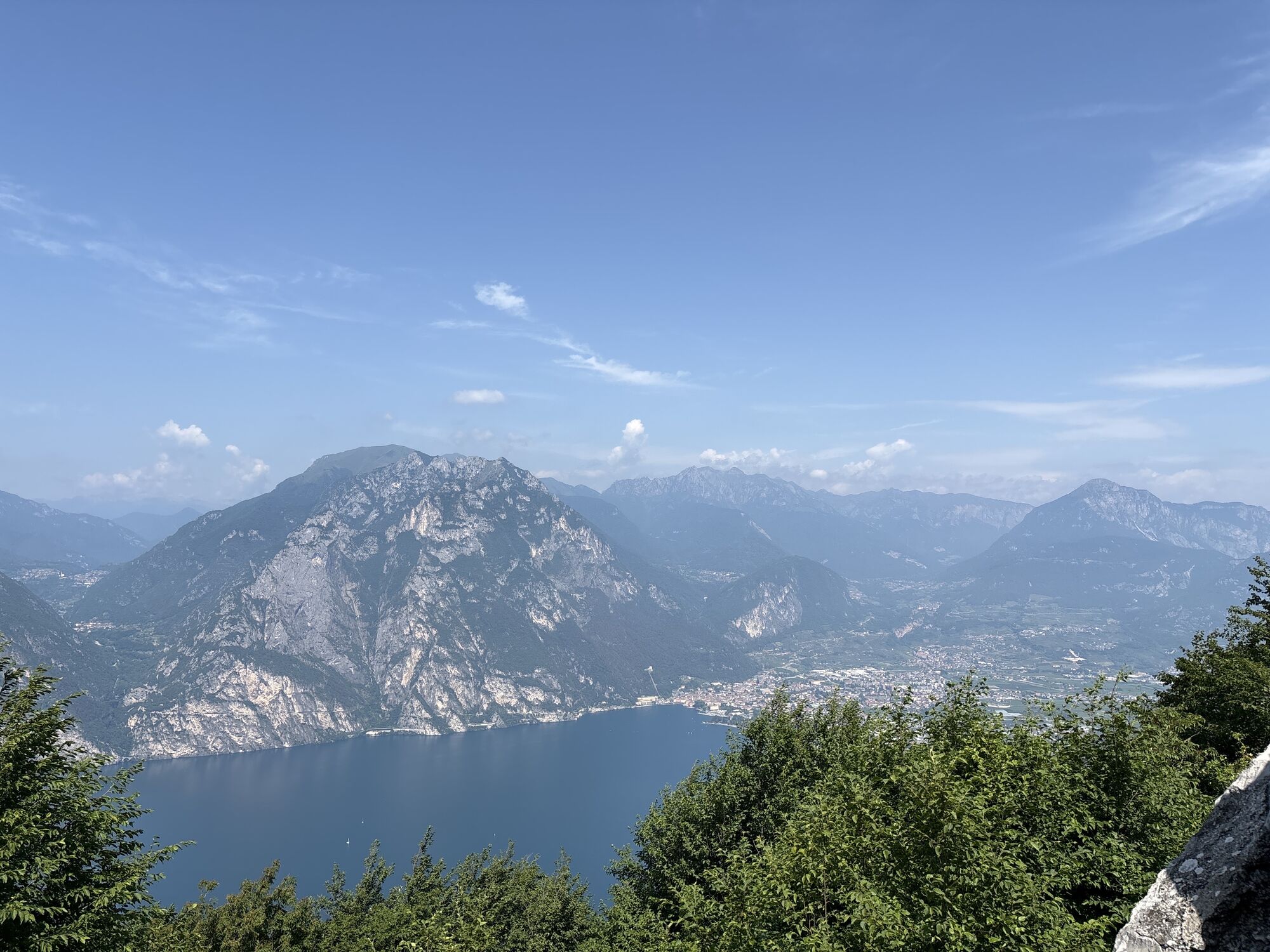
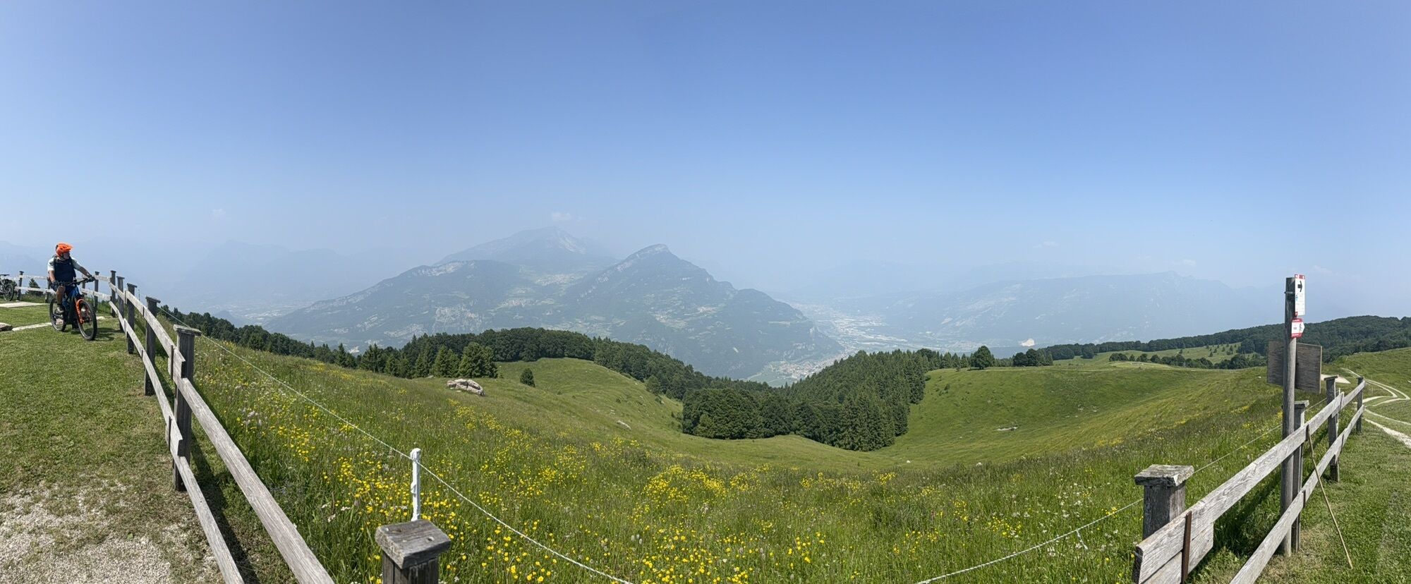
From Torbole you pass through the centre and ride up to Parco delle Busatte, then onto the tarmacked road towards Monte Altissimo. Follow the road, which rises steadily. After 8.5 km, switch to a forest track for about 6 km. An outstanding view of the northern part of Lake Garda makes the long climb more than worthwhile. From the end of the road, there’s another just under 100 metres to climb along a wide hiking trail until you reach to the highest point of the tour: the northeastern ridge of Monte Varagna at 1711 m. The descent begins with an easy trail which soon becomes a forest track down to Malga Campei (where you can stop for refreshments), then continues on a steep forest road to the beautifully situated village of Castione. Alternating between roads and trails, you soon reach the cycle path and follow it to Nago and back to your starting point in Torbole.


The departure point for this route is Piazza Santa Maria al Lago in Torbole. From here take Via Benaco, cross the main road and turn into Via alla Fitta, which runs through the historic centre of the village. Once you come to Piazza Goethe, start the ascent towards the Busatte area along Via Riccardo Pontalti. At the fork turn right anc continue the climb along Via delle Brae until you reach the Busatte park.
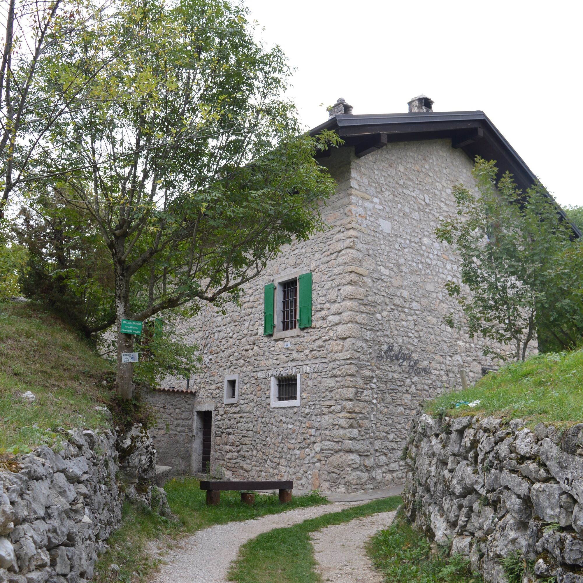
At the car park exit, the signposts for route 765 take you straight onto the steep uphill climb towards Nago. At the end of the cement stretch, follow the clear directions and turn onto the road for Monte Baldo. Stay on this road and pass Malga Zures and Doss Casina.
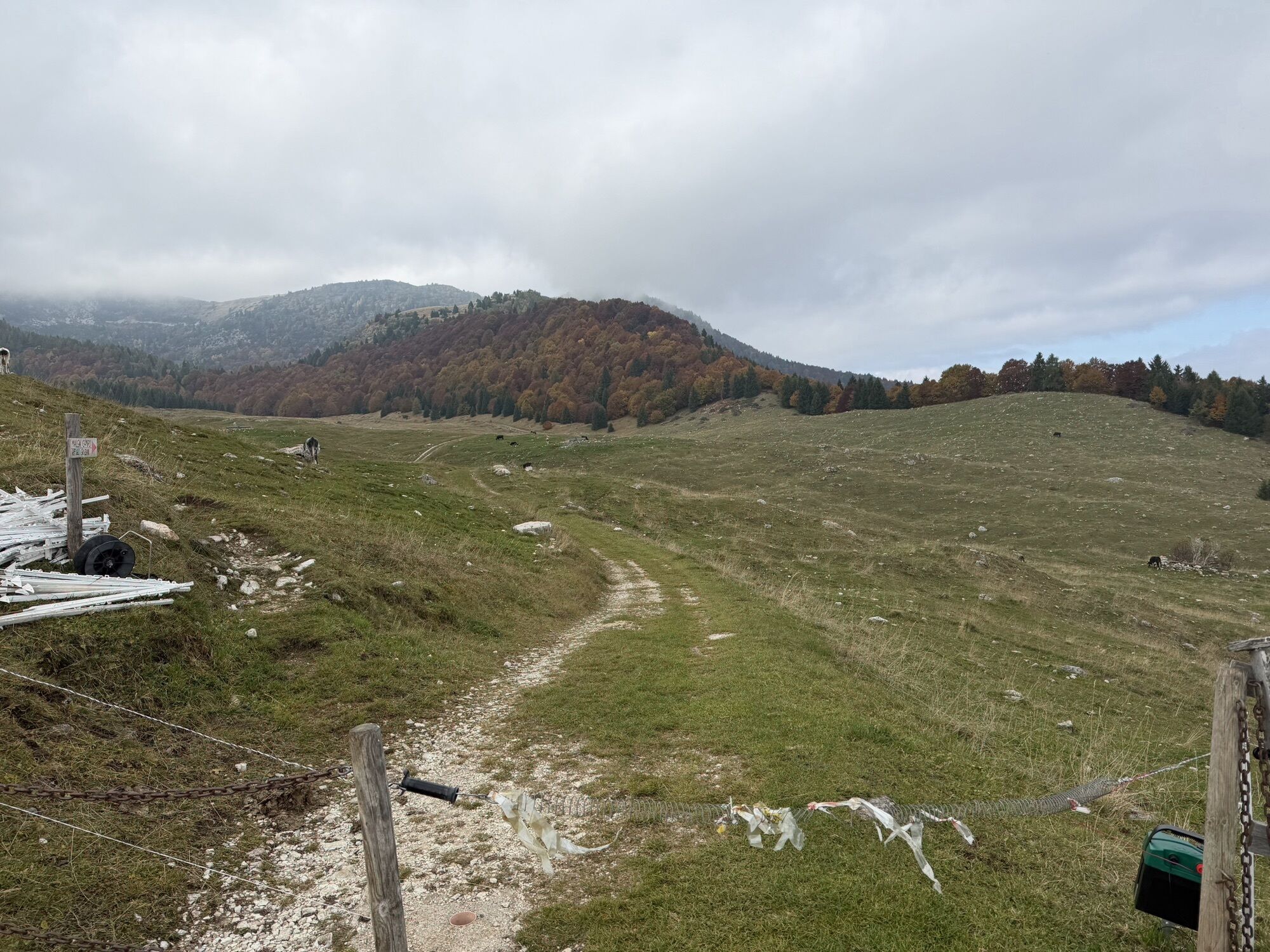
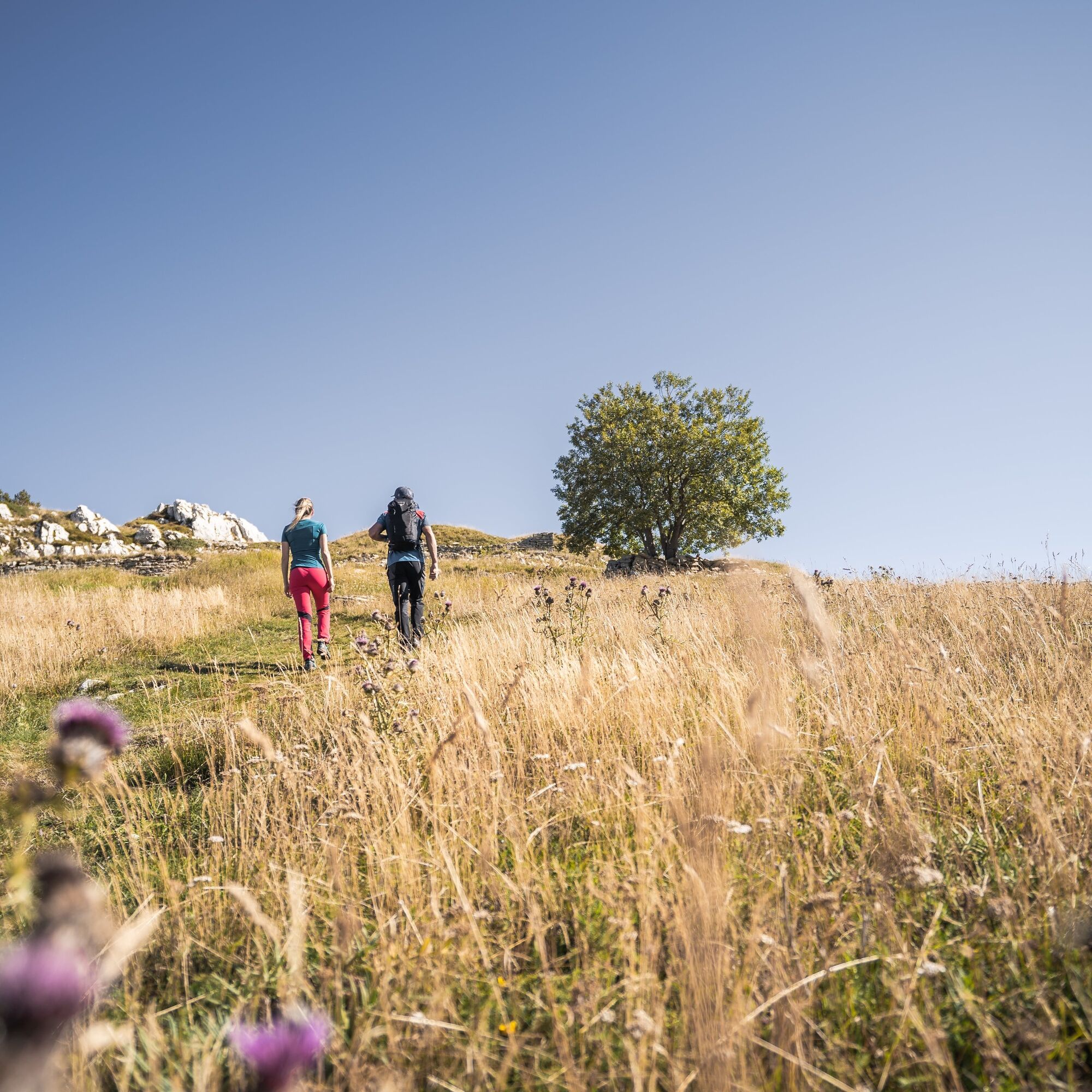
Further along the road you also pass Prati di Nago and a series of steeper bends, until you come to a car park where the paved road ends. Keep on going on the dirt road, follow the forest trail and pass the barrier. When you reach the saddle of Monte Varagna, you come to a fork in the road. Here you follow directions and turn onto a track on the right a little lower down. Directly below Monte Altissimo, you now cross the meadows of the pasture in the direction of Val del Parol. Remember to always close the gates when you enter and leave pastures.
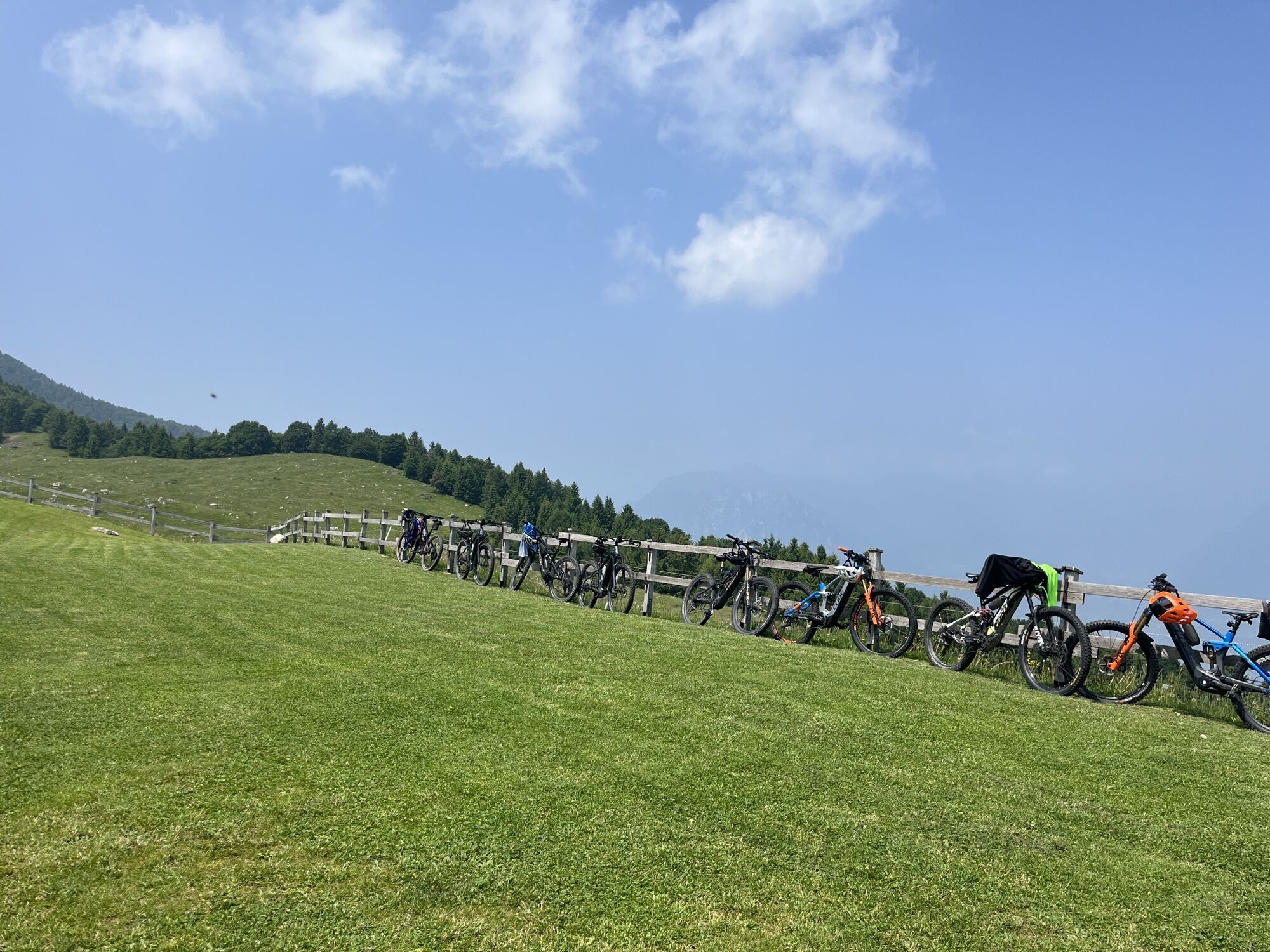
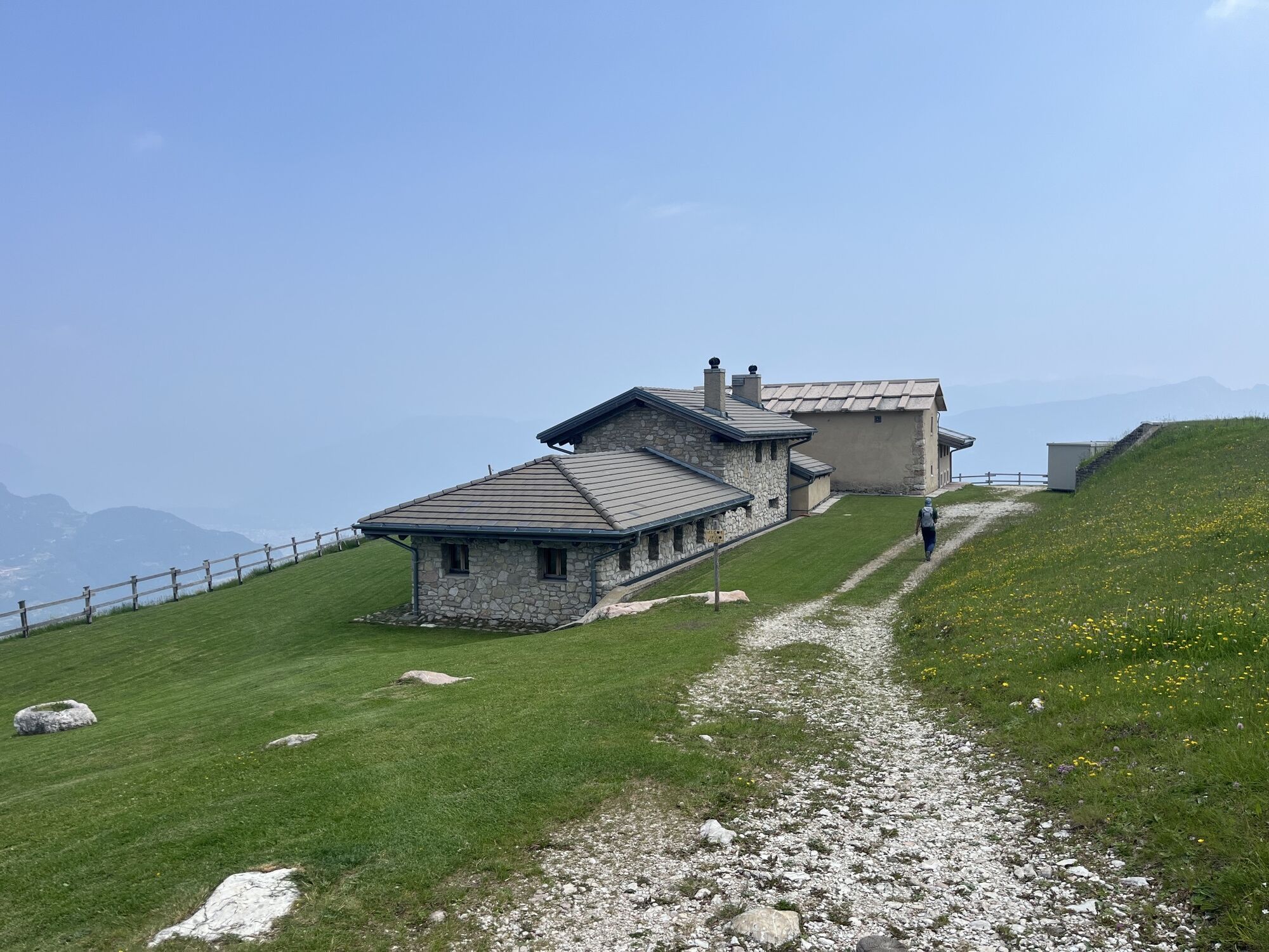
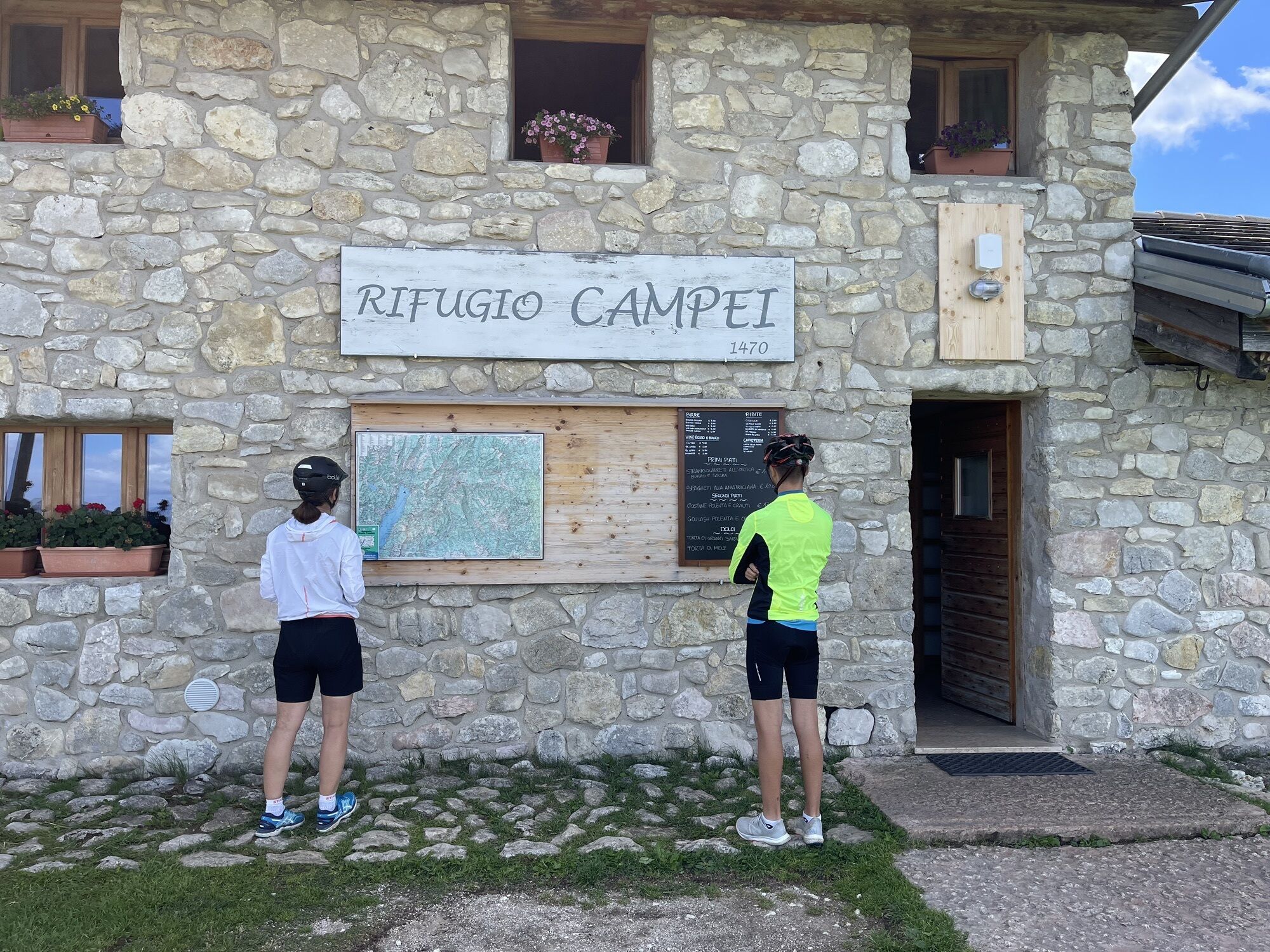
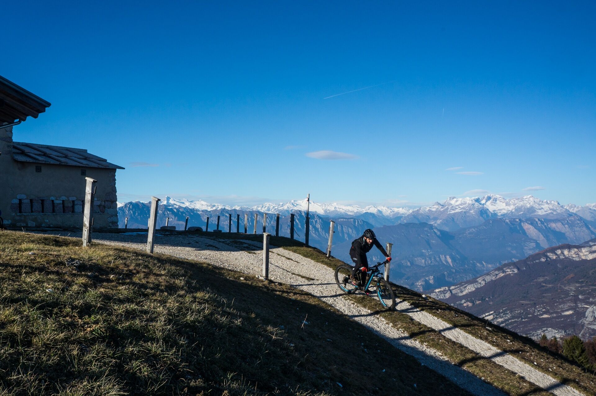
What comes next is the most technical part of the route, not very long, but rather rough going and with some tight bends. When you get to the dirt road which crosses Val del Parol, keep left and ride on through pastures until you come to the mountain hut Rifugio Campei. This is the only refreshment point you will meet on the mountain before you come to the villages on the plateau. Go on past the mountain hut and be sure not to underestimate the steep gradient, limit your speed and pay particular attention to the cemented tracks along the trail, especially when the going is wet.
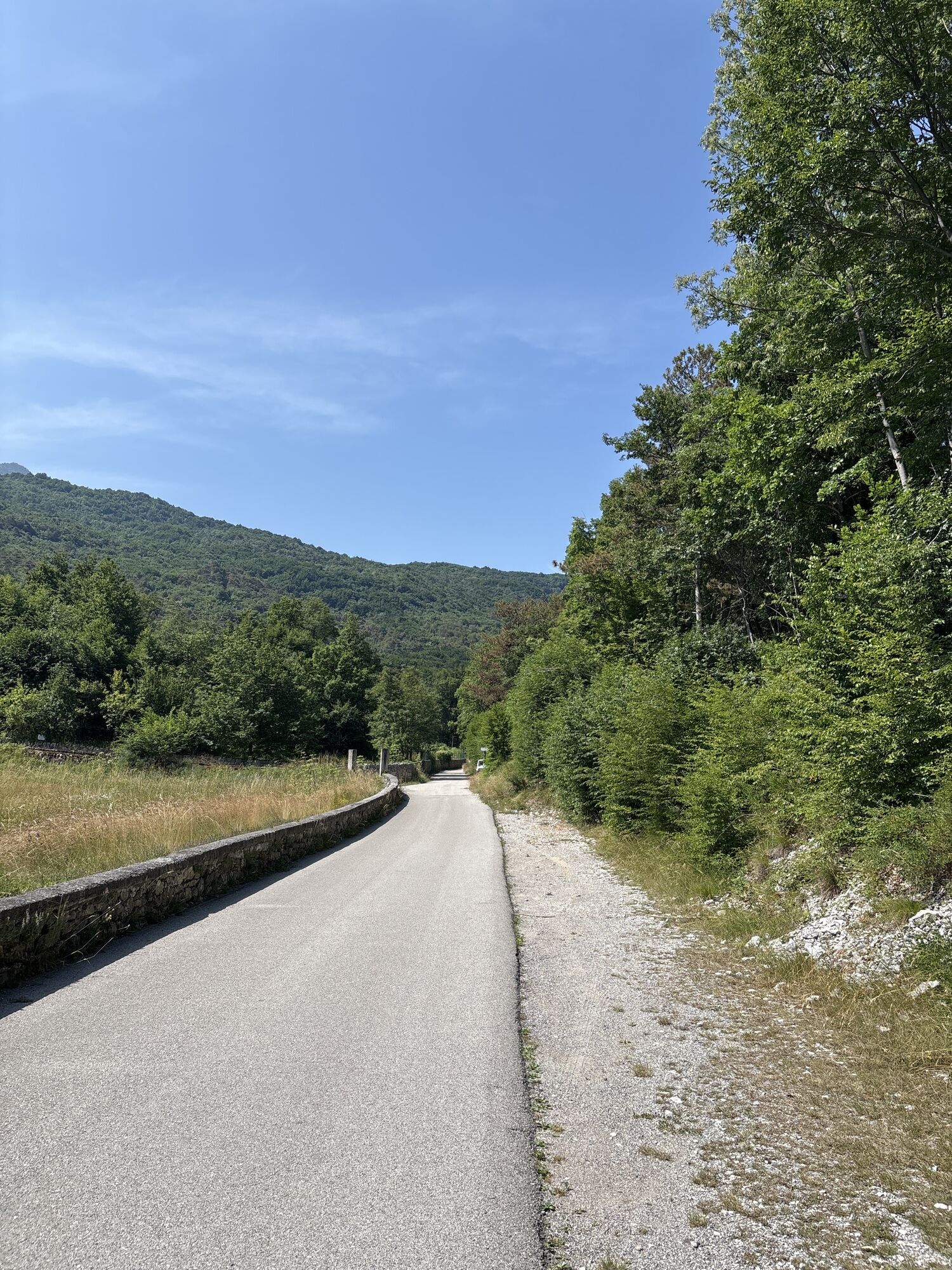
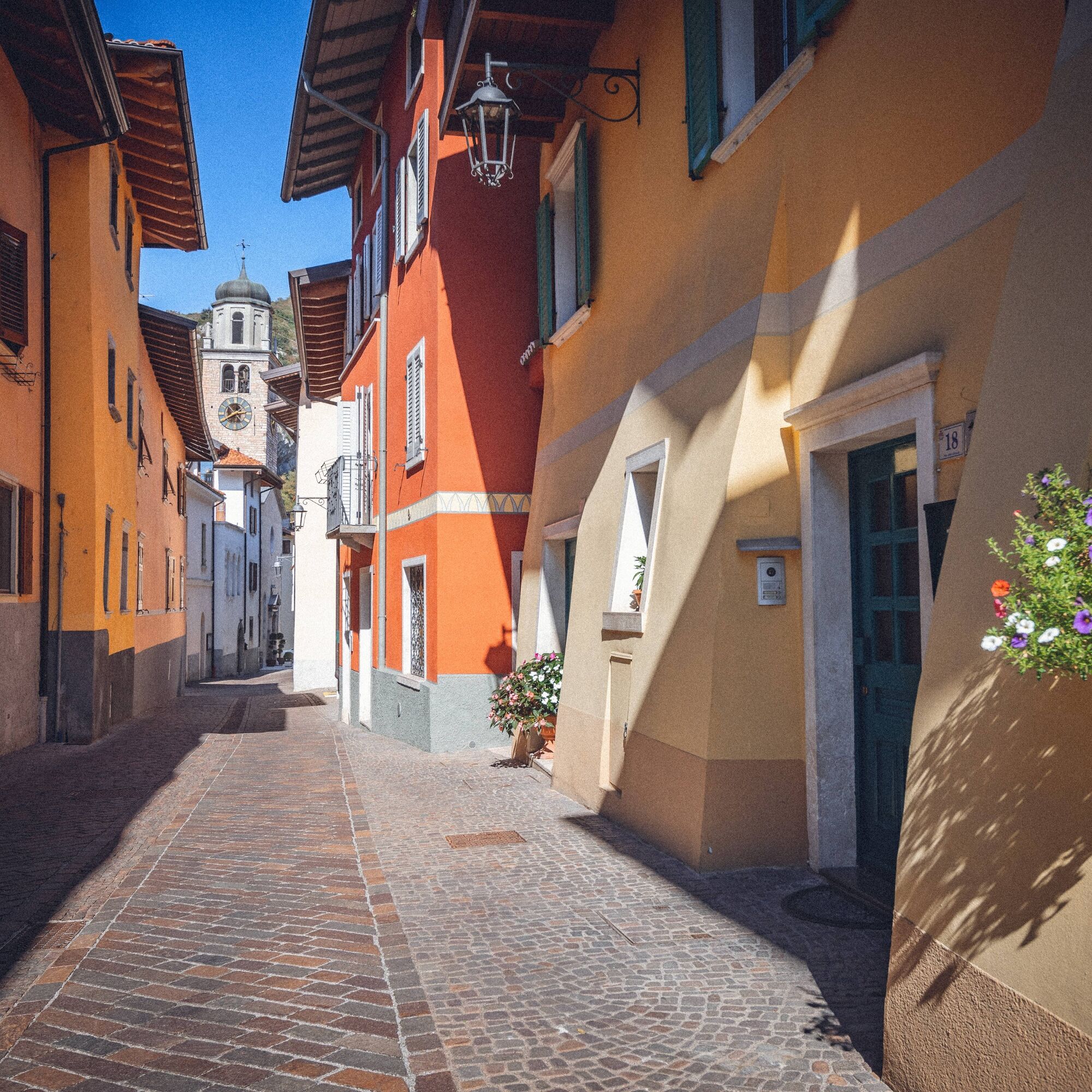
When you come to the Brentegana road, still on a dirt track, follow it downhill until you come to the farms in Festa. From here on, the route follows a paved road towards Brentonico. Shortly before you come to the village, follow directions and take a sharp left on a narrow uphill road. This will take you above the football pitches. Shortly after you pass them, keep right and turn onto a mule track which leads to the ruins of the old castle of Dosso Maggiore, of which only traces remain. Keep left, on a paved road once again, until you come to the village of Castione, heading for the piazza beneath the church. Continue onwards towards Sano where you need to keep left until you come to the valley floor.
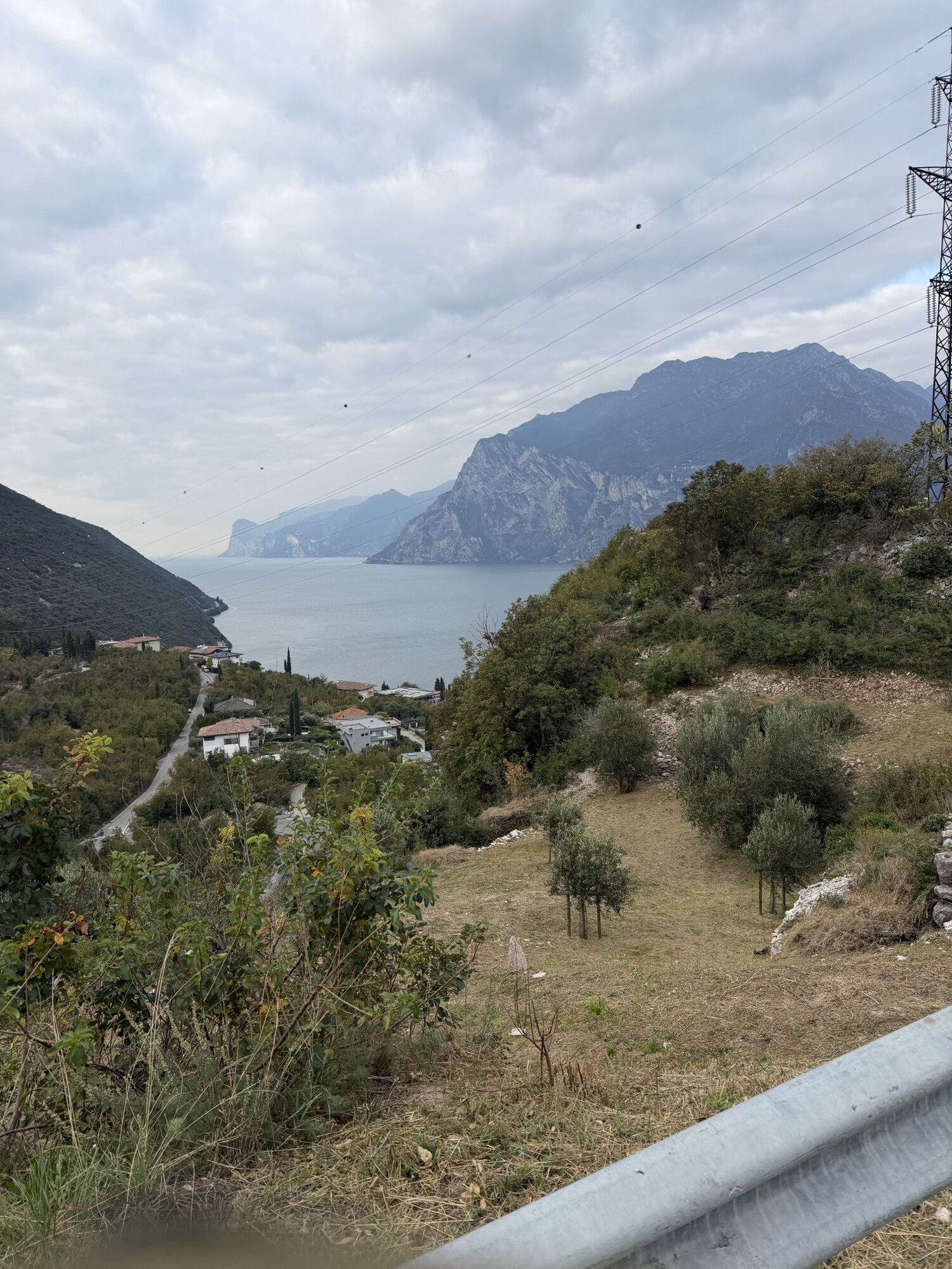
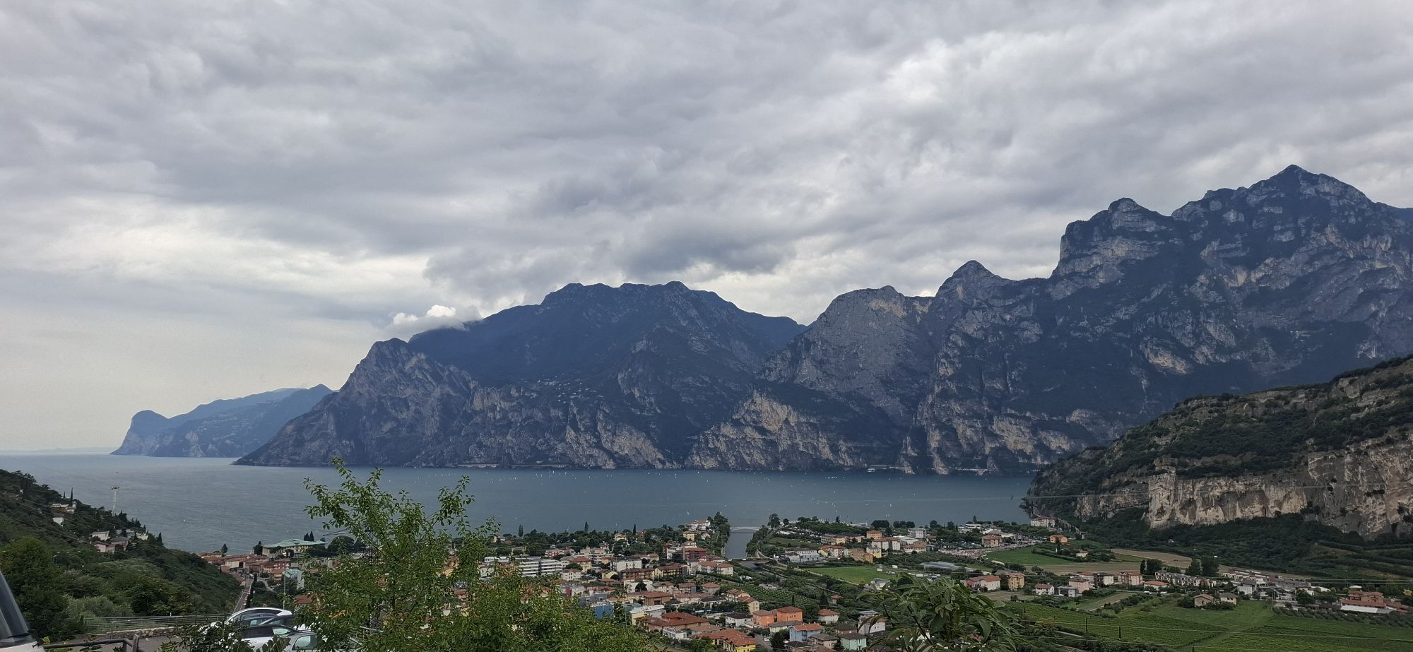
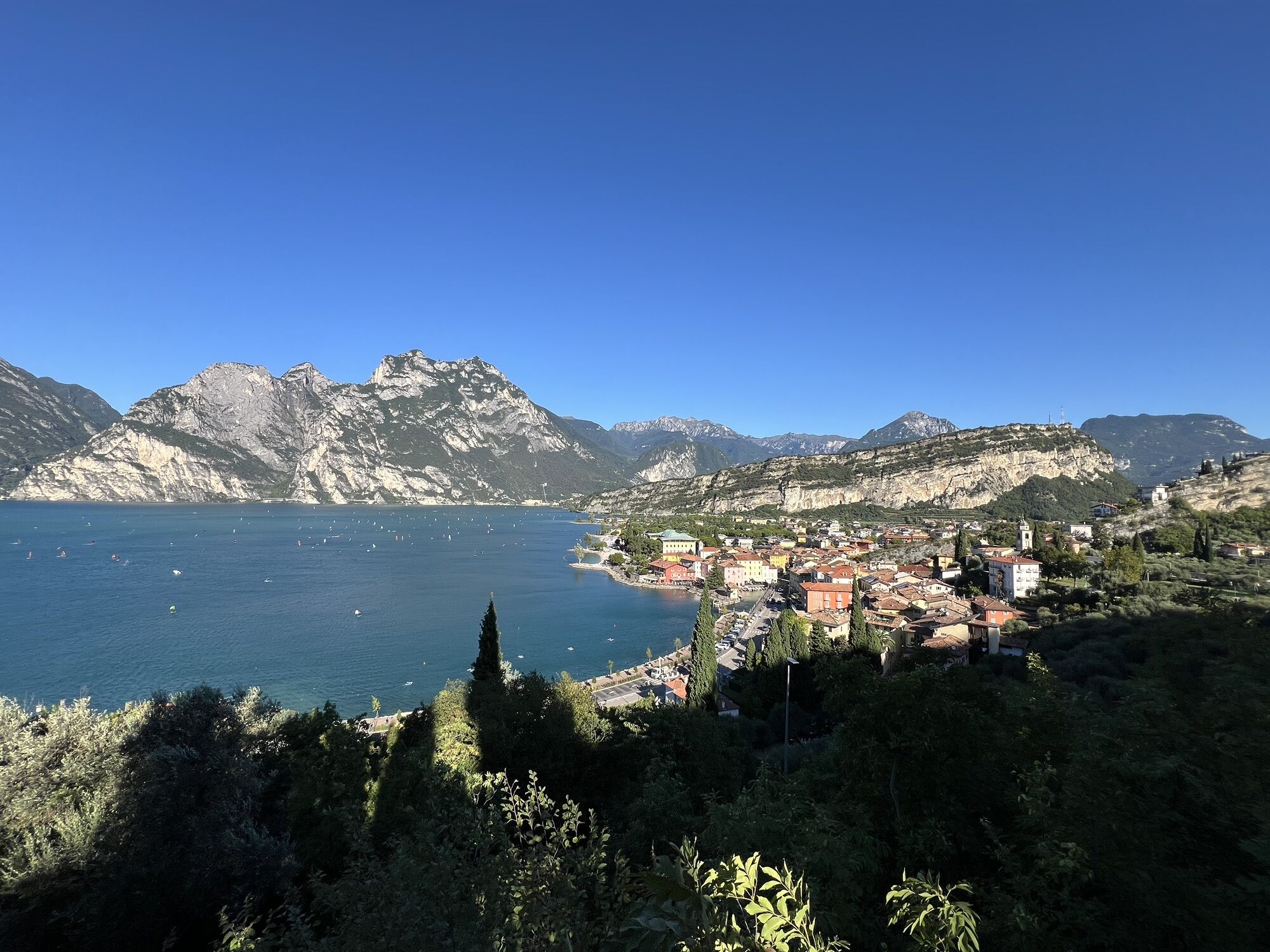
Here you cross the fields and come to the cycle path which runs along the main road. Follow it in the direction of Lake Garda over the Passo San Giovanni and you will come to Nago. Enter the village from Via delle Scuole and cycle on along Via Forni and Via Scipio Sighele until you come to a roundabout. Here, turn left into Via Europa and head for the fort, where the descent along the old road linking Nago and Torbole starts.
Riding your bike requires specific clothing and equipment, even for relatively short and easy trips. It is always better to be prepared… e.g. for bad weather or a sudden drop in your energy levels. The unexpected things are part of the fun!
Remember to thoroughly evaluate the type of route you plan on doing, the locations you intend to cross and the current season. Has it been raining? Attention: The paths may be slippery and require more caution.
What do I need to bring on my bike tour?
An adequate water supply according to your needs (considering temperature, possibility of refuelling and duration of the route) Plenty of snacks (for example, dried fruit or energy bars) Waterproof / Windproof jacket A spare top / spare socks (Descending in a sweaty garment, will make you cold). Suncream Sunglasses Bike gloves/mitts Map or GPS device Bike lights: best placed on your helmet or handlebars. (It is always best to be prepared) Bike repair kit for punctures and mechanical breakdowns First aid kit Emergency whistleIt is always advised to let someone know where you plan to go and how long you expect to be.
Emergency telephone number 112.
ITRS - International Trail Rating System
The ITRS is an objective way to assess trails and routes from a biker’s perspective, evaluating four aspects:
Technical Difficulty: riding skill level needed Endurance: combined effect of length, uphill and downhill Wilderness: amount of planning required based on mobile phone reception, rescue options, water supply and wildlife Exposure: consequences of a fallDiscover more about the ITRS system and check the classification of this tour in the photo gallery.
Safety Tips
Always wear your helmet. Plan your ride. You share the trail with other users. Yield right of way to hikers. Let your speed be determined by your experience. Ride slowly on crowded trails, overtake with politeness and respect. Cycle only on authorized and open trails. Avoid muddy trails in order not to damage them further. Respect public and private property. Always be self-sufficient. Do not cycle solo in remote areas.This information is subject to inevitable variations, so none of these indications are absolute. It is not entirely possible to avoid giving inexact or imprecise information, given how quickly environmental and weather conditions can change. For this reason, we decline any responsibility for changes which the user may encounter. In any case, it is advisable to check environment and weather conditions before setting out.
Find out how to reach Garda Trentino.
The main towns in Garda Trentino - Riva del Garda, Arco, Torbole sul Garda, Nago – are connected by several urban and intercity bus lines which will take you to the starting point of tours or in the immediate surroundings.
You can also get to Riva del Garda and Torbole sul Garda by the public ferry service.
Paid parking: Panorama (Via delle Brae), Goethe (Via Strada Granda), ex Villa Cian (Via Sarca Vecchio), Busatte (Via delle Busatte)Paid parking: Panorama, Via Strada Granda, Lungolago Conca d'Oro.
Are you a fat bike enthusiast? This is the tour for you!
Oblíbené prohlídky v okolí
- 5.0
Bastione and Santa Barbara, the lords of Riva del Garda
středníTuristika 2.94 km - 4.8
Via Ferrata Rio Sallagoni
středníVia ferrata 2.75 km - 4.8
Bocca Fortini - Tour
heavyMountainbike 35.4 km - 4.8
Via Ferrata Fausto Susatti - Cima Capi (from Ledro)
středníVia ferrata 7.11 km - 4.6
Via Ferrata delle Laste e Gallerie di Cima Rocca
světloVia ferrata 6.38 km - 4.6
Walking around Lake Ledro
světloTuristika 9.40 km - 4.7
Sentiero Busatte Tempesta
světloTuristika 7.90 km - 4.6
Colodri Klettersteig (A/B)
Via ferrata 7.50 km - 4.9
Via Ferrata dell’Amicizia - Cima SAT
středníVia ferrata 4.41 km - 4.4
Ferrata via dell'amicizia
středníVia ferrata 11.5 km
Pěší turistika a stopování


Nenechte si ujít nabídky a inspiraci pro vaši příští dovolenou
Vaše e-mailová adresa byl přidán do poštovního seznamu.