


Via Ferrata dell’Amicizia - Cima SAT
Úroveň obtížnosti: C
Fotografie našich uživatelů
 © Finn OettlVytvořeno dne 01.10.2023
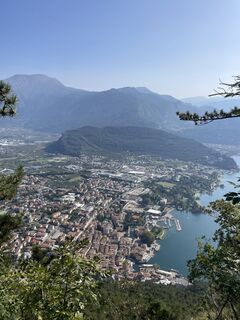 © Finn OettlVytvořeno dne 01.10.2023
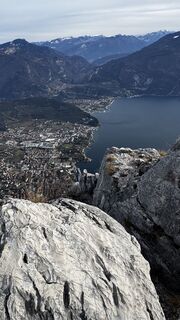
 © ROBERTO BONIOTTIVytvořeno dne 05.01.2026
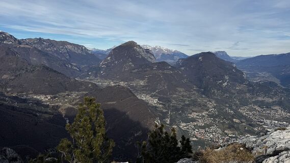 © ROBERTO BONIOTTIVytvořeno dne 05.01.2026
 © ROBERTO BONIOTTIVytvořeno dne 05.01.2026
 © ROBERTO BONIOTTIVytvořeno dne 05.01.2026
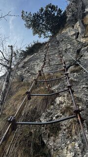 © ROBERTO BONIOTTIVytvořeno dne 05.01.2026
 © ROBERTO BONIOTTIVytvořeno dne 05.01.2026
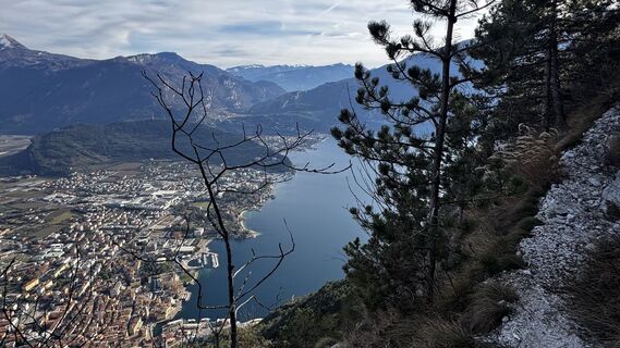 © ROBERTO BONIOTTIVytvořeno dne 05.01.2026
 © ROBERTO BONIOTTIVytvořeno dne 05.01.2026
 © ROBERTO BONIOTTIVytvořeno dne 05.01.2026
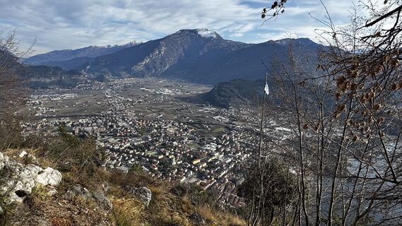 © ROBERTO BONIOTTIVytvořeno dne 05.01.2026
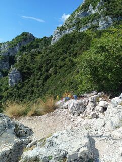
 © Rémy BaumgartVytvořeno dne 30.07.2025
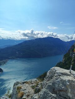 © Rémy BaumgartVytvořeno dne 30.07.2025
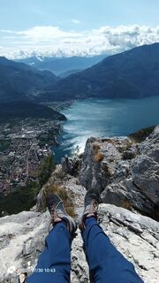 © Rémy BaumgartVytvořeno dne 30.07.2025
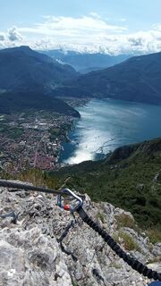 © Rémy BaumgartVytvořeno dne 30.07.2025
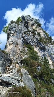 © Rémy BaumgartVytvořeno dne 30.07.2025
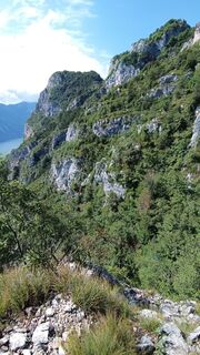 © Rémy BaumgartVytvořeno dne 30.07.2025
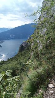 © Rémy BaumgartVytvořeno dne 30.07.2025
 © Rémy BaumgartVytvořeno dne 30.07.2025
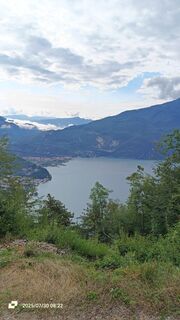 © Rémy BaumgartVytvořeno dne 30.07.2025
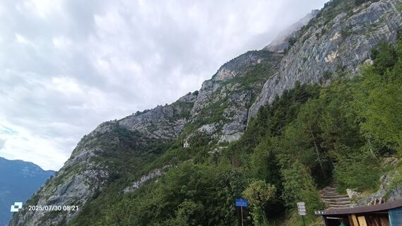 © Rémy BaumgartVytvořeno dne 30.07.2025
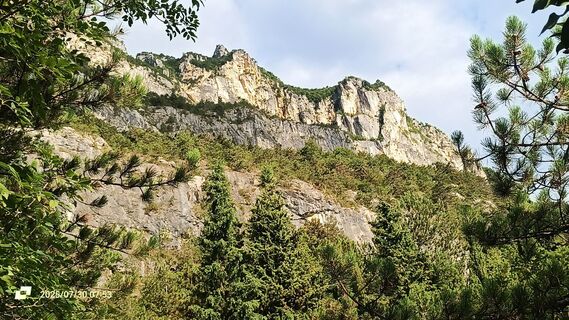 © Rémy BaumgartVytvořeno dne 30.07.2025
 © HeikoalaVytvořeno dne 24.10.2021
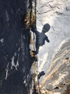 © HeikoalaVytvořeno dne 24.10.2021
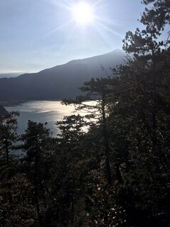 © HeikoalaVytvořeno dne 24.10.2021
 © HeikoalaVytvořeno dne 24.10.2021
 © Finn OettlVytvořeno dne 01.10.2023
 © Finn OettlVytvořeno dne 01.10.2023
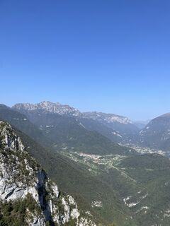 © Finn OettlVytvořeno dne 01.10.2023
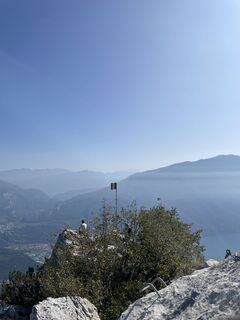 © Finn OettlVytvořeno dne 01.10.2023
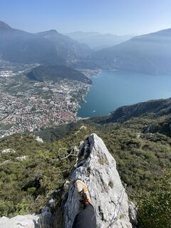 © Finn OettlVytvořeno dne 01.10.2023
 © Finn OettlVytvořeno dne 01.10.2023
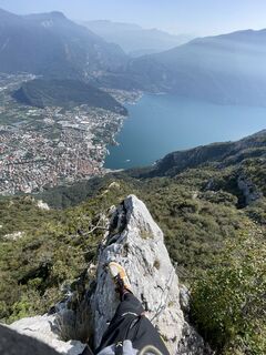 © Finn OettlVytvořeno dne 01.10.2023
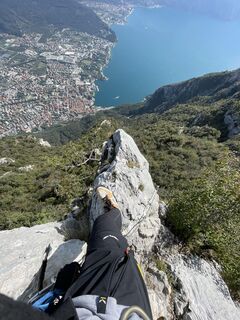 © Finn OettlVytvořeno dne 01.10.2023
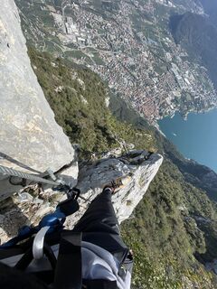 © Finn OettlVytvořeno dne 01.10.2023
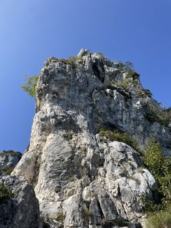 © Finn OettlVytvořeno dne 01.10.2023
 © Finn OettlVytvořeno dne 01.10.2023
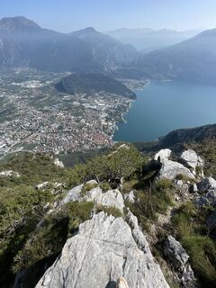 © Finn OettlVytvořeno dne 01.10.2023
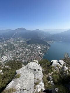 © Finn OettlVytvořeno dne 01.10.2023
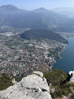 © Finn OettlVytvořeno dne 01.10.2023
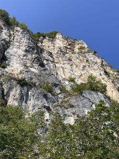 © Finn OettlVytvořeno dne 01.10.2023
 © Finn OettlVytvořeno dne 01.10.2023
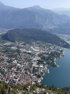 © Finn OettlVytvořeno dne 01.10.2023
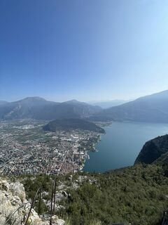 © Finn OettlVytvořeno dne 01.10.2023
 © Finn OettlVytvořeno dne 01.10.2023
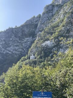 © Finn OettlVytvořeno dne 01.10.2023
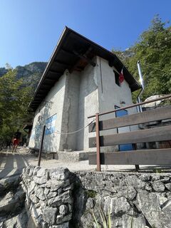 © Finn OettlVytvořeno dne 01.10.2023
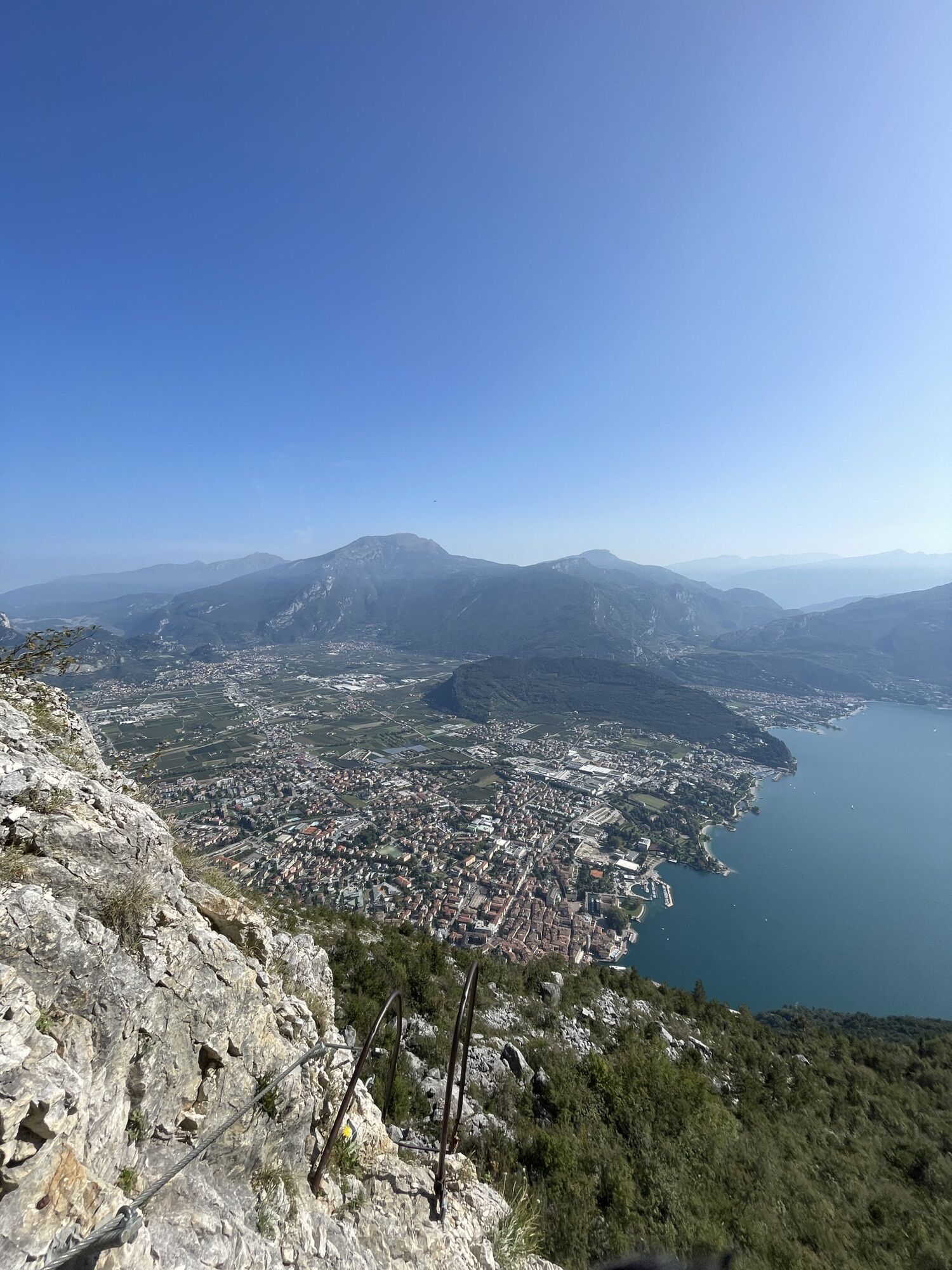
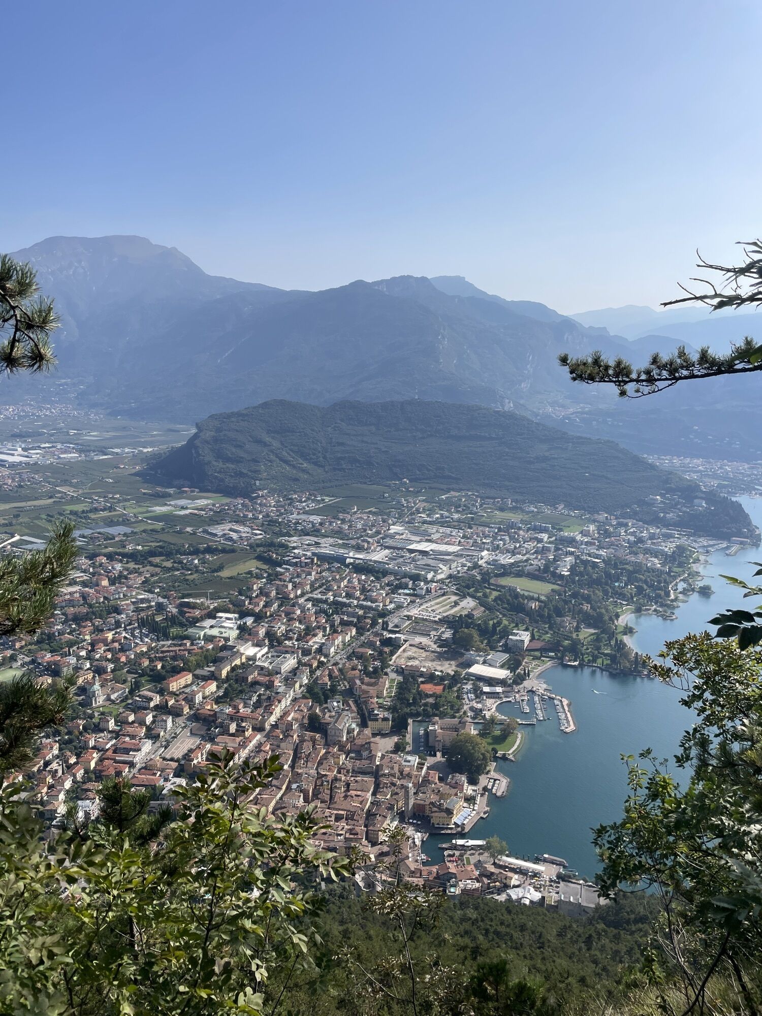

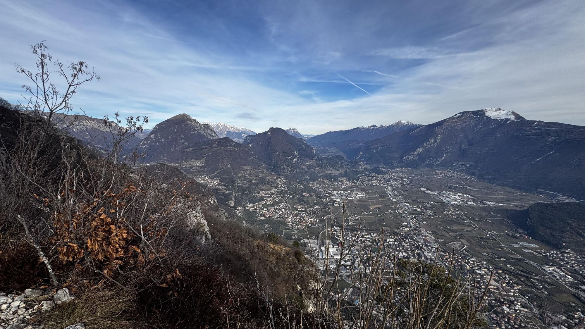


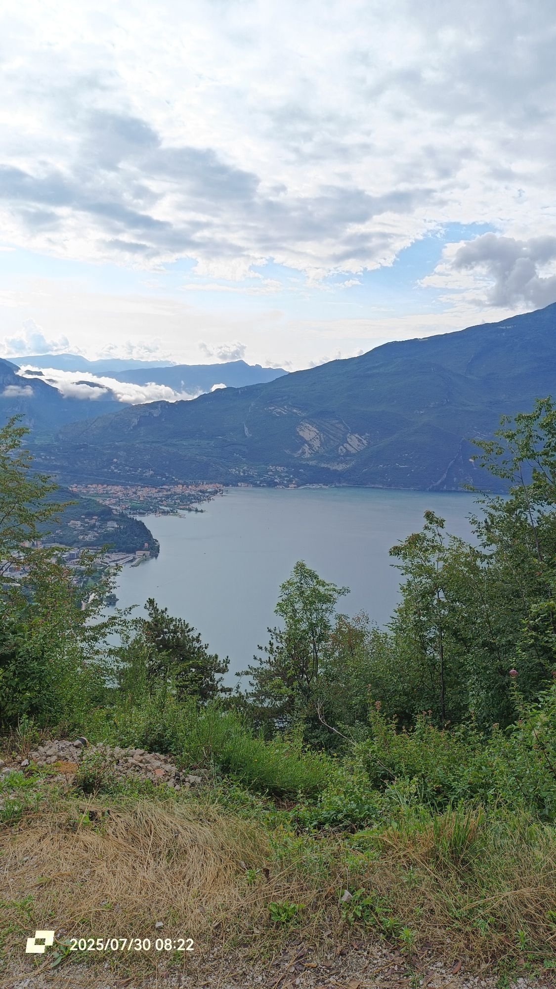

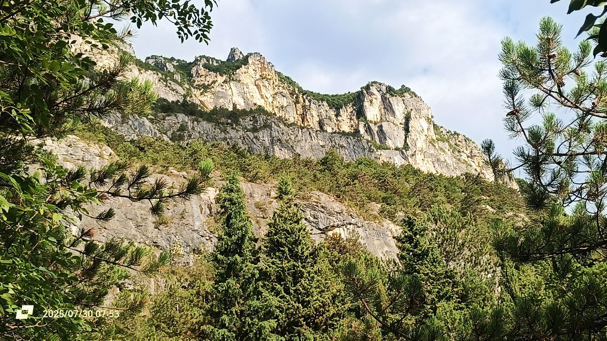


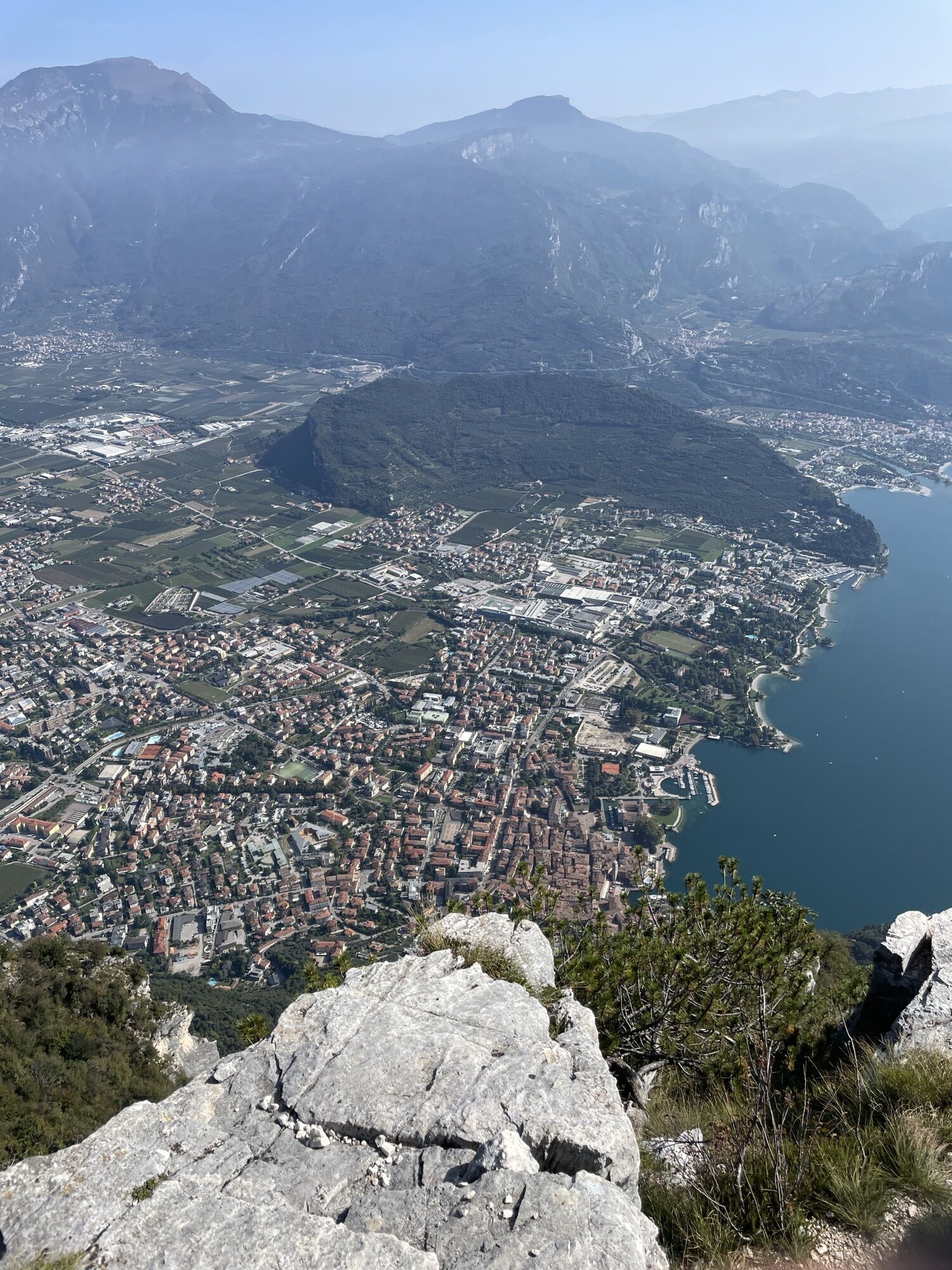


As you head off from the centre of Riva del Garda towards the base of the ferrata, you can see the walls you are about to scale rising sheer above you.
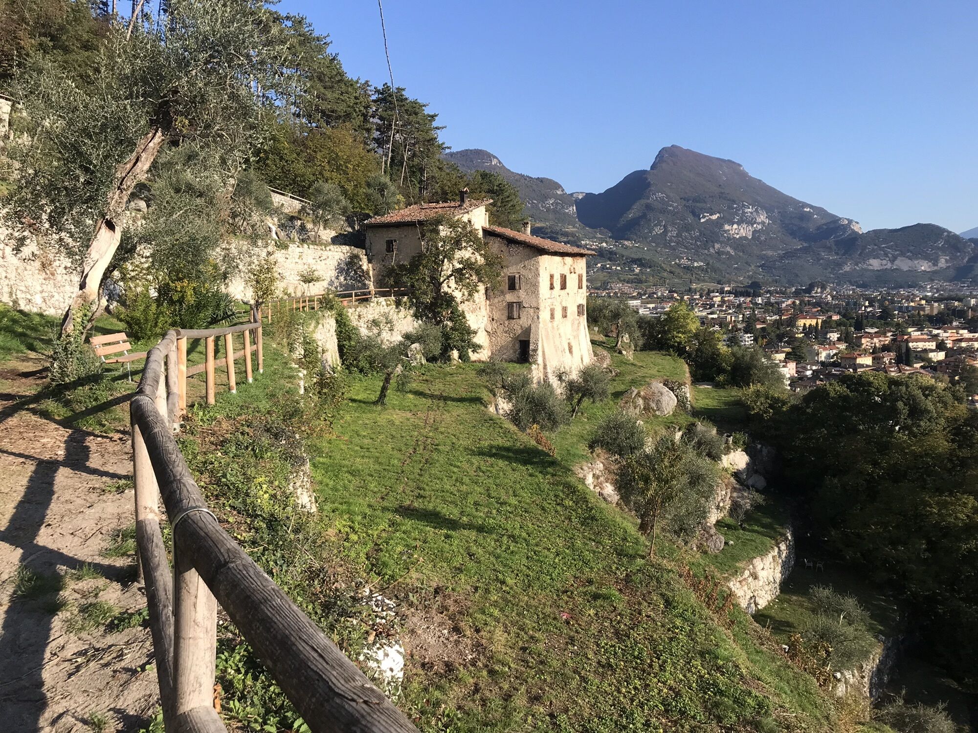
Pass by Bastione and Capanna Santa Barbara to reach...
As you head off from the centre of Riva del Garda towards the base of the ferrata, you can see the walls you are about to scale rising sheer above you.
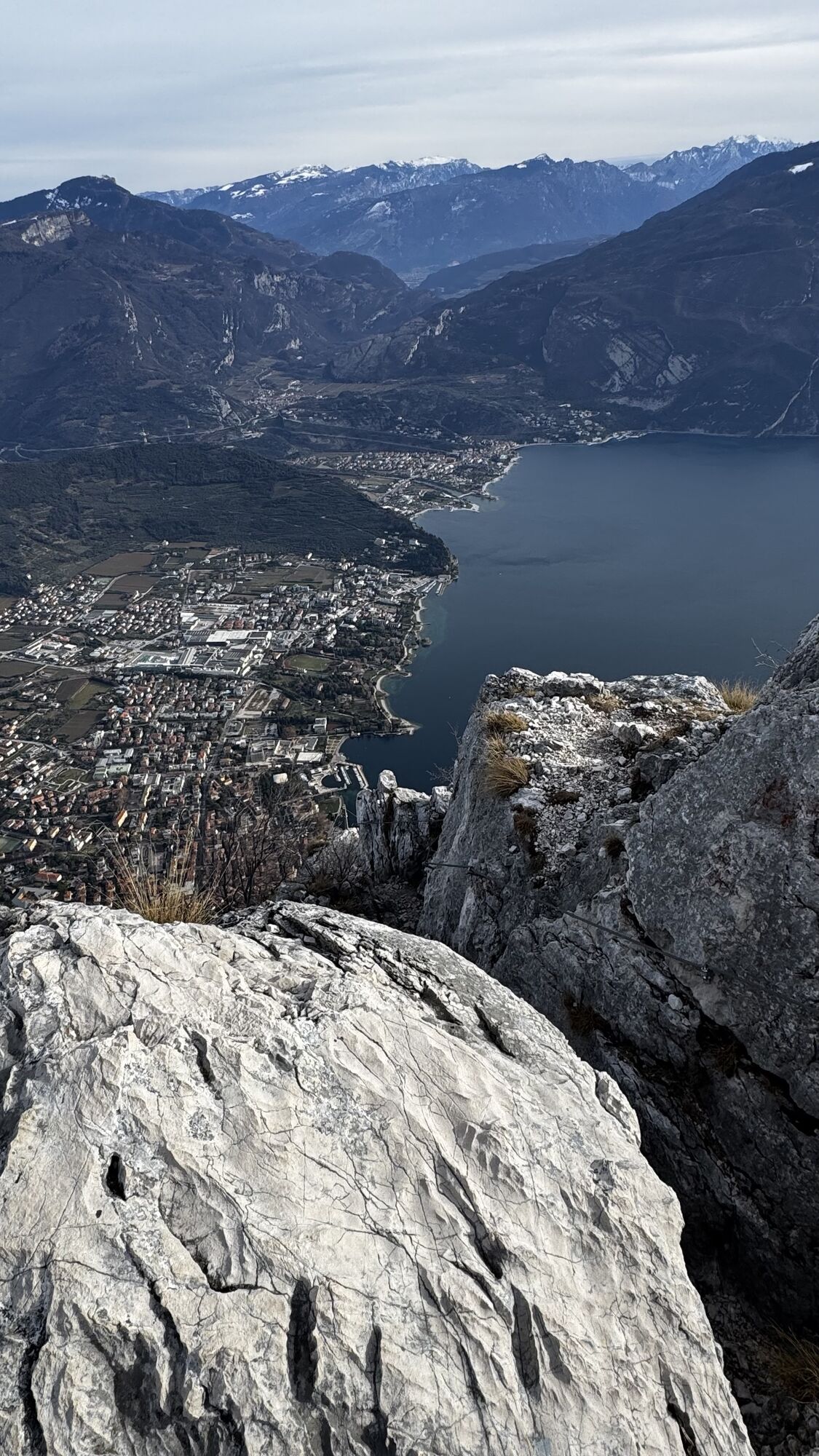
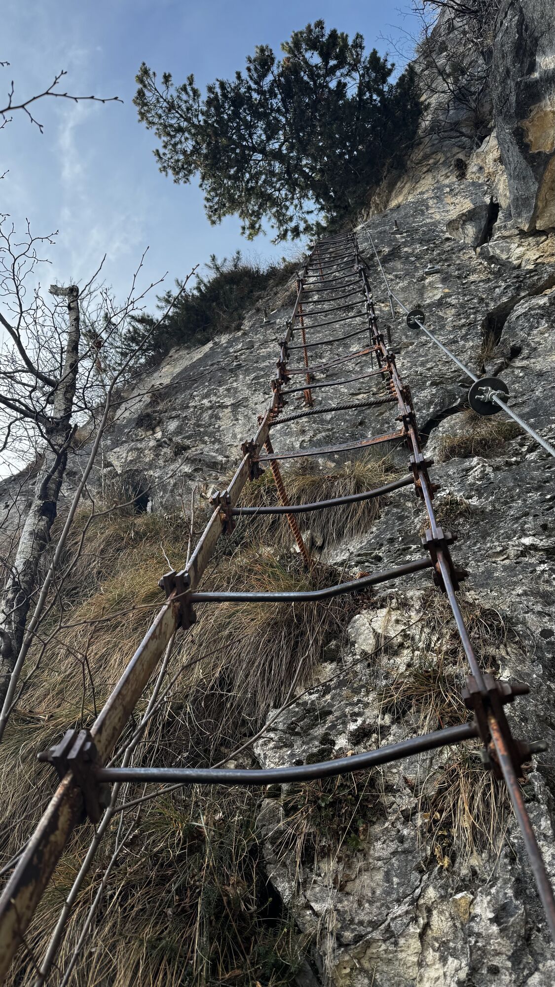
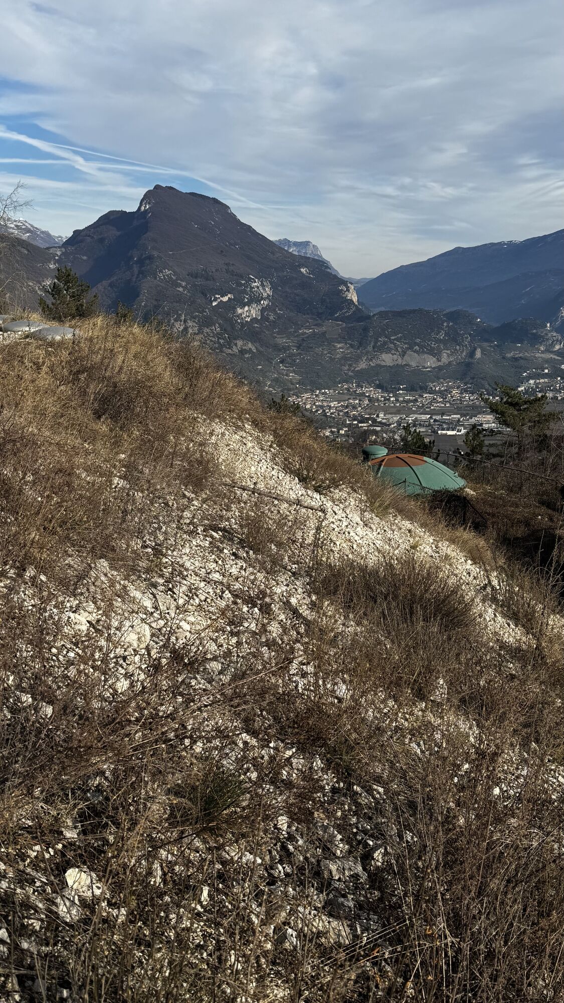
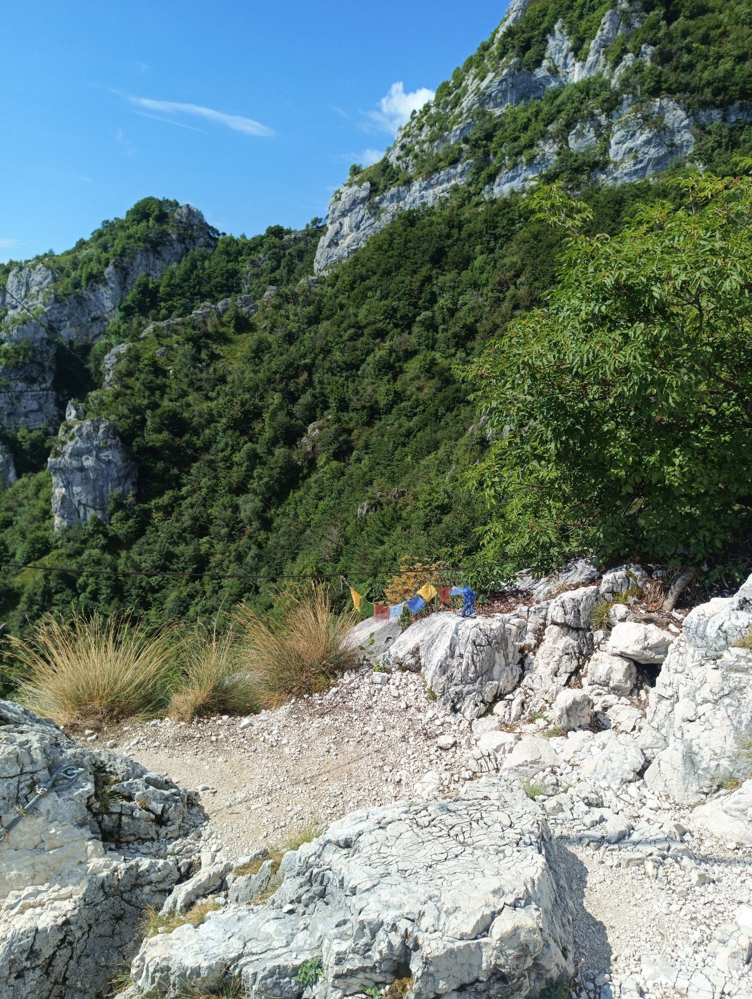
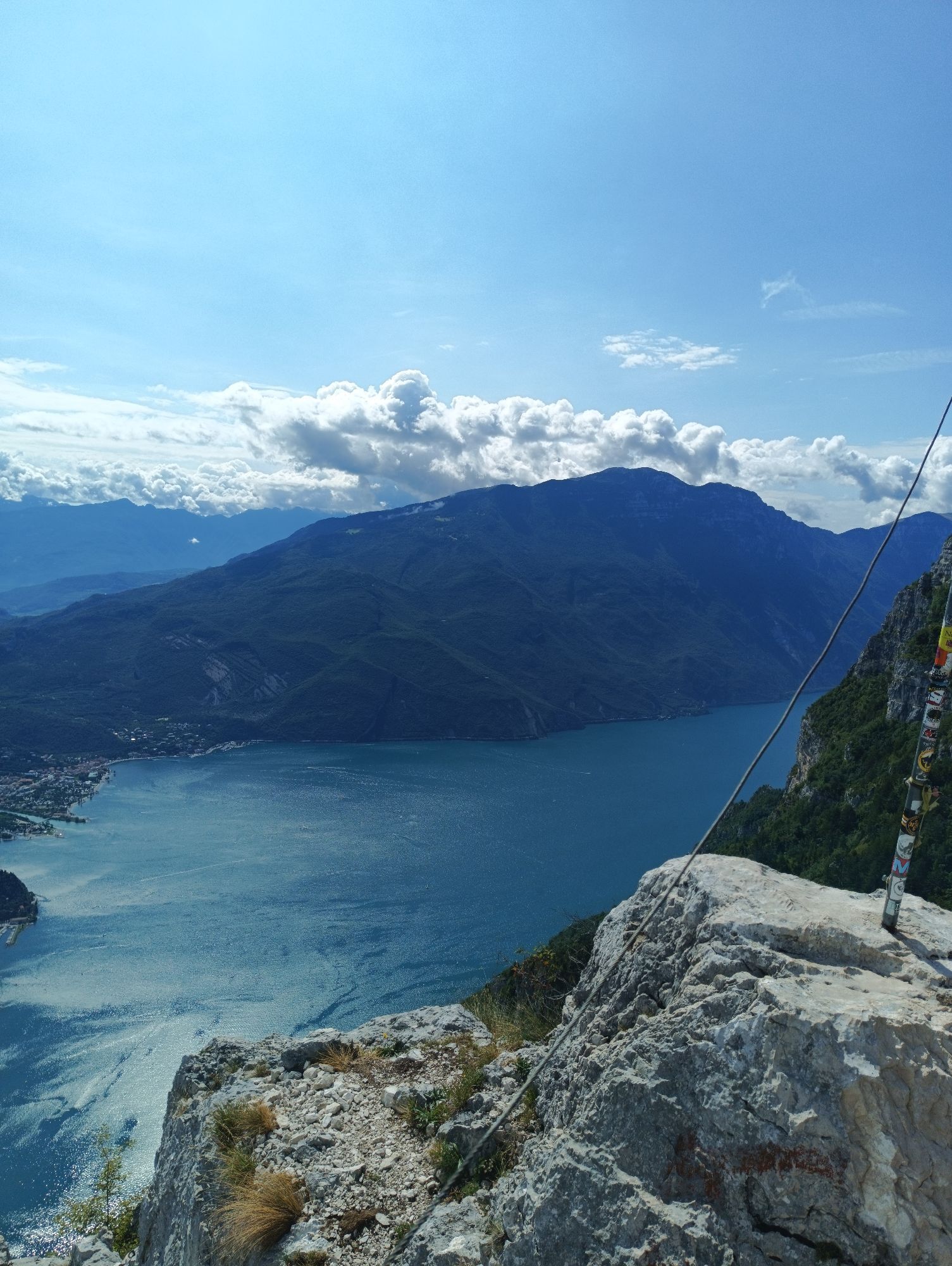
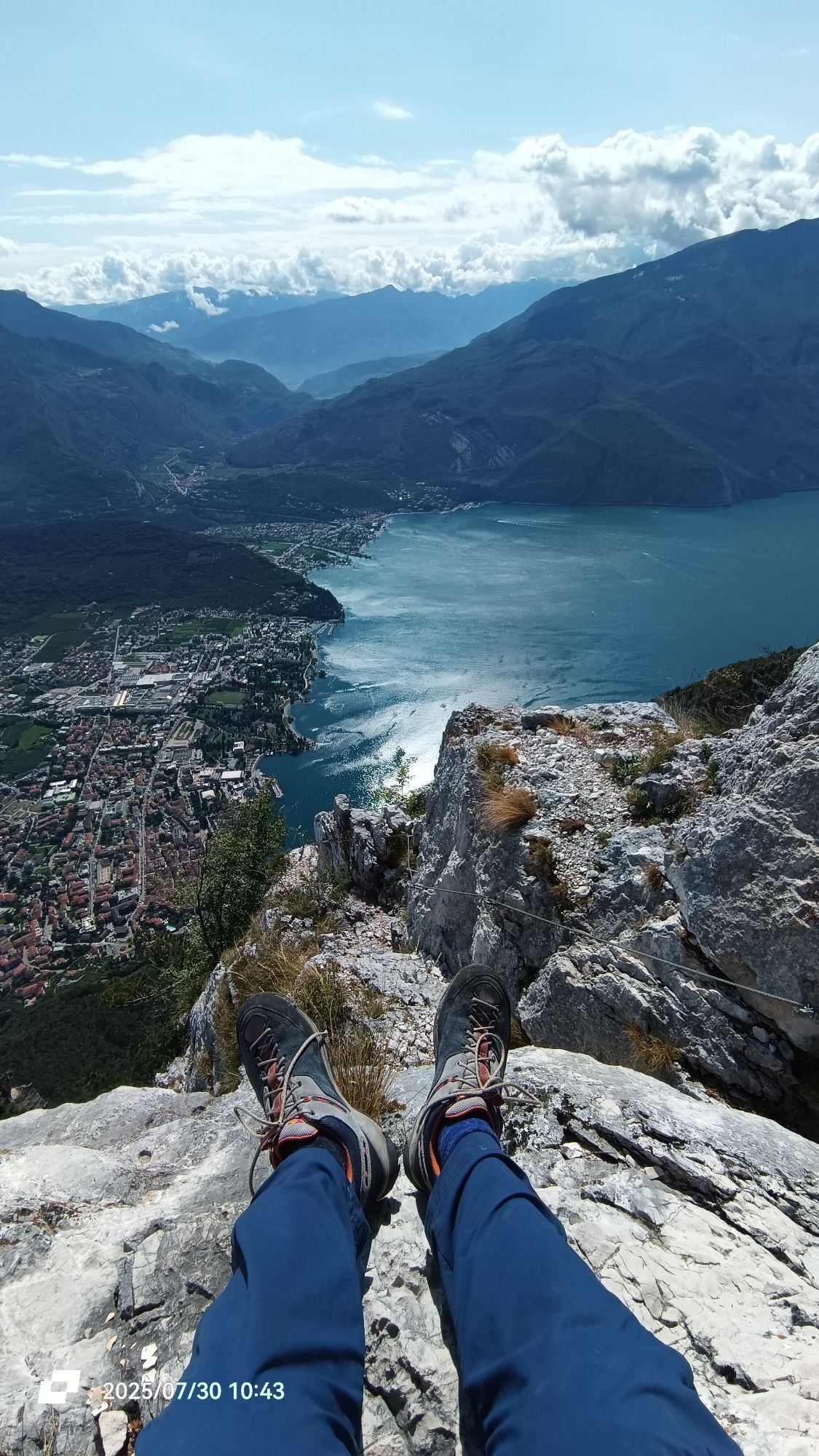
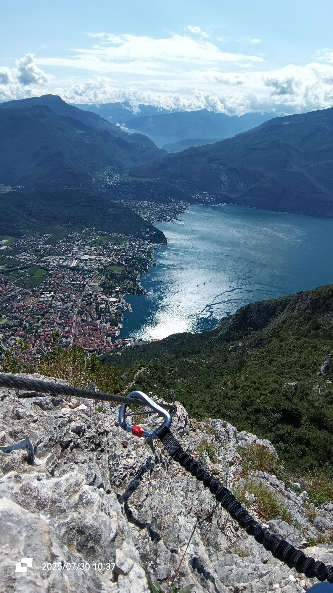
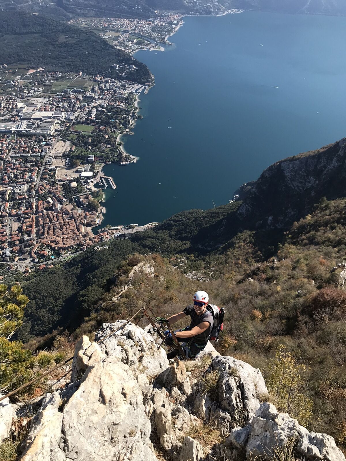
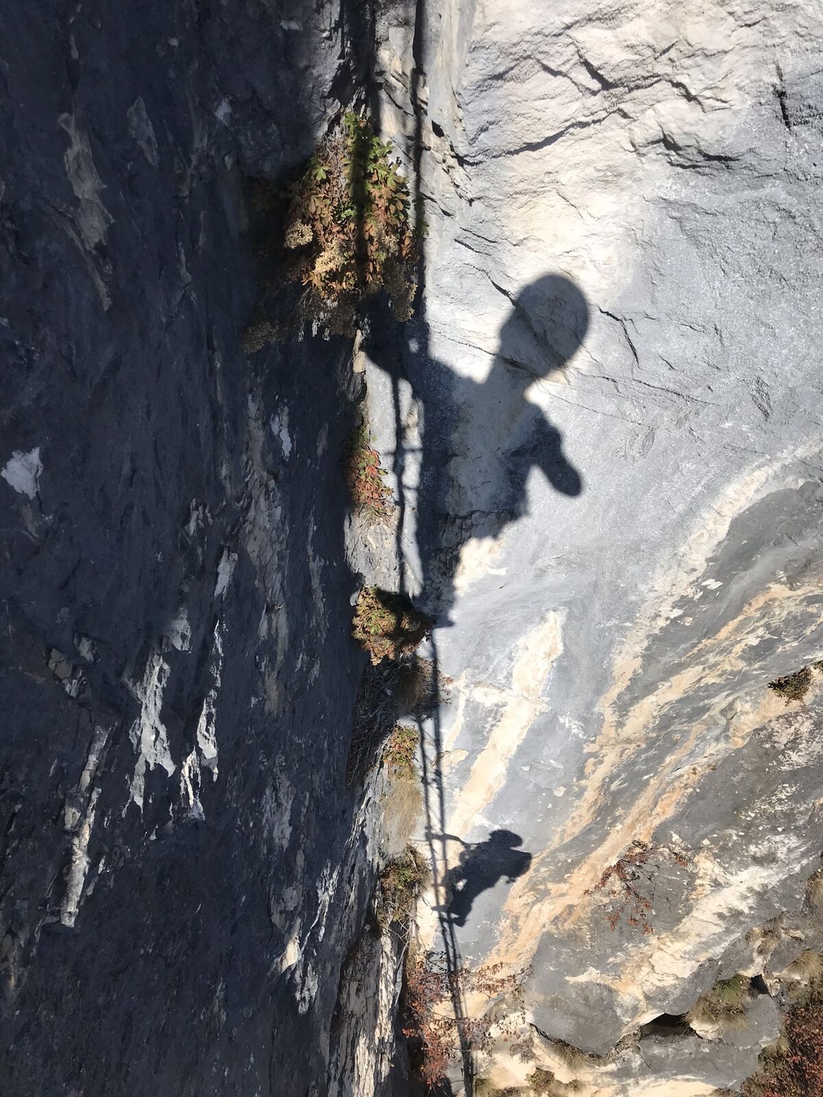
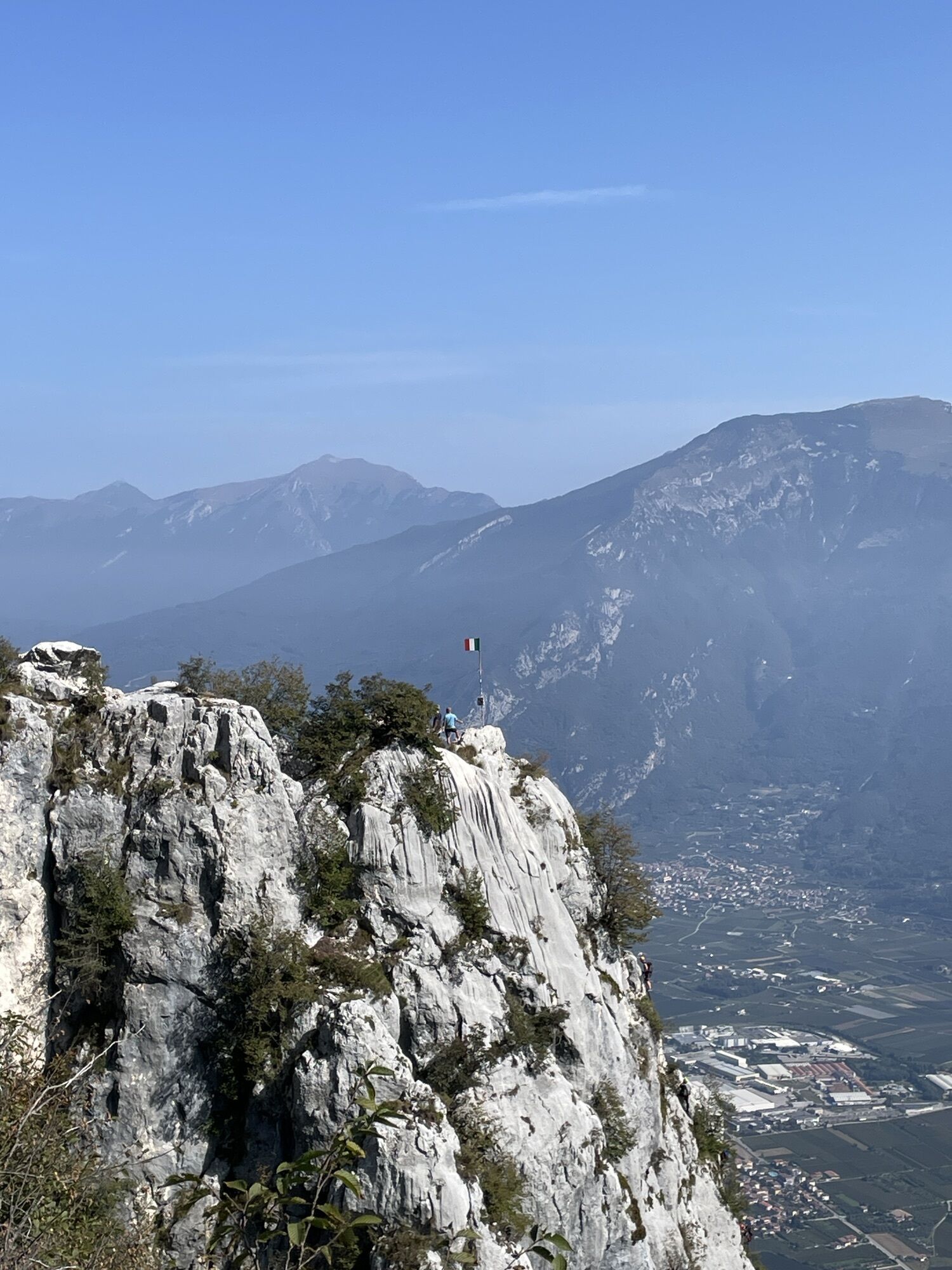
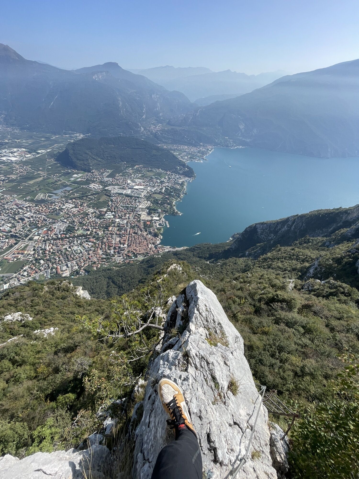
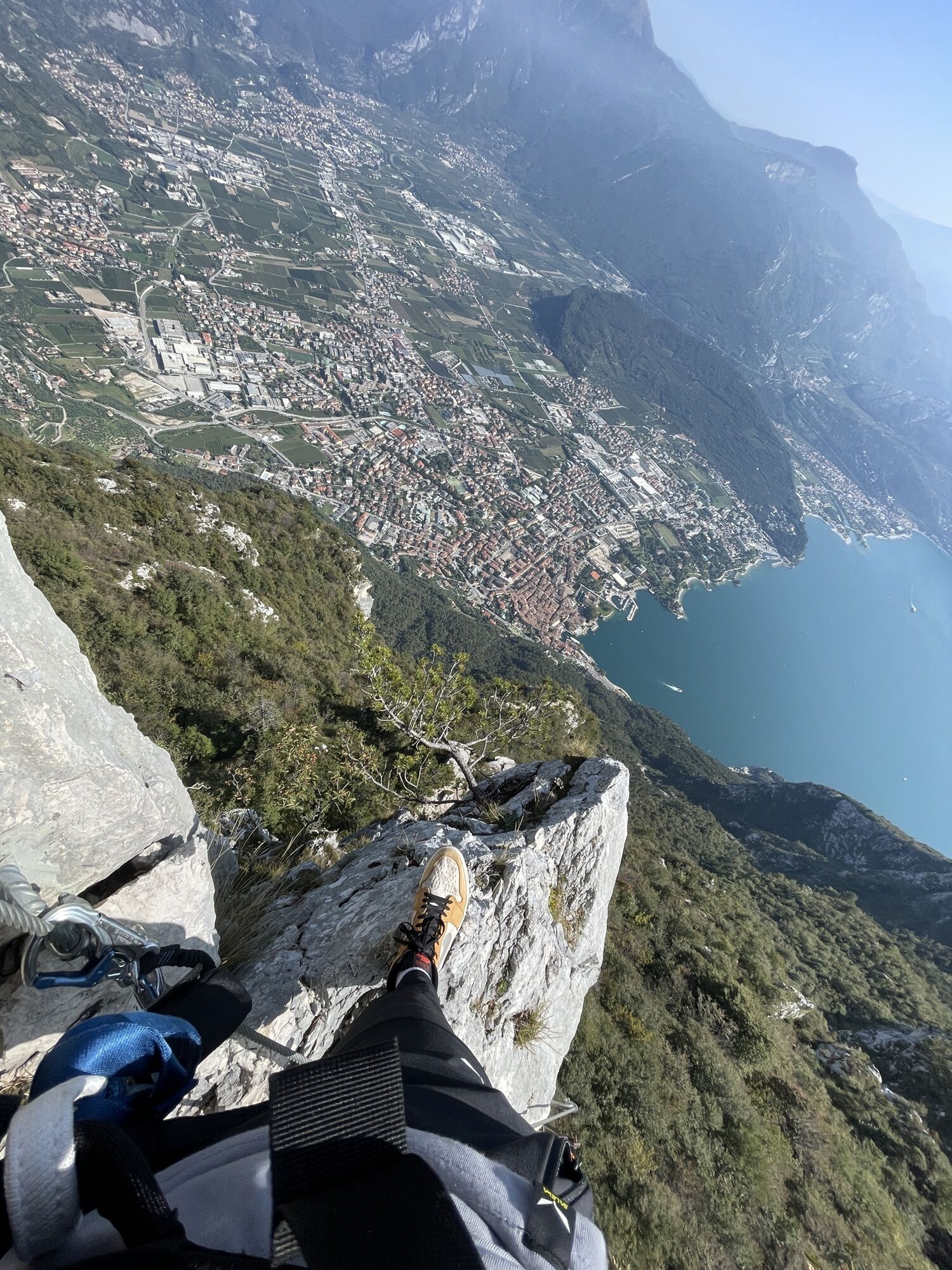
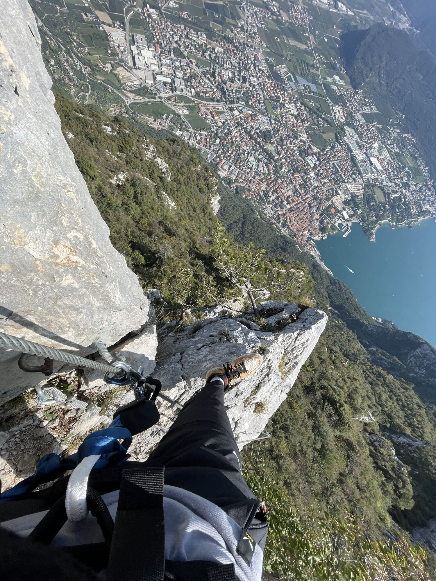
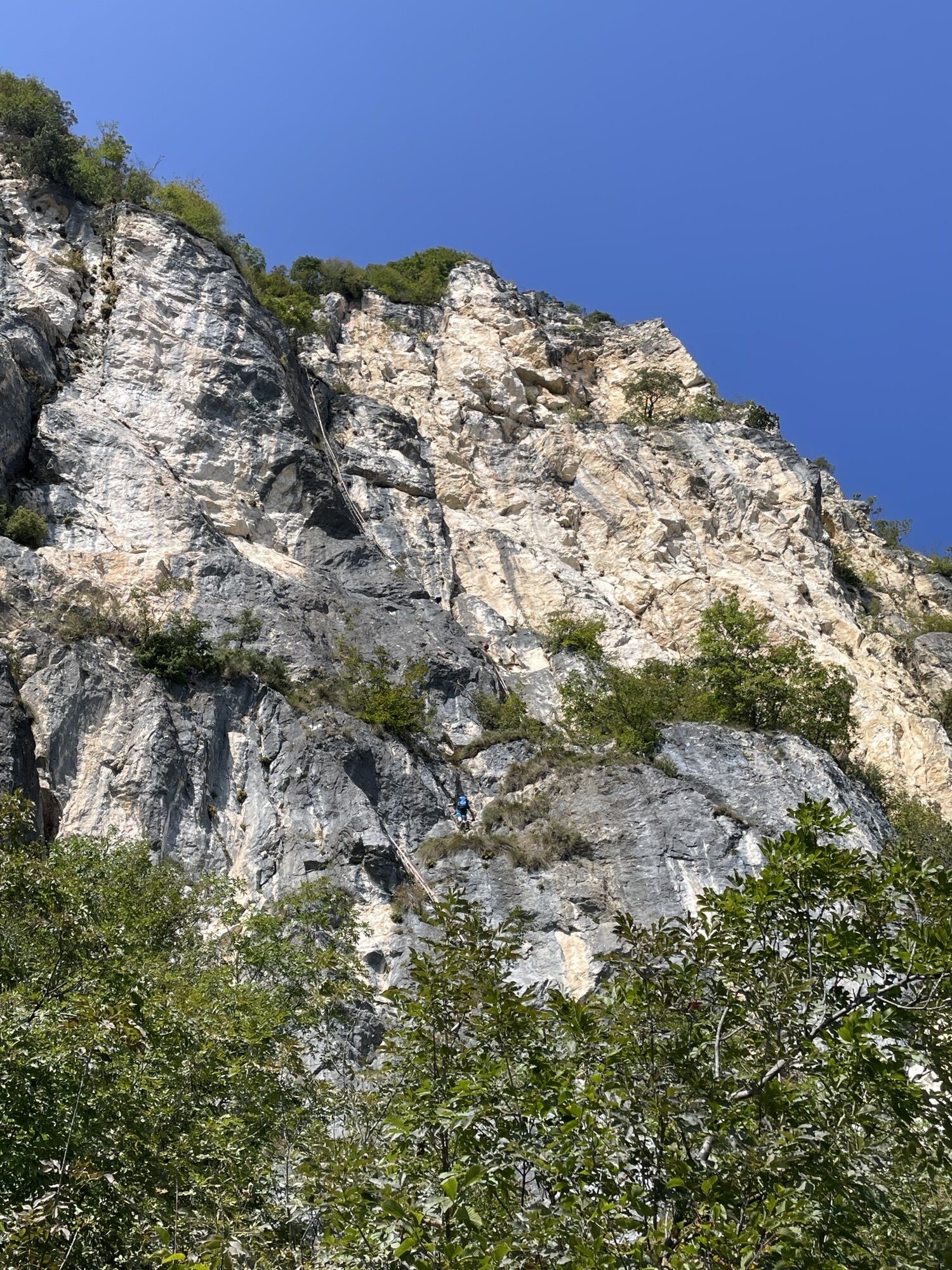
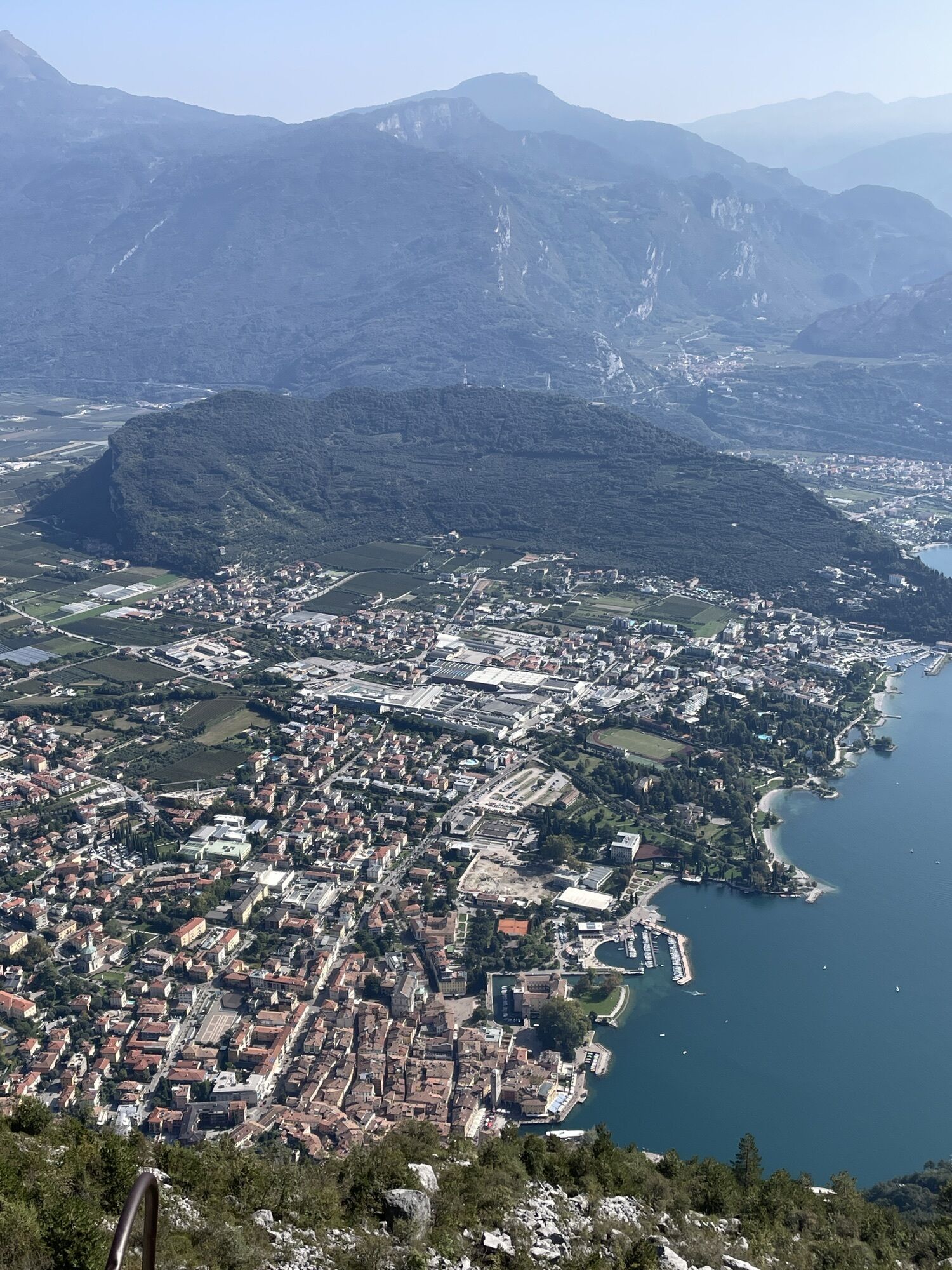
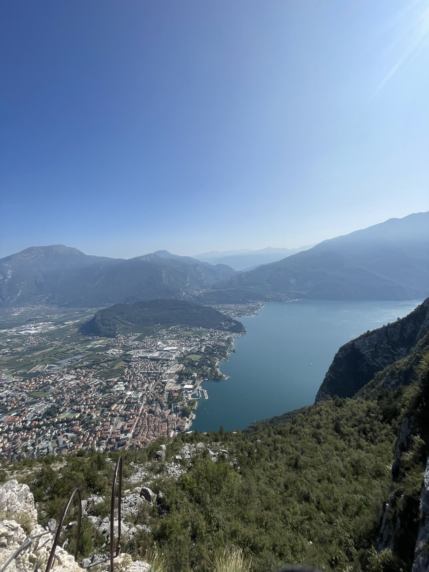
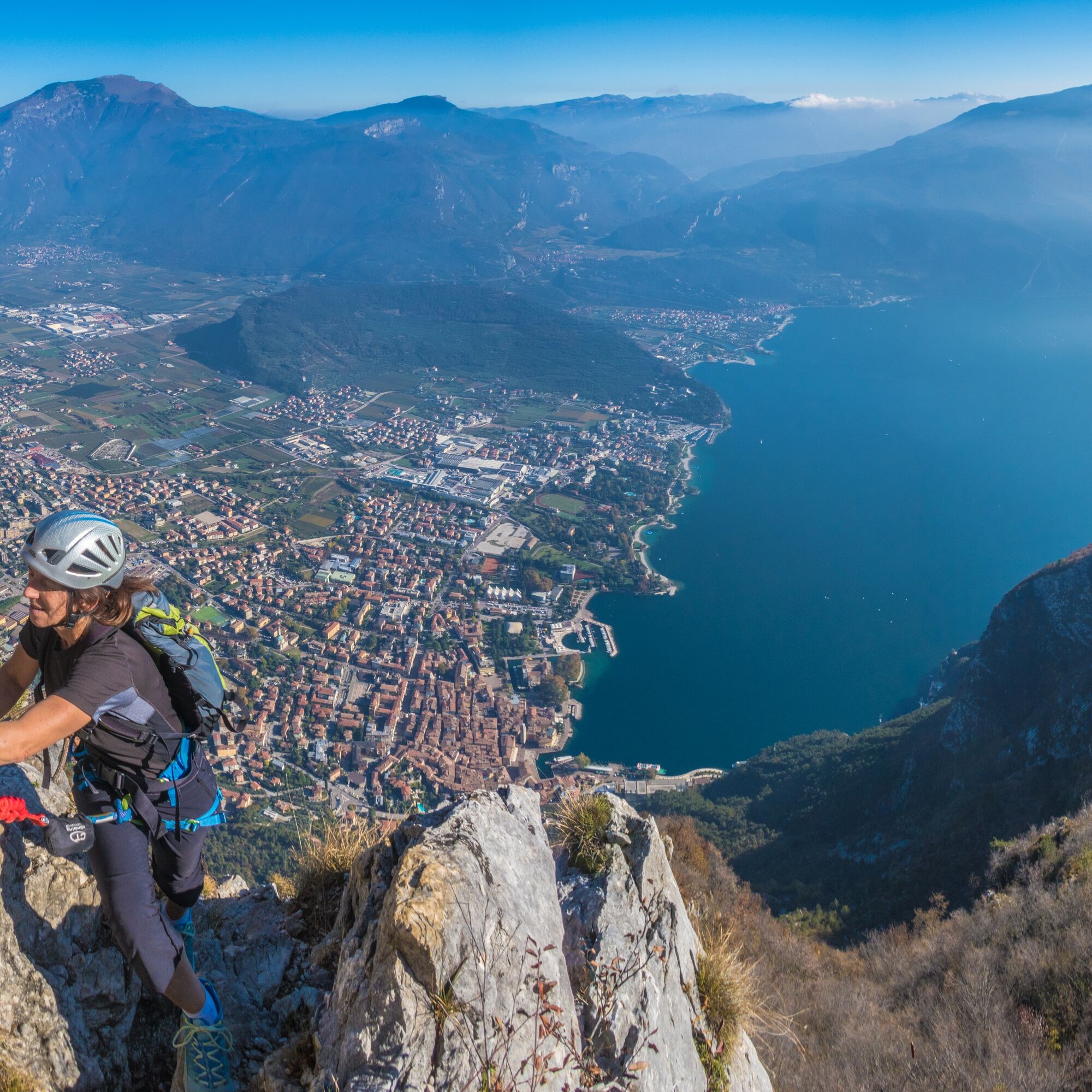
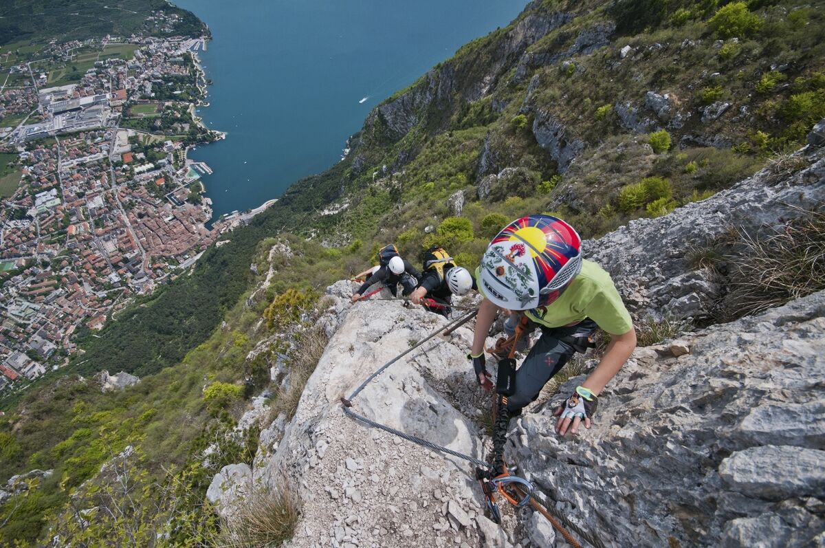
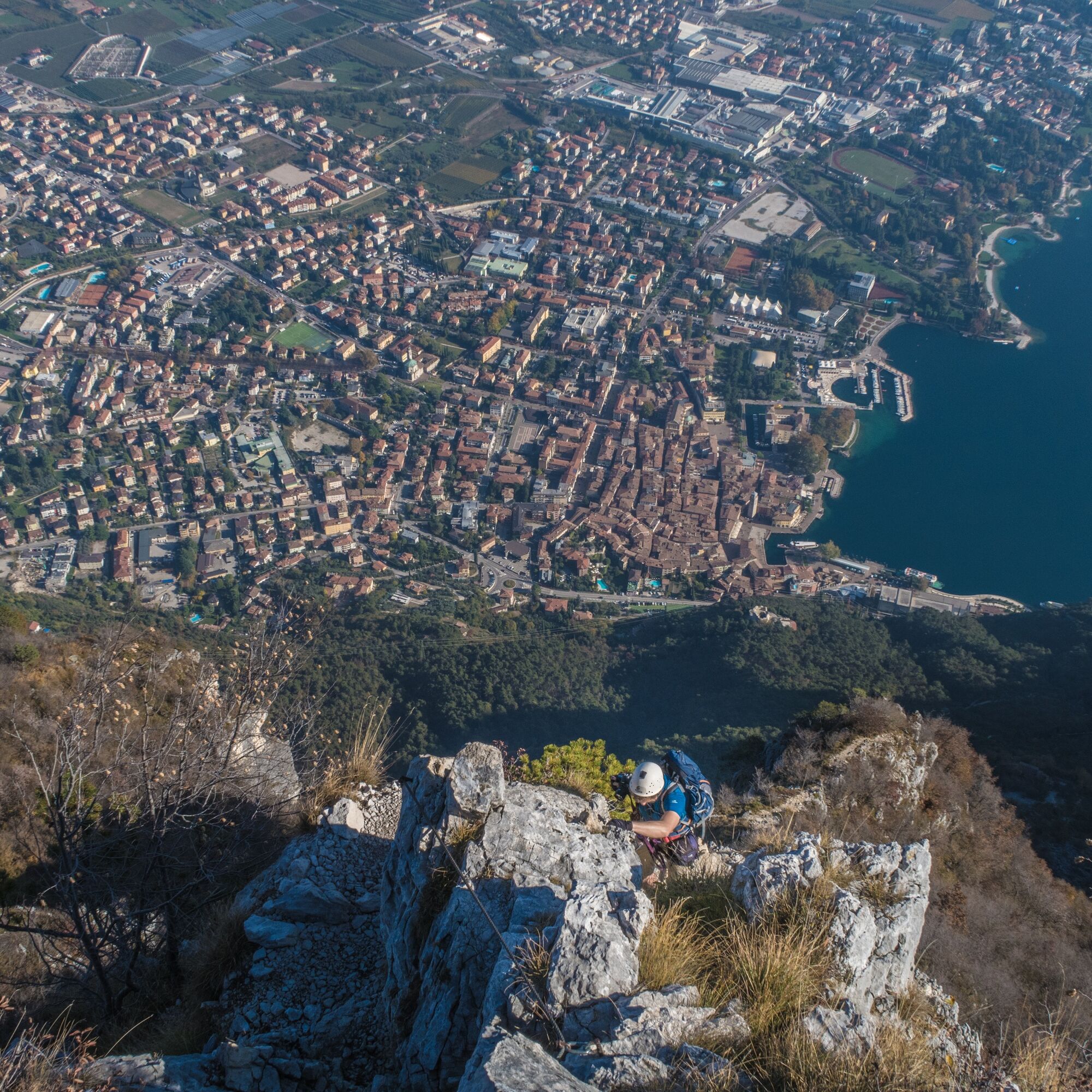
Pass by Bastione and Capanna Santa Barbara to reach the beginning of the Via Ferrata. As you ascend the wall of Rocchetta you can see the roofs of Riva del Garda and the blue waters of Lake Garda beneath your feet. Although the long series of ladders, slightly overhanging in places, are not technically demanding, they do require determination and you must not suffer from a fear of heights.
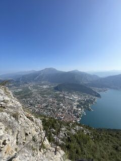
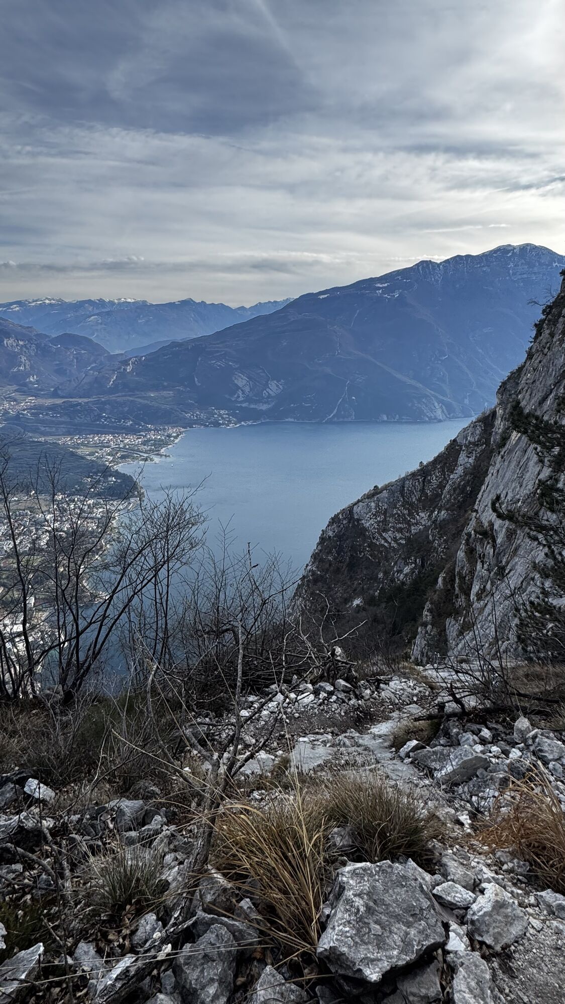
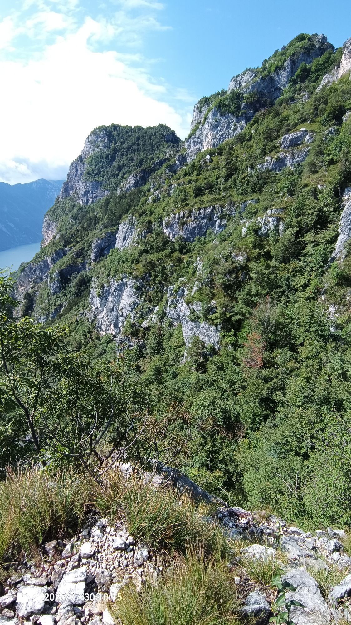
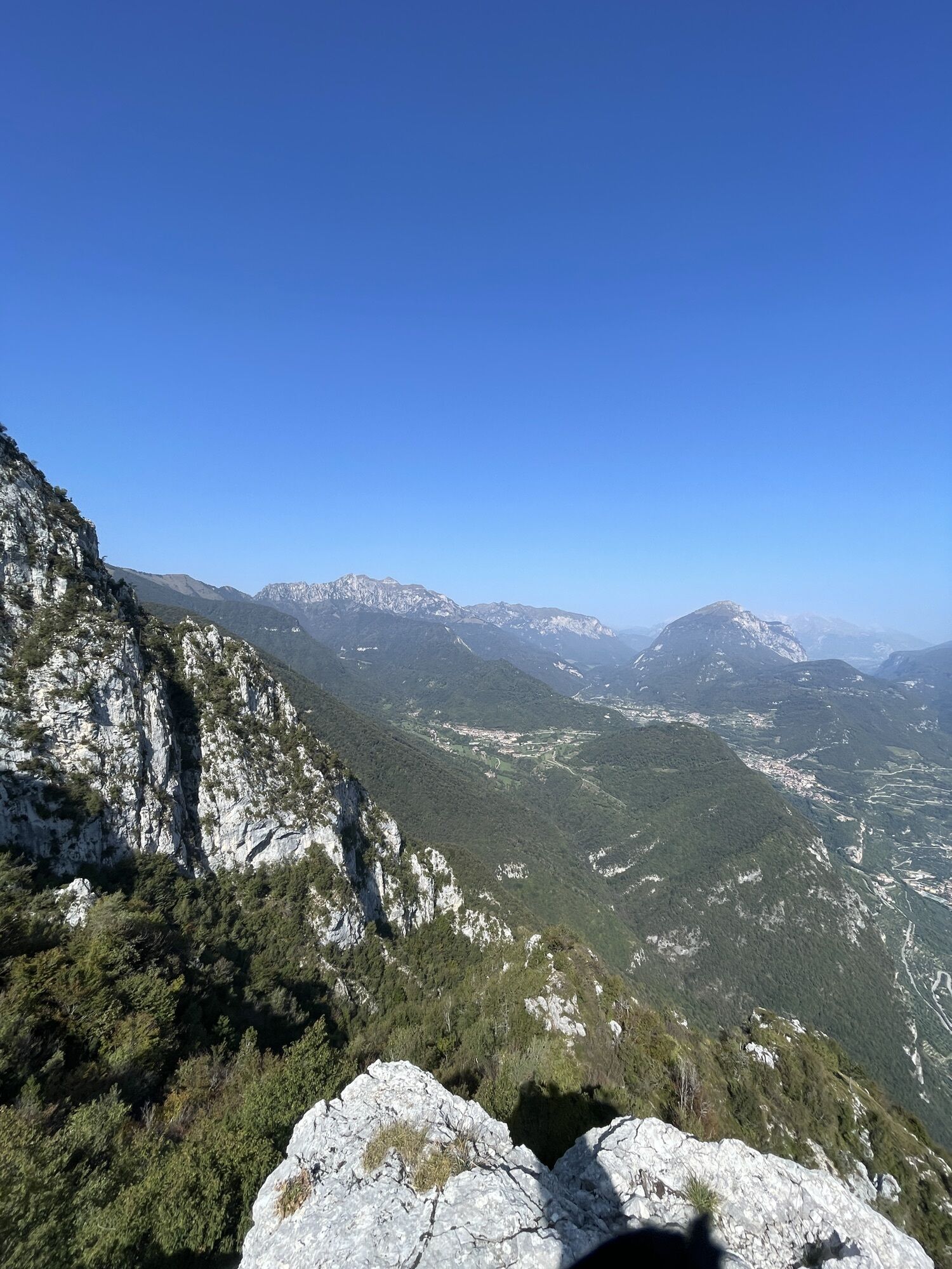
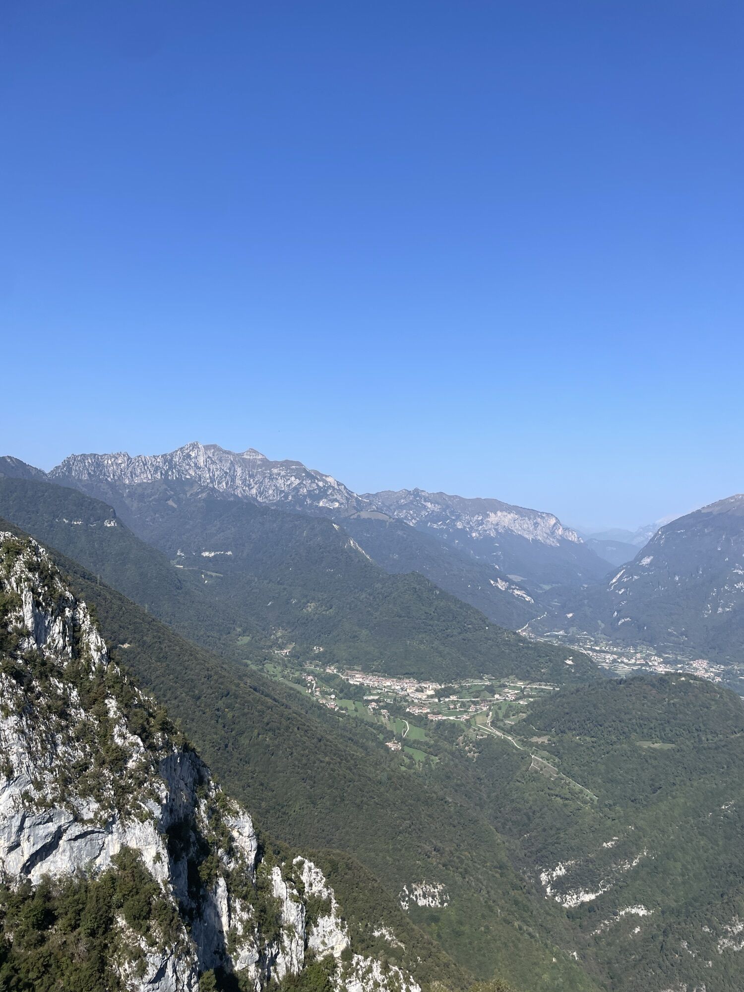
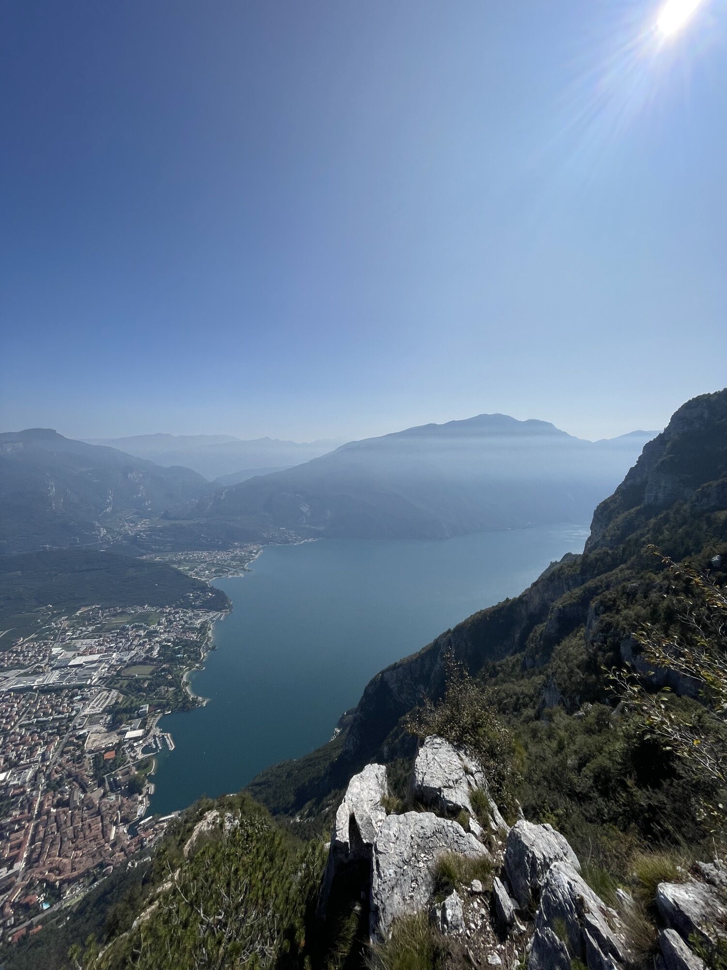
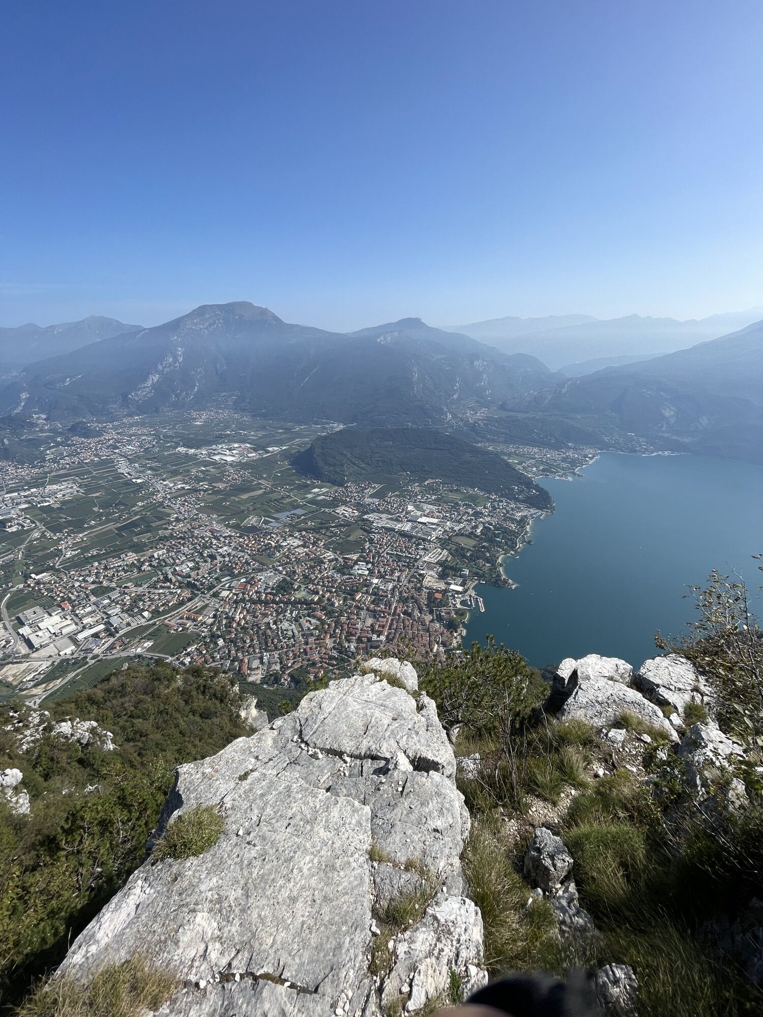
After 1200 m of ascent, the view from Cima Sat extends from south to north, from the basin of Lake Garda to the entire Sarca Valley.

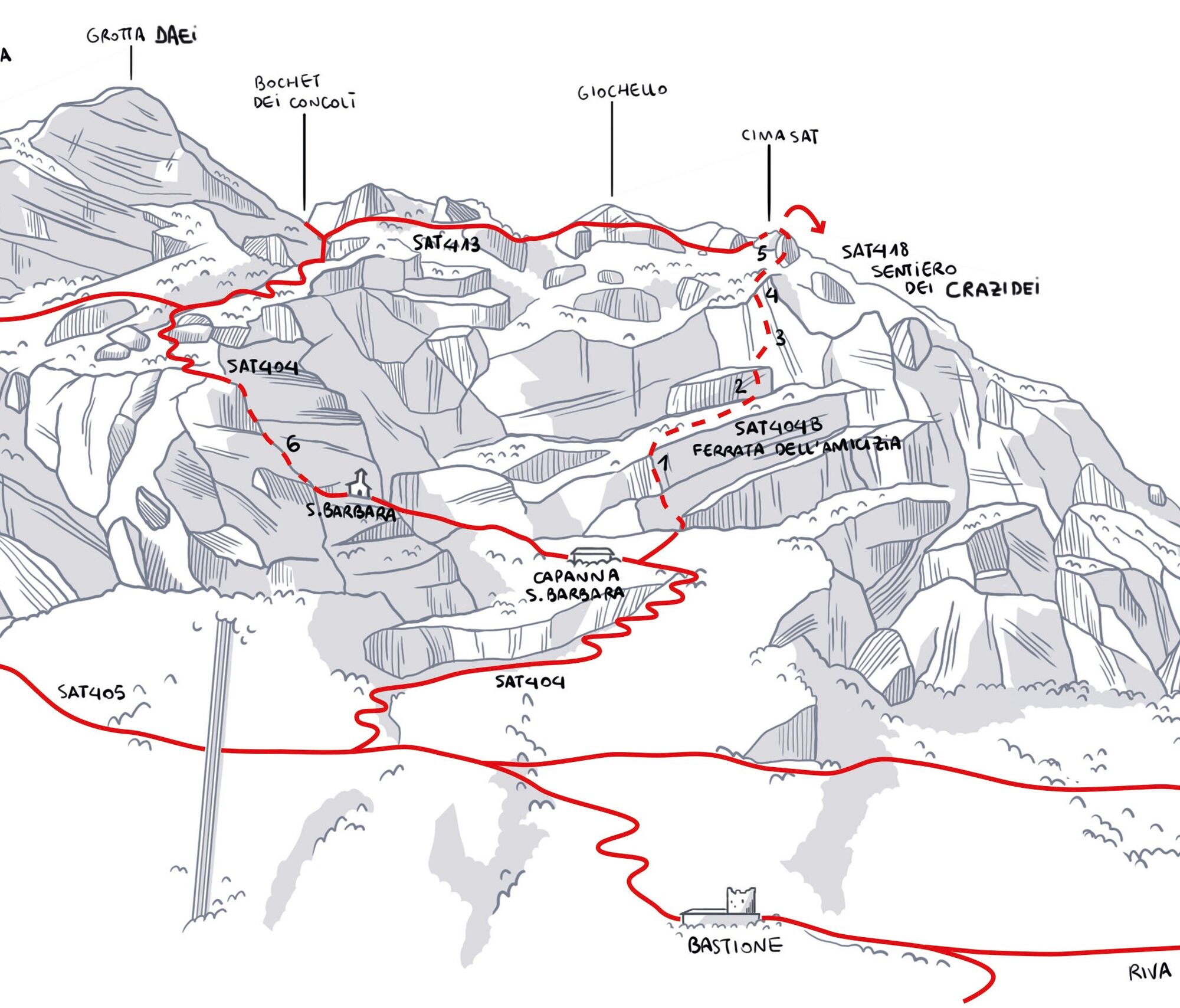

Access
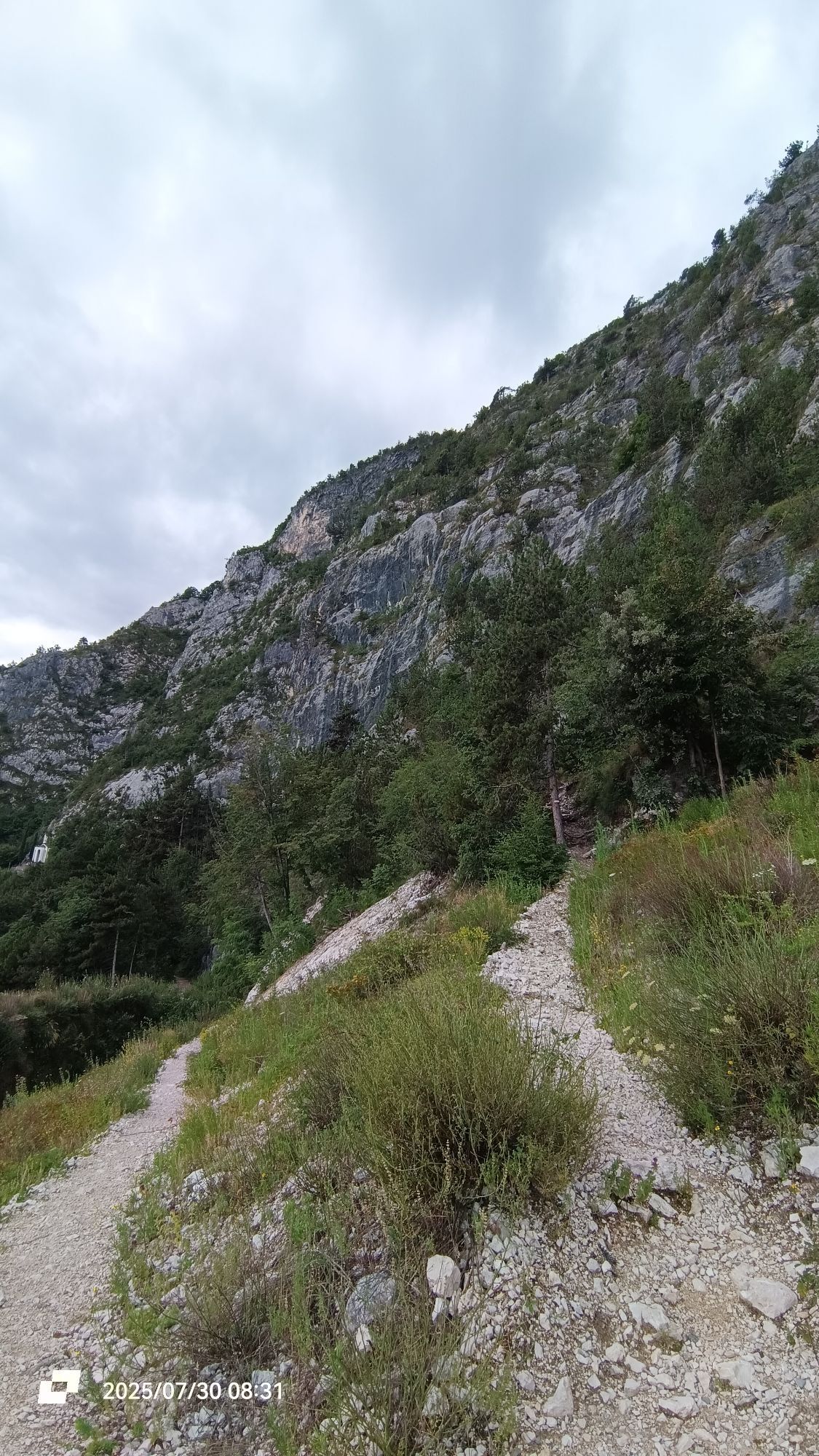
From Riva del Garda head up along the SAT404 trail until the mountain hut Capanna Santa Barbara, then continue along the SAT404B trail.
Route
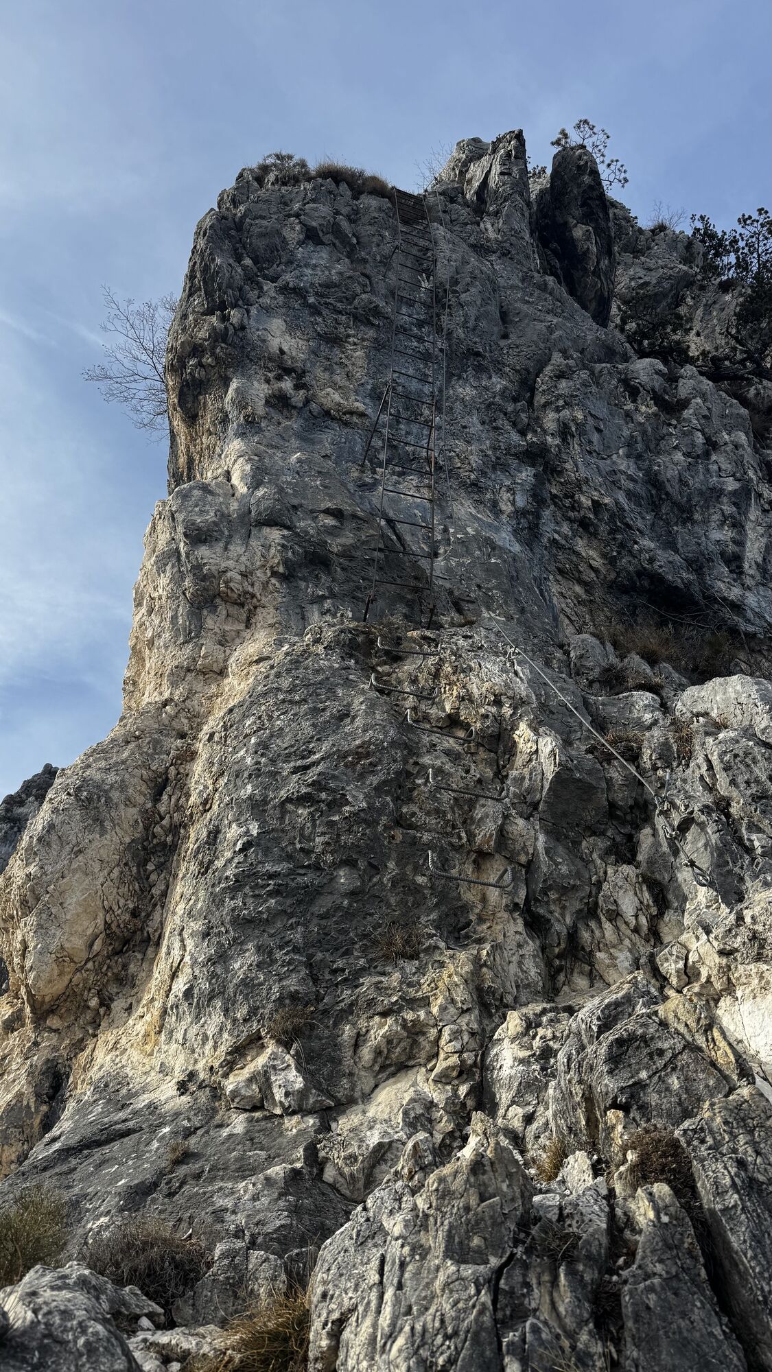
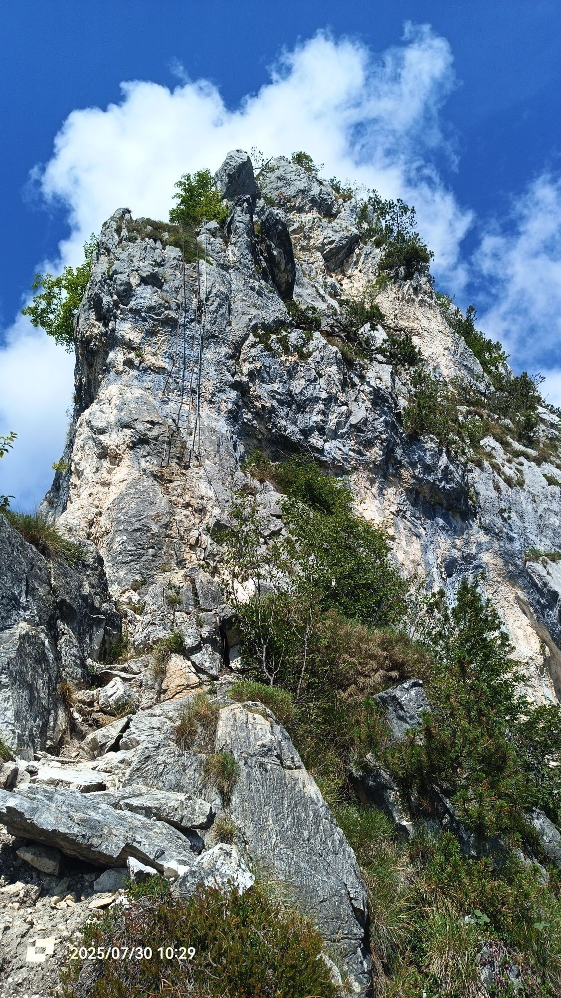
After the first easy bolted slabs you come to the foot of a wall which you ascendby means of a 40 metres ladder (1). At the other end, you proceed on rockyoutcrops until you come to a big rock wall. A first ladder 15 metres long (2) takesyou to the 70 metres ladder (3). Finally, a short ladder of just 15 metres (4) takesyou into the woods and from there, a trail takes you to the rocky ridge boltedwith cables and ladders (5) which takes you to the summit of Cima SAT.
Return
There are two options:
• from the summit head down the other side along a bolted section until the fork in the trail, where you take the right-hand path, Sentiero dei Crazidei (SAT418), and then the SAT402 which descends to Riva del Garda.
• descend the bolted section as far as the fork and then head left over ledges bolted with metal cables on SAT413, leaving the trail for Bochet de Concolì on your right. Follow the trail SAT404 and reach, thanks to a short ladder (6) first the chapel of Santa Barbara, the mountain hut of the same name and then Riva del Garda.
Ano
You need to wear the right clothing and take the proper gear when you go hiking in the mountains. Even on relatively short easy outings make sure to take all you need so you don't run into trouble if things take an unexpected turn, for example a storm blows up or you have a sudden drop in energy levels.
What should you absolutely have with you on a via ferrata tour?
rucksack (25/30L capacity) for a day trip technical mountain clothing hiking boots with Vibram or similar sole via ferrata gear harness helmet gloves pickaxe and crampons (when necessary) a length of rope (recommended)Safety Tips
Choose the route based on your actual psycho-physical preparation, technical ability, and experience. Always assess the conditions of crowding, weather, the state of the fixed equipment, and the route. The final decision and responsibility for the passability of the route lie entirely with the person who decides to undertake it. If you are unsure, seek information or rely on qualified professionals.
Only do the via ferrata if you are reasonably fit and in excellent health. Use proper safety gear (helmet, harness, ferrata kit with double selflocking carabiners and energy absorbing systems). Put on your helmet once you get near to the wall in case of rock falls. Check the weather report and do not undertake the via ferrata ascent in adverse weather conditions, especially in the event of a thunderstorm threat. The risk of rock falls increases if there are others on the via ferrata or with wind or rain. During progression always keep both carabiners clipped onto the safety cable and when you pass the anchor points make sure at least one carabiner is clipped on to the metal cable. Only one person may be on any length of cable between two anchor points. Always check route conditions; in winter you may find snow and ice, making progress very dangerous. Do not do the via ferrata alone: if you have an accident nobody will be able to call for help.Emergency telephone number 112.
The information on this chart is subject to inevitable variations, so this means that none of the indications are absolute. It is not entirely possible to avoid giving inexact or imprecise information, given how quickly environmental and weather conditions can change. For this reason, we decline any responsibility for changes which the user may encounter. In any case, the hiker is advised to check the conditions of the places, environment and weather before setting out.
A22 motorway, exit: Rovereto Sud - Lake Garda. Then SS240 in the direction of Riva del Garda.
Find out how to reach Garda Trentino.
The main towns in Garda Trentino - Riva del Garda, Arco, Torbole sul Garda, Nago – are connected by several urban and intercity bus lines which will take you to the starting point of tours or in the immediate surroundings.
You can also get to Riva del Garda and Torbole sul Garda by the public ferry service.
Free parking near the former hospital (Via Rosmini).
Paid parking: Terme Romane (Viale Roma), Vecchia stazione (Largo Medaglie d’Oro), Ex-agraria (Via Lutti).
C
"Endless ladders lead to one of the most panoramic peak of northern Lake Garda" (from the website via-ferrata.de).


Oblíbené prohlídky v okolí
- 5,0
Bastione and Santa Barbara, the lords of Riva del Garda
středníTuristika 2,94 km - 5,0
Via Ferrata Signora delle Acque - Rio Ruzza
heavyVia ferrata 5,32 km - 4,8
Via Ferrata Rio Sallagoni
středníVia ferrata 2,75 km - 4,8
Bocca Fortini - Tour
heavyMountainbike 35,4 km - 4,8
Via Ferrata Fausto Susatti - Cima Capi (from Ledro)
středníVia ferrata 7,11 km - 4,7
Sentiero Busatte Tempesta
světloTuristika 7,90 km - 4,6
Via Ferrata delle Laste e Gallerie di Cima Rocca
světloVia ferrata 6,38 km - 4,5
Walking around Lake Ledro
světloTuristika 9,40 km - 4,3
Tremalzo Big - Tour
heavyMountainbike 45,6 km - 4,6
Colodri Klettersteig (A/B)
Via ferrata 7,50 km

Pěší turistika a stopování


Nenechte si ujít nabídky a inspiraci pro vaši příští dovolenou
Vaše e-mailová adresa byl přidán do poštovního seznamu.