Circular hike Bretterwandbach
střední
Navigace na stránkách
Navigace na stránkách
Pořiďte si tuto prohlídku do mobilního telefonu
Circular hike Bretterwandbach
střední
Turistika
12,50
km
Naskenujte QR kód a spusťte navigaci v aplikaci bergfex.


Pěší turistika a stopování





Circular hike Bretterwandbach
střední
Vzdálenost
12,50
km
Doba trvání
05:40
h
Ascent
767
hm
Hladina moře
978 -
1.753
m
Stažení skladby
Circular hike Bretterwandbach
střední
Turistika
12,50
km
The torrent hike starts in the centre of Matrei in Osttirol and hike up between the walls of the stream Bretterwandbach. Follow the path across the curling rink to the level of the chapel Bach Kirchl and...
Popis
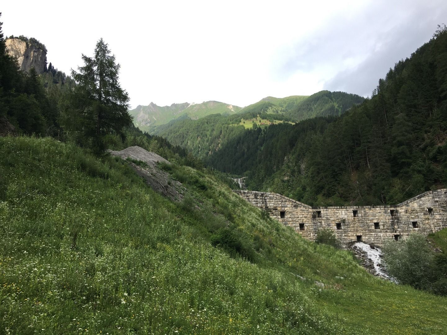
The torrent hike starts in the centre of Matrei in Osttirol and hike up between the walls of the stream Bretterwandbach. Follow the path across the curling rink to the level of the chapel Bach Kirchl and cross the bridge. Follow the ditch path, always along the orographic (flow direction) right bank of the stream Bretterwandbach. You will pass numerous torrent obstructions, such as the imposing Kalkofensperre.
Take the turnoff to the district Preßlab. The steep trail leads you to the highest district of Matrei in Osttirol, called Preßlab. Follow the wide path over Lichtegg until reaching the hiking trail Goldriedriese. 15 minutes uphill, the huts Jagatee Stub'n and Kuenzer Alm invite you to take a break. Via the Goldriedriese and Innerklaunz you will find your way back to Matrei in Osttirol.
Take the turnoff to the district Preßlab. The steep trail leads you to the highest district of Matrei in Osttirol, called Preßlab. Follow the wide path over Lichtegg until reaching the hiking trail Goldriedriese. 15 minutes uphill, the huts Jagatee Stub'n and Kuenzer Alm invite you to take a break. Via the Goldriedriese and Innerklaunz you will find your way back to Matrei in Osttirol.
Trasa
Matrei in Osttirol
(944 m)
Město
0,1 km
Bach-Kapelle
(1.028 m)
Místo konání bohoslužeb
0,6 km
Hinterburg
(1.126 m)
Vesnice
0,6 km
Jagateestube
(1.758 m)
Restaurace
6,7 km
Klaunzkapelle
(1.074 m)
Místo konání bohoslužeb
11,4 km
Hinterburg
(1.126 m)
Vesnice
11,8 km
Bach-Kapelle
(1.028 m)
Místo konání bohoslužeb
11,8 km
Trasa
Circular hike Bretterwandbach
střední
Turistika
12,50
km
Matrei in Osttirol
(944 m)
Město
0,1 km
Bach-Kapelle
(1.028 m)
Místo konání bohoslužeb
0,6 km
Hinterburg
(1.126 m)
Vesnice
0,6 km
Klaunz
(1.121 m)
Vesnice
0,7 km
Kuenzeralm
(1.769 m)
Restaurace
6,7 km
Jagateestube
(1.758 m)
Restaurace
6,7 km
Klaunz
(1.121 m)
Vesnice
11,1 km
Klaunzkapelle
(1.074 m)
Místo konání bohoslužeb
11,4 km
Hinterburg
(1.126 m)
Vesnice
11,8 km
Bach-Kapelle
(1.028 m)
Místo konání bohoslužeb
11,8 km
Matrei in Osttirol
(944 m)
Město
12,3 km




Oceňování

5
(1)
4
(0)
3
(0)
2
(0)
1
(0)
Získejte přehled Vždy živě na místě s více než 9 500 webkamerami. bergfex Jako uživatel Pro si nyní můžete zobrazit odpovídající webové kamery pro mnoho prohlídek v aplikaci prohlídky z. Můžete si tak přímo prohlédnout aktuální podmínky. Oblíbené prohlídky v okolí
- 4,5
Circular hike Proßeggklamm
středníTuristika 8,41 km - 4,9
Glockner
středníVysokohorská turistika 19 km - 5,0
Rotenkogel
heavyTuristika 4,22 km - 4,3
Stüdlhütte -Großglockner
Turistika 4,68 km - 5,0
Figerhorn, 2743m, Lucknerhaus
středníTuristika 6,69 km - 4,3
Lucknerhaus zur Glorerhütte über Lucknerhütte zurück
středníTuristika 11,2 km - 4,0
Böses Weibele, 3119m, Lucknerhaus
heavyTuristika 13,8 km - 4,5
Großglockner Normalweg (1-Tages-Tour) - Top of Austria 3798m
heavyVysokohorská turistika 19,9 km - 4,9
Circular hike suspension bridge Isel Canyon via "Hohe Bank"
středníTuristika 8,11 km - 4,5
Lucknerhütte vom Lucknerhaus
středníHorská turistika 4,81 km
Pěší turistika a stopování

Více než 550.000 návrhů výletů, podrobné mapy a intuitivní plánovač tras dělají z aplikace nezbytnou výbavu pro všechny milovníky přírody.

Nenechte si ujít nabídky a inspiraci pro vaši příští dovolenou
Přihlaste se k odběru newsletteru
Chyba
Došlo k chybě. Zkuste to prosím znovu.Děkujeme za vaši registraci
Vaše e-mailová adresa byl přidán do poštovního seznamu.
Zájezdy po celé Evropě
Rakousko Švýcarsko Německo Itálie Slovenia Francie Nizozemsko Belgie Polsko Lichtenštejnsko Česko Slovensko Španělsko Chorvatsko Bosna a Hercegovina Lucembursko Andorra Portugal Iceland United Kingdom Ireland Greece Albania North Macedonia Malta Norway Montenegro Moldova Kosovo Hungary San Marino Romania Estonia Latvia Belarus Cyprus Lithuania Serbia Bulgaria Monaco Denmark Sweden Finland





