Eisenreich 2.665m
heavy
Navigace na stránkách
Navigace na stránkách
Pořiďte si tuto prohlídku do mobilního telefonu
Eisenreich 2.665m
heavy
Lyžařská trasa
5.55
km
Naskenujte QR kód a spusťte navigaci v aplikaci bergfex.

Pěší turistika a stopování


Eisenreich 2.665m
heavy
Vzdálenost
5.55
km
Doba trvání
04:50
h
Ascent
1242
hm
Hladina moře
1421 -
2660
m
Stažení skladby
Eisenreich 2.665m
heavy
Lyžařská trasa
5.55
km

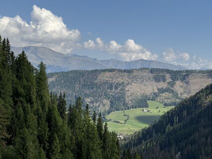
Another tour destination in Kartitsch’s Winklertal is the long draw-out summit of the Eisenreich. It is located to the west of the Pfannspitze and is tackled directly from Obstanser Wiesenboden. During...
Popis
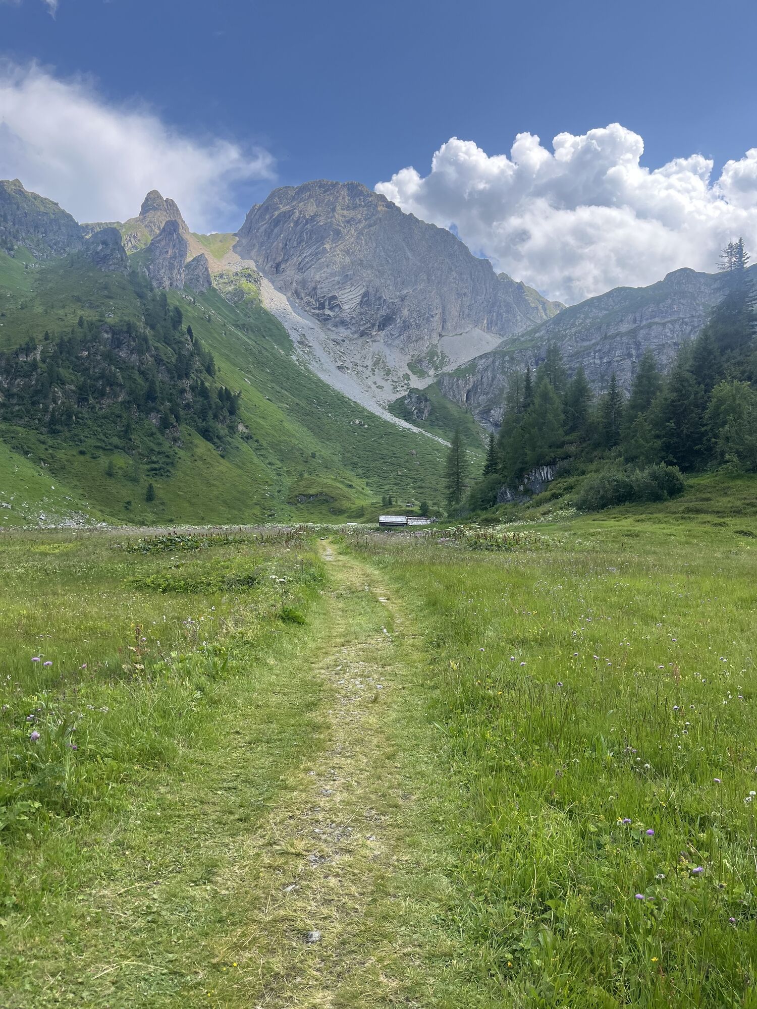
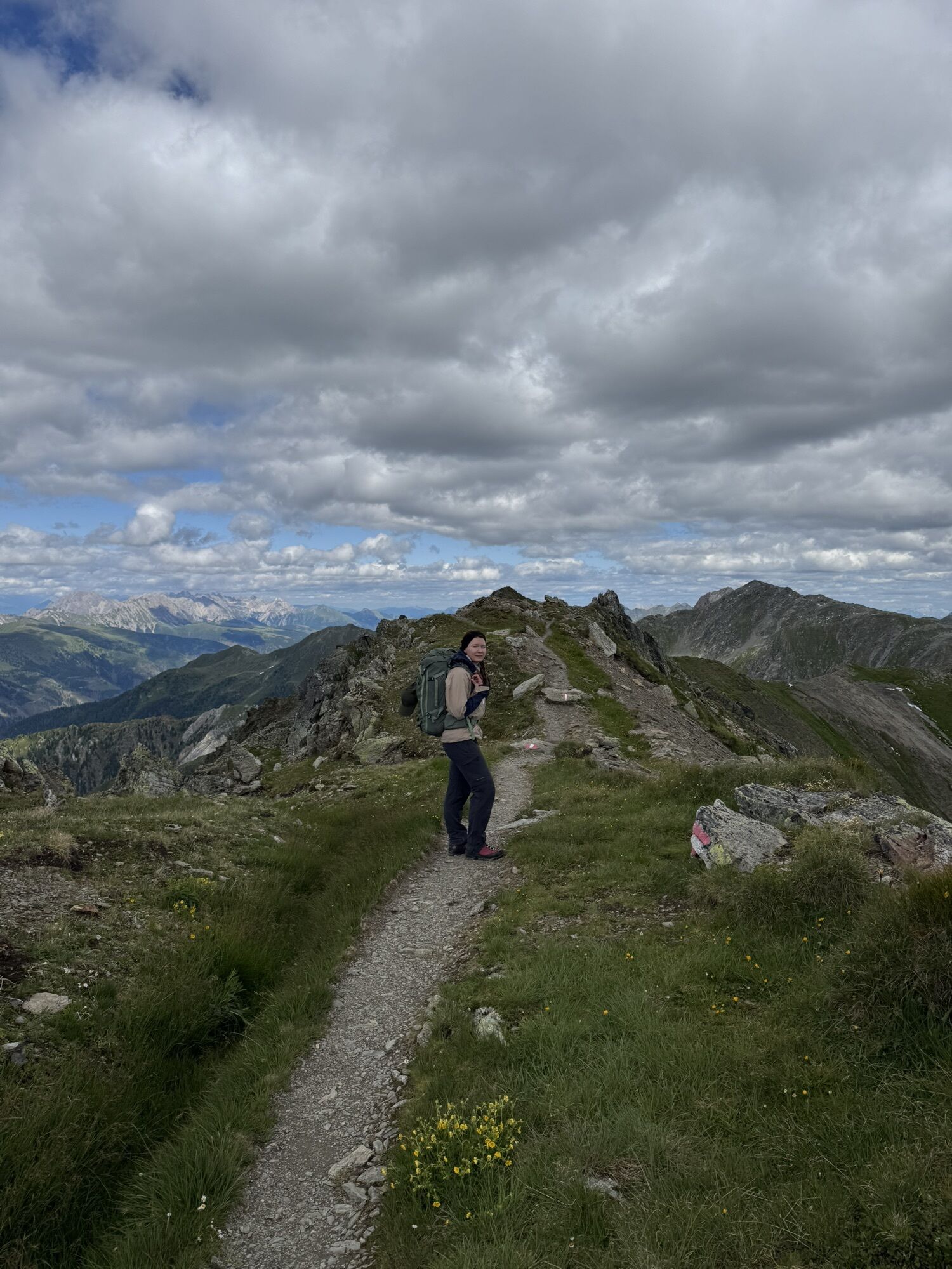
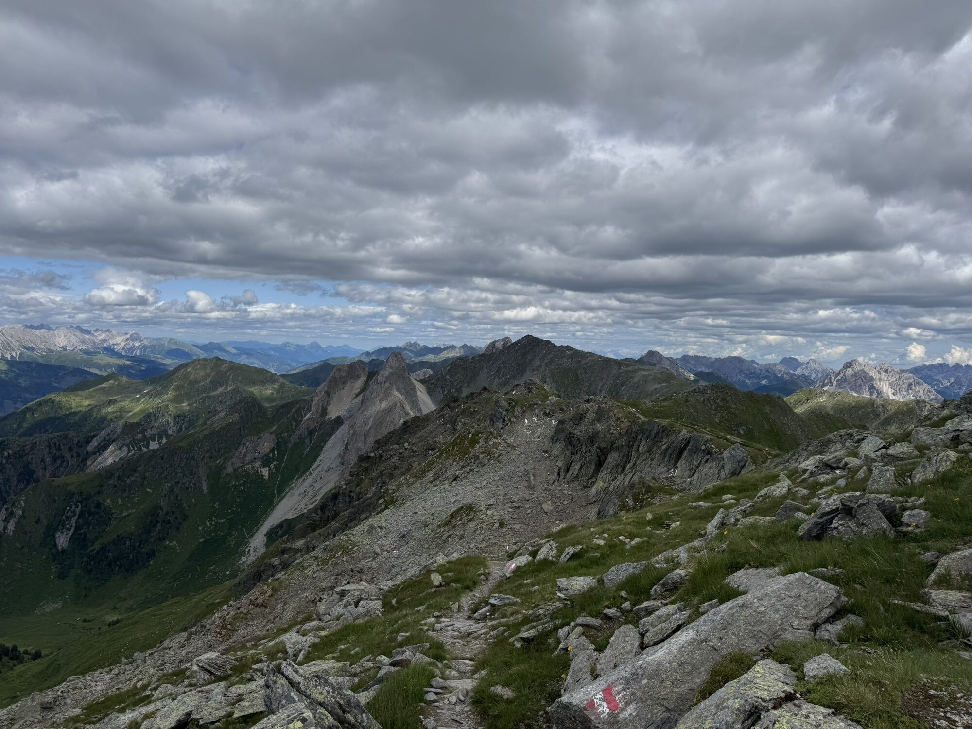
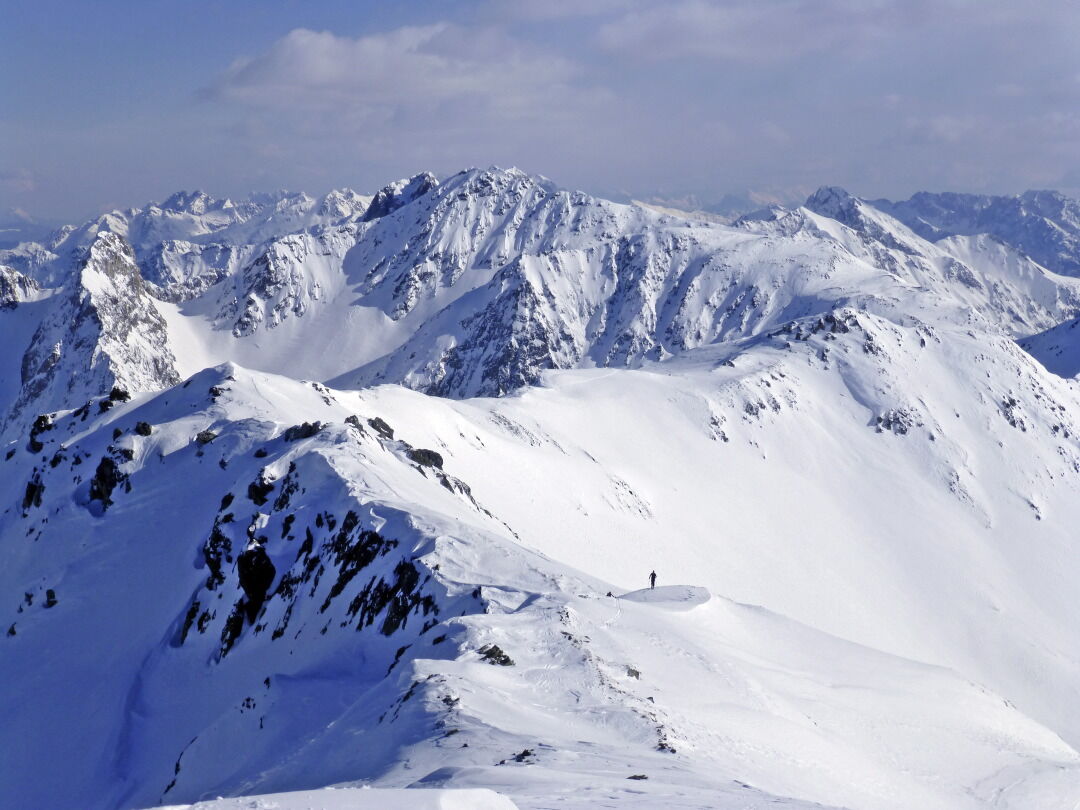
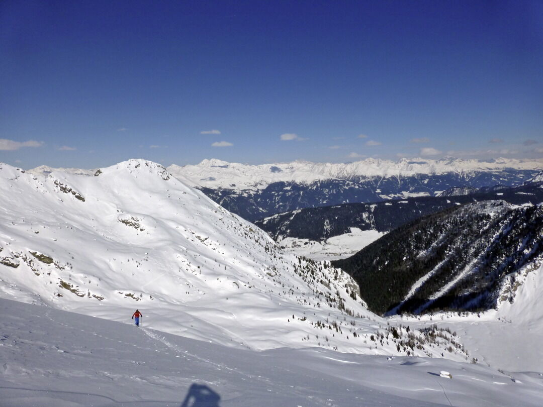
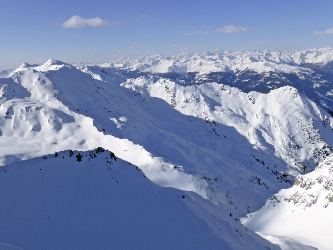
Another tour destination in Kartitsch’s Winklertal is the long draw-out summit of the Eisenreich. It is located to the west of the Pfannspitze and is tackled directly from Obstanser Wiesenboden. During this tour to the blocked rocky area at the head of the Winklertal is to be negotiated before we get to enjoy the ski-friendly slopes. Starting point: the entrance to Obstanser Wiesenboden proceeds the same as the ski tour to the Pfannspitze, and the same precautions apply! The ascent to the Eisenreich proceeds direct from Wiesenboden (1962 m) up via a wide ramp terrain, which, 200 metres after the lovely wooden hay barn in the plateau is like a solidified tongue of ice. Via these, in cleared hairpin bends heading south-west, until at around 2400 m we cross to the south on the accompanying ridge, leaving the superb slopes. Via the ridge which now narrows, the track takes us west on the cleared ridge line, where we proceed up and downhill continuing west to the peak of the Eisenreich, which is very secluded in the winter. This is where Friedensweg 403 proceeds in the summer, bringing together the entire Carnic region and reminds us of the horrors of World War 1. Descent along the ascent track. For photos of the rocky area see the tour to the Gatterspitze.
Additional ski tour tips can be obtained in the ski tour guides by Thomas Mariacher. These are available here: http://www.grafikzloebl.at/verlag/buecher/
Additional ski tour tips can be obtained in the ski tour guides by Thomas Mariacher. These are available here: http://www.grafikzloebl.at/verlag/buecher/
Trasa
Prinz-Heinrich-Kapelle
(1959 m)
Místo konání bohoslužeb
3.1 km
Eisenreich - Montagna del Ferro
(2665 m)
Summit
5.2 km
Trasa
Eisenreich 2.665m
heavy
Lyžařská trasa
5.55
km
Prinz-Heinrich-Kapelle
(1959 m)
Místo konání bohoslužeb
3.1 km
Eisenreich - Montagna del Ferro
(2665 m)
Summit
5.2 km
Informace o příjezdu
Příjezd
Mit dem Auto bis zum Sportplatz Kartitsch
Veřejná doprava
Mit dem Bus bis zur Haltestelle "Kartitsch Gemeindeamt"
Parkování
Parkplatz Sportplatz Kartitsch
Oceňování
5
(1)
4
(0)
3
(0)
2
(0)
1
(0)

Oblíbené prohlídky v okolí
-
4.9
Drei Zinnen
středníTuristika 19.6 km -
4.8
Fischleintal zu den 3 Zinnen Hütte mit Besteigung des Sextner Steins
středníTuristika 16.2 km -
4.5
Kartitsch-Obstansersee Hütte
středníTuristika 13.1 km -
4.8
Rotwandwiesen kreuzbergpass rundweg
středníTuristika 12.0 km -
3.9
Rotwandspitze
středníVia ferrata 10.6 km -
5.0
Porzehütte (1.942 m)
světloTuristika 9.01 km -
4.8
Sillianer Hütte 2.447 m
středníTuristika 16.8 km -
4.2
Connyalm (2.070 m)
Turistika 6.36 km -
5.0
Carnic altitude trail. Stage 4: Porzehütte – Hochweißsteinhaus
heavyTuristika 17.5 km -
3.8
Karnischer Höhenweg KHW 403 - "Weg des Friedens"
středníTuristika 46.7 km

Pěší turistika a stopování

Více než 550.000 návrhů výletů, podrobné mapy a intuitivní plánovač tras dělají z aplikace nezbytnou výbavu pro všechny milovníky přírody.

Nenechte si ujít nabídky a inspiraci pro vaši příští dovolenou
Přihlaste se k odběru newsletteru
Chyba
Došlo k chybě. Zkuste to prosím znovu.
Děkujeme za vaši registraci
Vaše e-mailová adresa byl přidán do poštovního seznamu.
Zájezdy po celé Evropě
Rakousko
Švýcarsko
Německo
Itálie
Slovenia
Francie
Nizozemsko
Belgie
Polsko
Lichtenštejnsko
Česko
Slovensko
Španělsko
Chorvatsko
Bosna a Hercegovina
Lucembursko
Andorra
Portugal
Iceland
United Kingdom
Ireland
Greece
Albania
North Macedonia
Malta
Norway
Montenegro
Moldova
Kosovo
Hungary
San Marino
Romania
Estonia
Latvia
Belarus
Cyprus
Lithuania
Serbia
Bulgaria
Monaco
Denmark
Sweden
Finland