


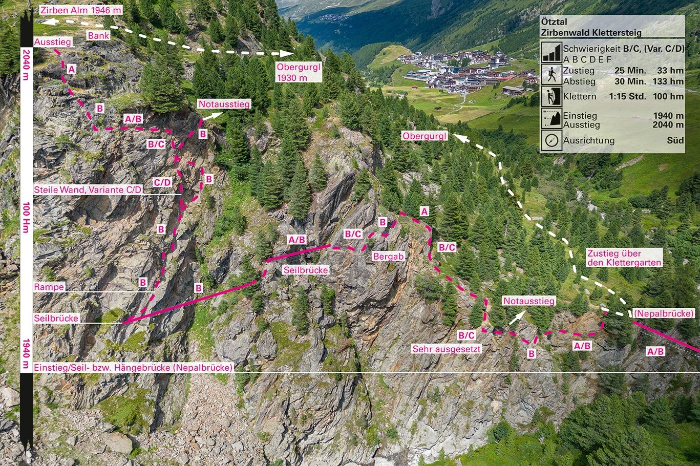
Via ferrata Zirbenwald | Obergurgl
Úroveň obtížnosti: B/C
Fotografie našich uživatelů

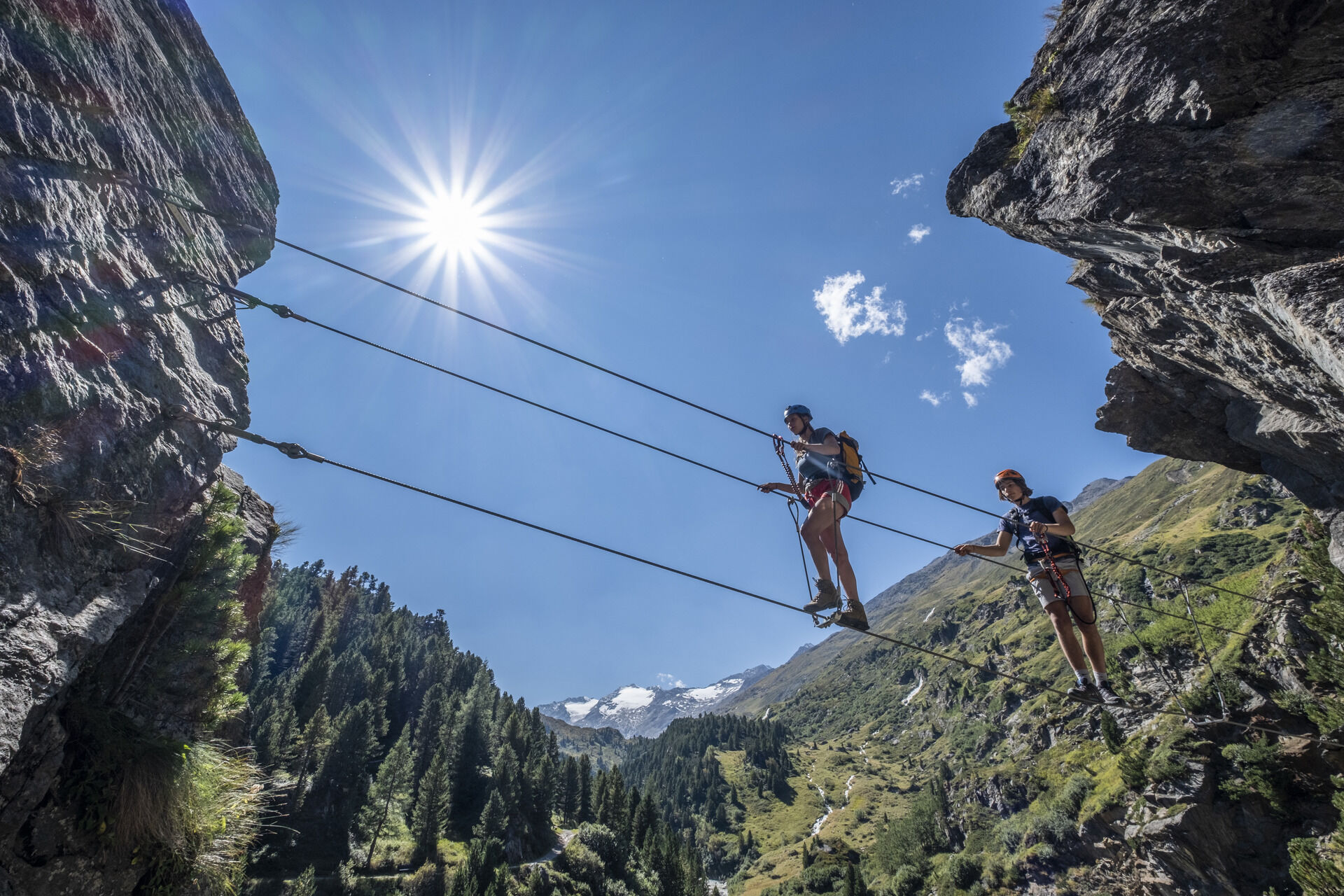
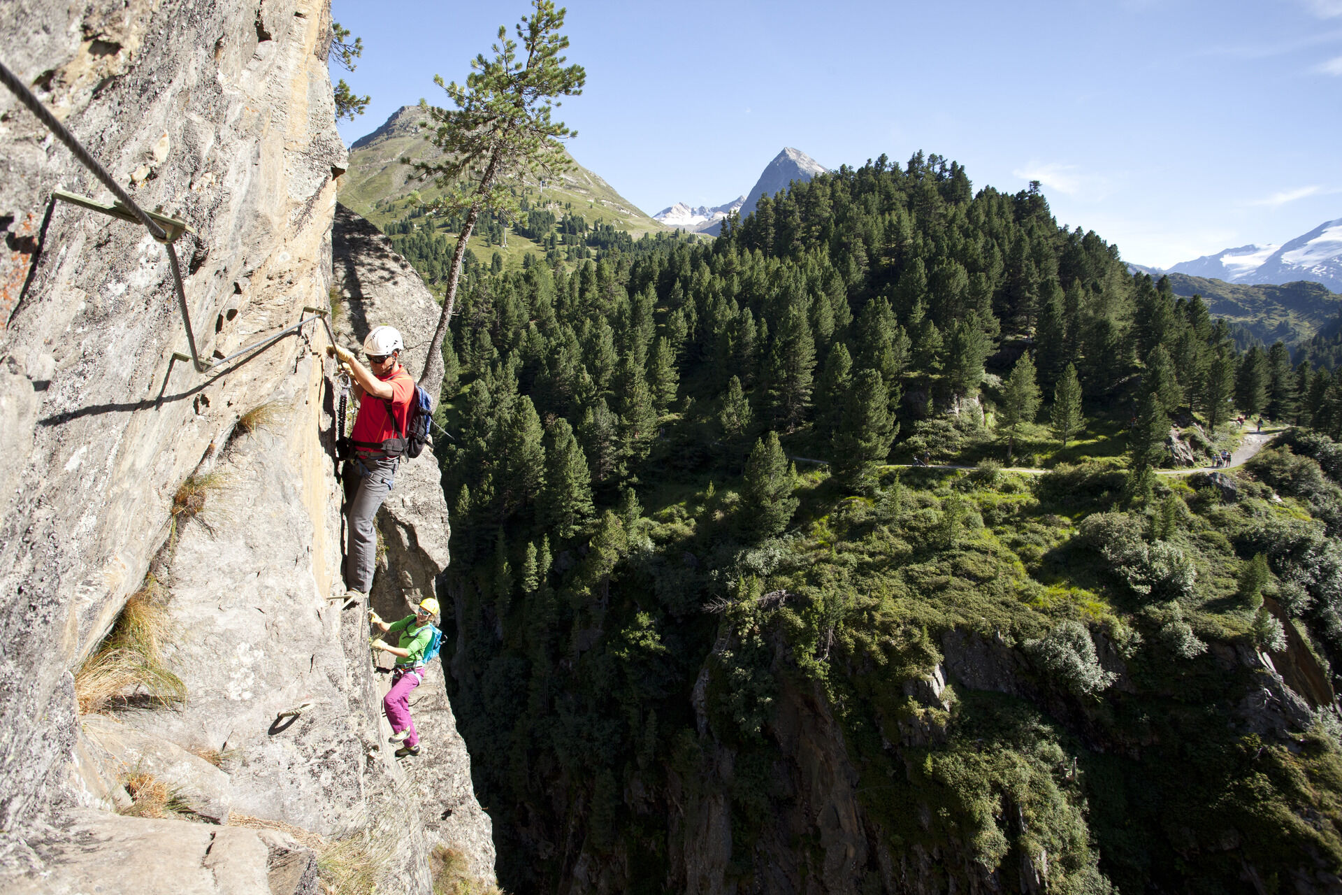
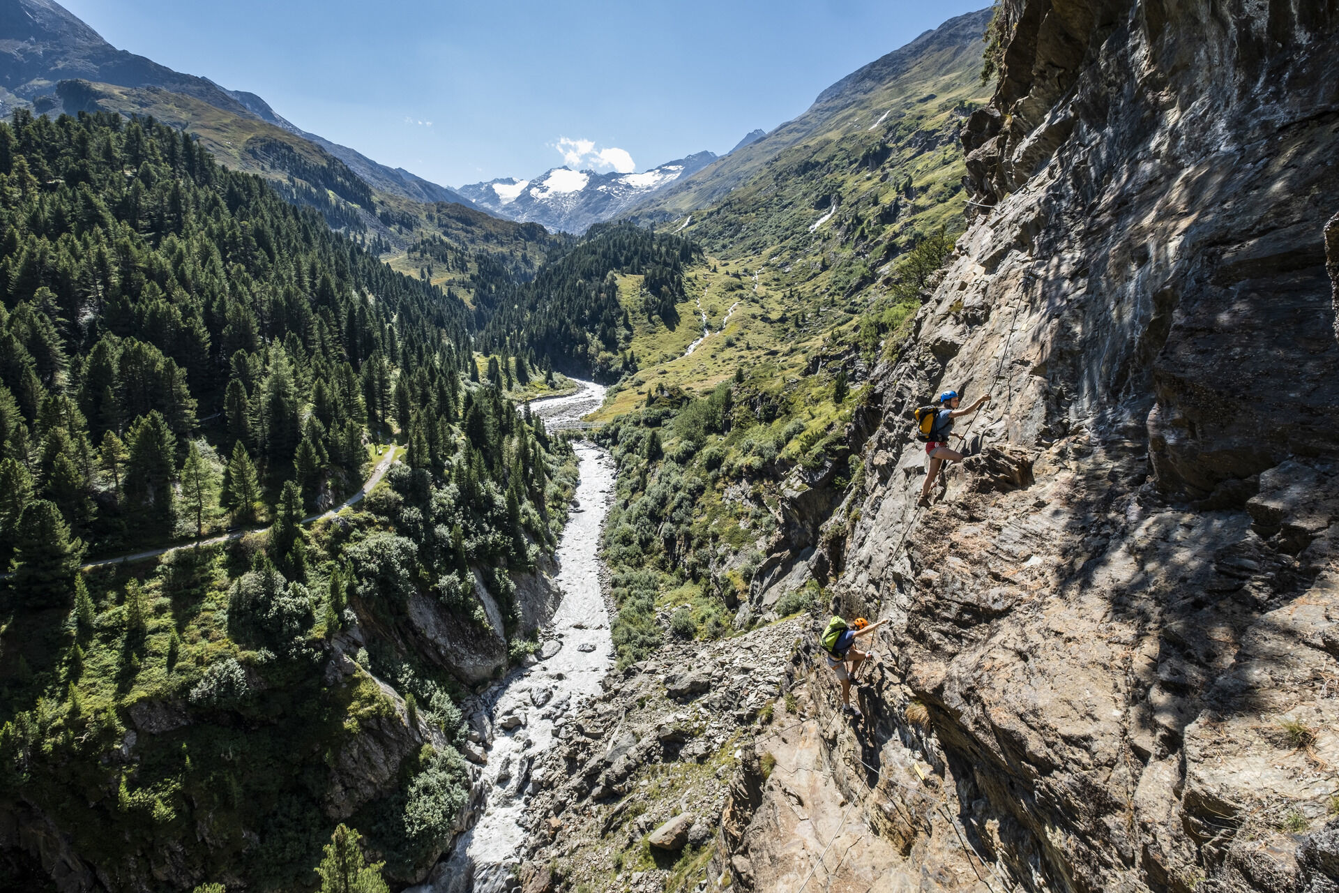
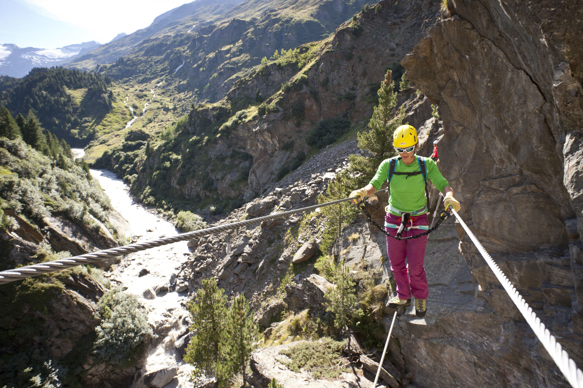
Crossing the suspension bridge at the start already requires courage and skill; a cable for securing with the via ferrata set is provided. The easy hiking trail to and from the exit is especially pleasant,...
Crossing the suspension bridge at the start already requires courage and skill; a cable for securing with the via ferrata set is provided. The easy hiking trail to and from the exit is especially pleasant, so non-climbers can also be close to the action.
Length and time required
100 meters altitude and 400 m climbing length. approx. 1.5 to 2 hours, about 3 hours including descent.
More details about the via ferrata / www.climbers-paradise.com

Ano
Helmet, climbing harness with via ferrata set, via ferrata gloves, and suitable footwear.
SAFETY ON THE VIA FERRATA
The Austrian Alpine Club has formulated 10 recommendations for via ferrata climbing to increase safety:
Plan carefully Adjust the target to your personal abilities Use complete, standards-compliant equipment Do not start if there is a thunderstorm risk Critically check the cable and anchors Partner check at the start Maintain sufficient distances Clear communication when overtaking Beware of rockfall Respect nature and the environmentMinimum age of children: 10 years (1.40 m height)
Driving to the ÖTZTAL. Located in Tyrol, the ÖTZTAL branches southwards as the longest side valley of the Eastern Alps. Traveling by car leads visitors via the Inn valley to the valley entrance and further along the Ötztal. In addition to the toll motorway, country roads can also be used. Your journey can quickly and conveniently be planned with the route planner: To the route planner: https://www.google.at/maps
Travel comfortably and safely by train to the Ötztal station. The final stop or exit point is the ÖTZTAL station. Afterwards, you can conveniently and quickly continue your journey to your desired destination within the entire valley by public transport or local taxi companies! The current bus schedule can be found at: http://fahrplan.vvt.at
The following parking options are available in Gurgl:
Parking garage village center Obergurgl (down to the right in front of the church), paid Parking garage village entrance – valley station Festkoglbahn, paidB/C
More info about climbing in the Ötztal: https://www.oetztal.com/klettern
Oblíbené prohlídky v okolí
-
4.3
Vorderkaser - Eishof / Texelgruppe
světloTuristika 4.83 km -
4.8
Vent - Kreuzspitze
Turistika 20.6 km -
4.6
Passerschlucht
světloTuristika 8.84 km -
4.4
Hochtour Wildspitze, 3.768m
středníVysokohorská turistika 9.75 km -
4.4
Passerschlucht mit Stieber Wasserfällen, Trentino-Südtirol/Italien
středníTuristika 9.49 km -
3.1
Tiefenbachglacier - Mountaineering Village Vent
středníTuristika 10.8 km -
4.5
Vent - Wilder Mann - Breslauer Hütte - Stableinalm
středníTuristika 7.25 km -
4.9
Pfossental - vom Vorderkaser auf die Stettinerhütte
středníTuristika 23.7 km -
4.4
Hochwilde - Pfelders
středníVysokohorská turistika 22.1 km -
5.0
Obergurgl - Ramolhaus
Turistika 7 km

Pěší turistika a stopování


Nenechte si ujít nabídky a inspiraci pro vaši příští dovolenou
Vaše e-mailová adresa byl přidán do poštovního seznamu.