


BergeSeen Trail S2: Ischler Hütte - Hochkogelhaus


The second section of this alpine variant leads over one of the most beautiful panoramic mountains in the Salzkammergut. Nevertheless, the people of Ischl gave it its name for a different reason: its round,...
The second section of this alpine variant leads over one of the most beautiful panoramic mountains in the Salzkammergut. Nevertheless, the people of Ischl gave it its name for a different reason: its round, grassy summit hood reminds them of the shape of a "Schölln", i.e. a cowbell. On the descent to the Hochkogelhaus, however, the summit shows why the people of Ebensee, who see its rocky northern side, call it the "Wildenkogel".

From the Ischler Hütte, first take trail no. 211 in the direction of "Schönberg". Through sparse forest you reach a fork in the trail. There you take the right path - no. 226 - and hike up through the unclear mountain pine and karst terrain below the Feuchterkogel. Above it, the Altarkögerl (1,723 m) rises on the left. Still further up, the trail finally leads through the grassy southwestern flank up to the summit cross on the Schönberg (2,090 m). The highest point of the massif - plus three meters! - is located on the neighboring knoll to the west and can be reached via a short secured passage. 2:00 h
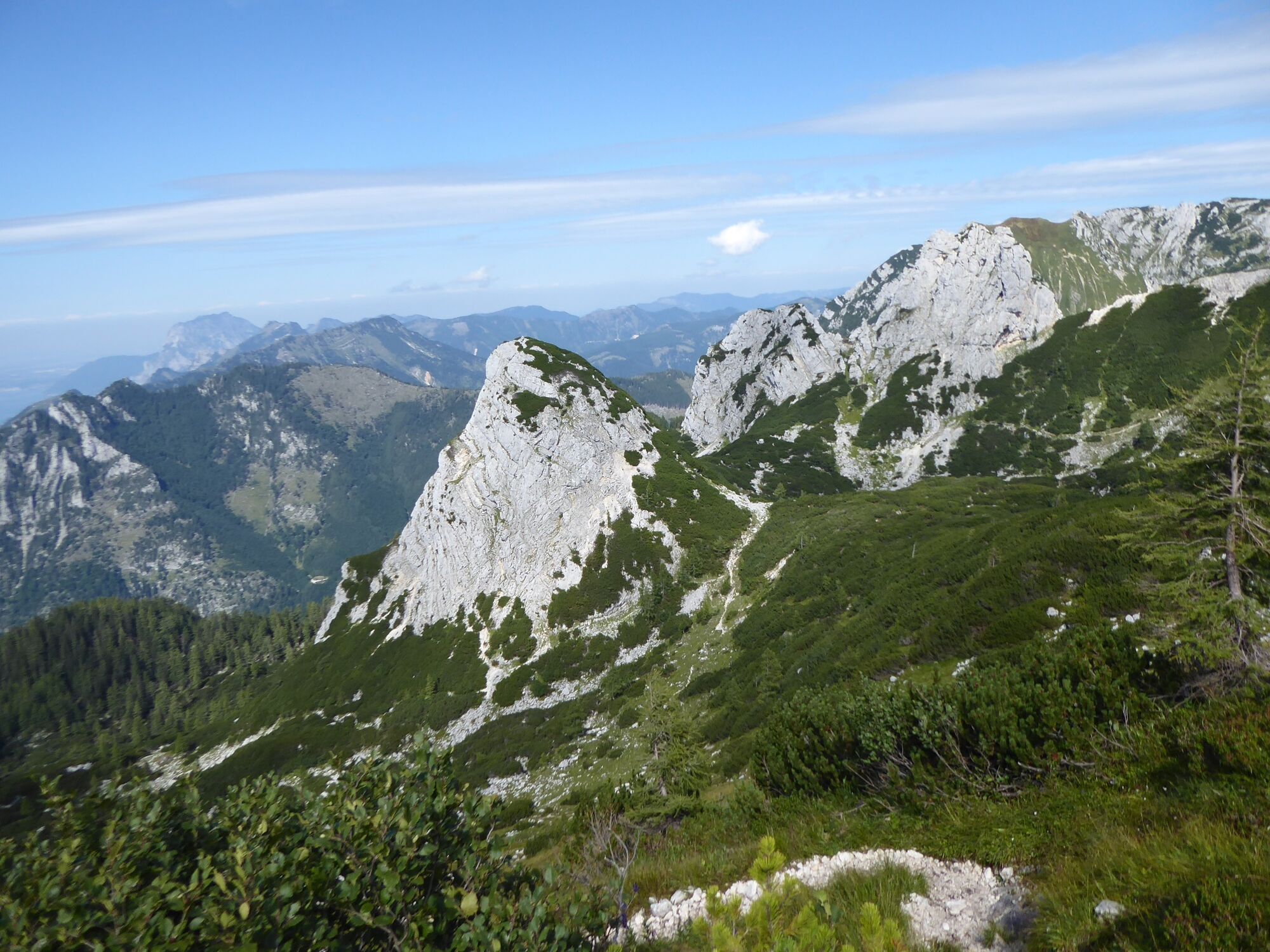
Descent to the left across the summit meadow and the rocky, in places also with mountain pines overgrown northwest ridge (marking No. 227). The view down to the north to the Rauhen Kögeln is impressive, but the precipitous wall falls to the right of the path warn you to be careful! Finally, the ridge runs out in the mountain pine thicket above a saddle adorned with some pools in front of the inconspicuous Möselhorn (1,657 m). Already above it, the path turns to the right and meets path no. 211, which runs to the east of the Schönberg from the Ischler Hütte to the Hochkogelhaus.
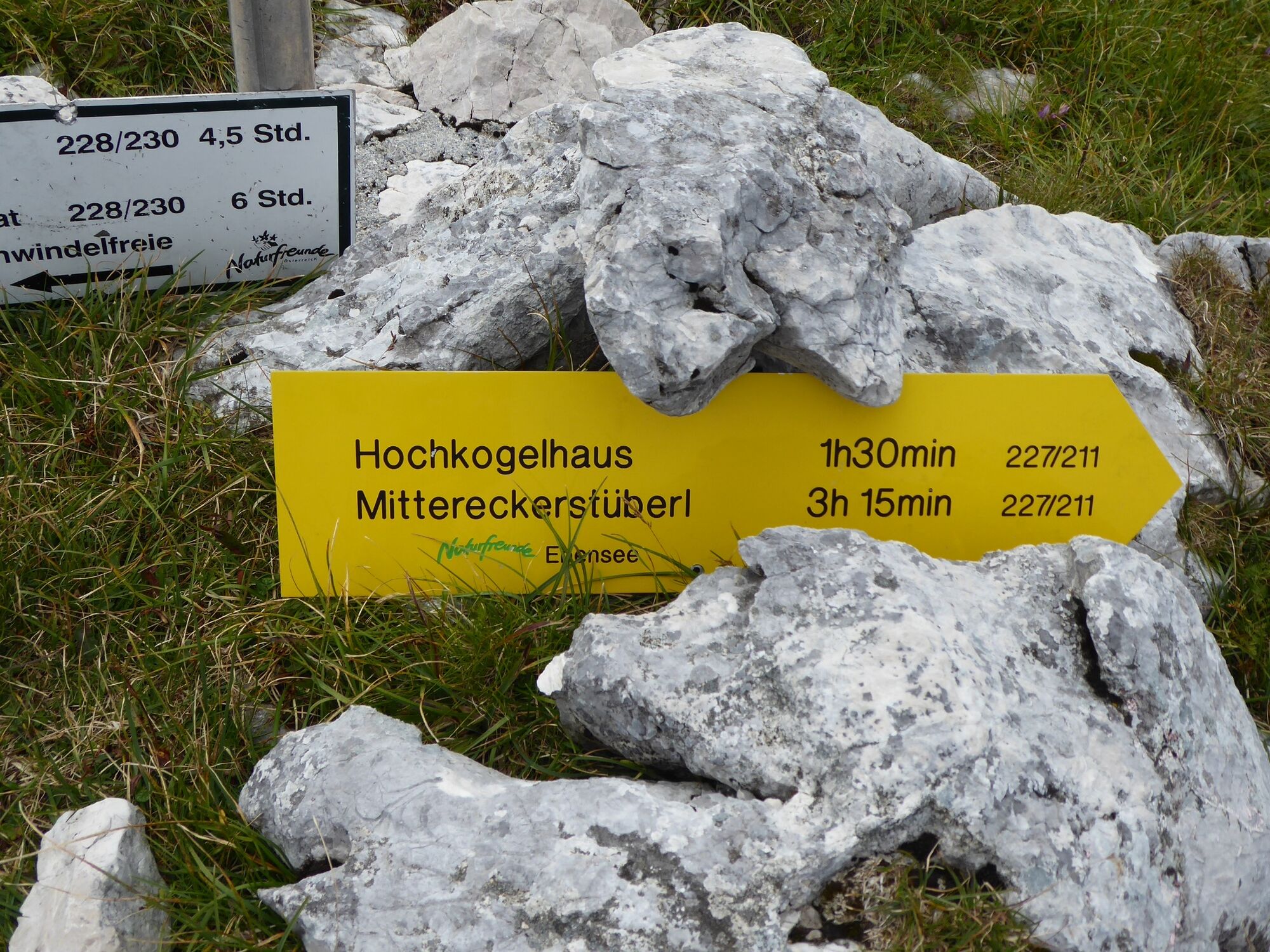
On this path you now go downhill to the right and over a cirque into the depression below the Großer Rauhenkogel. At the fork there, stay left and continue hiking under the rugged west face of the Großer and Kleiner Rauhenkogel through steep rock, mountain pine and scree terrain (there is a via ferrata on the right above). Finally you reach the Hochkogelhaus (1,558 m) of the Ebenseer Naturfreunde via a wooded ridge. 2:00 h
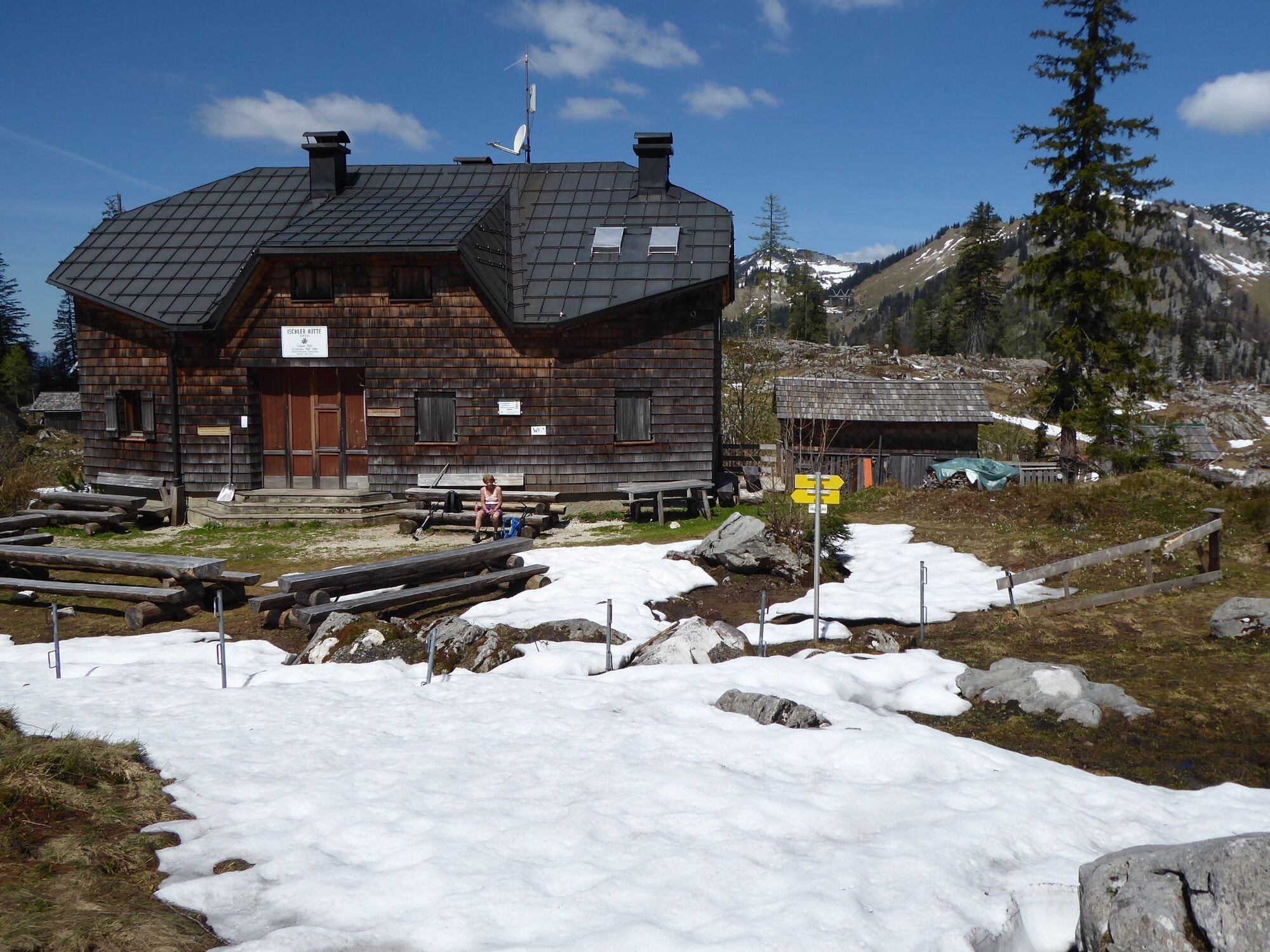
The shelter, opened in 1924, stands on a particularly beautiful spot against the wild backdrop of impressive rocky peaks. As a short extra, it is recommended to climb the nearby summit of the Hochkogel (1,591 m), which is secured by a fence, because it promises a great view to the north and to the nearby rock towers of the Rauhenkogel.
For all stages you will need hiking or mountain boots with a treaded rubber sole as well as wind- and rainproof clothing.
A change of clothes and a small first-aid kit should also be in your backpack. How much food you pack depends on the number of stops you make. In any case, you should take enough to drink. Telescopic poles are especially helpful when going downhill.
In alpine terrain, pay attention to the danger of falling rocks.
Until early summer you can encounter steep snowfields or firn gullies - especially in icy conditions there is then an acute danger of falling and thus of death!
Due to storm damage, forestry work or construction work, individual sections of the trail may be temporarily difficult or impossible to pass.
Cows on the alp are often curious. Because they are mother cows, they develop a strong drive to protect their calves. Therefore, move quietly on cow pastures, keep at least 20 m distance to the animals and do not stroke calves under any circumstances! In case of threatening gestures (pawing, stamping) slowly move away backwards (do not turn your back). Dogs on a leash, they must not bark at cows or even chase them. In the event of an attack, it is essential to let them off the leash.
Text kindly provided by the publisher KOMPASS-Verlag and Wolfgang Heitzmann.
Further information at trail.salzkammergut.at
to the Rinnerkogel (2,012 m)
Oblíbené prohlídky v okolí
- 4,4
Bad Goisern: Pötschenhöhe – Sarstein - Obertraun
Turistika11,4 km - 5,0
Gößl - Pühringerhütte - Rotgschirr
středníHorská turistika24,6 km - 4,5
Hike to the Hütteneckalm
světloTuristika8,70 km - 4,8
Loserrunde über Augstsee, Loserfenster, Losergipfel und Loserhütte
středníTuristika4,69 km - 4,7
Schneiderberg
středníTuristika9,35 km - 4,7
/\ Erlakogel
středníTuristika9,67 km - 4,4
Schneiderberg im Almtal
středníTuristika7,97 km - 4,4
+++ Grundlsee Umrundung
světloTuristika14,9 km - 4,4
Rundweg Großer & Kleiner Sonnstein, Ebensee am Traunsee, Oberösterreich/Österreich
středníTuristika9,64 km - 4,4
Drei-Seen-Blick / Grundlsee - Toplitzsee - Kammersee
středníTuristika12,1 km
Pěší turistika a stopování


Nenechte si ujít nabídky a inspiraci pro vaši příští dovolenou
Vaše e-mailová adresa byl přidán do poštovního seznamu.