


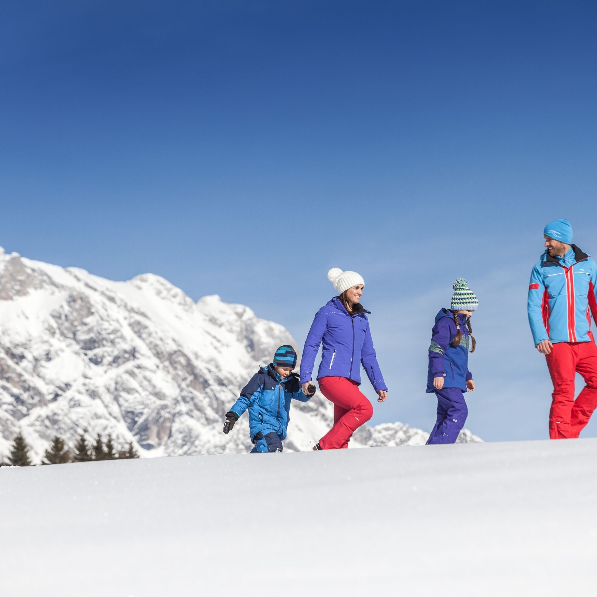
Winter hiking from Dienten to the Steinbockalm


The trail starts at the car park of the Grünegg toboggan run. From there we follow the toboggan run until we arrive at the Grünegg Alm. Here the prepared winter hiking trail starts in the direction of...
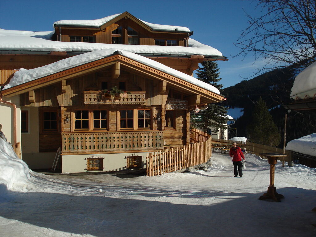
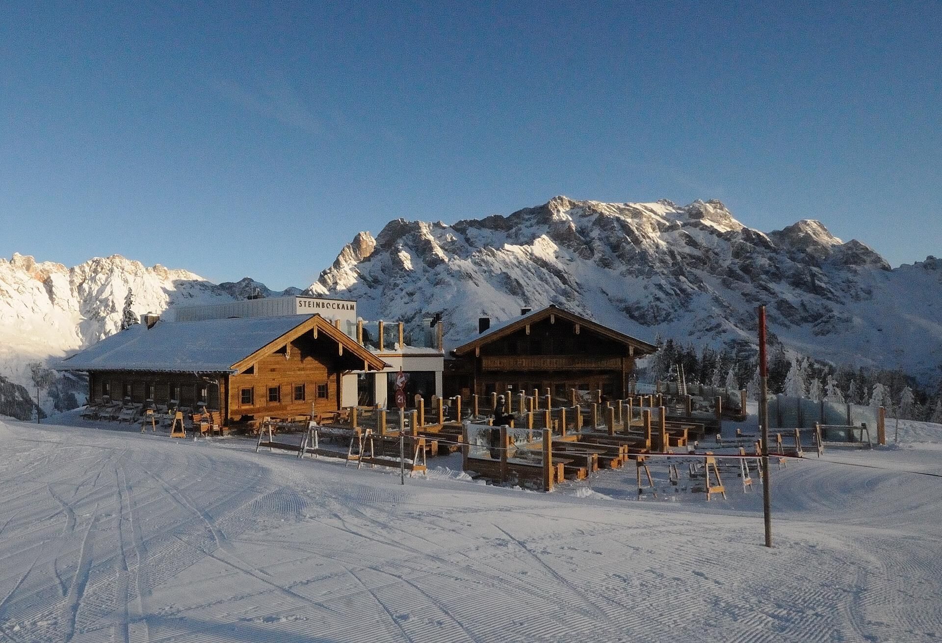
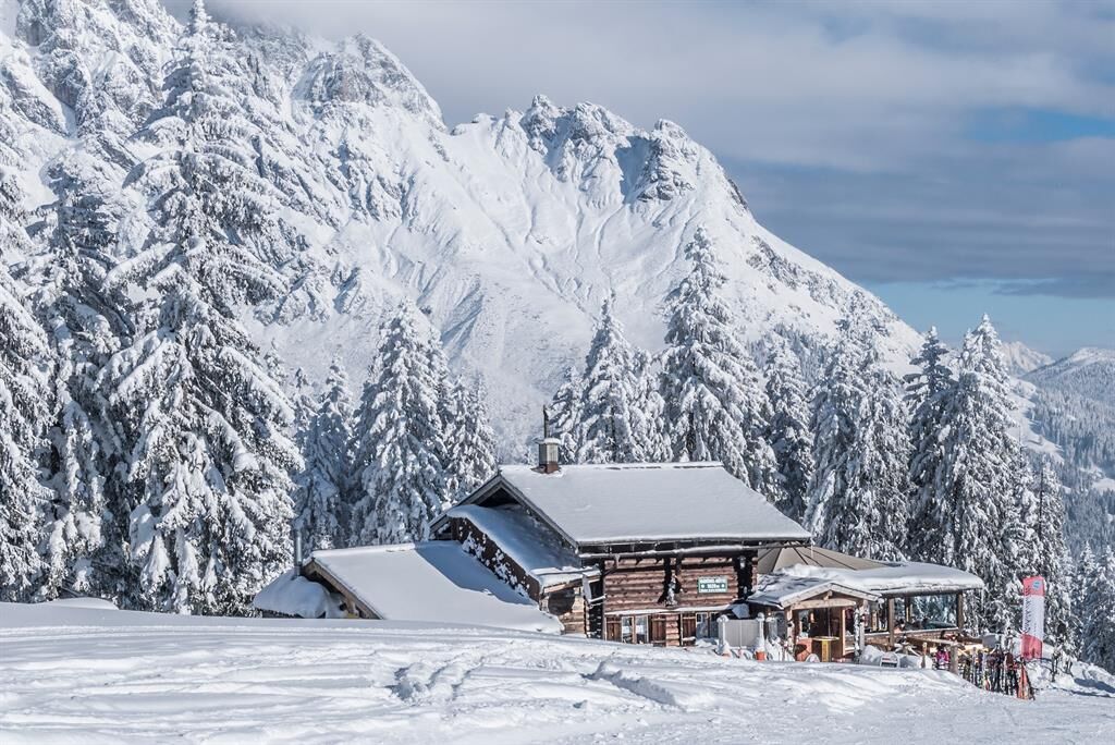
The trail starts at the car park of the Grünegg toboggan run. From there we follow the toboggan run until we arrive at the Grünegg Alm. Here the prepared winter hiking trail starts in the direction of Filzensattel/Gabühel. Trail no. 50 first crosses the ski slope and then we reach the Gabühel/Filzensattel fork. Now we follow trail no. 51 uphill in the direction of Gabühelhütte/Steinbockalm. We have to cross the ski slope again to follow the prepared trail, or we choose the forest trail (yellow signs) to the Gabühel hut. On the normal path we reach the mountain station of the Gabühelbahn - there we pass to the left until we reach the Steinbockalm. From there we have a wonderful panoramic view of the valley and the majestic Hochkönig. The way back is via the same route - otherwise you can also choose the descent with the 10-person Gabühel cable car. Tickets are available directly at the cable car!

The trail starts at the car park of the Grünegg toboggan run. From there we follow the toboggan run until we arrive at the Grünegg Alm. Here the prepared winter hiking trail starts in the direction of Filzensattel/Gabühel. Trail no. 50 first crosses the ski slope and then we reach the Gabühel/Filzensattel fork. Now we follow trail no. 51 uphill in the direction of Gabühelhütte/Steinbockalm. We have to cross the ski slope again to follow the prepared trail or we choose the forest trail (yellow signs) to the Gabühel hut. On the normal path we reach the mountain station of the Gabühelbahn - there we pass to the left until we reach the Steinbockalm. From there we have a wonderful panoramic view of the valley and the majestic Hochkönig. The way back is via the same route - otherwise you can also choose the descent with the 10-person Gabühel cable car. Tickets are available directly at the cable car!
Ano
Sturdy, waterproof footwear
Possibly snow shoes
Appropriate winter clothing with gloves
Adjustable poles
Bagpack with hot drink and light snack
Necessary medication
First aid kit
Stay on the marked hiking trails. Small steps and a steady pace save energy going uphill and protect your joints going downhill. If you tilt your upper body slightly forward when going downhill, you reduce the risk of slipping. Check the weather forecast. Fog and bad weather can come surprisingly quickly. Turn back in good time before you take a risk. Do not leave waste in the countryside
Emergency numbers: Alpine emergency call: 140
International emergency call: 122
Coming from Salzburg: Take the A10 freeway to the Bischofshofen exit, then take the B311 in the direction of Bischofshofen. Follow the Hochkönig Bundesstraße/B164 to Mühlbach and further to Dienten.
Coming from Innsbruck/ Kufstein: On the Loferer Straße/B178 in the direction of St. Johann i.T., then on the Hochkönig Bundesstraße/B164 via Saalfelden and Maria Alm to Dienten or to the Filzensattel.
A valid vignette is required to use the Austrian motorway and motorway network. It is also compulsory to carry a first-aid kit, warning triangle and high-visibility waistcoat. Further information can be found under Asfinag.
ÖBB-Scotty: Timetable information
Bus line 620: Timetable information
Bus line 631: Timetable information
Ski bus: Timetable information
Free parking at the Dienten Ski Centre
An overview map is available at the tourist office.
www.hochkoenig.at
region@hochkoenig.at
+43 (0)6584 20388
Stop at the Gabühelhütte or the Steinbockalm.
Oblíbené prohlídky v okolí
- 4,8
Summit storming route Taghaube
heavyTuristika6,25 km - 4,8
Hochkönig - Gipfel der Gefühle - Matrashaus
heavyTuristika20,9 km - 4,6
Panorama hike to the Hochkeil
středníTuristika6,07 km - 3,5
Wanderung zur Ostpreußenhütte in Werfen (1.630 m)
středníTuristika11,2 km - 4,8
About the "Four Huts circular route" to Windraucheggalm
středníTuristika10,1 km - 4,3
Riemannhaus
heavyTuristika3,69 km - 4,3
Peter-Wiechenthaler Hut
středníTuristika4,32 km - 3,9
Mühlbacher Höhenweg
středníTuristika11,2 km - 4,9
Breithorn
středníTuristika10,0 km - 4,6
Steinalm
světloTuristika2,71 km
Pěší turistika a stopování


Nenechte si ujít nabídky a inspiraci pro vaši příští dovolenou
Vaše e-mailová adresa byl přidán do poštovního seznamu.