


5A | Grubalmkar trail


Fotografie našich uživatelů
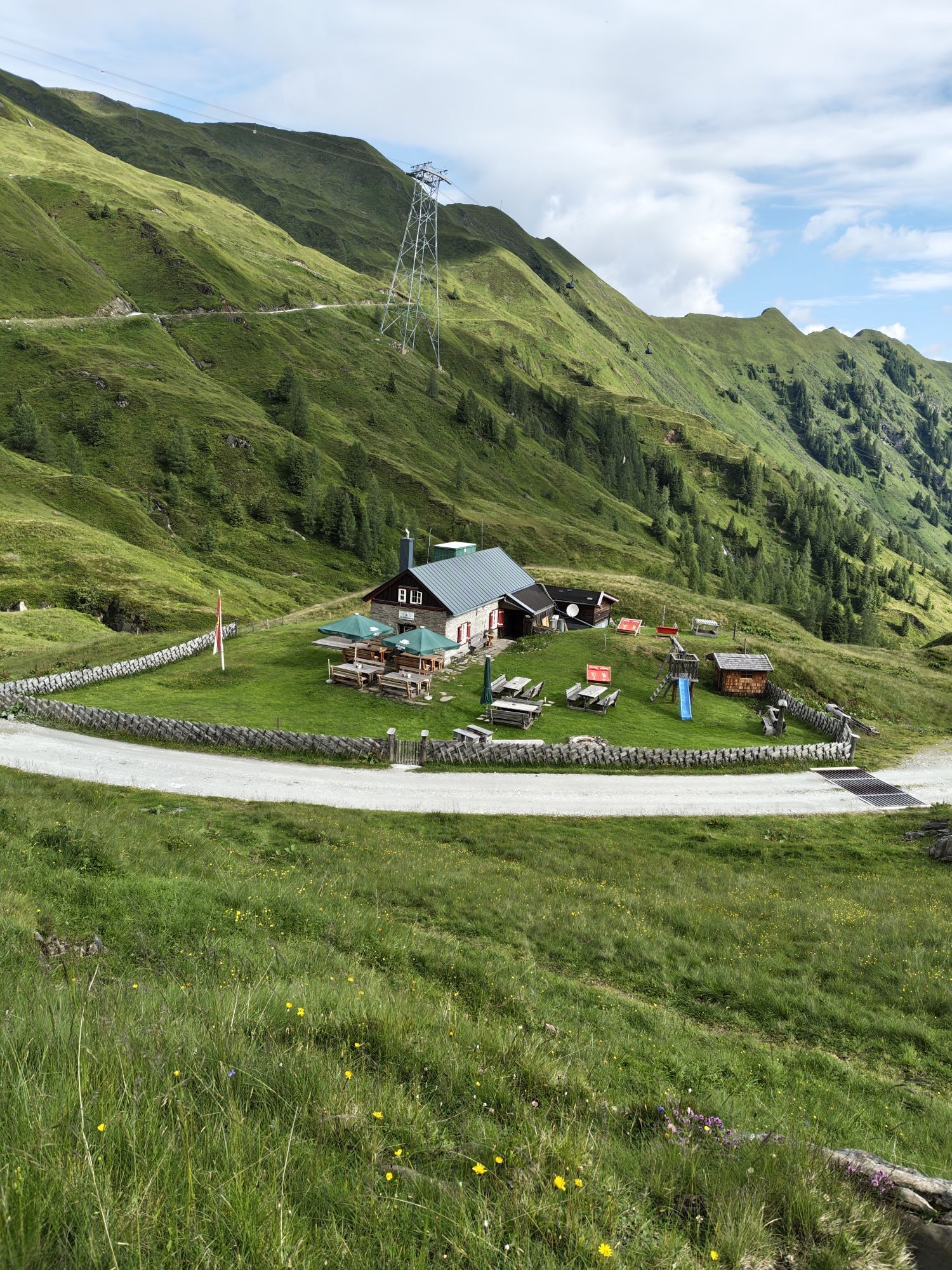
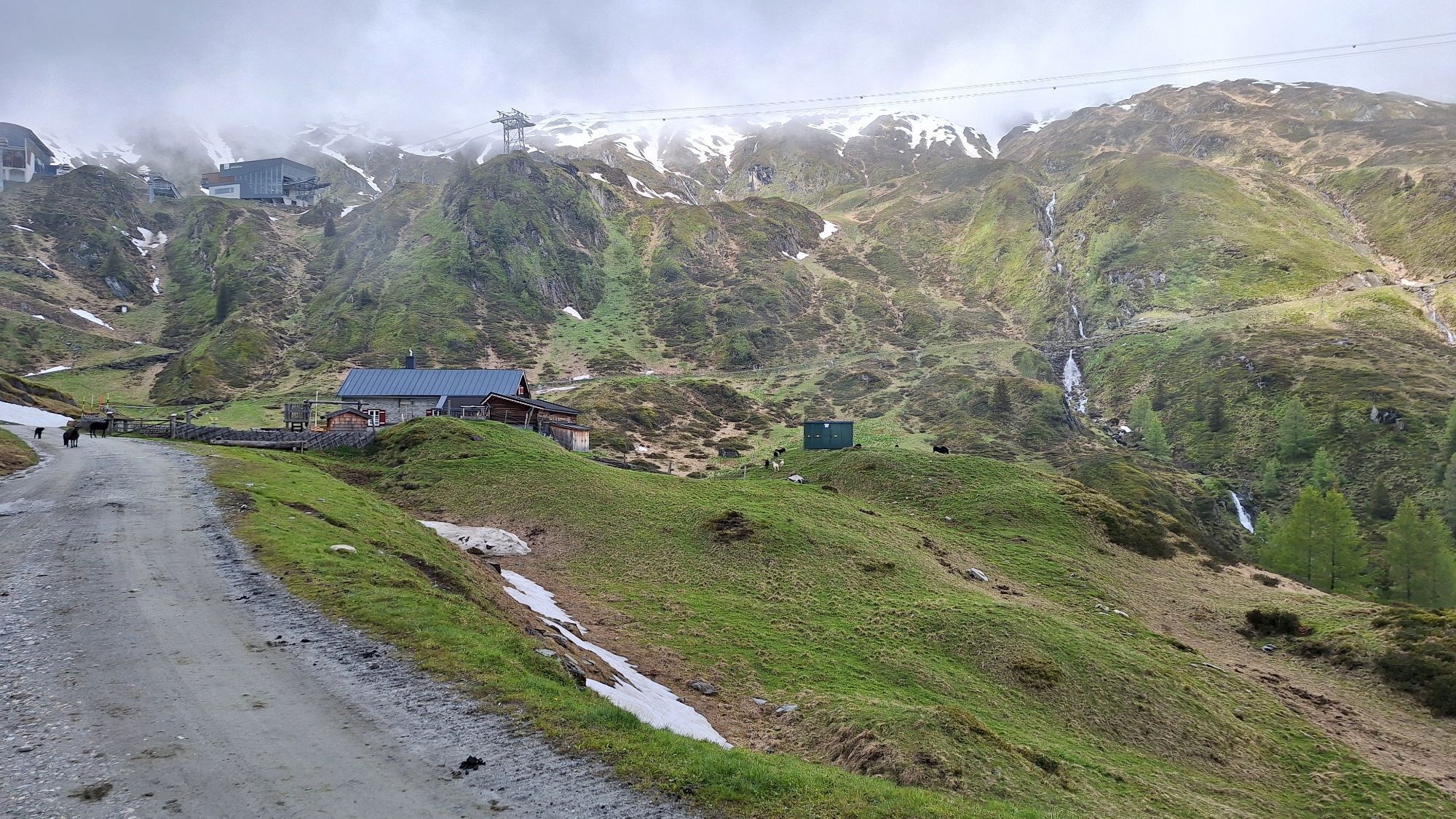
At an altitude of around 1,950 metres, the connecting path branches off from Krefelderweg 711 in a north-westerly direction. The path leads above the dam wall, past the Langwied cable car and reaches a...
At an altitude of around 1,950 metres, the connecting path branches off from Krefelderweg 711 in a north-westerly direction. The path leads above the dam wall, past the Langwied cable car and reaches a small high moor at the Häuslalm. From there, the trail continues gently uphill to a mountain ditch before climbing westwards in serpentines to an altitude of around 2,240 m. There you will meet the Alexander Enzinger Weg, which continues south-east over the Maiskogel to Kaprun.
This path branches off north-west from the Krefelder path no. 711 at an altitude of 1,950 m. Make your way past the top of the reservoir dam by the Langwied cable car and the Häuslalm farm and ascend gently over an alpine moor towards a small mine. The path now continues ascending in several windings in a westerly direction to a height of approximately 2,240 m and then joins the Alexander Enzinger path. From here, continue south-east in the
direction of the Maiskogel and further on towards Kaprun.
good footwear, rain and sun protection
Bus no 660
Oblíbené prohlídky v okolí
-
5.0
Kaiser-Franz-Josefs-Höhe zur Oberwalderhütte
heavyTuristika 5.52 km -
4.3
Bruck: 732+736+730 | Drei Brüder
heavyTuristika 16.1 km -
4.5
Sigmund Thun Klamm
světloTuristika 3.10 km -
4.7
Fusch: Gleiwitzer Hütte
heavyTuristika 8.26 km -
4.6
3 Oktober Fusch Walcher Grung und Hohalm
středníTuristika 8.57 km -
4.8
Sigmund Thun Klamm, Klammsee, Bürgkogel
světloTuristika 4.56 km -
4.7
Runde um den Weißsee - Gletscherlehrpfad Uttendorf, Österreich
středníTuristika 6.48 km -
4.4
Thumersbach, Runde um den Zeller See
světloTuristika 13.3 km -
Fusch an der Glocknerstrasse: Zum Fuschertörl
Mountainbike 25.4 km -
4.9
Großes Wiesbachhorn 3564 mnv Kaprun, Austrija
heavyTuristika 13.4 km
Pěší turistika a stopování


Nenechte si ujít nabídky a inspiraci pro vaši příští dovolenou
Vaše e-mailová adresa byl přidán do poštovního seznamu.