



FFC cycling circuit n°18: The right bank loop

The route passes through numerous medieval villages perched high above the Var valley. The route takes in the little-known village of Bonson. Located on the foothills of Mont Vial, the promontory features...
The route passes through numerous medieval villages perched high above the Var valley. The route takes in the little-known village of Bonson. Located on the foothills of Mont Vial, the promontory features an ancient military fortress that dominates the Var and Estéron valleys from a rocky spur over 400 meters high. Access is via the route des Bréa, the sacred road of the Alpes-Maritimes, which leads to the church of Saint-Benoît.
The road to Roquestéron then passes through former railway stations whose buildings are still standing: Collebelle, Vescous, Pierrefeu, Vallon le Rac, a reminder of the 1924 opening of the railroad line between Pont-Charles-Albert and Roquestéron. The line was soon decommissioned (1929) and the rails dismantled.
All the outdoor activities of the Nice Côte d'Azur metropolitan area can be found at https://outdoor.nicecotedazur.org

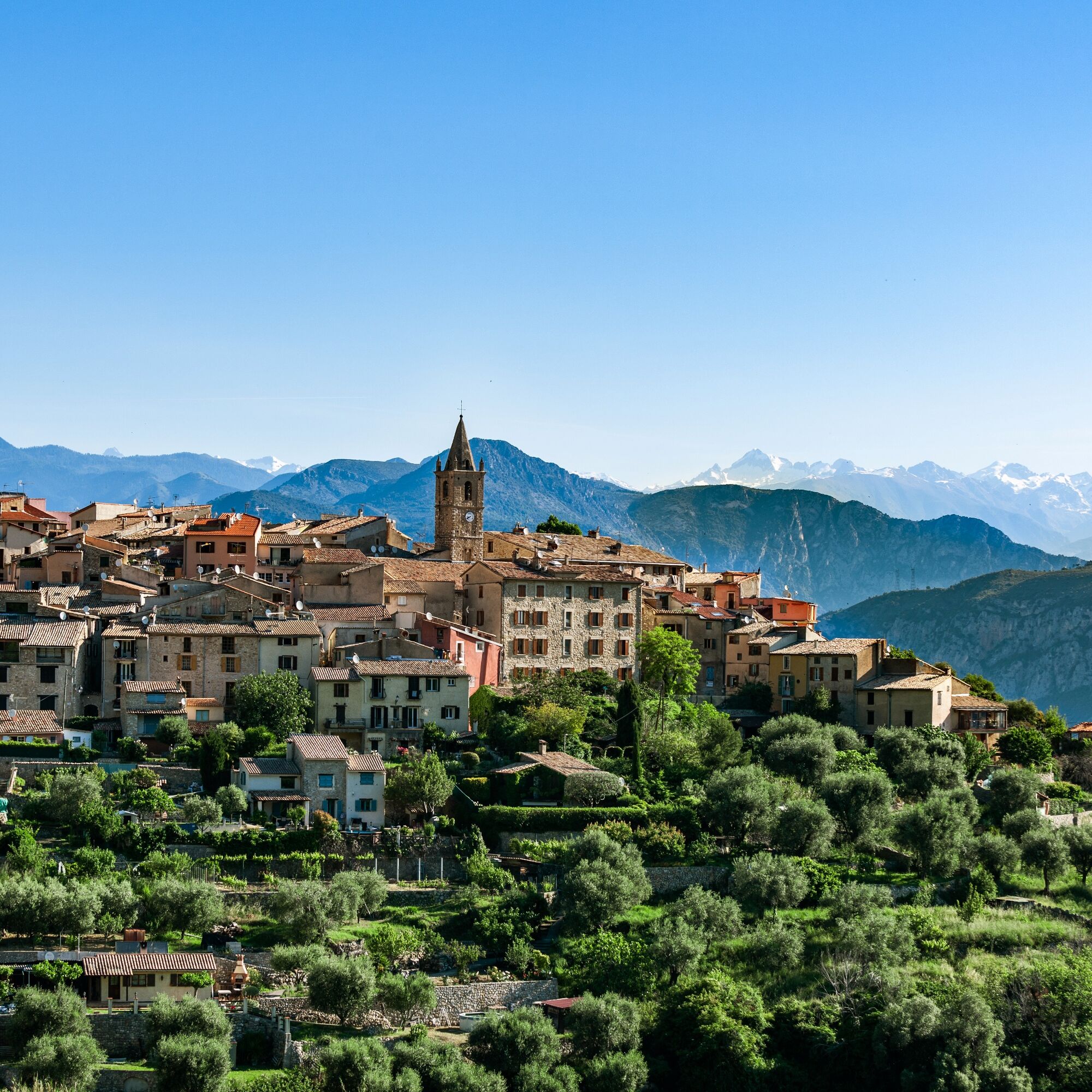

The panoramic starting point is at the large roundabout at the entrance to Vence. From here, take Rue Victor Tuby to the right to join the bridge and the RM 2210 towards Saint-Jeannet. Follow the RM 2210 to Peyron de Saint-Jeannet (Km 5.8). At the roundabout, continue on the RM 2210 towards Gattières. At the Gattières traffic circle, continue towards Carros village, still on the RM 2210. At the traffic-light-controlled intersection, turn left onto the RM 1 towards Carros Village- Le Broc. At the entrance to this old village of great architectural value, leave the RM 1 (Km 18.2 ) and turn right onto the RM 101 and its Rue de la Voute. Once you've passed under the archway, you'll come to a 4-spout fountain, spouting clear, cool water in the middle of a picturesque square. It's the perfect opportunity to stop and refill your water bottles. To continue, take the alleyway towards the Mairie and Pont-Charles Albert. This route leads us towards the RD2209, which we reach after 2.4 km of steep, narrow descent. The descent on the RD2209 is very pleasant and leads to the banks of the Estéron river. Following the river in a long straight line, you come to the Pont Louis Nucéra roundabout (Km 26.7), a writer from Nice whose passion was cycling, the theme of many of his books. Once over this bridge, turn right onto the cycle path along the Estéron river, a very pleasant route in the middle of a natural area. Once you've left the parking lot, at the roundabout (Km 28.8) turn left onto the RM 17 climb towards Gilette-Bonson, etc. At the intersection with the RM 27 (Km 32.6) turn right towards Bonson onto the route des Bréa. The village of Bonson is perched on the foothills of Mont Vial, and at the top of the promontory stands an ancient military fortress overlooking the Var and Estéron valleys from a rocky spur over 400 meters high. Once you've reached the village, the climb continues up to the Col de Rostan. The descent reaches a 1st intersection with the RM 227 (Km 40.2) , which leads to Gilette, but once you've reached the M27 (Km 42.3), turn right towards Pierrefeu - Roquestéron.At Roquestéron-Grasse, after the bridge over the Estéron (Km 62.5), turn left onto the RD 1, which winds through the foothills of the Estéron river. After a few km, the road rises to reach the village of Conségudes . From this point, the route crosses a magnificent plateau, passing under the village of Les Ferres and reaching the intersection with the RD 8 (Km 82.2) under the village of Bouyon . From this point, turn right, continuing on the RD8 towards Coursegoules at the top of the climb. At the crossroads with the RD 2, turn left towards Nice-Vence. Passing the Col de Vence (Km 100) won't be difficult on this side of the road (just over 1 km uphill). The descent to Vence quickly brings cyclists back to the starting point.
Ano
-Wear an approved helmet
-Check the condition of your tires
-Carry a repair kit in case of a puncture
-Prefer at least one flashing LED light to be fixed on the seatpost to be seen by motorists, especially in the small tunnels which are not lacking in Metropolitan France.
-Do not overestimate your physical abilities
-Find out about mountain weather and pass opening times before you set off.
-Carry identification and a number to call in case of danger.
-Respect traffic lights
-Use bicycle paths whenever possible.
In other words: a sign may force you to
If the "cycle path" sign is square: you decide.
If it's round, you must use the lane .
-Respect the environment and other road users
From the A8 "La Provençale" freeway:
From Paris, Lyon, Marseille, Aix-en-Provence, take Villeneuve-Loubet / Cagnes-sur-Mer exit no. 47
From Nice, take exit Cagnes-sur-Mer n°48
Then take the RM 336, the M 36 expressway and the M 2210 to reach Vence directly.
Bus routes can be found at: https://www.lignesdazur.com
Parking Marie Antoinette near the departure panoramic - Paid surface parking - 153 spaces
All outdoor activities in the Nice Côte d'Azur region can be found at https://outdoor.nicecotedazur.org
Circuit for hardened athletes - FFC color: Black
Oblíbené prohlídky v okolí
-
FFC bike circuit no. 5: on the Tour De France routes (big loop)
středníSilniční kolo 74.2 km -
FFC bike circuit no. 8: the 70.3 circuit (Half IRONMAN)
středníSilniční kolo 92.8 km -
A short walk in Saint-Jeannet : Les Baous de la Gaude and St-Jeannet
středníTuristika 12.2 km -
FFC bike route no. 7: Tour of Vence
světloSilniční kolo 57.7 km -
The "Route des Paysages" between the coast and the middle country of Nice
světloMotorrad 147.7 km -
FFC MTB route no. 25: The summit of Broc
středníMountainbike 18.9 km -
VTT FFC circuit no. 7 - The Olive Trees Loop
světloMountainbike 8.09 km -
Mountain bike FFC circuit no. 5: Le Gabre
středníMountainbike 4.91 km -
FFC cycling route no. 13: the tour of the perched villages of the Var valley
heavySilniční kolo 57.6 km -
Itinerary n°1 - 2 days - Stage 1 Nice - Isola Village
heavySilniční kolo 109.8 km
Pěší turistika a stopování


Nenechte si ujít nabídky a inspiraci pro vaši příští dovolenou
Vaše e-mailová adresa byl přidán do poštovního seznamu.


