







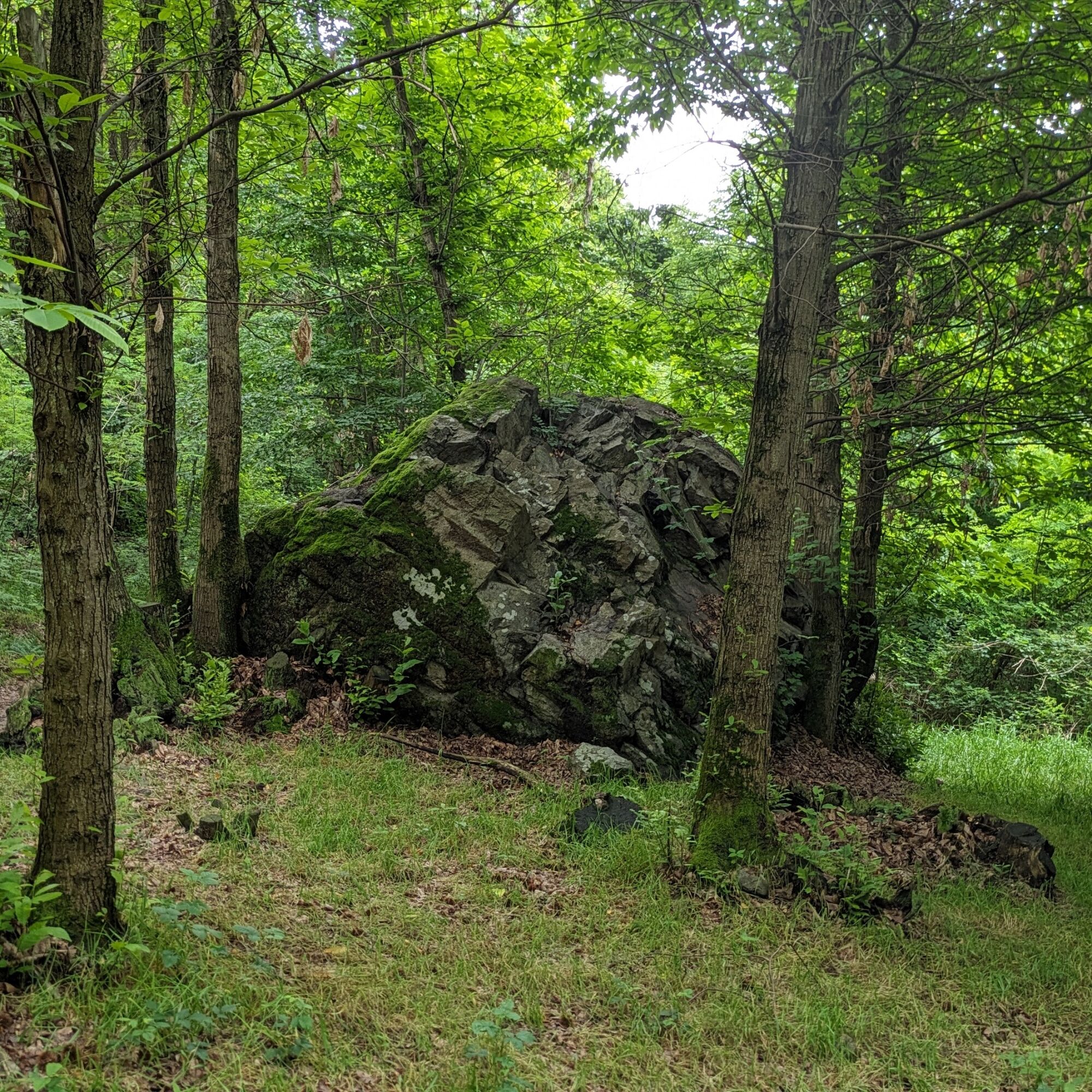
The erratic boulders of the moraine hill of Avigliana

Úroveň obtížnosti: T2
Start from the dirt road at the intersection of Via Monte Cuneo and Via Chiattera. At the first fork, encountered after a few meters, go straight following the hiking signs (white-red markers). The trail...
Start from the dirt road at the intersection of Via Monte Cuneo and Via Chiattera. At the first fork, encountered after a few meters, go straight following the hiking signs (white-red markers). The trail continues with a slight constant ascent until reaching the first highlight of the hike: the Grey Boulder. Continuing on the trail you arrive in an area with a large concentration of monoliths all to explore, among the largest: Pera Laila and Pera 'd le Masche. A little further on, after a left turn, you reach a clearing called "Bal 'dle Masche" (the witches' dance), a crossroads of other naturalistic trails in the area. Continue on the second useful trail starting on the right, still gently uphill and, with a short detour from the trail, you can reach Roca Parpaiola, a panoramic point over the small lake of Avigliana and surrounding area. Resuming the main trail, continue along the contour to reach Col Buchet, another viewpoint and crossroads. Keeping to the left, descend along the "root forest" encountering other smaller erratic boulders and the Moncuni fountain. For a short stretch cross a cart road, via Case Canale, then return to the woods. Continue on the Avigliana side of the mountain until you meet Pera Luvera and, at the next hairpin bend, Pera d' Bagiacu. After a short descent, pass by the last boulder of the hike, Roc Gris. Then continue descending until returning to the dirt road at the start.


Ano
Recommended footwear and equipment suitable for a mountain hike.
Bring enough water, due to the scarce presence of fountains on the route
Always check weather forecasts before starting the trail.
Travel times are indicative and may vary depending on individual capabilities.
By train, via the Torino PN - Bardonecchia or Torino PN - Susa railway line, Avigliana stop. From the train station it is possible to reach the trailhead by taking line 253 of the Cavourese bus service (Paschè stop) and continue on foot along Via San Pietro - Via Oronte Nota - Via Monte Cuneo
By car from Torino follow signs for the North Ring Road in the direction of Trafori - Frejus. Take the A32 motorway towards Bardonecchia and exit at Avigliana centro, continue towards Corso Laghi - Via San Pietro - Via Oronte Nota - Via Monte Cuneo
Torino Porta Nuova - Bardonecchia or Torino Porta Nuova - Susa railway line - Avigliana stop
From the train station it is possible to reach the trailhead by taking line 253 of the Cavourese bus service (Paschè stop).
Parking along the road between Via Monte Cuneo and Via Chiattera
T2
Route feasible in all seasons
Given the large quantity and variety of routes present on Monte Cuneo, it is recommended to pay particular attention to the trail to follow
Along the route, at the main points of interest, there are naturalistic signboards to learn about the local nature and history.
Oblíbené prohlídky v okolí
-
4.7
On the summit of the magical Musiné
světloTuristika 6.94 km -
Avigliana Lakes - Easy route, ideal for families with children
světloTuristika 9.25 km -
CASELETTE - The Musiné loop
středníTuristika 7.52 km -
GIVOLETTO Madonna della Neve on Monte Lera
středníTuristika 6.11 km -
5.0
Unspoiled woods and ancient hamlets in Valsangone - Selvaggio Loop - Bagaggera
světloTuristika 9.08 km -
COLLE DEL LYS Monte Arpone loop
světloTuristika 4.50 km -
Easy route - Monte Cuneo (Moncuni) Loop route from Reano
světloTuristika 7.97 km -
COLLE DEL LYS Alpine Loop
středníTuristika 15.3 km -
CUMIANA by MTB on the Amphitheater Path
středníMountainbike 32.4 km -
A walk in the Megalithic - The Menhirs of Pietraborga - Direct route from the Torrioni
středníTuristika 9.30 km
Pěší turistika a stopování


Nenechte si ujít nabídky a inspiraci pro vaši příští dovolenou
Vaše e-mailová adresa byl přidán do poštovního seznamu.





