


PRAELATO Tour of Allevé
Úroveň obtížnosti: T2
The very scenic route develops among green woods and panoramic points and combines glimpses of unspoiled nature with traces of the presence and wisdom of the mountaineer. It encounters the upper hamlets...
The very scenic route develops among green woods and panoramic points and combines glimpses of unspoiled nature with traces of the presence and wisdom of the mountaineer. It encounters the upper hamlets of Allevé, Rif, Grand Puy and Faussimagna before descending to Souchères Basses, reaching the main town La Ruà remaining on the left side of the river and following a path leading to the Gofree Tourist Village, via Roma, Viale Cavalieri di Vittorio Veneto (with the parish church S. Maria Assunta), crossing the provincial road 23 of Sestriere and taking Via Albergian which becomes Old Royal Road, reaching Granges, with the possibility of seeing typical fountains, ovens, sundials and many details of Occitan culture at the Museum of Costume and Traditions of Alpine Peoples, visitable at scheduled times and consultable at: http://www.pragelatoturismo.it/cultura.asp
Technical description supported by Beatrice Griot (nature guide).

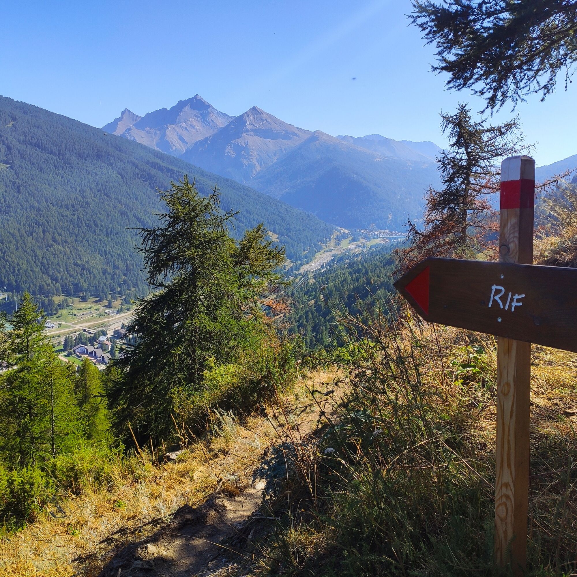
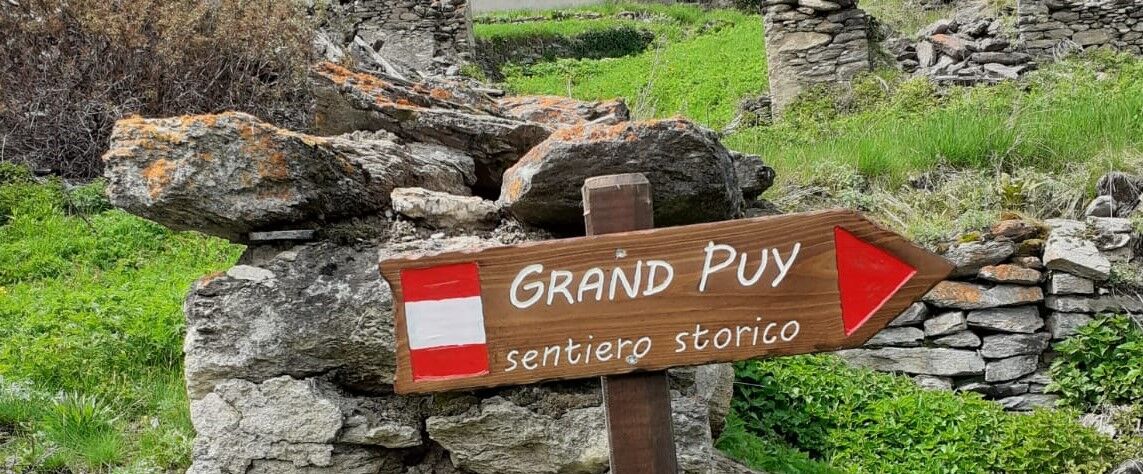
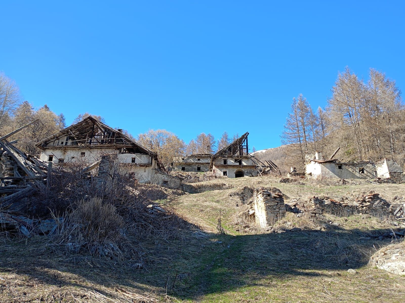
From Piazza Mario Costa, take the road behind the Café des Alpes (Via degli Alpini) and at the fountain turn left, finding the path to Allevé, quite challenging at the beginning and then becoming a balcony path after Allevé. Upon reaching the hamlet, you will encounter the chapel Notre Dame des Neiges, the Allevé Inn and, turning right, the village oven. Continue straight to the Cabòt fountain and the fork with signs to the left for the Colle di Costa Piana and to the right towards Rif. Proceed along the path to Rif, slightly downhill, arriving at the uninhabited and ruined hamlet crossing wet and marshy areas. Continue on flat ground through the ruins, being careful not to descend towards the valley (path leading to Rivets) nor to turn left at the sign indicating Colle di Costa Piana; cross the Rio Pomerol on a small bridge and then a path leads to the dirt road of the Giarasson alpine pasture. Continue until you meet the mule track descending from Col Blegier, reaching first Grand Puy and then, passing a small pass (locality Boufuvent) Faussimagna.
Finally, take the path that descends to Souchères Basses. If you want to close a loop, you can cross the Chisone stream and climb up to Granges on the right side of the river or remain on the left side and return via the path reaching the Gofree Tourist Village, via Roma, via Albergian, Old Royal Road, etc... but there is still a long way!
Trekking boots and walking sticks are recommended.
Near the uninhabited hamlet of Rif, a striking example of alpine architecture still documented today, there is a section of about 50 meters particularly muddy and marshy.
We advise to:
- Contact mountain guides and/or nature guides;
- Check weather bulletins and free apps;
- Do not undertake the excursion alone or inform a trusted person of the intended itinerary.
- Remember that the indicated walking times for the various itineraries are average and indicative and can vary considerably depending on weather conditions and your abilities; environmental variability can significantly reduce safety levels.
By car you reach the hamlet of Granges on the S.P. 23 del Sestriere and park comfortably in Piazza Mario Costa, near the Café des Alpes.
https://arriva.it/app/uploads/sites/4/2021/01/000282.pdf
ARRIVA bus line from Turin, stop Granges (Albergo Passet). From the stop, take the internal road via Allevé and reach Piazza Mario Costa and the Café des Alpes. Behind the Café des Alpes, take Via degli Alpini up to the fountain and then turn left onto the path to Allevé.
https://www.facebook.com/caffe.desalpes/ Piazza Mario Costa - Granges hamlet
T2
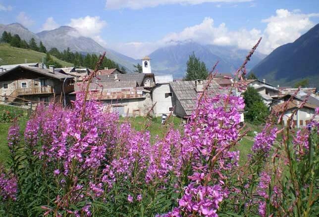
Upon arriving at Allevé, the Chapel Notre Dame des Neiges is worth a visit (open to the public in July and August), as is the oven in the hamlet of Grand Puy.
It is good practice to:
- Not throw waste into the environment, but possibly carry it with you;
- Respect private property and fenced areas;
- Open and close electric wires of shepherds' fences with the appropriate handles;
- Always keep your dog on a leash;
- Always carry a garbage bag with you;
- Keep a distance and do not approach shepherd dogs protecting the flocks.
For cyclists and horse riders, the path from Granges to Allevé is not passable by bike or on horseback (see PRAGELATO Tourist Map).
Webové kamery z prohlídky
Oblíbené prohlídky v okolí
-
5.0
SESTRIERE Monte Rognosa
heavyTuristika 6.42 km -
5.0
CESANA T.SE Cesana - Fenils
světloTuristika 4.60 km -
5.0
CESANA T.SE Thures - Cima Bosco
heavySněžnice 3.94 km -
SAUZE D'OULX Richardette - Montagne Seu )
středníMountainbike 19.9 km -
OULX Borgata Seu (Gran Bosco Natural Park)
světloSněžnice 5.93 km -
PRAGELATO Colle dell'Assietta
heavyMountainbike 53.3 km -
PRAGELATO The winter charm of the Val Troncea Natural Park
světloSněžnice 4.62 km -
SESTRIERE Monte Fraiteve m. 2701
středníTuristika 8.65 km -
La Via dei Saraceni (Sauze d'Oulx)
středníMountainbike 33.6 km -
The Fort Roads - stage 11 from Massello to Prali
heavyPoutní stezka 13.7 km
Pěší turistika a stopování


Nenechte si ujít nabídky a inspiraci pro vaši příští dovolenou
Vaše e-mailová adresa byl přidán do poštovního seznamu.