


CESANA T.SE San Sicario Alto - Forte Seguin - Les Chalmettes - Soleil Boeuf loop
The circular route starting from the San Sicario Alto village in the municipality of Cesana Torinese, a well-known ski resort, except for the climb section which offers wide views towards the Colle di...
The circular route starting from the San Sicario Alto village in the municipality of Cesana Torinese, a well-known ski resort, except for the climb section which offers wide views towards the Colle di Sestrieres and the Argentera and Thuras Valleys, is set in the middle of woods, mainly conifers, and therefore cool even in the hottest periods. The excursion is not penalized by the presence of ski slopes and lifts in the area as it rarely crosses them and mostly remains in the woods that host them. The trip allows you to visit and refresh yourself in the characteristic village of Champlas Seguin, whose renovated huts feature stone slab and shingle roofs, to buy local cheeses at an alpine pasture, to reach not only the remains of a late 19th-century military fortification in a strategic and panoramic position, of which practically only the external protective wall immersed in vegetation and some positions remain, but also two refuges with a restaurant both located in panoramic positions but on opposite sides. If you want to do only the first part of the itinerary up to Champlas round trip, it results in a very pleasant walk in the coolness of the woods, very easy and almost flat, also passable with strollers.
Technical support and description by Barbara Demonte - Environmental hiking guide.

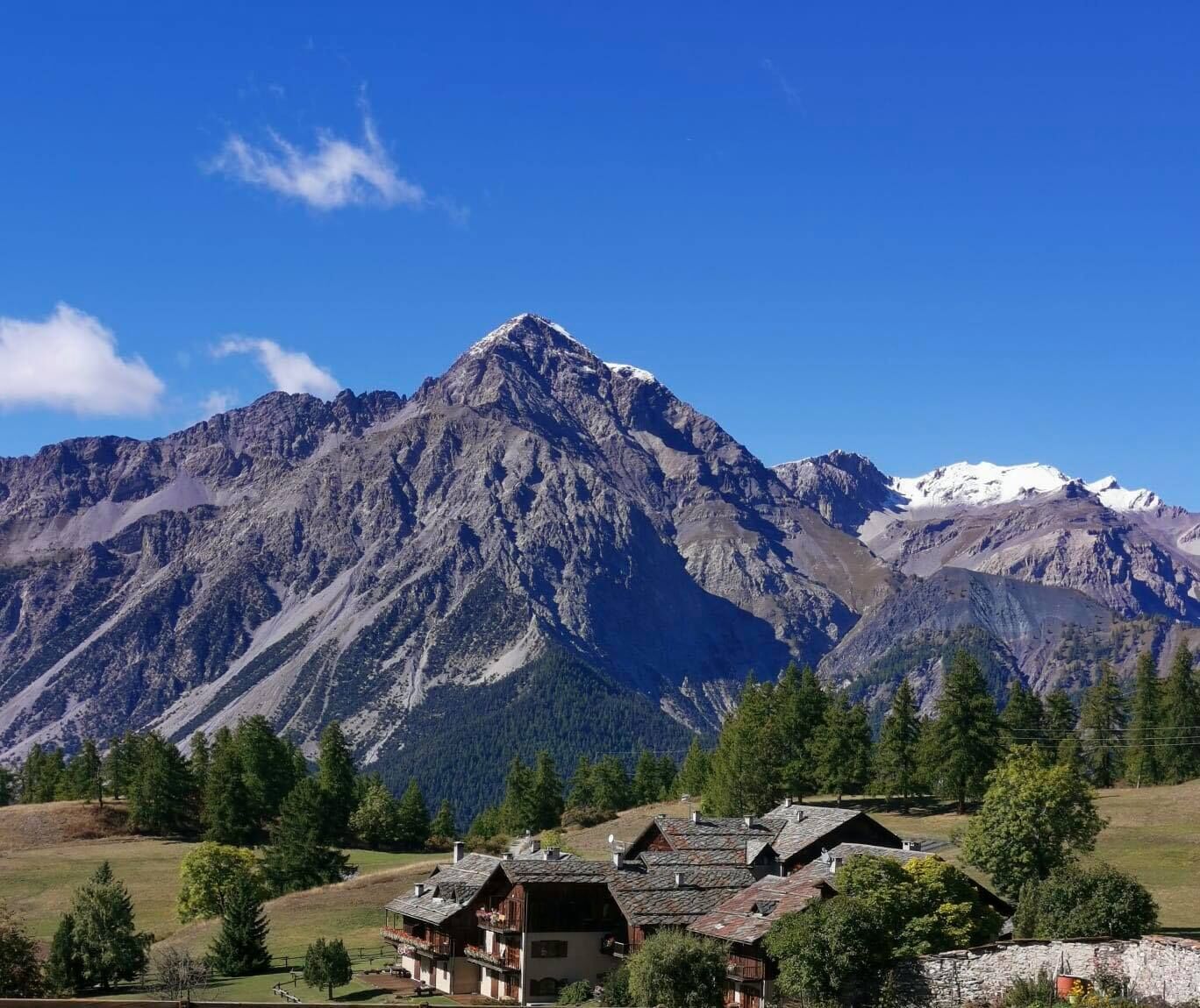
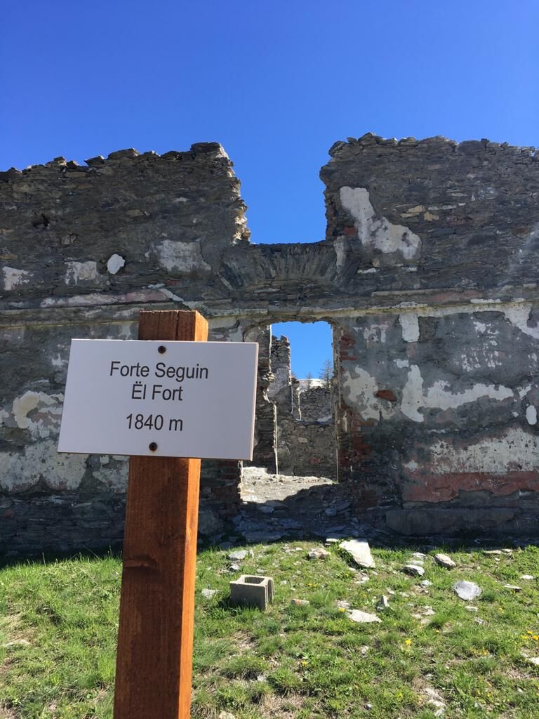
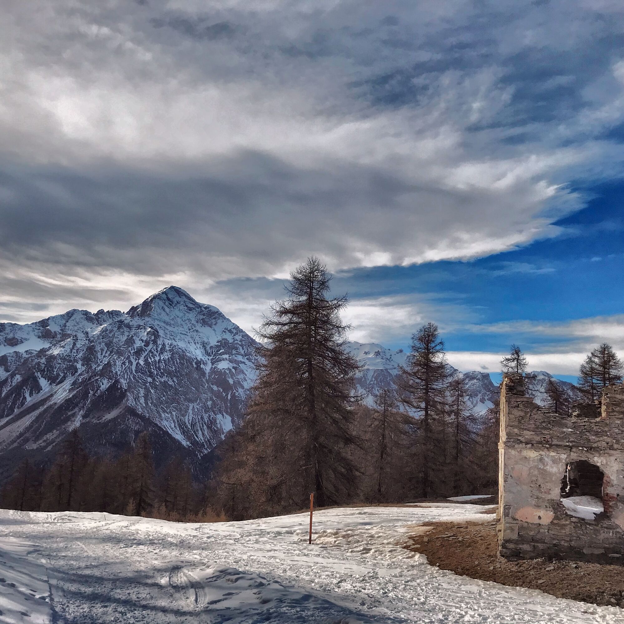
The route starts from San Sicario Alto, reachable from Cesana (6 km) by taking the provincial road towards Sestriere and turning left after a couple of kilometers; after starting the climb and passing San Sicario Borgo, you continue to a series of marked hairpin bends; just after the sign for the 4th hairpin, turn right to access the "La Sellette" lifts where you can leave your car in the large parking lot from which the hike begins at altitude 1,720 m. Facing the arrival of the "Ski-Lodge" cable car, take a path to the right heading southeast, an unmarked trail that comes out after about fifty meters, just above the 4th hairpin, onto a dirt road closed to traffic, indicated as Champlas Seguin. From here, proceeding constantly south for about 2 km, with a slight climb, you will reach the gates of Champlas. Along the route, you pass near a sports field down to the right and at Prà Carie near a reforestation of stone pines on the left, staying constantly in the woods which sometimes opens for a view towards Monte Chaberton. After about 2.2 km from the start, at the end of the straight, you reach a fork where you ignore the Monte Crouzore sign to the right downhill, and continue on the main road already in sight of Champlas Seguin; after a short and slight ascent, you reach altitude 1,780 m near the church of Sant'Andrea and Sant'Ippolito where there are two fountains. Between the church and the old oven, turn left onto an asphalt road marked Soleil Beuf, which climbs very steeply and soon becomes a dirt road that, at altitude 1,885 m, crosses a trail coming from the right which is ignored. Here the path eases and shortly after passes near a ruined barracks behind which a few minutes away you could reach an alpine pasture selling cheese. Continuing briefly on the dirt road, in a panoramic position are the remains of Forte di Champlas (altitude about 1,820 m, 3.6 km from the start). You continue climbing on the main road towards Chalmette/Refugio Chalmettes, ignoring the road on the left towards Soleil Beuf and the paths on the right towards Champlas Janvier and a little further ahead to Gro Bial; passing the refuge which is on the right and normally open even in summer, you reach a plateau at an altitude of 2,110 m where there is a characteristic frame and a picnic table; here the view is beautiful with Monte Chaberton in the foreground. Turn left onto the road coming from Monte Rotta, which is half asphalt and half dirt, and continue for about 1.5 km on gentle ups and downs until you reach at altitude 2,060 m the locality Soleil Beuf with a panoramic view of the Upper Susa Valley, where the homonymous refuge stands and the chairlift "Roccia Rotonda" starts. Leaving the chairlift on the left, the road bends to the right and after about ten meters, ignoring the fork to the left, a steep and very steep descent begins with sharp hairpins and straight cuts towards San Sicario (sign indicated San Sicario Ski Lodge); immediately you pass near a piste with snow cannons and then finally enter the woods up to altitude 1,740 m where you find the chairlift "Le Sellette" just above the parking lot where the car was left, reachable either by turning right and after 100 meters to the left, or by passing in front of the lift departure and then turning right towards the parking lot.
Ano
Wear clothing and footwear suitable for the environment and the season.
Between the Champlas Seguin village and Forte Seguin, a road open to vehicle traffic; be careful.
By car from Turin follow the signs for the Northern Ring Road towards Trafori - Frejus. Take the A32 motorway towards Bardonecchia and exit at Oulx -Monginevro-Sestriere.
Continue on SS 24 towards Cesana Torinese and then on SP 23 towards Sestriere.
After 2 km turn left at the San Sicario sign.
Pass the first village of San Sicario Borgo and after about 3 km park in the direction of the lift.
Parking available near the Ski-Lodge cable car lift
- Before undertaking any excursion, it is advisable to check the weather reports or ask for information at the local Tourist Offices.
- It is good practice not to undertake an excursion alone and always inform someone about your destination.
- Do not litter; carry your rubbish with you and possibly pick up any left by others.
- The indicated travel times are approximate and may vary depending on weather conditions and individual abilities.
Tasting of typical dishes at the refreshment points Les Chalmettes and Soleil Boeuf - check the opening times of the refreshment points and any booking requirements
Fountains in the village of Champlas Seguin
Oblíbené prohlídky v okolí
-
5.0
BARDONECCHIA Forte Jafferau Loop
heavyMountainbike 36.8 km -
5.0
BARDONECCHIA Col des Acles - Passo della Mulattiera
středníTuristika 6.23 km -
5.0
SESTRIERE Monte Rognosa
heavyTuristika 6.42 km -
BARDONECCHIA - Loop Colle della Scala - Col de Montgenèvre - Colle del Sestriere
heavySilniční kolo 91.9 km -
5.0
CESANA T.SE Cesana - Fenils
světloTuristika 4.60 km -
5.0
CESANA T.SE Thures - Cima Bosco
heavySněžnice 3.94 km -
5.0
BARDONECCHIA Chesal nature route
světloTuristika 3.48 km -
CESANA T.SE Lago Nero - Seven Colors Lake
středníTuristika 3.51 km -
SAUZE D'OULX Richardette - Montagne Seu )
středníMountainbike 19.9 km -
OULX Borgata Seu (Gran Bosco Natural Park)
světloSněžnice 5.93 km

Pěší turistika a stopování


Nenechte si ujít nabídky a inspiraci pro vaši příští dovolenou
Vaše e-mailová adresa byl přidán do poštovního seznamu.