






Val Varaita Trekking: Stage 6A Borgata Pleyne - Colle di Vers
From the village of Pleyn you follow the road that goes up the valley towards S. Anna di Bellino passing through the villages of Prafauchier, Chiazale, Meleze, until you reach S. Anna. From S. Anna di...
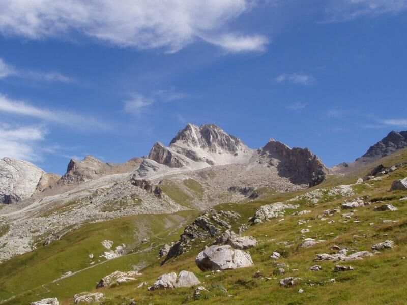
From the village of Pleyn you follow the road that goes up the valley towards S. Anna di Bellino passing through the villages of Prafauchier, Chiazale, Meleze, until you reach S. Anna. From S. Anna di Bellino you cross the bridge at the beginning of the dirt road and then follow a dirt road on the left that, with some hairpin bends, allows you to enter Pian Traversagn, where the road ends near some huts. Keeping to the left of the vast plateau, you continue along the track for the Col di Vers which you reach on the border with the Maira Valley.


The villages of Prauchier, Chiazale, alpine architecture, devotional frescoes, sundials

Oblíbené prohlídky v okolí
-
4.5
Acceglio, bric boscasso
středníLyžařská trasa 12.1 km -
5.0
04 Monviso Ring. Rifugio du Viso - Rifugio Alevè . Pontechianale, Piemont/Italien
světloTuristika 13.3 km -
5.0
Rifugio Quintino sella - monte Monviso
středníHorolezectví 9.13 km -
5.0
Occitan routes: Stage 6 Elva - San Michele di Prazzo
středníTuristika 11.5 km -
5.0
Occitan Routes: Stage 8 Borgata Ussolo - Borgata Chiappera
středníTuristika 14.5 km -
5.0
01-Monviso Ring. Rifugio Alevè - Rifugio Quintino sella Pontechianale, Piemont/Italien
světloTuristika 11.8 km -
5.0
Percorsi Occitani: Tappa 4 Frazione Camoglieres - San Martino Inferiore
středníTuristika 16.8 km -
5.0
Chiappera- Spaziergang
světloTuristika 8.39 km -
3.5
Occitan Routes Stage 5
středníTuristika 6.86 km -
Saint-Véran- Col de la Noire - Col Longet - Col Blanchet
středníTuristika 19.4 km
Pěší turistika a stopování


Nenechte si ujít nabídky a inspiraci pro vaši příští dovolenou
Vaše e-mailová adresa byl přidán do poštovního seznamu.





