


Grande Traversata del Biellese: Stage 7 Pollone - Zumaglia
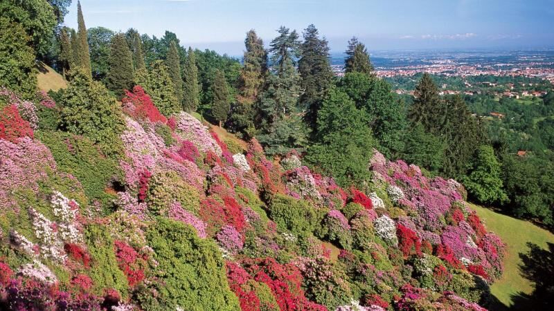
We cross the Burcina Park, climbing up to the Martini Tower. From here a mixed route of paths and asphalt roads descends towards the Rio Bolume valley until it crosses the provincial road for Pollone....
We cross the Burcina Park, climbing up to the Martini Tower. From here a mixed route of paths and asphalt roads descends towards the Rio Bolume valley until it crosses the provincial road for Pollone. After tackling the steep path that climbs towards the Cossila San Giovanni cemetery, we turn left towards Oropa. After leaving the state road in the direction of the Antua equipped area, we continue on the dirt road up to the bridge over the Oropa stream, which we cross to turn right onto the Pralungo-Favaro road. A path between the fields leads to the village of Sant'Eurosia, where we continue for a short stretch along the asphalt road. After the descent towards the Rio Stono, we cross it to go back to the Bazzera area. We take a mule track in the woods that ends on an asphalt road, which leads to Miagliano. We continue towards the Cervo stream, which can be crossed on a pedestrian walkway that leads to the delightful Oratory of the SS. Trinity. A mule track goes up towards the historic center of Sagliano Micca, from where you continue towards Andorno Micca and then tackle the cart track that winds up through the woods towards Colma. After crossing the woods of Monte Turlo, we arrive on an asphalt road, we turn right, and immediately after the crossroads for Vaglio we take a track that goes down into the woods, to get to Zumaglia.

Ano
Burcina Park, Bridge and Oratory of the SS. Trinit, Pietro Micca museum
Oblíbené prohlídky v okolí
-
Da Coumarial al rifugio Barma
středníTuristika 7.31 km -
Cammino d’oropa itinerario Valle Mosso -Bocchetta di Luvera
středníHorská turistika 9.30 km -
SETTIMO VITTONE Colma di Mombarone from Trovinasse
středníTuristika 3.92 km -
Mars
středníTuristika 8.46 km -
CHIAVERANO Loop on the Serra d'Ivrea
středníTuristika 14.5 km -
On the roads of wool and wine
středníSilniční kolo 56.3 km -
The road of Sanctuaries
středníMountainbike 30.4 km -
The Water Valley and the Zegna Oasis
středníSilniční kolo 79.2 km -
From Biella to Oropa through Valle Cervo
heavyMountainbike 45.1 km -
GTA: Tappa 27 Rifugio Rivetti - Santuario di San Giovanni d'Andorno
středníTuristika 14.7 km
Pěší turistika a stopování


Nenechte si ujít nabídky a inspiraci pro vaši příští dovolenou
Vaše e-mailová adresa byl přidán do poštovního seznamu.