


GPR Tappa 7: Santuario di San Besso - Frazione Piamprato
From San Besso the pathway climbs to the Colle della Borra on the steep slope following a regular sloping track that along the hill leads to the ruins of a small mine nearby. This route was once used to...
The itinerary was promoted within the platform as part of the PITEM M.I.T.O. project. – Outdoor OFF - Interreg Italy-France Cross-Border Cooperation Program ALCOTRA 2014-2020.

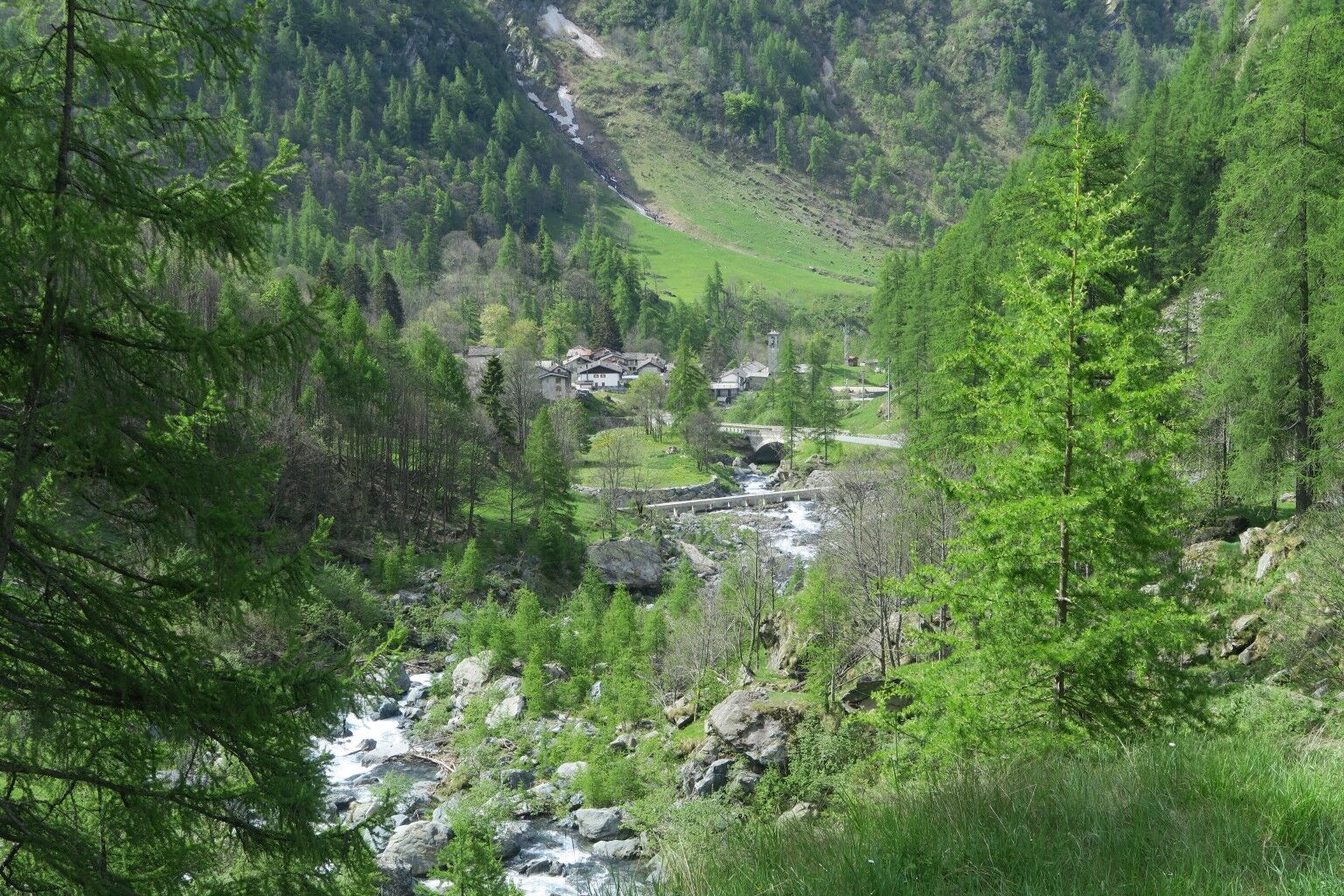
From San Besso the path climbs towards Colle della Borra on the steep slope following a regular slope, which through the hill connects to the remains of a small mine nearby. This route was once used to descend with sledges loaded with the extracted ore, towards Campiglia. The same toponym "Borra" would derive from the presence of tunnels and caves. From the Colle you descend on the opposite slope, first touching the Grange la Borra, in a state of abandonment and, further down the valley, the Grange Orletto and Vandilliana, both still used for summer montication.
The use of adequate equipment is recommended: anorak, waterproof mountain boots, trekking poles.
It is recommended to provide water and food supplies due to the lack of refreshment places along the entire path.
For the Piedmont side of the park: from Turin take the SP 460 of Valle Orco, turning right at Pont Canavese for Val Soana or continuing up to Ceresole Reale; - from Ivrea (Milan motorway junction) follow the SP 565 of Castellamonte which joins the SP 460 in Rivarolo Canavese.
Piamprato, public bus.
Presence of free parking nearby.
The cartography of the tracks, partly also downloadable from the site, "Giroparco Gran Paradiso" is to be used as a basis for planning itineraries and trips and is in no way to be understood as a map to be used in the field for orientation along the route. In the area under consideration, there are reliable orientation maps on the market which are absolutely essential to accompany the excursion route.
Heiligtum von San Besso.
Oblíbené prohlídky v okolí
-
3.0
Cascate di Lillaz
Turistika 6 km -
4.7
Lillaz - Lago delle Loie - Val Bardoney - Lillaz
středníTuristika 14.7 km -
5.0
Lago Muffè & Alpe di Lago Bianco
světloTuristika 10.5 km -
5.0
VALCHIUSELLA Loop Fondo - Tissone - Tallorno
středníTuristika 5.08 km -
4.0
TRAVERSELLA Souls and Transhumance Path
středníTuristika 10.0 km -
4.0
Ciavanassa refuge from Piamprato
středníSněžnice 4.88 km -
GPR - Giroparco Gran Paradiso
heavyTuristika 100.4 km -
CAMPIGLIA SOANA Sanctuary of San Besso
středníTuristika 6.65 km -
COLLERETTO CASTELNUOVO Pian del Lupo - Quinseina di Santa Elisabetta
heavyTuristika 6.27 km -
Punta Arbella from Campidaglio
středníTuristika 6.29 km
Pěší turistika a stopování


Nenechte si ujít nabídky a inspiraci pro vaši příští dovolenou
Vaše e-mailová adresa byl přidán do poštovního seznamu.