


Le Strade dei Forti - stage 10 from Laval/Pragelato to Massello

Between Val Troncea and Val Germanasca numerous stories intertwine: life in the alpine villages of the past, partisans and the Resistance in Val Chisone, the Glorious repatriation of the Waldensians who...
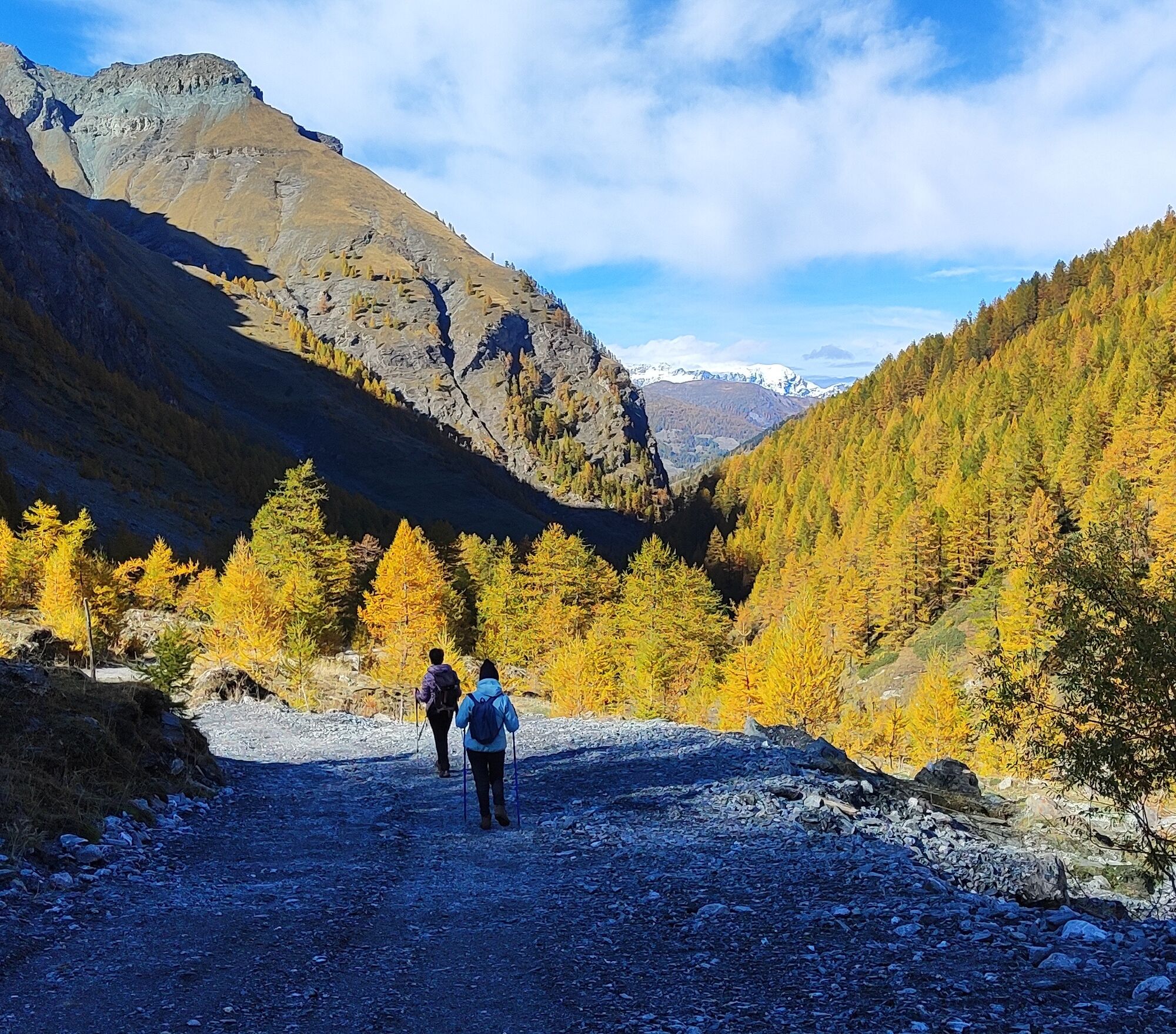
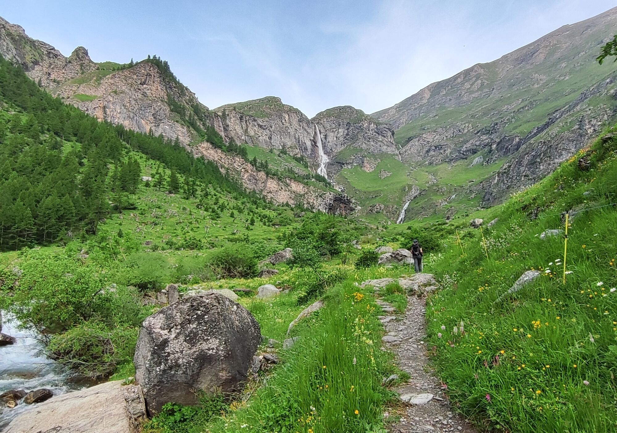
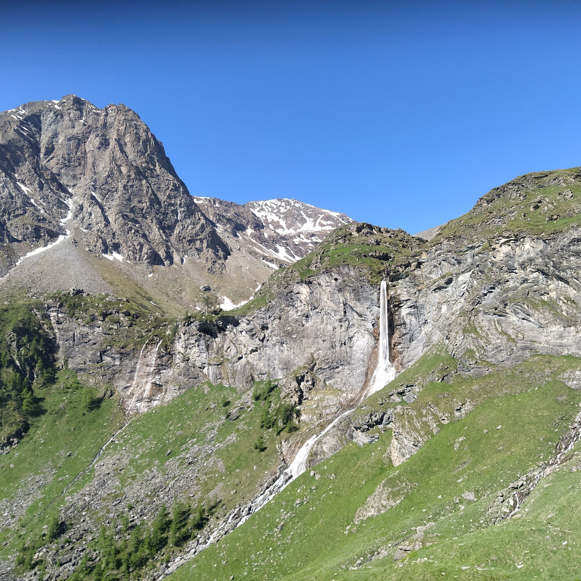
Starting from Val Troncea, the route first follows the valley floor, then ascends through magnificent alpine landscapes. Upon reaching Colle del Pis, a splendid panorama prepares you for the descent into Val Germanasca: among fields of flowers in spring, at the thaw, and remnants of ancient fortifications, you reach the beautiful Pis Waterfall and then the hamlet of Balziglia up to the Massello Foresteria.
Partial travel times: Mulino di Laval Refuge - Clot de la Soma 2h 15min / Clot de la Soma - Pis Waterfall 2h 20min / Pis Waterfall - Massello Foresteria 1h 45min

Continuing on the road, you then come across the Joussaud hamlet, also abandoned except for a single house now used by shepherds; it is one of the places where the Waldensians stopped during their march.
From this point onward, follow the road faithfully until the Colle Clot de la Soma. The road is pleasant and alternates between shade and sun across larch woods and alpine meadows where herds and flocks graze. It is advisable to keep away from the animals and not to invade the grazing area. As you gain altitude, the larch forest thins out to make way for meadows with tall grass and wild flora. On a sunny day, you can observe beautiful colors contrasting with the blue sky.
Upon reaching Colle Clot de la Soma, the first spectacular panoramic point opens up over the Val Chisone and Vallone del Mendie. At this point, there are two options:
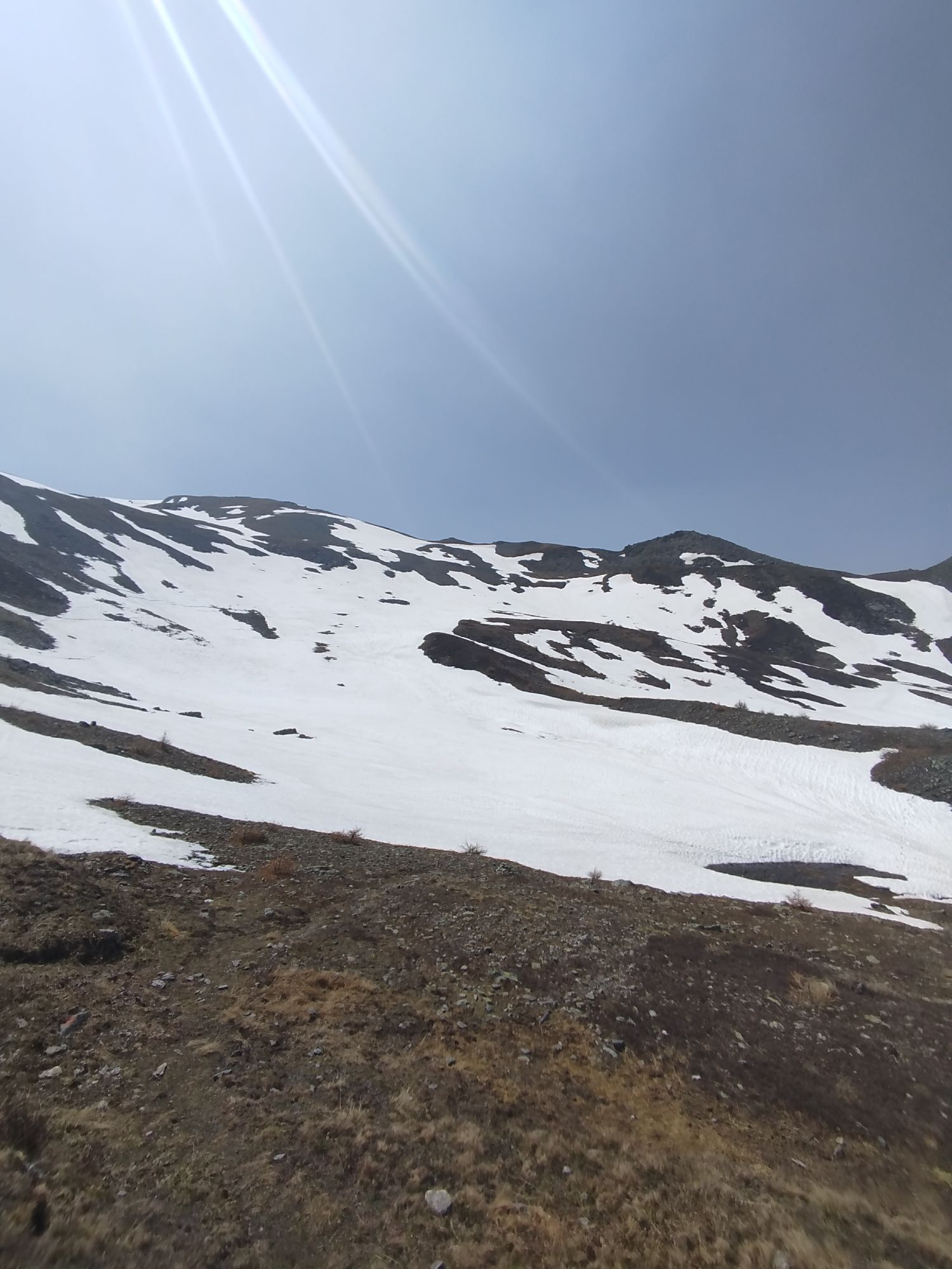
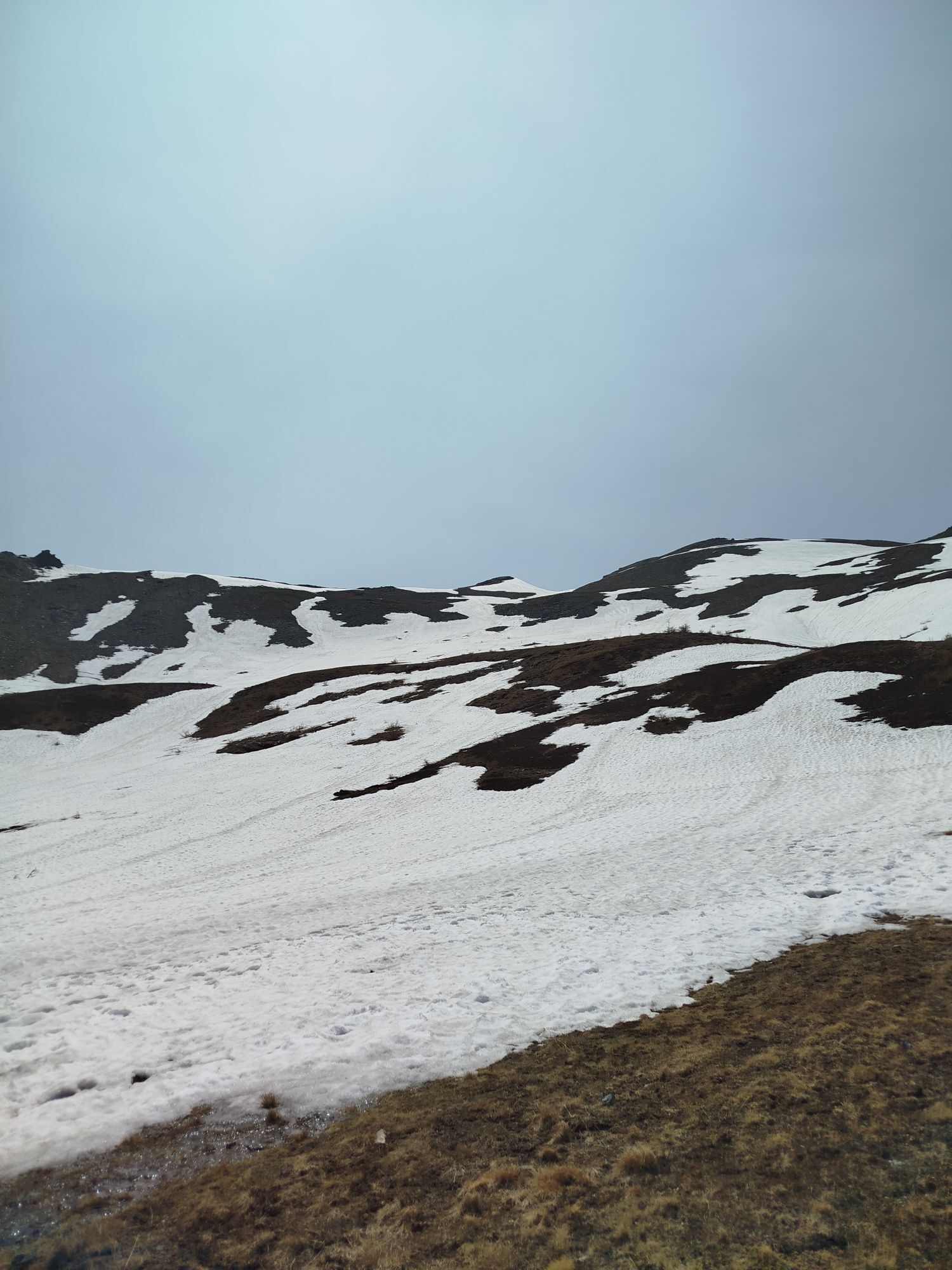
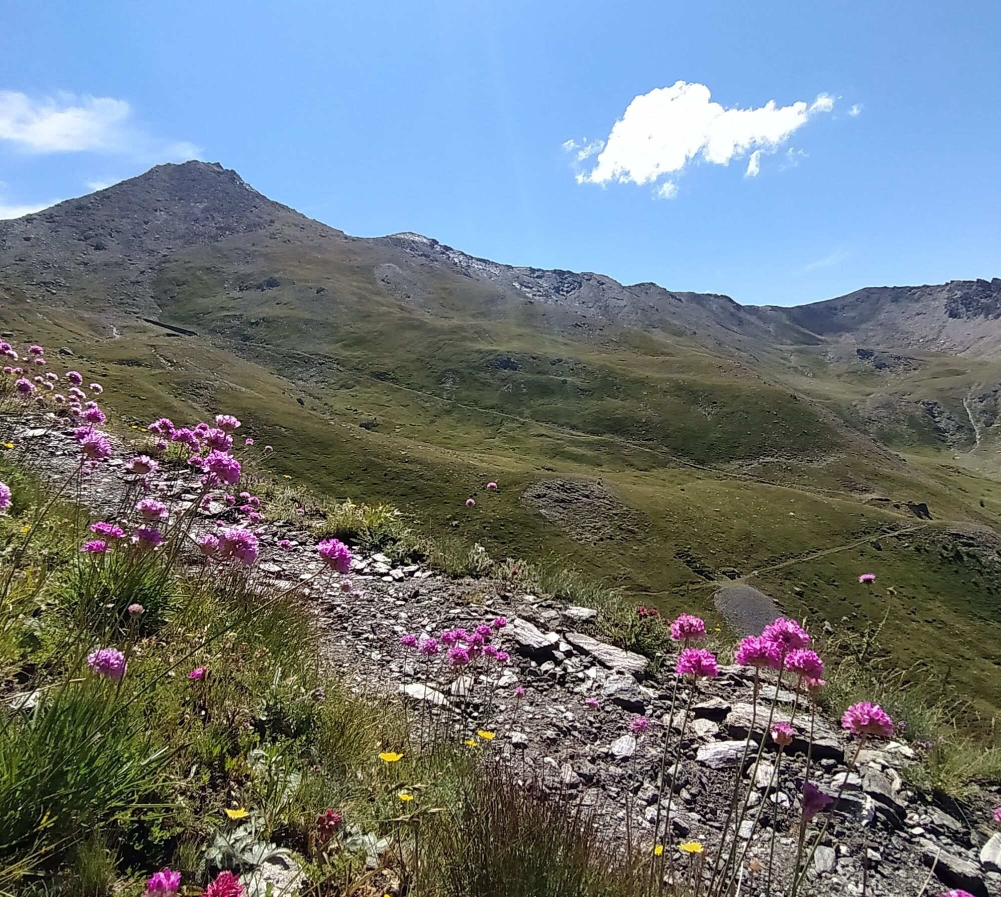
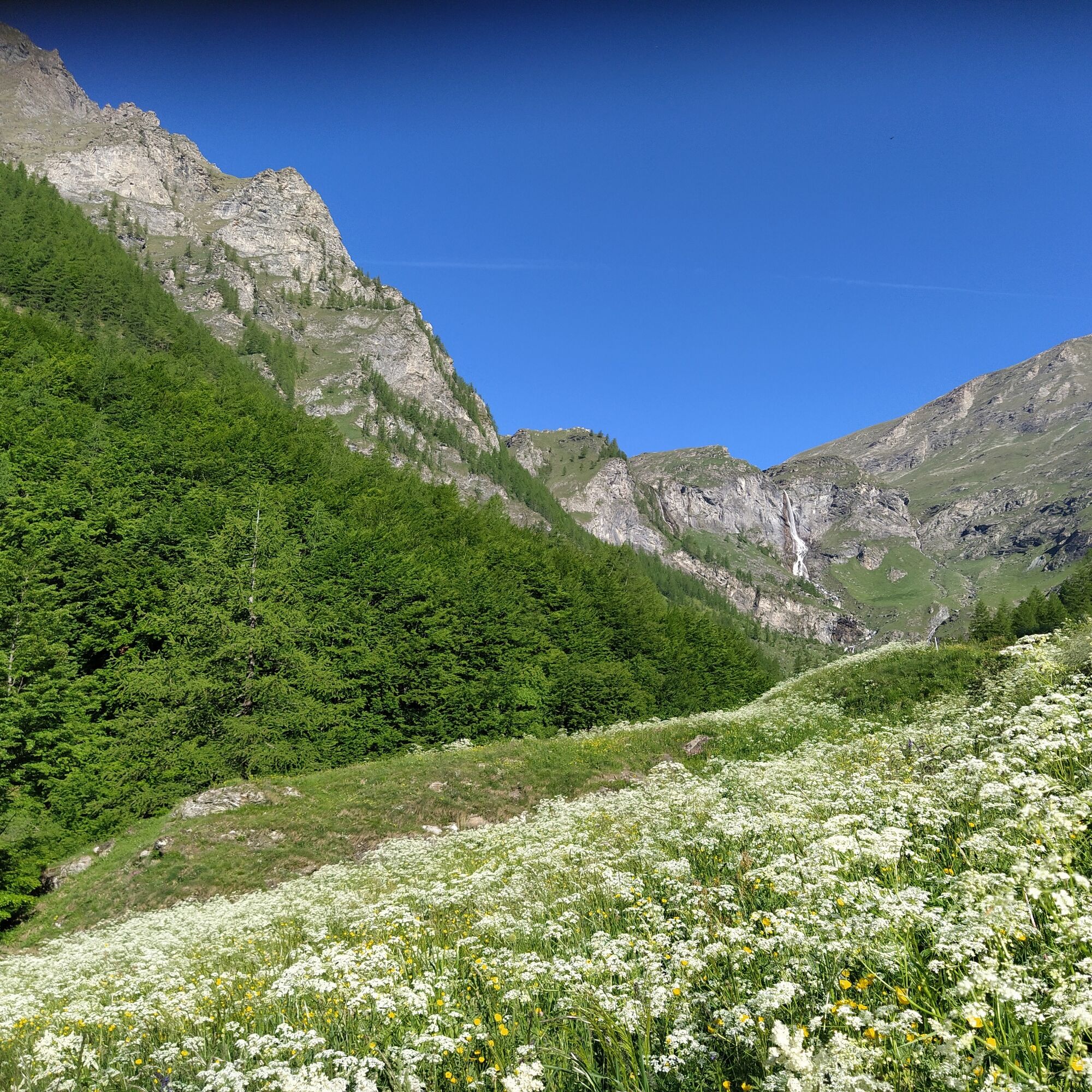
continue along the road and after the commemorative plaque/monument (which can be seen high up on the left going up, along the ridge), enter the ridge trail and continue on the trail in the same direction (trail marked in white-red) or from the pass take the ridge path directly. The first section is very steep and then continues up and down more gently along the ridge. Beyond the commemorative monument, pass the old ski lifts and continue along the marked path.The vegetation has changed: this is the realm of bilberries, rhododendrons, wild thyme, sempervivum, and hardy high-altitude flowers. Before reaching Colle del Pis, you cross a meadow on the side of which you can observe a beautiful flowering of alpine cotton-grass, also called “mountain cotton”.
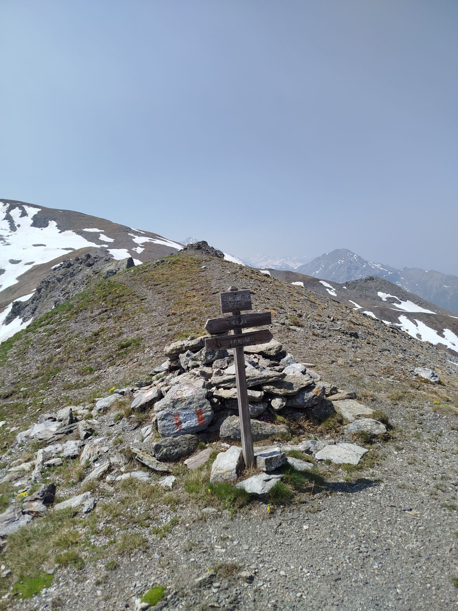
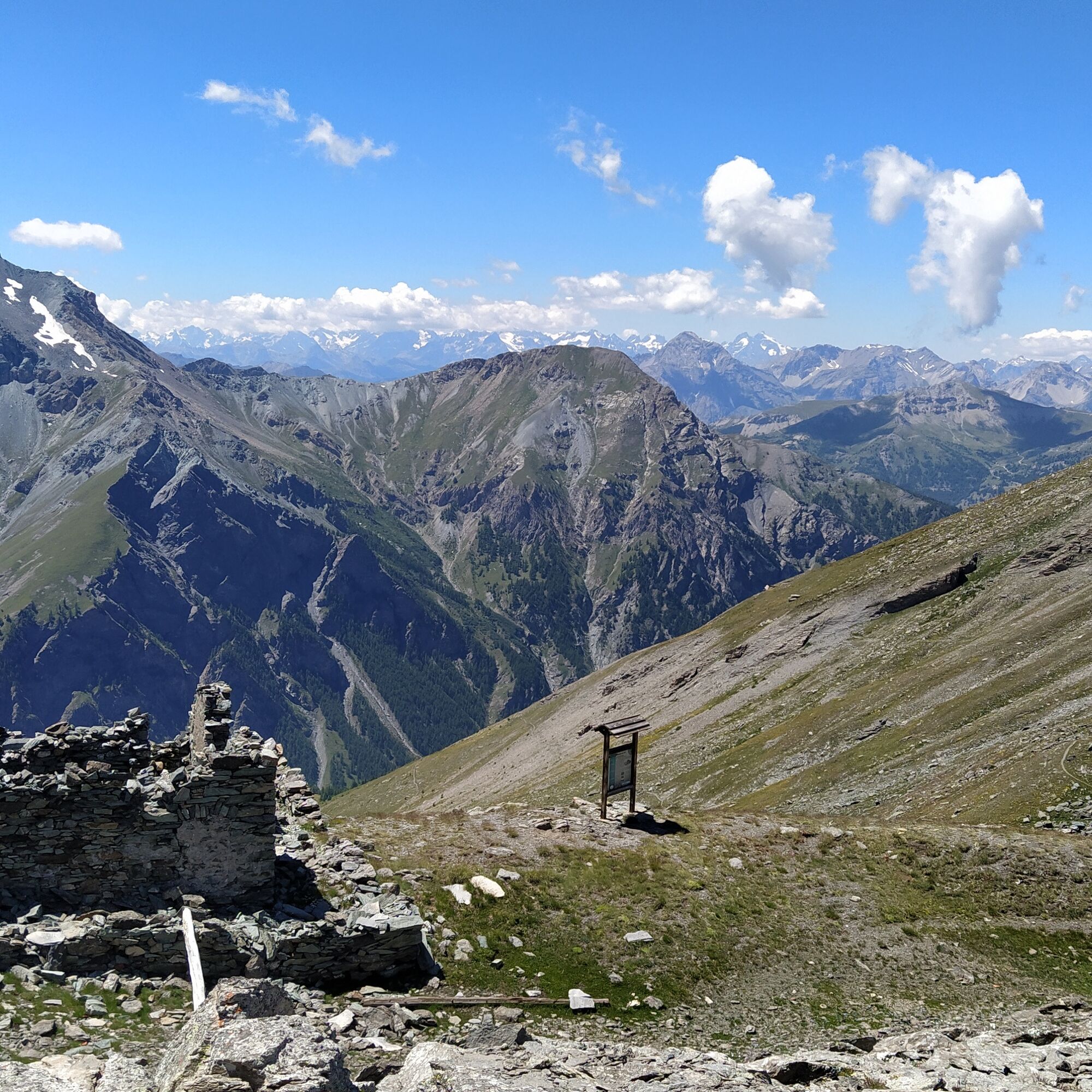
At Colle del Pis, the view extends to Colle dell’Albergian, below which the Moremout military shelters, Monte Ruetas, and the Morefreddo shelters can be glimpsed on the right, as well as the basin descending towards Val Germanasca.
If you wish, you can make a detour to visit the Monte Morefreddo shelters (about 30 minutes extra to get there) and enjoy the view of Val Troncea from there. From there, return along the same trail and continue.
For Balsiglia and Massello, take trail 216 which gently descends, making a curve in the panoramic basin to then reach the other side of the basin. At a certain point, a path leading to the Moremout shelters is clearly visible. It takes about twenty minutes to reach them, leaving the main trail behind.
At the fork, take the path to the left and always follow the signs for Balsiglia.
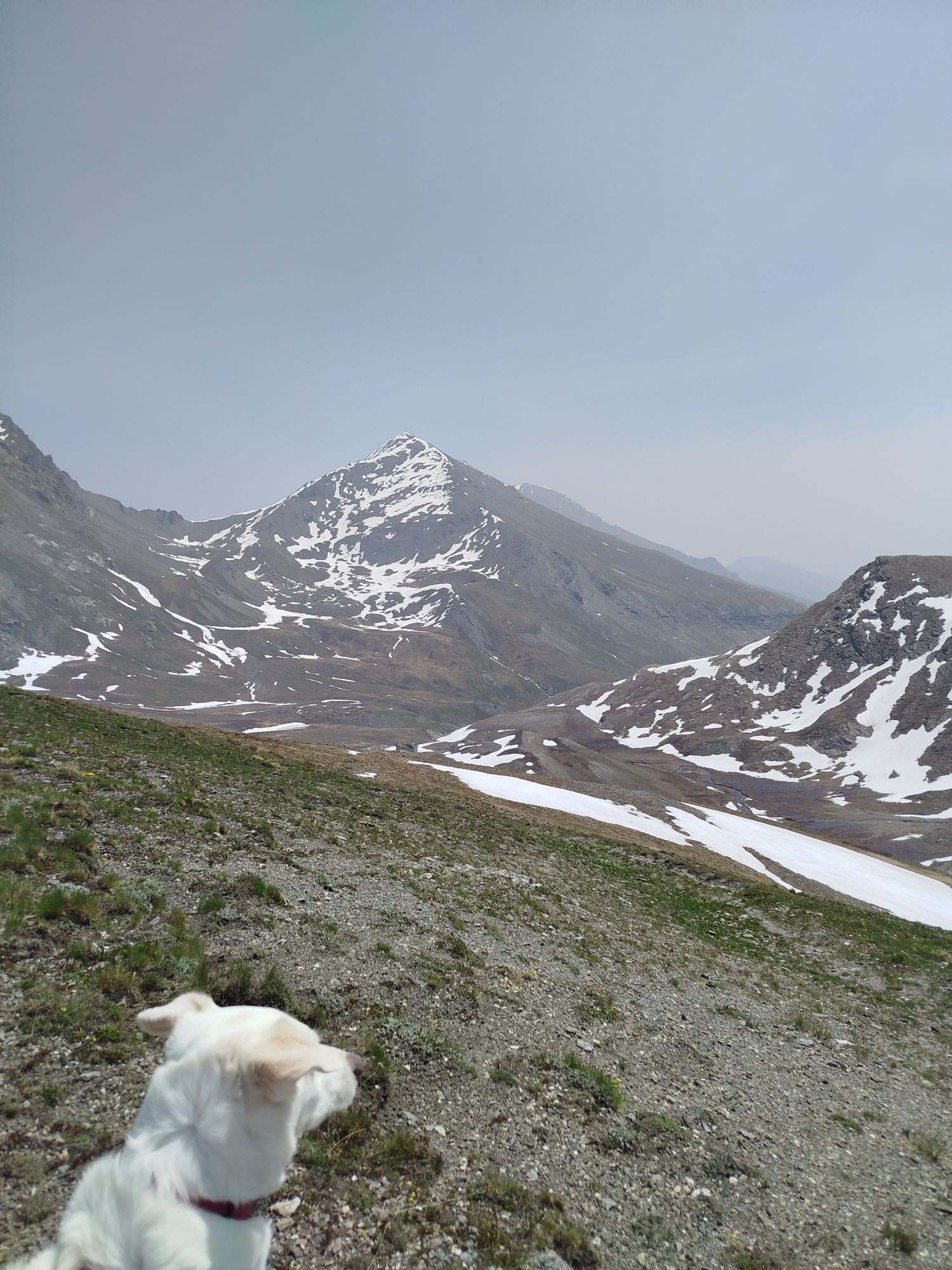
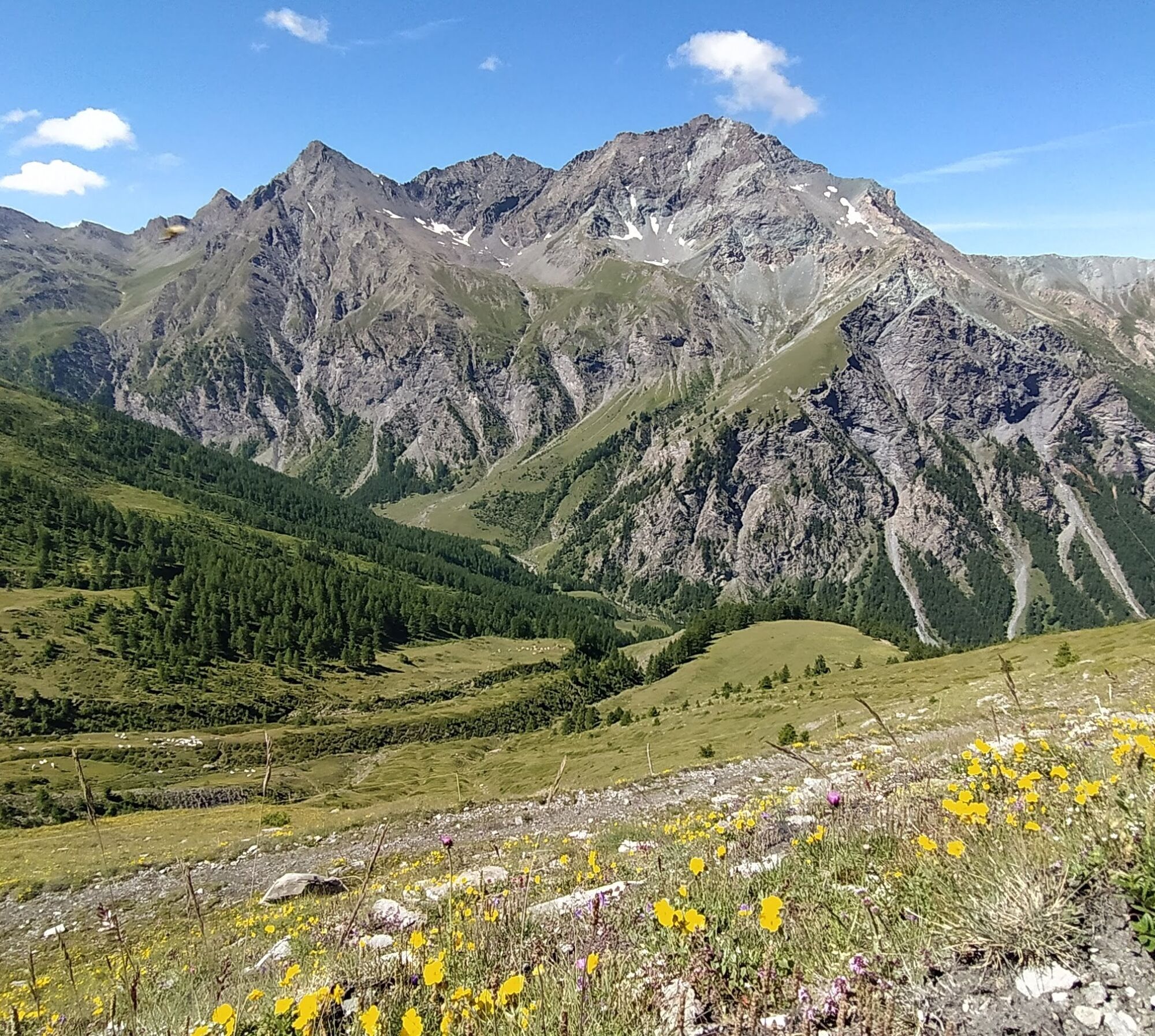
Here the route becomes a balcony trail over the basin, beautiful and panoramic, and skirting the Monte Fea Nera before the shepherd's hut. Finally, the sound of water flowing is heard, and the view opens onto the Massello valley and the imposing Pis waterfall.
At the Lauson shepherd's hut, the path changes direction and begins to descend. From here there is a first steeper downhill section on the slope and then a long section along the stream with a gentler slope reaching Balsiglia. It is a quiet valley of beauty that still seems wild and unspoiled.
Upon arrival in Balsiglia, cross the hamlet and reach the road where notice boards with informational panels about Waldensian history are present. If you wish to stay overnight, there is a self-managed GTA stopover. There is also free municipal Wi-Fi.
To resume the walk towards Massello, follow the paved road to the fork for the trail located on the right at the height of the Piccolo Passet hamlet. Here you can choose to continue along the paved road, which is still little trafficked, or to divert onto the trail that descends on the same slope to a wooden bridge. After crossing the bridge, the path continues by crossing the stream using small bridges or fords, following the naturalistic route “The wheel and the water,” along which you encounter informational boards about local fauna and flora and about the ancient water mill, up to the bridge of the Massello Foresteria.
Ano
Wear clothing and footwear suitable for the environment and season.
There are no fountains or springs along the entire crossing.
It is advisable to be cautious if there are shepherd dogs and/or guard dogs protecting the flock.
From Turin, after passing Pinerolo, take the SP23 to Pragelato and follow the signs for Val Troncea.
There is parking at the entrance to the Val Troncea.
Before undertaking any hike, it is advised to check weather bulletins or ask for information at local Tourism Offices.
It is good practice not to hike alone and always inform someone of your destination.
Do not litter but carry out your waste, possibly collecting that left by others.
Travel times indicated are approximate and may vary depending on weather conditions and your abilities.
A beautiful stage to walk even in autumn during the foliage season.
Webové kamery z prohlídky
Oblíbené prohlídky v okolí
-
5.0
SESTRIERE Monte Rognosa
heavyTuristika 6.42 km -
5.0
CESANA T.SE Cesana - Fenils
světloTuristika 4.60 km -
5.0
CESANA T.SE Thures - Cima Bosco
heavySněžnice 3.94 km -
SAUZE D'OULX Richardette - Montagne Seu )
středníMountainbike 19.9 km -
PRAGELATO Colle dell'Assietta
heavyMountainbike 53.3 km -
OULX Borgata Seu (Gran Bosco Natural Park)
světloSněžnice 5.93 km -
CESANA T.SE Val Thuras
středníTuristika 7.58 km -
PRAGELATO The winter charm of the Val Troncea Natural Park
světloSněžnice 4.62 km -
SESTRIERE Monte Fraiteve m. 2701
středníTuristika 8.65 km -
La Via dei Saraceni (Sauze d'Oulx)
středníMountainbike 33.6 km

Pěší turistika a stopování


Nenechte si ujít nabídky a inspiraci pro vaši příští dovolenou
Vaše e-mailová adresa byl přidán do poštovního seznamu.