Navigace na stránkách
Pořiďte si tuto prohlídku do mobilního telefonu
Mapa
Don Bosco's Walk
heavy
Poutní stezka
40.78 km
Naskenujte QR kód a spusťte navigaci v aplikaci bergfex.
QR Code
Pěší turistika a stopování

Don Bosco's Walk

Vzdálenost
40.8 km
Doba trvání
12:00 h
Ascent
941 hm
Hladina moře
207 - 668 m
Stažení skladby
Mapa
Don Bosco's Walk
heavy
Poutní stezka
40.78 km

The Don Bosco Walk departs from the Sanctuary of Maria Ausiliatrice (Mother house of Turin Valdocco, a symbol of the Salesian Order and burial place of Saint Giovanni Bosco) to arrive at Colle Don Bosco...

Popis

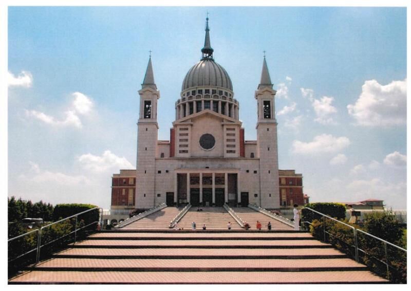
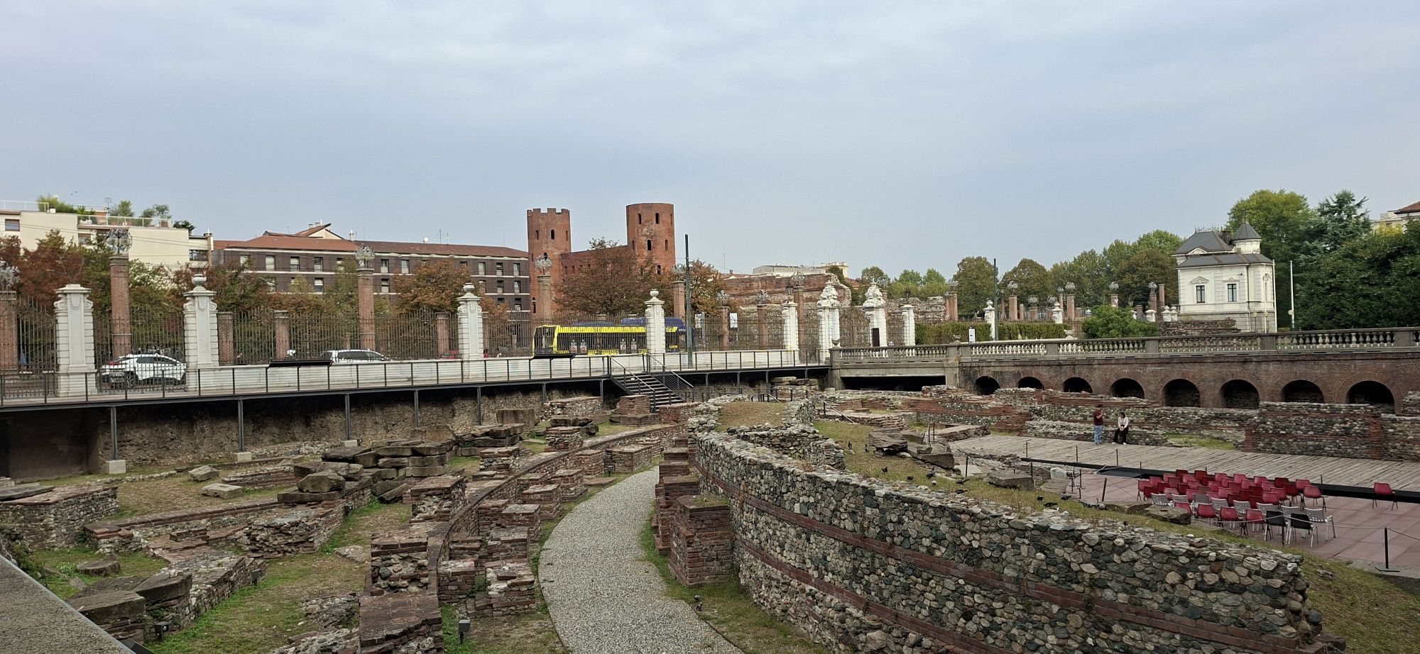
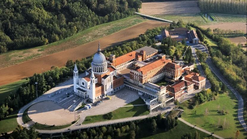
The Don Bosco Walk departs from the Sanctuary of Maria Ausiliatrice (Mother house of Turin Valdocco, a symbol of the Salesian Order and burial place of Saint Giovanni Bosco) to arrive at Colle Don Bosco (Castelnuovo Don Bosco, Asti). The route lends itself to a great variety of uses: from a one-day walk to several days of trekking which can also includereturning to Turin on a ring route. The route presents no specific difficulty: marked by white green signposts in a clockwise direction with departure from Turin, it is particularly suited to hikes and walks immersed in nature. Beyond the recreational and sports aspects, the San Giovanni Bosco Walk allows to discover a territory which remembers and describes the places which marked the childhood, training and studies of the Saint. The farmhouses, fields,schools,cities andplaces of worship that are encountered travelling the three ways preserve the memory of the man, here where he matured his religious authenticity and methods of persuasion. Finally, the Walk gives the opportunity to discover a rich widespread heritage of small and large historical, artistic, gastronomic and natural excellence that make this hilly territory to the south of Turin extraordinarily interesting and precious.

Trasa
Sacro Cuore di Gesù
(237 m)
Místo konání bohoslužeb
0.0 km
Chiesa della Madonna del Pilone
(220 m)
Místo konání bohoslužeb
5.7 km
Superga
(672 m)
Summit
14.7 km
Bric Palouc
(616 m)
Summit
17.6 km
Bric della Croce Bianca
(539 m)
Summit
20.5 km
Chiesa di San Rocco
(410 m)
Místo konání bohoslužeb
28.5 km
Cinzano
(486 m)
Vesnice
34.9 km
Trasa
Mapa
Don Bosco's Walk
heavy
Poutní stezka
40.78 km
Valdocco
(234 m)
Sousedství
0.0 km
Sacro Cuore di Gesù
(237 m)
Místo konání bohoslužeb
0.0 km
Porta Palazzo
(236 m)
Sousedství
1.0 km
Chiesa di San Lorenzo
(240 m)
Místo konání bohoslužeb
1.8 km
Chiesa della Santissima Trinità
(241 m)
Místo konání bohoslužeb
1.8 km
Centro
(241 m)
Sousedství
2.1 km
Turin
(239 m)
Město
2.1 km
Chiesa di San Francesco da Paola
(237 m)
Místo konání bohoslužeb
2.6 km
Santissima Annunziata
(233 m)
Místo konání bohoslužeb
2.9 km
Borgo Po
(235 m)
Sousedství
3.6 km
Madonna del Pilone
(220 m)
Sousedství
5.4 km
Chiesa della Madonna del Pilone
(220 m)
Místo konání bohoslužeb
5.7 km
Sassi
(223 m)
Vesnice
6.7 km
Bocciofila del Meisino
(209 m)
Restaurace
9.9 km
Superga
(672 m)
Summit
14.7 km
Tetti Rocco
(566 m)
Vypořádání
15.2 km
Superga
(669 m)
Vypořádání
15.3 km
Trattoria Superga
(620 m)
Restaurace
15.3 km
Bel Deuit
(616 m)
Restaurace
15.3 km
Bric del Duca
(671 m)
Summit
16.6 km
Bric San Giacomo
(660 m)
Summit
17.0 km
Bric Palouc
(616 m)
Summit
17.6 km
Osteria del Paluch
(556 m)
Restaurace
18.0 km
Village Palouc
(547 m)
Vypořádání
18.0 km
Il Pilonetto
(556 m)
Vesnice
18.4 km
Bric del Pilonetto
(576 m)
Summit
18.5 km
Tetti Pietraforata
(593 m)
Vypořádání
19.1 km
Bric Pietraforata
(593 m)
Summit
19.2 km
Bric della Croce Bianca
(539 m)
Summit
20.5 km
Tetti Varetti - Rogliatti
(416 m)
Vypořádání
22.0 km
Bardassano
(452 m)
Vypořádání
24.6 km
Tetti Grosso
(436 m)
Vypořádání
26.1 km
Regione Curlando
(453 m)
Vypořádání
26.6 km
Regione Bavento
(422 m)
Vypořádání
26.8 km
Chiesa di Santa Lucia del Fagnour
(477 m)
Místo konání bohoslužeb
27.5 km
Chiesa di San Rocco
(410 m)
Místo konání bohoslužeb
28.5 km
Ristorante del Pino
(413 m)
Restaurace
28.5 km
Sciolze
(410 m)
Vesnice
28.6 km
La Locanda delle Marionette
(418 m)
Restaurace
28.9 km
Regione Fasella
(378 m)
Vypořádání
30.1 km
Regione Aprà
(415 m)
Vypořádání
32.8 km
Regione Sant'Antonio
(452 m)
Vypořádání
34.1 km
Punto panoramico di Cinzano
(481 m)
Úhel pohledu
34.7 km
Cinzano
(486 m)
Vesnice
34.9 km
Torrazza
(424 m)
Vypořádání
36.2 km
Pogliano
(403 m)
Vypořádání
38.8 km
Betlemme
(409 m)
Vypořádání
39.4 km
Vezzolano
(415 m)
Vypořádání
40.7 km
Informace o prohlídce

The Cammino offers the opportunity to discover the rich, widespread heritage of historical, artistic, gastronomic and naturalistic excellence of the hilly area south of Turin.

Technologie
n.a.
Stav
6 / 6
Krajina
3 / 6
Zkušenosti
4 / 6
Celoročně přístupné
Led
Úno
Bře
Dub
Kvě
Čen
Čec
Srp
Zář
Říj
Lis
Pro
Sdílet prohlídku
Mapa
Don Bosco's Walk
heavy
Poutní stezka
40.78 km
Chyba
Došlo k chybě. Zkuste to prosím znovu.
Pěší turistika a stopování

Pěší turistika a stopování

Pěší turistika a stopování
Více než 550.000 návrhů výletů, podrobné mapy a intuitivní plánovač tras dělají z aplikace nezbytnou výbavu pro všechny milovníky přírody.
bergfex