


Sentiero Tanaro: Tappa 5 Priero - Nucetto
The stage connects Priero with Nucetto, among the imposing woods that mark the border between Liguria and Piedmont. Reached Perlo, through the Chapel of S. Anna you go up the soft hills thick with chestnut...

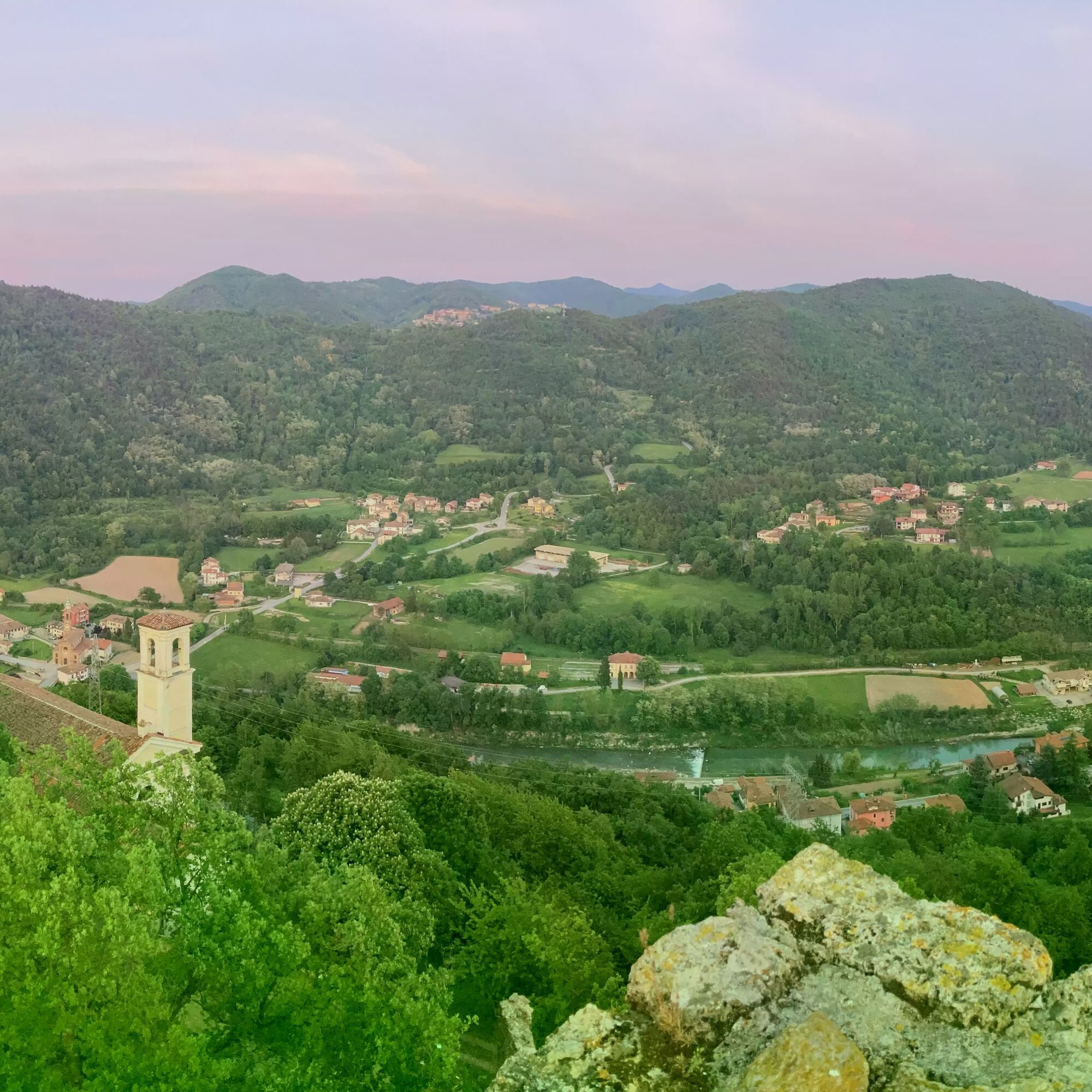
La tappa di 15km (percorribile in circa 4 ore) collega Priero con Nucetto, tra gli imponenti boschi che segnano il confine tra la Liguria ed il Piemonte. Raggiunto Nucetto , attraverso la Cappella di S. Anna si risale sulle morbide colline fitte di boschi di castagno per ridiscendere quindi nella Valle Tanaro, arrivare al bivio dell'ex-miniera di lignite e raggiungere il paese di Nucetto. Qui il castello, detto "d'Aleramo" (risalente al X secolo), eretto sul contrafforte montuoso alla sinistra del Tanaro, è visitabile e regala un'ampia panoramica sul territorio e sulle altre fortezze con le quali era anticamente collegato: da quella di Perlo a Battifollo, Bagnasco, Castelnuovo e Malpotremo.
Si raccomanda attrezzatura adatta (con giacca antivento ed eventuale cambio)
Il borgo medievale di Priero con il castello, sede del Museo Napoleonico; Nucetto, con il castello e l'antica miniera di lignite
Oblíbené prohlídky v okolí
Sentiero Tanaro: Tappa 14 Lisio - Viola St Gree
světloJízda na kole 7,88 kmSentiero Tanaro: Tappa 6 Nucetto - Priola (Borgata Casario)
světloJízda na kole 16,5 kmSentiero Tanaro: Tappa 3 Castellino Tanaro - Sale S. Giovanni
středníMountainbike 24,9 kmVioil trail
středníSilniční kolo 43,8 kmGTL | Tappa 5 - Gottasecca - Saliceto
středníTuristika 11,4 kmGTL mountain biking | Stage 6 Saliceto - Mombarcaro
středníMountainbike 18,8 kmSentiero Tanaro: Tappa 2A Mombasiglio - Lisio
světloMountainbike 11,5 kmGTL mountain biking | Stage 5 Gottasecca - Saliceto
heavyMountainbike 11,4 kmSentiero Tanaro: Tappa 4 Sale S. Giovanni - Priero
světloMountainbike 5,55 kmSentiero Tanaro: Tappa 1A Castellino Tanaro - Mombasiglio
světloMountainbike 14,7 km
Pěší turistika a stopování


Nenechte si ujít nabídky a inspiraci pro vaši příští dovolenou
Vaše e-mailová adresa byl přidán do poštovního seznamu.