


Romanesque architecture? We discover it by bike in the province of Asti
The route unfolds in the Asti area discovering beautiful examples of Romanesque architecture: from rural churches and chapels to the Abbey of Vezzolano, among the most important medieval monuments in Piedmont,...
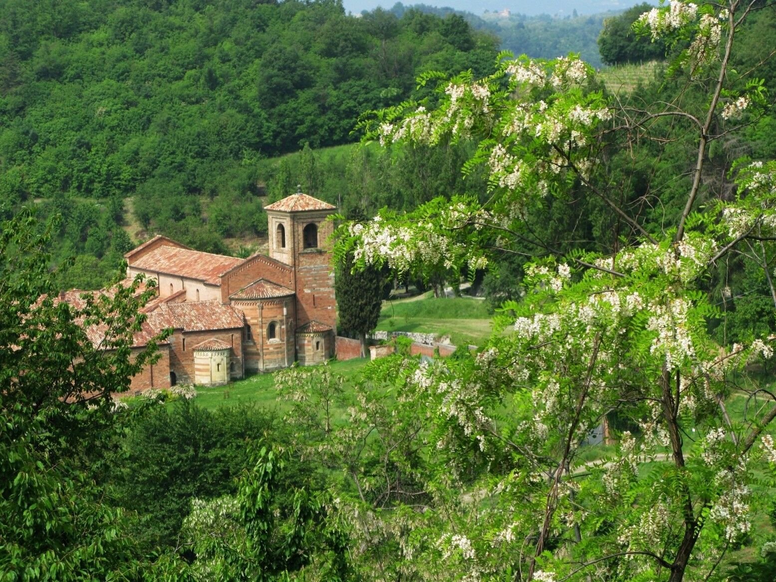
The route unfolds in the Asti area discovering beautiful examples of Romanesque architecture: from rural churches and chapels to the Abbey of Vezzolano, among the most important medieval monuments in Piedmont, and to the church of San Secondo in Cortazzone, on the Mongiglietto hill. Along with the parish church of San Lorenzo in Montiglio Monferrato, Santa Fede in Cavagnolo, Saints Nazario and Celso in Montechiaro d'Asti, in particular the church of San Secondo shares the bichromy of the masonry structures, created by the combination of the red of the bricks with the golden blond of the sandstone blocks, the presence of carved stone capitals, and the use of a remarkable variety of decorative elements, such as hanging arches, simple and intertwined, carved corbels, frames with checkerboard motifs. All elements that capture the visitor and testify to the widespread flourishing of Romanesque style between Asti and the Monferrato Astigiano.

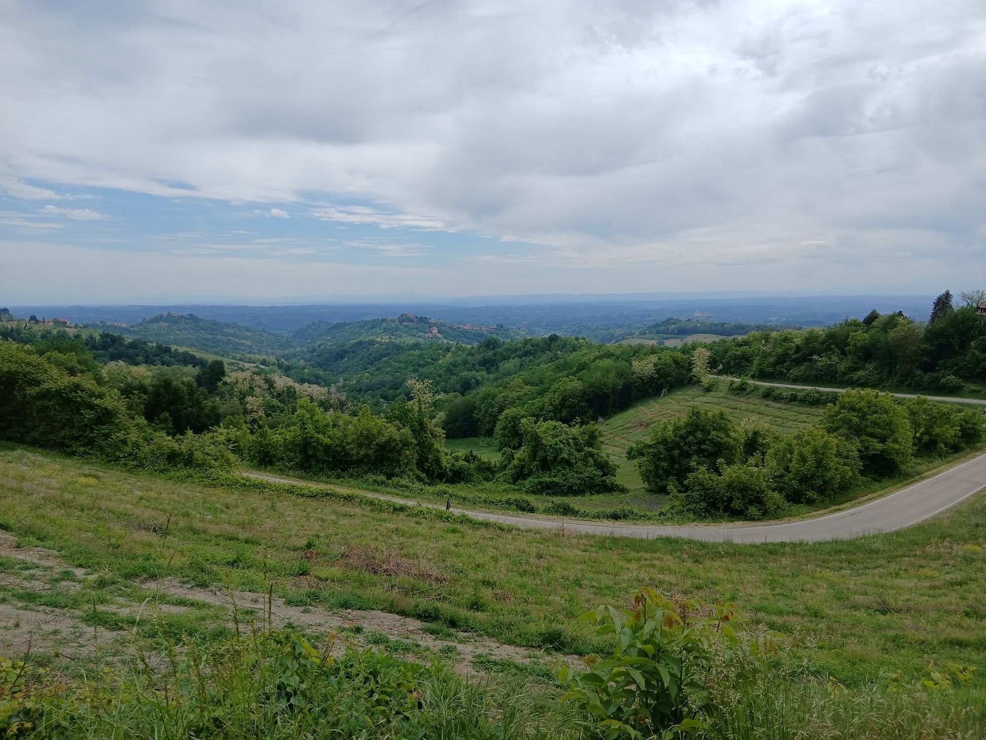
A 60-kilometer loop route through the hills of upper Asti, mainly on low-traffic roads, following the traces of Romanesque architecture. The route starts from Cunico station (170 m above sea level) (on the Asti-Chivasso line) and heads out onto the provincial road towards Asti; after about five hundred meters, turn right toward Montechiaro. Shortly after (km 3) there is a small road on the right that climbs to the church of Saints Nazario and Celso, whose bell tower stands out among the hills. Continue on the trail through the vineyards climbing the hill and reach the provincial road to Montechiaro near the cemetery. Climb toward the village; on the entrance it is possible to take a right turn to visit the Romanesque parish church of Piesenzana. Pass through Montechiaro and descend towards the station. At the second left hairpin bend take Vignasone road, which leads with a pleasant up-and-down to the intersection (km 7) with the SS 458; cross it and start the climb towards Cortazzone. Less than two kilometers away, near Casasco castle, turn right and continue along the ridge to Soglio (km 10 - 275 m above sea level). Continue descending to Cortazzone (km 13); after another kilometer descending and crossing the intersection, continue straight towards Montafia; less than a kilometer and turn right to the Mongiglietto hill: a short and steep climb leads to the magical church of San Secondo, which can be visited by asking for the keys at the gas station at the end of the village or at the nearby pizzeria. Then continue on the Mongiglietto road for about a kilometer until you quickly descend to reach the provincial road to Montafia. Cross the village (km 18) and upon exiting, turn left towards the cemetery to face a short but steep climb to the church of San Martino. Going back, turn in the plain towards Capriglio. After passing the village (km 22) climb, passing Serra and then descending; pass next to the imposing sanctuary of Colle Don Bosco and continue on the plain until Castelnuovo Don Bosco (km 29 - 250 m above sea level). A long panoramic climb among the vineyards leads to Albugnano (km 34 - 507 m above sea level). Without entering the village, descend left towards the monumental abbey of Vezzolano (km 36 - closed on Mondays). It is possible to visit the small church of San Pietro in the cemetery of Albugnano. Descend towards Aramengo until you reach the SS 458, turn for two hundred meters towards Chivasso, and climb on the right along a steep little road that crosses the Masio hamlet and leads to the little church of San Giorgio (km 41 - 390 m above sea level). Continue on the dirt road leading to Aramengo. Cross it and descend to the SS 458, follow it until the left junction for Cocconato. A demanding three-kilometer climb leads to the village (420 m above sea level). Take a steep descent and briefly climb again to Piovà Massaia (300 m above sea level). Cross the village and descend towards Montiglio. Climb to the hamlet of Carboneri and then with a pleasant up-and-down of three kilometers, arrive at Cunico to reach the starting point again. In total, 60 kilometers. By Claudio Pasero and Daniela Pestarino
(route geomapped by Claudio Trombin)
Suitable equipment is recommended, including a windbreaker jacket and a change of clothes
Rest and refreshment points along the route
For more information see:
www.visitlmr.it/it/itinerari/cicloturismo/la-strada-del-romanico
and https://www.cittaecattedrali.it/it/chiese_aperte
Basilica and birthplace of the Saint in Castelnuovo Don Bosco; Nicola Restauri workshop in Aramengo, Chivasso, and Cocconato, the "capital" of Robiola DOP cheese
Oblíbené prohlídky v okolí
CHIERI - Among vineyards, hills and history toward the Abbey of Vezzolano.
středníSilniční kolo 58,6 kmSentiero 700 - SVC Tratto Murisengo - Crea in mountain bike
Mountainbike 18,6 kmCHIERI - Loop towards Riva presso Chieri
Jízda na kole 32,5 kmAvanti Savoia!
středníMountainbike 25,0 kmCASALBORGONE - Bosc Grand and Bosco del Vaj by MTB
středníMountainbike 22,6 kmSentiero giro del Monte Favato - sentiero 711 in mountain bike
Mountainbike 6,43 kmSentiero giro del Monte Favato - sentiero 711 in camminata
Poutní stezka 6,43 kmSentieri i colli pietrosi - Sentieri 737 in mountain bike
Mountainbike 6,52 kmSentiero il Monte Lungo - Sentiero 712 in mountain bike
Mountainbike 6,74 kmSentiero 700 - SVC Tratto Murisengo - Crea in camminata
Poutní stezka 18,6 km
Pěší turistika a stopování


Nenechte si ujít nabídky a inspiraci pro vaši příští dovolenou
Vaše e-mailová adresa byl přidán do poštovního seznamu.