


Pulkkilanharju nature trail (4.7 km), Päijänne National Park
The Pulkkilanharju nature trail runs along a good-quality dry heath forest path in beautiful ridge and lake scenery. On the nature trail, you can enjoy stunning views of Päijänne, pine forest, and mire...
The Pulkkilanharju nature trail runs along a good-quality dry heath forest path in beautiful ridge and lake scenery. On the nature trail, you can enjoy stunning views of Päijänne, pine forest, and mire nature. The easy-to-walk route is suitable for hikers of all ages. The information boards along the trail tell about the area's geology and nature.
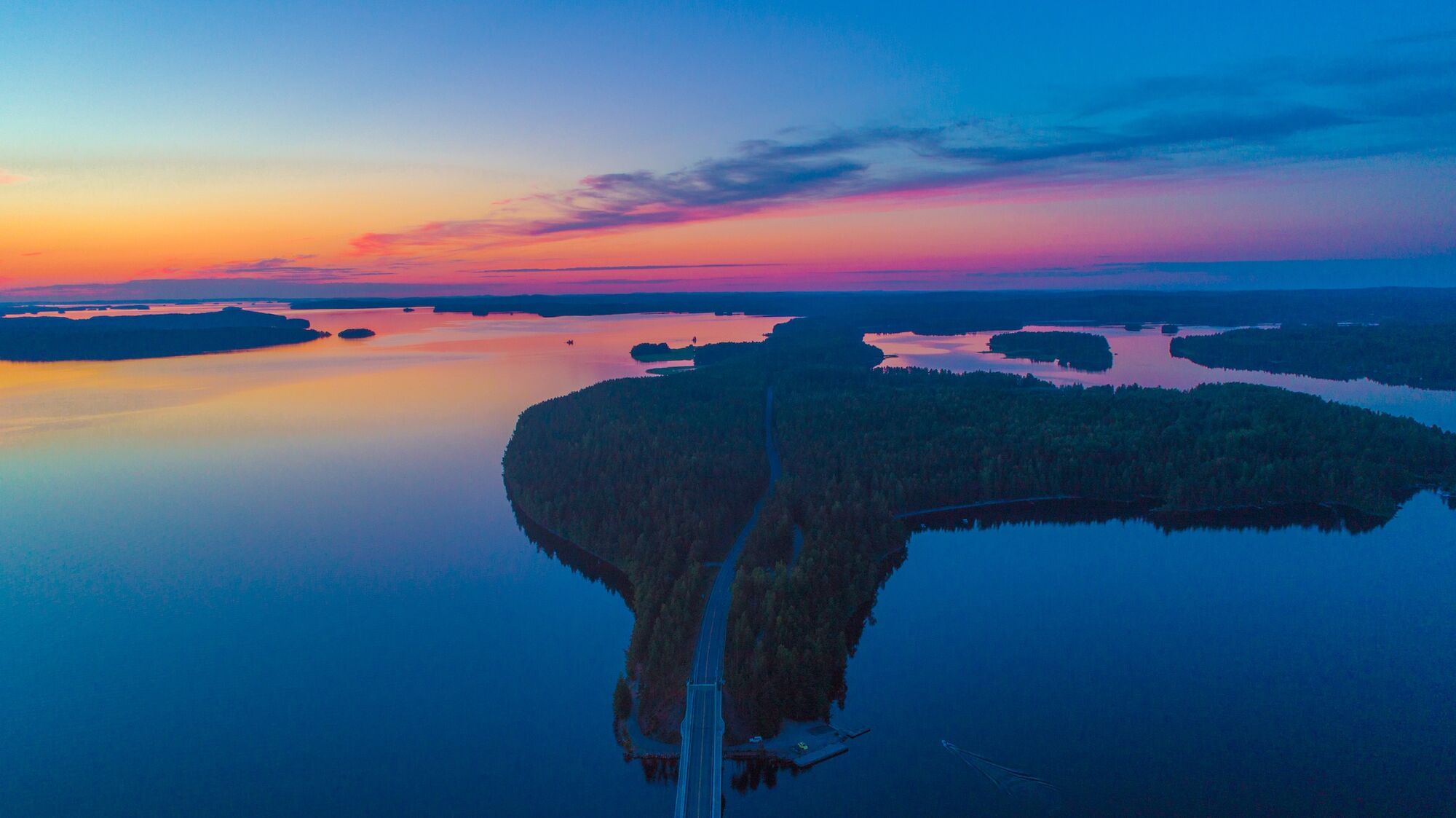
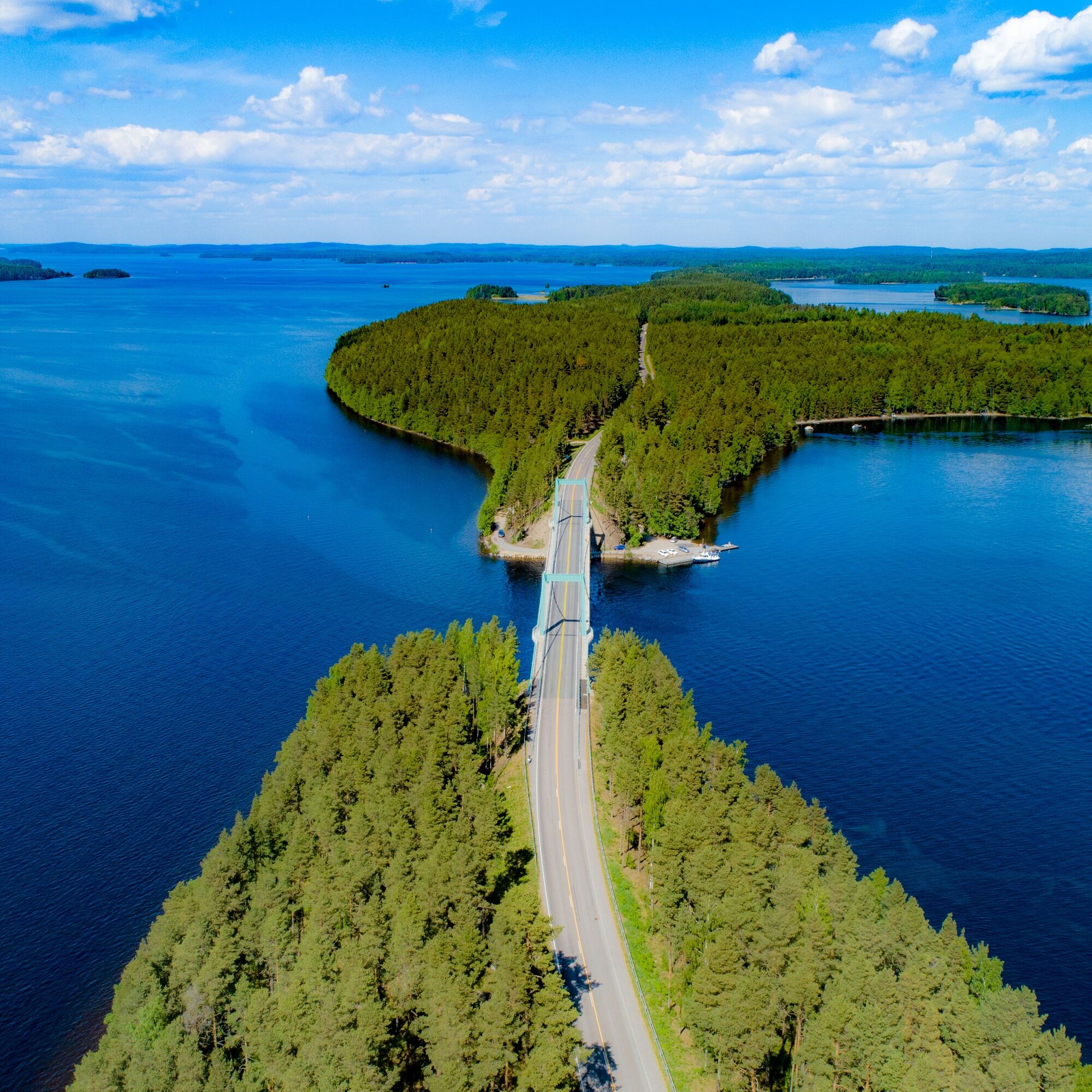
The narrow Pulkkilanharju, which stretches across Päijänne, is an eight-kilometer-long island chain connected by bridges and one of the most beautiful sights in Lake Finland. Pulkkilanharju, located in Päijänne National Park, is part of a nationally valuable landscape area and an important observation point for birds during spring and autumn migration.
Pulkkilanharju is one of the most significant sites of the Salpausselkä Geopark and an internationally representative example of the latest ice age's remnants. Pulkkilanharju was formed about 11,500 years ago at the location of an ice river flowing within the continental glacier, from meltwater-deposited gravel and sand at the end of the ice age.

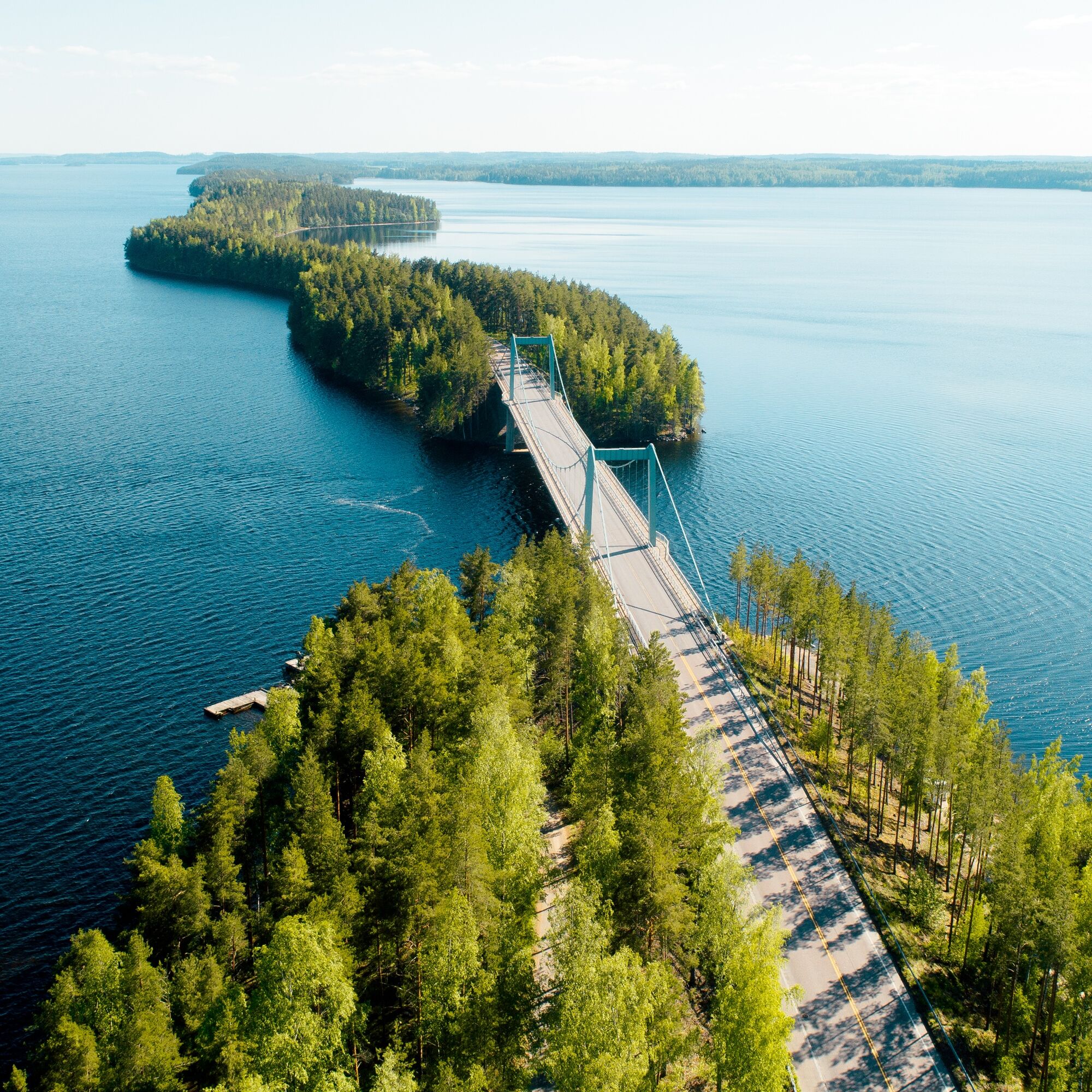
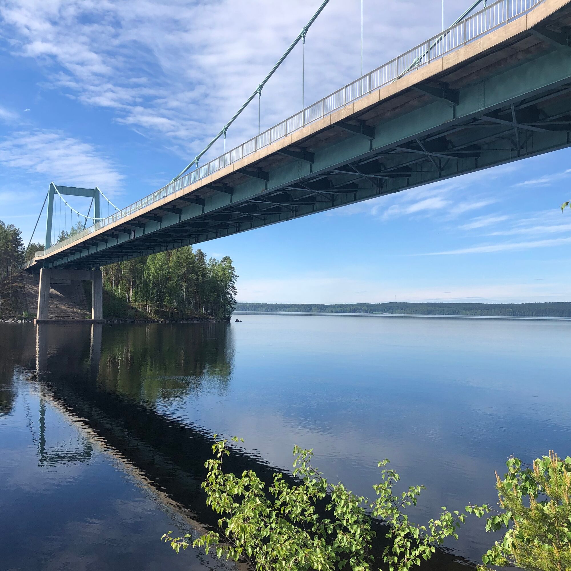
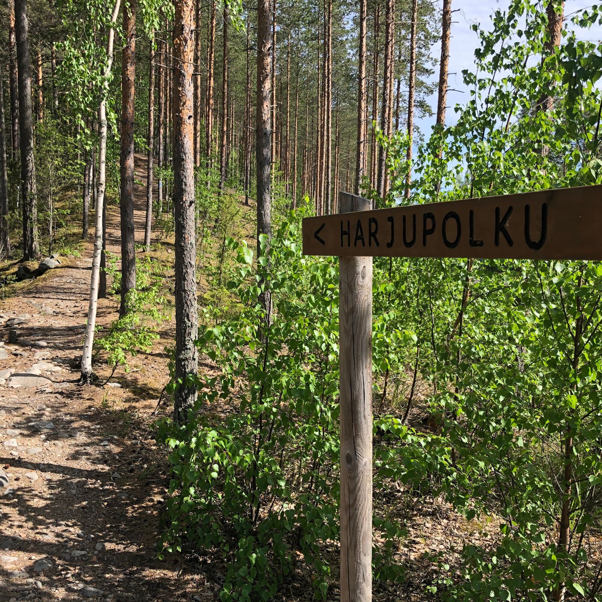
The route starts from the Karisalmi Bridge parking lot, following a well-maintained dry heath forest trail. Follow the ridge trail signs and blue route markings. Be especially careful at intersections and when crossing forest roads.
Ano
Ano
The stairs and boardwalks on the route can be slippery, especially after rain.
You can reach Pulkkilanharju from Vääksy and Sysmä via road 314, by bike, private car, or bus. The start and end point of the route is the Karisalmi Bridge parking lot at Pulkkilantie 955, Asikkala. A light traffic route runs from Vääksy to Karisalmi.
You can reach the Karisalmi stop by bus from Vääksy and Sysmä.
See bus timetables at www.matkahuolto.fi
There is free parking at the Karisalmi Bridge parking lot.
Familiarize yourself with the national park's instructions and regulations: luontoon.fi/paijanne
Hiking instructions, rules, and tips: luontoon.fi/retkeilynabc
Bring your swimsuit and you can take a dip in Päijänne at the beautiful sandy beach along the route.
In summer, a route ship departs from Karisalmi to the national park's Kelvenne island.
Oblíbené prohlídky v okolí
Pulkkilanharju nature trail (2.4 km), Asikkala
světloTematická stezka 2,35 kmKultainen Tassu route, Asikkala
světloTuristika 1,95 kmKelvenne ridge trail, Päijänne National Park
středníTuristika 9,40 kmNational park paddling to Kelvente, Padasjoki
středníKajak / Kánoe 30,0 kmCycling the Asikkala Ice Age Route
středníJízda na kole 78,8 kmPäijänne-Ilves, Padasjoki
středníTuristika 12,9 kmTwo Canals, Lahti-Heinola
heavyKajak / Kánoe 72,0 kmSalonsaari nature trail, Asikkala
světloTematická stezka 3,21 kmPäijänteen Paras - paddling route from Padasjoki
heavyKajak / Kánoe 142,6 kmMyllytonttu nature trail, Vääksy
světloTematická stezka 0,43 km
Pěší turistika a stopování


Nenechte si ujít nabídky a inspiraci pro vaši příští dovolenou
Vaše e-mailová adresa byl přidán do poštovního seznamu.