


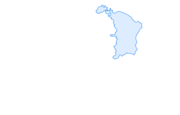

Berlingen Panorama Circular Route

The Berlingen Panorama Circular Route initially leads uphill through forest and meadows above the Untersee village of Berlingen. The route offers expansive views of the Untersee landscape. From the westernmost...
The Berlingen Panorama Circular Route initially leads uphill through forest and meadows above the Untersee village of Berlingen. The route offers expansive views of the Untersee landscape. From the westernmost point, a side trip over the White Rocks to the Jochental excursion restaurant is worthwhile. Adolf Dietrich has already walked these paths, and some of the views can be rediscovered in his works. Many stories revolve around the painter, which the writer Beat Brechbühl processed into a "foot journey with Adolf Dietrich." Back in Berlingen, a visit to the museum and the opposite Adolf-Dietrich-Garden is worthwhile.
The Panoramaweg is signposted.



From Berlingen train station, the path leads west onto Bergstrasse. We follow this uphill until the Weidegasse starts straight ahead. Follow the Weidegasse along the forest edge until some houses are visible on the right. The Weidegasse leads down to the right back to the village. The Panoramaweg follows the forest edge to the left. Cross the forest, then follow the forest edge again until a meadow path crosses the valley on the left. Follow the path (Bergstrasse) to the right / west until after crossing the valley again the hiker stands at a T-junction. Straight ahead there is a detour to the Jochental excursion restaurant. To the right, the hike leads back over Mühlhofstraße to Berlingen.
Mühlhofstraße turns into Langgasse. The Pfarrgasse goes down on the left and leads to the Adolf-Dietrich-Haus museum. Langgasse ends at Bachstrasse. Cross this and follow Obderdorfstrasse to Bergstrasse and to the train station.
Berlingen is accessible from the Kreuzlingen/Konstanz and Schaffhausen motorway exits via National Road 13.
Starting point of the route is Berlingen train station
There are parking spaces at Berlingen train station
Book tip: Beat Brechbühl, Foot journey with Adolf Dietrich,
Adolf-Dietrich-Haus: The former home of the important Swiss painter has been transformed into a museum by the Thurgau Art Museum.

Oblíbené prohlídky v okolí
- 5.0
Mindelsee-Runde
světloTuristika 7.83 km - 5.0
Hike on the panorama route of the Höri Peninsula
středníTuristika 8.11 km - 4.0
Around the island of Reichenau
světloTuristika 10.9 km - 4.0
Bodanrück-Runde
heavyTuristika 8.36 km - 5.0
Stein am Rhein - Hohenklingen Castle - Stein am Rhein
středníTuristika 7.68 km - 4.0
Circular hike Gaienhofen-Middle Höri
středníTuristika 12.6 km - 4.5
Mühlsberg route
středníTuristika 8.67 km - 4.0
Rundwanderung Liggeringen - Bodman
středníTuristika 13.0 km - 5.0
Natur & Kultur - Rundtour entlang des Überlinger Sees
světloJízda na kole 32.7 km - 3.7
Firstweg Langenmos
středníTuristika 5.76 km
Pěší turistika a stopování


Nenechte si ujít nabídky a inspiraci pro vaši příští dovolenou
Vaše e-mailová adresa byl přidán do poštovního seznamu.


