


Circular route through the Klettgau vineyards via high-altitude path
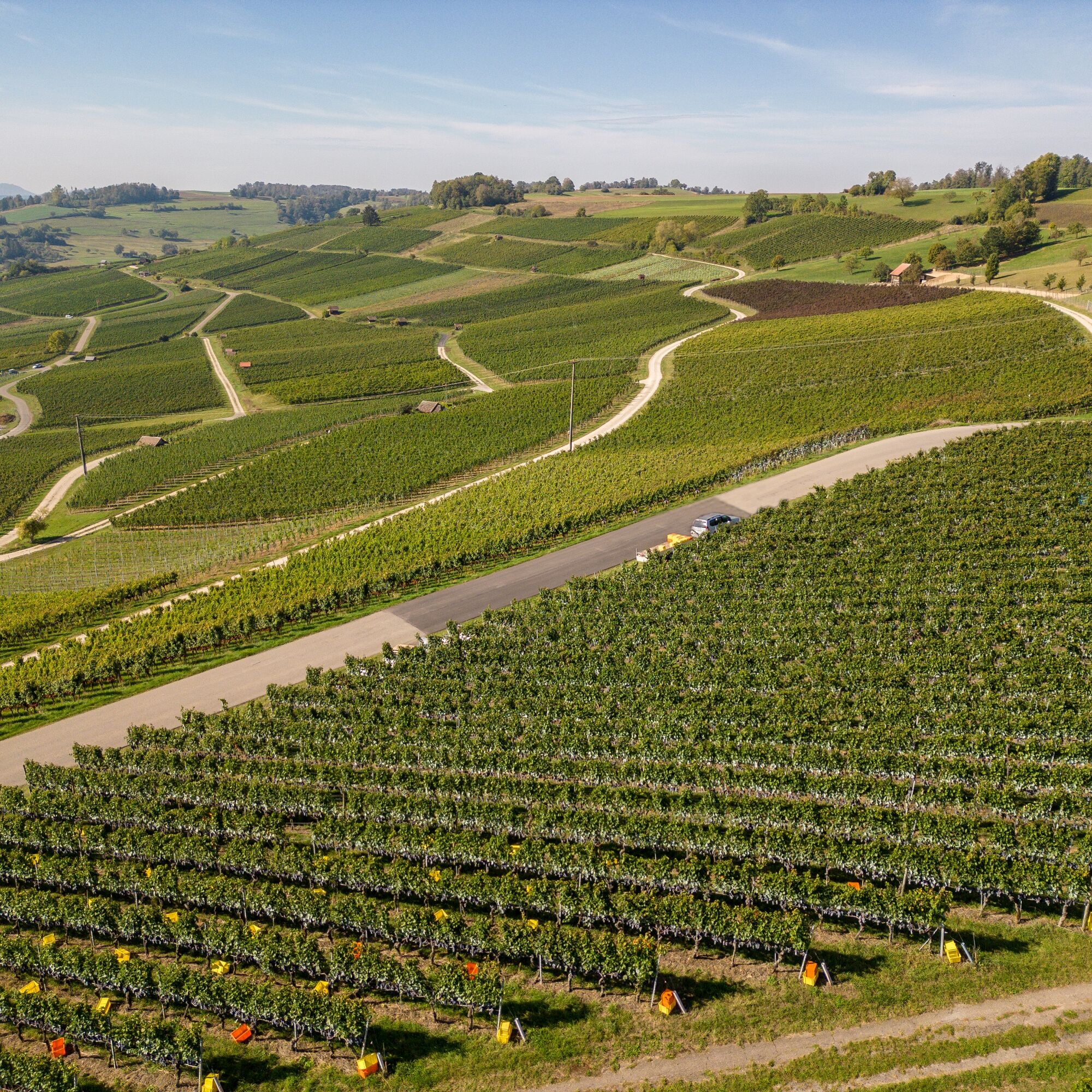
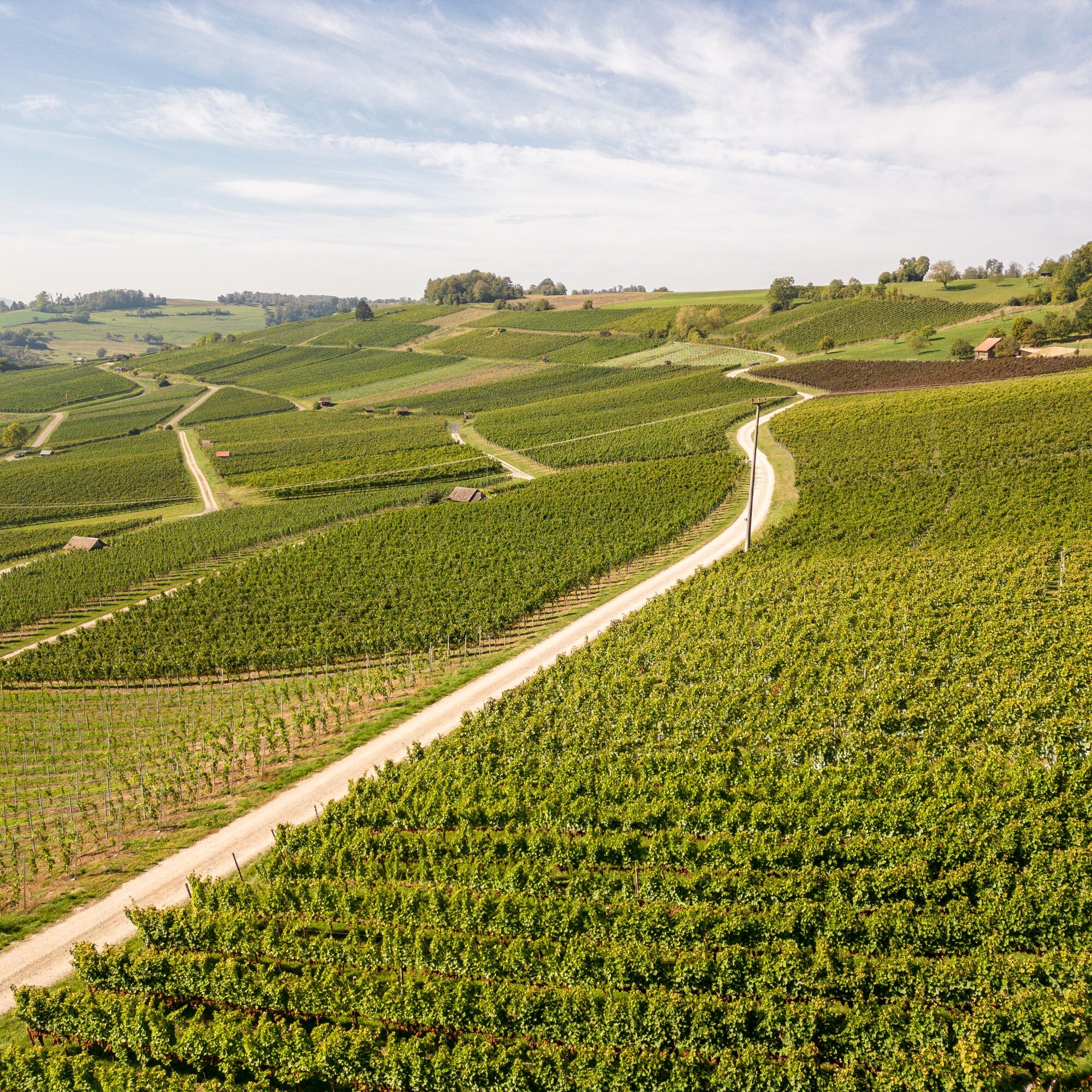
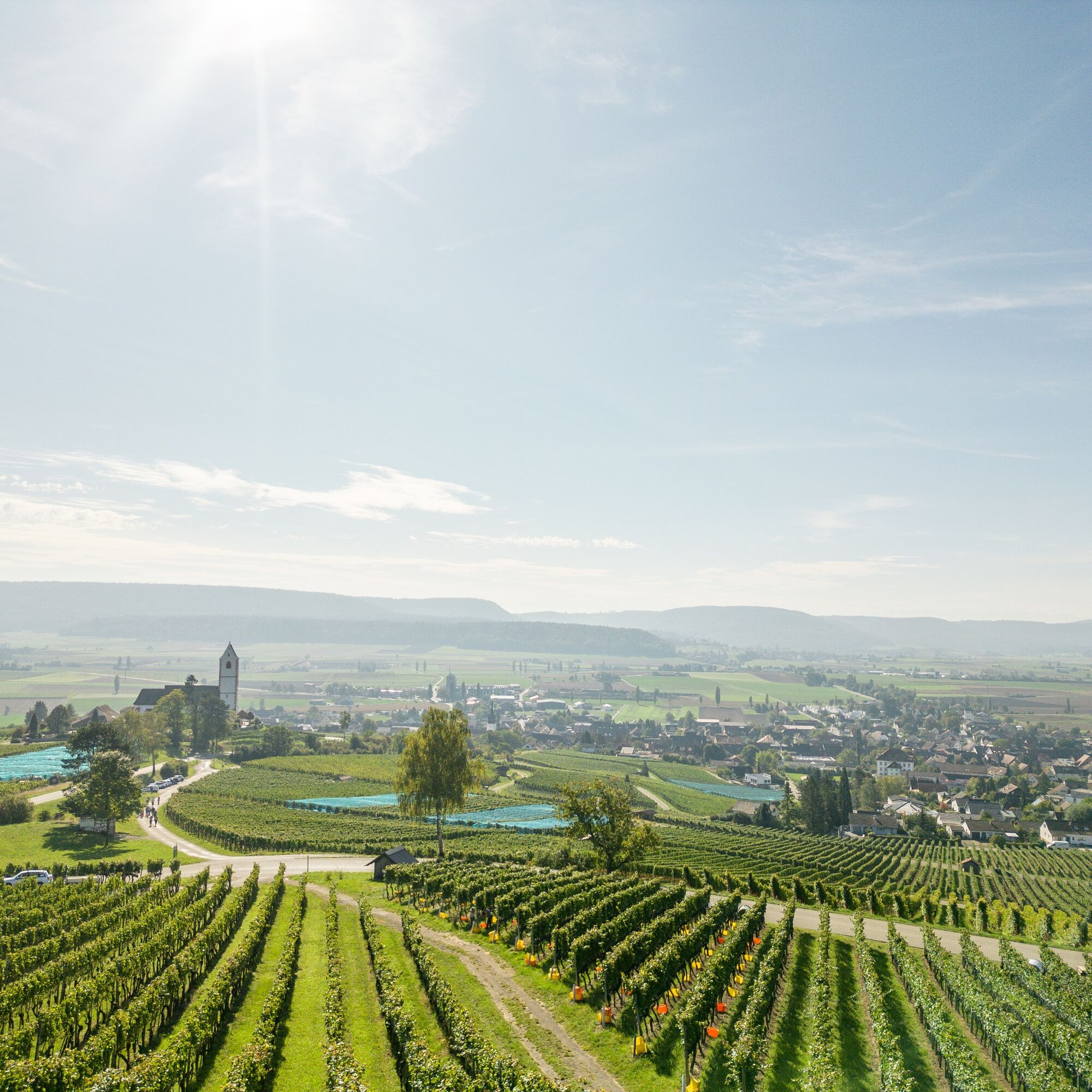
The circular route starting at the church in Gächlingen leads you through the Klettgau vineyards, past small but fine vineyard cottages to the Hallauer mountain church St. Moritz. Take your time and visit...
The circular route starting at the church in Gächlingen leads you through the Klettgau vineyards, past small but fine vineyard cottages to the Hallauer mountain church St. Moritz. Take your time and visit the mountain church. It's worth it! On the high-altitude path, you always have a great view over the different villages in the area. In Oberhallau, there is an opportunity to stop for refreshments.


Gächlingen (CH) - Oberhallau (CH) - Gächlingen (CH)
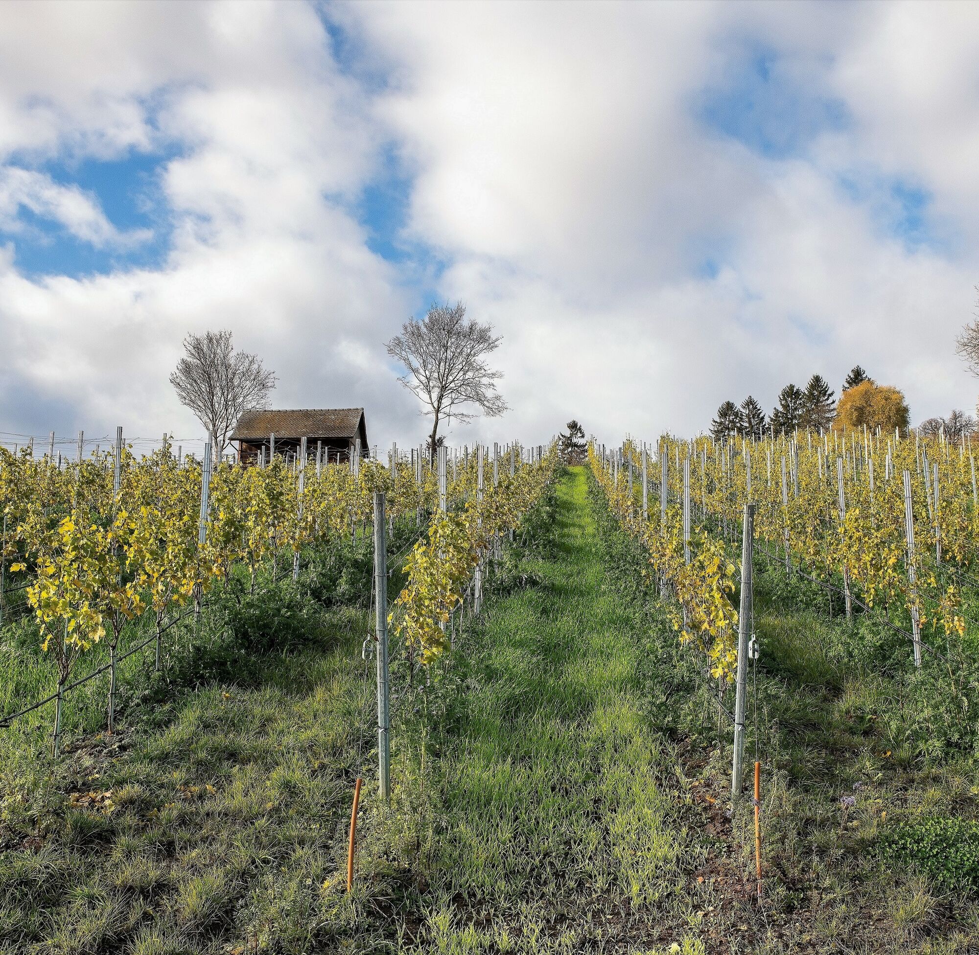
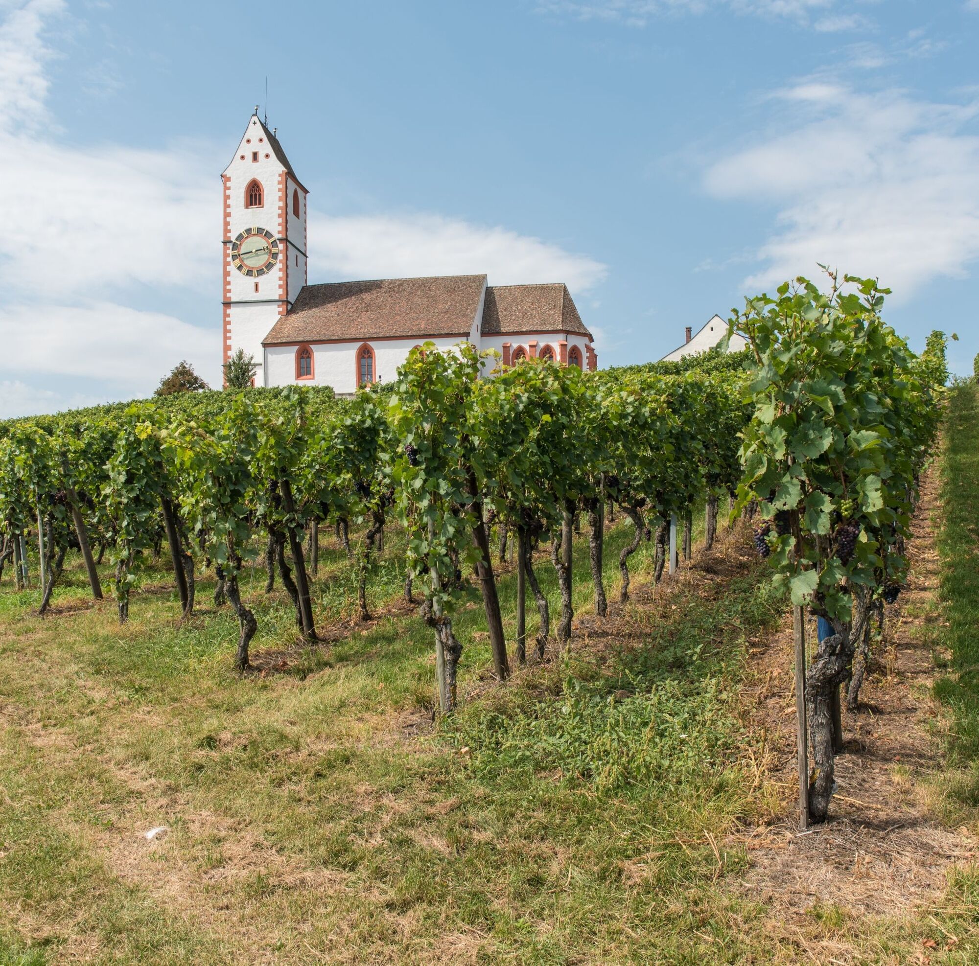
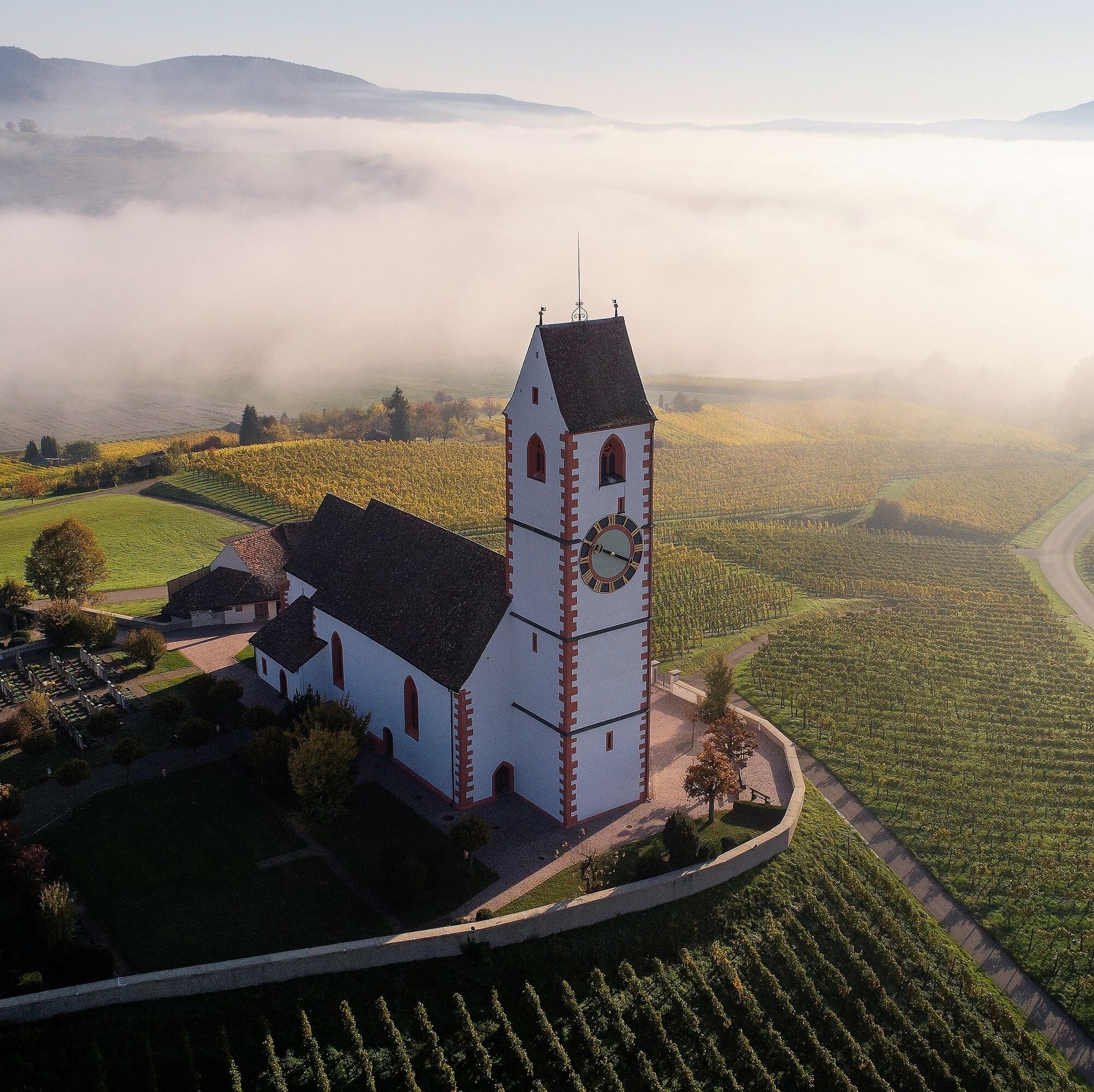
The starting point of the hike is the church in Gächlingen. We walk back along the main street towards Oberhallau and turn right onto Dorfstrasse at the intersection. We leave the community center on the left and continue up Schulstrasse. At the “Agricultural Cooperative” we go straight ahead (sign: Im Berg Siblinger Höhe 40 minutes). We now always follow the "hiking trail" sign, which points us to the right at a lamppost, leading us up towards the vineyards. A little higher up, at a vineyard cottage, we leave the paved path and continue straight ahead. After a right turn, we cross a small street further on and come to the main road. We now walk up through the district “Im Berg” on this road and past a hut on the left, then immediately after a hiking parking lot, turn left onto the high-altitude path (direction “Hammel-Silstig”). We then reach a memorial stone with a pillar with yellow plates, follow the hiking trail to the left, and now hike approximately straight ahead on the high-altitude path towards “Hintere Berghöfe.” Going slightly downhill in a curve, we reach the main road again, along which we walk left to the mountain farms. At the mountain farms, we leave the marked hiking trail. We walk downhill on the main road towards Oberhallau until the first hairpin bend. There we turn right onto a path (not the paved path uphill, but the vineyard path, which leads us gently downhill). After about 1 km, roughly straight direction, partly along the upper edge of the vineyards, we meet a paved path, which we follow downhill to the left until we reach a dense thuja hedge. There we turn right again into the vineyards. A few steps further, we already see our next destination, the Hallauer mountain church St. Moritz. We reach it by going straight through the vineyards again and finally meeting a main road. We walk briefly left downhill on the main road and then turn left to the church (wonderful view on the other side in front of the church). After visiting the church, we follow the sign “hiking trail” and after a few meters reach a paved path, where we continue right until we meet the main road again and walk about 100 meters to the left. At the curve, we take the path to the left. After 50 meters, we turn right downhill until after 150 meters we reach a crossing, where we go right to the next intersection. There we turn left again and now walk straight towards the village Oberhallau. At the first houses shortly after a high-voltage line, we turn right and walk along a pasture fence into the village towards the church. We cross over a pedestrian bridge over the stream to the main road, walk about 100 meters to the left uphill past the fountain until we see a yellow “hiking trail” sign at a lamppost again. We now follow this sign back to Gächlingen (there is an opportunity to stop for refreshments in Oberhallau beforehand). Our hiking trail leads us past a church and a cemetery wall and after crossing a village street between two houses, goes straight steeply uphill into the vineyards (several cross paths are crossed). This uphill path is a pure grass path. At the top stands a large lone tree, and we see our yellow “Gächlingen” sign again, which we follow roughly straight around the mountain to the first right turn. We now walk right downhill as long as the vines end on our right. Here we turn left, turn right again at a small hut under a birch tree, and then continue towards the village Gächlingen. In the village we walk back to our starting point, the church.
Good footwear, drinks, and snacks for in between.
Starting point: Gächlingen church
End point: Gächlingen church
Route planner
Stop: Gächlingen Dorf (arrival from Schaffhausen by train, change to bus in Neunkirch)
Connection from Schaffhausen: every half hour.
Starting point: Gächlingen church (distance: 200m on foot)
Parking options are limited near the church
Mountain church, St. Moritz, Hallau
Mountain farms, Hallau
Webové kamery z prohlídky
Oblíbené prohlídky v okolí
-
4.6
Small Rheinfall Circular Route
světloTuristika 3.48 km -
4.8
Rundwanderweg Rheinau
světloTuristika 6.85 km -
5.0
Circular hike over the Hinterranden
středníTuristika 11.0 km -
4.5
Nature trail Merishausen: Brown route
středníTematická stezka 11.4 km -
Circular hike Schaffhausen - Rhine Falls - Schaffhausen
středníTuristika 10.0 km -
4.5
SchweizMobil 593: Nordspitze Panoramaweg
středníTuristika 13.7 km -
SwitzerlandMobility 896: Rhine Falls Circular Route
středníTuristika 7.12 km -
5.0
Circular hike to the Judenlöcher at Hohenlupfen Castle
středníTuristika 7.26 km -
5.0
Schlüchttal circuit
světloTuristika 6.77 km -
In-Vino-Veritas Trail Hallau
středníTematická stezka 6.94 km
Pěší turistika a stopování


Nenechte si ujít nabídky a inspiraci pro vaši příští dovolenou
Vaše e-mailová adresa byl přidán do poštovního seznamu.