


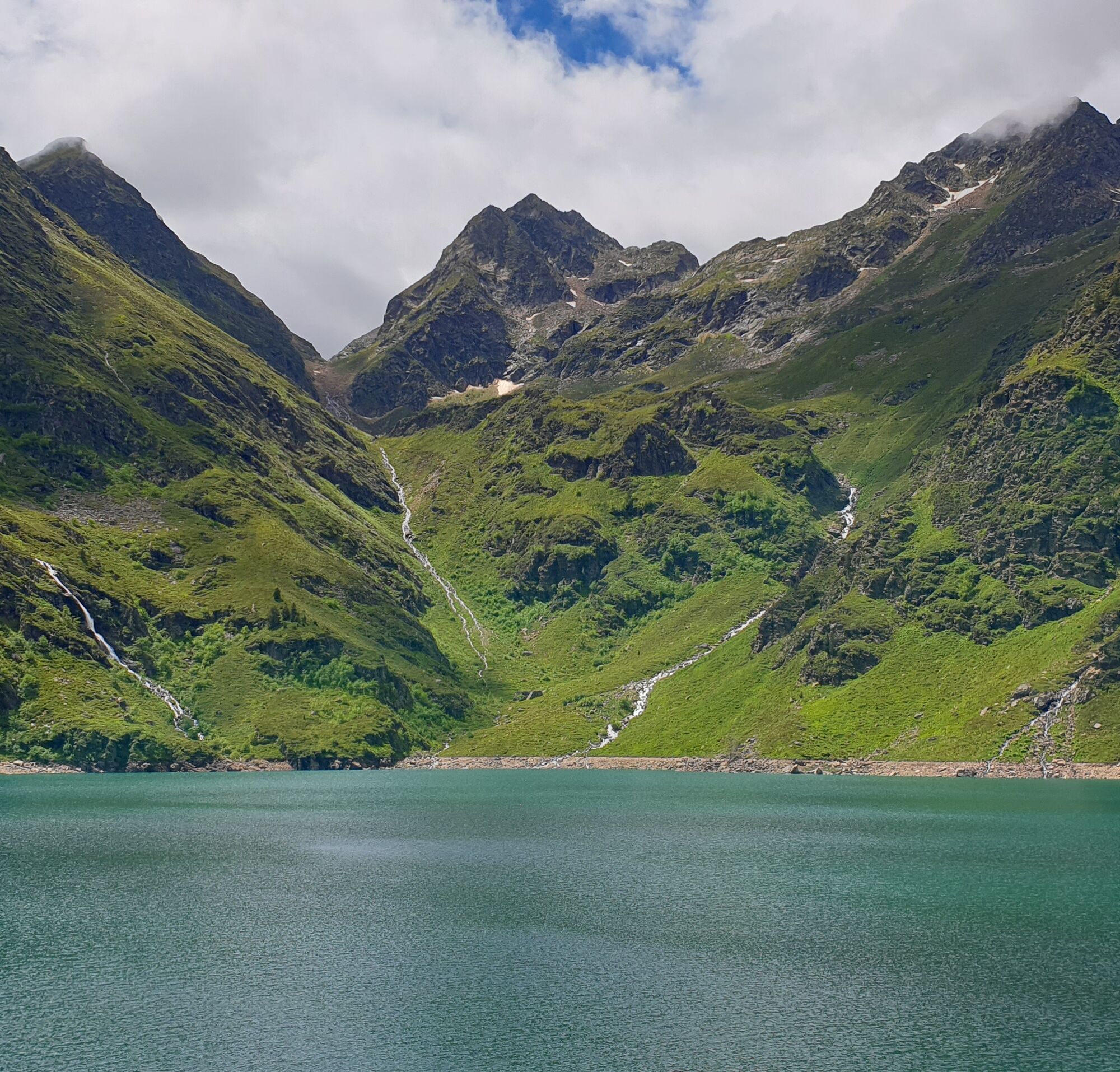
Étang d'Izourt
Access: from Vicdessos, on the D8, pass Auzat. Shortly after the Capunta bridge, turn left onto the road to Artiès, which you'll have to pass (there's a fountain and toilet on the right-hand side of the...
Access: from Vicdessos, on the D8, pass Auzat. Shortly after the Capunta bridge, turn left onto the road to Artiès, which you'll have to pass (there's a fountain and toilet on the right-hand side of the road...). You must park in the Pradières-d'en-haut parking lot on the right.

(D/A) From Pradières-d'en-haut to Garguéran (1177m) at the parking lot, follow the signs for Etangs du Fourcat (white and red markings), Refuge du Fourcat. Continue through a birch wood, leaving the stream and the power station on the left bank. Cross the stream by the footbridge. You return to the road and shortly afterwards the path starts off to the right through the ferns.
0h55 - ORRIS DE LA COUME (1522m). Pass the small Coume lock on a hairpin bend, and the path leads down into the valley.
1h40 - ETANG D'IZOURT (1647m). Keep your distance from the buildings. Go past the hut, straight through the low walls, the opening is on the right. Return to the path.
2h45 - A - Return to the Pradières-d'en-haut parking lot.
Ano
The tourist office, the communities of communes and the communes crossed by these trails cannot be held responsible for accidents of any kind that may occur to hikers, nor for any changes that may occur in the terrain (routes and markings).
Oblíbené prohlídky v okolí
-
GR®10 - The great crossing of the Pyrenees
heavyTuristika 278.3 km -
E 5. Etappe Vicdessos-Aulus, Okzitanien/Frankreich
heavyJízda na kole 32.8 km -
GR10 Pyrenäenweg Etappe 38
střednídálková pěší trasa 21.5 km -
Montcalm and the Pique d'Estats
heavyTuristika 17.4 km -
5.0
Étang de Guzet by the Ars waterfall
heavyTuristika 12.3 km -
Ars waterfall
středníTuristika 8.64 km -
Pic de Comapedrosa
středníTuristika 14.2 km -
5.0
Blue Pond
světloTuristika 9.90 km -
D 4. Etappe Tarascon-sur-Ariège-Vicdessos, Okzitanien/Frankreich
světloJízda na kole 15.4 km -
Saint James' Way Trail
středníTuristika 10.6 km

Pěší turistika a stopování


Nenechte si ujít nabídky a inspiraci pro vaši příští dovolenou
Vaše e-mailová adresa byl přidán do poštovního seznamu.