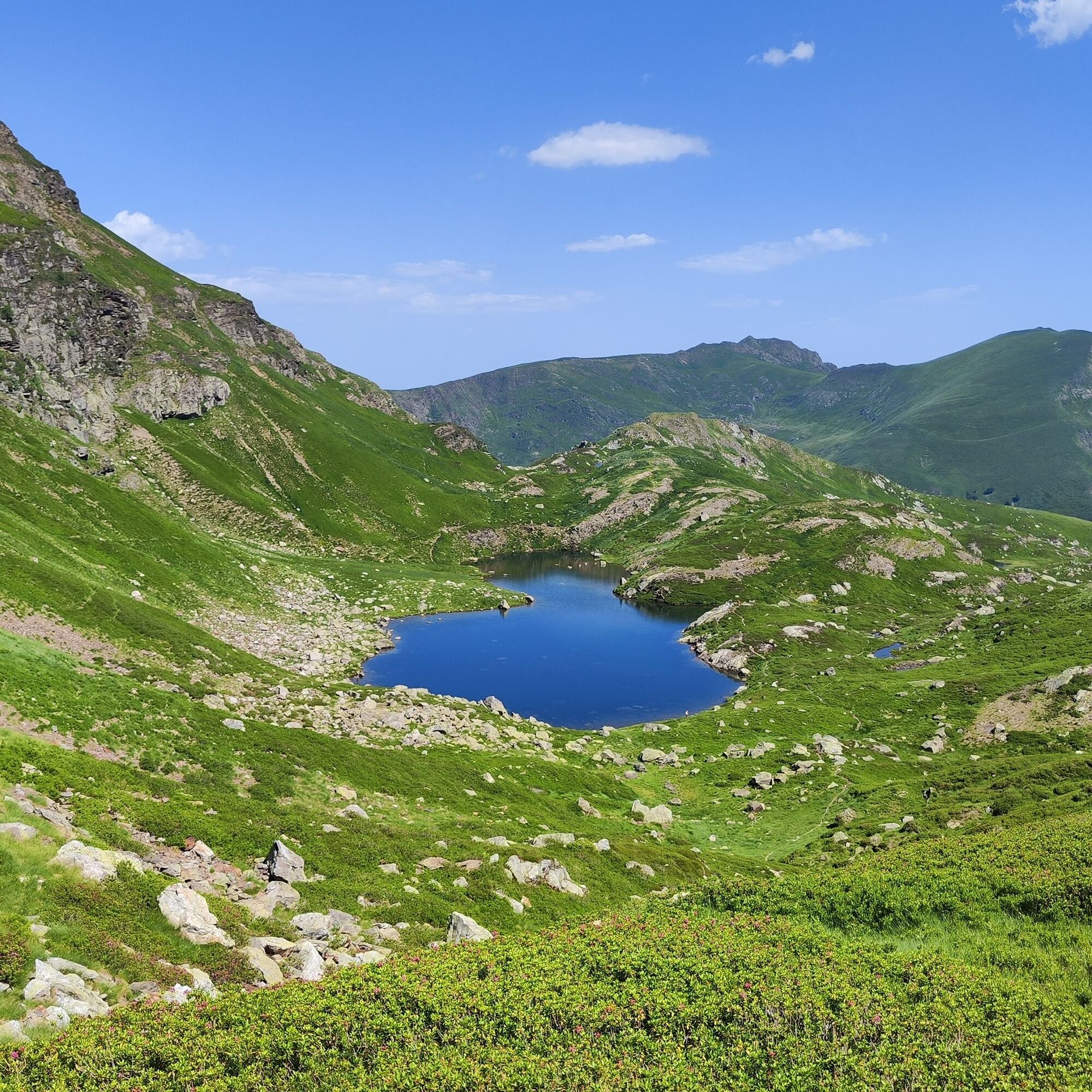
Blue Pond
světlo
Navigace na stránkách
Navigace na stránkách
Pořiďte si tuto prohlídku do mobilního telefonu
Blue Pond
světlo
Turistika
9.90
km
Naskenujte QR kód a spusťte navigaci v aplikaci bergfex.

Pěší turistika a stopování


Blue Pond
světlo
Vzdálenost
9.90
km
Doba trvání
04:30
h
Ascent
756
hm
Hladina moře
1024 -
1806
m
Stažení skladby
Blue Pond
světlo
Turistika
9.90
km
Access: From Tarascon sur Ariège, take the D618 to Surba, towards Col de Port. Then head for Rabat-les-Trois-Seigneurs on the D223. Go through the village, then through the hamlet of La Freyte, and reach...
Popis
Access: From Tarascon sur Ariège, take the D618 to Surba, towards Col de Port. Then head for Rabat-les-Trois-Seigneurs on the D223. Go through the village, then through the hamlet of La Freyte, and reach the end of the road.
Trasa

Naposledy sledované
před jedním dnem
Informace o trase
Trasa
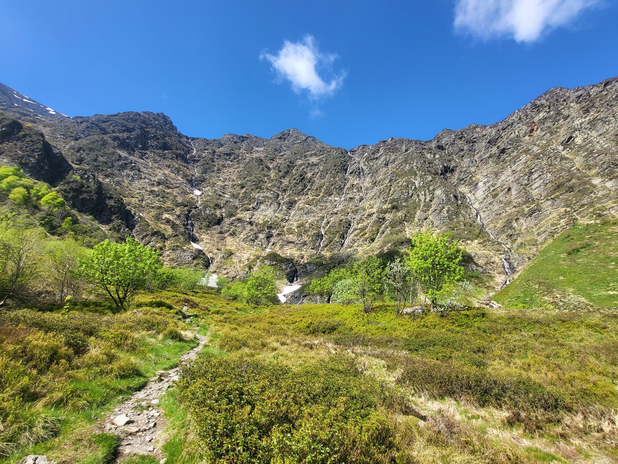
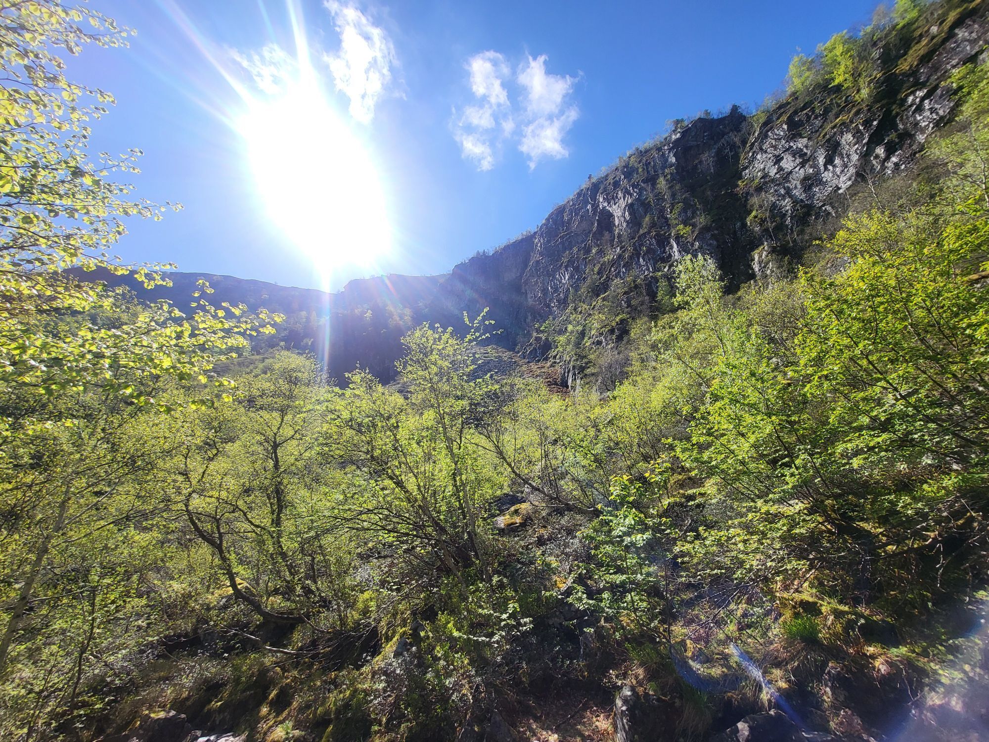
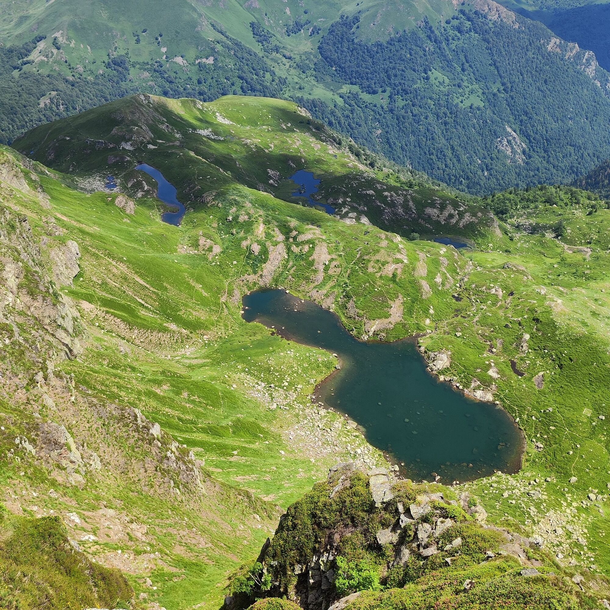
(D/A) - From the Pla du Ressec at 1022m, follow the track for about a kilometer to reach a ford. You need to cross the Courbière stream on the left by the cemented ford (or by the wooden footbridge slightly higher up), don't be confused by the routes on the right which take you from this point, this will be the way back. Heading east on this forest road, you gradually enter a beautiful fir forest. After 400 m, turn right onto a logging track.
0h30 - Leave the road and turn right onto this track, which runs west-south-west and after 10 minutes becomes a footpath. After two short hairpin bends, you enter the Bois du Debès du Ressec. The path runs alongside the Barataus stream.
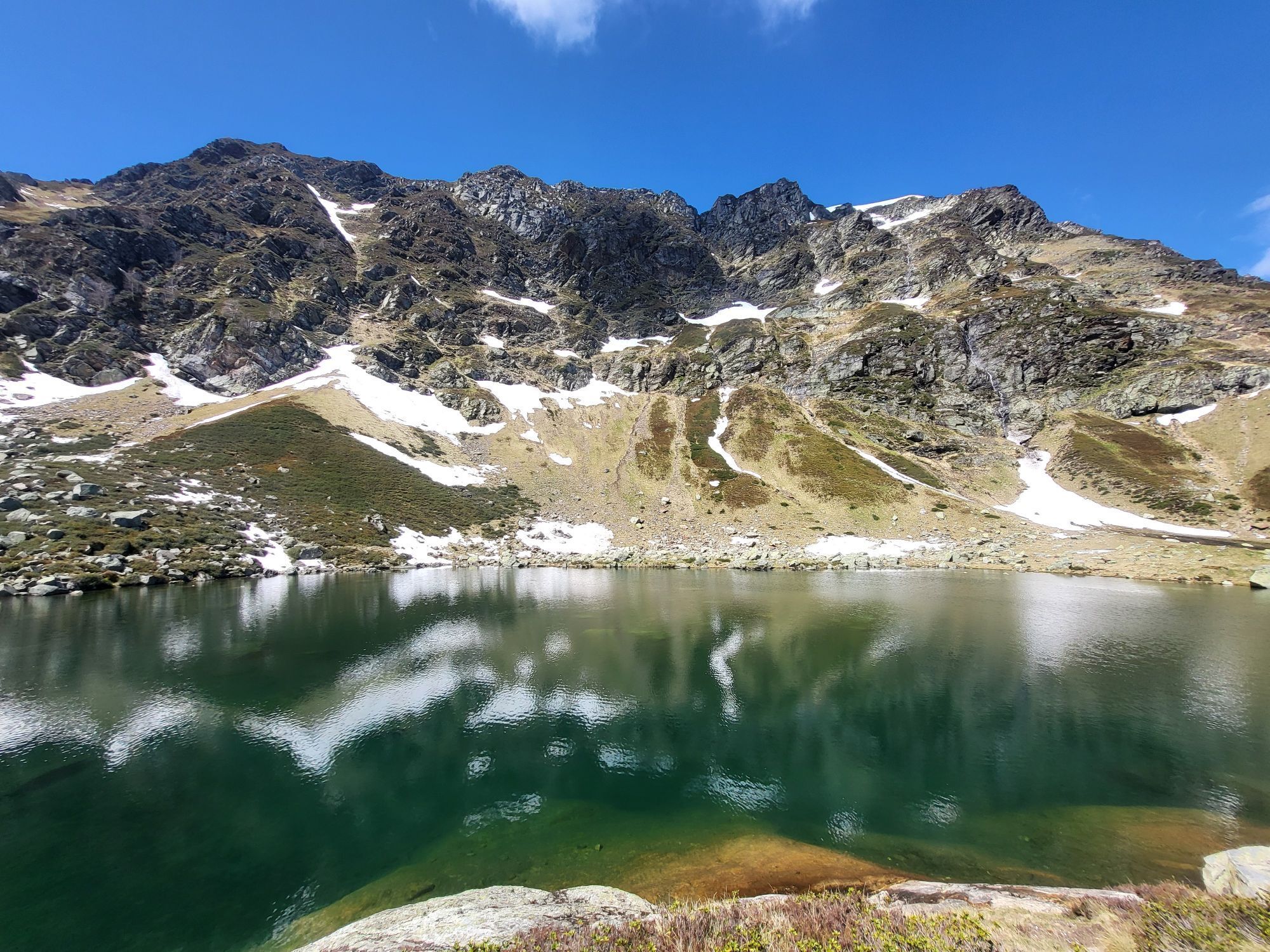
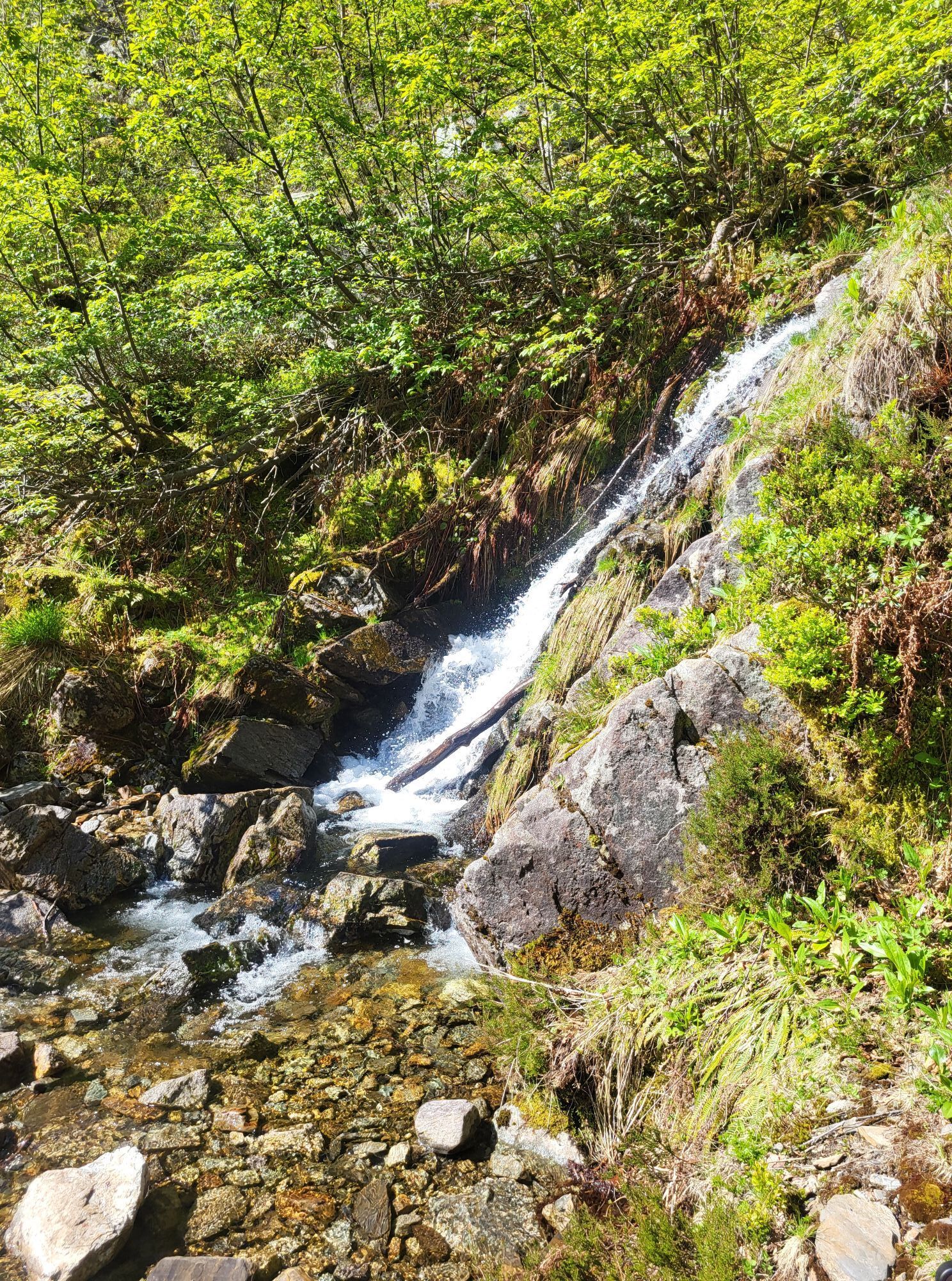
0h50 - ORRI 1273m) From the orri, the path becomes steeper and first enters a beech forest. Later, as you follow the series of switchbacks, you see the Rocher de l'Aigle on your left. Soon you ford the Barataus (1670m), and finally arrive at the Jasse de l'Étang Bleu (1h50), where you'll find numerous ruins of shepherds' huts. The climb continues due west to Étang Bleu.
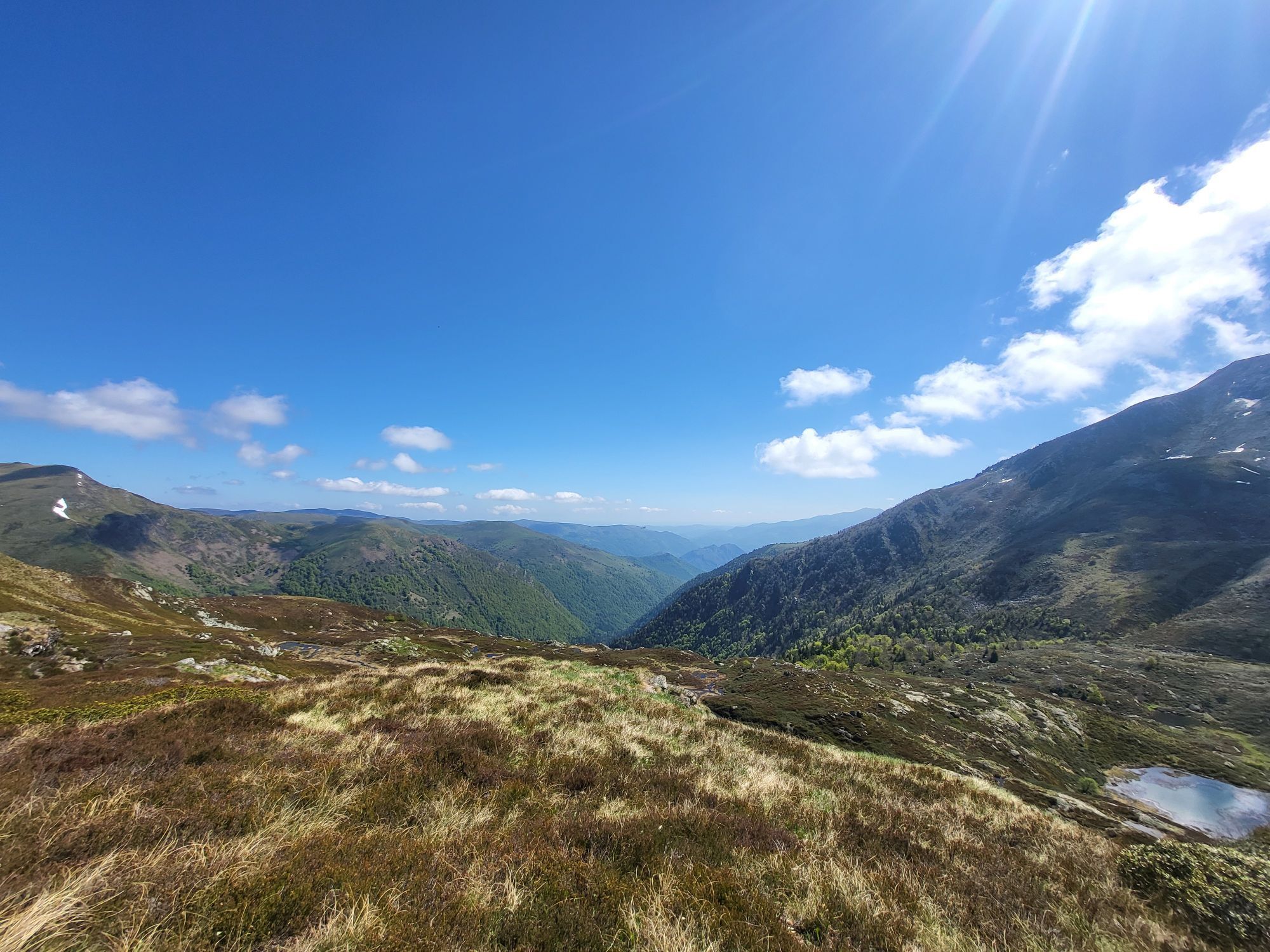
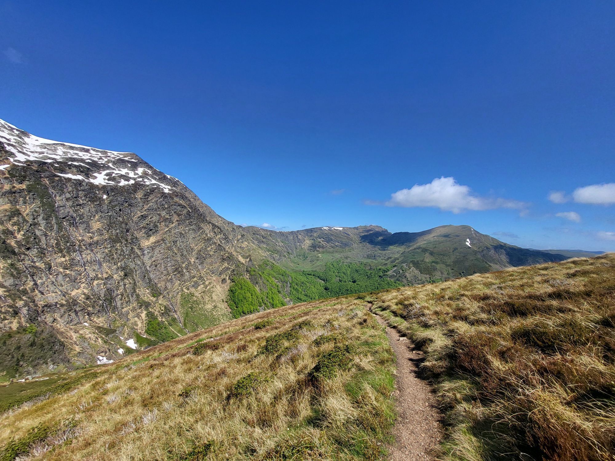
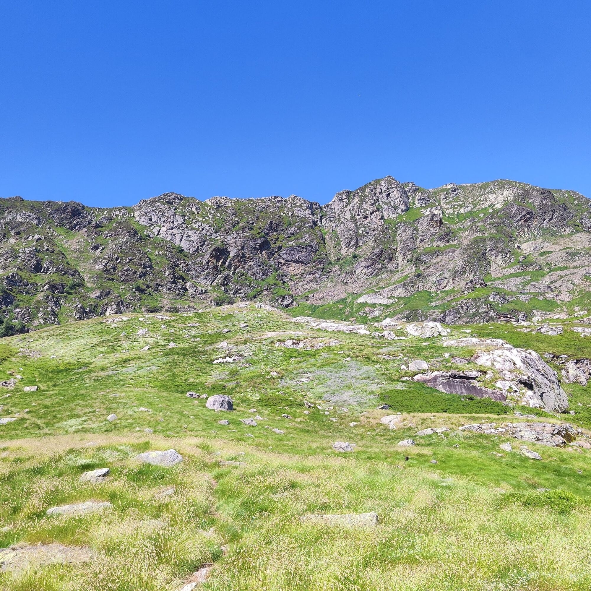
2h40 - L'ETANG BLEU .From l'Étang Bleu, the path climbs to the right over the small mound. Take the Chemin du Cirque d'Embans and follow the ridgeline (1822m) above Étang Long. After a few hairpin bends to the west and a ford across the Embans torrent, the path descends steeply for around 300m (this area is particularly steep and care should be taken with children).
3h00 - CIRQUE D'EMBANS. The descent continues into the Bois du Cirier, through a beech forest. A series of small switchbacks brings you to the footbridge over the Courbière.
4h00 - CABANE D'EMBANELS (1180m). Go right across the meadow to reach the forest road at the ford.
4h30 - Return to the Ressec flat.
0h30 - Leave the road and turn right onto this track, which runs west-south-west and after 10 minutes becomes a footpath. After two short hairpin bends, you enter the Bois du Debès du Ressec. The path runs alongside the Barataus stream.
0h50 - ORRI 1273m) From the orri, the path becomes steeper and first enters a beech forest. Later, as you follow the series of switchbacks, you see the Rocher de l'Aigle on your left. Soon you ford the Barataus (1670m), and finally arrive at the Jasse de l'Étang Bleu (1h50), where you'll find numerous ruins of shepherds' huts. The climb continues due west to Étang Bleu.
2h40 - L'ETANG BLEU .From l'Étang Bleu, the path climbs to the right over the small mound. Take the Chemin du Cirque d'Embans and follow the ridgeline (1822m) above Étang Long. After a few hairpin bends to the west and a ford across the Embans torrent, the path descends steeply for around 300m (this area is particularly steep and care should be taken with children).
3h00 - CIRQUE D'EMBANS. The descent continues into the Bois du Cirier, through a beech forest. A series of small switchbacks brings you to the footbridge over the Courbière.
4h00 - CABANE D'EMBANELS (1180m). Go right across the meadow to reach the forest road at the ford.
4h30 - Return to the Ressec flat.
Oceňování
5
(1)
4
(0)
3
(0)
2
(0)
1
(0)

Oblíbené prohlídky v okolí
-
GR®10 - The great crossing of the Pyrenees
heavyTuristika 278.3 km -
Randonnée d'Uscla
světloTuristika 5.95 km -
5.0
Étang de Guzet by the Ars waterfall
heavyTuristika 12.3 km -
Hors catégorie stage 100% Ariège tour de France - circuit n°12
heavySilniční kolo 103.7 km -
Ars waterfall
středníTuristika 8.64 km -
Cyclosport circuit 7 - The five passes
heavySilniční kolo 104.2 km -
Cyclotour de l'Ariège in 5 days
heavySilniční kolo 441.0 km -
Cyclosport route 10 - The three bumps near Foix
heavySilniční kolo 78.8 km -
Circuit cyclotourisme - Au tour du pic des trois seigneurs
heavySilniční kolo 74.2 km -
Cyclosport route 11 - The Ariège cycloroute - Stage 1: from Foix to Castillon-en-Couserans
heavySilniční kolo 86.0 km
Pěší turistika a stopování

Více než 550.000 návrhů výletů, podrobné mapy a intuitivní plánovač tras dělají z aplikace nezbytnou výbavu pro všechny milovníky přírody.

Nenechte si ujít nabídky a inspiraci pro vaši příští dovolenou
Přihlaste se k odběru newsletteru
Chyba
Došlo k chybě. Zkuste to prosím znovu.
Děkujeme za vaši registraci
Vaše e-mailová adresa byl přidán do poštovního seznamu.
Zájezdy po celé Evropě
Rakousko
Švýcarsko
Německo
Itálie
Slovenia
Francie
Nizozemsko
Belgie
Polsko
Lichtenštejnsko
Česko
Slovensko
Španělsko
Chorvatsko
Bosna a Hercegovina
Lucembursko
Andorra
Portugal
Iceland
United Kingdom
Ireland
Greece
Albania
North Macedonia
Malta
Norway
Montenegro
Moldova
Kosovo
Hungary
San Marino
Romania
Estonia
Latvia
Belarus
Cyprus
Lithuania
Serbia
Bulgaria
Monaco
Denmark
Sweden
Finland