


FROM MONTPELLIER TO SAINT-GUILHEM-LE-DÉSERT ON THE GR®653 ARLES WAY TO COMPOSTELA
This 43 km route, connecting Montpellier to Saint-Guilhem-le-Désert, offers a gradual immersion into the landscapes of Languedoc, between urban heritage, garrigues, and green valleys.
After a lively start...
After a lively start in the heart of Montpellier, the path follows the footsteps of Saint James pilgrims, marked by the Compostela nails and iconic sites. Quickly, the environment becomes more natural, crossing garrigue landscapes scented with thyme and rosemary. The route uses old drovers' roads used for transhumance. Further ahead, the Devil's Bridge, classified as a UNESCO World Heritage site, spans the Hérault river in a majestic setting, announcing the entrance to the spectacular Hérault Gorges. The arrival at Saint-Guilhem-le-Désert happens through a steep landscape, where the Abbey of Gellone, a medieval gem, marks the culmination of this journey combining nature and history.

1
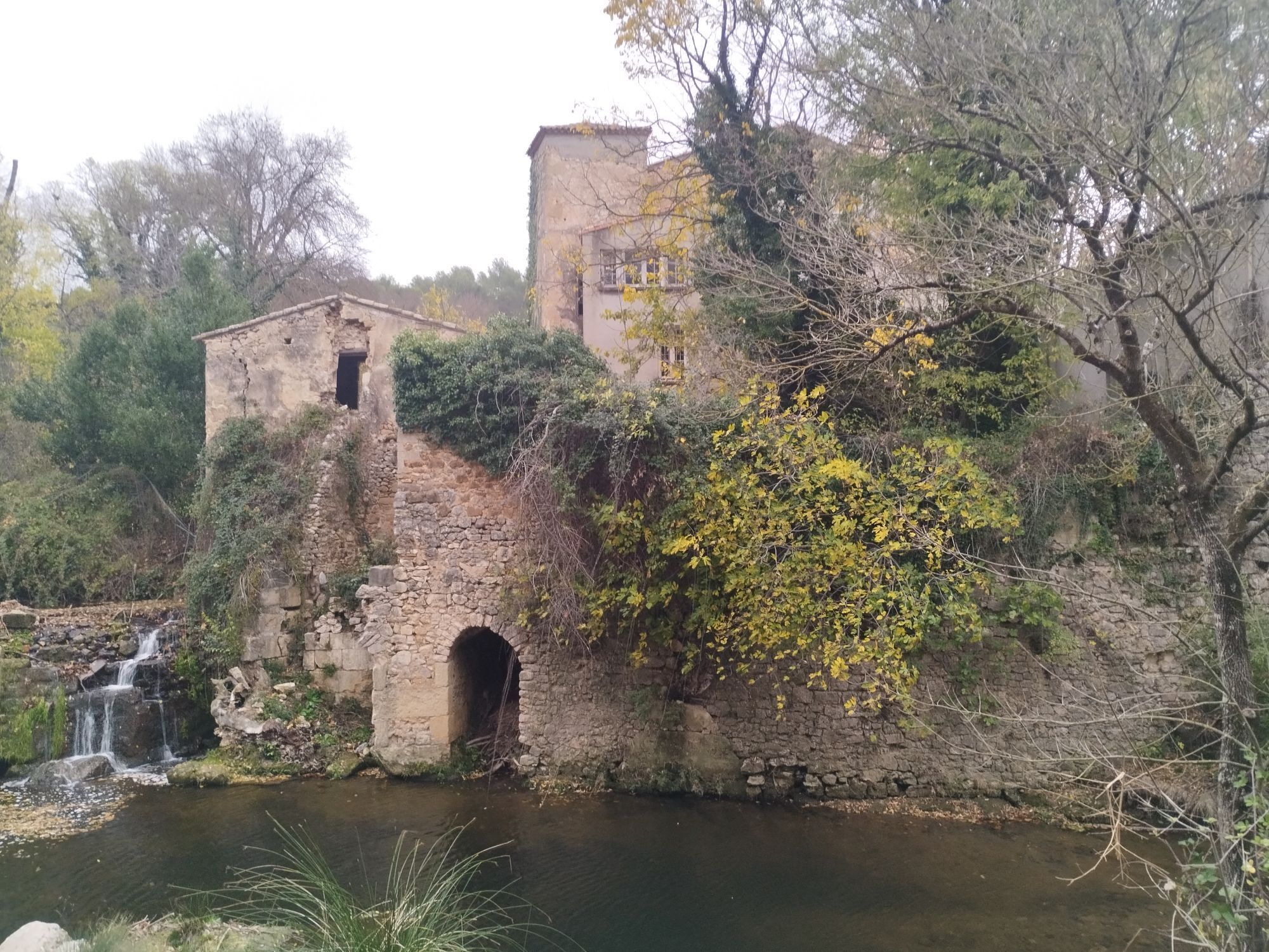
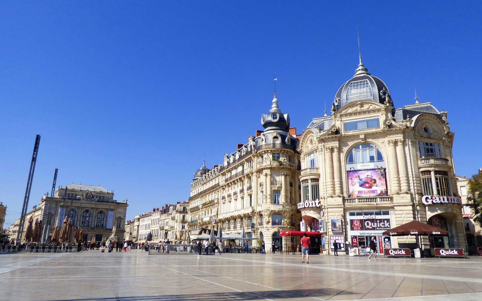
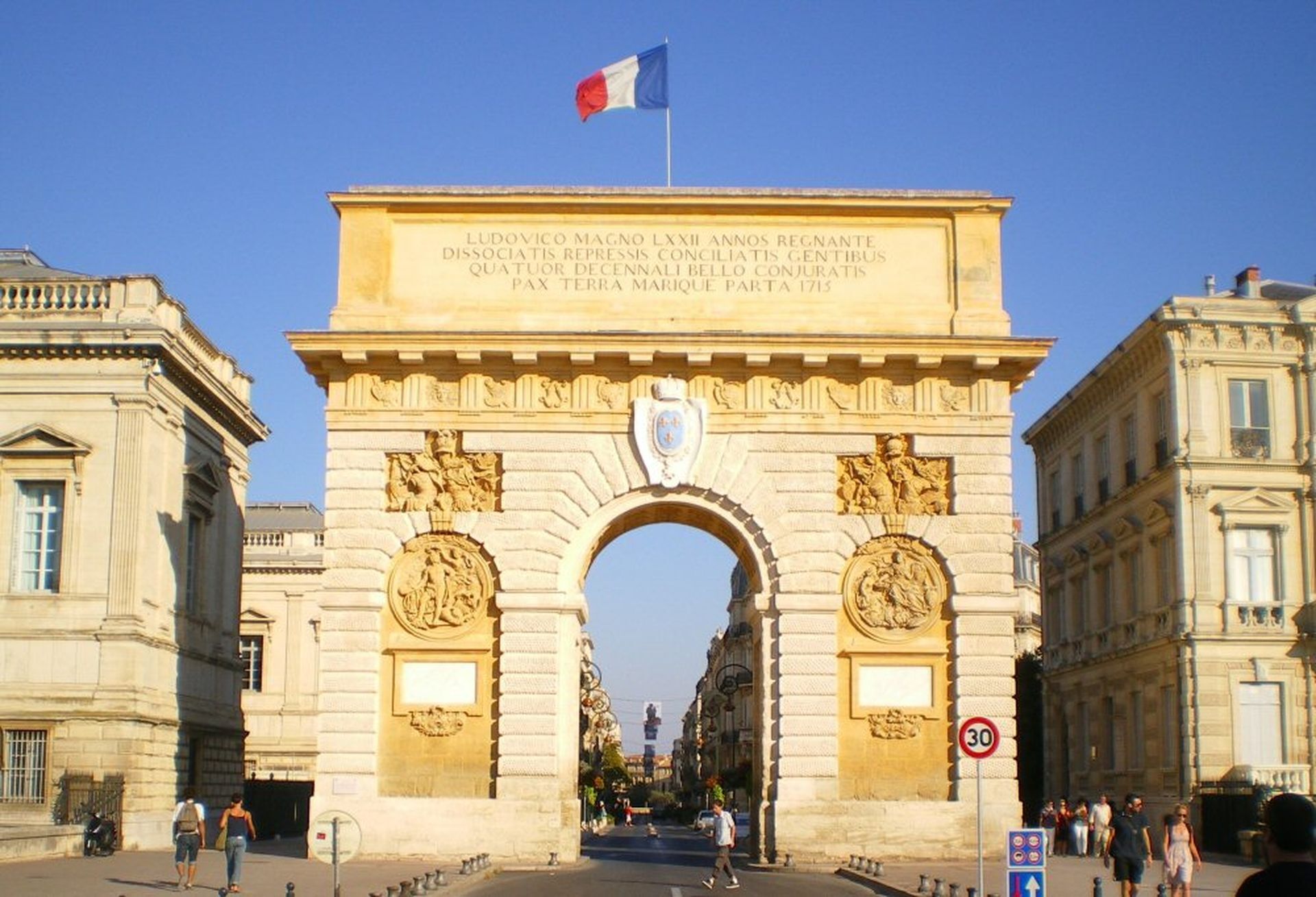
The departure is from Montpellier’s Saint-Roch station, a central point for many pilgrims and travelers. By reaching Saint-Roch church, a symbolic place on the Way of Saint James, you discover a series of Compostela-branded nails embedded in the ground, notably on rue de la Loge, guiding pilgrims through the city. Saint Roch, born in Montpellier, is a major figure of the pilgrimage, known for healing plague victims. Leaving the center, you pass the Arc de Triomphe and Place Royale du Peyrou, offering panoramic views of the region. The route then runs alongside the Aqueduct, crosses the Cévennes district before reaching the Mosson river, marking the transition from urban environment to Montpellier’s garrigue. Arrival at Grabels is via a road lined with cypresses and olive trees. The village is known for its Avy spring, where water naturally flows, and for its old 18th-century mill. A local legend tells of a dragon living in the spring punishing disobedient children. The Saint-Julien church, built with local limestone, stands out with its two bell towers, bearing witness to Grabels’ medieval past.
2
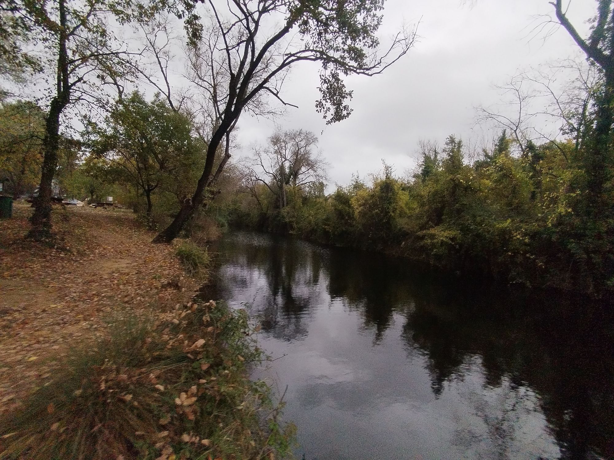
Leaving Grabels, you pass the Avy spring, whose clear water marked local history. On the way, you cross the Pelisse cross, marking a place of historical passage. The landscape becomes wilder, alternating fragrant garrigues of thyme and rosemary, and rocky areas. The path follows old drovers' roads traditionally used for moving herds. The route follows the D102 offering contrasting views of the surrounding nature. Further along, you pass a photovoltaic power plant, illustrating regional efforts in energy transition. Montarnaud, a perched village, is dominated by its perfectly preserved medieval castle, offering breathtaking views of the surroundings. The Saint-Martin church, a 12th-century Romanesque building, is a testimony to local architectural heritage. The village retains the charm of Languedoc small towns, with shady squares and stone houses.
3
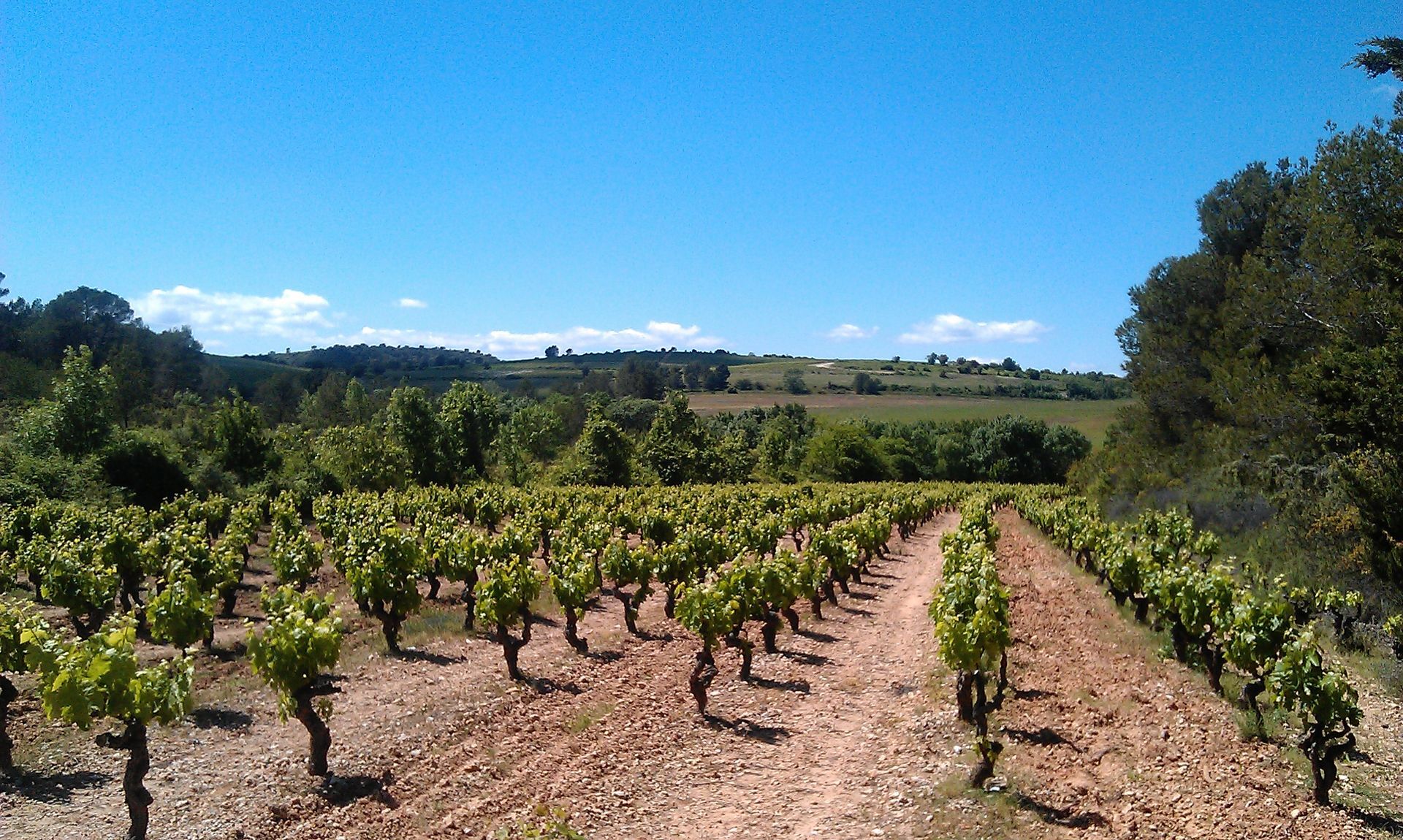
After a night of rest, the route continues northwest through rolling hills. On the way, you encounter several capitelles, dry-stone shelters typical of Languedoc shepherds. The route then crosses the village of La Boissière, whose history is marked by the old railway, closed in 1968, and by remains of a bauxite mine, witnesses to the region’s past industrial activity. A break at La Boissière lake can be considered, offering a relaxing setting before continuing the trail. Arrival at Aniane is marked by its Benedictine abbey, founded by Saint Benedict of Aniane in the 8th century. This monastic reformer influenced the monks’ rules of life across Europe. Aniane is also famous for its vineyards, part of the great terroirs of Languedoc.
4
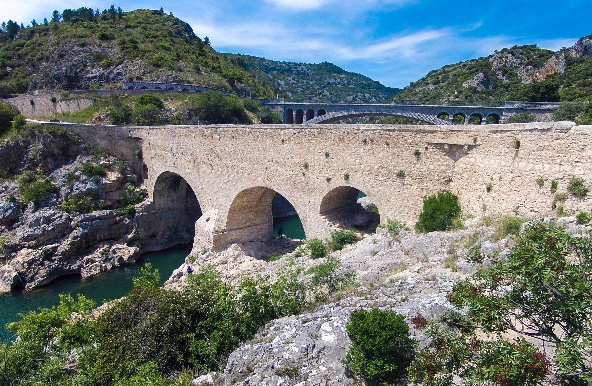
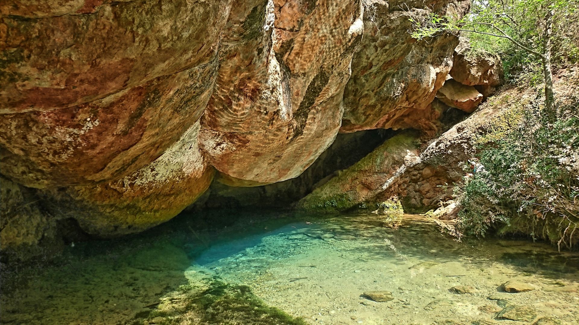
After Aniane, the route crosses vineyards and olive trees until Saint-Jean-de-Fos, where you reach the Devil's Bridge, one of the oldest medieval bridges in France (11th century), listed as a UNESCO World Heritage site. A legend says that each time the bridge was built, the Devil destroyed it at night until Saint-Guilhem trapped him with a clever trick. It is worth making a detour to visit the Grand Site of France House by crossing the Passerelle des Anges, a work by Rudy Ricciotti (the architect of MUCEM in Marseille). The path is then taken cautiously over 2 km in the Hérault gorges, along the departmental road. It allows considering a visit to the Clamouse Cave, and enjoying spectacular views of the river. Shortly after the Brunan Combe parking lot, the trail leaves the road to get closer to the watercourse, and emerge in Saint-Guilhem-le-Désert. This village, classified among the "Most Beautiful Villages of France", is a gem of Occitan heritage.
5
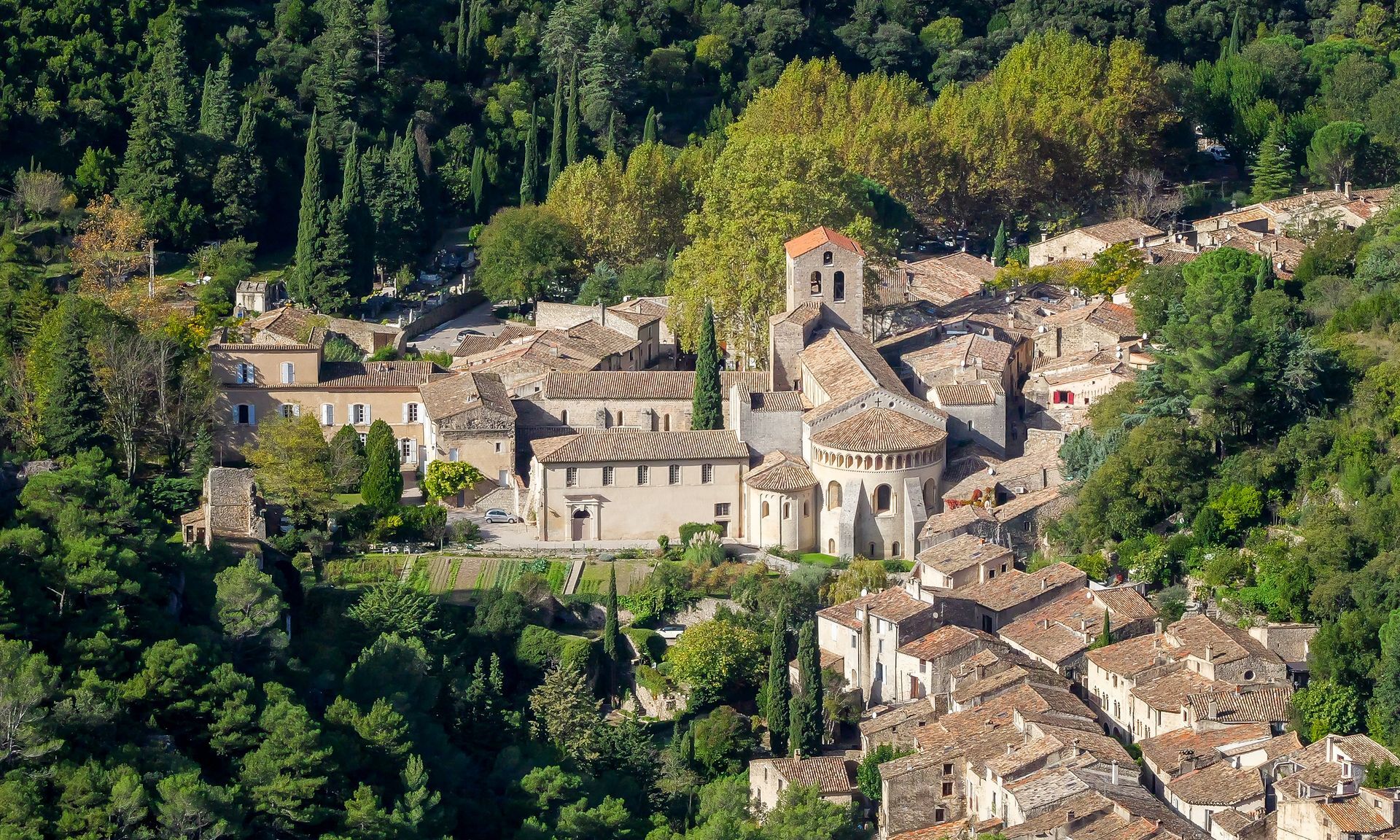
After these 2 days of effort and discovery, we finally arrive at Saint-Guilhem-le-Désert, fulfilled by this beautiful adventure in the heart of nature. Nestled in the mountains' hollow and bordered by the Verdus, this site gradually reveals its intact medieval architecture and the imposing Abbey of Gellone, founded in the 8th century by William of Aquitaine and listed by UNESCO as part of the Way of Saint James in France. The atmosphere is imbued with serenity, contrasting with the rugged surrounding relief, offering a timeless arrival where history and nature merge in perfect harmony. You cannot resist sharing a friendly drink on the village square, under the shade of the immense plane tree, lulled by the murmur of the beautiful fountain: a beautiful finale!
Saint-Roch Station
If you prefer to avoid some districts of Montpellier, take tram 1 to Euromédecine stop, and from there you can take bus 24 towards Grabels. For more safety, it is possible to take a free shuttle bus between the Devil's Bridge and Saint-Guilhem-le-Désert to avoid following the D4 road (available only in high season).
Don't forget to: - Check the weather to leave at the right time and avoid unpleasant surprises on the way. - Wear good shoes, because hiking is fun... except if your feet decide to give up before you!
Hiking is not a race. Look around you, breathe and savor every moment!
White and red GR
https://www.montpellier-tourisme.fr/
Montpellier Méditerranée Metropole Tourist Office & Congress Center
GR - FFR
Oblíbené prohlídky v okolí
- 5,0
DRAILLES HIKE
světloTuristika 7,16 km - 5,0
MOURE HILLS HIKE
středníTuristika 13,1 km HIKING THE OASIS OF THE GARRIGUES
středníTuristika 10,9 km- 4,0
BOIS DE LÈQUE HIKE
světloTuristika 9,34 km HIKE OF THE CHÂTEAU DE RESTINCLIERES
světloTuristika 7,86 kmOENORANDO® THE DRAGON TRAIL
středníTuristika 11,7 kmHIKING OF THE BALCONIES OF THE HERAULT
středníTuristika 17,9 kmLOOP CYCLO N°18 - LA SOURCE DU LEZ
světloJízda na kole 13,9 kmHIKING THE TOUR DES VILLAGES DU PIC - GR® DE PAYS TOURS IN GRAND PIC SAINT-LOUP
středníTuristika 47,5 kmWINE ROUTE IN THE SHADOW OF THE CHATEAU DE MONTFERRAND
Motorrad 49,8 km
Pěší turistika a stopování


Nenechte si ujít nabídky a inspiraci pro vaši příští dovolenou
Vaše e-mailová adresa byl přidán do poštovního seznamu.