Hike La Ronda del Peiraire
světlo
Pořiďte si tuto prohlídku do mobilního telefonu
Hike La Ronda del Peiraire
světlo
Turistika
14.95
km
Naskenujte QR kód a spusťte navigaci v aplikaci bergfex.

Pěší turistika a stopování


Hike La Ronda del Peiraire
světlo
Vzdálenost
14.95
km
Doba trvání
04:15
h
Ascent
257
hm
Hladina moře
461 -
682
m
Stažení skladby
Hike La Ronda del Peiraire
světlo
Turistika
14.95
km
GPS parking: 43.611208, 2.399151
The circuit begins at the site of the old stone quarries of Sidobre, before the advent of electricity. You will see the loading docks where ox-drawn carts used to supply....
Popis
GPS parking: 43.611208, 2.399151
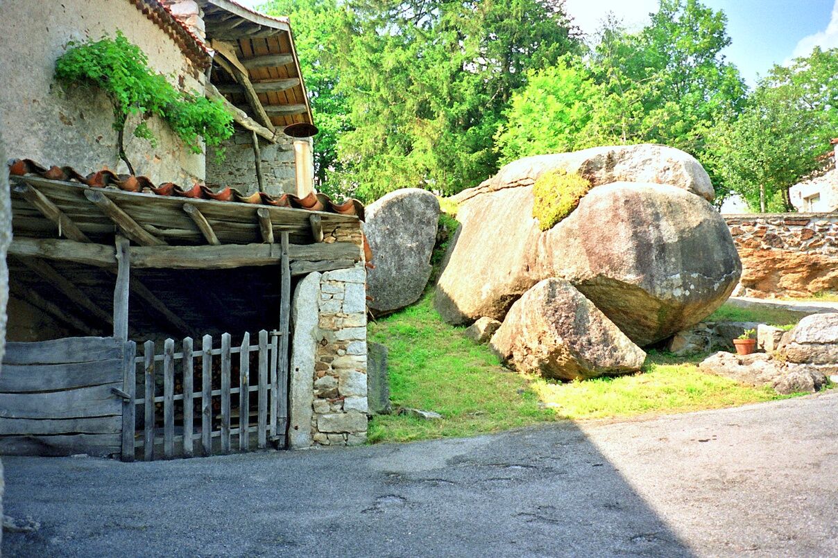
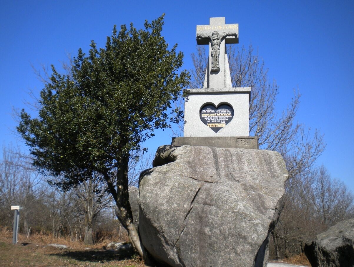
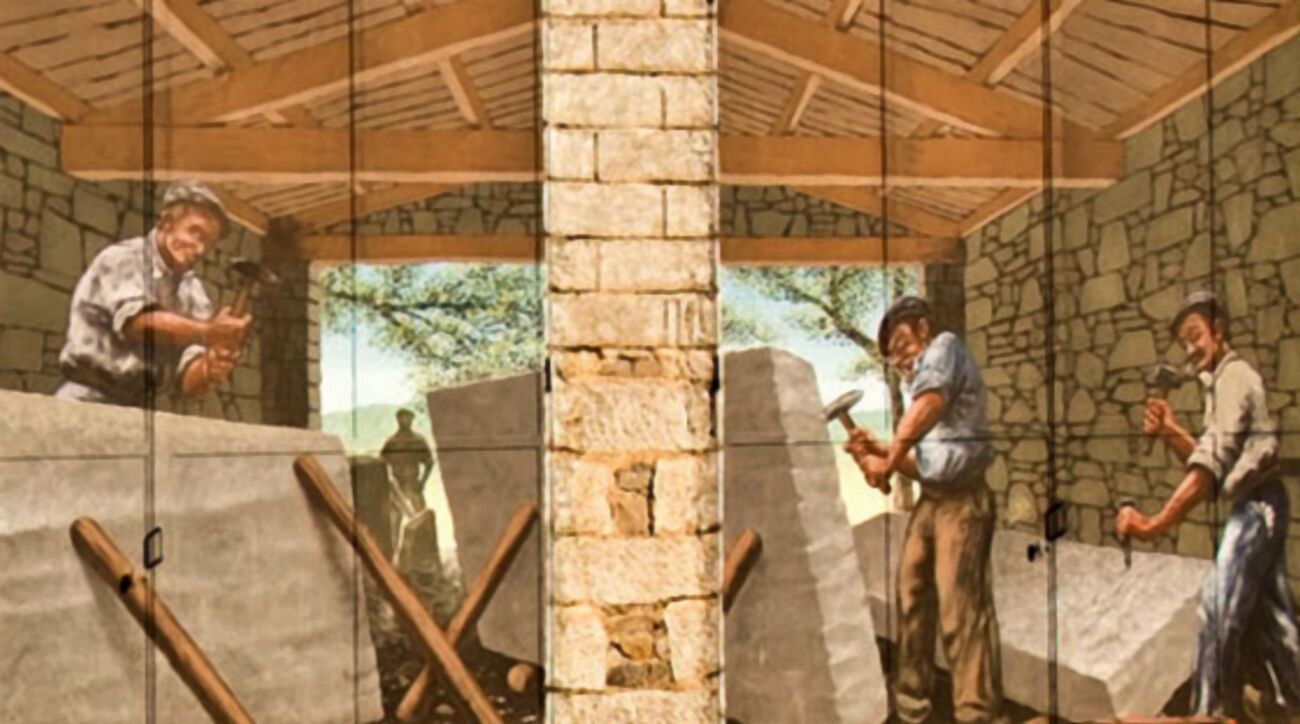
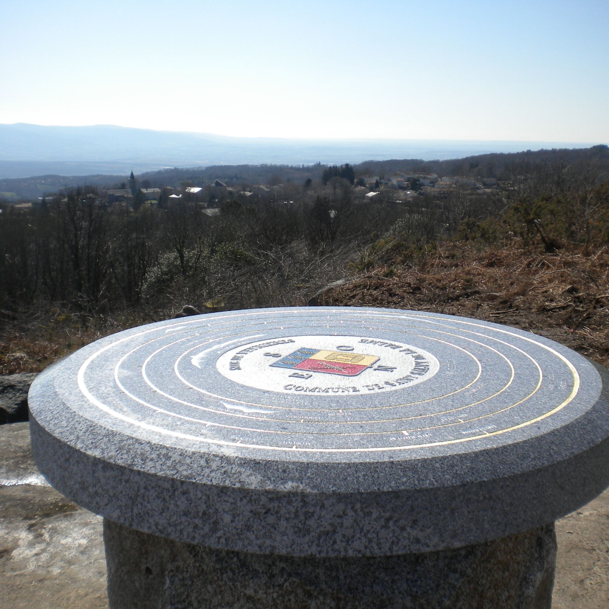
The circuit begins at the site of the old stone quarries of Sidobre, before the advent of electricity. You will see the loading docks where ox-drawn carts used to supply. The traces of the very particular "cuhns" that prepared the rock cutting, sometimes abandoned because the stonecutter, gone to war, did not return. At the quarrymen's cross, a magnificent viewpoint over the Castraise plain and, in clear weather, the Pyrenees.
Along your hike, through alleys lined with granite slabs, you will cross beautiful beech woods, chestnut groves and other coniferous forests. And always these rocks, this sculpted landscape: the anvil, the trembling rock of Lascombes, etc. Letting your imagination wander, you will spot the cow or the shark, here and there little streams, marshes and undergrowth that maintain a certain freshness.
You will find the itinerary details by downloading the attached PDF file.
Trasa
Trasa
Hike La Ronda del Peiraire
světlo
Turistika
14.95
km

Další informace a tipy
Další informace
Hiking also means planning appropriate equipment (shoes, clothing, water...) and respecting the environment of the trail.
Zatím žádné recenze
Oblíbené prohlídky v okolí
-
Randonnée pédestre : Les Hauts de la Môle 13km / 3h30
heavyTuristika 11.3 km -
Au fil de l'Eau 6,5km / 2h30
heavyTuristika 6.45 km -
Discovery trail of the Travet Meadows
světloTuristika 0.31 km -
Sentier Randonnée du Patrimoine 13km / 3h30
světloTuristika 13.0 km -
Circuit n°3 VTT - Secteur Lacrouzette
heavyMountainbike 28.1 km -
Circuit No. 2 MTB - Lacrouzette Area
heavyMountainbike 21.8 km -
Randonnée VTT Le Lac par l'Orée du Bois
heavyMountainbike 26.9 km -
Tour du Tarn on horseback: Montredon-Labessonnié / Cambounès
heavyJízda na koni 26.8 km -
Vignoble et châteaux
heavyTuristika 27.3 km -
Path of the crests of Bau del Poun
světloTuristika 9.25 km
Pěší turistika a stopování

Více než 550.000 návrhů výletů, podrobné mapy a intuitivní plánovač tras dělají z aplikace nezbytnou výbavu pro všechny milovníky přírody.

Nenechte si ujít nabídky a inspiraci pro vaši příští dovolenou
Přihlaste se k odběru newsletteru
Chyba
Došlo k chybě. Zkuste to prosím znovu.
Děkujeme za vaši registraci
Vaše e-mailová adresa byl přidán do poštovního seznamu.
Zájezdy po celé Evropě
Rakousko
Švýcarsko
Německo
Itálie
Slovenia
Francie
Nizozemsko
Belgie
Polsko
Lichtenštejnsko
Česko
Slovensko
Španělsko
Chorvatsko
Bosna a Hercegovina
Lucembursko
Andorra
Portugal
Iceland
United Kingdom
Ireland
Greece
Albania
North Macedonia
Malta
Norway
Montenegro
Moldova
Kosovo
Hungary
San Marino
Romania
Estonia
Latvia
Belarus
Cyprus
Lithuania
Serbia
Bulgaria
Monaco
Denmark
Sweden
Finland