


TRAIL OF THE TOUR OF SALAGOU LAKE (FROM VAILHÉS) - COUNTRY GR BETWEEN 2 LAKES AVÈNE – SALAGOU
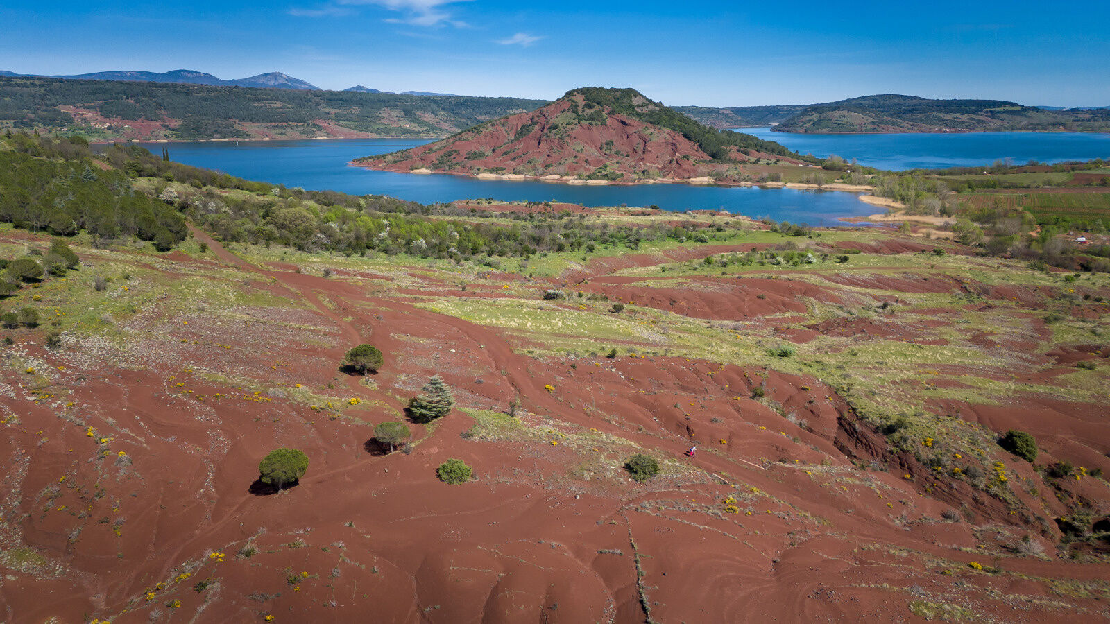
A sporty route through the ruffes dunes. Without major difficulty but a route that aims to be technical with its relays by the water and very fast on the DFCI track sections.
An exotic route... another world!

1
Take back the road you came from, just after the parking lot turn left into the ruffes.
2
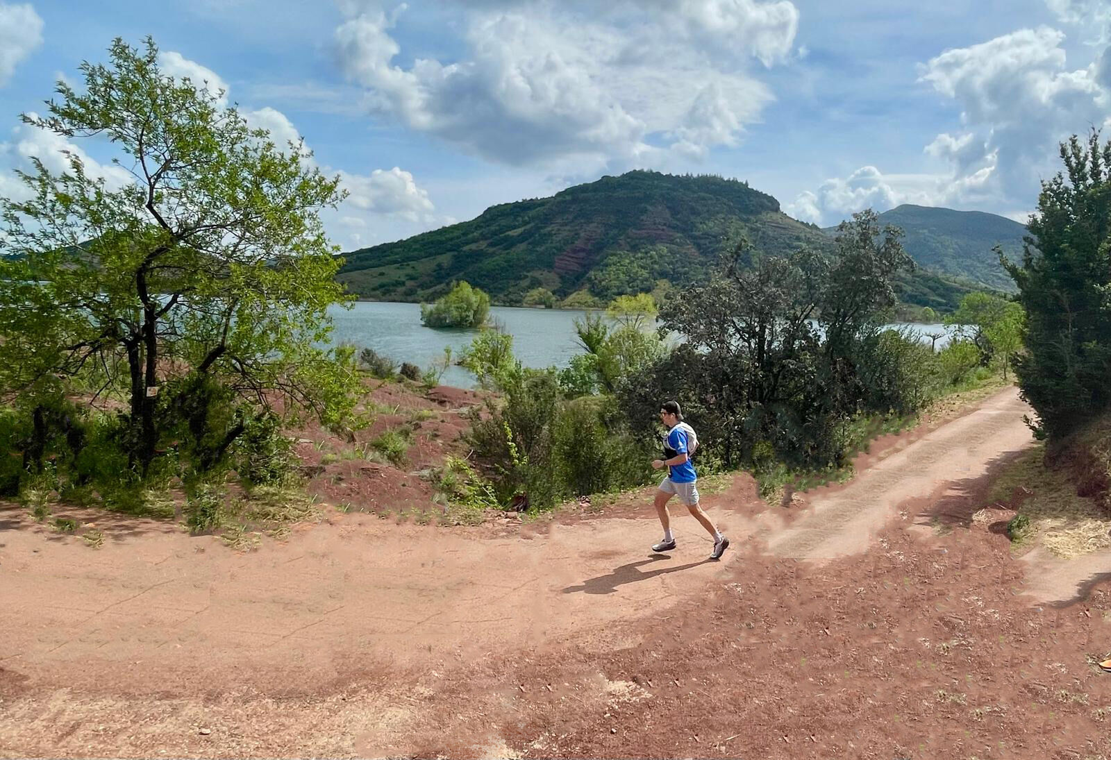
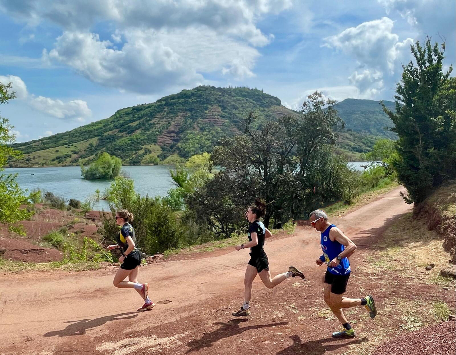
Take a left onto a path that goes around the Cébérou. Continue straight ahead facing the Larzac foothills and the Escandorgue massif. The path winds through the ruffes dunes, in a surreal setting. Regain the view of the lake.
3
Leave D 148 to the right and head left. Descend toward Celles. Before the hamlet, cut right and join the road. Go up right to the intersection under the departmental road. Turn left and head toward Mas de Riri.
4
Descend to the lakeshore. Head right along the bank, under the campsite. Continue on the path to the fishing dock and La Borne parking lot.
5
Continue on the road among the vineyards. After the bridge over the Révérignès, turn left toward the Nautical Relay. Warning, the road is submersible in heavy rain! Pass the parking lot, then access to Arcades campsite. Reach a track start on the right. Junction with the two lakes trail (Country GR Between two lakes Avène Salagou).
6
Continue on the road. Cross a first causeway, then a second.
7
Leave the road to the left at an old football stadium and walk along a field for 400m. Cross a riverside forest along the Salagou river for 500m, then walk along the lake shore to the road. Continue straight and follow a hilly path along the departmental road, at the foot of the Sure hill, for 1.5 km. At the road, turn left toward the Rouens peninsula. Cross the Plos parking, continue on the road between the lake and vineyards. Pass the parking lots of Rouens, Lavadou, Jonquier and walk about 400m.
8
Pass between imposing rock blocks and go down a track to the left. Walk along the banks to reach Liausson shores parking.
9
Head straight, between the parking lot and Salagou lake. The path borders vineyards, then winds through vegetation before opening near a large parking lot. Attention, follow the markings well. Continue on the coastal path and reach the starting parking lots on Clermont l'Hérault shores.
10
From the parking lots opposite the lake, take the track toward the outdoor base Destination Salagou. Pass the campsite, and just before a barrier, go up right on a path through the ruffe. Reach the departmental road D156E5.
11
Follow the road to the left. Caution! Leave the dam to the left. Continue along the road that descends and passes behind the structure. Further down, cross a small bridge and climb up to a junction with a track (barrier) on the left.
12
Leave the road and take the track which climbs the slope and meets the Salagou dam. In a left turn, climb right on a stony path. Stay on the main path which zigzags up to the basalt columns. Climb a rocky section. Follow a small wall, continue straight and reach a wide track. Take it left for about 800m. Junction with PR Les Vailhés.
13
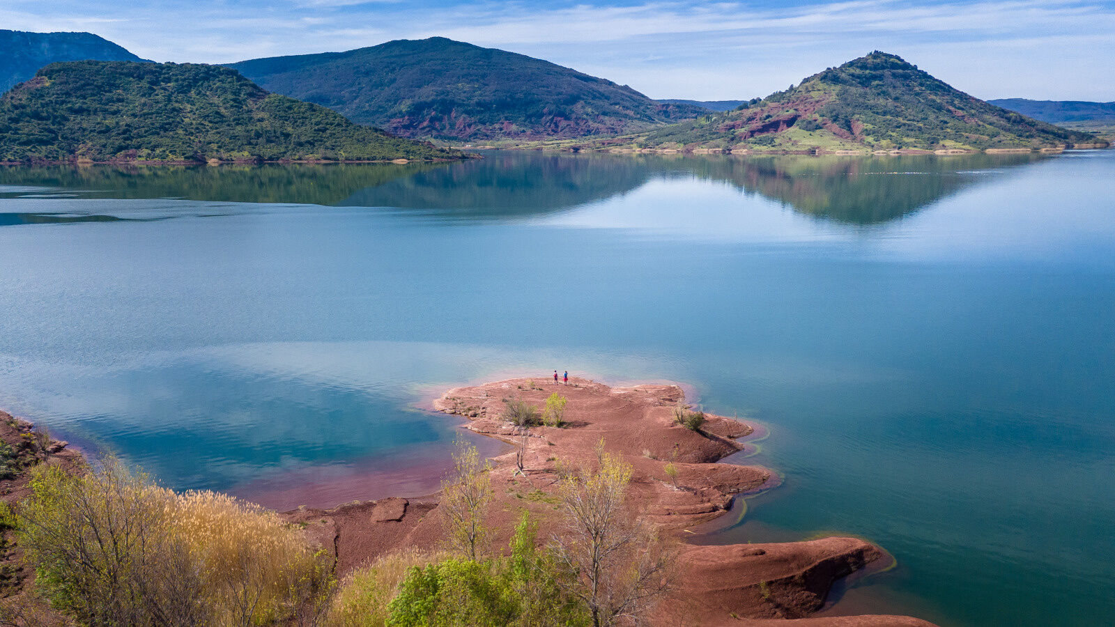
Leave the track to the left. Gradually descend the path toward the lake shores. Caution when wet. Slippery. At the bottom, turn right, walk along the shore at the edge of the lake. Further on, pass under Notre Dame des Clans chapel. Always along the lake, join the path coming from the hamlet of Vailhés, near a small peninsula. Separation from PR Les Vailhés.
14
Continue straight on the lakeside path and reach the Salagou nautical base - Baie des Vailhés.
A75 Exit 54 - 55
Take water
Avoid during summer
Shared space with other users: MTB, hikers
Yellow MTB markers
Yellow and red country GR
+33 4 67 88 86 44
LODEVOIS ET LARZAC TOURIST OFFICE
GRP - FFR
Oblíbené prohlídky v okolí
- 5.0
CIRQUE DE MOUREZE HIKE
středníTuristika 6.86 km - 5.0
LES VAILHÉS HIKING TRAIL
středníTuristika 9.28 km - 5.0
MONT LIAUSSON HIKE
středníTuristika 7.36 km - 4.0
HIKE OF THE GRÉZAC PLATEAU
středníTuristika 14.0 km LAVAL DE NIZE HIKE
světloTuristika 6.07 kmBEALS TRAIL HIKE
středníTuristika 4.51 kmVILLENEUVETTE HIKE
světloTuristika 3.08 kmOENORANDO® OF THE VINEYARDS AND VOLCANOES OF FONTES
středníTuristika 11.2 kmVINEYARDS AND VOLCANOES TRAIL OF FONTES
světloTrailrunning 11.2 kmTOUR DU LAC DU SALAGOU HIKE - GR® DE PAYS ENTRE 2 LACS AVÈNE - SALAGOU
středníTuristika 36.3 km

Pěší turistika a stopování


Nenechte si ujít nabídky a inspiraci pro vaši příští dovolenou
Vaše e-mailová adresa byl přidán do poštovního seznamu.